-
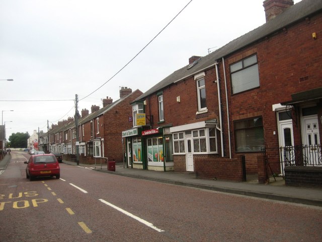
County Durham
- Aldin Grange
- Allensford
- Alum Waters
- Annfield Plain
- Archdeacon Newton
- Auckland Park
- Aukside
- Aycliffe Village
- Baldersdale
- Barforth
- Barmpton
- Barnard Castle (town)
- Barningham
- Beamish (Village)
- Bearpark
- Beaumont Hill
- Bedburn
- Belmont
- Benfieldside
- Bildershaw, County Durham
- Billy Row
- Binchester
- Bishop Auckland
- Bishop Middleham
- Blackhall Colliery
- Blackhall Rocks
- Blackhill
- Bloemfontein
- Bolam
- Boldron
- Bournmoor
- Bowbank
- Bowburn
- Bowes
- Bowlees
- Bradbury
- Brafferton
- Brancepeth
- Brandon
- Brasside, County Durham
- Bridge Place
- Brignall
- Broomielaw
- Broompark
- Browney, Country Durham
- Brusselton
- Burn Hall, County Durham
- Burnhope
- Burnigill
- Burnopfield
- Butterknowle
- Butterwick
- Byers Green
- Carlbury
- Carrville
- Cassop
- Castle Eden
- Castleside
- Catchgate
- Causey
- Chester Moor
- Chester-le-Street
- Chilton
- Civil Parishes in County Durham
- Cleatlam
- Close House (village)
- Clough Dene
- Coatham Mundeville
- Cocken
- Cockfield
- Cold Hesledon
- Consett
- Copley
- Coppy, County Durham
- Copthill
- Cornforth
- Cornriggs
- Cornsay Colliery (village)
- Cornsay
- Coronation
- Cotherstone
- Coundon Grange
- Coundon
- County Durham, 1848
- Cowpen Bewley
- Cowshill
- Coxhoe
- Craghead
- Crawleyside
- Crimdon
- Crook
- Crookhall
- Croxdale
- Daddry Shield
- Dalton Heights
- Dalton-le-Dale
- Deaf Hill
- Delves Lane
- Derwent Reservoir
- Dipton
- Dryderdale
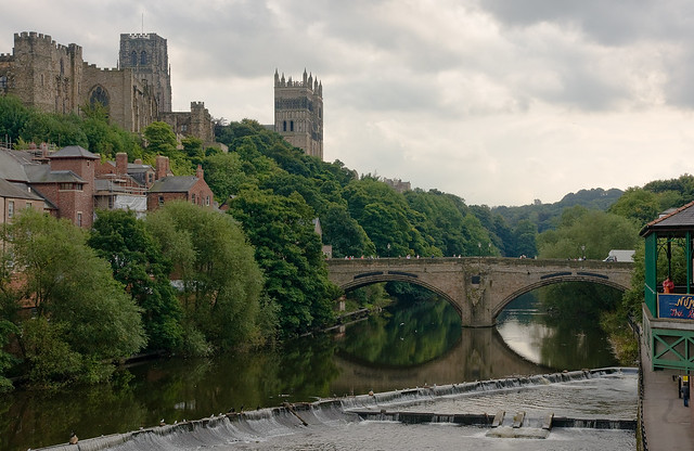
- Durham (City)
- Easington Colliery - town
- Easington
- East Blackdene, County Durham
- East Butsfield
- East Hedleyhope
- East Howle, County Durham
- East Kyo
- Eastgate
- Ebchester
- Edmondsley
- Edmundbyers
- Egglesburn
- Eggleston
- Eldon Lane
- Eldon
- Elstob
- Embleton
- Escomb
- Esh Winning
- Esh
- Etherley Dean
- Etherley Grange
- Evenwood Gate
- Ettersgill, County Durham
- Evenwood
- Farms in County Durham
- Ferryhill
- Ferryhill Station
- Fir Tree, County Durham
- Fishburn
- Forest-in-Teesdale
- Foxton
- Framwellgate Moor
- Frosterley
- Gainford
- Garmondsway
- Gilesgate
- Gilesgate Moor
- Gilmonby
- Grains O'th' Beck, Lunedale
- Grange Villa
- Grants Houses
- Grassholme
- Great Burdon
- Great Isle, County Durham
- Great Lumley
- Great Stainton
- Greencroft
- Greenhead, Stanhope
- Greta Bridge
- Gurney Valley
- Hallgarth
- Hamsteels, County Durham
- Hamsterley, near Bishop Auckland
- Hamsterley, near Consett
- Handen Hold
- Harelaw
- Harperley
- Harwood
- Haswell Moor
- Haswell Plough
- Haswell
- Hawthorn
- Headlam
- Healeyfield
- Heathery Cleugh (parish)
- Hedley Hope
- Heighington
- Helmington Row
- Hesleden
- Hett
- High Coniscliffe
- High Etherley
- High Handenhold
- High Hesleden
- High Lands
- High Pittington
- Hill End
- Hilton
- Historical Accounts of County Durham
- Hobson
- Hollinside, County Durham
- Holmside
- Holwick
- Holywell, near Sunderland Bridge
- Hope, County Durham
- Horden
- Houghton Bank
- Howden-le-Wear
- Hulam
- Hummerbeck, West Aukland
- Hunderthwaite
- Hunstanworth
- Hunwick
- Hurworth Place
- Hurworth-on-Tees
- Hutton Henry
- Hutton Magna
- Ingleton
- Inkerman
- Ireshopeburn
- Iveston
- Kelloe
- Ketton
- Keverstone Grange
- Kimblesworth
- Kinley Hill
- Kinninvie
- Kip Hill, County Durham
- Kirk Merrington
- Knitsley
- Laithkirk
- Lanchester
- Lane Head (Hutton Magna)
- Lanehead
- Langdon Beck, County Durham
- Langley Moor
- Langley Park
- Langton
- Lartington
- Leadgate
- Leamside
- Leasingthorne
- Leeholme
- Lintz Green
- Lintz
- Lintzford
- Little Isle, County Durham
- Little Newsham
- Littletown, County Durham
- Low Allers
- Low Beechburn
- Low Coniscliffe
- Low Disdale
- Low Etherley
- Low Lands
- Low Westwood, Hamsterley
- Ludworth
- Lynesack
- Maiden Law, County Durham
- Mainsforth
- Meadowfield
- Medomsley
- Metal Bridge, County Durham
- Mickleton
- Middle Blackdene
- Middlestone
- Middleton-in-Teesdale
- Middridge
- Monk Hesleden
- Moorsley Banks
- Mordon
- Morley
- Morton Grange
- Morton Tinmouth
- Muggleswick
- Murton
- Nesbitt
- Nettlesworth
- New Brancepeth
- New Kyo
- Newbiggin (Teesdale)
- Newfield (Bishop Auckland)
- Newfield (Pelton)
- Newton Aycliffe
- No Place
- North Bitchburn
- Oakenshaw
- Old Cassop
- Old Durham
- Old Eldon
- Old Park, County Durham
- Old Quarrington
- Ouston
- Ovington
- Oxhill
- Parkhill
- Pelton
- Pelton Fell
- Perkinsville
- Peterlee
- Phoenix Row, County Durham
- Pickering Nook
- Pity Me
- Plawsworth
- Plawsworth Gate
- Preston-le-Skerne
- Quaking Houses, County Durham
- Quarrington Hill
- Quebec
- Quickburn Grange
- Rainton Gate
- Raisby
- Ramshaw (Bishop Auckland)
- Ramshaw, near Consett
- Roddymoor
- Rokeby
- Romaldkirk
- Rookhope
- Rowley
- Ruffside, County Durham
- Rushyford
- Sacriston
- Satley
- Scargill
- Seaham
- Seaton
- Sedgefield
- Shadforth
- Sheraton
- Sherburn Hill
- Sherburn House
- Sherburn Village
- Shield Row, Stanley
- Shildon
- Shincliffe & High Shincliffe
- Shittlehope
- Shotley Bridge
- Shotton Colliery
- Shotton, near Sedgefield
- Slingley Hill, County Durham
- South Church
- South Cleatlam
- South Hetton
- South Moor
- South Wingate
- Spennymoor
- Spring Gardens, County Durham
- St Helen Auckland
- St John's Chapel
- Staindrop
- Stainton Grove
- Stainton
- Stanhope
- Stanley Crook
- Stanley
- Startforth
- Station Town
- Stockley, County Durham
- Streatlam
- Sunderland Bridge
- Sunniside
- Sunnybrow, County Durham
- Tanfield
- Tanfield Lea
- Tantobie
- The Middles, Stanley, County Durham
- Thornley (near Durham)
- Thornley, Weardale
- Thorpe, County Durham
- Thringarth
- Thrislington
- Tindale Crescent (village), County Durham
- Toft Hill
- Tow Law
- Town Kelloe
- Trimdon
- Tudhoe
- Tursdale
- Urpeth
- Ushaw Moor
- Wackerfield
- Waldridge
- Waskerley
- Waterhouses
- Wearhead
- Weeds, near Westgate
- West Auckland
- West Blackdene, County Durham
- West Butsfield
- West Kyo
- West Pelton
- West Rainton
- West Thickley
- Westerton
- Westgate
- Westwick, County Durham
- Wheatley Hill
- White-le-Head
- Whitwell House
- Whitworth
- Whorlton
- Willington
- Wind Mill
- Windlestone
- Wingate
- Winston
- Witton Gilbert
- Witton Park
- Witton-le-Wear
- Wolsingham
- Woodland
- Woodstone Village
- Wycliffe
County Durham
 |
 |
 |
 |
 |
| Barnard Castle | Bishop Auckland | Chester-le-Street | Consett | Darlington |
 |
 |
 |
 |
 |
| Durham (city) | Newton Aycliffe | Peterlee | Shildon | Spennymoor |
Settlements: A B C D E F G H I J K L M N O P Q R S T U V W X Y Z
Nb. this is not an exhaustive list. See also: Tees Valley, some of which includes settlements within the ceremonial county of County Durham.
Anglian Kingdom of Bernicia
Around AD 547, an Angle named Ida founded the kingdom of Bernicia after spotting the defensive potential of a large rock at Bamburgh, upon which many a fortification was thenceforth built . Ida was able to forge, hold and consolidate the kingdom; although the native British tried to take back their land, the Angles triumphed and the kingdom endured.
Kingdom of Northumbria
In AD 604, Ida's grandson Æthelfrith forcibly merged Bernicia (ruled from Bamburgh) and Deira (ruled from York, which was known as Eforwic at the time) to create the Kingdom of Northumbria. In time, the realm was expanded, primarily through warfare and conquest; at its height, the kingdom stretched from the river Humber (from which the kingdom drew its name) to the Forth. Eventually, factional fighting and the rejuvenated strength of neighbouring kingdoms, most notably Mercia, led to Northumbria's decline . The arrival of the Vikings hastened this decline, and the Scandinavian raiders eventually claimed the Deiran part of the kingdom in AD 867 (which became Jórvík). The land that would become County Durham now sat on the border with the Great Heathen Army, a border which today still (albeit with some adjustments over the years) forms the boundaries between Yorkshire and County Durham.
Despite their success south of the river Tees, the Vikings never fully conquered the Bernician part of Northumbria, despite the many raids they had carried out on the kingdom . However, viking control over the Danelaw, the central belt of Anglo-Saxon territory, resulted in Northumbria becoming isolated from the rest of Anglo-Saxon Britain. Scots invasions in the north pushed the kingdom's northern boundary back to the river Tweed, and the kingdom found itself reduced to a dependent earldom, its boundaries very close to those of modern-day Northumberland and County Durham. The kingdom was annexed into England in AD 954.
City of Durham Founded
In AD 995, St Cuthbert's community, who had been transporting Cuthbert's remains around, partly in an attempt to avoid them falling into the hands of Viking raiders, settled at Dunholm (Durham) on a site that was defensively favourable due to the horseshoe-like path of the River Wear . St Cuthbert's remains were placed in a shrine in the White Church, which was originally a wooden structure but was eventually fortified into a stone building.
County Palatine of Durham
Once the City of Durham had been founded, the Bishops of Durham gradually acquired the lands that would become County Durham. Bishop Aldhun began this process by procuring land in the Tees and Wear valleys, including Norton, Stockton, Escomb and Aucklandshire in 1018. In 1031, King Canute gave Staindrop to the Bishops. This territory continued to expand, and was eventually given the status of a liberty. Under the control of the Bishops of Durham, the land had various names: the "Liberty of Durham", "Liberty of St Cuthbert's Land" "the lands of St. Cuthbert between Tyne and Tees" or "the Liberty of Haliwerfolc".
The bishops' special jurisdiction rested on claims that King Ecgfrith of Northumbria had granted a substantial territory to St Cuthbert on his election to the see of Lindisfarne in 684. In about 883 a cathedral housing the saint's remains was established at Chester-le-Street and Guthfrith, King of York granted the community of St Cuthbert the area between the Tyne and the Wear, before the community reached its final destination in 995, in Durham.
Following the Norman invasion, the administrative machinery of government extended only slowly into northern England. Northumberland's first recorded Sheriff was Gilebert from 1076 until 1080 and a 12th-century record records Durham regarded as within the shire. However the bishops disputed the authority of the sheriff of Northumberland and his officials, despite the second sheriff for example being the reputed slayer of Malcolm Canmore, King of Scots. The crown regarded Durham as falling within Northumberland until the late thirteenth century. Matters came to a head in 1293 when the bishop and his steward failed to attend proceedings of quo warranto held by the justices of Northumberland. The bishop's case went before parliament, where he stated that Durham lay outside the bounds of any English shire and that "from time immemorial it had been widely known that the sheriff of Northumberland was not sheriff of Durham nor entered within that liberty as sheriff. . . nor made there proclamations or attachments". The arguments appear to have prevailed, as by the fourteenth century Durham was accepted as a liberty which received royal mandates direct. In effect it was a private shire, with the bishop appointing his own sheriff. The area eventually became known as the "County Palatine of Durham".
Sadberge was a liberty, sometimes referred to as a county, within Northumberland. In 1189 it was purchased for the see but continued with a separate sheriff, coroner and court of pleas. In the 14th century Sadberge was included in Stockton ward and was itself divided into two wards. The division into the four wards of Chester-le-Street, Darlington, Easington and Stockton existed in the 13th century, each ward having its own coroner and a three-weekly court corresponding to the hundred court. The diocese was divided into the archdeaconries of Durham and Northumberland. The former is mentioned in 1072, and in 1291 included the deaneries of Chester-le-Street, Auckland, Lanchester and Darlington.
The term palatinus is applied to the bishop in 1293, and from the 13th century onwards the bishops frequently claimed the same rights in their lands as the king enjoyed in his kingdom.
Early administration
Overview
The historic boundaries of County Durham included a main body covering the catchment of the Pennines in the west, the River Tees in the south, the North Sea in the east and the Rivers Tyne and Derwent in the north. The county palatinate also had a number of liberties: the Bedlingtonshire, Islandshire and Norhamshire exclaves within Northumberland, and the Craikshire exclave within the North Riding of Yorkshire. In 1831 the county covered an area of and had a population of 253,910. These exclaves were included as part of the county for parliamentary electoral purposes until 1832, and for judicial and local-government purposes until the coming into force of the Counties (Detached Parts) Act 1844, which merged most remaining exclaves with their surrounding county. The boundaries of the county proper remained in use for administrative and ceremonial purposes until the 1972 Local Government Act.
The Early English and Norman period
Following the Battle of Hastings, William the Conqueror appointed Copsig as Earl of Northumbria, thereby bringing what would become County Durham under Copsig's control. Copsig was, just a few weeks later, killed in Newburn. Having already being previously offended by the appointment of a non-Northumbrian as Bishop of Durham in 1042, the people of the region became increasingly rebellious. In response, in January 1069, William despatched a large Norman army, under the command of Robert de Comines, to Durham City. The army, believed to consist of 700 cavalry (about one-third of the number of Norman knights who had participated in the Battle of Hastings), entered the city, whereupon they were attacked, and defeated, by a Northumbrian assault force. The Northumbrians wiped out the entire Norman army, including Comines, all except for one survivor, who was allowed to take the news of this defeat back.
Following the Norman slaughter at the hands of the Northumbrians, resistance to Norman rule spread throughout Northern England, including a similar uprising in York. William The Conqueror subsequently (and successfully) attempted to halt the northern rebellions by unleashing the notorious Harrying of the North (1069–1070). Because William's main focus during the harrying was on Yorkshire, County Durham was largely spared the Harrying. The best remains of the Norman period include Durham Cathedral and Durham Castle, and several parish churches, such as St Laurence Church in Pittington. The Early English period has left the eastern portion of the cathedral, the churches of Darlington, Hartlepool, and St Andrew, Auckland, Sedgefield, and portions of a few other churches.
11th to 15th Century
Until the 15th century, the most important administrative officer in the Palatinate was the steward. Other officers included the sheriff, the coroners, the Chamberlain and the chancellor. The palatine exchequer originated in the 12th century. The palatine assembly represented the whole county, and dealt chiefly with fiscal questions. The bishop's council, consisting of the clergy, the sheriff and the barons, regulated judicial affairs, and later produced the Chancery and the courts of Admiralty and Marshalsea.
The prior of Durham ranked first among the bishop's barons. He had his own court, and almost exclusive jurisdiction over his men. There were ten palatinate barons in the 12th century, most importantly the Hyltons of Hylton Castle, the Bulmers of Brancepeth, the Conyers of Sockburne, the Hansards of Evenwood, and the Lumleys of Lumley Castle. The Nevilles owned large estates in the county. John Neville, 3rd Baron Neville de Raby rebuilt Raby Castle, their principal seat, in 1377.
Edward I's quo warranto proceedings of 1293 showed twelve lords enjoying more or less extensive franchises under the bishop. The repeated efforts of the Crown to check the powers of the palatinate bishops culminated in 1536 in the Act of Resumption, which deprived the bishop of the power to pardon offences against the law or to appoint judicial officers. Moreover, indictments and legal processes were in future to run in the name of the king, and offences to be described as against the peace of the king, rather than that of the bishop. In 1596 restrictions were imposed on the powers of the chancery, and in 1646 the palatinate was formally abolished. It was revived, however, after the Restoration, and continued with much the same power until 5 July 1836, when the Durham (County Palatine) Act 1836 provided that the palatine jurisdiction should in future be vested in the Crown.
15th Century to the modern era
During the 15th-century Wars of the Roses, Henry VI passed through Durham. On the outbreak of the Great Rebellion in 1642 Durham inclined to support the cause of the Parliament, and in 1640 the high sheriff of the palatinate guaranteed to supply the Scottish army with provisions during their stay in the county. In 1642 the Earl of Newcastle formed the western counties into an association for the King's service, but in 1644 the palatinate was again overrun by a Scottish army, and after the Battle of Marston Moor (2 July 1644) fell entirely into the hands of the parliament.
In 1614 a bill was introduced in parliament for securing representation to the county and city of Durham and the borough of Barnard Castle. The bishop strongly opposed the proposal as an infringement of his palatinate rights, and the county was first summoned to return members to parliament in 1654. After the Restoration of 1660 the county and city returned two members each. In the wake of the Reform Act of 1832 the county returned two members for two divisions, and the boroughs of Gateshead, South Shields and Sunderland acquired representation. The boroughs of Darlington, Stockton and Hartlepool returned one member each from 1868 until the Redistribution Act of 1885.
Modern local government
The Municipal Corporations Act 1835 reformed the municipal boroughs of Durham, Stockton on Tees and Sunderland. In 1875, Jarrow was incorporated as a municipal borough, as was West Hartlepool in 1887. At a county level, the Local Government Act 1888 reorganised local government throughout England and Wales. Most of the county came under control of the newly-formed Durham County Council in an area known as an administrative county. Not included were the county boroughs of Gateshead, South Shields and Sunderland. However, for purposes other than local government, the administrative county of Durham and the county boroughs continued to form a single county to which the Crown appointed a Lord Lieutenant of Durham.
Over its existence, the administrative county lost territory, both to the existing county boroughs, and because two municipal boroughs became county boroughs: West Hartlepool in 1902 and Darlington in 1915. The county boundary with the North Riding of Yorkshire was adjusted in 1967: that part of the town of Barnard Castle historically in Yorkshire was added to County Durham, while the administrative county ceded the portion of the Borough of Stockton-on-Tees in Durham to the North Riding. In 1968, following the recommendation of the Local Government Commission, Billingham was transferred to the county borough of Teesside, in the North Riding. In 1971 the population of the county - including all associated county boroughs (an area of ) - was 1,409,633, with a population outside the county boroughs of 814,396.
In 1974, the Local Government Act 1972 abolished the administrative county and the county boroughs, reconstituting County Durham as a non-metropolitan county. The reconstituted County Durham lost territory to the north-east (around Gateshead, South Shields and Sunderland) to Tyne and Wear and to the south-east (around Hartlepool) to Cleveland. At the same time it gained the former area of Startforth Rural District from the North Riding of Yorkshire. The area of the Lord Lieutenancy of Durham was also adjusted by the Act to coincide with the non-metropolitan county (which occupied in 1981).
In 1996, as part of the 1990s UK local government reform, Cleveland was abolished and its districts were reconstituted as unitary authorities. Hartlepool and Stockton-on-Tees (north of the River Tees) were returned to Durham for the purposes of Lord Lieutenancy. The change in area for Lord Lieutenancy purposes to reflect the abolition of Cleveland was confirmed by the Lieutenancies Act 1997. Cleveland was adopted as a postal county in 1974 and by the time of its abolition, the Royal Mail had abandoned the use of postal counties altogether. Since 1996 the use of a county address line is permitted but not mandatory and can be however a writer wishes.
In 1997 Darlington became a unitary authority and was separated from the shire county.
As part of the 2009 structural changes to local government in England initiated by the Department for Communities and Local Government, the seven district councils within the County Council area were abolished. The County Council assumed their functions and became a unitary authority. The changes came into effect on 1 April 2009.
Visit the page: County Durham for references and further details. You can contribute to this article on Wikipedia.
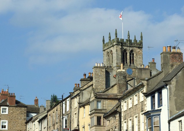
from Flickr (flickr)
Image taken from page 8 of 'Comprehensive Guide to the County of Durham. With maps and plans'
Pinned by Simon Cotterill
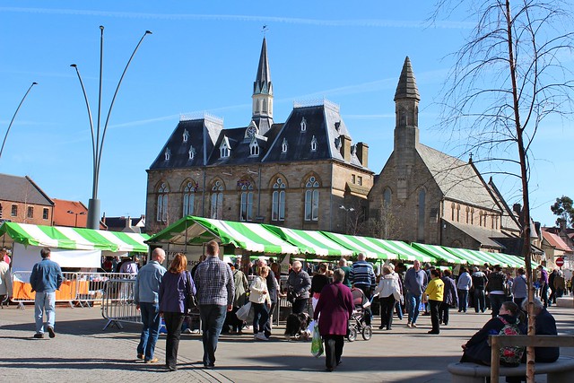
from Flickr (flickr)
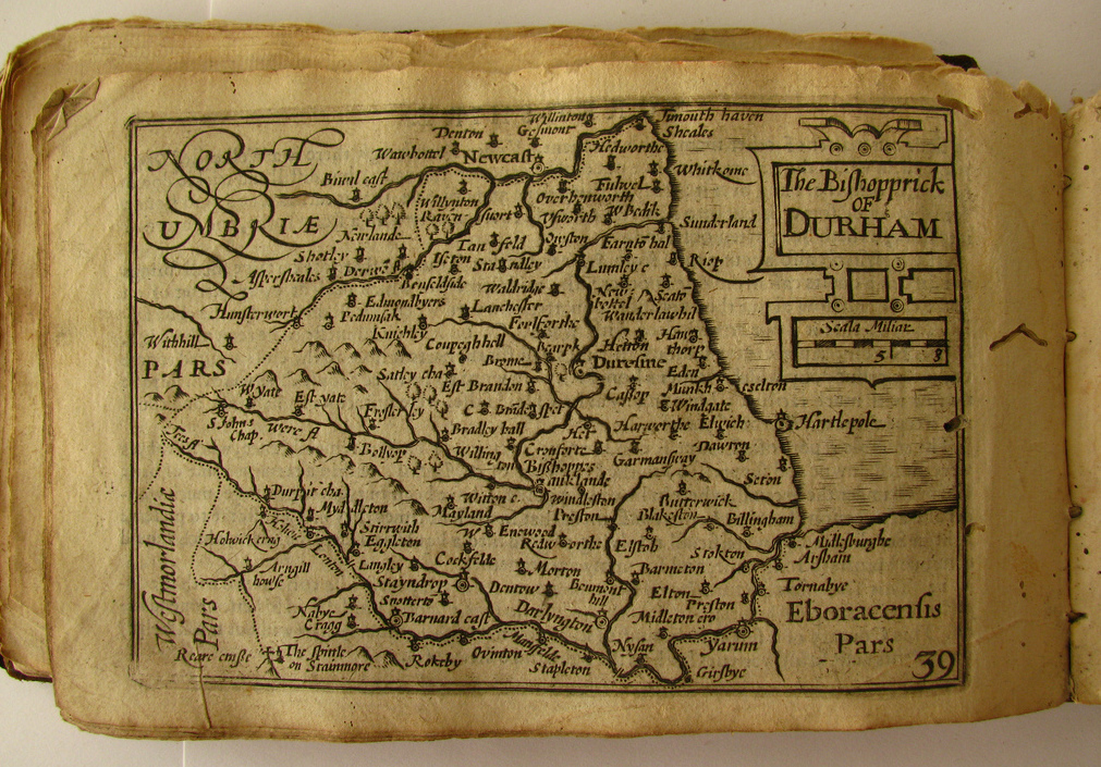
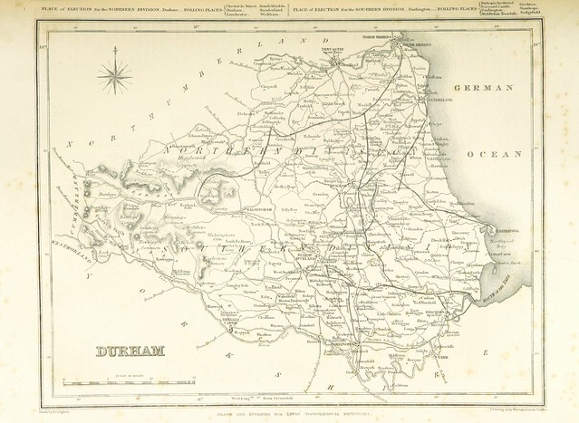
Image taken from page 119 of '[A Topographical Dictionary of England ... and the Islands of Guernsey, Jersey and Man ... with maps ... and a plan of London, etc.]'
Pinned by Simon Cotterill
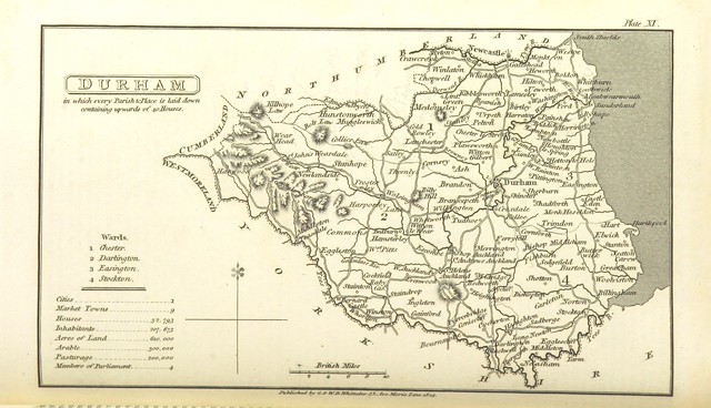
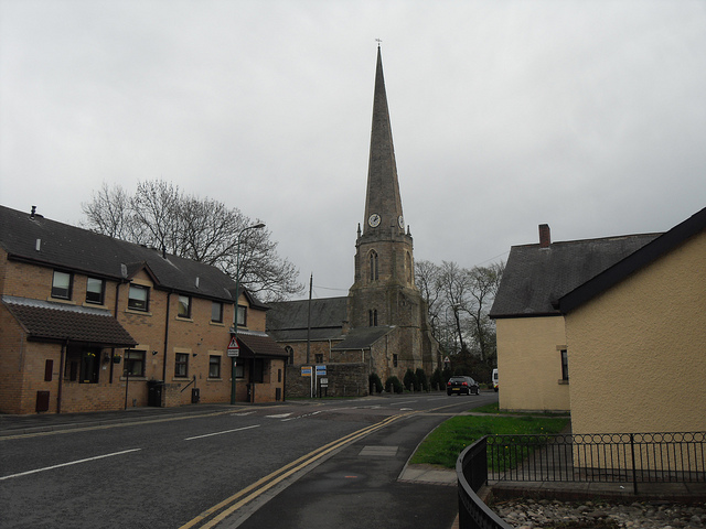
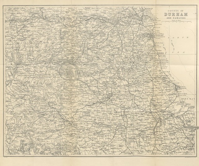
from Flickr (flickr)
Image taken from page 338 of '[A Topographical Dictionary of the United Kingdom ... accompanied by forty-six maps, etc.]'
Pinned by Simon Cotterill
Co-Curate Page
Sadberge
- Overview About Sadberge Map Street View Sadberge is a village located about 3 miles north-east of Darlington and 5 miles south-west of Stockton-on-Tees. Sadberge lies within the Borough of Darlington …
Co-Curate Page
Fencehouses
- Overview About Fencehouses Map Street View Fencehouses (or Fence Houses) is a village on the edge of the boundary between the City of Sunderland and County Durham. It is just …
from https://metalanddust.org/2016…
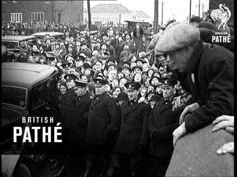
Planning for Destruction After the Death of Coal in County Durham
- "....The 1951 County Durham Development Plan was far-reaching and made full use of the authority’s new ability to exercise benevolent paternalism over its population. In the view of the plan’s …
Added by
Peter Smith


from Flickr (flickr)
Image taken from page 8 of 'Comprehensive Guide to the County of Durham. With maps and plans'
Pinned by Simon Cotterill
from Flickr (flickr)
Image taken from page 119 of '[A Topographical Dictionary of England ... and the Islands of Guernsey, Jersey and Man ... with maps ... and a plan of London, etc.]'
Pinned by Simon Cotterill
from Flickr (flickr)
Image taken from page 338 of '[A Topographical Dictionary of the United Kingdom ... accompanied by forty-six maps, etc.]'
Pinned by Simon Cotterill
Co-Curate Page
Sadberge
- Overview About Sadberge Map Street View Sadberge is a village located about 3 miles north-east of Darlington and 5 miles south-west of Stockton-on-Tees. Sadberge lies within the Borough of Darlington …
Co-Curate Page
Fencehouses
- Overview About Fencehouses Map Street View Fencehouses (or Fence Houses) is a village on the edge of the boundary between the City of Sunderland and County Durham. It is just …
from https://metalanddust.org/2016…
Planning for Destruction After the Death of Coal in County Durham
- "....The 1951 County Durham Development Plan was far-reaching and made full use of the authority’s new ability to exercise benevolent paternalism over its population. In the view of the plan’s …
Added by
Peter Smith


