Topics > Landmarks, Parks and Buildings > Bridges
Bridges
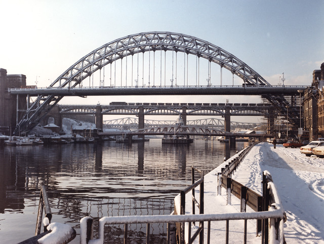
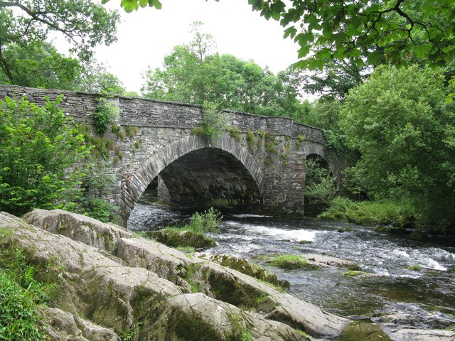
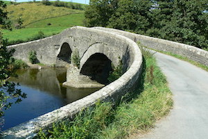
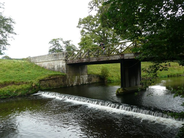
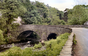
Some of the many wonderful bridges connecting communities in North East England and Cumbria... Timeline


| Bridge | Over | Type | Built | Location / Near | County / Met | Notes |
|
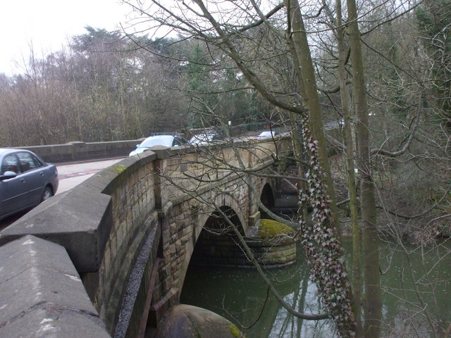
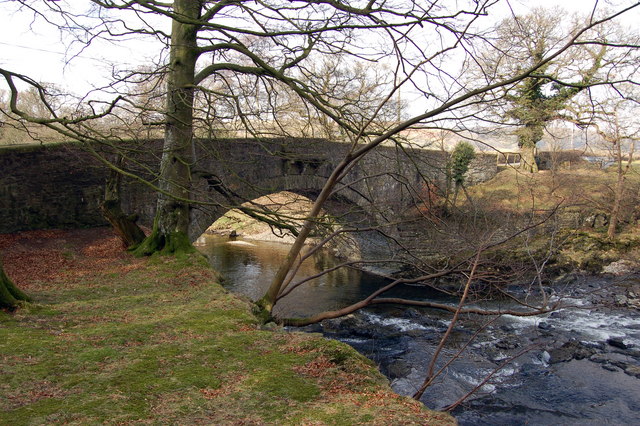
|
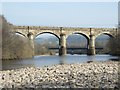
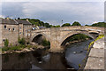
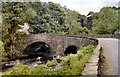
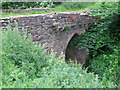
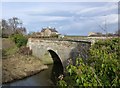
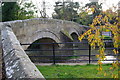
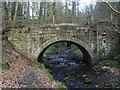
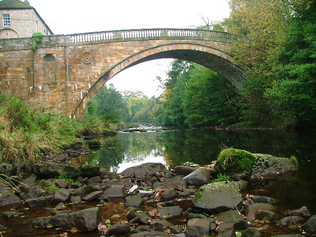
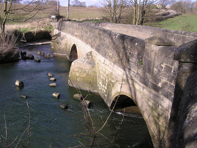
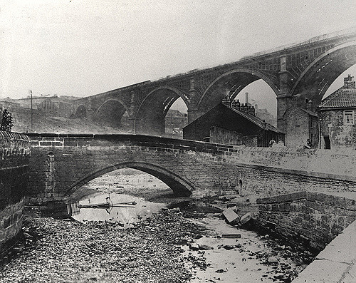
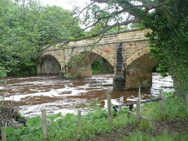
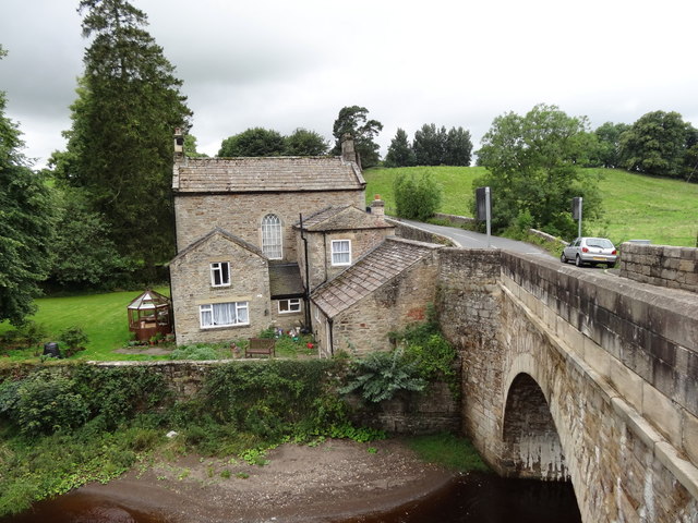
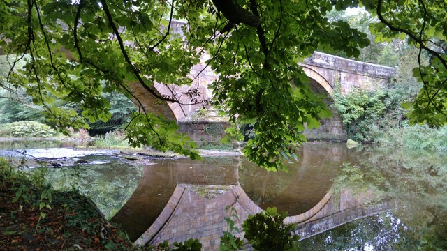
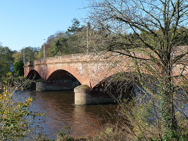
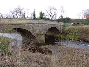
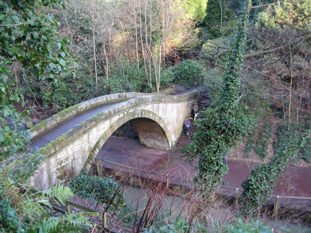
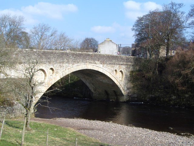
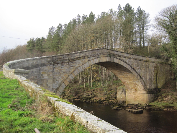
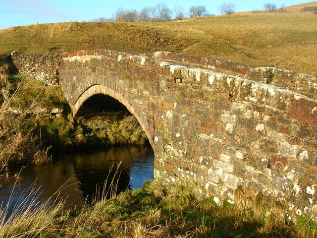
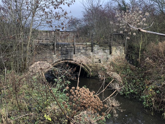
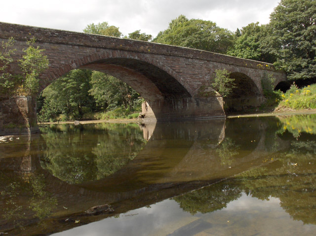
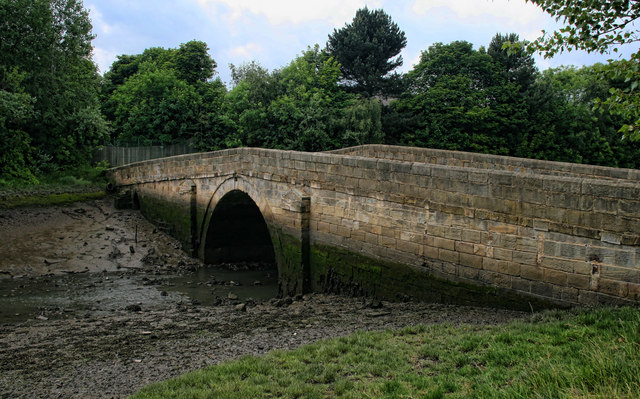
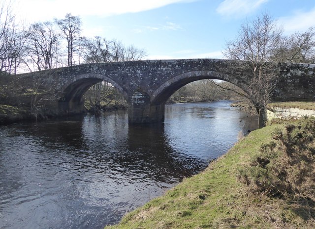
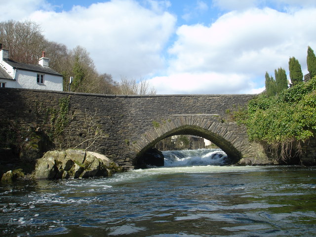
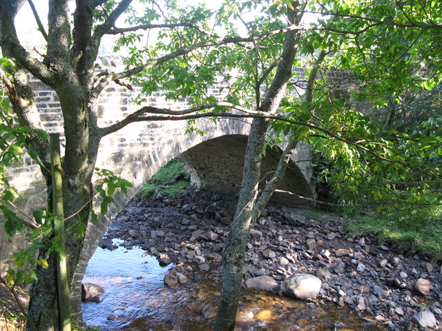
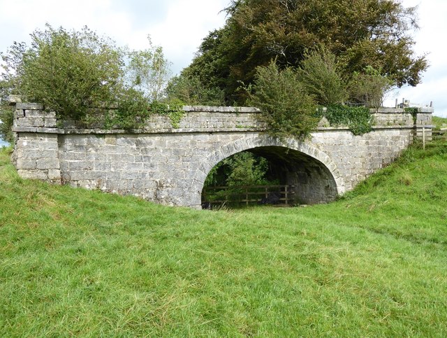
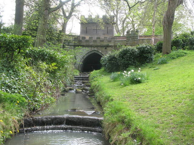
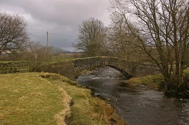
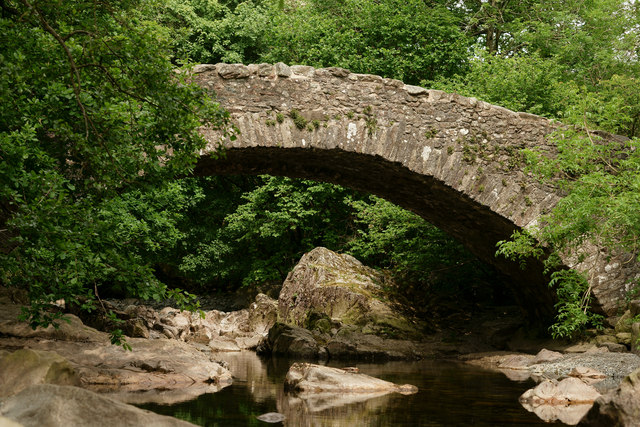
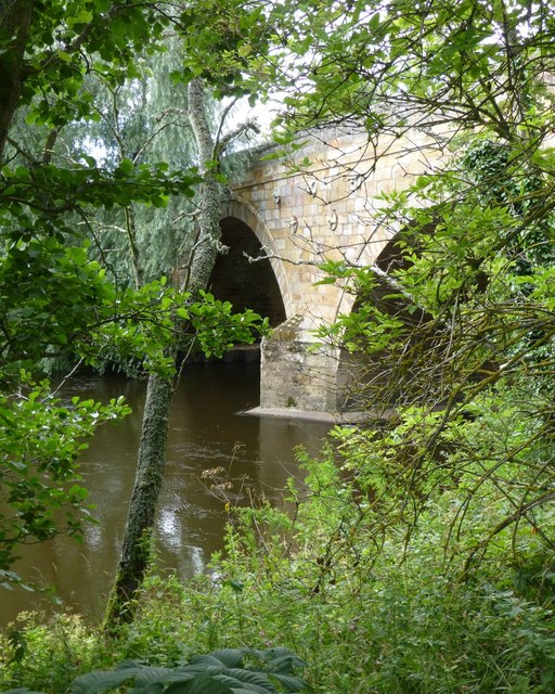
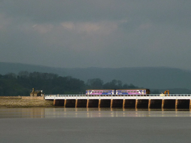
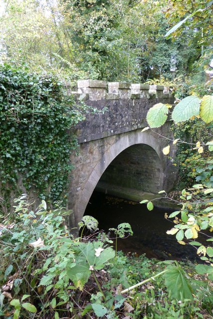
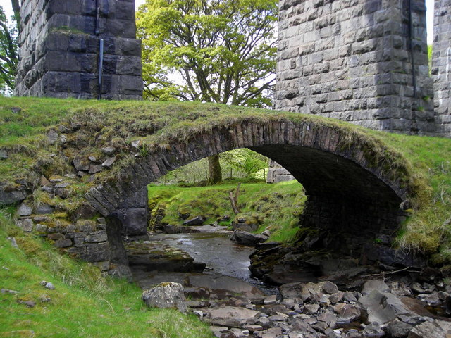
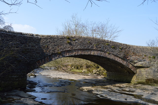
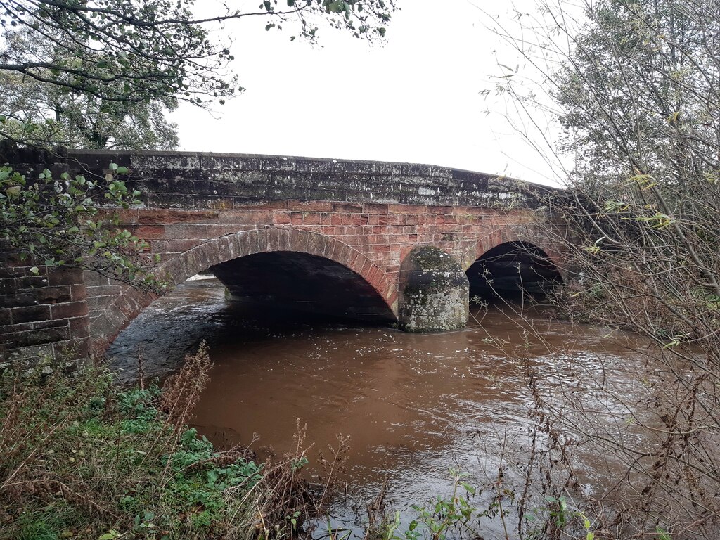
River Tees | Road | 1773 | Egglestone Abbey | County Durham | Grade II* listed |
|
|
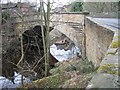
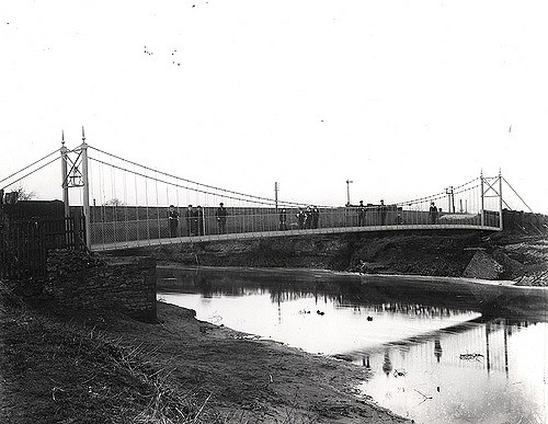
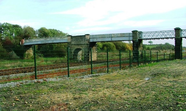
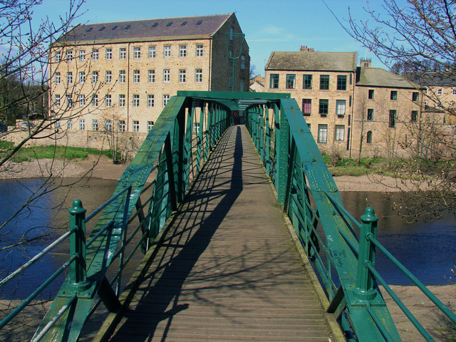
River South Tyne | Pedestrian | 1852 | Haltwhistle | Northumberland | Grade II listed. Built as a railway bridge. |
| River Eden | Road | C18th | Armathwaite | Cumbria | Grade II listed. | |
|
|
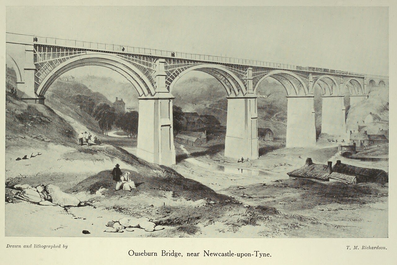
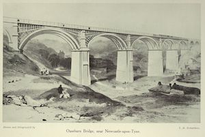
Ouseburn | Pedestrian | 1878 | Jesmond Dene | Newcastle | Grade II listed. Built as a road bridge. |
|
|
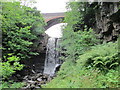
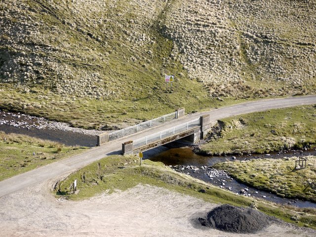
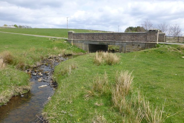
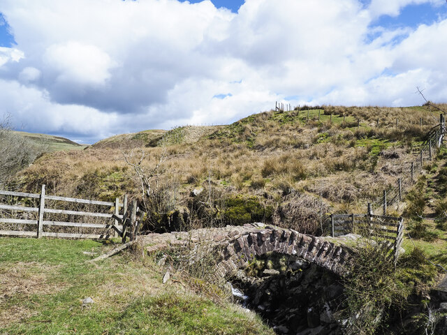
Ash Gill | Road | 1916 | Garrigill | Cumbria | Over Ashgill Force waterfall |
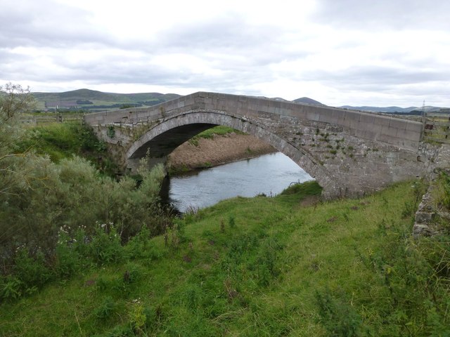
| River Lowther | Road | 1897 | Askham | Cumbria | Grade II listed | |
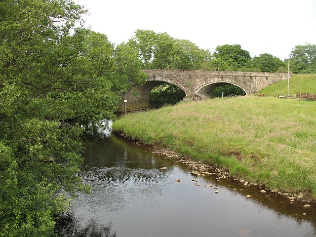
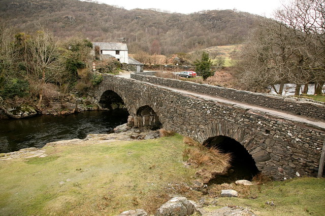
| River Leven (Cumbria) | Road | C18th | Backbarrow | Cumbria | Grade II listed | |
|
|
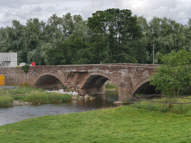
River Balder | Road | 1681 | Cotherstone | County Durham | Grade II* listed |
|
|
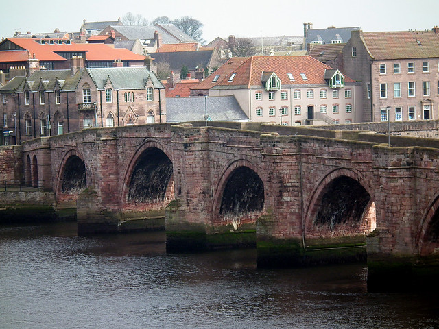
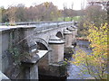
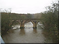
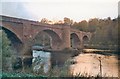
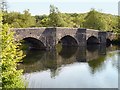
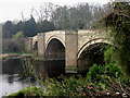
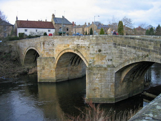
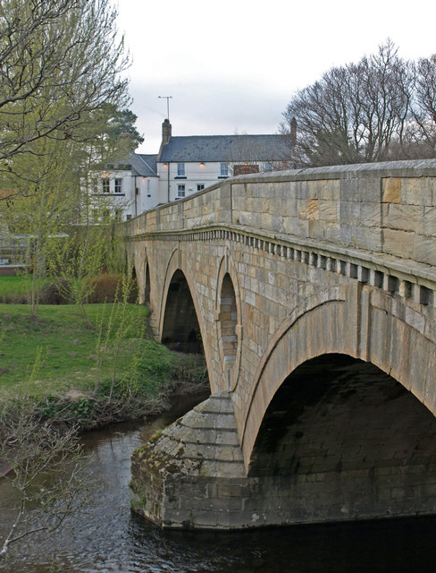
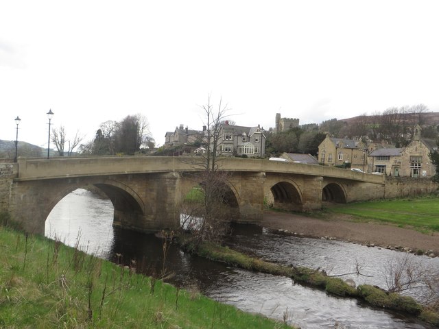
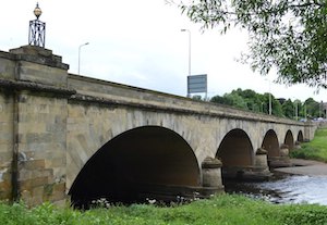
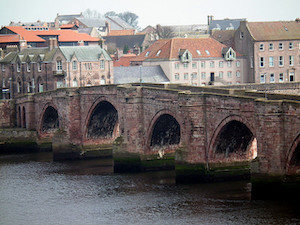
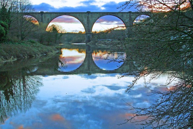
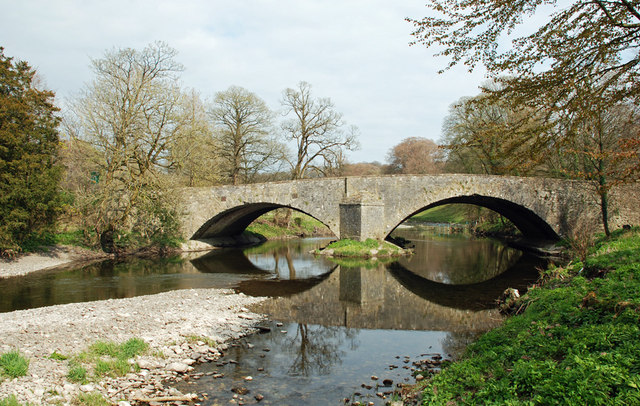
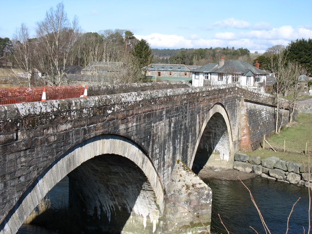
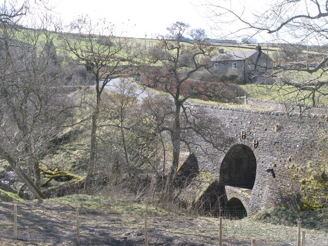
River Tees | Road | C14th | Barnard Castle - Starforth | County Durham | Grade I listed |
| River Blyth | Road | C16th | Bellasis, Stannington | Northumberland | Grade II listed | |
|
|
River North Tyne | Road | 1834 | Bellingham | Northumberland | |
| River Winster | Footbridge | C17th | South Lakeland | Cumbria | Grade II listed | |
|
|
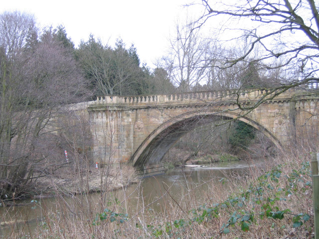
River Derwent (Tyne) | Road | C18th | Blanchland | Northumberland | Grade II listed |
| River Petteril | Road | C19th | Little Blencow | Cumbria | Grade II listed | |
|
|
River Eden | Road | 1870 | Bolton | Cumbria | |
|
|
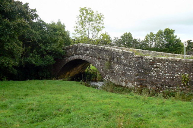
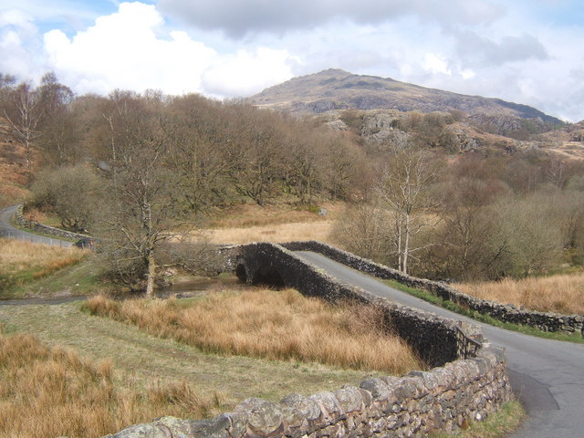
River Brathay | Road | Brathay | Cumbria | ||
|
|
River Brathay | Pedestrian | Brathay | Cumbria | ||
|
|
Devil's Water | Road | 1788 | Dilston | Northumberland | Grade II listed |
| River Till | Road | C19th | Doddington | Northumberland | Grade II listed | |
|
|
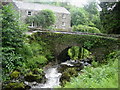
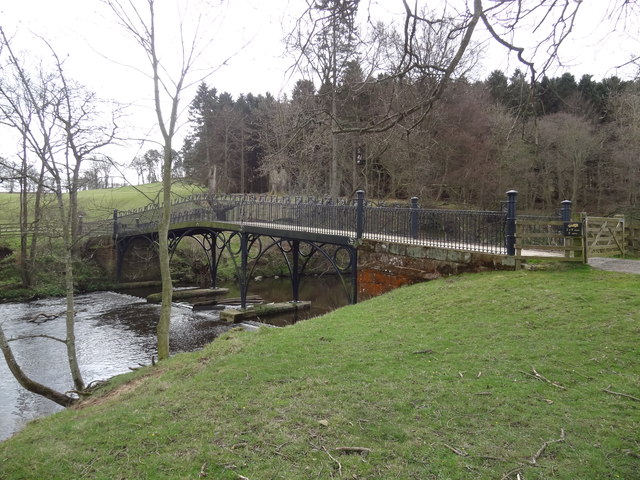
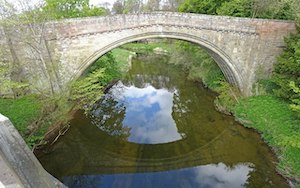
Rydal Beck | Road | C17th | Rydal | Cumbria | Grade II* listed |
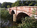
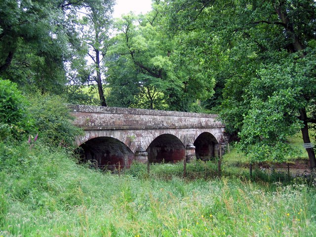
| River Derwent | Road | 1835 | Great Broughton | Cumbria | Grade II listed | |
| Wallsend Burn | Road | 2009 | Wallsend | North Tyneside | Replaced earlier bridge of 1913. | |
|
|
Ouseburn | Road | 1878 | Byker | Newcastle | Grade II listed |
|
|
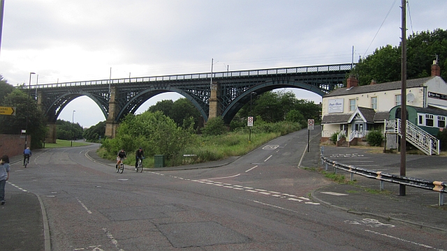
Ouseburn | Rail | 1979 | Byker | Newcastle | Purpose-built for T&W Metro |
|
|
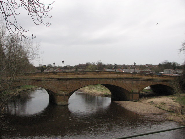
River Tyne | Road | 1838 | Bywell | Northumberland | Grade II listed |
|
|
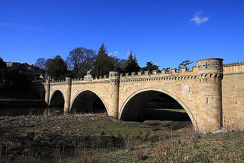
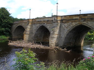
River Aln | Road | 1821 | Alnwick | Northumberland | Grade I listed |
| River Winster | c.1800 | Lindale | Cumbria | |||
|
|
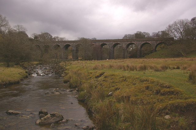
Causey Burn | Rail | 1726 | Tanfield | County Durham | Grade I listed |
| Lisles Burn | Road | C19th | East Woodburn | Northumberland | Grade II listed | |
|
|
Black Beck | Road | C14th | Barforth | County Durham | Grade II* listed |
|
|
River Wear | Road | C15th | Bournmoor | County Durham | Grade II* listed |
|
|
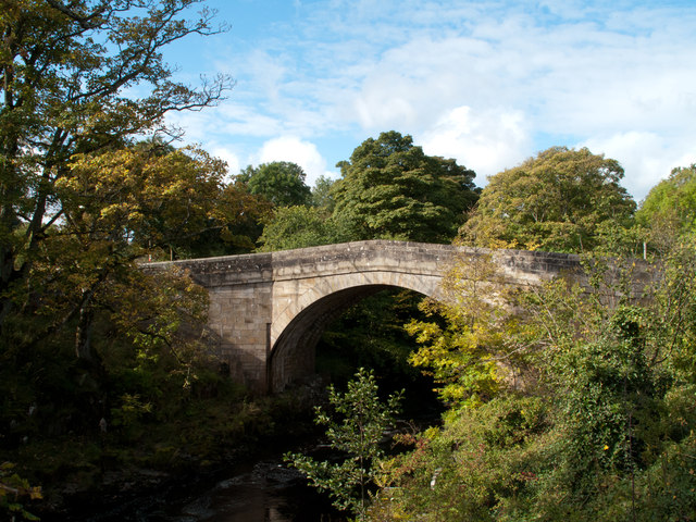
River North Tyne | Road | 1785 | Chollerford | Northumberland | Grade II listed |
| River Lyvennet | Road | 1825 | Cliburn | Cumbria | Grade II listed | |
| Clough River | Road | Clough, Garsdale | Cumbria | |||
|
|
River Tweed | Road | 1767 | Cornhill - Coldstream | Northumberland | Grade II* listed |
|
|
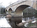
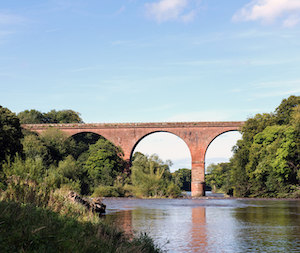
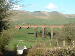
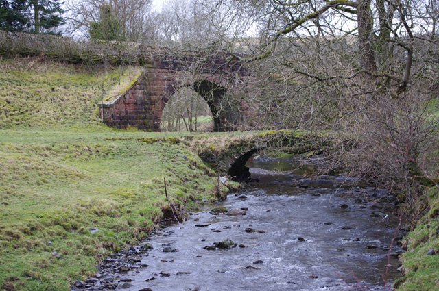
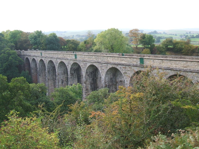
River Eden | Rail | 1834 | Great Corby - Wetheral | Cumbria | Grade I listed. aka Wetheral Viaduct |
|
|
River Tees | Pedestrian | 1932 | Cotherstone | County Durham | |
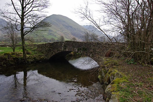
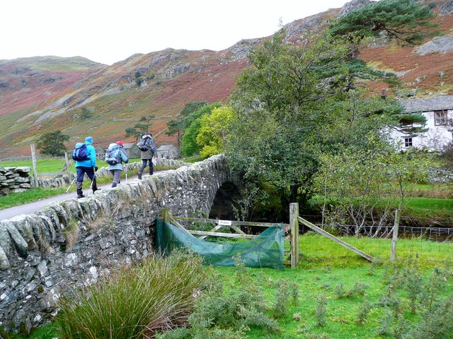
| Goldrill Beck | Road | C17th | Hartsop | Cumbria | Grade II listed | |
|
|
Ouseburn | Road | C18th | Ouseburn | Newcastle | Grade II listed |
|
|
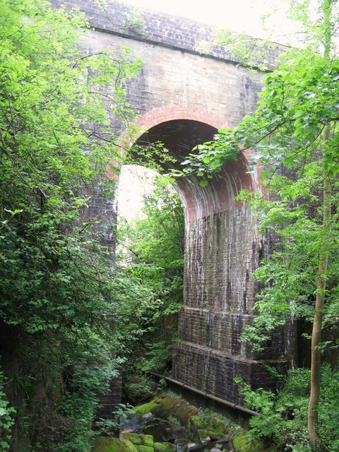
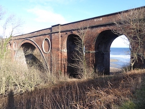
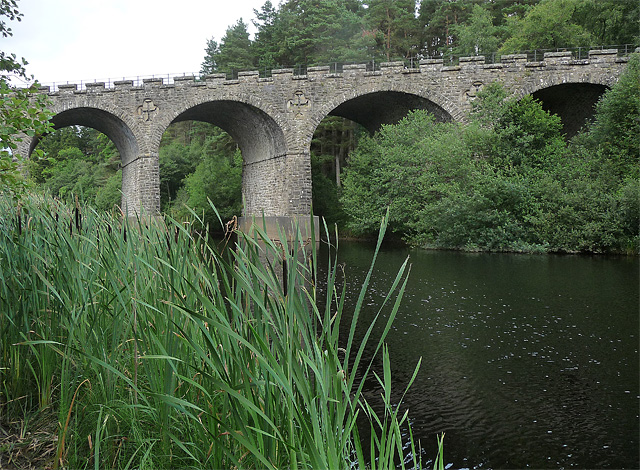
Crimdon Beck | Rail | 1905 | Crimdon | County Durham | |
|
|
River Lune (Cumbria) | Road | C16th | Crook of Lune, Lowgill | Cumbria | Grade II* listed |
| River Petteril | Road | C19th | Wreay | Cumbria | Grade II listed | |
| Croxdale Bridge | Croxdale Beck | Road | 1760 | Croxdale | County Durham | Grade II listed |
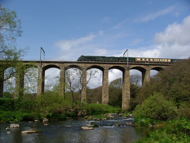
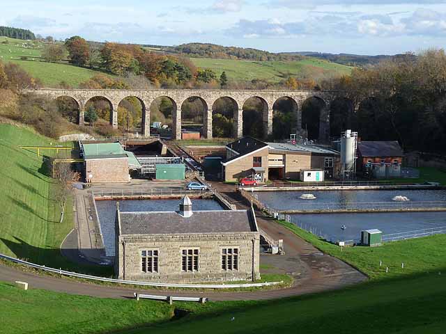
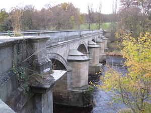
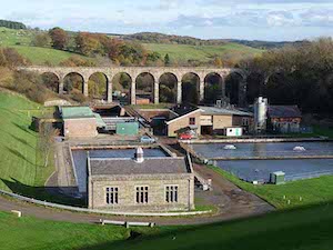
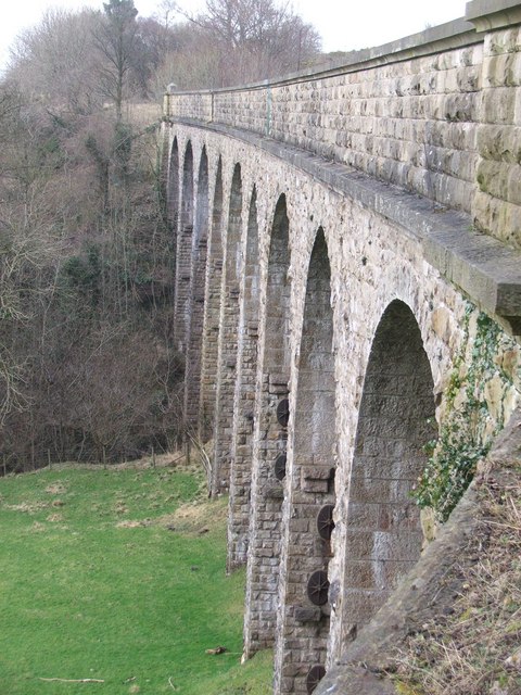
| Croxdale Viaduct | River Wear | Rail | 1872 | Croxdale | County Durham | |
| Cupola Bridge | River Allen | Road | 1778 | Whitfield | Northumberland | Grade II listed |
| Deepdale Footbridge | River Tees | Pedestrian | 1898 | Barnard Castle | County Durham | Grade II listed |
|
|
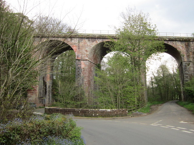
Castle Eden Burn | Rail | 1905 | Blackhall Colliery - Horden | County Durham | |
| Denwick Bridge | River Aln | Road | 1776 | Alnwick | Northumberland | Grade I listed |
| Devil's Bridge | River Lune (Cumbria) | Road | C14th | Kirkby Lonsdale | Cumbria | Grade I listed |
| Docker Viaduct | Flodder Beck | Rail | 1846 | Lamrigg | Cumbria | Grade II listed |
|
|
River Aln | Road | 1864 | Alnmouth | Northumberland | Grade II listed |
| Duchess's Footbridge | River Aln | Pedestrian | 1868 | Hulne Park, Alnwick | Northumberland | |
| Duke of Norfolk Bridge | River Petteril | Road | 1796 | Greystoke | Cumbria | Grade II listed & War memorial |
|
|
River Eamont | Road | C15th | Eamont Bridge | Cumbria | Grade I listed |
|
|
River Aln | Pedestrian | 1933 | Hulne Park, Alnwick | Northumberland | |
| Rookhope Burn | Road | C18th | Eastgate | County Durham | ||
|
|
River Eden | Road | 1815 | Carlisle | Cumbria | Grade I listed |
| Edlingham Railway Viaduct | Edlingham Burn | Rail | 1885 | Edlingham | Northumberland | Grade II listed |
| Eggleston Bridge | River Tees | Road | C17th | Eggleston | County Durham | Grade II* listed |
| Ellenhall Bridge | River Ellen | Road | C19th | Cumbria | Grade II listed | |
| Elliott Bridge | River Wansbeck | Pedestrian | 1982 | Morpeth | Northumberland | |
| Elsdon Bridge | Elsdon Burn | Road | C18th | Elsdon | Northumberland | Grade II |
|
|
River Wear | Road | 1160 | Durham | County Durham | Grade I, damaged by the Great Flood of 1771 |
| Factory Bridge | River Coquet | Road | 1865 | Guyzance | Northumberland | Grade II listed |
| Falstone Bridge | River North Tyne | Road | 1843 | Falstone | Northumberland | Grade II listed |
| Felton Old Bridge | River Coquet | Road | C15th | Felton - West Thirston | Northumberland | Grade II* listed |
| Featherstone Bridge | River South Tyne | Road | 1775 | Haltwhistle | Northumberland | Grade II* listed |
| Filbert Haugh Bridge | River Aln | Road | 1901 | Hulne Park, Alnwick | Northumberland | |
|
|
Long Nanny | Road | C19th | West Fleetham, Beadnell | Northumberland | Grade II listed |
| Footbridge by Banqueting Hall | Ouseburn | Pedestrian | 1870 | Jesmond Dene | Newcastle | Grade II listed |
| Footbridge by Dene Mill | Ouseburn | Pedestrian | 1862 | Jesmond Dene | Newcastle | Grade II listed |
| Footbridge over Harwood Beck | Harwood Beck | Pedestrian | Harwood, Teesdale | County Durham | ||
| Footbridge South of Red Walk | Ouseburn | Pedestrian | 1870 | Jesmond Dene | Newcastle | Grade II listed |
| Former Road Bridge | Elsdon Burn | Pedestrian | C18th | Elsdon | Northumberland | Grade II listed |
| Foss Bridge | River Wansbeck | Road | C18th | Mitford | Northumberland | Grade II listed |
| Fowberry Bridge | River Till | Road | 1825 | Fowberry | Northumberland | Grade II listed |
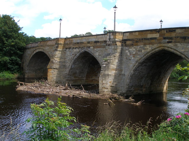
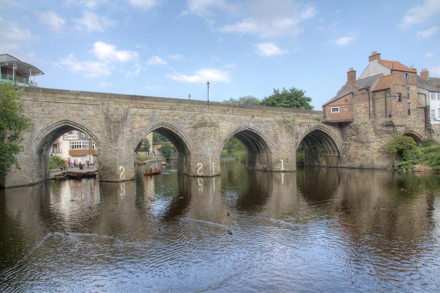
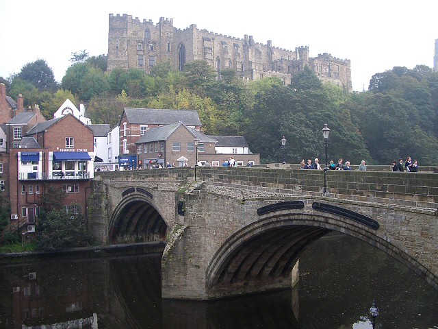
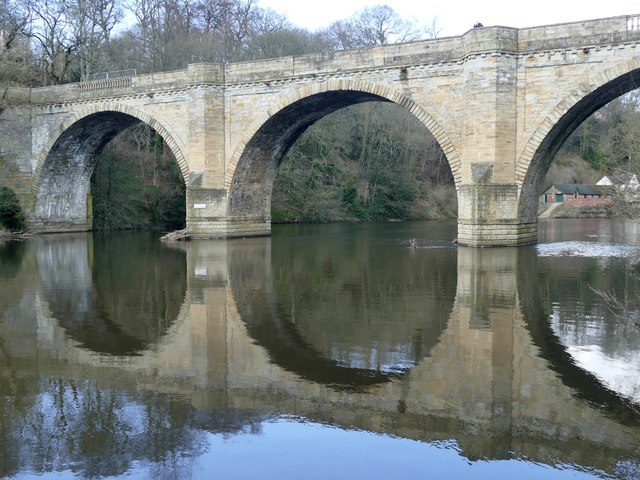
| Framwellgate Bridge | River Wear | Road | C15th | Durham | County Durham | Grade I listed |
| Frank's Bridge | River Eden | Pedestrian | C17th | Kirkby Stephen | Cumbria | Grade II listed |
|
|
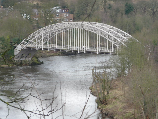
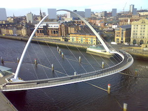
River Tyne | Pedestrian | 2001 | Newcastle - Gateshead | Newcastle, Gateshead | Pivot bridge - cycle & pedestrian |
| Dalton Bridge | Dalden Dene | Pedestrian | 1789 | Tees Valley | Grade II listed | |
| Gelt Bridge | River Gelt | Rail | 1835 | Hayton CP | Cumbria | Grade II* listed |
| Greta Bridge | River Greta | Road | 1773 | Greta Bridge | County Durham | Grade II* listed |
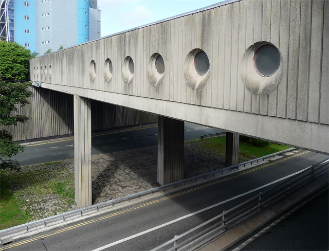
| Hadrian Bridge | Central Motorway | Pedestrian | C20th | Newcastle | Newcastle | by Robinson Library of Newcastle University |
| Hagg Bank Bridge | River Tyne | Pedestrian | 1876 | Wylam | Northumberland | Grade II* listed. Originally built as a railway bridge. |
| Hartford Bridge | River Blyth | Road | C16th | Hartford Bridge | Northumberland | Grade II listed |
| Hartburn Bridge | Hart Burn | Road | C18th | Hartburn | Northumberland | Grade II listed |
| Hawes Bridge | River Kent | Road | C18th | Natland | Cumbria | Grade II listed |
|
|
Hawthorn Burn | Rail | 1905 | Hawthorn | County Durham | Grade II listed |
| Heatherycleugh Bridge | Heathery Cleugh | Road | 1810 | Cornriggs | County Durham | Grade II listed |
| Hepple Bridge | River Coquet | Road | Hepple | Northumberland | Modern bridge on 1874 piers | |
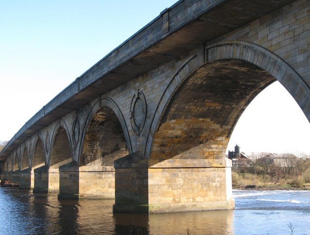
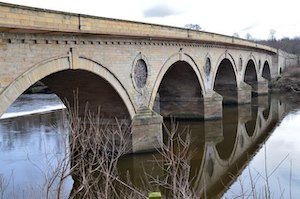
| Hexham Bridge | River Tyne | Road | 1793 | Hexham | Northumberland | Grade II* listed |
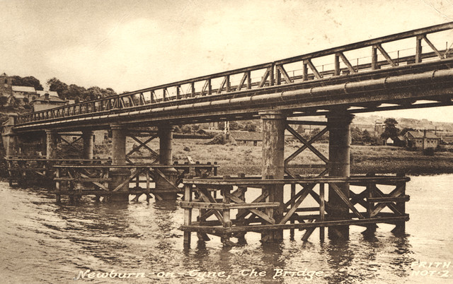
| Newburn Bridge | River Tyne | Road | 1893 | Newburn | Newcastle, Gateshead | Local List |
|
|
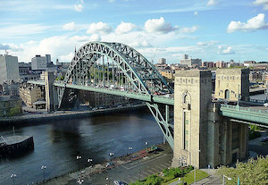
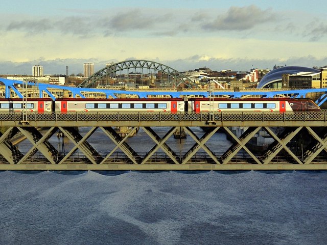
River Tyne | Road, Rail | 1849 | Newcastle - Gateshead | Newcastle, Gateshead | Grade I listed. Double decker road and rail bridge |
| Howlea Bridge | Bedburn Beck | Road | C18th | Bedburn | County Durham | Grade II listed |
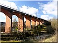
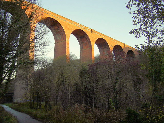
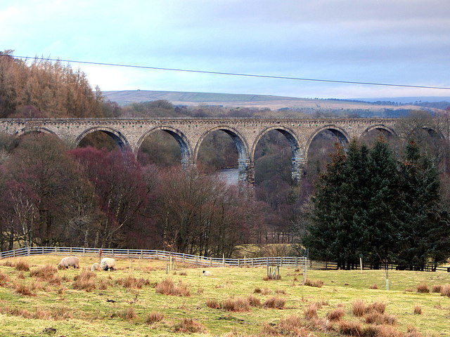
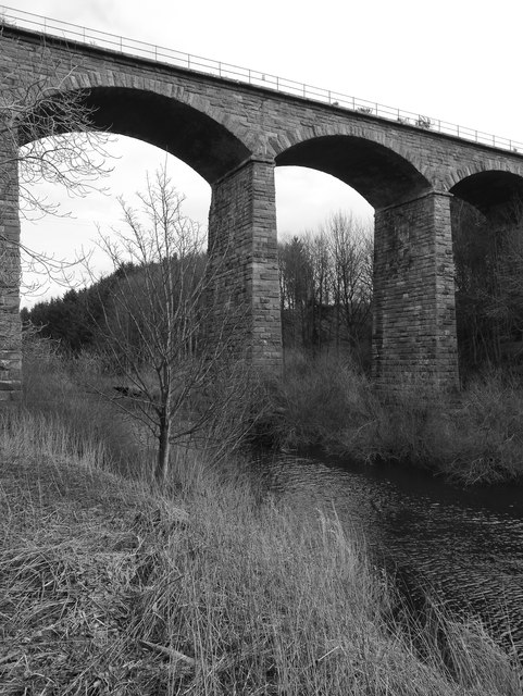
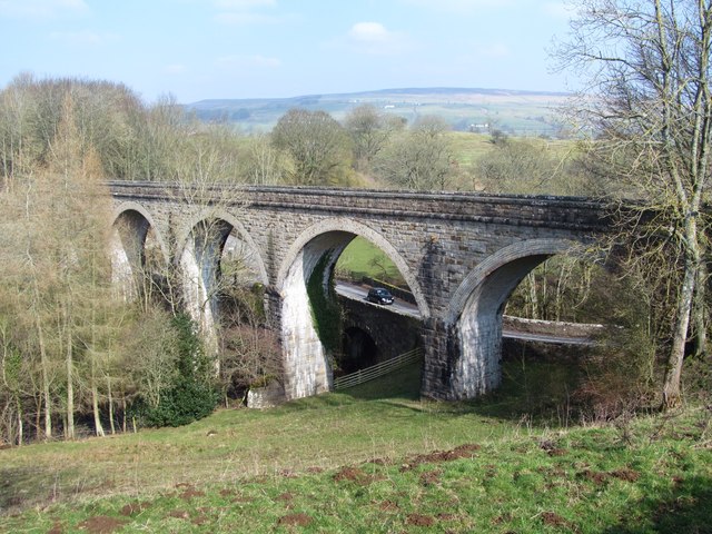
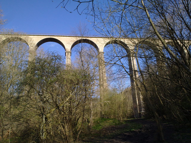
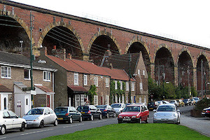
| Hownsgill Viaduct | Hown's Gill | Pedestian | 1858 | Consett | County Durham | Grade II* listed. Built as a railway bridge |
| Hulne Park Footbridge | River Aln | Pedestrian | 2009 | Hulne Park, Alnwick | Northumberland | |
|
|
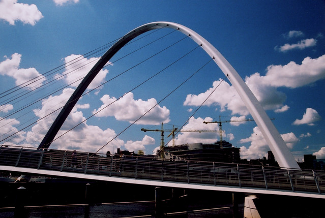
River Tees | Pedestrian | 2009 | Thoraby - Stockton | Tees Valley | Pedestrian and cycle |
| Iron Bridge | River Aln | Road | 1812 | Hulne Park, Alnwick | Northumberland | Grade II* listed |
| Iron Bridge | Debdon Burn | Pedestrian | 1870s | Cragside | Northumberland | Grade II* listed |
| River Derwent (Cumbria) | Road | 1812 | Isel | Cumbria | Grade II listed | |
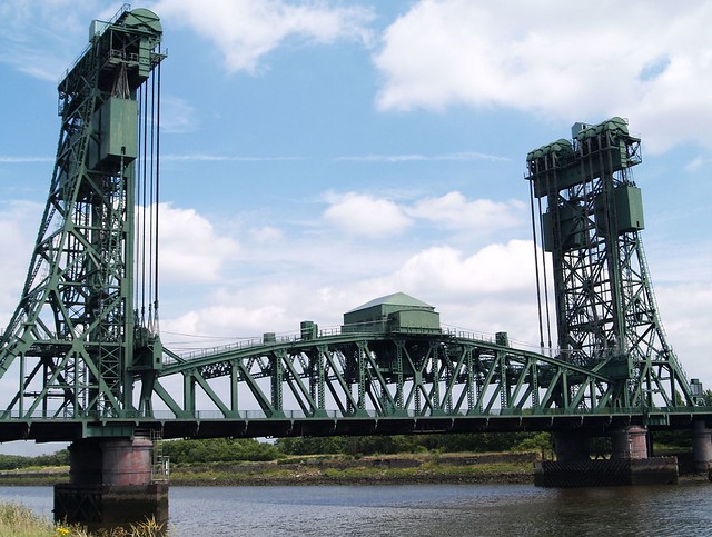
| River Don | Road (disused) | 1781 | Jarrow | South Tyneside | Grade II | |
|
|
Walney Channel | Road | 1908 | Barrow - Vickerstown | Cumbria | |
| Jubilee Bridge | Dane Gill Beck | Road | 1887 | Barrow | Cumbria | Grade II listed |
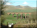
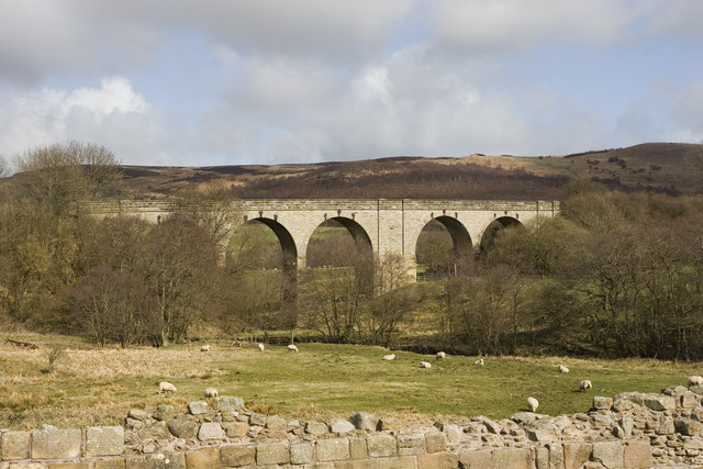
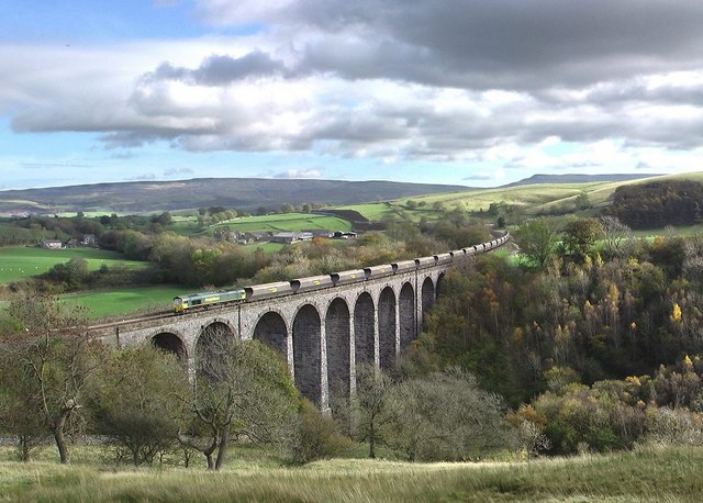
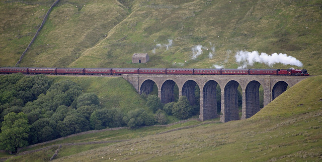
| Kielder Viaduct | River North Tyne | Rail (closed) | 1862 | Kielder | Northumberland | Scheduled Monument |
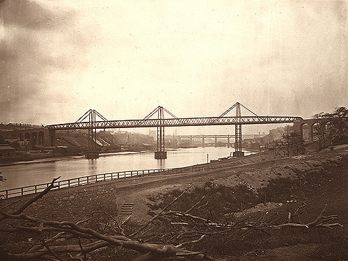
| King Edward VII Bridge | River Tyne | Rail | 1906 | Newcastle - Gateshead | Newcastle, Gateshead | Grade II listed |
| Kingsgate Bridge | River Wear | Pedestrian | 1965 | Durham | County Durham | Grade I listed |
| Knar Burn Railway Viaduct | Knar Burn | Rail | 1852 | Slaggyford | Northumberland | Grade II listed |
| Lady's Bridge | River Aln | Road | C18th | Eslington Park, Whittington | Northumberland | Grade II listed |
| Lady's Bridge | River Coquet | Pedestrian | ? | Rothbury | Northumberland | |
|
|
River Tweed | Road | 1887 | Norham | Northumberland | Grade II listed |
| Lamb Bridge | River Wear | Road | 1819 | Bournmoor | County Durham | Grade II* liste |
| Lambley Viaduct | River South Tyne | Rail | 1852 | Lambley | Northumberland | Grade II* listed |
| Lanercost Bridge | River Irthing | Road | 1724 | Lanercost | Cumbria | Scheduled Monument |
|
|
River Aln | Rail | 1849 | Lesbury | Northumberland | By Robert Stephenson. Grade II listed. |
| Leven Bridge | River Leven (North Yorks.) | Road | C19th | Ingleby Barwick | Tees Valley | Grade II listed |
| Linbriggs Bridge | River Coquet | Road | 1928 | Linbriggs | Northumberland | |
| Linnels Bridge | Devil's Water | Road | C16th | Linnels | Northumberland | Grade II listed |
|
|
River Aln | Road | 1775 | Alnwick | Northumberland | Grade I listed |
| Longtown Bridge | River Esk | Road | 1756 | Longtown | Cumbria | Grade II listed |
|
|
Rail | 1859 | Beck Foot, Lowgill | Cumbria | Grade II listed | |
| River Leven (Cumbria) | Road | C18th | Low Wood | Cumbria | Grade II listed | |
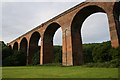
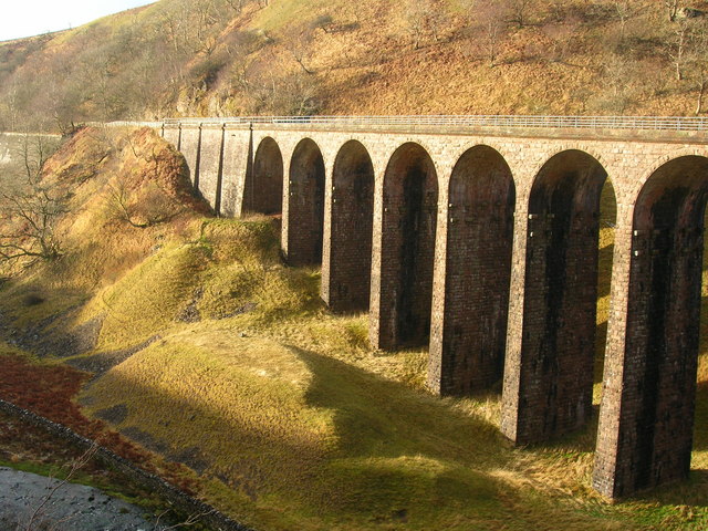
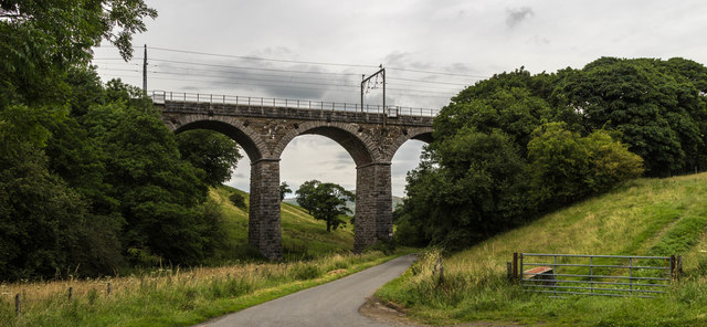
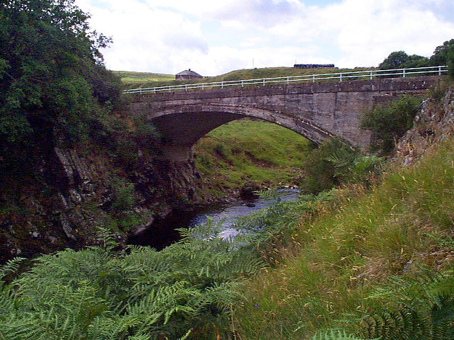
| Lune Railway Viaduct | River Lune (County Durham) | Rail | 1868 | Laithkirk | County Durham | Grade II listed |
| Lunes Bridge | River Lune (Cumbria) | Road | C19th | Tebay | Cumbria | Grade II listed |
| Makendon Bridge | River Coquet | Road | 1968 | Makendon | Northumberland | |
| Merrygill Viaduct | Hartley Beck | Rail | 1861 | Kirkby Stephen | Cumbria | Grade II listed. |
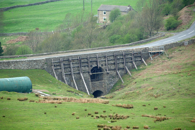
| Middleton Bridge | River Tees | Road | 1800 | Middleton-in-Teesdale | County Durham | Grade II* listed |
| Middleton Bridge | River Rawthey | Road | C17th | Middleton | Cumbria | Grade II listed |
| Mill Bridge | River Skern | Road | 1861 | Coatham Munderville - Brafferton | County Durham | Grade II listed |
|
|
River Font | Road | C19th | Mitford | Northumberland | Grade II listed |
| Monk's Bridge | River Aln | Road | 1901 | Hulne Park, Alnwick | Northumberland | |
| Monkridge Bridge | Elsdon Burn | Road | C20th | Monkridge | Northumberland | A696 |
| Monkwearmouth Railway Bridge | River Wear | Rail | 1876 | Sunderland | Sunderland | Grade II listed |
| Mosedale Bridge | River Caldew | Road | C19th | Mosedale | Cumbria | Grade II listed |
| Mosedale Viaduct | Mosdale Beck | Rail | 1864 | Scales | Cumbria | |
| Musgrave Bridge | River Eden | Road | 1825 | Great Musgrave - Little Musgrave | Cumbria | |
|
|
River Tyne | Road | 1876 | Newcastle - Gateshead | Newcastle, Gateshead | Grade II* listed. Built on the site of the Medieval Tyne Bridge |
| New Bridge | River Aln | Road | 2004 | Lesbury | Northumberland | |
| New Footbridge | River Aln | Pedestrian | 2009 | Hulne Park, Alnwick | Northumberland | |
| Newbiggin Bridge | Crowdundle Beck | Road | C18th | Newbiggin (Kirkby Thore) | Cumbria | Grade II listed |
|
|
River Leven (Cumbria) | Road | C17th? | Newby Bridge | Cumbria | Grade II* |
| Newton Cap Bridge | River Wear | Road | C14th | Bishop Auckland | County Durham | Grade I |
| Newton Cap Viaduct | River Wear | Road | 1857 | Bishop Auckland | County Durham | Grade II. Railway viaduct, converted to road in 1995. |
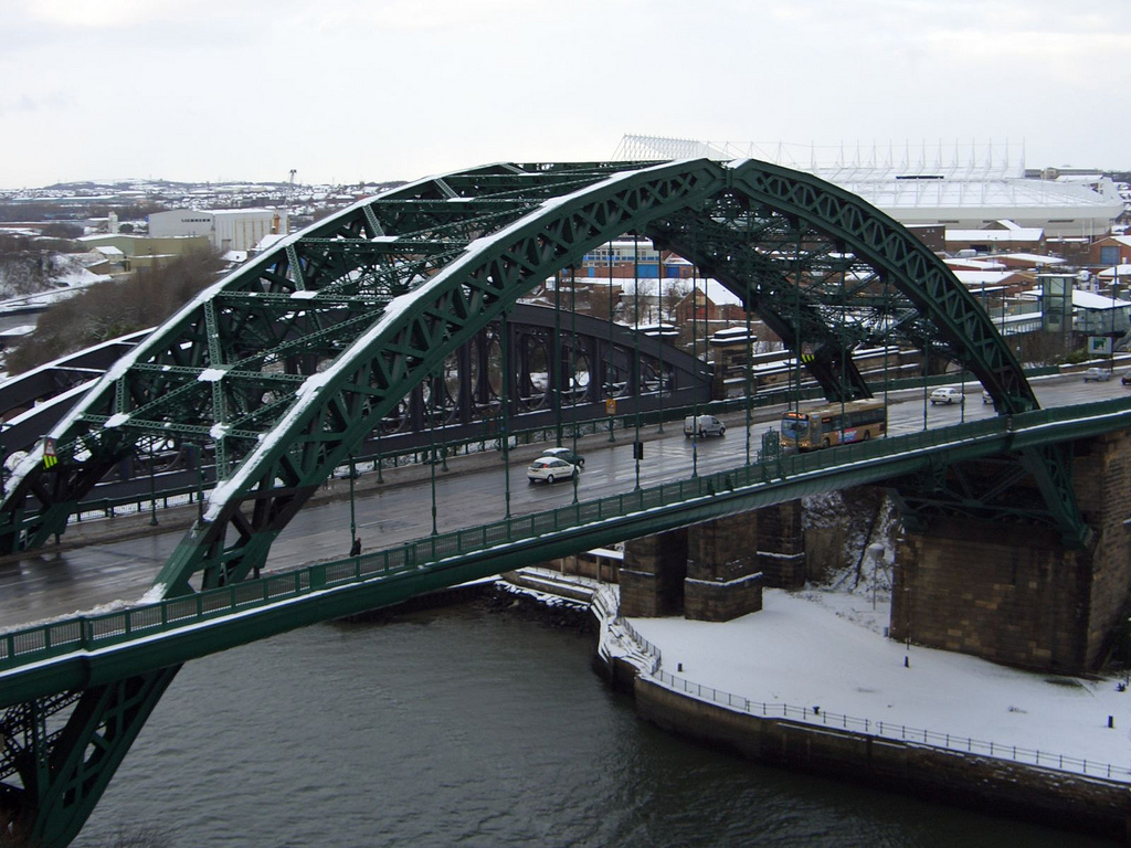
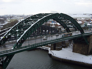
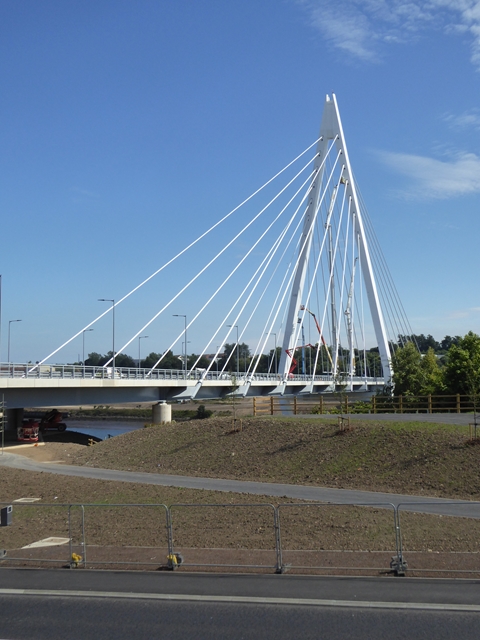
| Northern Spire Bridge | River Wear | Road | 2018 | Sunderland | Sunderland | |
|
|
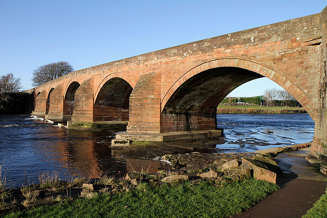
River Tweed | Road | 1634 | Berwick | Northumberland | Grade I listed |
| Old Bridge | Nor Beck | Pedestrian | C18th | Barningham | County Durham | Grade II listed |
| Old Bridge | Cor Burn | Road (closed) | C18th | Corbridge | Northumberland | Grade II listed |
| Old Bridge | River Aln | Road | C15th | Lesbury | Northumberland | Grade I listed |
| Old Bridge | River Coquet | Road | C14th | Warkworth | Northumberland | Grade II listed |
| Old Bridge | River Eden | Road | C16th | Warcop | Cumbria | Grade II* listed |
| Old Derwent Bridge | River Derwent (Tyne) | Road | 1779 | Swalwell | Gateshead | Grade II* listed |
|
|
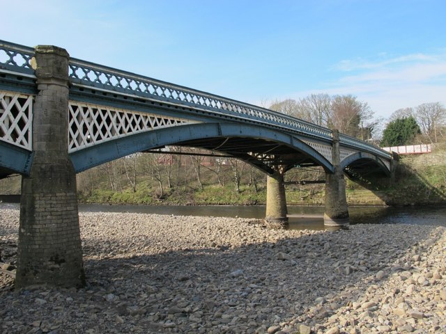
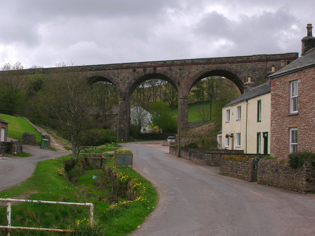
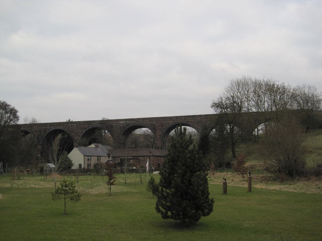
Ouseburn | Rail | 1839 | Ouseburn | Newcastle | Grade II* listed |
| Packhorse Bridge | Whillan Beck | Road | C18th | Boot, Eskdale | Cumbria | Grade II listed |
|
|
Whittle Burn | Pedestrian | C18th | Ovingham | Northumberland | Grade II listed |
| Pedestrian | C17th | Beck Foot, Lowgill | Cumbria | Grade II listed | ||
| Palmstrother Bridge | Shipley Burn | Road | C18th | Hulne Park, Alnwick | Northumberland | Grade II listed |
| Pauperhaugh Bridge | River Coquet | Road | 1862 | Pauperhaugh | Northumberland | Grade II listed |
|
|
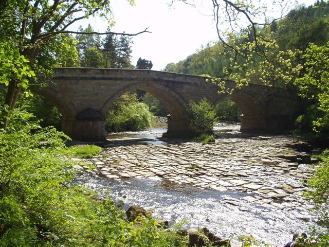
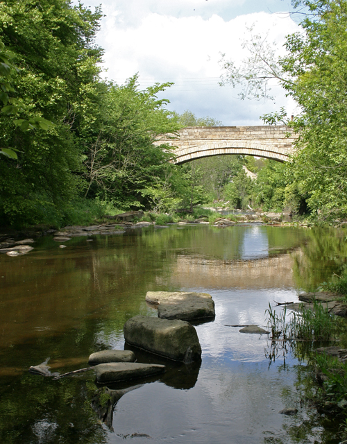
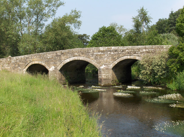
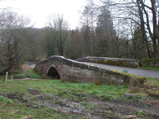
River Tees | Road | 1673 | Piercebridge | County Durham | Grade II* listed |
| Podgill Viaduct | Pod Gill | Rail | 1861 | Kirkby Stephen | Cumbria | Grade II listed |
| Prebends Bridge | River Wear | Pedestrian | 1778 | Durham | County Durham | Grade I listed |
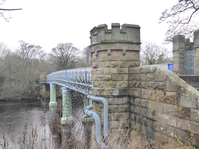
| Queen Alexandra Bridge | River Wear | Road | 1909 | Southwick - Deptford | Sunderland | Grade II listed. Originally a doubldecker road and rail bridge. |
|
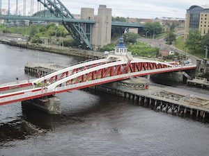
Queen Elizabeth II Metro Bridge
|
River Tyne | Rail | 1981 | Newcastle - Gateshead | Newcastle, Gateshead | Purpose-built Metro Bridge |
| Railway Viaduct | Poltross Burn | Rail | 1838 | Gilsland | Northumberland | Grade II listed |
|
|
River Font | Rail | 1870 | Netherwitton | Northumberland | Grade II listed |
| Redheugh Bridge | River Tyne | Road | 1983 | Newcastle -Gateshead | Newcastle, Gateshead | Replaced earlier bridges of the same name. |
| Rede Bridge | River Rede | Road | 1715 | Redesmouth | Northumberland | Grade II listed |
| Ridley Bridge | River South Tyne | Road | 1792 | Bardon Mill | Northumberland | Grade II* listed |
| Rothbury Bridge | River Coquet | Road | 1460 | Rothbury | Northumberland | Grade II listed |
|
|
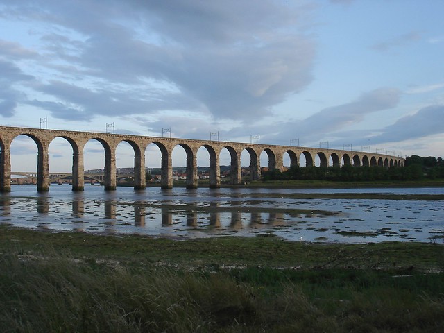
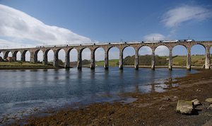
River Tweed | Rail | 1850 | Berwick | Northumberland | By Robert Stephenson. Grade I Listed |
|
|
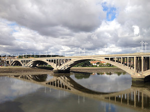
River Tweed | Road | 1928 | Berwick | Northumberland | Grade II* listed |
| Rusland Pool | Road | C18th | Rusland | Cumbria | Grade II listed | |
| Rutherford Bridge | River Greta | Road | 1773 | Scargill | County Durham | Grade II listed |
| Salters Bridge | Ouseburn | Road | C14th | Gosforth | Newcastle | Grade I listed |
| Sands Suspension Bridge | River Derwent | Footbridge | 1902 | Swalwell | Gateshead | Local List. aka 'The Hicky Bridge' |
|
|
River Tyne | Road | 1967 | Blaydon - Scotswood | Newcastle, Gateshead | Replaced chain bridge of 1831 |
| Sheepwash Bridge | River Wansbeck | Road | 1920 | Sheepwash | Northumberland | Replaced bridge of 1894 |
| Sheepwash Footbridge | River Wansbeck | Pedestrian | 1968 | Sheepwash | Northumberland | |
| Sherburnhouse Bridge | Sherburnhouse Beck | - | 1335 | Sherburn House | County Durham | Scheduled Monument |
| Shilvington Bridge | River Blyth | Road | C18th | Shilvington | Northumberland | Grade II listed |
| Shotley Bridge | River Derwent (Tyne) | Road | C18th | Shotley Bridge | County Durham | Grade II listed |
| Skelwith Bridge | River Brathay | Road | Skelwith Bridge | Cumbria | Grade II listed | |
|
|
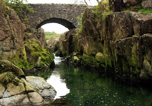
River Brathay | Pedestrian | C17th | Little Langdale | Cumbria | Grade II* listed. Former packhorse bridge. |
| Scandal Beck | Road | C18th | Smardale | Cumbria | Grade II. Former packhorse bridge. | |
| Smardale Gill | Rail | 1860 | Smardale | Cumbria | Grade II* listed | |
| Scandal Beck | Rail | 1875 | Smardale | Cumbria | Grade II listed | |
| Raylees Burn | Road | 1956 | Monkridge | Northumbeland | ||
| River Eden | Road | 1889 | Appleby-in-Westmorland | Cumbria | Grade II listed | |
| Stanhope Bridge | River Wear | Road | C15th | Stanhope | County Durham | Grade II* listed |
|
|
Stanley Burn | Road | C18th? | Crawcrook | County Durham | Local list |
| River Petteril | Road | C18th | Greystoke | Cumbria | Grade II listed | |
| Debdon Burn | Footbridge | C19th | Cragside | Northumberland | Grade II Listed | |
| River Dee | Road | C17th | Dentdale | Cumbria | Grade II listed | |
| Sunderland Bridge | River Wear | Road | C14th | Sunderland Bridge | County Durham | Grade I listed |
|
|
River Tees | Road | 1934 | Middlesbrough - Stockton | Tees Valley | Grade II listed |
|
|
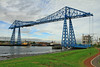
River Tees | Road | 1911 | Middlesbrough - Port Clarence | Tees Valley | Grade II* listed |
| Telford Bridge | River Wansbeck | Road | 1831 | Morpeth | Northumberland | Grade II* listed |
| Thropton Bridge | Wreigh Burn | Road | 1810 | Thropton | Northumberland | Grade II listed |
|
|
River Till | Road | 1511 | Cornhill-on-Tweed | Northumberland | Grade I listed |
| Twizel Viaduct | River Till | Rail | 1849 | Twizel | Northumberland | Grade II listed |
|
|
River Tyne | Road | 1928 | Newcastle - Gateshead | Newcastle, Gateshead | Grade II* listed |
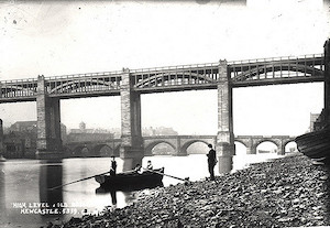
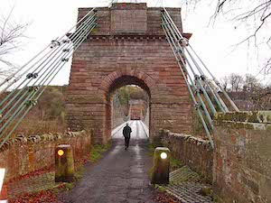
| Tyne Bridge | River South Tyne | Pedestraian | 1875 | Haltwhistle | Northumberland | Grade II listed. Built as a road bridge. |
| Tyne Bridge | River Tyne | Road | 1674 | Corbridge | Northumberland | Grade I listed. Only bridge on the Tyne to survive the Great Flood of 1771. |
|
|
River Tweed | Road | 1820 | Horncliff - Fishwick | Northumberland | Grade I listed |
| Victoria Viaduct | River Wear | Rail | 1838 | Fatfield, Washington | Sunderland | Grade II* listed |
| Warenford Bridge | Waren Burn | Road | C18th | Warenford | Northumberland | Grade II listed |
| Warwick Bridge | River Eden | Road | 1835 | Warwick Bridge | Cumbria | |
| Warkworth Old Bridge | River Coquet | Road | C14th | Warkworth | Northumberland | Grade II listed (possibly rebuilt c18th) |
|
|
River Wear | Road | 1929 | Sunderland | Sunderland | |
| Weldon Bridge | River Coquet | Road | 1760 | Weldon Bridge | Northumberland | Grade I |
| Willington Dene Viaduct | Wallsend Burn | Rail | 1839 | Willington, Wallsend | North Tyneside | Grade II listed |
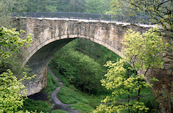
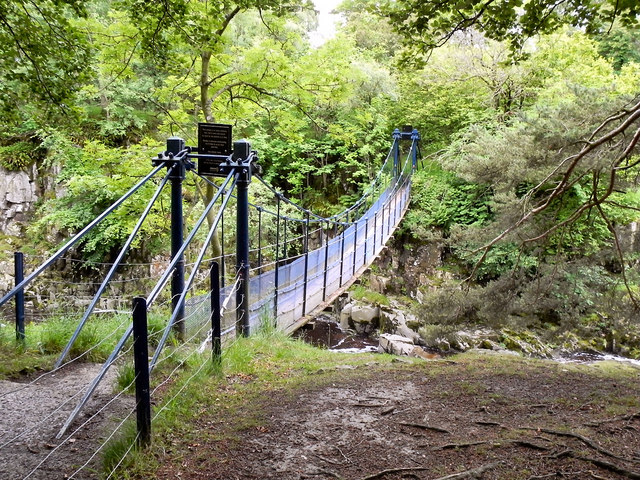
| Winch Bridge | River Tees | Pedestrian | 1820 | Holwick | County Durham | Grade II* listed |
|
|
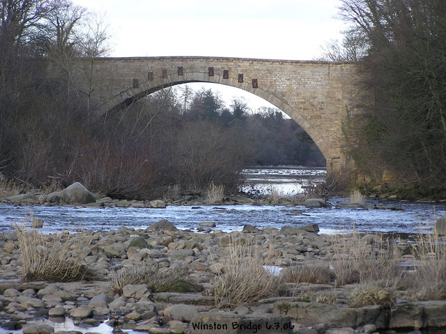
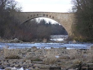
River Tees | Road | 1763 | Winston | County Durham | Grade II* listed |
| Witton Bridge | River Wear | Road | 1788 | Witton-le-Wear | County Durham | Grade II* listed |
| Whelpo Bridge | Whelpo Beck | Road | C18th | Whelpo | Cumbria | Grade II |
| Whittingham Bridge | River Aln | Road | C19th | Whittingham | Northumberland | Grade II listed |
|
|
River Tees | Road | 1831 | Whorlton | County Durham | Grade II* listed |
| River Petteril | Road | 1830s | Wreay | Cumbria | Grade II listed | |
|
|
River Tees | Road | c1400 | Yarm - Egglescliffe | Tees Valley | Grade II* listed |
|
|
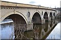
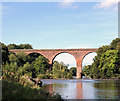
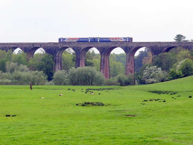
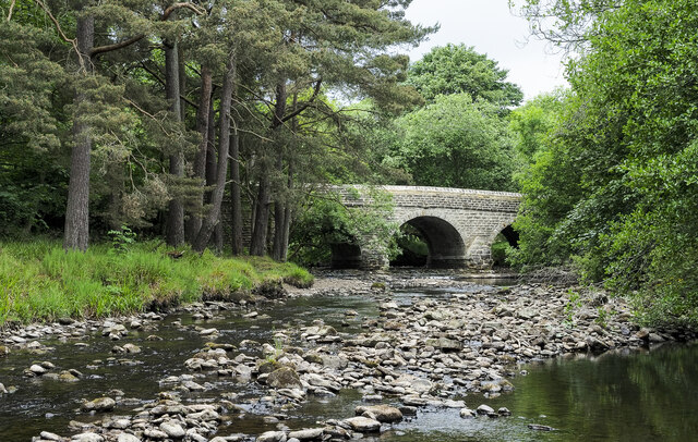
River Tees | Rail | 1851 | Yarm - Egglescliffe | Tees Valley | Grade II listed |
| Waren Burn | Road | 1906 | Lucker | Northumberland | Grade II listed |


from http://www.bridgesonthetyne.c…
Bridges on the Tyne
- .....and other bridges of North East England. Website with extensive information and photos of bridges in the region. It also includes information about fords, ferries and former bridges.
Added by
Simon Cotterill
Co-Curate Page
Piercebridge Roman Bridge
- Overview About the Roman Bridge Map Street View The Roman bridge at Piercebridge crossed the River Tees, carrying Dere Street, the Roman road that linked York with Corbridge, near Hadrian’s …

Co-Curate Page
Rivers
- Rivers have played an important role in shaping the development and identity of communities in the North East. Many settlements have grown up at locations near rivers, which provided essential …
from Newcastle libraries (flickr)
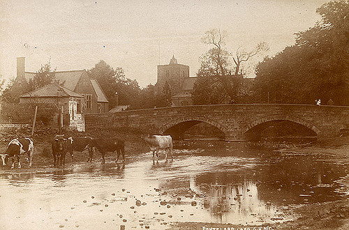
001931:View of Ponteland from the riverbank towards the church black-and-white photograph around 1900.
Pinned by Simon Cotterill
from Flickr (flickr)
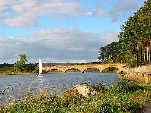
Bridge over The River Coquet - Felton, Northumberland
Pinned by Simon Cotterill
Co-Curate Page
Sunderland Bridge
- Overview About Sunderland Bridge Map Street View Sunderland Bridge is both a bridge and a village in County Durham, located about 3 miles south of the City of Durham. The …
Co-Curate Page
Croxdale Viaduct
- Croxdale Viaduct, over the River Wear near Croxdale and Sunderland Bridge, was built by the North Eastern Railway in 1872. Today the 11 arched viaduct is still in use for the …
Co-Curate Page
The Lion Bridge
- Overview Map Street View The Lion Bridge over the River Aln at Alnwick was built in 1775 by John Adam.[1] The stone bridge has 4 arches and in the centre of …
Co-Curate Page
Chollerford Bridge
- Overview Street View The stone bridge over the River North Tyne at Chollerford in Northumberland was built in 1785 by Robert Mylne. It replaced an earlier medieval bridge which had been …

Co-Curate Page
Warkworth Old Bridge
- The old stone bridge over the River Coquet at Warkworth dates from c.1380. John Cook of Newcastle, who died in 1378/9, bequeathed 20 marks towards the building of the bridge.[1] …

Co-Curate Page
Sunderland Bridge (bridge)
- Overview Map Street View This stone bridge across the River Wear near the village of Sunderland Bridge, Croxdale, dates from the 14th Century. The bridge has undergone several modifications, with …
Co-Curate Page
Greta Bridge (bridge)
- Overview Map Street View The stone bridge over the River Greta at Great Bridge village in County Durham, was built in 1773 by John Carr for John Sawry Morritt. It replaced …

Co-Curate Page
Newton Cap Viaduct
- Overview Map Street View Newton Cap Viaduct was built in 1857 to carry the Bishop Auckland to Durham City railway across the River Wear and Newton Cap Bank, which leads …

Co-Curate Page
Newton Cap Bridge
- Overview Map Street View Newton Cap Bridge is a stone bridge across the River Wear at Bishop Auckland, County Durham. Reputedly it was built in the late 14th century for …

Co-Curate Page
Barnard Castle Bridge
- Overview Map Street View The stone Bridge over the River Tees connects the town of Barnard Castle with Startforth. It dates from the 14th Century and is overlooked by the castle. It …
Co-Curate Page
Rutherford Bridge
- Overview Map Street View A stone bridge over the River Greta just over a mile North West of Scargill, County Durham. The bridge was built in 1773 following the great …

Co-Curate Page
Cupola Bridge
- Overview Map Street View Cupola Bridge is a three arch stone bridge which carries the A686 road over the River Allen, built 1778 and located 1½ miles from Whitfield, Northumberland. …
Co-Curate Page
Mill Bridge, Coatham Munderville
- Overview Map Street View Mill Bridge is located east of Coatham Mundeville, and carries Brafferton Lane over the River Skerne. The stone bridge was built in 1861. The bridge straddles the …
Co-Curate Page
Salters Bridge
- Overview Map Street View Salters Bridge crosses the Ouseburn in South Gosforth. It dates from the 14th Century and is Grade I listed on the National Heritage List for England …
Co-Curate Page
Winston Bridge
- Overview Map Street View The bridge over the River Tees near Winston in Counry Durham was built in 1762-1763, designed by Sir Thomas Robinson[1]. The bridge is notable for its …
Co-Curate Page
Whorlton Suspension Bridge
- Overview Map Street View The toll bridge over the River Tees at Whorlton, County Durham, was opened in 1831. It was designed by John and Benjamin Green of Newcastle, who …
Co-Curate Page
Hartford Bridge (bridge)
- Overview Map Street View Hartford Bridge carries the A192 / A1068 road over the River Blyth at Hartford, north of Cramlington. There was once a ford to cross the river near …
Co-Curate Page
Old Bridge
- Overview Map Street View The old stone bridge over the River Aln at Lesbury dates from the 15th century, though substantially altered in the 19th century. The bridge is Grade …
Co-Curate Page
New Bridge
- Overview Map Street View The 'new' road bridge over the River Aln at Lesbury was opened in 2004 and carries the A1068. Prior to that the road was routed over …
Co-Curate Page
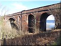
Railway Viaduct
- Overview Map Street View The viaduct just north west of Lesbury carries the railway over the River Aln in Northumberland. The viaduct has 18 arches and was built in 1848/1849 …

Co-Curate Page
Duchess Bridge
- Overview Map Street View This stone bridge over the River Aln at Alnmouth was built in 1864. The bridge is Grade II listed on the National Heritage List for England. A …
Co-Curate Page
Lambley Viaduct
- Overview About Lambley Viaduct Map Lambley viaduct was built by George Barclay Bruce for the Newcastle and Carlisle Railway in 1852 to carry the Haltwhistle to Alston branch line over the …
Co-Curate Page
Bridge over the Wear
- Overview Map Street View This stone bridge over the River Wear just west of Stanhope dates from medieval times. The bridge now carries the B6278 road. It is Grade II* …

Co-Curate Page
Denemouth Viaduct, Castle Eden Dene
- Overview Map The railway viaduct at Dene Holme over Castle Eden Dene was completed in 1905.[1] It is between Blackhall Colliery and Horden, in County Durham. The viaduct has 10 …
Co-Curate Page
Bywell Bridge, over the Tyne
- Overview Map Street View Bywell bridge over the River Tyne was built 1836-1838, designed by George Basevi. The stone bridge carries the B6309 road over the Tyne, with Bywell on the north …
Co-Curate Page
Queen Alexandra Bridge
- Overview About the Bridge Map Street View The Queen Alexandra Bridge over the River Wear links the Southwick and Deptford areas of Sunderland. The bridge was built 1907-1909, originally as a double-decker …
Co-Curate Page
Shotley Bridge (bridge)
- Overview Map Street View The stone bridge over the River Derwent at Shotley Bridge was built in the late 18th century, later widened in c1820. The bridge is Grade II …
Co-Curate Page
Denwick Bridge
- Overview Map Street View Denwick Bridge over the River Aln is located about half a mile north east of Alnwick and a similar distance south west of Denwick. The stone …
Co-Curate Page
Telford Bridge
- Overview Map Street View Telford Bridge (aka 'New Bridge') in Morpeth was built 1829 - 1831 by Thomas Telford.[1] The stone bridge carries the A192 road over the River Wansbeck. …
Co-Curate Page
Weldon Bridge - Bridge
- Overview Map Street View The stone bridge over the River Coquet at Weldon Bridge was built c.1760[1] The bridge has 3 arches and distinctive circular openings between the arches. It …
Co-Curate Page
Pauperhaugh Bridge
- Overview Map Street View Pauperhaugh bridge over the River Coquet.
Co-Curate Page
Road Bridge, Sheepwash
- Overview Map Street View The bridge at Sheepwash carries the A1068 road over the River Wansbeck. It was built in 1920 to replace a stone bridge damaged by floods in …
Co-Curate Page
Fleetham Bridge
- The stone single arched bridge over the Long Nanny at West Freetham, near Beadnell, was built in the early 19th century. The bridge is Grade II listed on the Ntional …
Co-Curate Page
Hexham Bridge
- Overview Map Street View Hexham Bridge carries the A6079 road over the River Tyne at Hexham. The nine arched stone bridge was built in 1793, to the designes of John …
Co-Curate Page
Coldstream Bridge
- Overview About Coldstream Bridge Map Street View Coldstream Bridge, linking Coldstream, Scottish Borders with Cornhill-on-Tweed, Northumberland, is an 18th-century Grade II* listed bridge between England and Scotland, across the …

Co-Curate Page
Crimdon Dene Railway Viaduct
- Overview Map Street View The viaduct over Crimdon Dene was built in 1905 to carry the North Eastern Railway. The viaduct is located close to the mouth of Crimdon Dene, …
Co-Curate Page
Warenford Bridge
- Overview Map Street View The stone bridge over Waren Burn at Warenford in Northumberland was built in the late 18th or early 19th century and is Grade II listed.[1] The …
Co-Curate Page
Twizel Viaduct
- Twizel Viaduct was built between 1846 and 1849 by the Newcastle & Berwick Railway, to carry the Tweedmouth to Kelso railway branch line over the River Till at Twizell in …

Co-Curate Page
Balder Bridge, Cotherstone
- Overview Map Street View The stone road bridge over the River Balder at Cotherstone dates back to the 15th century. It was rebuilt c.1681 and the upstream side of the …
Co-Curate Page
Cotherstone Footbridge
- Overview Map The footbridge over the River Tees just north of Cortherstone, County Durham, was built in 1932 by Joseph L Thompson and Sons Ltd of Sunderland. It replaced two …
Co-Curate Page
Lune Railway Viaduct
- Overview Map Street View Disused railway viaduct over the River Lune, built in 1868 for the Tees Valley Railway Company. The viaduct is Grade II listed on the National Heritage …
Co-Curate Page
Bewick Bridge
- Overview Map Street View The stone road bridge near Old Bewick in Northumberland was built in the early 19th century, or possibly earlier. There is also a small hamlet by …
Co-Curate Page
Heatherycleugh Bridge
- Overview Map Street View Heatherycleugh Bridge carries School Hill road (part of the A689) over the steep valley of the Heathery Cleugh (a stream), shortly before it flow into Killhope …
Co-Curate Page
Union Chain Bridge
- Overview About The Union Chain Bridge Map Street View The Union Chain Bridge spans the River Tweed between Horncliffe in England and Fishwick in Scotland. The bridge was built for …
Co-Curate Page
Hawthorn Dene Viaduct
- Overview Map Street View The railway viaduct over Hawthorn Dene was built in 1905 for the North-Eastern Railway Company. The viaduct is located near the coast at the mouth of …
Co-Curate Page
Bridge over Croxdale Beck
- Overview Map A stone single-track road bridge over Croxdale Beck, built c.1760 by Christopher Ebdon.[1] It is located just north of Sunderland Bridge, near Croxdale Hall. The bridge was built …

Co-Curate Page
Dalton Bridge
- Overview Map Street View The single arch limestone bridge over Dalden Dene at Dalton-le-Dale is dated 1789. The bridge is Grade II listed.[1] It is reputed that Oliver Cromwell crossed …
Co-Curate Page
Edlingham Railway Viaduct
- Overview Map Street View This railway viaduct is located under half a mile north-east of Edlingham in Northumberland, and close to Edlingham Castle. It was built in c.1885 for the …
Co-Curate Page
Haltwhistle Tyne Bridge
- Overview Map Street View The pedestrian bridge (a former road bridge) over the River South Tyne at Haltwhistle was built in 1875. It was constructed with wrought-iron arches and cast-iron …

Co-Curate Page
Alston Arches Viaduct
- Overview Map Street View Alston Arches Viaduct is a disused railway viaduct over the River South Tyne at Haltwhistle. It was built in 1852 by Sir George Barclay Bruce for …
Co-Curate Page
Ouseburn Viaduct
- Overview Map Street View Ouseburn Viaduct is a railway bridge over the valley of the Ouseburn (river). It was built between 1837-1839 by John and Benjamin Green for the Newcastle …
Co-Curate Page
Willington Dene Viaduct
- Overview Map Street View Willington Dene Viaduct is a railway bridge over the valley of Wallsend Burn near Willington and Wallsend. It was built between 1837-1839 by John and Benjamin Green …
Co-Curate Page
Byker Bridge
- Overview About Byker Bridge Map Street View The Byker Bridge is a 344.65m (1130 ft) long road bridge that carries the A193 road over the River Ouseburn in Newcastle …
Co-Curate Page
Crawford's Bridge
- Overview Map Street View Crawford's bridge is a small segmental arch stone bridge over the Ouseburn (river) in Newcastle, built in the early to mid-18th century. It is the oldest …

Co-Curate Page
Piercebridge Bridge
- Overview Map Street View The stone bridge over the River Tees at Piercebridge was built in 1673. The bridge was widened on its downstream side in 1781.[1] Today the bridge …
Co-Curate Page
Palmstrother Bridge
- Palmstrother Bridge in Hulne Park is a late 18th century stone bridge over Shipley Burn, just before its confluence with the River Aln. It is close to East Brizlee Bridge. Palmstrother Bridge …
Co-Curate Page
New Footbridge
- This footbridge over the River Aln at Hulne Park was built in 2009 and replaced an earlier bridge which was destroyed in the floods of September 2008.
Co-Curate Page
Factory Bridge over River Coquet
- Overview Map Street View This road bridge over the River Coquet was built in c.1865. It is known as Factory Bridge, presumably for the close proximity to the former mill/factory …
Co-Curate Page
Hepple Bridge
- Overview Map Street View Hepple Bridge carries the B6341 road across the River Coquet a quarter of a mile south of Hepple, Northumberland. The bridge dates from 1874, though the …
Co-Curate Page
Makendon Bridge
- Overview Map Street View The small road bridge over the River Coquet, located just under a quater mile noth-east of Makendon, was built in 1968.[1] It is in a remote …
Co-Curate Page
Bridge at Chew Green
- Overview Map Street View The small concrete bridge over the River Coquet, near the remains of Chew Green Roman Fort, was built in 1968.[1] It is the first bridge over …
Co-Curate Page
Buckham's Bridge, Blindburn
- Overview Map Street View Buckham's Bridge is a road bridge over the River Coquet near Blindburn in Northumberland. The bridge is very close to the confluence of Buckham's Walls Burn …
Co-Curate Page
Rothbury Bridge
- Overview Map The road bridge over the River Coquet at Rothbury was originally built in 1460. The bridge is Grade II listed on the National Heritage List for England. The …
Co-Curate Page
Golf Club Bridge
- Overview Map Street View Only the piers remain (2016) after the bridge was damaged.
Co-Curate Page
Lands Viaduct (remains)
- Overview About Lands Viaduct Map Lands Viaduct was built in 1863 to carry the South Durham and Lancashire Union Railway over the River Gaunless. Gaunless Viaduct, also known as the …

Co-Curate Page
Blanchland Bridge
- Overview Map Street View The stone arched bridge over the River Derwent at Blanchland was built in the mid 18th century; it is Grade II listed. The south end of …
Co-Curate Page
Winch Bridge, nr Holwick
- Overview Map Street View An iron suspension footbridge with planked walkway, over the River Tees, by the Low Force waterfalls, near Holwick and Newbiggin. The bridge was built c.1820 for the …
Co-Curate Page
Old Bridge over Nor Beck
- Overview Map Street View The old bridge over Nor Beck, located about half a kilometre north of Barningham, was built in the 18th century. It was once the main route …
Co-Curate Page
Hartburn Bridge
- Overview Map Street View The stone bridge over the Hart Burn between Hartburn and Meldon Park was built in the 18th century. It was widened in 1850 and now carries …
Co-Curate Page
Eggleston Bridge
- Overview Map Street View Eggleston Bridge is a single track road bridge across the River Tees near Eggleston in County Durham. The bridge here can be traced back to the 15th …
Co-Curate Page
Bridge over Wreigh Burn, Thropton
- Overview Map Street View The stone hump-backed bridge over the Wreigh Burn at Thropton was built in 1810. It was built by George Robson, a local Catholic landowner, at a …
Co-Curate Page
Leven Bridge
- Overview Map Street View Leven Bridge carries the A1044 road over the River Leven, near High Leven and Ingleby Barwick. The bridge was built in the early 19th Century and …
Co-Curate Page
Kielder Viaduct
- Overview Map Street View Kielder Viaduct spans the River North Tyne just north of Bakethin Reservoir and Kielder Water. It once carried the Border Counties Railway. The viaduct was completed in …

Co-Curate Page
Bellingham Bridge
- The stone bridge over the River North Tyne at Bellingham was built in 1834 by John Green.[1] The bridge is a Grade II listed structure.
Co-Curate Page
Foss Bridge
- Foss Bridge is a mid 18th century stone bridge over the River Wansbeck at Mitford, near Mitford Castle (sometimes caled "Wansbeck Bridge"). The bridge is Grade II listed on the National …
Co-Curate Page
Warwick Bridge (bridge)
- Bridge over the River Eden at Warwick Bridge, Cumbria.
Co-Curate Page
Wetheral Viaduct
- Overview Map Street View Corby Bridge (more commonly called Wetheral Viaduct) is a railway viaduct over the River Eden, between Great Corby and Wetheral in Cumbria. The 5 arch, red …
Co-Curate Page
Tyne Bridge
- Overview About Corbridge Bridge Map Street View The seven arched stone bridge over the River Tyne at Corbridge was completed in 1674. It replaced an earlier bridge of 1235 and …
Co-Curate Page
Bridge over Whillan Beck
- Overview Map Street View The stone bridge over Whillan Beck, by Esksdale Mill in Boot, was originally built as packhorse bridge in the early 18th century.[1] The bridge is Grade …
Co-Curate Page
Jubilee Bridge over Walney Channel
- Overview About the Bridge Map Street View Jubilee Bridge over the Walney Channel connects the centre of Barrow-in-Furness with Walney Island. The bridge was built in 1908 to cater for …
Co-Curate Page
Hagg Bank Bridge
- Overview About West Wylam Bridge Map Street View West Wylam Bridge (also known as Hagg Bank Bridge and Points Bridge) is a footbridge over the River Tyne to the south-west …
Co-Curate Page
Former Road Bridge over Elsdon Burn
- Overview Map Street View The former road bridge over Elsdon Burn, at the north-end of the village of Elsdon was built in the late 18th or early 19th century.[1] The …

Co-Curate Page
Iron Bridge
- The iron footbridge over Debdon Burn at Cragside was manufactured in 1870s at Lord Armstrong's Elswick Works. The footbridge is Grade II* listed on the National Heritage List for England.[1] …
Co-Curate Page
Isel Bridge
- Isel Bridge is a road bridge over the River Derwent near St Michael's Church in Isel, Cumbria. The bridge, with 3 segmental arches, was built in 1812, replacing an earlier …
Co-Curate Page
Old Derwent Bridge
- Overview Map Street View The stone bridge over the River Derwent at Swalwell was built in c.1779 for the Gateshead - Hexham Turnpike road.[1] It is known as the Clavering …
Co-Curate Page
Monkwearmouth Railway Bridge
- Overview About Monkwearmouth Railway Bridge Map Street View Monkwearmouth Railway Bridge (officially Monkwearmouth Bridge, also called Wearmouth Railway Bridge or Sunderland Railway Bridge) is a railway bridge built in …
Co-Curate Page
Devil's Bridge
- Overview Map Street View Devil's Bridge crosses the River Lune to the south-east of the town of Kirkby Lonsdale. The bridge straddles the civil parishes of Kirkby Lonsdale and Casterton. …
Co-Curate Page
Eamont Bridge (bridge)
- Overview About Eamont Bridge Map Street View The sandstone bridge over the River Eamont at Eamont Bridge (village) dates from the c.15th century. The bridge crossed the old county boundary …
Co-Curate Page
Eden Bridge
- Overview Map Street View Eden Bridge in Carlisle is a road bridge over the River Eden connecting the city centre to Stanwix to the north. The bridge, with 5 segmental …
Co-Curate Page
Brougham Castle Bridge
- The red sandstone bridge over the River Eamont, near Brougham Castle, was built in 1813. The bridge, near Penrith, was built to carry the Penrith-Appleby turnpike road over the River Eamont, …
Co-Curate Page
Mosedale Viaduct
- Overview About Mosedale Viaduct Map This 12 arch stone viaduct was built to carry the Cockermouth, Keswick and Penrith Railway over Mosedale, located about 1 mile south-east of Scales in …
Co-Curate Page
Yarm Bridge
- In c.1400 Bishop Skirlaw of Durham built this stone bridge across the River Tees. The bridge was widened at a later date. It is still in use as a road …
Co-Curate Page
Yarm Railway Viaduct
- Overview Map Street View The railway viaduct over the River Tees between the towns of Yarm and Egglescliffe was built for the Leeds Northern Railway between 1849 and 1851, and officially …
Co-Curate Page
Deepdale Aqueduct
- Overview Map Street View This combined aquaduct and footbridge over the River Tees was built in 1898. The aqueduct is Grade II listed on the National Heritage List for England.
Co-Curate Page
Elliott Bridge
- Elliott Bridge is a pedestrian footbridge over the River Wansbeck joining Morpeth town centre to Carlisle Park. The bridge was built in 1982, replacing the original Elliott Bridge of 1924, …
Co-Curate Page
Mosedale Bridge
- Mosedale Bridge crosses the River Caldew, between Mosedale and the hamlet of Bowscale in Cumbria. The single span bridge is built from coursed Skiddaw slate, with sandstone coping. It was originally a packhorse bridge, …
Co-Curate Page
Newby Bridge (bridge)
- Overview Map Street View The bridge over the River Leven at Newby Bridge in Cumbria dates from the 17th century or earlier. It is Grade II* listed on the National …

Co-Curate Page
Bridge over Rydal Beck, Rydal Hall
- The stone rubble bridge over Rydal Beck is located in the grounds of Rydal Hall. The single segmental arch bridge was built in 1682 by Sir Daniel Fleming, probably replacing …

Co-Curate Page
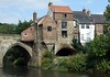
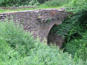
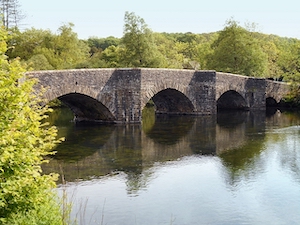
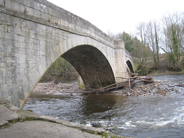
Abbey Bridge, near Egglestone Abbey
- Overview Map Street View Abbey Bridge crosses the River Tees about a quater of a mile south-east of Egglestone Abbey, near Barnard Castle in County Durham. The road bridge was built …
Co-Curate Page
Elvet Bridge
- Overview Further Information Map Street View Elvet Bridge is a stone bridge which crosses the River Wear connecting the peninsula in central Durham and the Elvet area of the city. …
Co-Curate Page
Scotswood Bridge
- Overview History Map Street View 16th April 1831; opening of the Scotswood Bridge (Chain Bridge) crossing the tyne between Newcastle and Blaydon 20th March 1967; opening of the current Scotswood Bridge. Scotswood Bridge is one of the main …
Co-Curate Page
Ladykirk and Norham Bridge
- Overview About Ladykirk and Norham Bridge Map Street View Ladykirk and Norham Bridge is a stone arched bridge crossing the River Tweed, connecting Norham in Northumberland, England, with Ladykirk in …
Co-Curate Page
Wearmouth Bridge
- Overview History Timeline Map Street View The Wearmouth Bridge crosses the River Wear in Sunderland. The current bridge was built 1927 to 1929 and replaced an earlier cast-iron bridge in the same …
Co-Curate Page
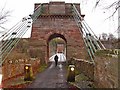
Kingsgate Bridge
- Overview About Kingsgate Bridge Map Street View Kingsgate Bridge is a footbridge over the River Wear, which was built in 1965. The bridge connects Bow Lane in the centre old of …

Co-Curate Page
Stockton Infinity Bridge
- Overview About the Infinity Bridge Map Street View The Infinity Bridge is a pedestrian and cycle bridge over the River Tees, linking the North Shore development (Stockton-on-Tees) with the University …
Co-Curate Page
Northern Spire Bridge
- Overview About the Northern Spire Bridge Map Street View The bridge was opened on the 28th of August 2018 - the first bridge to be built over the River Wear in …
Co-Curate Page
Framwellgate Bridge
- Overview About Framwellgate Bridge Map Street View Framwellgate Bridge is a medieval stone bridge over the River Wear in Durham. The bridge was built in the 15th century and replaced …
Co-Curate Page
Royal Border Bridge
- Railway bridge across the River Tweed designed by Robert Stephenson and built between 1847 and 1850, at its height the workforce numbered 2,700 men. The bridge was officially opened by …
Co-Curate Page
Old Bridge
- Overview Map Street View Berwick Bridge, over the River Tweed at Berwick, was built between 1611 and 1634 by James Burrell. The red sandstone bridge has 15 arches and is …
Co-Curate Page
Royal Tweed Bridge
- Overview History and Design Map Street View The Royal Tweed Bridge in Berwick-upon-Tweed was officially opened by the Prince of Wales on 16th May 1928. Grade II* listed on the …
Co-Curate Page
Twizel Bridge
- Overview Map Street View Twizel Bridge, over the River Till, was built in 1511. At that time it provided the only dry crossing of the River Till between the Tweed …
Co-Curate Page
Victoria Viaduct
- Overview About the Victoria Viaduct Map Victoria Bridge is a 810 ft long rail viaduct over the River Wear near Fatfield, Washington. It was built for the Durham Junction Railway and opened …

Co-Curate Page
Causey Arch
- Overview History Map Causey Arch bridge near Tanfield was built by the Grand Allies in 1726 and is renowned to be the world's oldest surviving single-arch railway bridge. Horse-drawn wagons …
Co-Curate Page
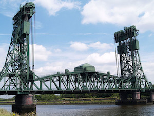
Tees Newport Bridge
- Overview History Map Street View The Tees Newport Bridge was the first large vertical lift bridge in Europe, and opened by Prince Albert (later King George VI) on 28 February, …

Co-Curate Page
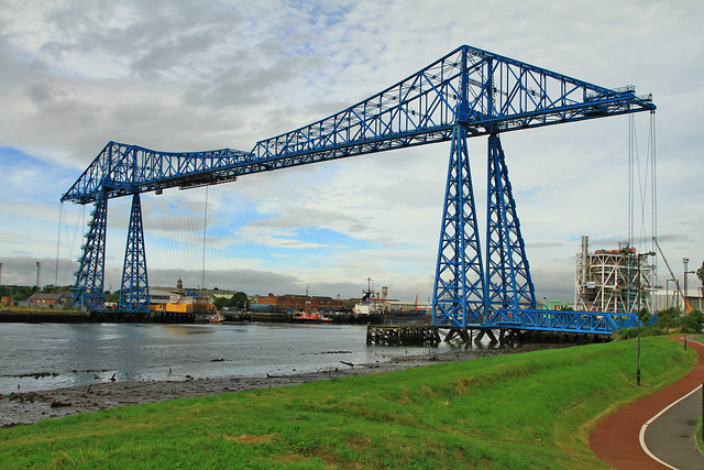
Tees Transporter Bridge
- Overview History Facts & Figures Map Street View The Tees Transporter Bridge was opened on the 17th October 1911 by Prince Arthur of Connaught. The bridge over the River Tees connects Middlesbrough, on the south bank, …
Co-Curate Page
Prebends Bridge
- Overview About Prebends Bridge Map Street View Prebends Bridge over the River Wear at Durham was built for the Dean and Chapter of Durham to provide access to Durham Cathedral …
Co-Curate Page
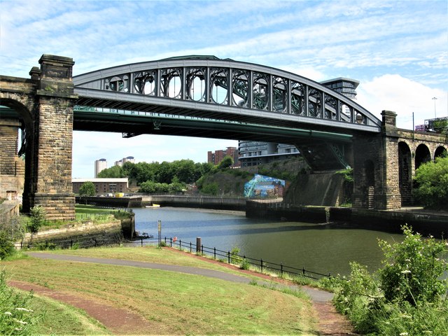
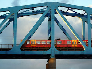
Queen Elizabeth II Metro Bridge
- Overview About the Bridge Map Street View The Queen Elizabeth II Bridge carries the Tyne and Wear Metro over the River Tyne between Newcastle and Gateshead. The bridge was purpose-built …
Co-Curate Page
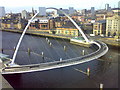
Gateshead Millennium Bridge
- Overview About the Millennium Bridge Map Street View The Gateshead Millennium Bridge is a pedestrian and cycle bridge over the River Tyne. It connects Newcastle Quayside with the Gateshead Quays …

Co-Curate Page
Tyne Bridge
- Overview About the Tyne Bridge Map Street View The Tyne Bridge is an iconic arch bridge over the River Tyne which links Newcastle and Gateshead. Construction of the bridge by …

Co-Curate Page
Newcastle Swing Bridge
- Overview Further Information Map Street View The Swing Bridge over the River Tyne was first used for road traffic on 15th June 1876 and opened for river traffic on 17th …
from Newcastle libraries (flickr)
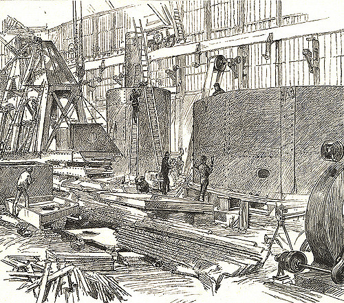
003867:The Bridge Yard Sir W.G. Armstrong Mitchell
Pinned by Simon Cotterill

Co-Curate Page
High Level Bridge
- Overview About the High Level Bridge Map Street View The High Level Bridge is a 'double decker' road and railway bridge spanning the River Tyne between Newcastle and Gateshead. The …
Co-Curate Page
King Edward VII Bridge
- Overview About the King Edward VII Bridge Map Street View The King Edward VII railway bridge was opened by King Edward VII and Queen Alexandra on the 10th of July …
Co-Curate Page
Redheugh Bridge
- Overview Further Information Map Street View There have been 3 Redheugh Bridges spanning the River Tyne and currently carrying the A189 road. The first Redheugh Bridge, built by Thomas Bouch, was …
Co-Curate Page
Witton Bridge
- Overview Map Street View Witton Bridge crosses the River Wear about a quarter of a mile south of Witton-le-Wear and a similar distance north-west of Witton Castle. The bridge was formerly …
Co-Curate Page
Middleton Bridge
- Overview Map Street View Middleton Bridge carries the B6277 road over the River Tees at Middleton-in-Teesdale. The stone bridge has a single high segmental arch. It was built in c.1800, …
Co-Curate Page
Chester New Bridge, near Lambton Castle
- Overview Map Street View Chester New Bridge is a single-track road bridge over the River Wear, located to the east of Chester-le-Street and about 1 mile west of Lambton Castle. …
Co-Curate Page
Featherstone Bridge
- Overview Map Street View Featherstone Bridge ia a single-track road bridge over River South Tyne, located about half a mile east of Featherstone Castle and 2 miles north-west of Haltwhistle. …
Co-Curate Page
Lamb Bridge, near Lambton Castle
- Overview Map Lamb Bridge is a single arched ashlar sandstone bridge over the River Wear on the Lambton Estate. The bridge was built in 1819 by Ignatius Bonomi for John …

Co-Curate Page
Ashgill Bridge over Ashgill Force
- Overview Map Street View Ashgill Bridge carries the B6277 road over Ash Gill, by Ashgill Force Waterfall, about 1 mile south-east of Garrigill. A plaque on the bridge notes that …

Co-Curate Page
Armstrong Bridge
- Overview Map Armstrong Bridge is an iron bridge which spans Jesmond Dene. Originally open to traffic it is now restricted to pedestrians. The bridge hosts an arts and crafts fair …
Co-Curate Page
Slater's Bridge, Little Langdale
- Overview Map Street View Slater's Bridge is a 17th century packhorse bridge that crosses the River Brathay in Little Langdale. It is built of slate and natural boulders. A large …
Co-Curate Page
Skelwith Bridge (bridge)
- Overview Map Street View The slate bridge over the River Brathay is at the south of the settlement of Skelwith Bridge. The bridge, with two segmental arches, carries the A593 …
Co-Curate Page
Crook of Lune Bridge
- Overview Map Street View This stone road bridge over the River Lune, near Lowgill in Cumbria, was built in the 16th century or possibly earlier. The bridge formed part of …
Co-Curate Page
Monk's Bridge
- Monk's Bridge is a wooden bridge over the River Aln in Hulne Park, near Alnwick, built in 1901. The wooden rails are suppored stone abutments from an earlier bridge of c.1854.[1]
Co-Curate Page
Brathay Bridge
- Brathay Bridge carries the B5286 over the River Brathay near Clappersgate.
Co-Curate Page
Lowgill Viaduct
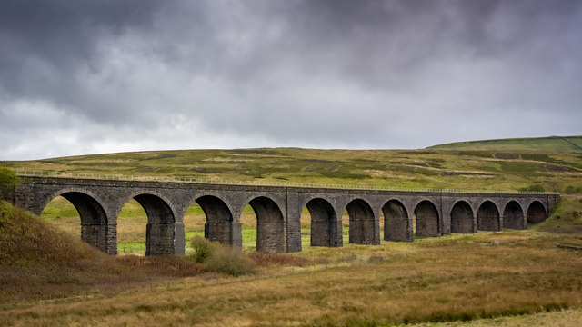
- Overview Map Street View Lowgill Viaduct was built in 1859 by Joseph Locke and John Errington for the Ingleton Branch Line of the London and North Western Railway.[1] The 11 …
Co-Curate Page
Brathay Footbridge
- Stone footbridge over the River Brathay between Brathay Hall and Clappersgate.

Co-Curate Page
Byker Metro Bridge
- Overview About Byker Metro Bridge Map Street View Byker Metro Bridge (also known as Byker Viaduct) was constructed 1978-1979 and was purpose built for the Tyne & Wear Metro system, …
Co-Curate Page
Frank's Bridge
- Overview About Frank's Bridge Map Street View Frank's Bridge is a narrow pedestrian stone footbridge over the River Eden in Kirkby Stephen. It was built in the 17th century as …
Co-Curate Page
Podgill Viaduct
- Overview Map Street View Street View (top) Podgill Viaduct is a former railway viaduct over Ladthwaite Beck, located about ½ mile south-east of Kirkby Stephen and ½ mile south of …
Co-Curate Page
Smardale Viaduct
- Overview Map Street View Smardale Viaduct was built from 1870 to 1875 to carry the Settle to Carlisle railway line over the steep sided valley of Scandal Beck. It built …
Co-Curate Page
Smardale Gill Viaduct
- Overview Map Street View Smardale Gill Viaduct is just over a mile south-west of the village of Smardale in Cumbria. The viaduct was built for the South Durham and Lancashire Union …
Co-Curate Page
Bolton Bridge, Bolton
- Overview Map Street View The red sandstone bridge over the River Eden at Bolton in Cumbria is dated 1870.
Co-Curate Page
Lanercost Bridge
- The old red sandstone bridge at Lanercost was built in c.1724. The bridge has two arches, the larger arch spans the River Irthing and the smaller one spans the millstream …
Co-Curate Page
Hadrian Bridge over Central Motorway
- Overview Map Street View Hadrian Bridge is a pedestrian and cycle bridge over the Central Motorway which connects the parts of Newcastle University campus by Claremont Road to the area …
Co-Curate Page
Storch Bridge, Greystoke
- Overview Map Street View Storch Bridge over the River Petteril is located just to the east of Greystoke in Cumbria, near Woodside Caravan Park. The segmental-arched hump-back bridge was built in …
Co-Curate Page
Wreay Bridge
- Wreay Bridge - a red sandstone road bridge over the River Petteril, to the south-east of Wreay in Cumbria. The 3 arched bridge was built in the 1830's.[1] The bridge …
Co-Curate Page
Crook's Bridge, near Wreay
- Overview Map Street View Crook's Bridge is a 3 arched bridge over the River Petteril, located just over half a mile slouth-east of Wreay in Cumbria. The bridge was built …
Co-Curate Page
Sherburnhouse Bridge
- Overview Map Street View The old Sherburnhouse Bridge, located to the north-west of the hamlet of Sherburn House in County Durham, dates from 1335, with the upper part of the …
Co-Curate Page
Askham Bridge
- Askham Bridge over the River Lowther was built in 1897. The bridge is Garde II listed.
Co-Curate Page
Fowberry Bridge
- Overview Map Street View Fowberry Bridge, over the River Till, was built in 1825, for Matthew Culley of Fowberry Tower. The bridge at Fowberry has one arch over the river …
Co-Curate Page
Gelt Bridge
- Gelt Bridge (aka Middle Gelt Bridge ) is a railway viaduct over the River Gelt in Cumbria. It was built from 1832-1835 for the Newcastle and Carlisle Railway. It was one …
Co-Curate Page
Docker Viaduct
- Overview Map Street View Docker Viaduct was built by Joseph Locke in 1846 to carry the Lancaster and Carlisle Railway over Flodder Beck. It is located to the north-east of the vilage …
Co-Curate Page
Middleton Bridge over the Rawthey
- Overview Map Street View Middleton Bridge carries the A683 road over the River Rawthey, close to it's confluence with the River Lune to the north of Middleton, Cumbria. The bridge was …
Co-Curate Page
Road Bridge, near Station Cottages
- Overview Map Street View The road bridge over Waren Burn, near Station Cottages, north-west of Lucker, was built in 1906. Built by by Ferro-Concrete Construction, it carries the B1341 road …
Co-Curate Page
The Hikey Bridge
- The Sands Suspension Bridge, known locally as the 'Hikey Bidge', is a footbridge over the River Derwent at Swalwell, Gateshead. It was built in 1902 to link the allotments on …
Co-Curate Page
Stone Footbridge over Debdon Burn
- This stone humped bridge crosses the Debdon Burn on the Cragside estate, south of the Iron Bridge. It was built in the late 19th century for Lord Armstrong. It is …
Co-Curate Page
Bellasis Bridge
- Overview Map Street View Bellasis Bridge carries Green Lane over the River Blyth. It is located about half a mile souuth-west of the Bellasis and 2 miles south-west from Stannington. …
Co-Curate Page
Newburn Bridge
- Overview About Newburn Bridge Map Street View Newburn Bridge is a road bridge over the River Tyne between Newburn in the City of Newcastle upon Tyne and Ryton in the …
Co-Curate Page
Rede Bridge, Redesmouth
- Overview Map Rede Bridge over the River Rede, is located about half a mile north of Redesmouth in Northumberland (not to be confused with the downstream Redesmouth Bridge). The stone …
Co-Curate Page
Botcherby Bridge
- Overview Map Street View Botcherby Bridge carries Warwick Road (A69) over the River Petteril. The current bridge has a plaque commemorating it's opening in June 1932. There have been earlier …
Co-Curate Page
Low Wood Bridge, over River Leven
- Overview Map Street View Low Wood Bridge carries the B5278 road over the River Leven between Low Wood and Haverthwaite in Cumbria. The bridge is located at the upper tidal limit of …
Co-Curate Page
Backbarrow Bridge
- Overview Map Street View The bridge at Backbarrow carries the road over white water falls on the River Leven. The bridge dates from the late 17th or 18th century and …
Co-Curate Page
Falstone Bridge
- Overview Map Street View The three arched stone bridge over the River North Tyne at Falstone was built in 1843. On it's western parapet is a plaque inscribed "HENRY WELCH, …
Co-Curate Page
Newbiggin Bridge, Newbiggin, Kirkby Thore
- The bridge over Crowdundle Beck in Newbiggin (Kirkby Thore) in Cumbria dates from the late 18th Century. The bridge is Grade II listed.
Co-Curate Page
South Monkridge Bridge
- Overview Map Street View South Monkridge Bridge carries a minor road over Raylees Burn at Monkridge. The bridge was built in 1956.

Co-Curate Page
Monkridge Bridge
- Overview Map Street View Bridge carrying the A696 road over Elsdon Burn at Monkridge.
Co-Curate Page
Duke of Norfolk Bridge, Greystoke
- The Duke of Norfolk Bridge over the River North Petteril at Greystoke was originally built in 1796. The bridge was widened in 1920 in remberance of those who died in the First …
Co-Curate Page
Hawes Bridge, Nantland
- Overview Map Street View Hawes Bridge is a road bridge which carries Hawes Lane over the River Kent, just west of Natland and east of Prizet. The bridge dates from …
Co-Curate Page
Shilvington Bridge
- Overview Map Street View Shilvington Bridge carries a minor road over the River Blyth, located roughly half way between Ogle and Shilvington in Northumberland. The stone bridge was built in …
Co-Curate Page
East Thickley Bridge
- Overview Map East Thickley Bridge (footbridge) is located a short distance east of Locomotion: the National Railway Museum at Shildon. The accommodation bridge crosses Shildon sidings and the former Stockton and …
Co-Curate Page
Burn Closes Bridge
- Overview Map Street View Burn Closes Bridge carries St Peter's Road over Willington Dene (the lower part of the valley formed by Wallsend Burn). The current bridge was built in …
Co-Curate Page
Broughton High Bridge
- Overview Map Street View Broughton High Bridge is a road bridge over the River Derwent, located about ¼ mile south of Great Broughton and Little Broughton, and ½ mile north …
Co-Curate Page
Cliburn Mill bridge
- Overview Map Street View Cliburn Mill bridge is a road bridge over the River Lyvennet, which was built in 1827. The bridge is located about ¾ mile east of the …
Co-Curate Page
St Lawrence's Bridge
- Overview Map Street View St Lawrence's Bridge (aka Appleby Bridge) carries Bridge Street over the River Eden in Appleby-in-Westmorland. The present bridge was built in 1889, replacing a much earlier …
Co-Curate Page
Stonehouse Bridge, Dentdale
- Overview Map Street View Stonehouse Bridge is a road bridge over the River Dee at Stone House in Dentdale, Cumbria. The stone segmental arched bridge is thought to date from …
Co-Curate Page
Birks Bridge over the River Winster
- Overview Map Street View Birks Bridge is a stone footbridge over the River Winster in the South Lakeland district of Cumbria, located about 1 mile south-west of Winster and 2 …
Co-Curate Page
Corn Mill Bridge, Spartylea
- The stone bridge over the River East Allen is located near the old corn mill and St Peter's Church in Spartylea. The bridge dates from the early 19th century and …
Co-Curate Page
Whelpo Bridge
- Overview Map Street View Whelpo Bridge is a stone road bridge over Whelpo Beck in Caldbeck Civil Parish in Cumbria. The bridge, by the hamlet of Whelpo, dates from the …
Co-Curate Page
Ellenhall Bridge
- Overview Map Street View Ellenhall Bridge is a red sandstone road bridge over the River Ellen, located in between Girclux and Oughterside in Cumbria. It straddles the civil parishes of …
Co-Curate Page
Artengill Viaduct
- Overview Map Street View Artengill Viaduct (aka Arten Gill Viaduct) carries the Settle and Carisle Railway line over the valley of Artengill Beck (stream). It is located to the north …
Co-Curate Page
Dandrymire Viaduct
- Overview Map Street View Dandrymire Viaduct carries the Settle and Carlisle Railway line over Dandry Mire, a short distance north-east of Garsdale Station. The coursed sandstone viaduct is about 200m …
Co-Curate Page
Railway Bridge, Garsdale Head
- Overview Map Street View This railway bridge carries the Settle and Carlisle Railway over Hawes Road (A684) near Garsdale Head in Cumbria, very close to the county boundary with North …
Co-Curate Page
Chairford Bridge
- Overview Map Street View Chairford Bridge, in East Woodburn, carries the road over Lisles Burn. It is a stone hup-backed bridge, built in the early 19th century. Chairford Bridge is Grade …
Co-Curate Page
Crosby Garrett Viaduct
- Overview Map Street View Crosby Garrett Viaduct was built in 1875 by J. S Crossley (Engineer) for the Midland Railway, as part of the Settle and Carlisle line. Located at the …
Co-Curate Page
Lunes Bridge, Tebay
- Overview Map Street View Lunes Bridge is an early-mid 19th century bridge over the River Lune, located about half mile south-east of Roundthwaite and a mile south of Tebay. The …
Co-Curate Page
Little Salkeld Viaduct
- Overview Map Street View This railway viaduct, located about half mile south of Little Salkeld, was built for the Midland Railway in 1875. The viaduct has 7 arches and carries …
Co-Curate Page
Sedgwick Aqueduct
- Overview Map Street View Sedgwick Aqueduct carries the Lancaster Canal over a road in the village of Sedgewick in Cumbria. The limestone aqueduct was built in 1818 by William Crosley …
Co-Curate Page
Ormside Viaduct
- Overview Map Ormside Viaduct carries the Settle and Carlisle Railway over the River Eden, about ½ mile north-west of Great Ormside. The viaduct was built from 1870 to 1875.
Co-Curate Page
Christy Bridge, Martindale
- Christy Bridge is a bridge over Howgrain Beck in Martindale. The stone rubble bridge was built in 1851. The bridge is Grade II listed on the National Heritage List for …
Co-Curate Page
Packhorse Bridge, Wasdale Head
- Overview Map Street View Row Bridge, usually referred to as "Packhorse Bridge", is an c.18th century footbridge over Mosedale Beck. It is located in Wasdale Head, a short distance north …
Co-Curate Page
Westlinton Bridge
- Overview Map Street View Westlinton Bridge is located immediately north of the village of Westlinton and carries the A7 road over the River Lyne. The red sandstone bridge has 2 …
Co-Curate Page
Low Sweden Bridge, Ambleside
- Overview Map Street View Low Sweden Bridge over Scandale Beck is located north of Ambleside, near Nook End Farm. The bridge was built in the late 17th century, now with a modern …
Co-Curate Page
Elterwater Bridge
- Overview Map Street View Elterwater Bridge is a road bridge over Great Langdale Beck at the village of Elterwater. The bridge was built in 1702, replacing an earlier bridge here. Later, …
Co-Curate Page
Belmont Viaduct
- Overview Map Belmont Viaduct is a railway viaduct over the River Wear, built in 1856 for the Auckland branch line of the North Eastern Railway. It is located north of the …
Co-Curate Page
Lancaster Canal Aqueduct, Farleton
- Overview Map Street View There is an aqueduct carrying the Lancaster Canal over Farleton Beck (aka Lupton Beck), at the village of Farleton. The aqueduct, built in c.1816, is Grade …
Co-Curate Page
Gote Bridge, Cockermouth
- Overview Map Street View Gote Bridge (aka Derwent Bridge) is the main road bridge across the River Derwent in Cockermouth. The bridge was built in 1822 and connects the town …
Co-Curate Page
Cocker Bridge, Cockermouth
- Overview Map Street View Cocker Bridge in Cockermouth carries Main Street over the River Cocker. The single segmental arch bridge was rebuilt in 1828. It is Grade II listed on …
Co-Curate Page
Irthing Bridge, near Brampton
- Overview Map Street View Irthing Bridge carries the A6071 road over the River Irthing, north-west of Brampton in Cumbria. The 3 arched stone bridge was built in c.1729 and altered …
Co-Curate Page
Brancepeth Bridge
- Overview Map Brancepeth Bridge, to the west of Brancepeth Castle, carries the road (the old route of the A690) over Stockley Burn (aka Brancepeth Beck). The castellated sandstone bridge was …
Co-Curate Page
Bridge over the Wansbeck, south of Wallington
- Overview History Map Street View This bridge is located about ¼ mile south-east of Wallington Hall, carries the B6342 road over the River Wansbeck. The bridge was built in 1755 …
Co-Curate Page
Gilesgate Bridge over Halgut Burn
- This bridge over Halgut Burn in the Sele in Hexham dates from the 13th century, with a mid-19th century crenelated parapet and overbuilding. It is located in the former grounds …

Co-Curate Page
Seathwaite Bridge
- Overview Map Street View Seathwaite Bridge is a road bridge over Tarn Beck, located about ½ mile north-east of the village of Seathwaite in South Lakeland. The stone rubble bridge has …
Co-Curate Page
Bridge over Witton Row Beck, nr Witton Castle
- Overview Map Street View This small low segmental arch road bridge over Witton Row Beck is located a short distance south-east of Witton Castle. It was built in the early …
Co-Curate Page
Gilderdale Bridge
- Overview Map Street View Gilderdale Bridge carries the A689 road over Gilderdale Burn, about 1 mile south-east of Kirkhaugh and 1½ miles north-west of Alston. The stone bridge was built in 1836 …
Co-Curate Page
Bow Bridge, near Furness Abbey
- Overview Map Street View Bow Bridge is a 15th Century multi-span bridge over Mill Beck, located about ¼ mile south east of Furness Abbey. It was built by the monks …
Co-Curate Page
Elishaw Bridge
- Overview Map Street View Elishaw Bridge carries the A68 road over the River Rede at Elishaw in Northumberland..
Co-Curate Page
Dobson's Bridge, nr Threlkeld
- Overview Map Street View Dobson's Bridge is a single wide arch roadbridge over the River Glendermackin, located about 1½ miles north-east of Threlkeld and a short distance west of the …
Co-Curate Page
Pack Horse Bridge, Stainton
- Overview Map Street View The pack horse bridge over Stainton Beck in Stainton village is thought to date from the 17th century. It is a single segmented arch bridge made …
Co-Curate Page
Levens Bridge
- Overview Map Street View Levens Bridge carries the A6 road over the River Kent at Levens in Cumbria. The limestone bridge is thought to date from the 17th century, though …
Co-Curate Page
Doctor Bridge, Eskdale
- Overview Map Street View Doctor Bridge is a stone road bridge over the River Esk in Eskdale. It was originally a packhorse bridge built in the 17th century. It's name …
Co-Curate Page
West Woodburn Bridge
- Overview Map Street View This stone bridge carries the A68 road over the River Rede at West Woodburn. The bridge was originally built in the early 19th century. It was …
Co-Curate Page
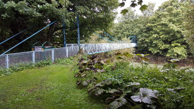
Greystead Foot Bridge
- Overview Map Street View Greystead Foot Bridge over the River North Tyne. This suspension bridge was built c.1862 to connect Greystead and the south bank of the river to the …
Co-Curate Page
Bridge over Lewis Burn, The Forks
- Overview Map The bridge carrying Bloody Bush Road over Lewis Burn, is located near The Forks in Kielder Forest. It was built in 1829 for Sir J. Swinburn. The single …
Co-Curate Page
Ford Bridge
- Overview Map Street View Ford Bridge carries the B6353 road over the River Till, about half a mile west of Ford village. The current bridge was built in 1809, but …
Co-Curate Page
Stone Bridge, near Hartley West Farm
- Mid 18th century stone bridge over Seaton Burn on the track to Hartley West Farm in Holywell Dene. The bridge is Grade II listed on the National Heritage List for …
Co-Curate Page
Healeyfield Bridge
- Overview Map Healeyfield Bridge is a stone bridge which carryies the track from Healeyfield farm over the Waskerley Way (a former railway line). The bridge was built c.1832 by T.E. …
Co-Curate Page
Bridge over Broomside Railway Cutting
- Overview Map Street View Road bridge over Broomside Cutting on Broomside Lane / Pittington Lane - was buit in 1848 for Great North of England Railway. The bridge is Grade II …
Co-Curate Page
Thorngate Footbridge
- This footbridge over the River Tees, in Barnard Castle, was constructed in 1882 for workers of the nearby mills, and it allowed access, on foot, from across the river to …
Co-Curate Page
Chantry Footbridge
- Overview Map Street View The Chantry Footbridge over the River Wansbeck is located by Chantry Place in Morpeth. It was built in 1869 by Swinney Bros. of Morpeth, funded by …
Co-Curate Page
Lowford Bridge, Morpeth
- Overview Map Street View Lowford bridge carries Mitford Road (B6343) over the River Wansbeck at the east of Morpeth. The stone bridge was erected in 1836, funded by public subscription. …
Co-Curate Page
Arnside Viaduct
- Overview Map Street View Arnside railway viaduct (aka the Kent Viaduct) is a 51 span structure carrying the Carnforth and Whitehaven Line over the estuary of the River Kent, a …
Co-Curate Page
Laverock Bridge
- Overview Map Street View Laverock Bridge, over the River Mint, is located south-west of Meal Bank in Cumbria. It is a stone segmental arch bridge, probably built in the 17th …
Co-Curate Page
Bridge over Devil's Water, Harwood Shield
- Overview Map The stone segmental arch bridge over Devil's Water, south of Harwood Shield, was built in 1832. The bridge is Grade II listed on the National Heritage List for …
Co-Curate Page
Bridge at Baybridge
- Overview Map Street View This stone bridge carries the Bale Hill road over the River Derwent at Baybridge. The hamlet of Baybridge is in Northumberland, but the bridge itself is …
Co-Curate Page
Lowlynn Bridge
- Overview Map Street View Lowlynn Bridge, located east of Lowlynn Mill, is a road bridge over South Low (river). It is a single segmental arch bridge, built in the early …
Co-Curate Page
Eachwick Bridge
- Overview Map Street View The stone road bridge over the River Pont, to the east of Eachwick, was built in 1819. It is part of landscaped setting of Dissington Hall. …

from Youtube (youtube)
ROYAL: Edward, Prince of Wales opens the new bridge across the Tweed (1928)
Pinned by Simon Cotterill

from Youtube (youtube)
ROYAL: Prince of Wales opens Royal Tweed bridge in 1928 (1928)
Pinned by Simon Cotterill
Co-Curate Page
Bowston Bridge
- Overview Map Street View The stone bridge over the River Kent at Bowston dates from the 17th century; it was later widened on its North side. The bridge is Grade …
Co-Curate Page
Dent Head Viaduct
- Overview Map Street View Dent Head Viaduct carryies the Settle to Carlisle Railway line over Fell End Gill. It was built c.1869-1875, for the Midland Railway Company, Chief Engineer John …
Co-Curate Page
Packsaddle Bridge beside Dent Head Viaduct
- Packsaddle Bridge is an 18th century packhorse bridge over Fell End Gil. It stands next to, and is dwarfed by, the late 19th century Dent Head Viaduct. Packsaddle Bridge is …
Co-Curate Page
Cowgill Bridge
- Overview Map Street View This road bridge crosses Cowgill Beck, shortly before the becks confluence with the River Dee. It is located near St John's Church in Cowgill. The bridge …
Co-Curate Page
Allenmill Bridge
- Overview Map Street View Allenmill Bridge, located just over half mile north-west of Allendale Town, carries the B6295 road over the River East Allen. The stone bridge, with 2 segmental …
Co-Curate Page
Dockra Bridge
- Overview Map Dockra Bridge is a road bridge over Cowgill Beck, located on the north side of Cowgill, along Dockra Lane. It was built in the late 18th century to …
Co-Curate Page
Rash Bridge
- Overview Map Street View Rash Bridge carries the road over the River Dee on Mill Lane, near Rash in Cumbria. The coursed rubble bridge was probably built in the 18th …
Co-Curate Page
Church Bridge, Dent
- Overview Map Street View Church Bridge carries Beach Hill (road) over the River Dee in Dent, Cumbria. It is located a short distance north east of St Andrew's Church and …
Co-Curate Page
Ouse Bridge, Setmurthy
- Overview Map Street View Ouse Bridge is arched bridge which carries the B5291 road over River Derwent, at the northern end of Bassenthwaite Lake. The bridge dates from the early 19th …
Co-Curate Page
Upperby Bridge
- Overview Map Street View The bridge connects the Upperby and Harraby areas of Carlisle, carrying Petteril Bank Road over the River Petteril. A pedestrian bridge over the Petteril stands a …
Co-Curate Page
Allendale Town Bridge
- Overview Map Street View Allendale Town Bridge, located at the east of Allendale Town, carries the B6925 road over the River East Allen. The stone segmental arch bridge dates from the …
Co-Curate Page
Bridge over Sipton Burn on the Long Drag
- Overview Map This bridge, dated 1878 and inscribed with the initials W.B.B., carries the Long Drag (road) over Sipton Burn. It is located about a mile north-east of Spartylea. The …
Co-Curate Page
Sipton Bridge, over Sipton Sike
- Overview Map Street View Sipton Bridge carries the B6295 road over Sipton Sike. The bridge at Sipton dates from the early 19th century and is located about half mile north …
Co-Curate Page
Sinderhope Bridge, over Sinderhope Burn
- Overview Map Street View Sinderhope Bridge at Sinderhope in Northumberland, carries the B6295 road over Sinderhope Burn, a short distance downstream of its confluence with Hollocks Burn. Built in the …
Co-Curate Page
Cunsey Bridge
- Overview Map Street View Cunsey Bridge is a stone rubble road bridge across Cunsey Beck, thought to date from the 18th century. The bridge has two segmental arches with a …
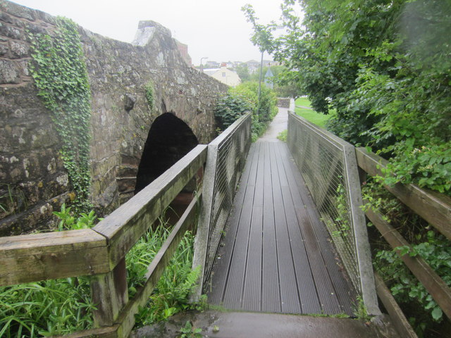
Co-Curate Page
Pow Bridge, St. Bees
- Pow Bridge is a stone roadbridge over Pow Beck, in St. Bees. The bridge, dated 1585, was built for Archbishop Grindal, whose coat of arms and initials appear on dated …
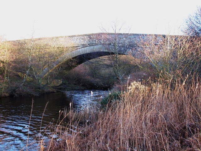
Co-Curate Page
Derwent Bridge near Derwent Reservoir
- Overview Map Street View Derwent Bridge (aka Ratchwoodford Bridge) carries the B6278 road over the River Derwent (Tyne) in Northumberland. It is located near the dam at the south end …
Co-Curate Page
Roddamburn Bridge
- Overview Map Street View There is a stone bridge over Roddam Burn about half mile north-east of the hamlet of Roddam and just under half mile south of Roseden in …
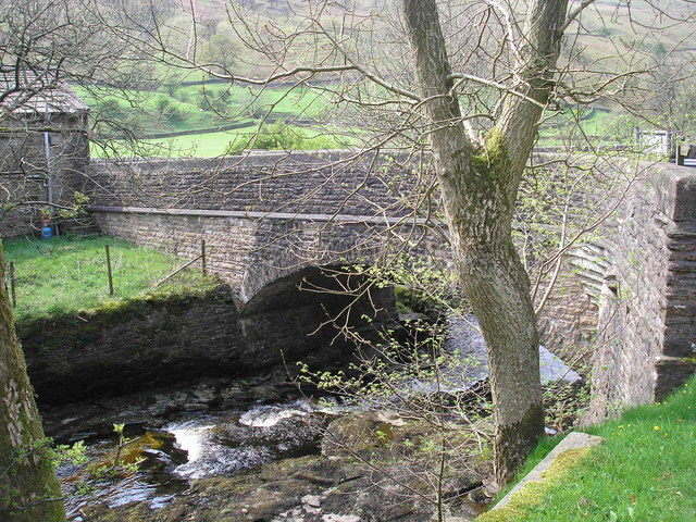
Co-Curate Page
Kirk Bridge, Garsdale
- Overview Map Street View Kirk Bridge carries Hawes Road (the A684) over Clough River in Garsdale. The stone bridge dates from the late 17th or early 18th century. In 1834, …
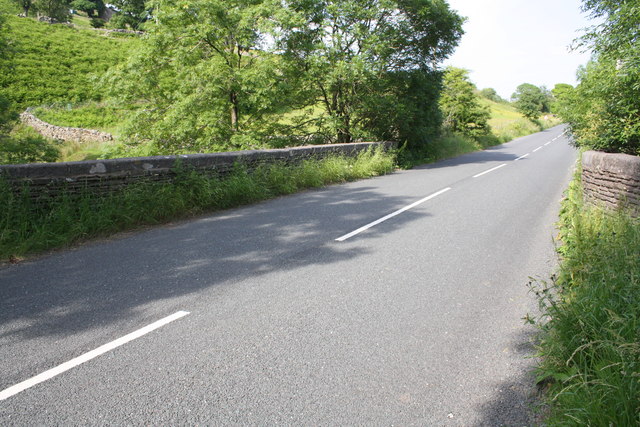
Co-Curate Page
Mill Bridge, A684
- Overview Map Street View Mill Bridge carries Hawes Road (A684) over Clough River, east of Garsdale in Cumbria. The 19th century stone bridge is Grade II listed on the National …
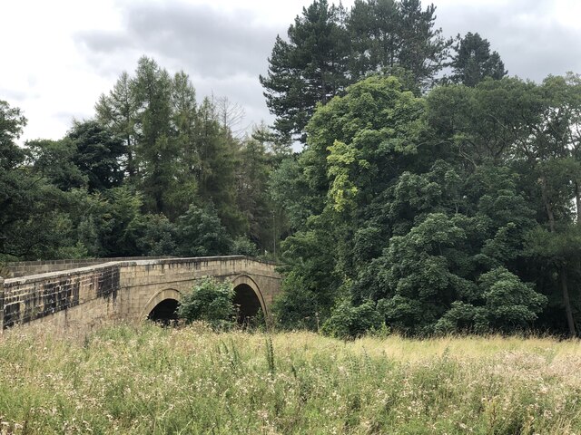
Co-Curate Page
Highford Bridge, Mitford
- Overview Map Street View Highford Bridge carries the B6343 road over the River Wansbeck, east of Mitford. The bridge, with three segmental arches, was built 1829 - 1830. It is …
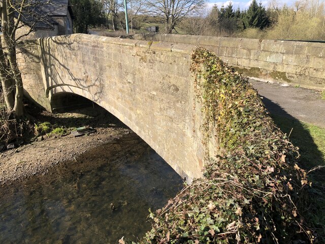
Co-Curate Page
Aldin Grange Bridge
- Overview Map Street View Aldin Grange Bridge over the River Browney is located east of Bearpark. The bridge dates from the 15th century. It is now a pedestrian bridge, since …
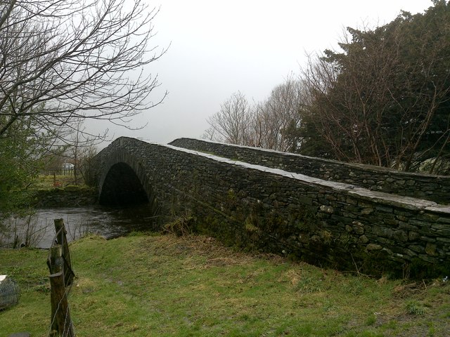
Co-Curate Page
Rosthwaite Bridge
- Overview Map Street View This bridge is a narrow humped-back bridge over Stonethwaite Beck, located at the north of Rosthwaite. It carries the minor road from Rosthwaite to Hazelbank. The …
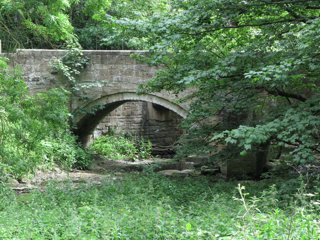
Co-Curate Page
Old Holywell Bridge
- Overview Map Street View This old bridge (now a footbridge) crosses Seaton Burn immediately west of the newer road bridge, south of Holywell. The old bridge dates from the 17th …

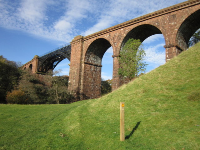
Co-Curate Page
Lune Viaduct at Newbys Dub
- Overview Map Street View The Lune Viaduct at Newbys Dub is located near the hamlet of Waterside and about 1½ miles north-west of Sedbergh. It was built to carry the …
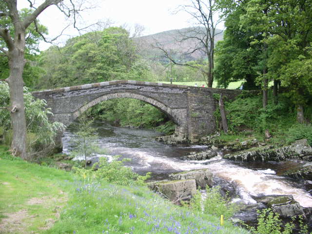
Co-Curate Page
Abbot Holme Bridge
- Overview Map Street View Abbot Holme Bridge carries the road over the River Dee at Abbot Holme, to the south of Sedbergh. The stone bridge dates from the 17th century …

Co-Curate Page
Rolling Bridge over Ulverston Canal
- Overview Map This unusual rolling railway bridge carried the railway over Ulverston Canal, to the East of Ulveston. It was built for the Furness Railway Comany in 1883, designed by …
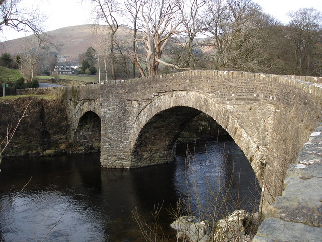
Co-Curate Page
Millthrop Bridge
- Overview History Map Street View Millthrop Bridge is a stone road bridge over the River Rawthey, to the north of Millthrop and south of Sedbergh. The bridge dates from the …
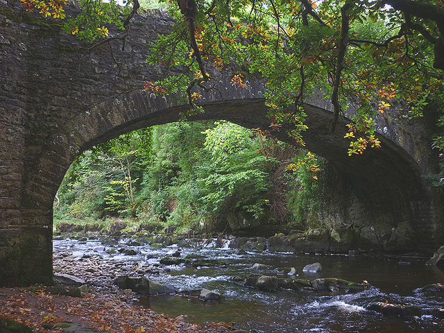
Co-Curate Page
Garsdale Bridge by Farfield Mill
- Overview Map Garsdale Bridge is located a short distance north-west of Farfield Mill, about a mile east of the town of Sedbergh. It carries a minor road over Clough River. …
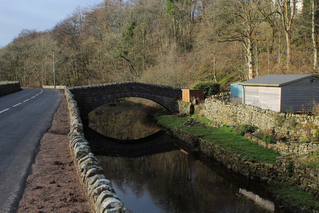
Co-Curate Page
Ben's Bridge, Garsdale
- Overview Map Street View Ben's Bridge is a former packhorse bridge over Clough River, in Garsdale, located off Hawes Road (A684), near Dandra Garth. The bridge is though to date …
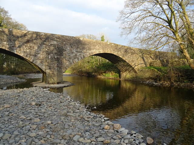
Co-Curate Page
New Bridge, Sedbergh
- Overview Map Street View New Bridge (aka Soolbank Bridge) is a bridge at the east of Sedbergh town, which carries Hawes Road (A684) over the River Rawthey. The bridge, with …
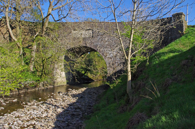
Co-Curate Page
Rawthey Bridge (road)
- Overview Map Street View Rawthey Bridge is a bridge which carries Caitley Road (A683) over the River Rawthey in Cautley, north of the town of Sedburgh. The bridge was rebuilt …
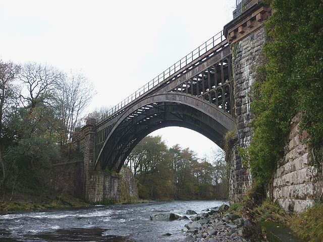
Co-Curate Page
Rawthey Bridge (rail), Brigflatts
- Overview Map Rawthey Bridge carried the railway over River Rawthey, near Brigflatts, about 4 miles northof Sedbergh, in Cumbria. It was built 1857-1861, for the Lancaster and Carlisle Railway Company. …
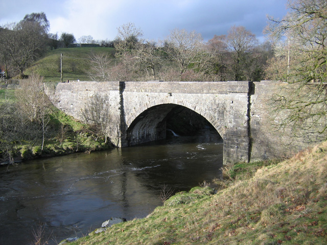
Co-Curate Page
Killington New Bridge, B6256
- Overview Map Street View Killington New Bridge carries the road (B6256) over the River Lune in Cumbria, it is located about 2½ miles south-west of the town of Sedbergh. The …
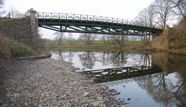
Co-Curate Page
Rigmaden Bridge
- Overview Map Street View Rigmaden Bridge is a single lane road brdge over the River Lune, located to the west of Rigmaden in Cumbria. It straddles the civil parishes of …

Co-Curate Page
Rosgill Bridge
- Overview Map Street View Rosgill Bridge is a roadbridge over the River Lowther, located to the south-east of Rosgill in Cumbria. It was built in the late 17th century, replacing …
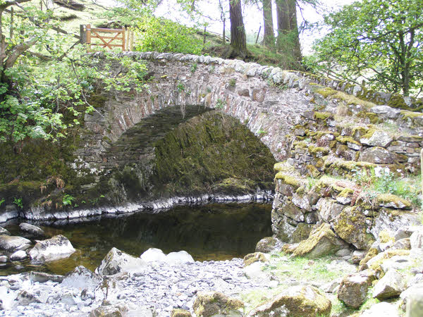
Co-Curate Page
Parish Crag Bridge over Swindale Beck
- Overview Map Parish Crag Bridge is an 18th century Packhorse bridge over Swindale Beck, located about 1½ miles north-west of the village of Shap. The bridge has a single segmental …
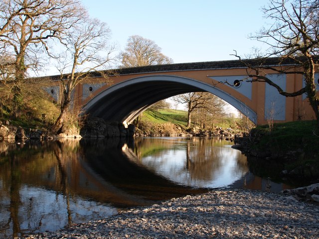
Co-Curate Page
Stanley Bridge
- Overview Map Street View Stanley Bridge carries the A65 road over the River Lune at the south-east of Kirkby Lonsdale. The bridge and new road route to by-pass the town …
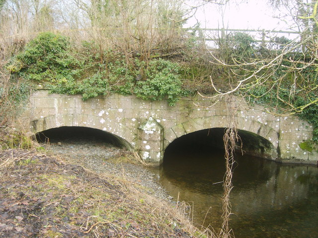
Co-Curate Page
Crooklands Aqueduct, Lancaster Canal
- Overview Map Street View At the south of Crooklands, by Milton Lane, is an aqueduct carrying the Lancaster Canal over Peasey Beck. The aqueduct, with two shallow elliptical arches, was …
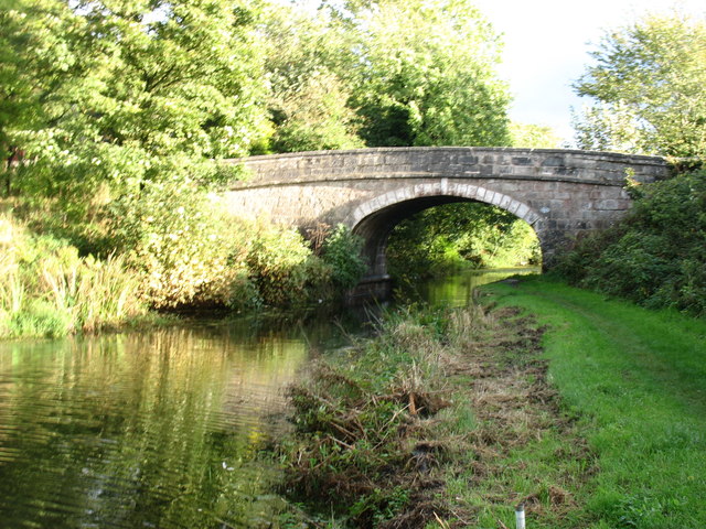
Co-Curate Page
Crooklands Bridge, Lancaster Canal
- Overview Map Street View Crooklands Bridge carries the B6385 road over the Lancaster Canal in Crooklands. The bridge was built in c.1818 by engineer, John Fletcher, to the original designs …
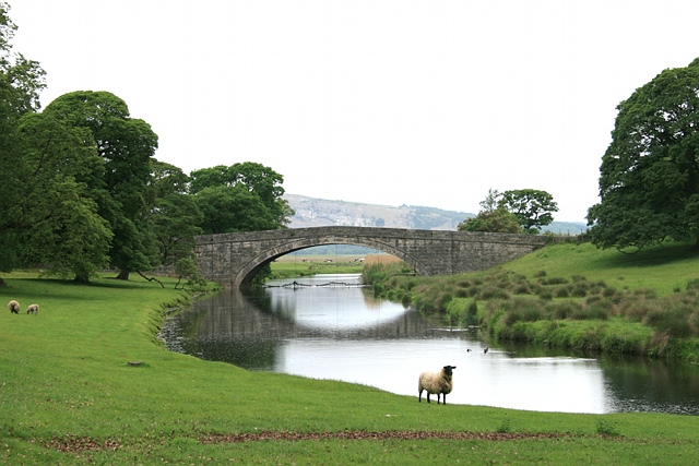
Co-Curate Page
Milnthorpe Bridge
- Overview Map Street View Milnthorpe Bridge is a stone bridge, which carries the B5282 road over the River Bela, which is located about ½ mile west of Milnthorpe. The single …
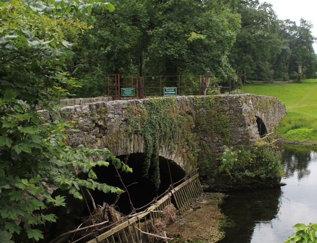
Co-Curate Page
Old Bridge over River Bela, Milnthorpe
- Overview Map Street View The Old Bridge over the River Bela in Milnthorpe is a former road bridge, now a foot bridge. The stone bridge, with two segmental arches, was …
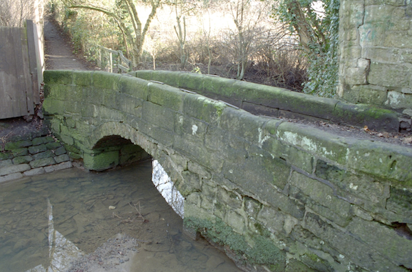
Co-Curate Page
Beggar Lane & footbridge, Morpeth
- Overview Map Street View Beggar Lane in Morpeth is a footpath which runs from Buller's Green / Newgate Street, through to Cottingwood Lane. Cotting Burn is a stream, which runs …
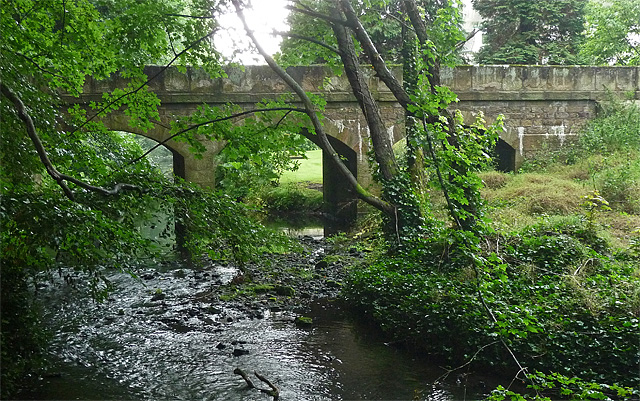
Co-Curate Page
Heugh Mill Bridge, near Stamfordham
- Overview Map Street View Heugh Mill Bridge is a stone road bridge over the River Pont, located just over half mile east of the village of Stamfordham, in Northumberland. The …
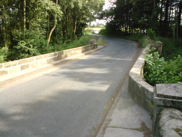
Co-Curate Page
Medburn Bridge, near Stamfordham
- Overview Map Street View Medburn Bridge is a road bridge over the Med Burn, located about 2 miles south-east of the village of Stamfordham. The stone bridge dates from the …
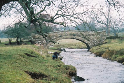
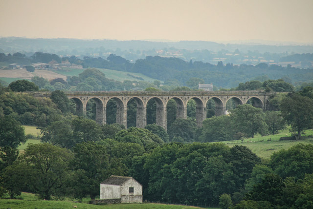
Co-Curate Page
Langley Viaduct
- Overview Map Langley Viaduct is a former railway viaduct over the valley of Langley Beck (Langleydale). The 11 arched bridge was built c.1863 for the North Eastern Railway Company. It …
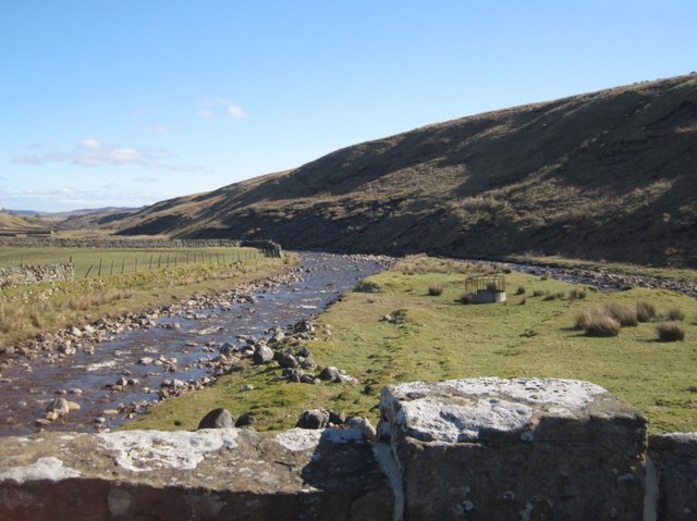
Co-Curate Page
Grains o'th' Beck Bridge
- Overview Map Street View There is a stone bridge carrying the B6276 road over Long Grain at Grains o'th' Beck in Lunedale. The bridge, with 2 segmental arches, dates from …

Co-Curate Page
Far Beck Bridge, Gain o'th' Beck
- Overview Map Street View Far Beck Bridge is a stone bridge carrying the B6276 road over Lune Head Beck at Grains o'th' Beck in Lunedale. The bridge, with a single segmental arch, dates …
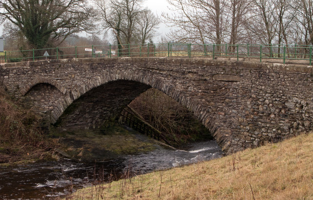
Co-Curate Page
Hodge Bridge, Barbon, A683
- Hodge Bridge carries the A683 road over Barbon Beck, west of the village of Barbon. The stone segmental arch bridge dates from the 18th century, with later parapets and widening. …
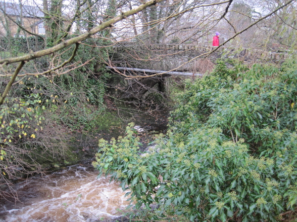
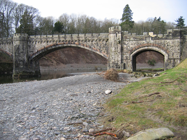
Co-Curate Page
Underley Bridge,
- Bridge over river Lune. 1872. For Earl of Bective. Rock-faced stone with ashlar dressings and parapet. 2 double-chamfered segmental arches with 4 ribs, and smaller segmental arch to north-east end …
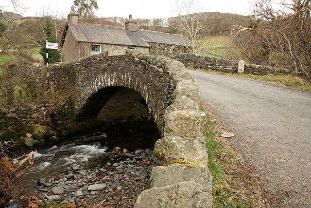
Co-Curate Page
Shop Bridge and Boundary Stone, Broughton Mills
- Overview Map Street View Shop Bridge is a stone road bridge over the River Lickle at Broughton Mills. The segmental arched bridge dates from the 18th century, with later widening. …
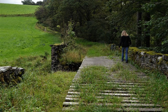
Co-Curate Page
Ivy Bridge over the River Mint
- Ivy Bridge is a stone rubble bridge over the River Mint, downstream of Patton Bridge (village) in Cumbria. It dates from the late 18th or early 19th century. The bridge …
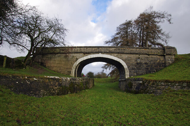
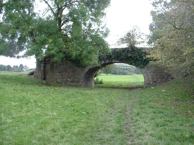

Co-Curate Page
Gossipgate Bridge, Alston
- Overview Map Gossipgate Bridge is a road bridge over the River Nent, located about ½ mile east of Alston. The stone bridge dates from the 18th century and has a …
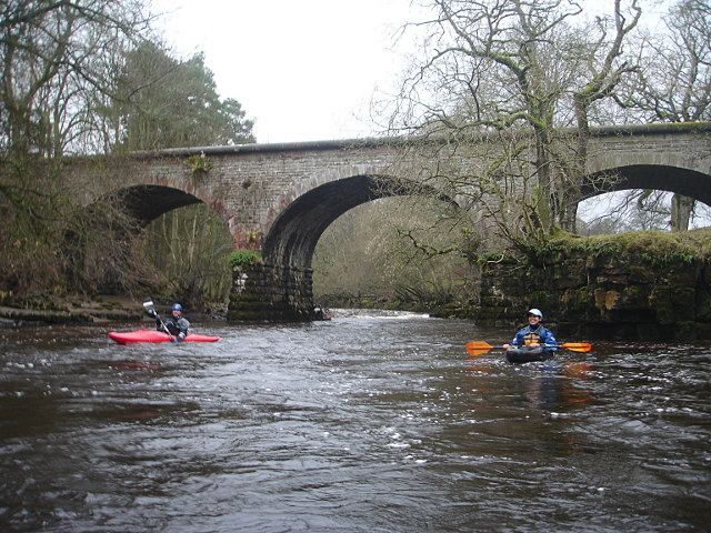
Co-Curate Page
Railway Bridge over the South Tyne, nr Coatlith Hill
- Overview Map There is a stone railway bridge over the River South Tyne, west of Coatlith Hill, about ½ mile north of Alston. It carries the South Tynedale Railway.
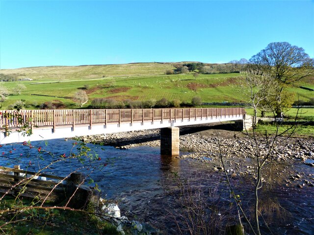
Co-Curate Page
Kirkhaugh Footbridge
- This footbridge over the River South Tyne is located at Kirkhaugh in Northumberland and is on Isaac's Tea Trail. The present bridge, opened on the 16th October 2020, replaced a …

Co-Curate Page
Bridge over Knar Burn
- Overview Map There is a hump-backed bridge over Knar Burn, located 200 metres north-east of Knar Farmhouse. The stone segmental arch bridge dates from the 18th century. It is Grade …
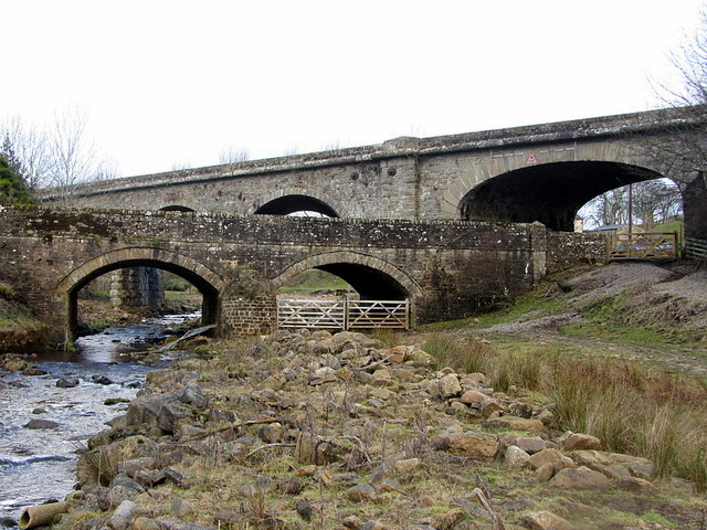
Co-Curate Page
Burnstones Bridge
- Overview Map Street View Burnstones Bridge carries the A689 road over Thinhope Burn. The bridge, at Burnstones, dates from the 18th century; it was rebuilt in 1940 from original materials …
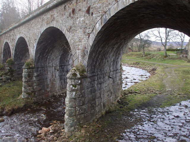
Co-Curate Page
Burnstones Railway Viaduct
- Overview Map Street View Burnstones Viaduct was built by Sir George Barclay Bruce in 1852 to carry the Haltwhistle and Alston Moor branch of the Newcastle and Carlisle Railway Company, …
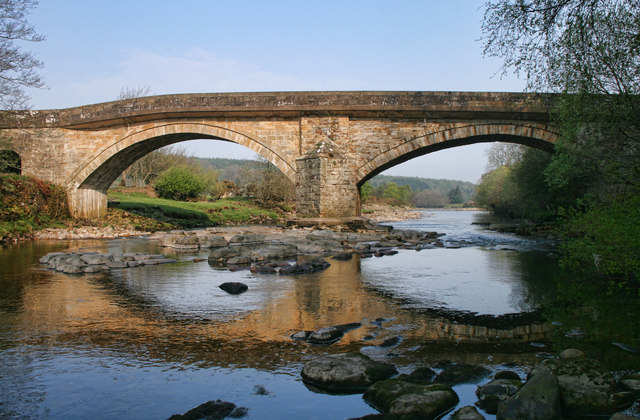
Co-Curate Page
Eals Bridge over the River South Tyne
- Overview Map Street View Eals Bridge carries the road over the River South Tyne south of Eals in Northumberland. The stone bridge dates from 1733 has two segmental arches. It …
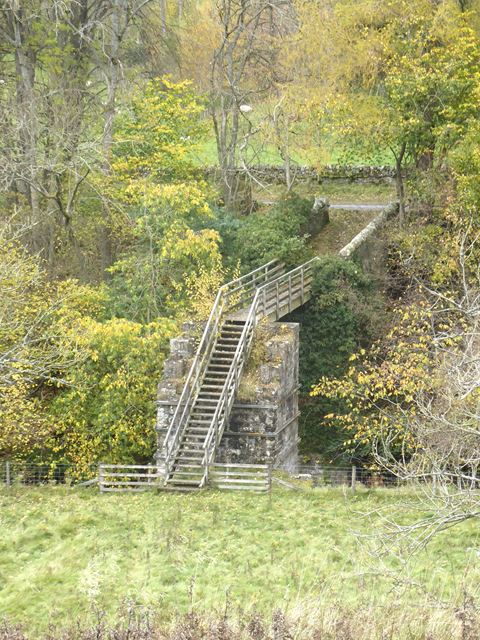
Co-Curate Page
Footbridge over Barhaugh Burn
- Overview Map Street View There is a footbridge over the Barhaugh Burn a short distance from where the burn joins the River South Tyne. It is notable for having massive …
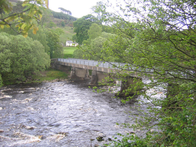
Co-Curate Page
Williamston Bridge over the South Tyne
- Williamston Bridge (aka Thompson's Well Bridge) is a road bridge over the River South Tyne. It carries the minor road to Williamston and beyond, joining the A689 south of Slaggyford. …
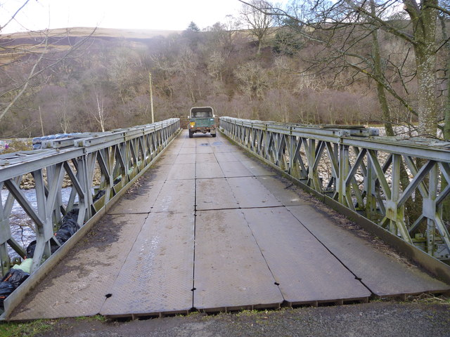
Co-Curate Page
Parson Shields Bridge, Knarsdale
- Overview Map Parson Shields Bridge is a single track steel girder bridge across the River South Tyne. It carries a minor farm road leading off the A689 about ¼mile north …
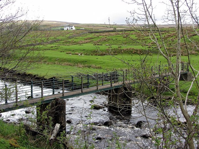
Co-Curate Page
Footbridge over the South Tyne
- Overview Map There is a footbridge carrying the Pennine Way over the River South Tyne near Dryburn Farm, about 1½ miles north-west of Garrigill.

Co-Curate Page
Footbridge over the South Tyne
- Overview Map Street View There is a footbridge over the River South Tyne near High Redwing, a short distance north-west of Garrigill.
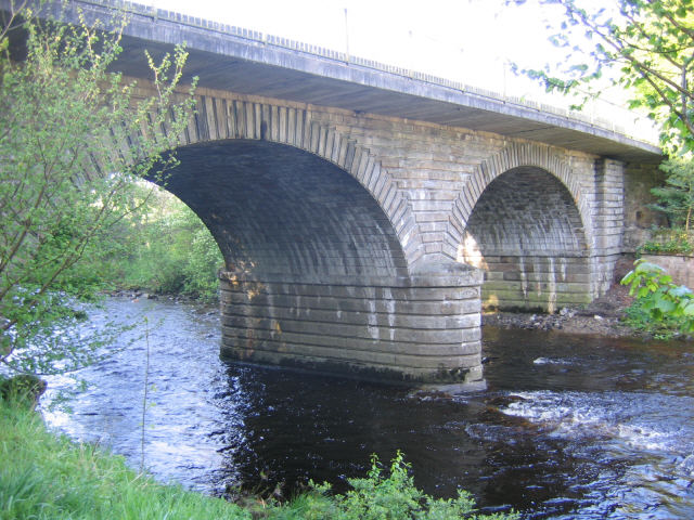
Co-Curate Page
Alston Bridge over the South Tyne
- Overview Map Street View This bridge over the River South Tyne is located on the south-western outskirts of Alston. It carries the A685 road and is also on the Pennine …
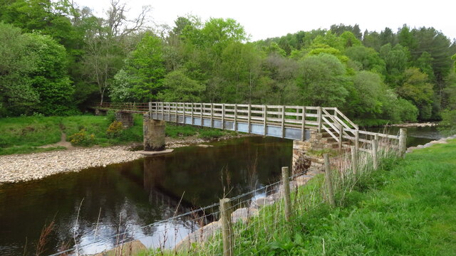
Co-Curate Page
Featherstone Footbridge
- Overview Map Street View Featherstone Footbridge (aka Castle Bridge) over the River South Tyne is in the parklands of Featherstone Castle, about 3 miles south-west of Haltwhistle. The wooden-decked girder …

Co-Curate Page
Bellister Bridge
- Overview Map Street View Bellister Bridge crosses the River South Tyne connecting the south-west of Haltwhistle with Plenmeller Road and the grounds of Bellister Castle. It was originally built as …

Co-Curate Page
Burnmouth Bridge, Whitfield
- Overview Map Street View Burnmouth Bridge carries the A686 road over Church Burn, shortly before the burn enters the River West Allen at Burnmouth. The stone bridge was built in …


Co-Curate Page
Shipley Bridge
- Overview Map Street View Shipley Bridge carries the B6346 road over Shipley Burn at Shipley, about 3½ miles north-west of Alnwick. The stone segmental arch bridge dates from the late …
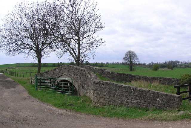
Co-Curate Page
Ketton Packhorse Bridge
- Overview Map Ketton Packhorse Bridge is located off Ketton Lane, to the north of Darlington. The bridge dates from the late 17th or early 18th century and crossed the River …

Co-Curate Page
Old Railway Bridge, Bellsburnfoot
- Overview Map Street View There is an old railway bridge over Bells Burn to the south of Bellsburnfoot. It was built for the Borders County Railway, which opened in stages …

Co-Curate Page
Cawledge Viaduct
- Overview Map Street View Cawlege Viaduct was built to carry the Alnwick Branch Line railway over Cawledge Burn. The line, built by Robert Stephenson, for the York, Newcastle & Berwick …

Co-Curate Page
Old bridge at Ebchester
- Overview Map Street View The stone bridge over the River Derwent at Ebchester was built in 1862. The stone bridge, with 3 arches, straddles the county border between County Durham …

Co-Curate Page
Ebchester Bridge
- Ebchester Bridge carries the B6309 road over the River Derwent at the west of Ebchester. The bridge was built in 1973 to replace the narrow Ebchester Old Bridge. The bridge …

Co-Curate Page
Whitelee Bridge
- Whitelee Bridge is a single arch stone bridge, which carries the A68 road over Lumsden Burn at Whitelee, about 1½ miles south-east of Carter Bar on the England-Scotland border. The …

Co-Curate Page
Bridge over Blakehope Burn
- Overview Map Street View There is a bridge carrying the Pennine Way over Blakehope Burn at Blakehopeburnhaugh. There is a car park and picnic area close to the bridge (the …

Co-Curate Page
Bridge over the River Rede, Blakehopeburnhaugh
- Overview Map Street View This bridge carryies the Pennine Way over the River Rede, north of the farm at Blakehopeburnhaugh.
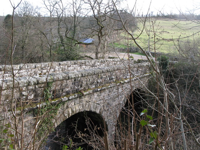
Co-Curate Page
Oakpool Bridge over the River East Allen
- Overview Map Street View There is a stone bridge with two arches over the River East Allen at Oakpool. The single track bridge caries Appletree Bank (road) over the river, …
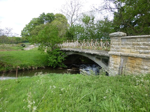
Co-Curate Page
Low Angerton Bridges
- Overview Map Street View Low Angerton Bridges are two adjacent bridges over the River Wansbeck at Low Angerton. The main bridge was built in 1908, by The British Concrete Steel …
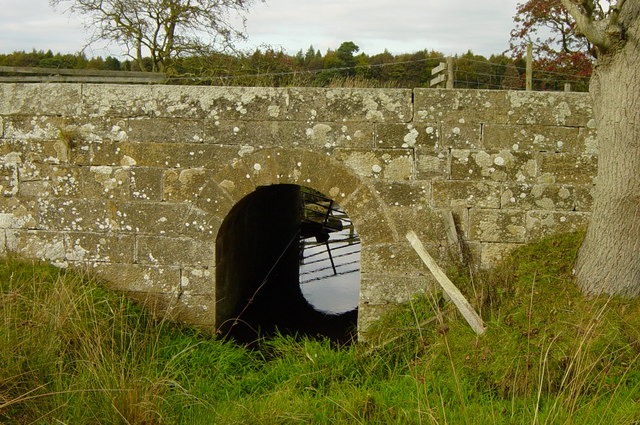
Co-Curate Page
Bridge on track from Low Angerton to Howlet Hall
- Overview Map There is a substantive stone bridge on the bridleway from Low Angerton to Howlet Hall. It is roughly halfway between the two loactions, and carries a track over …
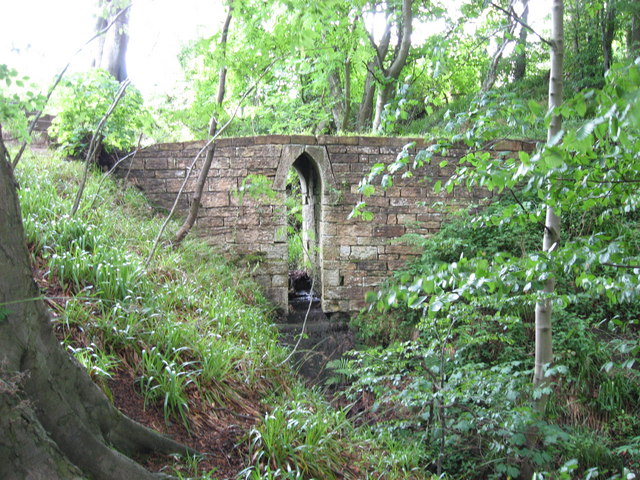
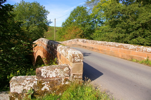
Co-Curate Page
Croglin Bridge
- Overview Map Street View A stone bridge carries the B6413 road over Croglin Water at the south of the village of Croglin in Cumbria. It was known as Croglin High …
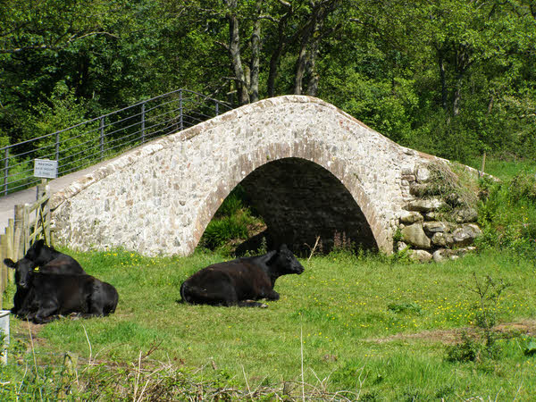
Co-Curate Page
Hollins Bridge
- Overview Map Hollins Bridge is a single track road bridge over the River Irt, located about ¼mile south-west of Hollins Farm, in Wasdale, Cumbria. Just 14 metres downstream is the …

Co-Curate Page
Old Hollins Bridge
- Overview Map Old Hollins Bridge is a dramatic humpback bridge over the River Irt. It is located about ¼mile south-west of Hollins Farm, in Wasdale, Cumbria. Just 14 metres upstream …

Co-Curate Page
Craghouse Bridge over the River Irt
- Overview Map Craghouse Bridge is a stone road bridge that carries Crag Lane over the River Irt in Cumbria. The single segmental arched bridge dates from the 18th century. The …

Co-Curate Page
Kirkwhelpington Bridge
- Kirkwhelpington Bridge over the River Wansbeck is located at the south-east of Kirkwhelpington. The bridge was built in 1819. It is Grade II listed on the National Heritage List for …
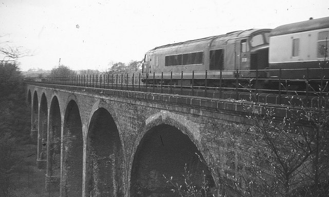
Co-Curate Page
Southburn Dene Railway Viaduct
- Overview Map To the south of Chester-le-Street is a railway viaduct carrying 2 tracks over Southburn Dene. The viaduct was built in 1868 for the North Eastern Railway. It is …

Co-Curate Page
Dovecote Bridge, Walton, Cumbria
- Overview Map Street View Dovecote Bridge is a road bridge over King Water in Cumbria, located to the west of Dovecote and about ¼mile east of Walton. The bridge was …

Co-Curate Page
Waverley Viaduct, Carlisle
- Overview Map Street View Waverley Viaduct (aka Engine Lonning Bridge) is a disused railway bridge over the River Eden in Carlisle. The viaduct was built in 1861 for the North …

Co-Curate Page
Glasson Bridge
- Overview Map Street View The bridge in Glasson was originally built to carry the road over the Carlisle Canal, which was built 1819-1823. After the canal closed and was replaced …
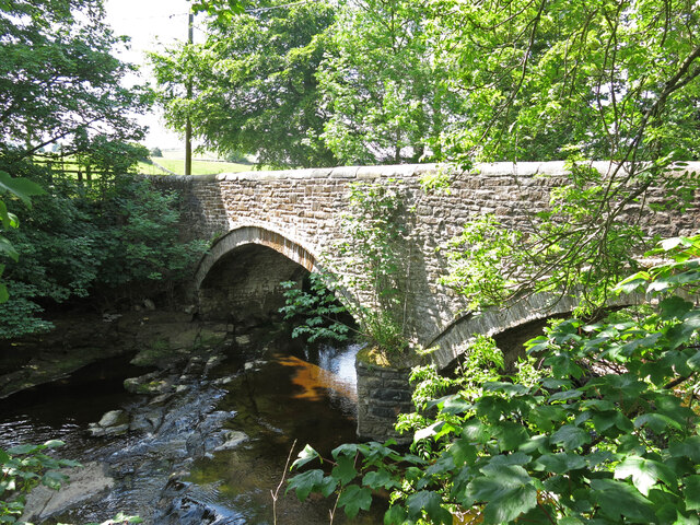
Co-Curate Page
West Blackdene Bridge
- Overview Map Street View The stone bridge over the River Wear in West Blackdene dates from the 18th century. The bridge, with two segmental arches, is Grade II listed on …
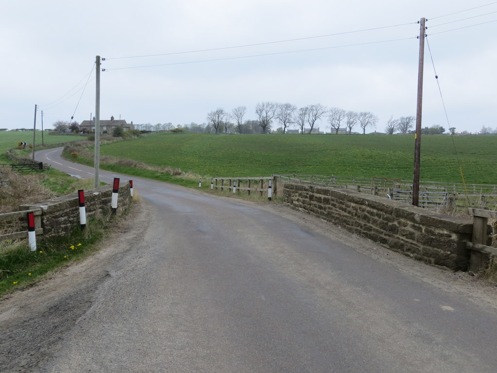
Co-Curate Page
Burnside Bridge, Slaley
- Overview Map Street View Burnside Bridge, to the south-west of Slaley, carries Strothers Bank Road (the B6306) over Strothers Burn. The stone segmental arch bridge date from the late 18th …
Co-Curate Page
Bridge over Linn Burn
- Overview Map This bridge over Linn Burn is located on Allendale Common, about 2 miles east of Sinderhope. It dates from the late 18th century and was part of the …

from http://www.bridgesonthetyne.c…
Bridges on the Tyne
- .....and other bridges of North East England. Website with extensive information and photos of bridges in the region. It also includes information about fords, ferries and former bridges.
Added by
Simon Cotterill
Co-Curate Page
Piercebridge Roman Bridge
- Overview About the Roman Bridge Map Street View The Roman bridge at Piercebridge crossed the River Tees, carrying Dere Street, the Roman road that linked York with Corbridge, near Hadrian’s …
Co-Curate Page
Rivers
- Rivers have played an important role in shaping the development and identity of communities in the North East. Many settlements have grown up at locations near rivers, which provided essential …
from Newcastle libraries (flickr)
001931:View of Ponteland from the riverbank towards the church black-and-white photograph around 1900.
Pinned by Simon Cotterill
from Flickr (flickr)
Bridge over The River Coquet - Felton, Northumberland
Pinned by Simon Cotterill
Co-Curate Page
Sunderland Bridge
- Overview About Sunderland Bridge Map Street View Sunderland Bridge is both a bridge and a village in County Durham, located about 3 miles south of the City of Durham. The …
Co-Curate Page
Croxdale Viaduct
- Croxdale Viaduct, over the River Wear near Croxdale and Sunderland Bridge, was built by the North Eastern Railway in 1872. Today the 11 arched viaduct is still in use for the …
Co-Curate Page
The Lion Bridge
- Overview Map Street View The Lion Bridge over the River Aln at Alnwick was built in 1775 by John Adam.[1] The stone bridge has 4 arches and in the centre of …
Co-Curate Page
Chollerford Bridge
- Overview Street View The stone bridge over the River North Tyne at Chollerford in Northumberland was built in 1785 by Robert Mylne. It replaced an earlier medieval bridge which had been …
Co-Curate Page
Warkworth Old Bridge
- The old stone bridge over the River Coquet at Warkworth dates from c.1380. John Cook of Newcastle, who died in 1378/9, bequeathed 20 marks towards the building of the bridge.[1] …
Co-Curate Page
Sunderland Bridge (bridge)
- Overview Map Street View This stone bridge across the River Wear near the village of Sunderland Bridge, Croxdale, dates from the 14th Century. The bridge has undergone several modifications, with …
Co-Curate Page
Greta Bridge (bridge)
- Overview Map Street View The stone bridge over the River Greta at Great Bridge village in County Durham, was built in 1773 by John Carr for John Sawry Morritt. It replaced …
Co-Curate Page
Newton Cap Viaduct
- Overview Map Street View Newton Cap Viaduct was built in 1857 to carry the Bishop Auckland to Durham City railway across the River Wear and Newton Cap Bank, which leads …
Co-Curate Page
Newton Cap Bridge
- Overview Map Street View Newton Cap Bridge is a stone bridge across the River Wear at Bishop Auckland, County Durham. Reputedly it was built in the late 14th century for …
Co-Curate Page
Barnard Castle Bridge
- Overview Map Street View The stone Bridge over the River Tees connects the town of Barnard Castle with Startforth. It dates from the 14th Century and is overlooked by the castle. It …
Co-Curate Page
Rutherford Bridge
- Overview Map Street View A stone bridge over the River Greta just over a mile North West of Scargill, County Durham. The bridge was built in 1773 following the great …
Co-Curate Page
Cupola Bridge
- Overview Map Street View Cupola Bridge is a three arch stone bridge which carries the A686 road over the River Allen, built 1778 and located 1½ miles from Whitfield, Northumberland. …
Co-Curate Page
Mill Bridge, Coatham Munderville
- Overview Map Street View Mill Bridge is located east of Coatham Mundeville, and carries Brafferton Lane over the River Skerne. The stone bridge was built in 1861. The bridge straddles the …
Co-Curate Page
Salters Bridge
- Overview Map Street View Salters Bridge crosses the Ouseburn in South Gosforth. It dates from the 14th Century and is Grade I listed on the National Heritage List for England …
Co-Curate Page
Winston Bridge
- Overview Map Street View The bridge over the River Tees near Winston in Counry Durham was built in 1762-1763, designed by Sir Thomas Robinson[1]. The bridge is notable for its …
Co-Curate Page
Whorlton Suspension Bridge
- Overview Map Street View The toll bridge over the River Tees at Whorlton, County Durham, was opened in 1831. It was designed by John and Benjamin Green of Newcastle, who …
Co-Curate Page
Hartford Bridge (bridge)
- Overview Map Street View Hartford Bridge carries the A192 / A1068 road over the River Blyth at Hartford, north of Cramlington. There was once a ford to cross the river near …
Co-Curate Page
Old Bridge
- Overview Map Street View The old stone bridge over the River Aln at Lesbury dates from the 15th century, though substantially altered in the 19th century. The bridge is Grade …
Co-Curate Page
New Bridge
- Overview Map Street View The 'new' road bridge over the River Aln at Lesbury was opened in 2004 and carries the A1068. Prior to that the road was routed over …
Co-Curate Page
Railway Viaduct
- Overview Map Street View The viaduct just north west of Lesbury carries the railway over the River Aln in Northumberland. The viaduct has 18 arches and was built in 1848/1849 …
Co-Curate Page
Duchess Bridge
- Overview Map Street View This stone bridge over the River Aln at Alnmouth was built in 1864. The bridge is Grade II listed on the National Heritage List for England. A …
Co-Curate Page
Lambley Viaduct
- Overview About Lambley Viaduct Map Lambley viaduct was built by George Barclay Bruce for the Newcastle and Carlisle Railway in 1852 to carry the Haltwhistle to Alston branch line over the …
Co-Curate Page
Bridge over the Wear
- Overview Map Street View This stone bridge over the River Wear just west of Stanhope dates from medieval times. The bridge now carries the B6278 road. It is Grade II* …
Co-Curate Page
Denemouth Viaduct, Castle Eden Dene
- Overview Map The railway viaduct at Dene Holme over Castle Eden Dene was completed in 1905.[1] It is between Blackhall Colliery and Horden, in County Durham. The viaduct has 10 …
Co-Curate Page
Bywell Bridge, over the Tyne
- Overview Map Street View Bywell bridge over the River Tyne was built 1836-1838, designed by George Basevi. The stone bridge carries the B6309 road over the Tyne, with Bywell on the north …
Co-Curate Page
Queen Alexandra Bridge
- Overview About the Bridge Map Street View The Queen Alexandra Bridge over the River Wear links the Southwick and Deptford areas of Sunderland. The bridge was built 1907-1909, originally as a double-decker …
Co-Curate Page
Shotley Bridge (bridge)
- Overview Map Street View The stone bridge over the River Derwent at Shotley Bridge was built in the late 18th century, later widened in c1820. The bridge is Grade II …
Co-Curate Page
Denwick Bridge
- Overview Map Street View Denwick Bridge over the River Aln is located about half a mile north east of Alnwick and a similar distance south west of Denwick. The stone …
Co-Curate Page
Telford Bridge
- Overview Map Street View Telford Bridge (aka 'New Bridge') in Morpeth was built 1829 - 1831 by Thomas Telford.[1] The stone bridge carries the A192 road over the River Wansbeck. …
Co-Curate Page
Weldon Bridge - Bridge
- Overview Map Street View The stone bridge over the River Coquet at Weldon Bridge was built c.1760[1] The bridge has 3 arches and distinctive circular openings between the arches. It …
Co-Curate Page
Pauperhaugh Bridge
- Overview Map Street View Pauperhaugh bridge over the River Coquet.
Co-Curate Page
Road Bridge, Sheepwash
- Overview Map Street View The bridge at Sheepwash carries the A1068 road over the River Wansbeck. It was built in 1920 to replace a stone bridge damaged by floods in …
Co-Curate Page
Fleetham Bridge
- The stone single arched bridge over the Long Nanny at West Freetham, near Beadnell, was built in the early 19th century. The bridge is Grade II listed on the Ntional …
Co-Curate Page
Hexham Bridge
- Overview Map Street View Hexham Bridge carries the A6079 road over the River Tyne at Hexham. The nine arched stone bridge was built in 1793, to the designes of John …
Co-Curate Page
Coldstream Bridge
- Overview About Coldstream Bridge Map Street View Coldstream Bridge, linking Coldstream, Scottish Borders with Cornhill-on-Tweed, Northumberland, is an 18th-century Grade II* listed bridge between England and Scotland, across the …
Co-Curate Page
Crimdon Dene Railway Viaduct
- Overview Map Street View The viaduct over Crimdon Dene was built in 1905 to carry the North Eastern Railway. The viaduct is located close to the mouth of Crimdon Dene, …
Co-Curate Page
Warenford Bridge
- Overview Map Street View The stone bridge over Waren Burn at Warenford in Northumberland was built in the late 18th or early 19th century and is Grade II listed.[1] The …
Co-Curate Page
Twizel Viaduct
- Twizel Viaduct was built between 1846 and 1849 by the Newcastle & Berwick Railway, to carry the Tweedmouth to Kelso railway branch line over the River Till at Twizell in …
Co-Curate Page
Balder Bridge, Cotherstone
- Overview Map Street View The stone road bridge over the River Balder at Cotherstone dates back to the 15th century. It was rebuilt c.1681 and the upstream side of the …
Co-Curate Page
Cotherstone Footbridge
- Overview Map The footbridge over the River Tees just north of Cortherstone, County Durham, was built in 1932 by Joseph L Thompson and Sons Ltd of Sunderland. It replaced two …
Co-Curate Page
Lune Railway Viaduct
- Overview Map Street View Disused railway viaduct over the River Lune, built in 1868 for the Tees Valley Railway Company. The viaduct is Grade II listed on the National Heritage …
Co-Curate Page
Bewick Bridge
- Overview Map Street View The stone road bridge near Old Bewick in Northumberland was built in the early 19th century, or possibly earlier. There is also a small hamlet by …
Co-Curate Page
Heatherycleugh Bridge
- Overview Map Street View Heatherycleugh Bridge carries School Hill road (part of the A689) over the steep valley of the Heathery Cleugh (a stream), shortly before it flow into Killhope …
Co-Curate Page
Union Chain Bridge
- Overview About The Union Chain Bridge Map Street View The Union Chain Bridge spans the River Tweed between Horncliffe in England and Fishwick in Scotland. The bridge was built for …
Co-Curate Page
Hawthorn Dene Viaduct
- Overview Map Street View The railway viaduct over Hawthorn Dene was built in 1905 for the North-Eastern Railway Company. The viaduct is located near the coast at the mouth of …
Co-Curate Page
Bridge over Croxdale Beck
- Overview Map A stone single-track road bridge over Croxdale Beck, built c.1760 by Christopher Ebdon.[1] It is located just north of Sunderland Bridge, near Croxdale Hall. The bridge was built …
Co-Curate Page
Dalton Bridge
- Overview Map Street View The single arch limestone bridge over Dalden Dene at Dalton-le-Dale is dated 1789. The bridge is Grade II listed.[1] It is reputed that Oliver Cromwell crossed …
Co-Curate Page
Edlingham Railway Viaduct
- Overview Map Street View This railway viaduct is located under half a mile north-east of Edlingham in Northumberland, and close to Edlingham Castle. It was built in c.1885 for the …
Co-Curate Page
Haltwhistle Tyne Bridge
- Overview Map Street View The pedestrian bridge (a former road bridge) over the River South Tyne at Haltwhistle was built in 1875. It was constructed with wrought-iron arches and cast-iron …
Co-Curate Page
Alston Arches Viaduct
- Overview Map Street View Alston Arches Viaduct is a disused railway viaduct over the River South Tyne at Haltwhistle. It was built in 1852 by Sir George Barclay Bruce for …
Co-Curate Page
Ouseburn Viaduct
- Overview Map Street View Ouseburn Viaduct is a railway bridge over the valley of the Ouseburn (river). It was built between 1837-1839 by John and Benjamin Green for the Newcastle …
Co-Curate Page
Willington Dene Viaduct
- Overview Map Street View Willington Dene Viaduct is a railway bridge over the valley of Wallsend Burn near Willington and Wallsend. It was built between 1837-1839 by John and Benjamin Green …
Co-Curate Page
Byker Bridge
- Overview About Byker Bridge Map Street View The Byker Bridge is a 344.65m (1130 ft) long road bridge that carries the A193 road over the River Ouseburn in Newcastle …
Co-Curate Page
Crawford's Bridge
- Overview Map Street View Crawford's bridge is a small segmental arch stone bridge over the Ouseburn (river) in Newcastle, built in the early to mid-18th century. It is the oldest …
Co-Curate Page
Piercebridge Bridge
- Overview Map Street View The stone bridge over the River Tees at Piercebridge was built in 1673. The bridge was widened on its downstream side in 1781.[1] Today the bridge …
Co-Curate Page
Palmstrother Bridge
- Palmstrother Bridge in Hulne Park is a late 18th century stone bridge over Shipley Burn, just before its confluence with the River Aln. It is close to East Brizlee Bridge. Palmstrother Bridge …
Co-Curate Page
New Footbridge
- This footbridge over the River Aln at Hulne Park was built in 2009 and replaced an earlier bridge which was destroyed in the floods of September 2008.
Co-Curate Page
Factory Bridge over River Coquet
- Overview Map Street View This road bridge over the River Coquet was built in c.1865. It is known as Factory Bridge, presumably for the close proximity to the former mill/factory …
Co-Curate Page
Hepple Bridge
- Overview Map Street View Hepple Bridge carries the B6341 road across the River Coquet a quarter of a mile south of Hepple, Northumberland. The bridge dates from 1874, though the …
Co-Curate Page
Makendon Bridge
- Overview Map Street View The small road bridge over the River Coquet, located just under a quater mile noth-east of Makendon, was built in 1968.[1] It is in a remote …
Co-Curate Page
Bridge at Chew Green
- Overview Map Street View The small concrete bridge over the River Coquet, near the remains of Chew Green Roman Fort, was built in 1968.[1] It is the first bridge over …
Co-Curate Page
Buckham's Bridge, Blindburn
- Overview Map Street View Buckham's Bridge is a road bridge over the River Coquet near Blindburn in Northumberland. The bridge is very close to the confluence of Buckham's Walls Burn …
Co-Curate Page
Rothbury Bridge
- Overview Map The road bridge over the River Coquet at Rothbury was originally built in 1460. The bridge is Grade II listed on the National Heritage List for England. The …
Co-Curate Page
Golf Club Bridge
- Overview Map Street View Only the piers remain (2016) after the bridge was damaged.
Co-Curate Page
Lands Viaduct (remains)
- Overview About Lands Viaduct Map Lands Viaduct was built in 1863 to carry the South Durham and Lancashire Union Railway over the River Gaunless. Gaunless Viaduct, also known as the …
Co-Curate Page
Blanchland Bridge
- Overview Map Street View The stone arched bridge over the River Derwent at Blanchland was built in the mid 18th century; it is Grade II listed. The south end of …
Co-Curate Page
Winch Bridge, nr Holwick
- Overview Map Street View An iron suspension footbridge with planked walkway, over the River Tees, by the Low Force waterfalls, near Holwick and Newbiggin. The bridge was built c.1820 for the …
Co-Curate Page
Old Bridge over Nor Beck
- Overview Map Street View The old bridge over Nor Beck, located about half a kilometre north of Barningham, was built in the 18th century. It was once the main route …
Co-Curate Page
Hartburn Bridge
- Overview Map Street View The stone bridge over the Hart Burn between Hartburn and Meldon Park was built in the 18th century. It was widened in 1850 and now carries …
Co-Curate Page
Eggleston Bridge
- Overview Map Street View Eggleston Bridge is a single track road bridge across the River Tees near Eggleston in County Durham. The bridge here can be traced back to the 15th …
Co-Curate Page
Bridge over Wreigh Burn, Thropton
- Overview Map Street View The stone hump-backed bridge over the Wreigh Burn at Thropton was built in 1810. It was built by George Robson, a local Catholic landowner, at a …
Co-Curate Page
Leven Bridge
- Overview Map Street View Leven Bridge carries the A1044 road over the River Leven, near High Leven and Ingleby Barwick. The bridge was built in the early 19th Century and …
Co-Curate Page
Kielder Viaduct
- Overview Map Street View Kielder Viaduct spans the River North Tyne just north of Bakethin Reservoir and Kielder Water. It once carried the Border Counties Railway. The viaduct was completed in …
Co-Curate Page
Bellingham Bridge
- The stone bridge over the River North Tyne at Bellingham was built in 1834 by John Green.[1] The bridge is a Grade II listed structure.
Co-Curate Page
Foss Bridge
- Foss Bridge is a mid 18th century stone bridge over the River Wansbeck at Mitford, near Mitford Castle (sometimes caled "Wansbeck Bridge"). The bridge is Grade II listed on the National …
Co-Curate Page
Warwick Bridge (bridge)
- Bridge over the River Eden at Warwick Bridge, Cumbria.
Co-Curate Page
Wetheral Viaduct
- Overview Map Street View Corby Bridge (more commonly called Wetheral Viaduct) is a railway viaduct over the River Eden, between Great Corby and Wetheral in Cumbria. The 5 arch, red …
Co-Curate Page
Tyne Bridge
- Overview About Corbridge Bridge Map Street View The seven arched stone bridge over the River Tyne at Corbridge was completed in 1674. It replaced an earlier bridge of 1235 and …
Co-Curate Page
Bridge over Whillan Beck
- Overview Map Street View The stone bridge over Whillan Beck, by Esksdale Mill in Boot, was originally built as packhorse bridge in the early 18th century.[1] The bridge is Grade …
Co-Curate Page
Jubilee Bridge over Walney Channel
- Overview About the Bridge Map Street View Jubilee Bridge over the Walney Channel connects the centre of Barrow-in-Furness with Walney Island. The bridge was built in 1908 to cater for …
Co-Curate Page
Hagg Bank Bridge
- Overview About West Wylam Bridge Map Street View West Wylam Bridge (also known as Hagg Bank Bridge and Points Bridge) is a footbridge over the River Tyne to the south-west …
Co-Curate Page
Former Road Bridge over Elsdon Burn
- Overview Map Street View The former road bridge over Elsdon Burn, at the north-end of the village of Elsdon was built in the late 18th or early 19th century.[1] The …
Co-Curate Page
Iron Bridge
- The iron footbridge over Debdon Burn at Cragside was manufactured in 1870s at Lord Armstrong's Elswick Works. The footbridge is Grade II* listed on the National Heritage List for England.[1] …
Co-Curate Page
Isel Bridge
- Isel Bridge is a road bridge over the River Derwent near St Michael's Church in Isel, Cumbria. The bridge, with 3 segmental arches, was built in 1812, replacing an earlier …
Co-Curate Page
Old Derwent Bridge
- Overview Map Street View The stone bridge over the River Derwent at Swalwell was built in c.1779 for the Gateshead - Hexham Turnpike road.[1] It is known as the Clavering …
Co-Curate Page
Monkwearmouth Railway Bridge
- Overview About Monkwearmouth Railway Bridge Map Street View Monkwearmouth Railway Bridge (officially Monkwearmouth Bridge, also called Wearmouth Railway Bridge or Sunderland Railway Bridge) is a railway bridge built in …
Co-Curate Page
Devil's Bridge
- Overview Map Street View Devil's Bridge crosses the River Lune to the south-east of the town of Kirkby Lonsdale. The bridge straddles the civil parishes of Kirkby Lonsdale and Casterton. …
Co-Curate Page
Eamont Bridge (bridge)
- Overview About Eamont Bridge Map Street View The sandstone bridge over the River Eamont at Eamont Bridge (village) dates from the c.15th century. The bridge crossed the old county boundary …
Co-Curate Page
Eden Bridge
- Overview Map Street View Eden Bridge in Carlisle is a road bridge over the River Eden connecting the city centre to Stanwix to the north. The bridge, with 5 segmental …
Co-Curate Page
Brougham Castle Bridge
- The red sandstone bridge over the River Eamont, near Brougham Castle, was built in 1813. The bridge, near Penrith, was built to carry the Penrith-Appleby turnpike road over the River Eamont, …
Co-Curate Page
Mosedale Viaduct
- Overview About Mosedale Viaduct Map This 12 arch stone viaduct was built to carry the Cockermouth, Keswick and Penrith Railway over Mosedale, located about 1 mile south-east of Scales in …
Co-Curate Page
Yarm Bridge
- In c.1400 Bishop Skirlaw of Durham built this stone bridge across the River Tees. The bridge was widened at a later date. It is still in use as a road …
Co-Curate Page
Yarm Railway Viaduct
- Overview Map Street View The railway viaduct over the River Tees between the towns of Yarm and Egglescliffe was built for the Leeds Northern Railway between 1849 and 1851, and officially …
Co-Curate Page
Deepdale Aqueduct
- Overview Map Street View This combined aquaduct and footbridge over the River Tees was built in 1898. The aqueduct is Grade II listed on the National Heritage List for England.
Co-Curate Page
Elliott Bridge
- Elliott Bridge is a pedestrian footbridge over the River Wansbeck joining Morpeth town centre to Carlisle Park. The bridge was built in 1982, replacing the original Elliott Bridge of 1924, …
Co-Curate Page
Mosedale Bridge
- Mosedale Bridge crosses the River Caldew, between Mosedale and the hamlet of Bowscale in Cumbria. The single span bridge is built from coursed Skiddaw slate, with sandstone coping. It was originally a packhorse bridge, …
Co-Curate Page
Newby Bridge (bridge)
- Overview Map Street View The bridge over the River Leven at Newby Bridge in Cumbria dates from the 17th century or earlier. It is Grade II* listed on the National …
Co-Curate Page
Bridge over Rydal Beck, Rydal Hall
- The stone rubble bridge over Rydal Beck is located in the grounds of Rydal Hall. The single segmental arch bridge was built in 1682 by Sir Daniel Fleming, probably replacing …
Co-Curate Page
Abbey Bridge, near Egglestone Abbey
- Overview Map Street View Abbey Bridge crosses the River Tees about a quater of a mile south-east of Egglestone Abbey, near Barnard Castle in County Durham. The road bridge was built …
Co-Curate Page
Elvet Bridge
- Overview Further Information Map Street View Elvet Bridge is a stone bridge which crosses the River Wear connecting the peninsula in central Durham and the Elvet area of the city. …
Co-Curate Page
Scotswood Bridge
- Overview History Map Street View 16th April 1831; opening of the Scotswood Bridge (Chain Bridge) crossing the tyne between Newcastle and Blaydon 20th March 1967; opening of the current Scotswood Bridge. Scotswood Bridge is one of the main …
Co-Curate Page
Ladykirk and Norham Bridge
- Overview About Ladykirk and Norham Bridge Map Street View Ladykirk and Norham Bridge is a stone arched bridge crossing the River Tweed, connecting Norham in Northumberland, England, with Ladykirk in …
Co-Curate Page
Wearmouth Bridge
- Overview History Timeline Map Street View The Wearmouth Bridge crosses the River Wear in Sunderland. The current bridge was built 1927 to 1929 and replaced an earlier cast-iron bridge in the same …
Co-Curate Page
Kingsgate Bridge
- Overview About Kingsgate Bridge Map Street View Kingsgate Bridge is a footbridge over the River Wear, which was built in 1965. The bridge connects Bow Lane in the centre old of …
Co-Curate Page
Stockton Infinity Bridge
- Overview About the Infinity Bridge Map Street View The Infinity Bridge is a pedestrian and cycle bridge over the River Tees, linking the North Shore development (Stockton-on-Tees) with the University …
Co-Curate Page
Northern Spire Bridge
- Overview About the Northern Spire Bridge Map Street View The bridge was opened on the 28th of August 2018 - the first bridge to be built over the River Wear in …
Co-Curate Page
Framwellgate Bridge
- Overview About Framwellgate Bridge Map Street View Framwellgate Bridge is a medieval stone bridge over the River Wear in Durham. The bridge was built in the 15th century and replaced …
Co-Curate Page
Royal Border Bridge
- Railway bridge across the River Tweed designed by Robert Stephenson and built between 1847 and 1850, at its height the workforce numbered 2,700 men. The bridge was officially opened by …
Co-Curate Page
Old Bridge
- Overview Map Street View Berwick Bridge, over the River Tweed at Berwick, was built between 1611 and 1634 by James Burrell. The red sandstone bridge has 15 arches and is …
Co-Curate Page
Royal Tweed Bridge
- Overview History and Design Map Street View The Royal Tweed Bridge in Berwick-upon-Tweed was officially opened by the Prince of Wales on 16th May 1928. Grade II* listed on the …
Co-Curate Page
Twizel Bridge
- Overview Map Street View Twizel Bridge, over the River Till, was built in 1511. At that time it provided the only dry crossing of the River Till between the Tweed …
Co-Curate Page
Victoria Viaduct
- Overview About the Victoria Viaduct Map Victoria Bridge is a 810 ft long rail viaduct over the River Wear near Fatfield, Washington. It was built for the Durham Junction Railway and opened …
Co-Curate Page
Causey Arch
- Overview History Map Causey Arch bridge near Tanfield was built by the Grand Allies in 1726 and is renowned to be the world's oldest surviving single-arch railway bridge. Horse-drawn wagons …
Co-Curate Page
Tees Newport Bridge
- Overview History Map Street View The Tees Newport Bridge was the first large vertical lift bridge in Europe, and opened by Prince Albert (later King George VI) on 28 February, …
Co-Curate Page
Tees Transporter Bridge
- Overview History Facts & Figures Map Street View The Tees Transporter Bridge was opened on the 17th October 1911 by Prince Arthur of Connaught. The bridge over the River Tees connects Middlesbrough, on the south bank, …
Co-Curate Page
Prebends Bridge
- Overview About Prebends Bridge Map Street View Prebends Bridge over the River Wear at Durham was built for the Dean and Chapter of Durham to provide access to Durham Cathedral …
Co-Curate Page
Queen Elizabeth II Metro Bridge
- Overview About the Bridge Map Street View The Queen Elizabeth II Bridge carries the Tyne and Wear Metro over the River Tyne between Newcastle and Gateshead. The bridge was purpose-built …
Co-Curate Page
Gateshead Millennium Bridge
- Overview About the Millennium Bridge Map Street View The Gateshead Millennium Bridge is a pedestrian and cycle bridge over the River Tyne. It connects Newcastle Quayside with the Gateshead Quays …
Co-Curate Page
Tyne Bridge
- Overview About the Tyne Bridge Map Street View The Tyne Bridge is an iconic arch bridge over the River Tyne which links Newcastle and Gateshead. Construction of the bridge by …
Co-Curate Page
Newcastle Swing Bridge
- Overview Further Information Map Street View The Swing Bridge over the River Tyne was first used for road traffic on 15th June 1876 and opened for river traffic on 17th …
from Newcastle libraries (flickr)
003867:The Bridge Yard Sir W.G. Armstrong Mitchell
Pinned by Simon Cotterill
Co-Curate Page
High Level Bridge
- Overview About the High Level Bridge Map Street View The High Level Bridge is a 'double decker' road and railway bridge spanning the River Tyne between Newcastle and Gateshead. The …
Co-Curate Page
King Edward VII Bridge
- Overview About the King Edward VII Bridge Map Street View The King Edward VII railway bridge was opened by King Edward VII and Queen Alexandra on the 10th of July …
Co-Curate Page
Redheugh Bridge
- Overview Further Information Map Street View There have been 3 Redheugh Bridges spanning the River Tyne and currently carrying the A189 road. The first Redheugh Bridge, built by Thomas Bouch, was …
Co-Curate Page
Witton Bridge
- Overview Map Street View Witton Bridge crosses the River Wear about a quarter of a mile south of Witton-le-Wear and a similar distance north-west of Witton Castle. The bridge was formerly …
Co-Curate Page
Middleton Bridge
- Overview Map Street View Middleton Bridge carries the B6277 road over the River Tees at Middleton-in-Teesdale. The stone bridge has a single high segmental arch. It was built in c.1800, …
Co-Curate Page
Chester New Bridge, near Lambton Castle
- Overview Map Street View Chester New Bridge is a single-track road bridge over the River Wear, located to the east of Chester-le-Street and about 1 mile west of Lambton Castle. …
Co-Curate Page
Featherstone Bridge
- Overview Map Street View Featherstone Bridge ia a single-track road bridge over River South Tyne, located about half a mile east of Featherstone Castle and 2 miles north-west of Haltwhistle. …
Co-Curate Page
Lamb Bridge, near Lambton Castle
- Overview Map Lamb Bridge is a single arched ashlar sandstone bridge over the River Wear on the Lambton Estate. The bridge was built in 1819 by Ignatius Bonomi for John …
Co-Curate Page
Ashgill Bridge over Ashgill Force
- Overview Map Street View Ashgill Bridge carries the B6277 road over Ash Gill, by Ashgill Force Waterfall, about 1 mile south-east of Garrigill. A plaque on the bridge notes that …
Co-Curate Page
Armstrong Bridge
- Overview Map Armstrong Bridge is an iron bridge which spans Jesmond Dene. Originally open to traffic it is now restricted to pedestrians. The bridge hosts an arts and crafts fair …
Co-Curate Page
Slater's Bridge, Little Langdale
- Overview Map Street View Slater's Bridge is a 17th century packhorse bridge that crosses the River Brathay in Little Langdale. It is built of slate and natural boulders. A large …
Co-Curate Page
Skelwith Bridge (bridge)
- Overview Map Street View The slate bridge over the River Brathay is at the south of the settlement of Skelwith Bridge. The bridge, with two segmental arches, carries the A593 …
Co-Curate Page
Crook of Lune Bridge
- Overview Map Street View This stone road bridge over the River Lune, near Lowgill in Cumbria, was built in the 16th century or possibly earlier. The bridge formed part of …
Co-Curate Page
Monk's Bridge
- Monk's Bridge is a wooden bridge over the River Aln in Hulne Park, near Alnwick, built in 1901. The wooden rails are suppored stone abutments from an earlier bridge of c.1854.[1]
Co-Curate Page
Brathay Bridge
- Brathay Bridge carries the B5286 over the River Brathay near Clappersgate.
Co-Curate Page
Lowgill Viaduct
- Overview Map Street View Lowgill Viaduct was built in 1859 by Joseph Locke and John Errington for the Ingleton Branch Line of the London and North Western Railway.[1] The 11 …
Co-Curate Page
Brathay Footbridge
- Stone footbridge over the River Brathay between Brathay Hall and Clappersgate.
Co-Curate Page
Byker Metro Bridge
- Overview About Byker Metro Bridge Map Street View Byker Metro Bridge (also known as Byker Viaduct) was constructed 1978-1979 and was purpose built for the Tyne & Wear Metro system, …
Co-Curate Page
Frank's Bridge
- Overview About Frank's Bridge Map Street View Frank's Bridge is a narrow pedestrian stone footbridge over the River Eden in Kirkby Stephen. It was built in the 17th century as …
Co-Curate Page
Podgill Viaduct
- Overview Map Street View Street View (top) Podgill Viaduct is a former railway viaduct over Ladthwaite Beck, located about ½ mile south-east of Kirkby Stephen and ½ mile south of …
Co-Curate Page
Smardale Viaduct
- Overview Map Street View Smardale Viaduct was built from 1870 to 1875 to carry the Settle to Carlisle railway line over the steep sided valley of Scandal Beck. It built …
Co-Curate Page
Smardale Gill Viaduct
- Overview Map Street View Smardale Gill Viaduct is just over a mile south-west of the village of Smardale in Cumbria. The viaduct was built for the South Durham and Lancashire Union …
Co-Curate Page
Bolton Bridge, Bolton
- Overview Map Street View The red sandstone bridge over the River Eden at Bolton in Cumbria is dated 1870.
Co-Curate Page
Lanercost Bridge
- The old red sandstone bridge at Lanercost was built in c.1724. The bridge has two arches, the larger arch spans the River Irthing and the smaller one spans the millstream …
Co-Curate Page
Hadrian Bridge over Central Motorway
- Overview Map Street View Hadrian Bridge is a pedestrian and cycle bridge over the Central Motorway which connects the parts of Newcastle University campus by Claremont Road to the area …
Co-Curate Page
Storch Bridge, Greystoke
- Overview Map Street View Storch Bridge over the River Petteril is located just to the east of Greystoke in Cumbria, near Woodside Caravan Park. The segmental-arched hump-back bridge was built in …
Co-Curate Page
Wreay Bridge
- Wreay Bridge - a red sandstone road bridge over the River Petteril, to the south-east of Wreay in Cumbria. The 3 arched bridge was built in the 1830's.[1] The bridge …
Co-Curate Page
Crook's Bridge, near Wreay
- Overview Map Street View Crook's Bridge is a 3 arched bridge over the River Petteril, located just over half a mile slouth-east of Wreay in Cumbria. The bridge was built …
Co-Curate Page
Sherburnhouse Bridge
- Overview Map Street View The old Sherburnhouse Bridge, located to the north-west of the hamlet of Sherburn House in County Durham, dates from 1335, with the upper part of the …
Co-Curate Page
Askham Bridge
- Askham Bridge over the River Lowther was built in 1897. The bridge is Garde II listed.
Co-Curate Page
Fowberry Bridge
- Overview Map Street View Fowberry Bridge, over the River Till, was built in 1825, for Matthew Culley of Fowberry Tower. The bridge at Fowberry has one arch over the river …
Co-Curate Page
Gelt Bridge
- Gelt Bridge (aka Middle Gelt Bridge ) is a railway viaduct over the River Gelt in Cumbria. It was built from 1832-1835 for the Newcastle and Carlisle Railway. It was one …
Co-Curate Page
Docker Viaduct
- Overview Map Street View Docker Viaduct was built by Joseph Locke in 1846 to carry the Lancaster and Carlisle Railway over Flodder Beck. It is located to the north-east of the vilage …
Co-Curate Page
Middleton Bridge over the Rawthey
- Overview Map Street View Middleton Bridge carries the A683 road over the River Rawthey, close to it's confluence with the River Lune to the north of Middleton, Cumbria. The bridge was …
Co-Curate Page
Road Bridge, near Station Cottages
- Overview Map Street View The road bridge over Waren Burn, near Station Cottages, north-west of Lucker, was built in 1906. Built by by Ferro-Concrete Construction, it carries the B1341 road …
Co-Curate Page
The Hikey Bridge
- The Sands Suspension Bridge, known locally as the 'Hikey Bidge', is a footbridge over the River Derwent at Swalwell, Gateshead. It was built in 1902 to link the allotments on …
Co-Curate Page
Stone Footbridge over Debdon Burn
- This stone humped bridge crosses the Debdon Burn on the Cragside estate, south of the Iron Bridge. It was built in the late 19th century for Lord Armstrong. It is …
Co-Curate Page
Bellasis Bridge
- Overview Map Street View Bellasis Bridge carries Green Lane over the River Blyth. It is located about half a mile souuth-west of the Bellasis and 2 miles south-west from Stannington. …
Co-Curate Page
Newburn Bridge
- Overview About Newburn Bridge Map Street View Newburn Bridge is a road bridge over the River Tyne between Newburn in the City of Newcastle upon Tyne and Ryton in the …
Co-Curate Page
Rede Bridge, Redesmouth
- Overview Map Rede Bridge over the River Rede, is located about half a mile north of Redesmouth in Northumberland (not to be confused with the downstream Redesmouth Bridge). The stone …
Co-Curate Page
Botcherby Bridge
- Overview Map Street View Botcherby Bridge carries Warwick Road (A69) over the River Petteril. The current bridge has a plaque commemorating it's opening in June 1932. There have been earlier …
Co-Curate Page
Low Wood Bridge, over River Leven
- Overview Map Street View Low Wood Bridge carries the B5278 road over the River Leven between Low Wood and Haverthwaite in Cumbria. The bridge is located at the upper tidal limit of …
Co-Curate Page
Backbarrow Bridge
- Overview Map Street View The bridge at Backbarrow carries the road over white water falls on the River Leven. The bridge dates from the late 17th or 18th century and …
Co-Curate Page
Falstone Bridge
- Overview Map Street View The three arched stone bridge over the River North Tyne at Falstone was built in 1843. On it's western parapet is a plaque inscribed "HENRY WELCH, …
Co-Curate Page
Newbiggin Bridge, Newbiggin, Kirkby Thore
- The bridge over Crowdundle Beck in Newbiggin (Kirkby Thore) in Cumbria dates from the late 18th Century. The bridge is Grade II listed.
Co-Curate Page
South Monkridge Bridge
- Overview Map Street View South Monkridge Bridge carries a minor road over Raylees Burn at Monkridge. The bridge was built in 1956.
Co-Curate Page
Monkridge Bridge
- Overview Map Street View Bridge carrying the A696 road over Elsdon Burn at Monkridge.
Co-Curate Page
Duke of Norfolk Bridge, Greystoke
- The Duke of Norfolk Bridge over the River North Petteril at Greystoke was originally built in 1796. The bridge was widened in 1920 in remberance of those who died in the First …
Co-Curate Page
Hawes Bridge, Nantland
- Overview Map Street View Hawes Bridge is a road bridge which carries Hawes Lane over the River Kent, just west of Natland and east of Prizet. The bridge dates from …
Co-Curate Page
Shilvington Bridge
- Overview Map Street View Shilvington Bridge carries a minor road over the River Blyth, located roughly half way between Ogle and Shilvington in Northumberland. The stone bridge was built in …
Co-Curate Page
East Thickley Bridge
- Overview Map East Thickley Bridge (footbridge) is located a short distance east of Locomotion: the National Railway Museum at Shildon. The accommodation bridge crosses Shildon sidings and the former Stockton and …
Co-Curate Page
Burn Closes Bridge
- Overview Map Street View Burn Closes Bridge carries St Peter's Road over Willington Dene (the lower part of the valley formed by Wallsend Burn). The current bridge was built in …
Co-Curate Page
Broughton High Bridge
- Overview Map Street View Broughton High Bridge is a road bridge over the River Derwent, located about ¼ mile south of Great Broughton and Little Broughton, and ½ mile north …
Co-Curate Page
Cliburn Mill bridge
- Overview Map Street View Cliburn Mill bridge is a road bridge over the River Lyvennet, which was built in 1827. The bridge is located about ¾ mile east of the …
Co-Curate Page
St Lawrence's Bridge
- Overview Map Street View St Lawrence's Bridge (aka Appleby Bridge) carries Bridge Street over the River Eden in Appleby-in-Westmorland. The present bridge was built in 1889, replacing a much earlier …
Co-Curate Page
Stonehouse Bridge, Dentdale
- Overview Map Street View Stonehouse Bridge is a road bridge over the River Dee at Stone House in Dentdale, Cumbria. The stone segmental arched bridge is thought to date from …
Co-Curate Page
Birks Bridge over the River Winster
- Overview Map Street View Birks Bridge is a stone footbridge over the River Winster in the South Lakeland district of Cumbria, located about 1 mile south-west of Winster and 2 …
Co-Curate Page
Corn Mill Bridge, Spartylea
- The stone bridge over the River East Allen is located near the old corn mill and St Peter's Church in Spartylea. The bridge dates from the early 19th century and …
Co-Curate Page
Whelpo Bridge
- Overview Map Street View Whelpo Bridge is a stone road bridge over Whelpo Beck in Caldbeck Civil Parish in Cumbria. The bridge, by the hamlet of Whelpo, dates from the …
Co-Curate Page
Ellenhall Bridge
- Overview Map Street View Ellenhall Bridge is a red sandstone road bridge over the River Ellen, located in between Girclux and Oughterside in Cumbria. It straddles the civil parishes of …
Co-Curate Page
Artengill Viaduct
- Overview Map Street View Artengill Viaduct (aka Arten Gill Viaduct) carries the Settle and Carisle Railway line over the valley of Artengill Beck (stream). It is located to the north …
Co-Curate Page
Dandrymire Viaduct
- Overview Map Street View Dandrymire Viaduct carries the Settle and Carlisle Railway line over Dandry Mire, a short distance north-east of Garsdale Station. The coursed sandstone viaduct is about 200m …
Co-Curate Page
Railway Bridge, Garsdale Head
- Overview Map Street View This railway bridge carries the Settle and Carlisle Railway over Hawes Road (A684) near Garsdale Head in Cumbria, very close to the county boundary with North …
Co-Curate Page
Chairford Bridge
- Overview Map Street View Chairford Bridge, in East Woodburn, carries the road over Lisles Burn. It is a stone hup-backed bridge, built in the early 19th century. Chairford Bridge is Grade …
Co-Curate Page
Crosby Garrett Viaduct
- Overview Map Street View Crosby Garrett Viaduct was built in 1875 by J. S Crossley (Engineer) for the Midland Railway, as part of the Settle and Carlisle line. Located at the …
Co-Curate Page
Lunes Bridge, Tebay
- Overview Map Street View Lunes Bridge is an early-mid 19th century bridge over the River Lune, located about half mile south-east of Roundthwaite and a mile south of Tebay. The …
Co-Curate Page
Little Salkeld Viaduct
- Overview Map Street View This railway viaduct, located about half mile south of Little Salkeld, was built for the Midland Railway in 1875. The viaduct has 7 arches and carries …
Co-Curate Page
Sedgwick Aqueduct
- Overview Map Street View Sedgwick Aqueduct carries the Lancaster Canal over a road in the village of Sedgewick in Cumbria. The limestone aqueduct was built in 1818 by William Crosley …
Co-Curate Page
Ormside Viaduct
- Overview Map Ormside Viaduct carries the Settle and Carlisle Railway over the River Eden, about ½ mile north-west of Great Ormside. The viaduct was built from 1870 to 1875.
Co-Curate Page
Christy Bridge, Martindale
- Christy Bridge is a bridge over Howgrain Beck in Martindale. The stone rubble bridge was built in 1851. The bridge is Grade II listed on the National Heritage List for …
Co-Curate Page
Packhorse Bridge, Wasdale Head
- Overview Map Street View Row Bridge, usually referred to as "Packhorse Bridge", is an c.18th century footbridge over Mosedale Beck. It is located in Wasdale Head, a short distance north …
Co-Curate Page
Westlinton Bridge
- Overview Map Street View Westlinton Bridge is located immediately north of the village of Westlinton and carries the A7 road over the River Lyne. The red sandstone bridge has 2 …
Co-Curate Page
Low Sweden Bridge, Ambleside
- Overview Map Street View Low Sweden Bridge over Scandale Beck is located north of Ambleside, near Nook End Farm. The bridge was built in the late 17th century, now with a modern …
Co-Curate Page
Elterwater Bridge
- Overview Map Street View Elterwater Bridge is a road bridge over Great Langdale Beck at the village of Elterwater. The bridge was built in 1702, replacing an earlier bridge here. Later, …
Co-Curate Page
Belmont Viaduct
- Overview Map Belmont Viaduct is a railway viaduct over the River Wear, built in 1856 for the Auckland branch line of the North Eastern Railway. It is located north of the …
Co-Curate Page
Lancaster Canal Aqueduct, Farleton
- Overview Map Street View There is an aqueduct carrying the Lancaster Canal over Farleton Beck (aka Lupton Beck), at the village of Farleton. The aqueduct, built in c.1816, is Grade …
Co-Curate Page
Gote Bridge, Cockermouth
- Overview Map Street View Gote Bridge (aka Derwent Bridge) is the main road bridge across the River Derwent in Cockermouth. The bridge was built in 1822 and connects the town …
Co-Curate Page
Cocker Bridge, Cockermouth
- Overview Map Street View Cocker Bridge in Cockermouth carries Main Street over the River Cocker. The single segmental arch bridge was rebuilt in 1828. It is Grade II listed on …
Co-Curate Page
Irthing Bridge, near Brampton
- Overview Map Street View Irthing Bridge carries the A6071 road over the River Irthing, north-west of Brampton in Cumbria. The 3 arched stone bridge was built in c.1729 and altered …
Co-Curate Page
Brancepeth Bridge
- Overview Map Brancepeth Bridge, to the west of Brancepeth Castle, carries the road (the old route of the A690) over Stockley Burn (aka Brancepeth Beck). The castellated sandstone bridge was …
Co-Curate Page
Bridge over the Wansbeck, south of Wallington
- Overview History Map Street View This bridge is located about ¼ mile south-east of Wallington Hall, carries the B6342 road over the River Wansbeck. The bridge was built in 1755 …
Co-Curate Page
Gilesgate Bridge over Halgut Burn
- This bridge over Halgut Burn in the Sele in Hexham dates from the 13th century, with a mid-19th century crenelated parapet and overbuilding. It is located in the former grounds …
Co-Curate Page
Seathwaite Bridge
- Overview Map Street View Seathwaite Bridge is a road bridge over Tarn Beck, located about ½ mile north-east of the village of Seathwaite in South Lakeland. The stone rubble bridge has …
Co-Curate Page
Bridge over Witton Row Beck, nr Witton Castle
- Overview Map Street View This small low segmental arch road bridge over Witton Row Beck is located a short distance south-east of Witton Castle. It was built in the early …
Co-Curate Page
Gilderdale Bridge
- Overview Map Street View Gilderdale Bridge carries the A689 road over Gilderdale Burn, about 1 mile south-east of Kirkhaugh and 1½ miles north-west of Alston. The stone bridge was built in 1836 …
Co-Curate Page
Bow Bridge, near Furness Abbey
- Overview Map Street View Bow Bridge is a 15th Century multi-span bridge over Mill Beck, located about ¼ mile south east of Furness Abbey. It was built by the monks …
Co-Curate Page
Elishaw Bridge
- Overview Map Street View Elishaw Bridge carries the A68 road over the River Rede at Elishaw in Northumberland..
Co-Curate Page
Dobson's Bridge, nr Threlkeld
- Overview Map Street View Dobson's Bridge is a single wide arch roadbridge over the River Glendermackin, located about 1½ miles north-east of Threlkeld and a short distance west of the …
Co-Curate Page
Pack Horse Bridge, Stainton
- Overview Map Street View The pack horse bridge over Stainton Beck in Stainton village is thought to date from the 17th century. It is a single segmented arch bridge made …
Co-Curate Page
Levens Bridge
- Overview Map Street View Levens Bridge carries the A6 road over the River Kent at Levens in Cumbria. The limestone bridge is thought to date from the 17th century, though …
Co-Curate Page
Doctor Bridge, Eskdale
- Overview Map Street View Doctor Bridge is a stone road bridge over the River Esk in Eskdale. It was originally a packhorse bridge built in the 17th century. It's name …
Co-Curate Page
West Woodburn Bridge
- Overview Map Street View This stone bridge carries the A68 road over the River Rede at West Woodburn. The bridge was originally built in the early 19th century. It was …
Co-Curate Page
Greystead Foot Bridge
- Overview Map Street View Greystead Foot Bridge over the River North Tyne. This suspension bridge was built c.1862 to connect Greystead and the south bank of the river to the …
Co-Curate Page
Bridge over Lewis Burn, The Forks
- Overview Map The bridge carrying Bloody Bush Road over Lewis Burn, is located near The Forks in Kielder Forest. It was built in 1829 for Sir J. Swinburn. The single …
Co-Curate Page
Ford Bridge
- Overview Map Street View Ford Bridge carries the B6353 road over the River Till, about half a mile west of Ford village. The current bridge was built in 1809, but …
Co-Curate Page
Stone Bridge, near Hartley West Farm
- Mid 18th century stone bridge over Seaton Burn on the track to Hartley West Farm in Holywell Dene. The bridge is Grade II listed on the National Heritage List for …
Co-Curate Page
Healeyfield Bridge
- Overview Map Healeyfield Bridge is a stone bridge which carryies the track from Healeyfield farm over the Waskerley Way (a former railway line). The bridge was built c.1832 by T.E. …
Co-Curate Page
Bridge over Broomside Railway Cutting
- Overview Map Street View Road bridge over Broomside Cutting on Broomside Lane / Pittington Lane - was buit in 1848 for Great North of England Railway. The bridge is Grade II …
Co-Curate Page
Thorngate Footbridge
- This footbridge over the River Tees, in Barnard Castle, was constructed in 1882 for workers of the nearby mills, and it allowed access, on foot, from across the river to …
Co-Curate Page
Chantry Footbridge
- Overview Map Street View The Chantry Footbridge over the River Wansbeck is located by Chantry Place in Morpeth. It was built in 1869 by Swinney Bros. of Morpeth, funded by …
Co-Curate Page
Lowford Bridge, Morpeth
- Overview Map Street View Lowford bridge carries Mitford Road (B6343) over the River Wansbeck at the east of Morpeth. The stone bridge was erected in 1836, funded by public subscription. …
Co-Curate Page
Arnside Viaduct
- Overview Map Street View Arnside railway viaduct (aka the Kent Viaduct) is a 51 span structure carrying the Carnforth and Whitehaven Line over the estuary of the River Kent, a …
Co-Curate Page
Laverock Bridge
- Overview Map Street View Laverock Bridge, over the River Mint, is located south-west of Meal Bank in Cumbria. It is a stone segmental arch bridge, probably built in the 17th …
Co-Curate Page
Bridge over Devil's Water, Harwood Shield
- Overview Map The stone segmental arch bridge over Devil's Water, south of Harwood Shield, was built in 1832. The bridge is Grade II listed on the National Heritage List for …
Co-Curate Page
Bridge at Baybridge
- Overview Map Street View This stone bridge carries the Bale Hill road over the River Derwent at Baybridge. The hamlet of Baybridge is in Northumberland, but the bridge itself is …
Co-Curate Page
Lowlynn Bridge
- Overview Map Street View Lowlynn Bridge, located east of Lowlynn Mill, is a road bridge over South Low (river). It is a single segmental arch bridge, built in the early …
Co-Curate Page
Eachwick Bridge
- Overview Map Street View The stone road bridge over the River Pont, to the east of Eachwick, was built in 1819. It is part of landscaped setting of Dissington Hall. …
from Youtube (youtube)
ROYAL: Edward, Prince of Wales opens the new bridge across the Tweed (1928)
Pinned by Simon Cotterill
from Youtube (youtube)
ROYAL: Prince of Wales opens Royal Tweed bridge in 1928 (1928)
Pinned by Simon Cotterill
Co-Curate Page
Bowston Bridge
- Overview Map Street View The stone bridge over the River Kent at Bowston dates from the 17th century; it was later widened on its North side. The bridge is Grade …
Co-Curate Page
Dent Head Viaduct
- Overview Map Street View Dent Head Viaduct carryies the Settle to Carlisle Railway line over Fell End Gill. It was built c.1869-1875, for the Midland Railway Company, Chief Engineer John …
Co-Curate Page
Packsaddle Bridge beside Dent Head Viaduct
- Packsaddle Bridge is an 18th century packhorse bridge over Fell End Gil. It stands next to, and is dwarfed by, the late 19th century Dent Head Viaduct. Packsaddle Bridge is …
Co-Curate Page
Cowgill Bridge
- Overview Map Street View This road bridge crosses Cowgill Beck, shortly before the becks confluence with the River Dee. It is located near St John's Church in Cowgill. The bridge …
Co-Curate Page
Allenmill Bridge
- Overview Map Street View Allenmill Bridge, located just over half mile north-west of Allendale Town, carries the B6295 road over the River East Allen. The stone bridge, with 2 segmental …
Co-Curate Page
Dockra Bridge
- Overview Map Dockra Bridge is a road bridge over Cowgill Beck, located on the north side of Cowgill, along Dockra Lane. It was built in the late 18th century to …
Co-Curate Page
Rash Bridge
- Overview Map Street View Rash Bridge carries the road over the River Dee on Mill Lane, near Rash in Cumbria. The coursed rubble bridge was probably built in the 18th …
Co-Curate Page
Church Bridge, Dent
- Overview Map Street View Church Bridge carries Beach Hill (road) over the River Dee in Dent, Cumbria. It is located a short distance north east of St Andrew's Church and …
Co-Curate Page
Ouse Bridge, Setmurthy
- Overview Map Street View Ouse Bridge is arched bridge which carries the B5291 road over River Derwent, at the northern end of Bassenthwaite Lake. The bridge dates from the early 19th …
Co-Curate Page
Upperby Bridge
- Overview Map Street View The bridge connects the Upperby and Harraby areas of Carlisle, carrying Petteril Bank Road over the River Petteril. A pedestrian bridge over the Petteril stands a …
Co-Curate Page
Allendale Town Bridge
- Overview Map Street View Allendale Town Bridge, located at the east of Allendale Town, carries the B6925 road over the River East Allen. The stone segmental arch bridge dates from the …
Co-Curate Page
Bridge over Sipton Burn on the Long Drag
- Overview Map This bridge, dated 1878 and inscribed with the initials W.B.B., carries the Long Drag (road) over Sipton Burn. It is located about a mile north-east of Spartylea. The …
Co-Curate Page
Sipton Bridge, over Sipton Sike
- Overview Map Street View Sipton Bridge carries the B6295 road over Sipton Sike. The bridge at Sipton dates from the early 19th century and is located about half mile north …
Co-Curate Page
Sinderhope Bridge, over Sinderhope Burn
- Overview Map Street View Sinderhope Bridge at Sinderhope in Northumberland, carries the B6295 road over Sinderhope Burn, a short distance downstream of its confluence with Hollocks Burn. Built in the …
Co-Curate Page
Cunsey Bridge
- Overview Map Street View Cunsey Bridge is a stone rubble road bridge across Cunsey Beck, thought to date from the 18th century. The bridge has two segmental arches with a …
Co-Curate Page
Pow Bridge, St. Bees
- Pow Bridge is a stone roadbridge over Pow Beck, in St. Bees. The bridge, dated 1585, was built for Archbishop Grindal, whose coat of arms and initials appear on dated …
Co-Curate Page
Derwent Bridge near Derwent Reservoir
- Overview Map Street View Derwent Bridge (aka Ratchwoodford Bridge) carries the B6278 road over the River Derwent (Tyne) in Northumberland. It is located near the dam at the south end …
Co-Curate Page
Roddamburn Bridge
- Overview Map Street View There is a stone bridge over Roddam Burn about half mile north-east of the hamlet of Roddam and just under half mile south of Roseden in …
Co-Curate Page
Kirk Bridge, Garsdale
- Overview Map Street View Kirk Bridge carries Hawes Road (the A684) over Clough River in Garsdale. The stone bridge dates from the late 17th or early 18th century. In 1834, …
Co-Curate Page
Mill Bridge, A684
- Overview Map Street View Mill Bridge carries Hawes Road (A684) over Clough River, east of Garsdale in Cumbria. The 19th century stone bridge is Grade II listed on the National …
Co-Curate Page
Highford Bridge, Mitford
- Overview Map Street View Highford Bridge carries the B6343 road over the River Wansbeck, east of Mitford. The bridge, with three segmental arches, was built 1829 - 1830. It is …
Co-Curate Page
Aldin Grange Bridge
- Overview Map Street View Aldin Grange Bridge over the River Browney is located east of Bearpark. The bridge dates from the 15th century. It is now a pedestrian bridge, since …
Co-Curate Page
Rosthwaite Bridge
- Overview Map Street View This bridge is a narrow humped-back bridge over Stonethwaite Beck, located at the north of Rosthwaite. It carries the minor road from Rosthwaite to Hazelbank. The …
Co-Curate Page
Old Holywell Bridge
- Overview Map Street View This old bridge (now a footbridge) crosses Seaton Burn immediately west of the newer road bridge, south of Holywell. The old bridge dates from the 17th …
Co-Curate Page
Lune Viaduct at Newbys Dub
- Overview Map Street View The Lune Viaduct at Newbys Dub is located near the hamlet of Waterside and about 1½ miles north-west of Sedbergh. It was built to carry the …
Co-Curate Page
Abbot Holme Bridge
- Overview Map Street View Abbot Holme Bridge carries the road over the River Dee at Abbot Holme, to the south of Sedbergh. The stone bridge dates from the 17th century …
Co-Curate Page
Rolling Bridge over Ulverston Canal
- Overview Map This unusual rolling railway bridge carried the railway over Ulverston Canal, to the East of Ulveston. It was built for the Furness Railway Comany in 1883, designed by …
Co-Curate Page
Millthrop Bridge
- Overview History Map Street View Millthrop Bridge is a stone road bridge over the River Rawthey, to the north of Millthrop and south of Sedbergh. The bridge dates from the …
Co-Curate Page
Garsdale Bridge by Farfield Mill
- Overview Map Garsdale Bridge is located a short distance north-west of Farfield Mill, about a mile east of the town of Sedbergh. It carries a minor road over Clough River. …
Co-Curate Page
Ben's Bridge, Garsdale
- Overview Map Street View Ben's Bridge is a former packhorse bridge over Clough River, in Garsdale, located off Hawes Road (A684), near Dandra Garth. The bridge is though to date …
Co-Curate Page
New Bridge, Sedbergh
- Overview Map Street View New Bridge (aka Soolbank Bridge) is a bridge at the east of Sedbergh town, which carries Hawes Road (A684) over the River Rawthey. The bridge, with …
Co-Curate Page
Rawthey Bridge (road)
- Overview Map Street View Rawthey Bridge is a bridge which carries Caitley Road (A683) over the River Rawthey in Cautley, north of the town of Sedburgh. The bridge was rebuilt …
Co-Curate Page
Rawthey Bridge (rail), Brigflatts
- Overview Map Rawthey Bridge carried the railway over River Rawthey, near Brigflatts, about 4 miles northof Sedbergh, in Cumbria. It was built 1857-1861, for the Lancaster and Carlisle Railway Company. …
Co-Curate Page
Killington New Bridge, B6256
- Overview Map Street View Killington New Bridge carries the road (B6256) over the River Lune in Cumbria, it is located about 2½ miles south-west of the town of Sedbergh. The …
Co-Curate Page
Rigmaden Bridge
- Overview Map Street View Rigmaden Bridge is a single lane road brdge over the River Lune, located to the west of Rigmaden in Cumbria. It straddles the civil parishes of …
Co-Curate Page
Rosgill Bridge
- Overview Map Street View Rosgill Bridge is a roadbridge over the River Lowther, located to the south-east of Rosgill in Cumbria. It was built in the late 17th century, replacing …
Co-Curate Page
Parish Crag Bridge over Swindale Beck
- Overview Map Parish Crag Bridge is an 18th century Packhorse bridge over Swindale Beck, located about 1½ miles north-west of the village of Shap. The bridge has a single segmental …
Co-Curate Page
Stanley Bridge
- Overview Map Street View Stanley Bridge carries the A65 road over the River Lune at the south-east of Kirkby Lonsdale. The bridge and new road route to by-pass the town …
Co-Curate Page
Crooklands Aqueduct, Lancaster Canal
- Overview Map Street View At the south of Crooklands, by Milton Lane, is an aqueduct carrying the Lancaster Canal over Peasey Beck. The aqueduct, with two shallow elliptical arches, was …
Co-Curate Page
Crooklands Bridge, Lancaster Canal
- Overview Map Street View Crooklands Bridge carries the B6385 road over the Lancaster Canal in Crooklands. The bridge was built in c.1818 by engineer, John Fletcher, to the original designs …
Co-Curate Page
Milnthorpe Bridge
- Overview Map Street View Milnthorpe Bridge is a stone bridge, which carries the B5282 road over the River Bela, which is located about ½ mile west of Milnthorpe. The single …
Co-Curate Page
Old Bridge over River Bela, Milnthorpe
- Overview Map Street View The Old Bridge over the River Bela in Milnthorpe is a former road bridge, now a foot bridge. The stone bridge, with two segmental arches, was …
Co-Curate Page
Beggar Lane & footbridge, Morpeth
- Overview Map Street View Beggar Lane in Morpeth is a footpath which runs from Buller's Green / Newgate Street, through to Cottingwood Lane. Cotting Burn is a stream, which runs …
Co-Curate Page
Heugh Mill Bridge, near Stamfordham
- Overview Map Street View Heugh Mill Bridge is a stone road bridge over the River Pont, located just over half mile east of the village of Stamfordham, in Northumberland. The …
Co-Curate Page
Medburn Bridge, near Stamfordham
- Overview Map Street View Medburn Bridge is a road bridge over the Med Burn, located about 2 miles south-east of the village of Stamfordham. The stone bridge dates from the …
Co-Curate Page
Langley Viaduct
- Overview Map Langley Viaduct is a former railway viaduct over the valley of Langley Beck (Langleydale). The 11 arched bridge was built c.1863 for the North Eastern Railway Company. It …
Co-Curate Page
Grains o'th' Beck Bridge
- Overview Map Street View There is a stone bridge carrying the B6276 road over Long Grain at Grains o'th' Beck in Lunedale. The bridge, with 2 segmental arches, dates from …
Co-Curate Page
Far Beck Bridge, Gain o'th' Beck
- Overview Map Street View Far Beck Bridge is a stone bridge carrying the B6276 road over Lune Head Beck at Grains o'th' Beck in Lunedale. The bridge, with a single segmental arch, dates …
Co-Curate Page
Hodge Bridge, Barbon, A683
- Hodge Bridge carries the A683 road over Barbon Beck, west of the village of Barbon. The stone segmental arch bridge dates from the 18th century, with later parapets and widening. …
Co-Curate Page
Underley Bridge,
- Bridge over river Lune. 1872. For Earl of Bective. Rock-faced stone with ashlar dressings and parapet. 2 double-chamfered segmental arches with 4 ribs, and smaller segmental arch to north-east end …
Co-Curate Page
Shop Bridge and Boundary Stone, Broughton Mills
- Overview Map Street View Shop Bridge is a stone road bridge over the River Lickle at Broughton Mills. The segmental arched bridge dates from the 18th century, with later widening. …
Co-Curate Page
Ivy Bridge over the River Mint
- Ivy Bridge is a stone rubble bridge over the River Mint, downstream of Patton Bridge (village) in Cumbria. It dates from the late 18th or early 19th century. The bridge …
Co-Curate Page
Gossipgate Bridge, Alston
- Overview Map Gossipgate Bridge is a road bridge over the River Nent, located about ½ mile east of Alston. The stone bridge dates from the 18th century and has a …
Co-Curate Page
Railway Bridge over the South Tyne, nr Coatlith Hill
- Overview Map There is a stone railway bridge over the River South Tyne, west of Coatlith Hill, about ½ mile north of Alston. It carries the South Tynedale Railway.
Co-Curate Page
Kirkhaugh Footbridge
- This footbridge over the River South Tyne is located at Kirkhaugh in Northumberland and is on Isaac's Tea Trail. The present bridge, opened on the 16th October 2020, replaced a …
Co-Curate Page
Bridge over Knar Burn
- Overview Map There is a hump-backed bridge over Knar Burn, located 200 metres north-east of Knar Farmhouse. The stone segmental arch bridge dates from the 18th century. It is Grade …
Co-Curate Page
Burnstones Bridge
- Overview Map Street View Burnstones Bridge carries the A689 road over Thinhope Burn. The bridge, at Burnstones, dates from the 18th century; it was rebuilt in 1940 from original materials …
Co-Curate Page
Burnstones Railway Viaduct
- Overview Map Street View Burnstones Viaduct was built by Sir George Barclay Bruce in 1852 to carry the Haltwhistle and Alston Moor branch of the Newcastle and Carlisle Railway Company, …
Co-Curate Page
Eals Bridge over the River South Tyne
- Overview Map Street View Eals Bridge carries the road over the River South Tyne south of Eals in Northumberland. The stone bridge dates from 1733 has two segmental arches. It …
Co-Curate Page
Footbridge over Barhaugh Burn
- Overview Map Street View There is a footbridge over the Barhaugh Burn a short distance from where the burn joins the River South Tyne. It is notable for having massive …
Co-Curate Page
Williamston Bridge over the South Tyne
- Williamston Bridge (aka Thompson's Well Bridge) is a road bridge over the River South Tyne. It carries the minor road to Williamston and beyond, joining the A689 south of Slaggyford. …
Co-Curate Page
Parson Shields Bridge, Knarsdale
- Overview Map Parson Shields Bridge is a single track steel girder bridge across the River South Tyne. It carries a minor farm road leading off the A689 about ¼mile north …
Co-Curate Page
Footbridge over the South Tyne
- Overview Map There is a footbridge carrying the Pennine Way over the River South Tyne near Dryburn Farm, about 1½ miles north-west of Garrigill.
Co-Curate Page
Footbridge over the South Tyne
- Overview Map Street View There is a footbridge over the River South Tyne near High Redwing, a short distance north-west of Garrigill.
Co-Curate Page
Alston Bridge over the South Tyne
- Overview Map Street View This bridge over the River South Tyne is located on the south-western outskirts of Alston. It carries the A685 road and is also on the Pennine …
Co-Curate Page
Featherstone Footbridge
- Overview Map Street View Featherstone Footbridge (aka Castle Bridge) over the River South Tyne is in the parklands of Featherstone Castle, about 3 miles south-west of Haltwhistle. The wooden-decked girder …
Co-Curate Page
Bellister Bridge
- Overview Map Street View Bellister Bridge crosses the River South Tyne connecting the south-west of Haltwhistle with Plenmeller Road and the grounds of Bellister Castle. It was originally built as …
Co-Curate Page
Burnmouth Bridge, Whitfield
- Overview Map Street View Burnmouth Bridge carries the A686 road over Church Burn, shortly before the burn enters the River West Allen at Burnmouth. The stone bridge was built in …
Co-Curate Page
Shipley Bridge
- Overview Map Street View Shipley Bridge carries the B6346 road over Shipley Burn at Shipley, about 3½ miles north-west of Alnwick. The stone segmental arch bridge dates from the late …
Co-Curate Page
Ketton Packhorse Bridge
- Overview Map Ketton Packhorse Bridge is located off Ketton Lane, to the north of Darlington. The bridge dates from the late 17th or early 18th century and crossed the River …
Co-Curate Page
Old Railway Bridge, Bellsburnfoot
- Overview Map Street View There is an old railway bridge over Bells Burn to the south of Bellsburnfoot. It was built for the Borders County Railway, which opened in stages …
Co-Curate Page
Cawledge Viaduct
- Overview Map Street View Cawlege Viaduct was built to carry the Alnwick Branch Line railway over Cawledge Burn. The line, built by Robert Stephenson, for the York, Newcastle & Berwick …
Co-Curate Page
Old bridge at Ebchester
- Overview Map Street View The stone bridge over the River Derwent at Ebchester was built in 1862. The stone bridge, with 3 arches, straddles the county border between County Durham …
Co-Curate Page
Ebchester Bridge
- Ebchester Bridge carries the B6309 road over the River Derwent at the west of Ebchester. The bridge was built in 1973 to replace the narrow Ebchester Old Bridge. The bridge …
Co-Curate Page
Whitelee Bridge
- Whitelee Bridge is a single arch stone bridge, which carries the A68 road over Lumsden Burn at Whitelee, about 1½ miles south-east of Carter Bar on the England-Scotland border. The …
Co-Curate Page
Bridge over Blakehope Burn
- Overview Map Street View There is a bridge carrying the Pennine Way over Blakehope Burn at Blakehopeburnhaugh. There is a car park and picnic area close to the bridge (the …
Co-Curate Page
Bridge over the River Rede, Blakehopeburnhaugh
- Overview Map Street View This bridge carryies the Pennine Way over the River Rede, north of the farm at Blakehopeburnhaugh.
Co-Curate Page
Oakpool Bridge over the River East Allen
- Overview Map Street View There is a stone bridge with two arches over the River East Allen at Oakpool. The single track bridge caries Appletree Bank (road) over the river, …
Co-Curate Page
Low Angerton Bridges
- Overview Map Street View Low Angerton Bridges are two adjacent bridges over the River Wansbeck at Low Angerton. The main bridge was built in 1908, by The British Concrete Steel …
Co-Curate Page
Bridge on track from Low Angerton to Howlet Hall
- Overview Map There is a substantive stone bridge on the bridleway from Low Angerton to Howlet Hall. It is roughly halfway between the two loactions, and carries a track over …
Co-Curate Page
Croglin Bridge
- Overview Map Street View A stone bridge carries the B6413 road over Croglin Water at the south of the village of Croglin in Cumbria. It was known as Croglin High …
Co-Curate Page
Hollins Bridge
- Overview Map Hollins Bridge is a single track road bridge over the River Irt, located about ¼mile south-west of Hollins Farm, in Wasdale, Cumbria. Just 14 metres downstream is the …
Co-Curate Page
Old Hollins Bridge
- Overview Map Old Hollins Bridge is a dramatic humpback bridge over the River Irt. It is located about ¼mile south-west of Hollins Farm, in Wasdale, Cumbria. Just 14 metres upstream …
Co-Curate Page
Craghouse Bridge over the River Irt
- Overview Map Craghouse Bridge is a stone road bridge that carries Crag Lane over the River Irt in Cumbria. The single segmental arched bridge dates from the 18th century. The …
Co-Curate Page
Kirkwhelpington Bridge
- Kirkwhelpington Bridge over the River Wansbeck is located at the south-east of Kirkwhelpington. The bridge was built in 1819. It is Grade II listed on the National Heritage List for …
Co-Curate Page
Southburn Dene Railway Viaduct
- Overview Map To the south of Chester-le-Street is a railway viaduct carrying 2 tracks over Southburn Dene. The viaduct was built in 1868 for the North Eastern Railway. It is …
Co-Curate Page
Dovecote Bridge, Walton, Cumbria
- Overview Map Street View Dovecote Bridge is a road bridge over King Water in Cumbria, located to the west of Dovecote and about ¼mile east of Walton. The bridge was …
Co-Curate Page
Waverley Viaduct, Carlisle
- Overview Map Street View Waverley Viaduct (aka Engine Lonning Bridge) is a disused railway bridge over the River Eden in Carlisle. The viaduct was built in 1861 for the North …
Co-Curate Page
Glasson Bridge
- Overview Map Street View The bridge in Glasson was originally built to carry the road over the Carlisle Canal, which was built 1819-1823. After the canal closed and was replaced …
Co-Curate Page
West Blackdene Bridge
- Overview Map Street View The stone bridge over the River Wear in West Blackdene dates from the 18th century. The bridge, with two segmental arches, is Grade II listed on …
Co-Curate Page
Burnside Bridge, Slaley
- Overview Map Street View Burnside Bridge, to the south-west of Slaley, carries Strothers Bank Road (the B6306) over Strothers Burn. The stone segmental arch bridge date from the late 18th …


