Topics > Geography > Rivers > River Tyne
River Tyne
Interactive map of the Tyne Operational Catchment area (river mapping data from the Environment Agency, except Tyne beyond the Tidal Limit and source of the North Tyne) on base map from Google MyMaps.
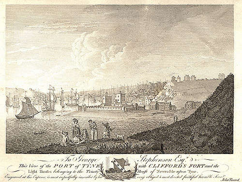
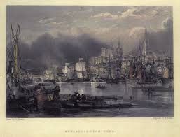
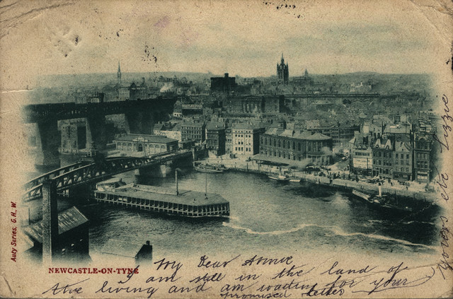
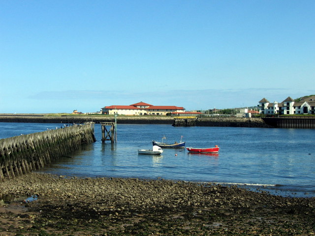
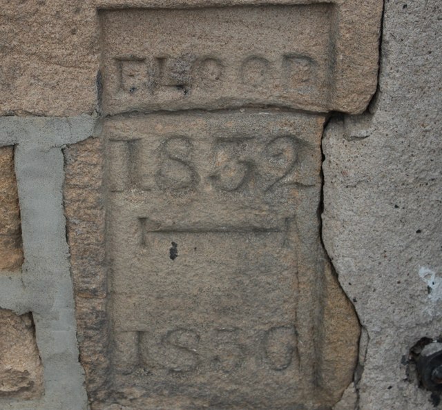
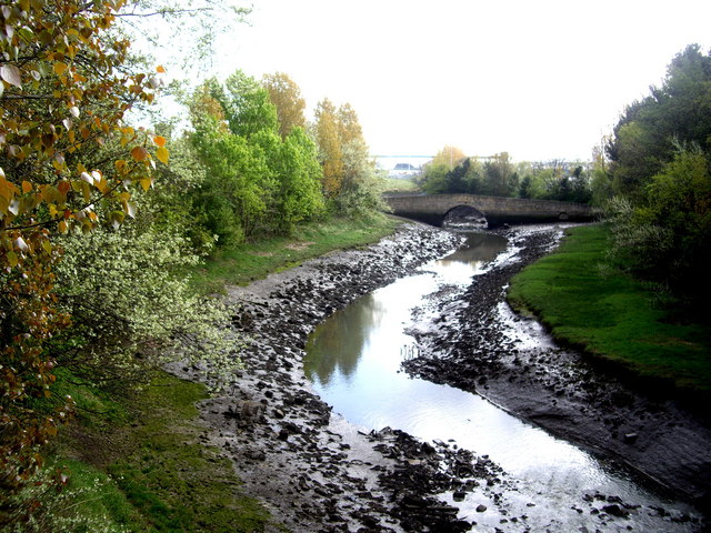
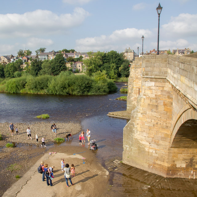
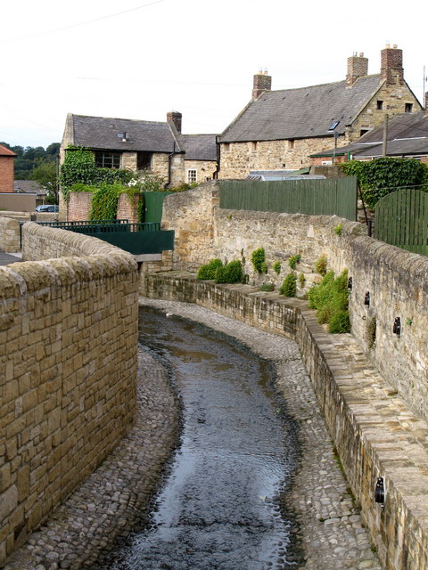
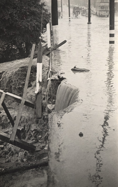
The Tyne is a major river in North East England, formed by the confluence of the River North Tyne and the River South Tyne, which converge at Warden Rock near Hexham. The Tyne discharges into the North Sea between Tynemouth and South Shields. The Romans built Pons Aelius (bridge) over the Tyne at Newcastle in c122 AD. Many of the bridges over the Tyne were destroyed in the Great Flood of 1771. In the 19th century the river became synonmous with ship building and the shipping of coal.
|
Settlements include: |
Crosings include: |
Major Tributaries include:
|
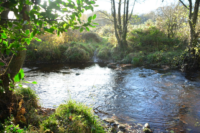
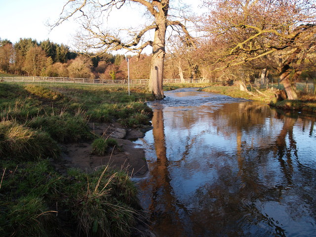
The River Tyne is a river in North East England and its length (excluding tributaries) is . It is formed by the confluence of two rivers: the North Tyne and the South Tyne. These two rivers converge at Warden Rock near Hexham in Northumberland at a place dubbed 'The Meeting of the Waters'.
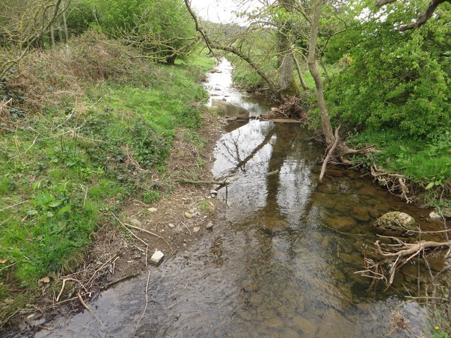
The North Tyne rises on the Scottish border, north of Kielder Water. It flows through Kielder Forest, and passes through the village of Bellingham before reaching Hexham.
The South Tyne rises on Alston Moor, Cumbria and flows through the towns of Haltwhistle and Haydon Bridge, in a valley often called the Tyne Gap. Hadrian's Wall lies to the north of the Tyne Gap. Coincidentally the source of the South Tyne is very close to the sources of the other two great rivers of the industrial north east namely the Tees and the Wear. The South Tyne Valley falls within the North Pennines Area of Outstanding Natural Beauty (AONB) - the second largest of the 40 AONBs in England and Wales.
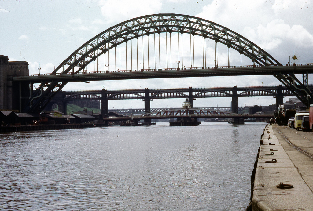
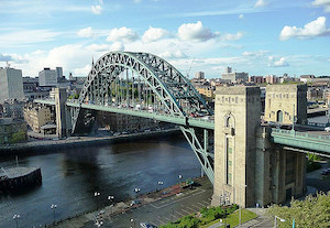
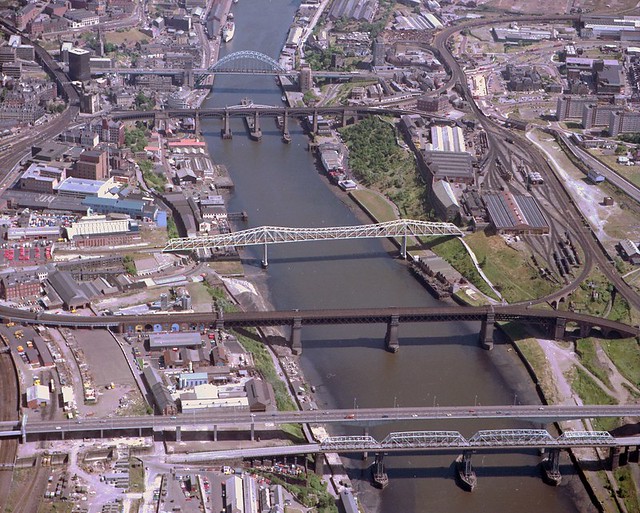
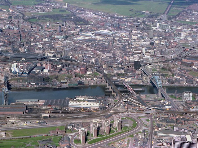
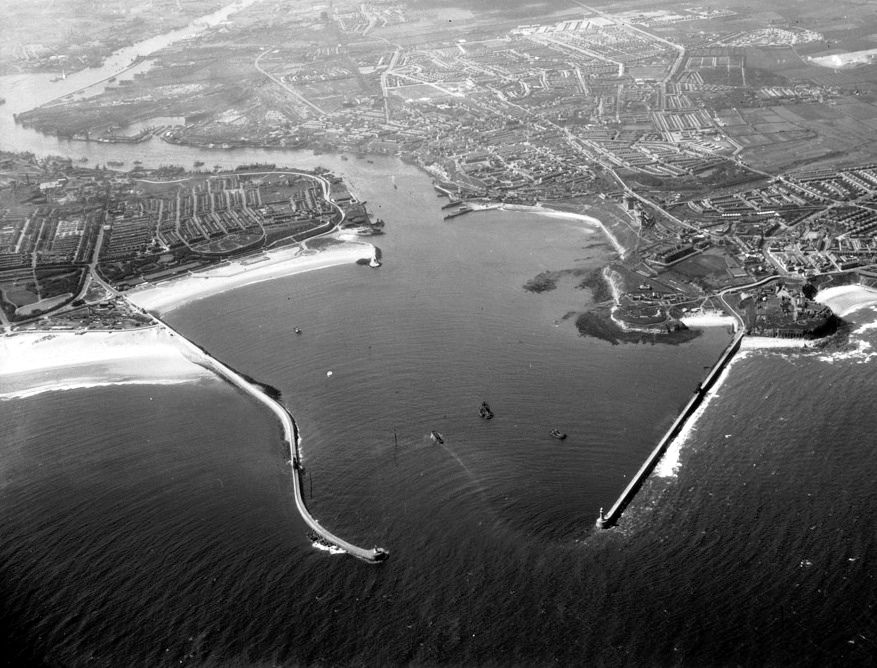
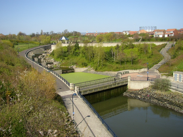
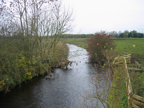
The combined Tyne flows from the convergence point at Warden Rock just to the north west of Hexham, the area where the river's now thriving barbel stocks were first introduced in the mid-1980s, through Corbridge in Northumberland. It enters the county of Tyne and Wear between Clara Vale (in the Borough of Gateshead on the south bank) and Tyne Riverside Country Park (in Newcastle upon Tyne on the north bank) and continues to divide Newcastle and Gateshead for , in the course of which it is spanned by 10 bridges. To the east of Gateshead and Newcastle, the Tyne divides Hebburn and Jarrow on the south bank from Walker and Wallsend on the north bank. Jarrow and Wallsend are linked underneath the river by the Tyne Tunnel. Finally it flows between South Shields and Tynemouth into the North Sea.
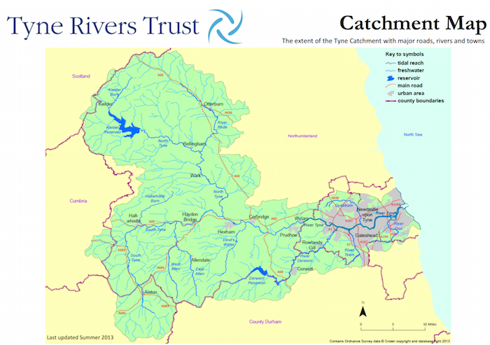
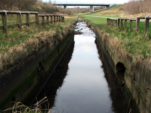
The Tyne Rivers Trust measure the whole Tyne catchment as 2,936 square kilometres (1,134 sq mi), containing around 4,399 kilometres (2,733 mi) of waterways.
The River Tyne is believed to be around 30 million years old.
Port of Tyne
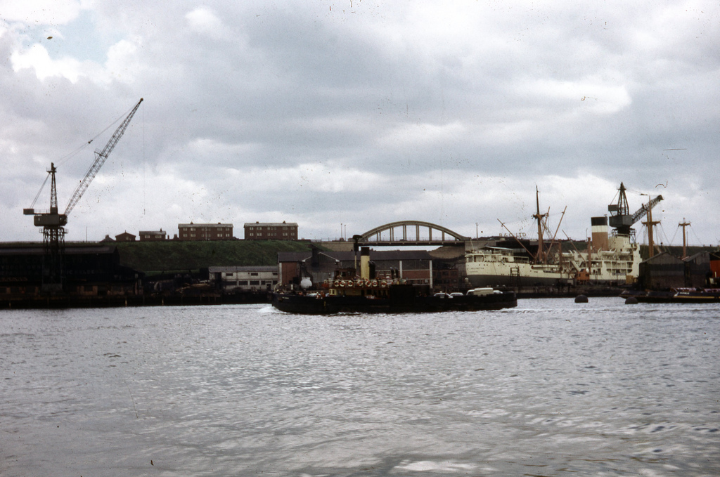
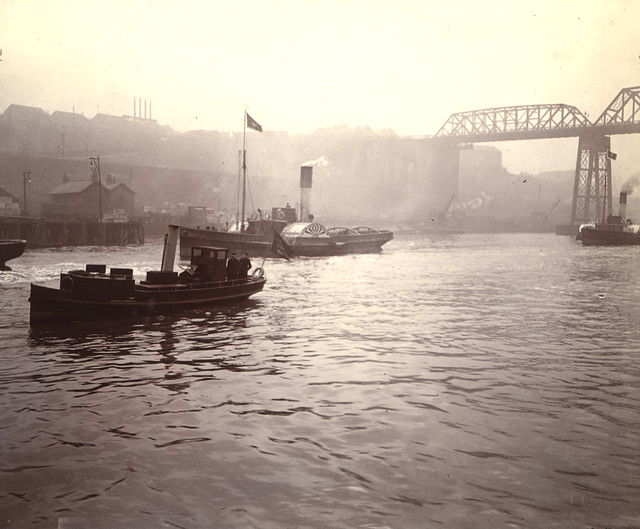
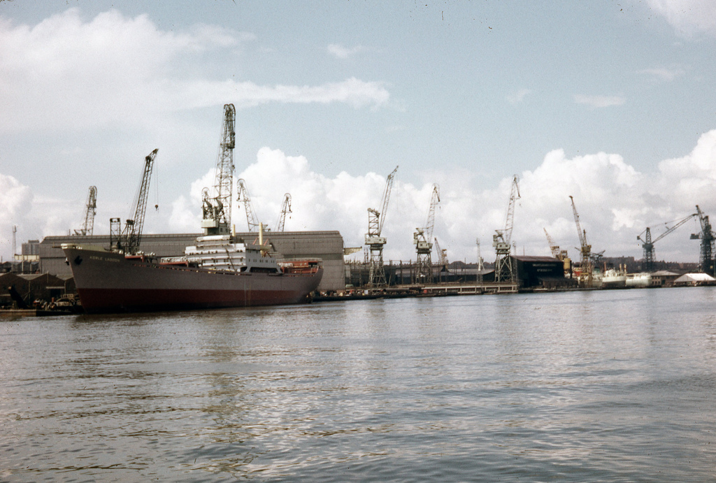
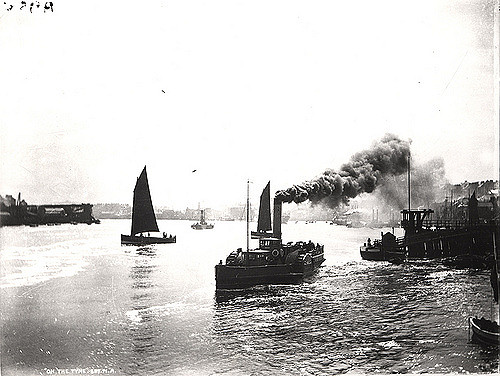
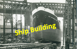
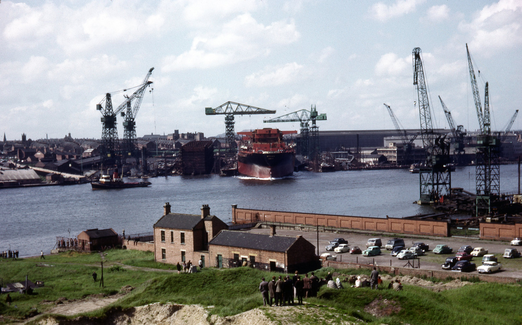
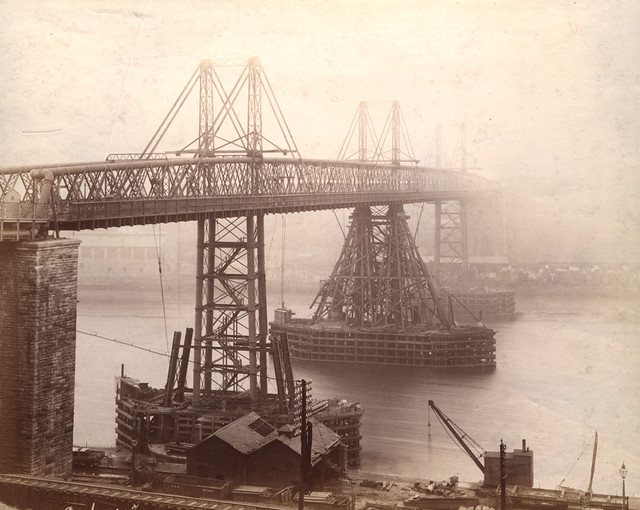
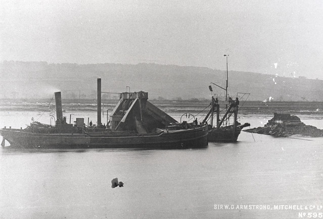
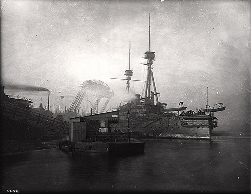
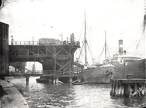
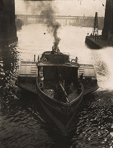
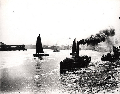
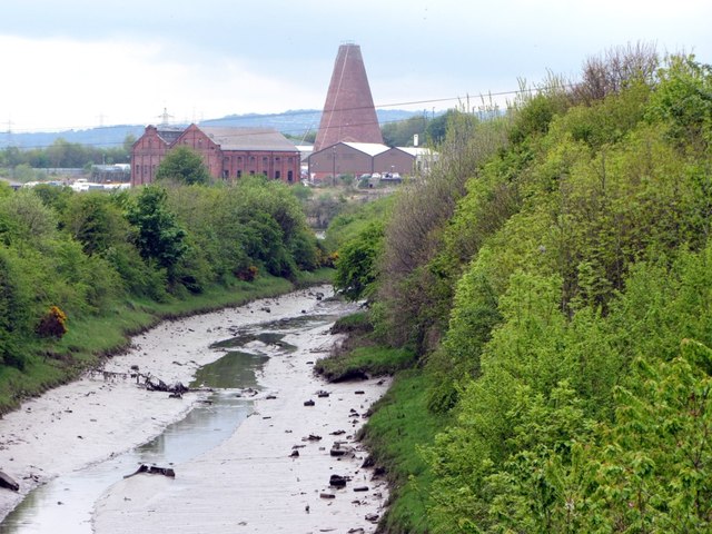
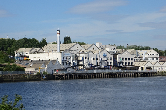
With its proximity to surrounding coalfields, the Tyne was a major route for the export of coal from the 13th century until the decline of the coal mining industry in North East England in the second half of the 20th century. The largest coal staithes were located at Dunston in Gateshead, Hebburn and Tyne Dock, South Shields. The dramatic wooden staithes (a structure for loading coal onto ships) at Dunston, built in 1890, have been preserved, although they were partially destroyed by fire in 2006. And to this day in 2016 Tyne Dock, South Shields is still involved with coal, importing 2 million tonnes of shipments a year. The lower reaches of the Tyne were, in the late 19th and early 20th centuries, one of the world's most important centres of shipbuilding, and there are still shipyards in South Shields and Hebburn to the south of the river. To support the shipbuilding and export industries of Tyneside, the lower reaches of the river were extensively remodelled during the second half of the 19th century, with islands removed and meanders in the river straightened.
The tidal river is now managed by the Port of Tyne Authority.
Origins of name
Nothing definite is known of the origin of the designation "Tyne", nor is the river known by that name until the Saxon period: Tynemouth is recorded in Anglo-Saxon as Tinanmuðe (probably dative case). There is a theory that Tīn was a word that meant "river" in the local Celtic language or in a language spoken in England before the Celts came: compare Tardebigge. There is also a river Tyne that rises in Midlothian in Scotland and flows through East Lothian into the North Sea. The River Vedra on the Roman map of Britain may be the Tyne, or may be the River Wear.
The late Thomas John Taylor supposed that the main course of the river anciently flowed through what is now Team Valley, its outlet into the tidal river being by a waterfall at Bill Point (in the area of Bill Quay). His theory is not far from the truth, as there is evidence that prior to the last Ice Age, the River Wear did once follow the current route of the lower River Team, merging with the Tyne at Dunston. Ice diverted the course of the Wear to its current location, flowing east the course of the Tyne) and joining the North Sea at Sunderland.
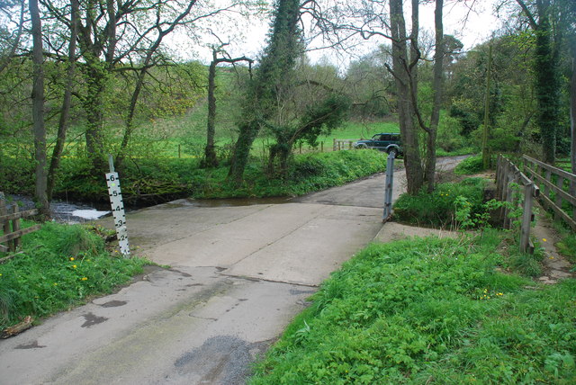
River crossings
River Tyne
- Shields Ferry (ferry service between North and South Shields)
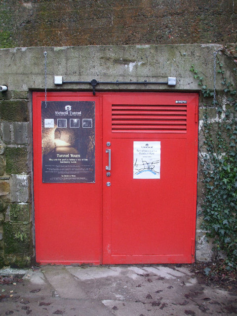
- New Tyne Tunnel (road)
- Old Tyne Tunnel (road)
- Tyne Pedestrian & Cycle Tunnel (foot, bicycle)
- Gateshead Millennium Bridge (foot, bicycle)
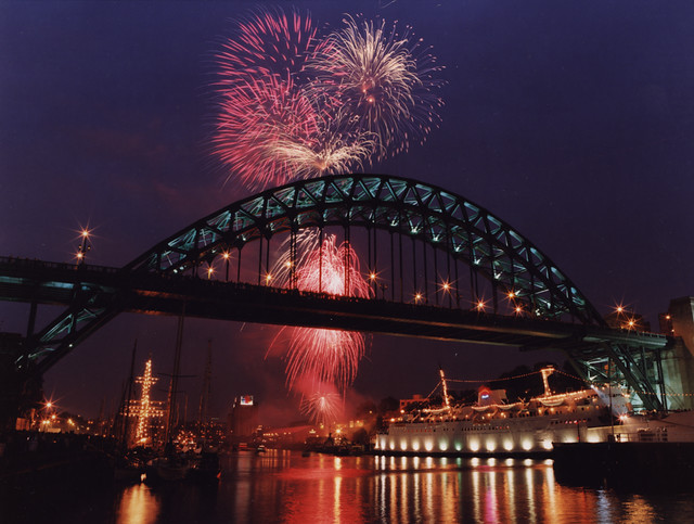
- Tyne Bridge (road, foot)
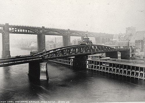
- Swing Bridge (road, foot)
- High Level Bridge (rail, road, foot)
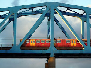
- Queen Elizabeth II Metro Bridge (Metro light rail)
- King Edward VII Bridge (rail)
- Redheugh Bridge (road, foot)
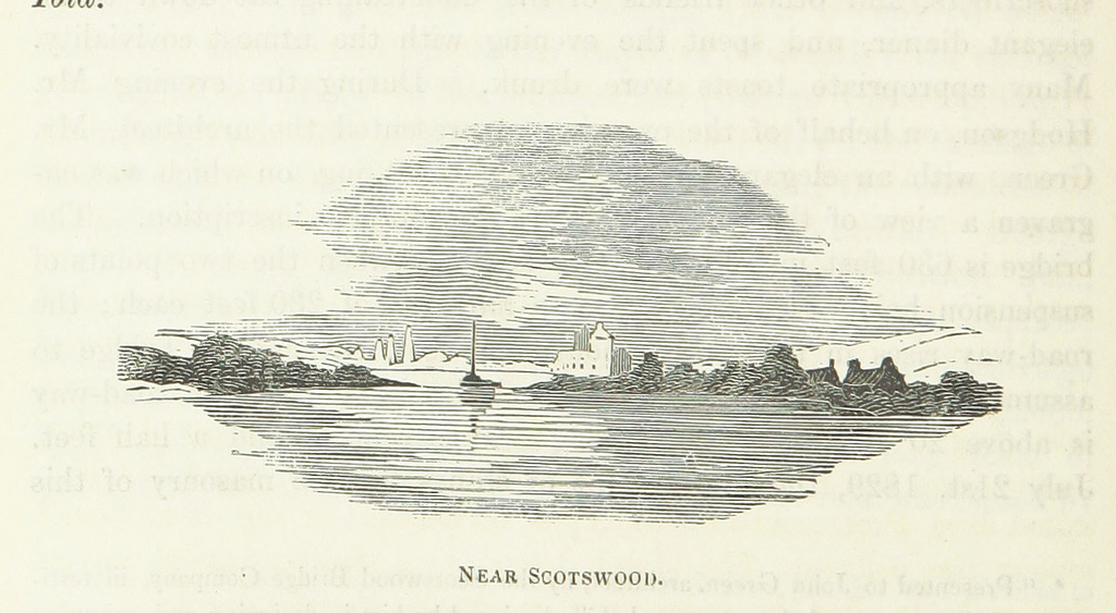
- Scotswood Bridge (road, foot)
- Scotswood Railway Bridge (disused rail, now carries water and gas mains)
- Blaydon Bridge (road)
- Newburn Bridge (road, foot)
- Wylam Bridge (road, foot)
- Wylam Railway Bridge (foot, bicycle, disused rail)
- Ovingham Footbridge (foot)
- Ovingham Bridge (road)
- Bywell Bridge (road, foot)
- Styford Bridge (road, foot)
- Corbridge Bridge (road, foot)
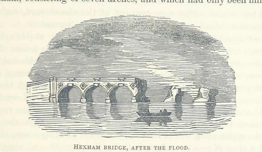
- Hexham Bridge (road, foot)
- Hexham Old Bridge (road, swept away 1771)
- Border Counties Bridge (former rail, only piers remain)
- Constantius Bridge (road)
26 crossings in total
River North Tyne
- Chesters Bridge (ruined Roman bridge)
- Chollerford Bridge (road, foot)
- Wark Bridge (foot)
- Bellingham Bridge (road, foot)
- Tarset Bridge (road, foot)
- Greystead Bridge (foot)
- Falstone Bridge (road, foot)
- Kielder Viaduct (foot – previously rail)
- Kerseycleugh Bridge (road, foot)
7 crossings in total, 6 in use
River South Tyne
- Warden Railway Bridge (rail)
- Warden Bridge (road, foot)
- New Haydon Bridge (road)
- Old Haydon Bridge (foot)
- Haydon Bridge Viaduct (road, foot)
- Lipwood Railway Bridge (rail)
- Ridley Bridge (road, foot)
- Ridley Railway Bridge (rail)
- Millhouse Bridge (at Bardon Mill) (foot)
- Haltwhistle A69 Bridge, East (road)
- Alston Arches Viaduct (at Haltwhistle) (disused rail)
- Blue Bridge, Haltwhistle (at Haltwhistle) (foot – previously road)
- Bellister Bridge (at Haltwhistle) (foot – previously road)
- Haltwhistle A69 Bridge, West (road, foot)
- Featherstone Bridge (road, foot)
- Featherstone Castle Footbridge (foot)
- Diamond Oak Bridge (at Coanwood) (road, foot)
- Lambley Footbridge (foot)
- Lambley Viaduct (foot – previously rail)
- Eals Footbridge (foot)
- Eals Bridge (road, foot)
- Parson Shields Farm Bridge (road, private)
- Slaggyford Bridge (road)
- Kirkhaugh Footbridge (foot)
- Harbut Lodge Railway Bridge (rail)
- Tyne (or Brewery) Bridge (at Alston) (road, foot)
- Garrigill Bridge (road, foot)
27 crossings in total
Artworks and sculpture
Newcastle-upon-Tyne
The river is represented, and personified, in a sculpture unveiled in 1968 as part of the new Civic Centre (seat of Newcastle City Council). Sculpted by David Wynne, the massive bronze figure incorporates flowing water into its design.
Salmon Trail
The Environment Agency is currently working with architects and cultural consultancy xsite, in collaboration with Commissions North, to create a travelling sculpture trail along the River Tyne.
The Tyne Salmon Trail will serve as a celebration of the river, its heritage and its increasingly diverse ecosystem. Historically a major symbol in the regional identity of the North East of England, the river plays host to a plethora of different species, the number of which is growing year on year in line with the rivers improving health.
The Tyne Salmon Trail looks to capture the imagination of residents and tourists visiting the area - providing them with the ultimate 'fact finding' design experience, which celebrates the salmon's migratory journey in the Northeast of England.
FINS, REFLECTION and JOURNEY were the first 3 cubes to be launched in December 2007 from a family of 10. Each cube is inspired by the textures, changing colours, movement and journey of the salmon. With each offering a 'modern day keepsake' to take away, in the form of a designed Bluetooth message.
The other cubes will be moving along the River Tyne over 1 year visiting different locations from Kielder to the Mouth of the Tyne in the summer 2008 before starting their long journey back to their birthplace.
Conversation Piece
Bamboo Bridge
For three days, between 18–20 July 2008, a temporary bamboo artwork was installed over the Tyne close to the Gateshead Millennium Bridge. The Bambuco Bridge was created as part of that year's 'SummerTyne' festival.
Conservation
The River Tyne has a charity dedicated to protecting and enhancing its waters and surrounding areas. The Tyne Rivers Trust, established in 2004, is a community-based organisation that works to improve habitat, promote better understanding of the Tyne catchment area and build the reputation of the Tyne catchment as a place of environmental excellence.
Songs featuring the Tyne
- Asonance - Kopce u pramenů řeky Tyne / Hills on Tyne's source (a Czech adaptation of the folk song The Rolling Hills of the Borders, which does not mention the Tyne)
- Blur - This Is a Low
- Busker - Home Newcastle
- Elvis Costello - Oliver's Army
- Elton John - Merry Christmas Maggie Thatcher (Billy Elliot musical)
- Mark Knopfler - Sailing to Philadelphia, Why Aye Man, Fare Thee Well Northumberland, 5.15 A.M.
- Lindisfarne - Fog on the Tyne
- Madness - Driving in My Car
- Jimmy Nail - Big River
- Gretchen Peters - England Blues
- Hilton Valentine - River Tyne
- Kate Rusby - Bring Me a Boat
- Sting - All This Time, I Was Brought To My Sense
- Dire Straits - Southbound Again, Down to the Waterline
- Gazza - Fog on the Tyne
- Traditional, covered by Sting - Waters of Tyne
- Renaissance - Back Home Once Again (The Paper Lads' TV Theme)
- Roger Whittaker - Durham Town (even though Durham is actually on the River Wear and not the Tyne)
- Eric Burdon and the Animals - The Immigrant Lad
- The Nice - Five Bridges Suite
- Genesis - Blood on the Rooftops
- Big Big Train - Swan Hunter
Visit the page: River Tyne for references and further details. You can contribute to this article on Wikipedia.
from Newcastle libraries (flickr)
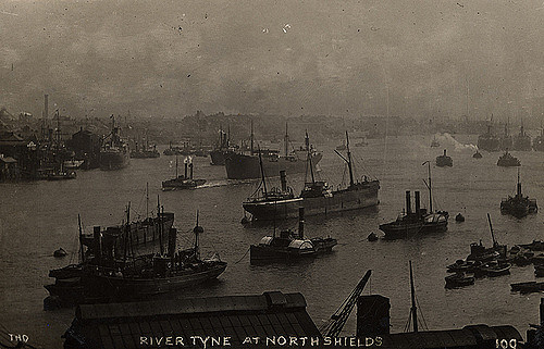
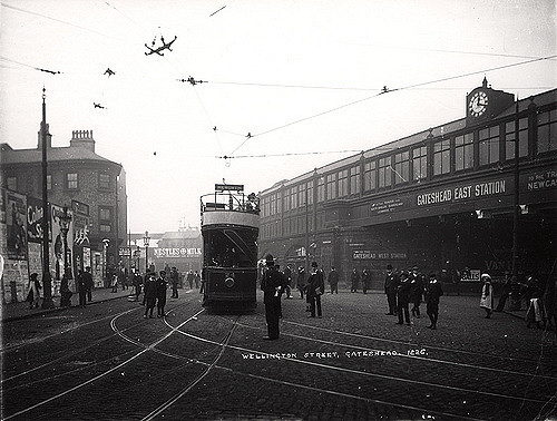
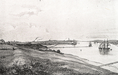
002524:River Tyne North Shields unknown c.1910
Pinned by Simon Cotterill
from Newcastle libraries (flickr)
051602:Redheugh Bridge Newcastle upon Tyne Unknown 1902
Pinned by Simon Cotterill
from Newcastle libraries (flickr)
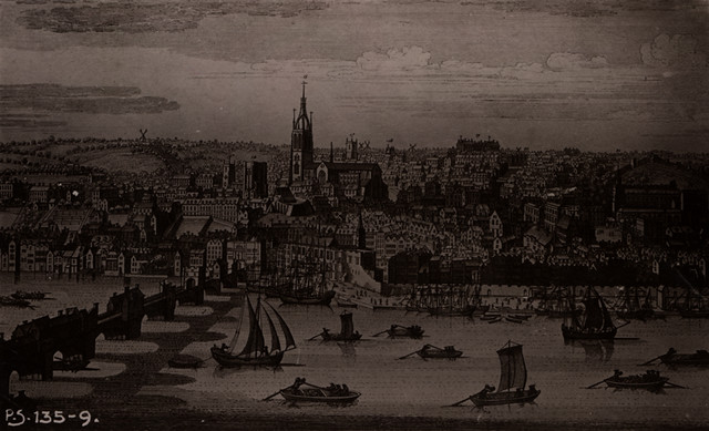
065928:The River Tyne and Newcastle quayside viewed from the south side of the river.1836.
Pinned by Simon Cotterill
Co-Curate Page
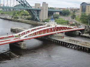
Newcastle Swing Bridge
- Overview Further Information Map Street View The Swing Bridge over the River Tyne was first used for road traffic on 15th June 1876 and opened for river traffic on 17th …
Co-Curate Page
Shields Ferry
- Overview About Shields Ferry Map There have been ferries to cross the River Tyne since the 14th century, particularly where the river is deep and wider towards the mouth of …
Co-Curate Page
Dunston Staiths
- Overview About Dunston Staiths Timeline Map Street View "Dunston Staiths on the River Tyne is believed to be the largest timber structure in Europe, at its height, 5.5m tonnes of …
Co-Curate Page
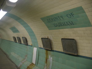
Tyne Pedestrian and Cyclist Tunnels
- Overview About the Tunnels The Tyne Pedestrian and Cyclist Tunnels were opened to the people of Tyneside on 24th July 1951. These two purpose-built tunnels were designed to connect Howdon …
Co-Curate Page
Pons Aelius
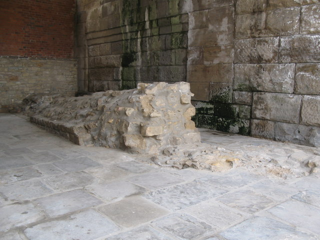
- Overview About Pons Aelius Remains The Romans built Pons Aelius, a bridge to cross the River Tyne, around 122AD. A fort was built there, eventually becoming known under the same …
Co-Curate Page
Tyne Tunnels
- There were calls to build a bridge between North and South Shields going back to before the 1900s, but these were not acted on because the river was a busy …
Co-Curate Page
Tyne Bridge
- Overview About the Tyne Bridge Map Street View The Tyne Bridge is an iconic arch bridge over the River Tyne which links Newcastle and Gateshead. Construction of the bridge by …
Co-Curate Page
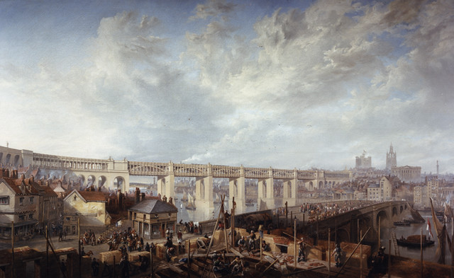
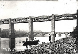
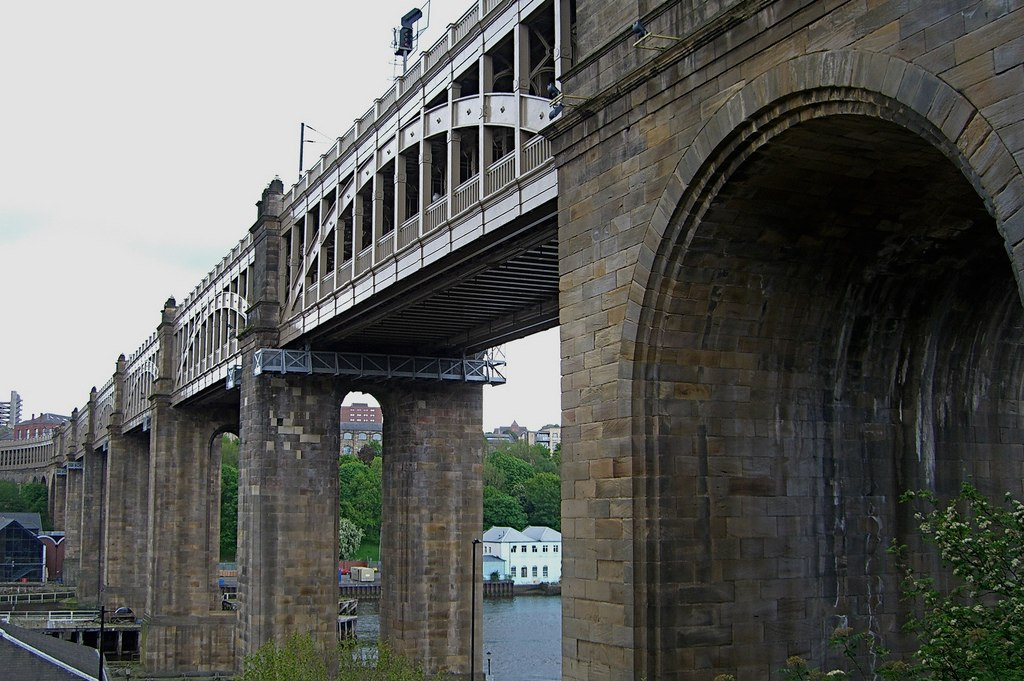
High Level Bridge
- Overview About the High Level Bridge Map Street View The High Level Bridge is a 'double decker' road and railway bridge spanning the River Tyne between Newcastle and Gateshead. The …
Co-Curate Page
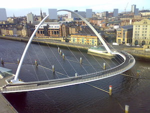
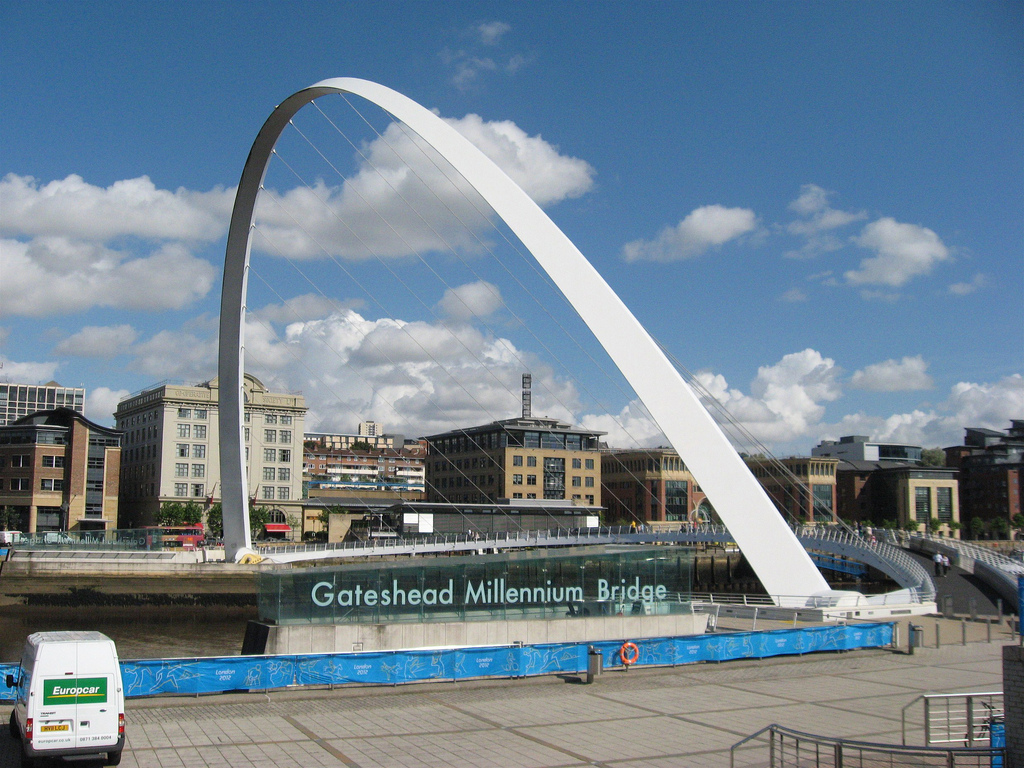
Gateshead Millennium Bridge
- Overview About the Millennium Bridge Map Street View The Gateshead Millennium Bridge is a pedestrian and cycle bridge over the River Tyne. It connects Newcastle Quayside with the Gateshead Quays …
Co-Curate Page
Opening of the Gateshead Millennium Bridge 2001
- The cycle and pedestrain tilt bridge was opened to the public on the 17th September 2001 and the official opening by Queen Elizabeth II was on 7th May 2002.
Co-Curate Page
Opening of the High Level Bridge, 1848
- Opening of the High Level Bridge across the Tyne, 29 August 1848
Co-Curate Page
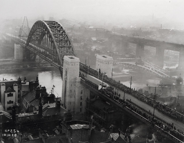
Opening of the Tyne Bridge, 1928
- Work on the Tyne bridge was completed in February 1928, and it was officially opened on the 10th of October by King George V and Queen Mary.
Co-Curate Page
River North Tyne
- Overview Bridges The River North Tyne rises near the Scottish border, north of Kielder Water. It flows through Kielder Forest, Falstone and Bellingham. It converges with the River South Tyne at Warden …
from http://tyneriverstrust.org/
Tyne Rivers Trust
- "Tyne Rivers Trust has a unique role as guardian of the River Tyne Catchment, overseeing the continuing conservation and regeneration of the river from the impacts of its industrial past. …
Added by
Simon Cotterill
from Newcastle libraries (flickr)
002653a:The River Tyne at Wallsend C. 1850
Pinned by Simon Cotterill
from Newcastle libraries (flickr)
067797:A general view of Newcastle upon Tyne in 1745 Unknown Undated
Pinned by Simon Cotterill
from Newcastle libraries (flickr)
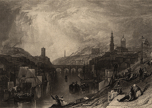
013065:A view of Newcastle upon Tyne Turner J.W.
Pinned by Simon Cotterill
from Newcastle libraries (flickr)
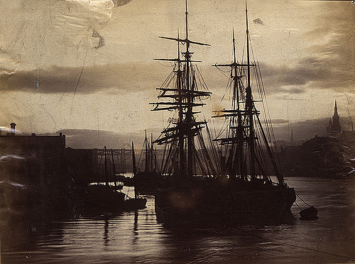
002528:Ships and boats at anchor on the River Tyne around 1890.
Pinned by Simon Cotterill
from Newcastle libraries (flickr)
003377:Scotswood Bridge Newcastle upon Tyne Unknown 1931
Pinned by Simon Cotterill
from Newcastle libraries (flickr)
666754:View of Newcastle upon Tyne, 1903 - Auty Collection
Pinned by Simon Cotterill
from Newcastle libraries (flickr)
050173:Redheugh Bridge Newcastle upon Tyne Morton G. R. 1898
Pinned by Simon Cotterill
from Newcastle libraries (flickr)
048904:High Level Bridge Newcastle upon Tyne Unknown c.1860s
Pinned by Simon Cotterill
from Newcastle libraries (flickr)
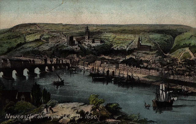
068219:A view of Newcastle upon Tyne in 1600 Unknown Undated
Pinned by Simon Cotterill
from Newcastle libraries (flickr)
049387:High Level and Swing Bridges Newcastle upon Tyne Unknown 1887
Pinned by Simon Cotterill
from http://www.thejournal.co.uk/n…
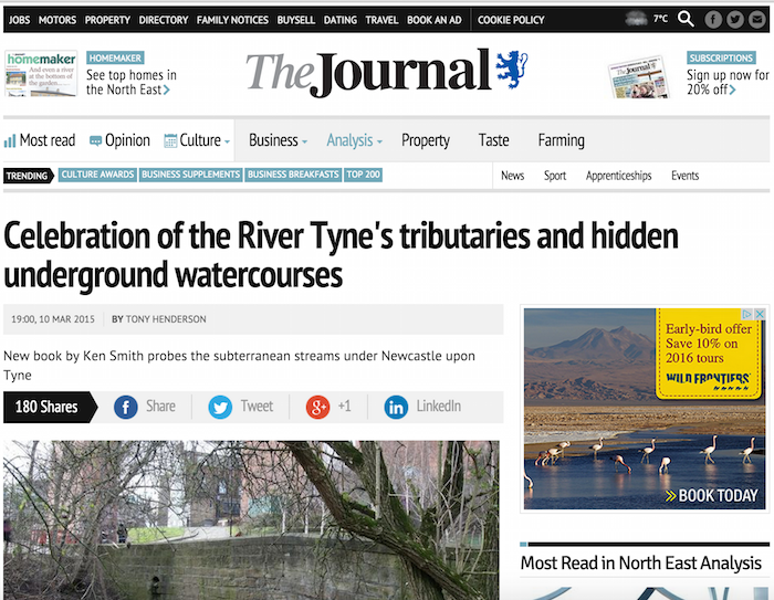
Celebration of the River Tyne's tributaries and hidden underground watercourses
- Article by Tony Henderson (The Journal, 10th March 2015) reviewing a new book by Ken Smith about the subterranean streams under Newcastle.
Added by
Simon Cotterill
Co-Curate Page
Clara Vale
- Overview About Clara Vale Map Street View Clara Vale is a small village near Ryton and Crawcrook on the south bank of the River Tyne and part of the Metropolitan …

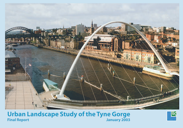
from https://www.gateshead.gov.uk/…
Urban Landscape Study of the Tyne Gorge
- A report prepared for English Heritage, CABE, Newcastle City Council and Gateshead Council by Land Use Consultants,
January 2003. "The pace of change along the Tyne Gorge has accelerated in …
Added by
Simon Cotterill
from Newcastle libraries (flickr)
069443:King's Meadow Scotswood Unknown c.1885
Pinned by Simon Cotterill
Co-Curate Page
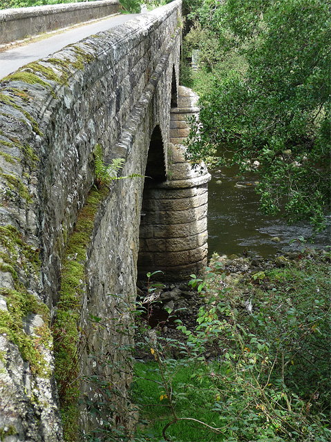
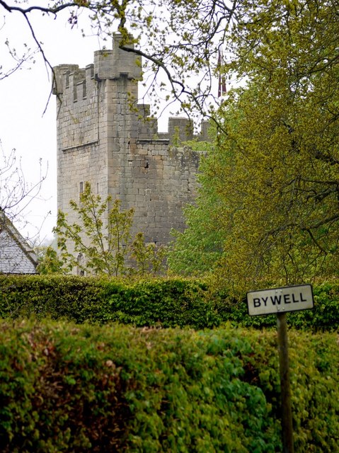
Bywell
- Overview About Bywell Map Street View Bywell Hall St Peter's Church St Andrew's Church Bywell Castle Bywell is a village in Northumberland, situated on the north bank of the River …
Co-Curate Page
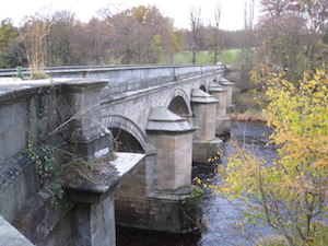
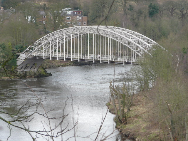
Bywell Bridge, over the Tyne
- Overview Map Street View Bywell bridge over the River Tyne was built 1836-1838, designed by George Basevi. The stone bridge carries the B6309 road over the Tyne, with Bywell on the north …
Co-Curate Page
Howdon - Jarrow Ferry (1854 - 1967)
- The ferry from Howdon to Jarrow across the River Tyne ceased operating when the Tyne Tunnel was opened in 1967. There had been numerous ferries operating from Jarrow; this service …
Co-Curate Page
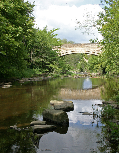
Hexham Bridge
- Overview Map Street View Hexham Bridge carries the A6079 road over the River Tyne at Hexham. The nine arched stone bridge was built in 1793, to the designes of John …

Co-Curate Page
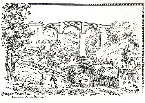
Tyne Bridge Damaged by Floods, 1771
- "On Sunday Morning the 17th of November 1771 an unprecedented inundation of the Tyne occurred by which the bridge at Newcastle with the shops and houses thereon were carried away …
Co-Curate Page
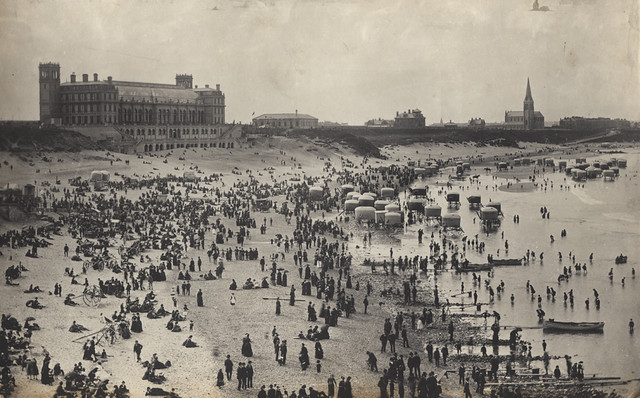
North Shields
- Overview About North Shields Map Street View North Shields is a town on the north bank of the River Tyne in North East England, eight miles (13 km) north-east …

Co-Curate Page
Newcastle upon Tyne
- Overview Map This section of Co-Curate provides a menu for the areas/districts within the City of Newcastle upon Tyne. Select the area (below). See also: Newcastle City Centre for streets, buildings, …
Co-Curate Page
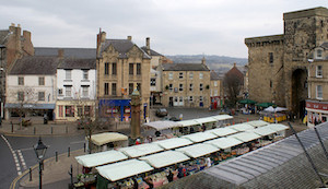
Hexham
- Overview About Hexham Map Street View Hexham is a market town and civil parish in Northumberland, England, south of the River Tyne, and was the administrative centre for the …
Co-Curate Page
Corbridge
- Overview About Corbridge Map Timeline Street View Corbridge is a large village by the River Tyne, located about 3 miles east of Hexham and 17 miles west of Newcastle. Corbridge …
Co-Curate Page
Tynemouth
- Overview About Tynemouth Map Street View Priory & Castle Pier & Lighthouse Collingwood Monument Watch House Tynemouth Station Long Sands Outdoor Pool Black Middens Tynemouth Plaza Front Street Tynemouth is …
Co-Curate Page
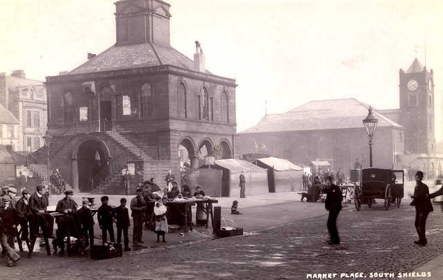
South Shields
- Overview History Timeline Map South Shields is a coastal town in South Tyneside at the mouth of the River Tyne, about 4.8 miles downstream from Newcastle. During the Roman occupation …
Co-Curate Page
Hebburn
- Overview About Hebburn Map Street View Hebburn is a town in South Tyneside, which is located on the south bank of the River Tyne, to the west of Jarrow. There …
Co-Curate Page
Jarrow
- Overview About Jarrow Map Street View Jarrow is a town in north-east England, located on the River Tyne. Historically part of County Durham, in 1974 it became part of …
Co-Curate Page
Wallsend
- Overview History Timeline Map Street View Wallsend is an area of North Tyneside situated on the North banks of the River Tyne just over 3 miles east of Newcastle city centre. …
Co-Curate Page
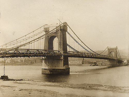
Redheugh Bridge
- Overview Further Information Map Street View There have been 3 Redheugh Bridges spanning the River Tyne and currently carrying the A189 road. The first Redheugh Bridge, built by Thomas Bouch, was …

from http://www.tynebuiltships.co.…
Tyne Built Ships
- Website by George Robinson and David Waller, and now part of the Shipping and Shipbuilding Research Trust. The site includes extensive information and photographs of ships built on the many …
Added by
Simon Cotterill
Co-Curate Page
River Don (Tyne and Wear)
- The River Don is a tributary of the River Tyne. It rises near Wrekenton in Gateshead, flowing east for about 6 km, then heading north to join the River Tyne …
Co-Curate Page
Ovington
- Overview About Ovington Map Street View Ovington is a village and civil parish in Northumberland. The village of Ovington is located near the River Tyne, a mile east of Ovingham. …
Co-Curate Page
Lemington Gut
- Overview Map Street View The River Tyne used to run closer to Lemington, until the Tyne Improvement Commission re-routed the river, making a shorter channel over the Blaydon Haugh. This …
Co-Curate Page
Tyne Bridge
- Overview About Corbridge Bridge Map Street View The seven arched stone bridge over the River Tyne at Corbridge was completed in 1674. It replaced an earlier bridge of 1235 and …
Co-Curate Page
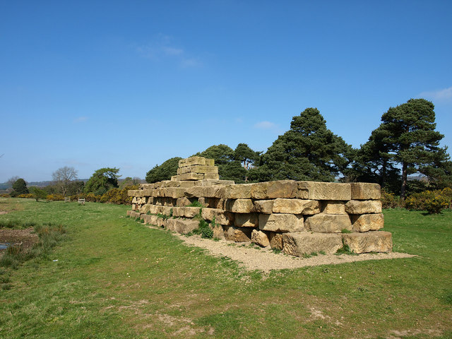
Roman Bridge at Corbridge
- The Romans built a bridge at Corbridge to carry Dere Street (the Roman road from York to Scotland) over the River Tyne. Remains of the southern end of the bridge are …
Co-Curate Page
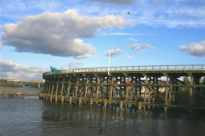
Hagg Bank Bridge
- Overview About West Wylam Bridge Map Street View West Wylam Bridge (also known as Hagg Bank Bridge and Points Bridge) is a footbridge over the River Tyne to the south-west …
Co-Curate Page
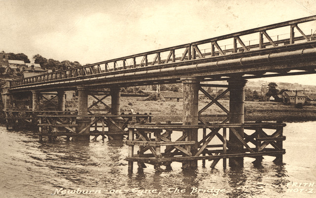
Newburn Bridge
- Overview About Newburn Bridge Map Street View Newburn Bridge is a road bridge over the River Tyne between Newburn in the City of Newcastle upon Tyne and Ryton in the …
from https://metalanddust.org/2016…
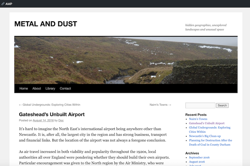
Jarrow Slake
- "Jarrow Slake was a large area of mudflats which would fill up and drain according to the level of the River Tyne.
Industry sprouted along the Slake, with historical ordnance …
Added by
Peter Smith
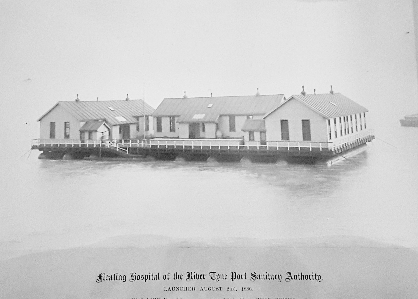
from https://blog.twmuseums.org.uk…
A Floating Hospital
- TWAM Blog June 5, 2020. "Assistant Keeper of History Adam Bell at South Shields Museum and Art Gallery shares how a floating hospital stemmed the influx of infectious diseases into …
Added by
Simon Cotterill

Co-Curate Page
Felling Shore
- Felling Shore is part of the Felling area of Gateshead, located by the River Tyne. Historically, Felling Shore was a separate settlement; then in 1894, it was one of the …


from Newcastle libraries (flickr)
002524:River Tyne North Shields unknown c.1910
Pinned by Simon Cotterill
from Newcastle libraries (flickr)
051602:Redheugh Bridge Newcastle upon Tyne Unknown 1902
Pinned by Simon Cotterill
from Newcastle libraries (flickr)
065928:The River Tyne and Newcastle quayside viewed from the south side of the river.1836.
Pinned by Simon Cotterill
Co-Curate Page
Newcastle Swing Bridge
- Overview Further Information Map Street View The Swing Bridge over the River Tyne was first used for road traffic on 15th June 1876 and opened for river traffic on 17th …
Co-Curate Page
Shields Ferry
- Overview About Shields Ferry Map There have been ferries to cross the River Tyne since the 14th century, particularly where the river is deep and wider towards the mouth of …
Co-Curate Page
Dunston Staiths
- Overview About Dunston Staiths Timeline Map Street View "Dunston Staiths on the River Tyne is believed to be the largest timber structure in Europe, at its height, 5.5m tonnes of …
Co-Curate Page
Tyne Pedestrian and Cyclist Tunnels
- Overview About the Tunnels The Tyne Pedestrian and Cyclist Tunnels were opened to the people of Tyneside on 24th July 1951. These two purpose-built tunnels were designed to connect Howdon …
Co-Curate Page
Pons Aelius
- Overview About Pons Aelius Remains The Romans built Pons Aelius, a bridge to cross the River Tyne, around 122AD. A fort was built there, eventually becoming known under the same …
Co-Curate Page
Tyne Tunnels
- There were calls to build a bridge between North and South Shields going back to before the 1900s, but these were not acted on because the river was a busy …
Co-Curate Page
Tyne Bridge
- Overview About the Tyne Bridge Map Street View The Tyne Bridge is an iconic arch bridge over the River Tyne which links Newcastle and Gateshead. Construction of the bridge by …
Co-Curate Page
High Level Bridge
- Overview About the High Level Bridge Map Street View The High Level Bridge is a 'double decker' road and railway bridge spanning the River Tyne between Newcastle and Gateshead. The …
Co-Curate Page
Gateshead Millennium Bridge
- Overview About the Millennium Bridge Map Street View The Gateshead Millennium Bridge is a pedestrian and cycle bridge over the River Tyne. It connects Newcastle Quayside with the Gateshead Quays …
Co-Curate Page
Opening of the Gateshead Millennium Bridge 2001
- The cycle and pedestrain tilt bridge was opened to the public on the 17th September 2001 and the official opening by Queen Elizabeth II was on 7th May 2002.
Co-Curate Page
Opening of the High Level Bridge, 1848
- Opening of the High Level Bridge across the Tyne, 29 August 1848
Co-Curate Page
Opening of the Tyne Bridge, 1928
- Work on the Tyne bridge was completed in February 1928, and it was officially opened on the 10th of October by King George V and Queen Mary.
Co-Curate Page
River North Tyne
- Overview Bridges The River North Tyne rises near the Scottish border, north of Kielder Water. It flows through Kielder Forest, Falstone and Bellingham. It converges with the River South Tyne at Warden …
from http://tyneriverstrust.org/
Tyne Rivers Trust
- "Tyne Rivers Trust has a unique role as guardian of the River Tyne Catchment, overseeing the continuing conservation and regeneration of the river from the impacts of its industrial past. …
Added by
Simon Cotterill
from Newcastle libraries (flickr)
002653a:The River Tyne at Wallsend C. 1850
Pinned by Simon Cotterill
from Newcastle libraries (flickr)
067797:A general view of Newcastle upon Tyne in 1745 Unknown Undated
Pinned by Simon Cotterill
from Newcastle libraries (flickr)
013065:A view of Newcastle upon Tyne Turner J.W.
Pinned by Simon Cotterill
from Newcastle libraries (flickr)
002528:Ships and boats at anchor on the River Tyne around 1890.
Pinned by Simon Cotterill
from Newcastle libraries (flickr)
003377:Scotswood Bridge Newcastle upon Tyne Unknown 1931
Pinned by Simon Cotterill
from Newcastle libraries (flickr)
666754:View of Newcastle upon Tyne, 1903 - Auty Collection
Pinned by Simon Cotterill
from Newcastle libraries (flickr)
050173:Redheugh Bridge Newcastle upon Tyne Morton G. R. 1898
Pinned by Simon Cotterill
from Newcastle libraries (flickr)
048904:High Level Bridge Newcastle upon Tyne Unknown c.1860s
Pinned by Simon Cotterill
from Newcastle libraries (flickr)
068219:A view of Newcastle upon Tyne in 1600 Unknown Undated
Pinned by Simon Cotterill
from Newcastle libraries (flickr)
049387:High Level and Swing Bridges Newcastle upon Tyne Unknown 1887
Pinned by Simon Cotterill
from http://www.thejournal.co.uk/n…
Celebration of the River Tyne's tributaries and hidden underground watercourses
- Article by Tony Henderson (The Journal, 10th March 2015) reviewing a new book by Ken Smith about the subterranean streams under Newcastle.
Added by
Simon Cotterill
Co-Curate Page
Clara Vale
- Overview About Clara Vale Map Street View Clara Vale is a small village near Ryton and Crawcrook on the south bank of the River Tyne and part of the Metropolitan …
from https://www.gateshead.gov.uk/…
Urban Landscape Study of the Tyne Gorge
- A report prepared for English Heritage, CABE, Newcastle City Council and Gateshead Council by Land Use Consultants,
January 2003. "The pace of change along the Tyne Gorge has accelerated in …
Added by
Simon Cotterill
from Newcastle libraries (flickr)
069443:King's Meadow Scotswood Unknown c.1885
Pinned by Simon Cotterill
Co-Curate Page
Bywell
- Overview About Bywell Map Street View Bywell Hall St Peter's Church St Andrew's Church Bywell Castle Bywell is a village in Northumberland, situated on the north bank of the River …
Co-Curate Page
Bywell Bridge, over the Tyne
- Overview Map Street View Bywell bridge over the River Tyne was built 1836-1838, designed by George Basevi. The stone bridge carries the B6309 road over the Tyne, with Bywell on the north …
Co-Curate Page
Howdon - Jarrow Ferry (1854 - 1967)
- The ferry from Howdon to Jarrow across the River Tyne ceased operating when the Tyne Tunnel was opened in 1967. There had been numerous ferries operating from Jarrow; this service …
Co-Curate Page
Hexham Bridge
- Overview Map Street View Hexham Bridge carries the A6079 road over the River Tyne at Hexham. The nine arched stone bridge was built in 1793, to the designes of John …
Co-Curate Page
Tyne Bridge Damaged by Floods, 1771
- "On Sunday Morning the 17th of November 1771 an unprecedented inundation of the Tyne occurred by which the bridge at Newcastle with the shops and houses thereon were carried away …
Co-Curate Page
North Shields
- Overview About North Shields Map Street View North Shields is a town on the north bank of the River Tyne in North East England, eight miles (13 km) north-east …
Co-Curate Page
Newcastle upon Tyne
- Overview Map This section of Co-Curate provides a menu for the areas/districts within the City of Newcastle upon Tyne. Select the area (below). See also: Newcastle City Centre for streets, buildings, …
Co-Curate Page
Hexham
- Overview About Hexham Map Street View Hexham is a market town and civil parish in Northumberland, England, south of the River Tyne, and was the administrative centre for the …
Co-Curate Page
Corbridge
- Overview About Corbridge Map Timeline Street View Corbridge is a large village by the River Tyne, located about 3 miles east of Hexham and 17 miles west of Newcastle. Corbridge …
Co-Curate Page
Tynemouth
- Overview About Tynemouth Map Street View Priory & Castle Pier & Lighthouse Collingwood Monument Watch House Tynemouth Station Long Sands Outdoor Pool Black Middens Tynemouth Plaza Front Street Tynemouth is …
Co-Curate Page
South Shields
- Overview History Timeline Map South Shields is a coastal town in South Tyneside at the mouth of the River Tyne, about 4.8 miles downstream from Newcastle. During the Roman occupation …
Co-Curate Page
Hebburn
- Overview About Hebburn Map Street View Hebburn is a town in South Tyneside, which is located on the south bank of the River Tyne, to the west of Jarrow. There …
Co-Curate Page
Jarrow
- Overview About Jarrow Map Street View Jarrow is a town in north-east England, located on the River Tyne. Historically part of County Durham, in 1974 it became part of …
Co-Curate Page
Wallsend
- Overview History Timeline Map Street View Wallsend is an area of North Tyneside situated on the North banks of the River Tyne just over 3 miles east of Newcastle city centre. …
Co-Curate Page
Redheugh Bridge
- Overview Further Information Map Street View There have been 3 Redheugh Bridges spanning the River Tyne and currently carrying the A189 road. The first Redheugh Bridge, built by Thomas Bouch, was …
from http://www.tynebuiltships.co.…
Tyne Built Ships
- Website by George Robinson and David Waller, and now part of the Shipping and Shipbuilding Research Trust. The site includes extensive information and photographs of ships built on the many …
Added by
Simon Cotterill
Co-Curate Page
River Don (Tyne and Wear)
- The River Don is a tributary of the River Tyne. It rises near Wrekenton in Gateshead, flowing east for about 6 km, then heading north to join the River Tyne …
Co-Curate Page
Ovington
- Overview About Ovington Map Street View Ovington is a village and civil parish in Northumberland. The village of Ovington is located near the River Tyne, a mile east of Ovingham. …
Co-Curate Page
Lemington Gut
- Overview Map Street View The River Tyne used to run closer to Lemington, until the Tyne Improvement Commission re-routed the river, making a shorter channel over the Blaydon Haugh. This …
Co-Curate Page
Tyne Bridge
- Overview About Corbridge Bridge Map Street View The seven arched stone bridge over the River Tyne at Corbridge was completed in 1674. It replaced an earlier bridge of 1235 and …
Co-Curate Page
Roman Bridge at Corbridge
- The Romans built a bridge at Corbridge to carry Dere Street (the Roman road from York to Scotland) over the River Tyne. Remains of the southern end of the bridge are …
Co-Curate Page
Hagg Bank Bridge
- Overview About West Wylam Bridge Map Street View West Wylam Bridge (also known as Hagg Bank Bridge and Points Bridge) is a footbridge over the River Tyne to the south-west …
Co-Curate Page
Newburn Bridge
- Overview About Newburn Bridge Map Street View Newburn Bridge is a road bridge over the River Tyne between Newburn in the City of Newcastle upon Tyne and Ryton in the …
from https://metalanddust.org/2016…
Jarrow Slake
- "Jarrow Slake was a large area of mudflats which would fill up and drain according to the level of the River Tyne.
Industry sprouted along the Slake, with historical ordnance …
Added by
Peter Smith
from https://blog.twmuseums.org.uk…
A Floating Hospital
- TWAM Blog June 5, 2020. "Assistant Keeper of History Adam Bell at South Shields Museum and Art Gallery shares how a floating hospital stemmed the influx of infectious diseases into …
Added by
Simon Cotterill
Co-Curate Page
Felling Shore
- Felling Shore is part of the Felling area of Gateshead, located by the River Tyne. Historically, Felling Shore was a separate settlement; then in 1894, it was one of the …

Geography

Rivers
Birkey Burn
Blaydon Burn (stream)
Chirton Burn
Cockshaw Burn
Cor Burn
Denton Burn (stream)
Devil's Water, Northumberland
Kingsmeadow Island, River Tyne
Lort Burn
March Burn / Ridingmill Burn
New Burn (Tyne)
Ouseburn (river)
Pandon Burn
Pow Burn
Red Burn (Tyne)
Skinner Burn
Stanley Burn (Tyne)
Stocksfield Burn
Stonyverge Burn
Wallsend Burn
Whittle Burn
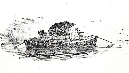
Keels on the Tyne - historical account
High Level Bridge, Newcastle-Gateshead
Opening of the Gateshead Millennium Bridge 2001
Opening of the Tyne Bridge, 1928
Tyne Bridge Damaged by Floods, 1771
Howdon - Jarrow Ferry (1854 - 1967)

Queen Elizabeth II Metro Bridge, Newcastle-Gateshead
Tyne Pedestrian and Cyclist Tunnels
