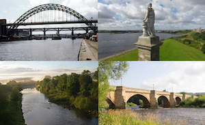
Topics > Geography > Rivers > River Tyne > Ouseburn (river)
Ouseburn (river)
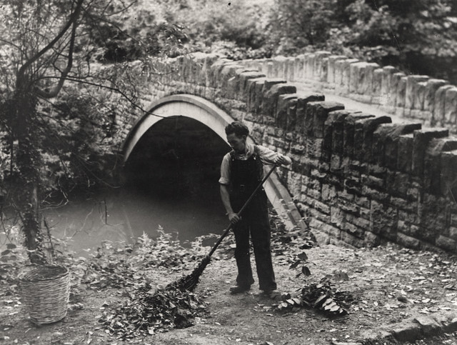
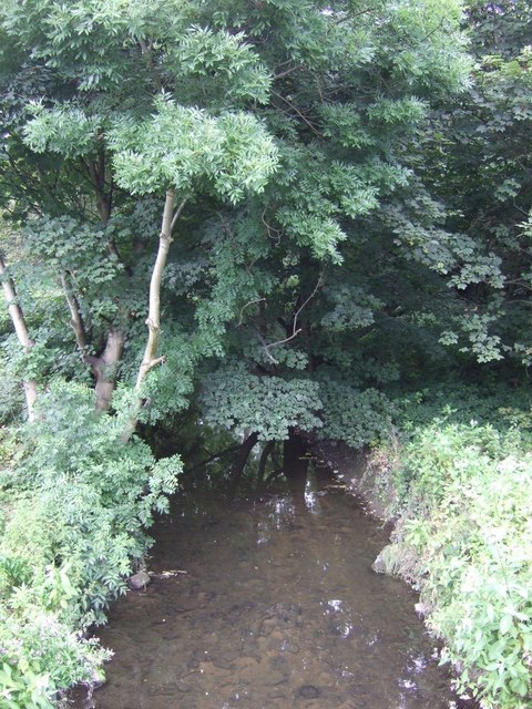
The Ouseburn is a tributary to the River Tyne. Its source is at Callerton, near Newcastle Airport. It flows through Kingston Park, Newcastle Great Park, Gosforth Park, Paddy Freeman's Park in South Gosforth and into Jesmond Dene, Armstrong Park and then Heaton Park. After this a culvert takes the river underground before coming out under Byker Bridge and through Ousburn Valley where it meets the River Tyne.
The Ouseburn is a small river in Tyne and Wear, England that flows through the city of Newcastle upon Tyne into the River Tyne. It gives its name to the Ouseburn electoral ward.
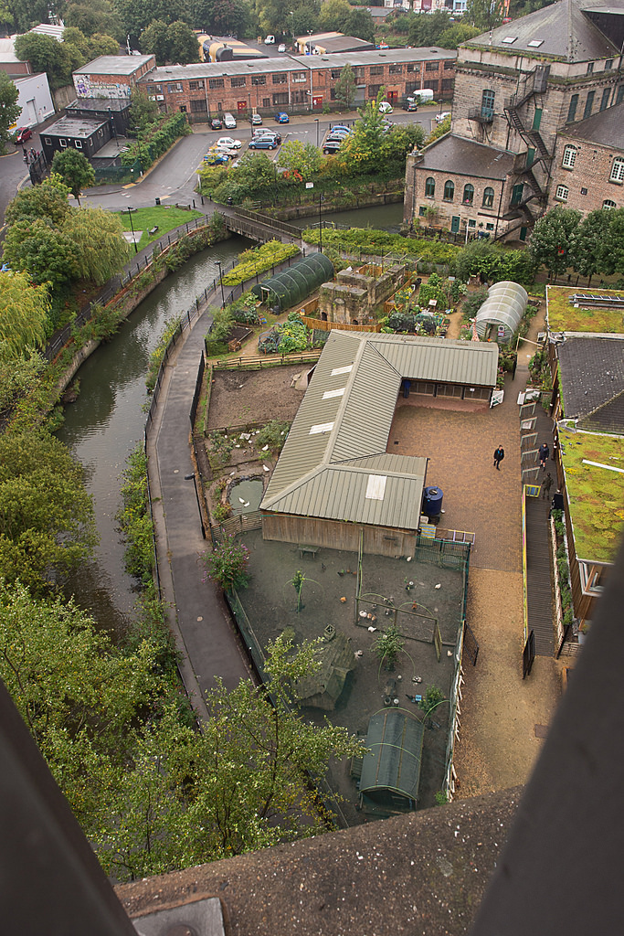
The Ouseburn has its source at Callerton in the north of the city near Newcastle Airport. It then flows through the Kingston Park area of the city, Newcastle Great Park, Gosforth Park and Whitebridge Park. The Ouseburn then continues through Paddy Freeman's Park in South Gosforth and into Jesmond Dene, Armstrong Park and Heaton Park, where it marks the boundary between Heaton and Sandyford. The river then flows through a culvert before re-emerging under Ouseburn railway viaduct, whence it flows past the City Farm, Seven Stories and the Toffee Factory and meets the River Tyne.
The river was previously tidal from the Viaduct, revealing dark mud at low tide. However, since 2009 a tidal barrage at the river mouth retains high water in the Ouseburn at low tide, with the objective of providing a more pleasant environment alongside its banks at low tide, thus promoting development. Despite the expense of its construction, the Ouseburn barrage has had operational problems and was left open for a length of time while they were corrected.
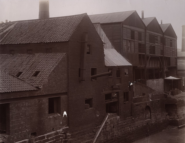
The lower Ouseburn Valley, whilst heavily industrialised in the past, serves as a hub for the arts and creative industries, and has a lively pub scene, noted for live music and real ale.
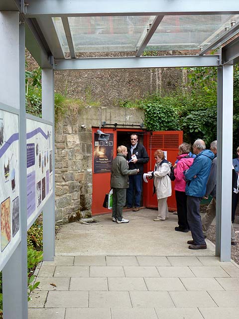
In Roman times the lower Ouseburn Valley was crossed by Hadrian's Wall, but there are now no visible traces to be seen. On the eastern side of the valley there is an information board with an artist's impression of the Wall crossing the valley. This section of the Wall was the later extension from the Roman fort of Pons Aelius (Newcastle) to that of Segedunum (Wallsend).
from Newcastle libraries (flickr)
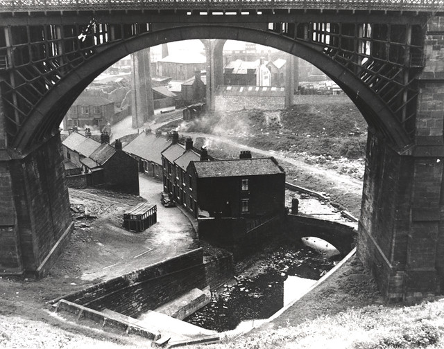
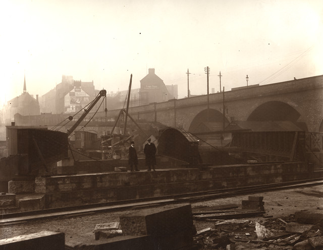
054107:Ouseburn Viaduct Newcastle upon Tyne Unknown 1960
Pinned by Simon Cotterill
from Newcastle libraries (flickr)
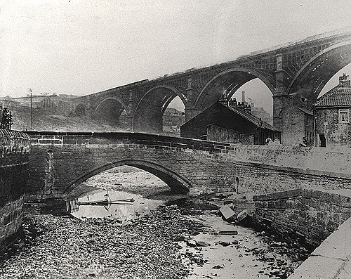
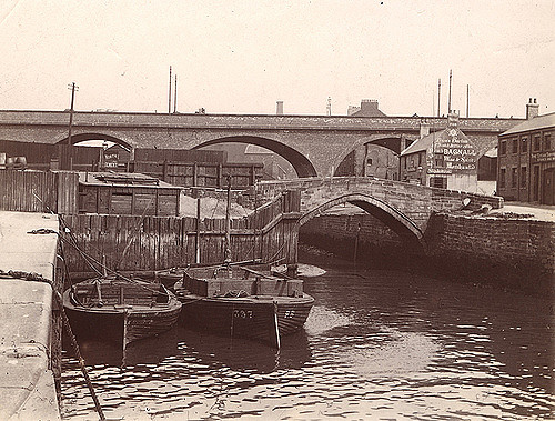
003986:Ouseburn Bridge Newcastle upon Tyne Unknown c.1920
Pinned by Simon Cotterill
from Newcastle libraries (flickr)
046465:Ouseburn Viaduct Newcastle upon Tyne Unknown c.1910
Pinned by Simon Cotterill
from Newcastle libraries (flickr)
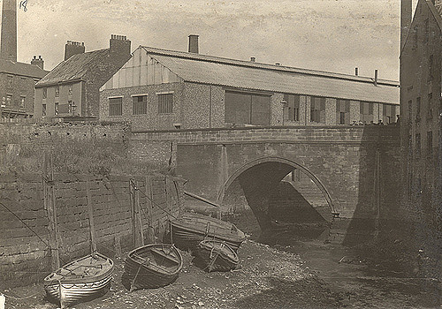
714529:Glasshouse Bridge Unknown c. 1890
Pinned by Simon Cotterill
from Newcastle libraries (flickr)
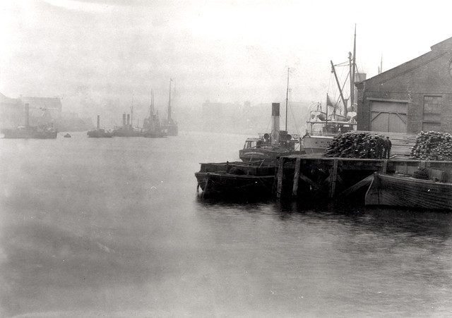
058347:The Tyne at the Mouth of the Ouseburn
Pinned by Simon Cotterill
from Newcastle libraries (flickr)
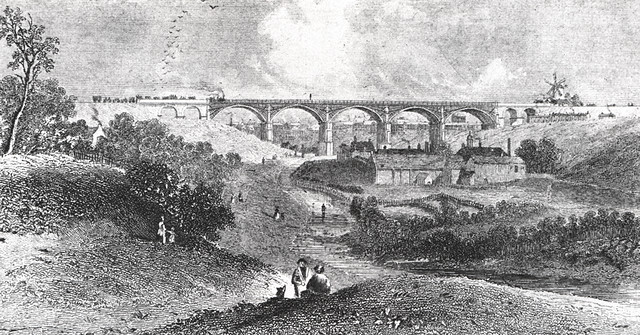
054125:Ouseburn Viaduct Newcastle upon Tyne J. W. Carmichael early 1840s
Pinned by Simon Cotterill
from Newcastle libraries (flickr)
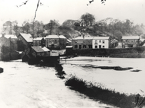
049448:Jesmond Vale during the floods of 1903 Unknown 1903
Pinned by Simon Cotterill
from Newcastle libraries (flickr)
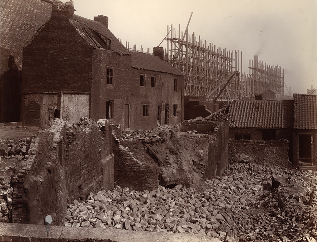
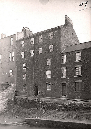
037540:Maling Street Byker Dept of Environmental Health c.1935
Pinned by Simon Cotterill
from Newcastle libraries (flickr)
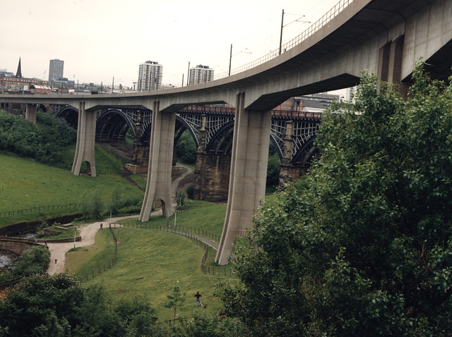
050505:Byker Metro Bridge Newcastle upon Tyne City Engineers 1986
Pinned by Simon Cotterill
Co-Curate Page
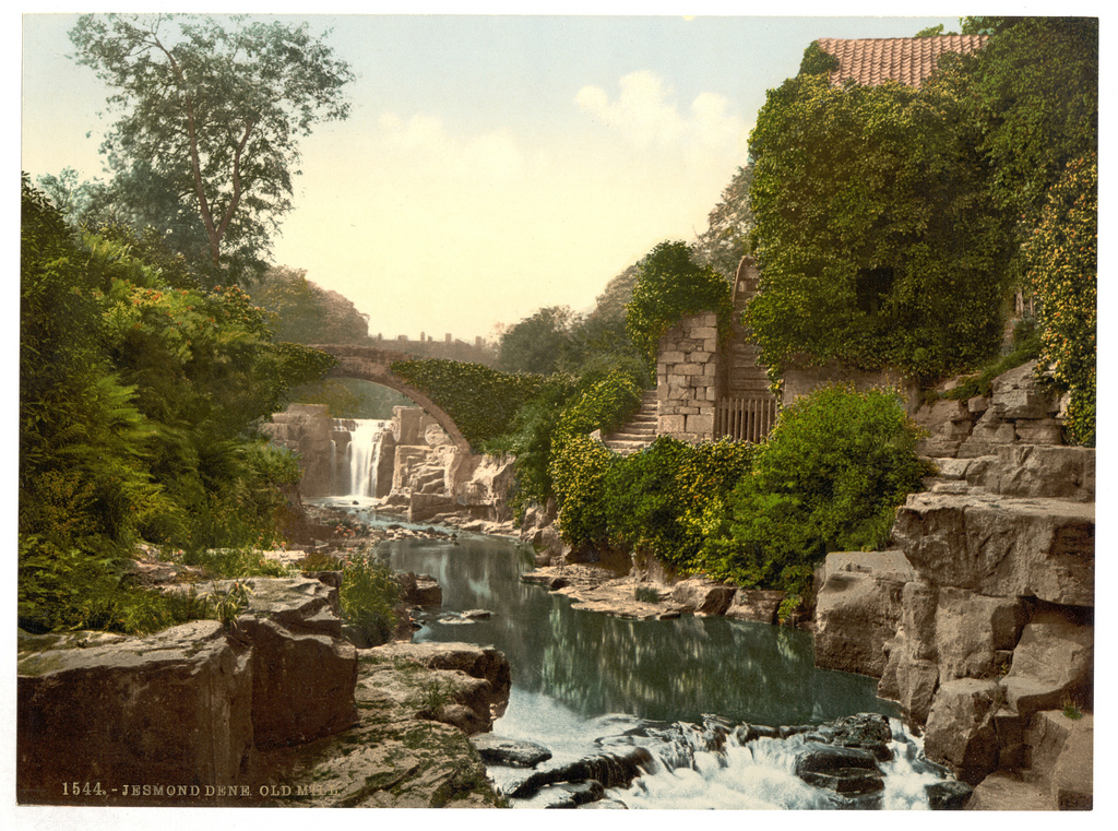
Jesmond Dene
- Overview About Jesmond Dene Map Street View Jesmond Dene is a public park in the valley of the Ouseburn river in Jesmond, Newcastle. The park was originally laid out in …
Co-Curate Page
Ouseburn
- "Around the Valley edges, significant and diverse populations live in Byker Wall, the St Lawrence area, St Ann’s and Battlefield estates and the Lime Square and Mariner’s Wharf developments plus …
from Newcastle libraries (flickr)
053564:Jesmond Dene Newcastle upon Tyne Unknown 1949
Pinned by Simon Cotterill
from Geograph (geograph)
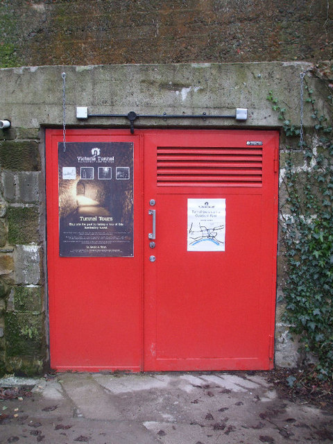
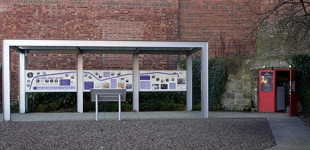
Victoria Tunnel information display & entrance, Ouse Street
Pinned by Simon Cotterill

Co-Curate Page
Jesmond
- Overview History Timeline Map Jesmond is a suburb of Newcastle located just to the north of the city centre, east of Town Moor and west of Jesmond Dene. According to …
Co-Curate Page
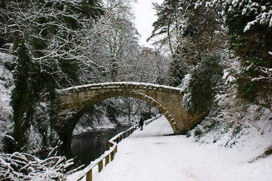
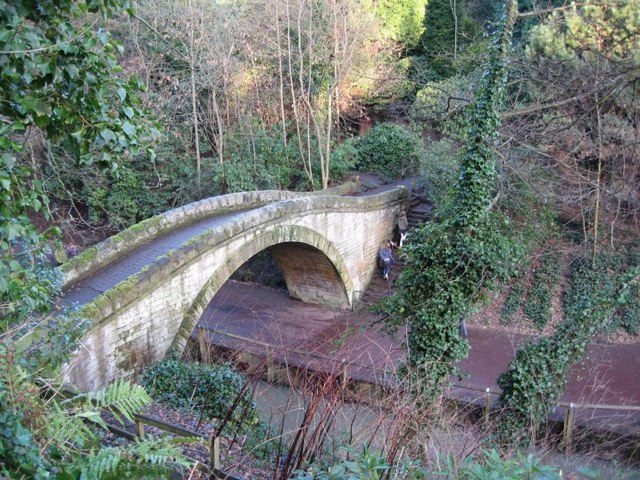
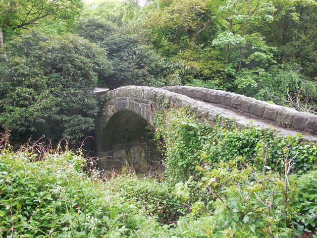
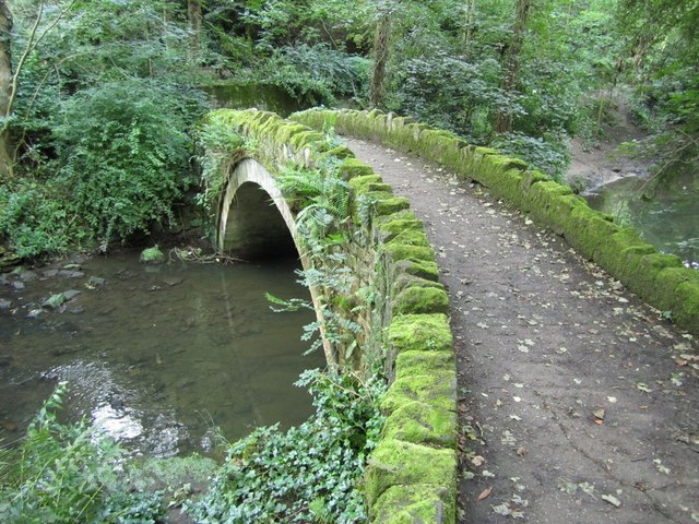
Salters Bridge
- Overview Map Street View Salters Bridge crosses the Ouseburn in South Gosforth. It dates from the 14th Century and is Grade I listed on the National Heritage List for England …
Co-Curate Page
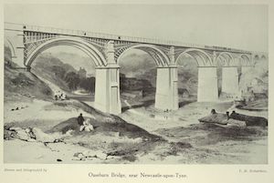
Ouseburn Viaduct
- Overview Map Street View Ouseburn Viaduct is a railway bridge over the valley of the Ouseburn (river). It was built between 1837-1839 by John and Benjamin Green for the Newcastle …

Co-Curate Page
Byker Metro Bridge
- Overview About Byker Metro Bridge Map Street View Byker Metro Bridge (also known as Byker Viaduct) was constructed 1978-1979 and was purpose built for the Tyne & Wear Metro system, …


Co-Curate Page
Blackies Valley / Little Dene
- Overview Map Little Dene (also known as Blackies Valley) in Newcastle was the valley formed by a small stream which flowed eastwards from Town Moor to join the Ouse Burn near …
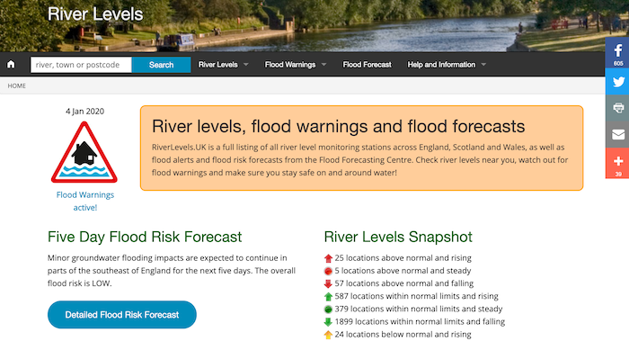
from https://riverlevels.uk/ouse-b…
Ouse Burn at Gosforth - River Level
- Current river level and graph of river levels over time.
Added by
Simon Cotterill
Co-Curate Page
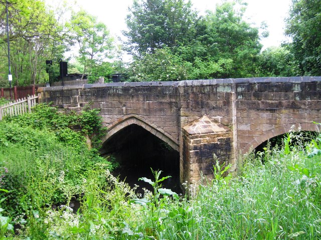
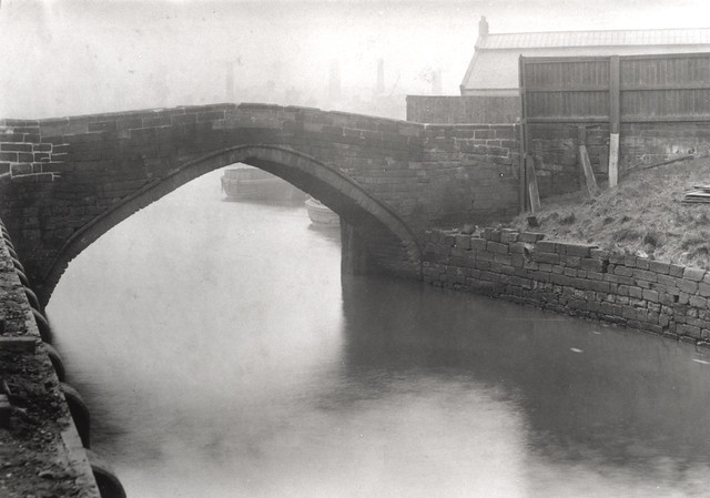
Old Glasshouse Bridge, Ouseburn
- The Glass house bridge over the Ouseburn, east of Newcastle, was of wood until 1669, when it was built of stone by Thomas Wrangham, shipwright, on account of lands which …

from Newcastle libraries (flickr)
054107:Ouseburn Viaduct Newcastle upon Tyne Unknown 1960
Pinned by Simon Cotterill
from Newcastle libraries (flickr)
003986:Ouseburn Bridge Newcastle upon Tyne Unknown c.1920
Pinned by Simon Cotterill
from Newcastle libraries (flickr)
046465:Ouseburn Viaduct Newcastle upon Tyne Unknown c.1910
Pinned by Simon Cotterill
from Newcastle libraries (flickr)
714529:Glasshouse Bridge Unknown c. 1890
Pinned by Simon Cotterill
from Newcastle libraries (flickr)
058347:The Tyne at the Mouth of the Ouseburn
Pinned by Simon Cotterill
from Newcastle libraries (flickr)
054125:Ouseburn Viaduct Newcastle upon Tyne J. W. Carmichael early 1840s
Pinned by Simon Cotterill
from Newcastle libraries (flickr)
049448:Jesmond Vale during the floods of 1903 Unknown 1903
Pinned by Simon Cotterill
from Newcastle libraries (flickr)
037540:Maling Street Byker Dept of Environmental Health c.1935
Pinned by Simon Cotterill
from Newcastle libraries (flickr)
050505:Byker Metro Bridge Newcastle upon Tyne City Engineers 1986
Pinned by Simon Cotterill
Co-Curate Page
Jesmond Dene
- Overview About Jesmond Dene Map Street View Jesmond Dene is a public park in the valley of the Ouseburn river in Jesmond, Newcastle. The park was originally laid out in …
Co-Curate Page
Ouseburn
- "Around the Valley edges, significant and diverse populations live in Byker Wall, the St Lawrence area, St Ann’s and Battlefield estates and the Lime Square and Mariner’s Wharf developments plus …
from Newcastle libraries (flickr)
053564:Jesmond Dene Newcastle upon Tyne Unknown 1949
Pinned by Simon Cotterill
from Geograph (geograph)
Victoria Tunnel information display & entrance, Ouse Street
Pinned by Simon Cotterill
Co-Curate Page
Jesmond
- Overview History Timeline Map Jesmond is a suburb of Newcastle located just to the north of the city centre, east of Town Moor and west of Jesmond Dene. According to …
Co-Curate Page
Salters Bridge
- Overview Map Street View Salters Bridge crosses the Ouseburn in South Gosforth. It dates from the 14th Century and is Grade I listed on the National Heritage List for England …
Co-Curate Page
Ouseburn Viaduct
- Overview Map Street View Ouseburn Viaduct is a railway bridge over the valley of the Ouseburn (river). It was built between 1837-1839 by John and Benjamin Green for the Newcastle …
Co-Curate Page
Byker Metro Bridge
- Overview About Byker Metro Bridge Map Street View Byker Metro Bridge (also known as Byker Viaduct) was constructed 1978-1979 and was purpose built for the Tyne & Wear Metro system, …
Co-Curate Page
Blackies Valley / Little Dene
- Overview Map Little Dene (also known as Blackies Valley) in Newcastle was the valley formed by a small stream which flowed eastwards from Town Moor to join the Ouse Burn near …
from https://riverlevels.uk/ouse-b…
Ouse Burn at Gosforth - River Level
- Current river level and graph of river levels over time.
Added by
Simon Cotterill