Topics > Tees Valley > Ingleby Barwick
Ingleby Barwick
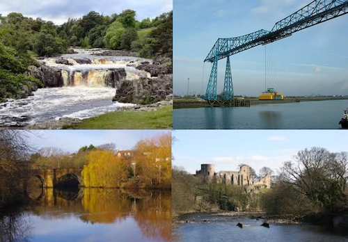
Ingleby Barwick is in the ceremonial county of North Yorkshire, but part of the unitary authority of Stockton-on-Tees, with close links to Teesside and the North East. It is bordered by the River Leven and River Tees. Parts of Ingleby Barwick are built on the former Thornaby Aerodrome.
Ingleby Barwick is a large private residential housing estate and civil parish built on what was the southern perimeter of Thornaby airfield in the borough of Stockton-on-Tees and ceremonial county of North Yorkshire, England. In 2011, the population was 21,045. The estate is enclosed by water to the west, north and east. It was officially opened in 1981 by the mayor of Langbaurgh.
History
Although the development of Ingleby Barwick, as the housing estate which is present today, did not start until the late 1970s, the land has been occupied for thousands of years. Ingleby Barwick has a ceremonial Coat of Arms. The arms contain a representation of the three rivers that run around Ingleby Barwick. It also depicts mill-rinds which are an historical link to the Turner family, who used to own the land which now forms Ingleby Barwick.
The crest shows a Teal bird which refers to a horse named Teal, trained at Middleham by Captain Neville Crump, which won the Grand National in 1952.
Early history
There are traces of human occupation from as far back as the Stone Age. Work at Quarry farm has discovered prolific concentrations of multi period flintwork along the South Bank of the River Tees in this area. Traces of Iron Age field patterns were discovered, also at Quarry Farm.
A salvage excavation was carried out in the Windmills Fields area of the town at the end of 1996. Five individual burials were found along with a wooden cist, these finds were accompanied by objects containing stone, jet and copper alloy of high status. This site was considered of European significance as it threw new light on the settlement of the area in the Bronze age and highlighted a change in tradition of burial traditions and trade networks at this time.
Roman settlement is also apparent in the town and a Roman Villa circa 200 AD, perhaps the most northerly in UK, was excavated in part. This has been preserved as a grassed area in The Forum area of Ingleby Barwick. The "official" report on the excavation was published in 2013 with the title "A Roman Villa at the Edge of Empire" (ISBN 978-1-902771-90-8 )
Middle Ages
The name Ingleby Barwick is derived from both Viking and Saxon place names. Ingleby is derived from Old Norse Englar+by and means 'farmstead or village of the English man', Barwick is Saxon in origin, Bere is Saxon for barley and Wick means farm. This suggests that the area was affected by both the Viking and Saxon invasions.It may have been that until the 17th century, Ingleby and Barwick were two separate places. After the Norman invasion The Manor of Barwick was given to Robert Malet the son of William Malet, King William's great chamberlain. In the 13th century the land was owned by the Priors of Guisborough & Jervaulx until the dissolution of monasteries. Between the 14th and 16th centuries landowners included the Percys of Northumberland and the Parrs of Nottingham. The Middle Ages are considered to have ended with the Renaissance in the mid 15th century
Early Modern history
In the 17th century the Manor of Barwick was sold to Sir Thomas Lynch, Governor of Jamaica and then to Sir William Turner of Kirkleatham. The land remaining in the ownership of the Turner's, with profits from the land used to support the free school and hospital at Kirkleatham, until it was sold in the 19th century.
19th century
Ingleby Barwick is listed as being a township in the parish of Stainton in 1887. Its population was given as 132. During this time the land was sold off by the Turner estate.
Modern history
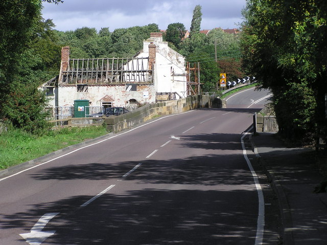
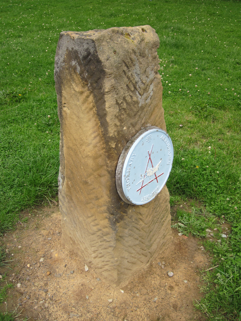
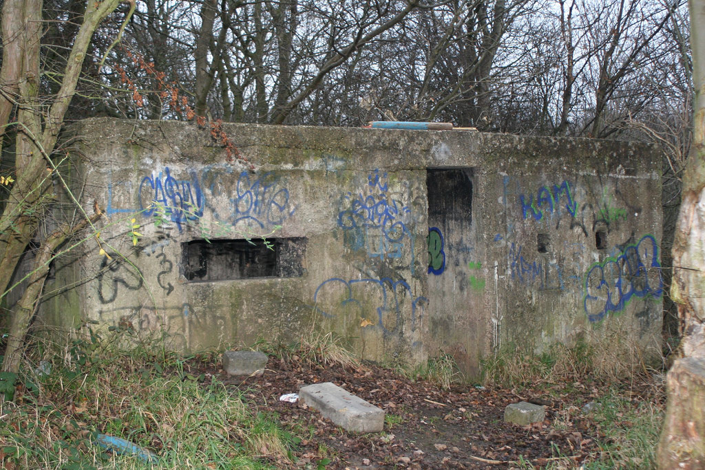
During the Second World War Ingleby Barwick stood near to the south-western perimeter of Thornaby Airfield and a number of aircraft crashed where Ingleby Barwick housing estate now stands. On 11 June 1940 a Coastal Command Lockheed Hudson crashed at Quarry Farm killing the four crew after the bomb load exploded on crashing. On 28 April 1941 a Bristol Blenheim crashed at Barwick Lane killing all three crew. On 18 December 1941 a Lockheed Hudson stalled soon after take off and crashed into Quarry Farm killing the five crew and four civilians. On 4 September 1942 a Lockheed Hudson crashed at Myton House Farm killing the four crew. The last aircraft accident was a Photo Reconnaissance de Havilland Mosquito which was attempting to land at Thornaby on one engine and crashed into land which is now home to Ingleby Mill School on 11 November 1943 killing both crew members; there is now a stone marking the crash site.
In 1969 Yarmside Holdings bought land for housing and the first houses were built at Lowfields in the late 1970s.
Since then there has been a major undertaking to build new housing and at one time Ingleby Barwick was reputed to be the largest private housing estate in Europe.
It is the home to one of the Olympic Golden Postboxes in honour of Kat Copeland's rowing gold at the 2012 London Olympics. The post box is located at the end of Apsley Way in The Rings.
Original features
There are still a number of features that pre-date the 1980s-onward development:
- The route of the original Barwick Lane, which gave access to much of the original farmland remains accessible. Its origin remains as a cul-de-sac, to the east of the Fox Covert Inn on Low Lane. This then becomes a cycle path, whose route can be navigated through Sober Hall, crossing Sober Hall Avenue, Pennine Way and Blair Avenue, passing close by Barley Fields Primary School and the Myton Road shops before crossing Blair Avenue's northern loop and terminating at the Myton Way/The Rings roundabout.
- Another original road route is preserved in the cycle path that runs in a westerly direction starting from the Teal Arms / Ingleby Barwick Post Office complex, this being the approximate former site of Low Farm. This route continues to the west of Myton Way, leading eventually to Barwick Farm.
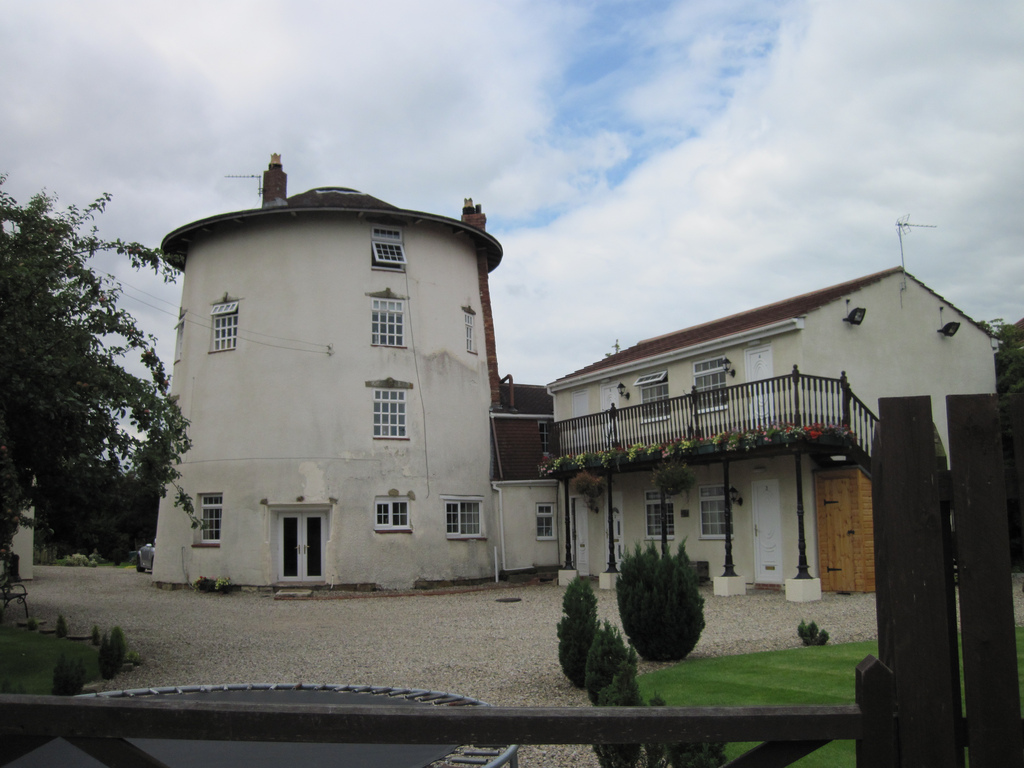
- Low Farm. One of the buildings is incorporated in the Teal Arms pub.
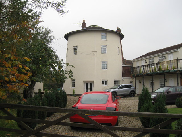
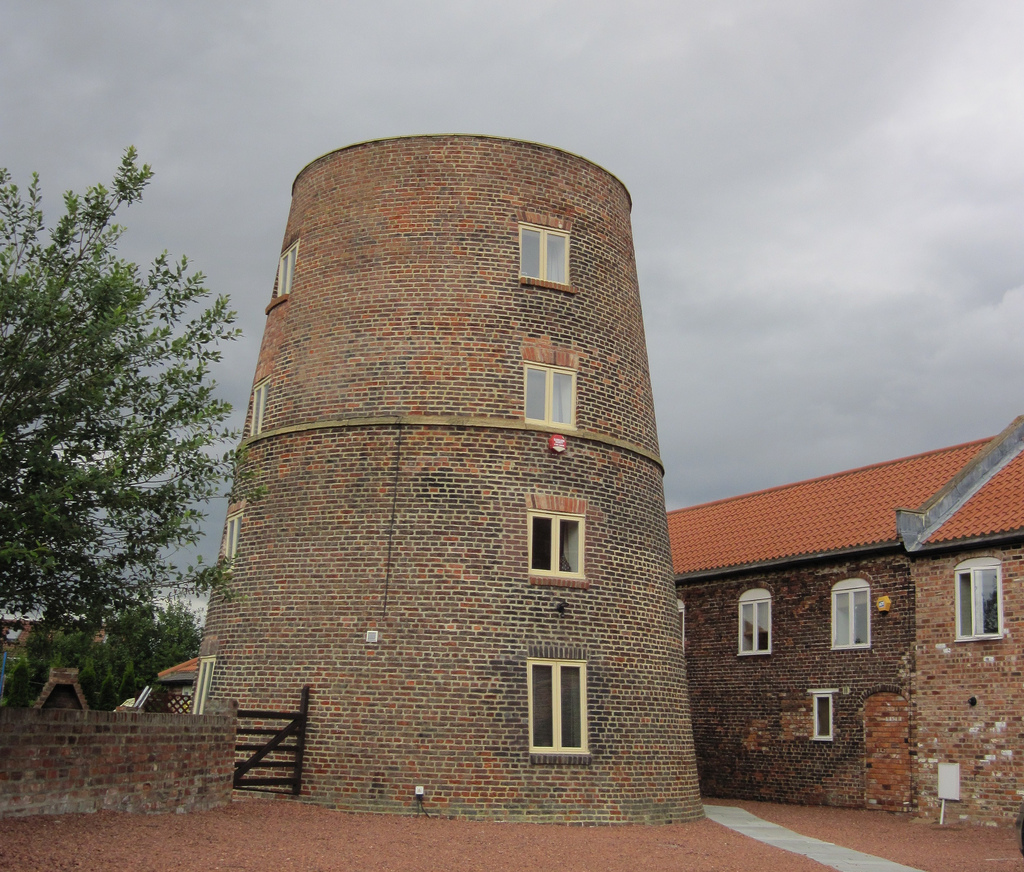
- Black Mill on Raydale Beck is the remnant of a corn mill built on the original Sober Hall Farm, now residential.
- The Old Mill at the southern end of Barwick Lane is now a bed and breakfast
- Cleveland View on Barwick Lane is another former farm building, belonging originally to Lane House Farm.
- There are original buildings from Ingleby Hill Farm at the end of Heddon Grove, now residential.
- Ingleby Close Farm buildings, which lie on land originally occupied by Betty's Close Farm, now residential, lie between Crosswell Park and Trevine Gardens.
- The route of the original road to Betty's Close Farm is preserved in the route of the cycle path that runs from Cleveland View to Roundhill Avenue (and whose route continues along the approach to Ingleby Close Farm buildings).
- The route of the original road to White House Farm is preserved in the line of trees behind Rochester Court and Thirwall Drive, continuing in the east-west cycle path from there to Blair Avenue and in the east-west footpath that runs to the south of Harlech Court.
- The original Myton House Farm site is marked by the public house that bears its name. The pub's website says "Formally (sic) a farmhouse..."
- Ingleby Hill Farm. "Impressive early C19, Late Georgian, Grade II Listed Farmhouse."
Administration
Ingleby Barwick, as part of the Stockton on Tees unitary authority, has six borough councillors representing the two wards Ingleby Barwick East and Ingleby Barwick West. The community is represented by councillors from the Ingleby Barwick Independent Society (IBIS) and the Conservative Party who were elected on 5 May 2015. They are: Ingleby Barwick East - Gillian Corr, Kevin Faulks, and Sally-Ann Watson; Ingleby Barwick West - Kenneth Dixon, David Harrington, and Ross Patterson.
Ingleby Barwick has also a Parish Council, now restyled Town Council, with 12 Town Councillors who were elected on 7 May 2015.They are: Ingleby Barwick East: - Stefan Barnes, Tom Bowman, Philip English, Jenny Rutland, Ted Strike, Cheryl Thomas. Ingleby Barwick West: - James Emmerson, Ann Kenyon, Megan Patterson, Ross Patterson, Sally-Ann Watson,Allan Mitchell.
Ingleby Barwick was represented in the House of Commons by James Wharton (Conservative), who was elected on 6 May 2010 for Stockton South (UK Parliament constituency). Wharton was re-elected with an increased majority on 7 May 2015. In August 2016 he was appointed Parliamentary Under-Secretary of State at the Department for International Development.
On 8 May 2017 Dr Paul Williams (Labour) was elected to represent the constituency of Stockton South in the House of Commons.
Geography
Ingleby Barwick consists largely of owner-occupied properties and private rental properties making up 98% of the population. Council housing makes up the other 2%.
The estate is divided into six "villages". These are not villages in the true sense of the word, but rather six geographic areas. The villages are:
- Lowfields
- Beckfields
- Sober Hall
- Round Hill
- Broom Hill
- The Rings (Under Construction, December 2014)
Latitude N 54:31:26
Longitude W 01:21:30
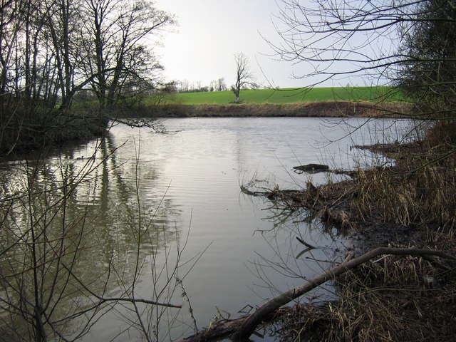
Rivers
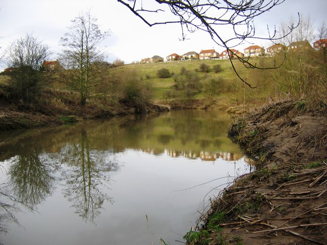
Ingleby Barwick is almost entirely surrounded by small rivers or streams. It is bordered by the Leven to the south, the Tees to the north and west, and Bassleton Beck to the east.
Demography
The United Kingdom Census 2001 found Ingleby Barwick had 5,862 households and a population of 16,280, of which 8,272 were male and 8,008 female.
Ethnic diversity is minimal in Ingleby Barwick. Over 95% of residents class themselves as White British. The population is generally younger than average for Stockton-On-Tees with a mean age of 31.87 highlighting the high proportion of families with children in the town. In 2011 however, 92% of Ingleby Barwick's 21,045 residents were White British, 5.2% Asian and 0.4% Black.
Residents of Ingleby Barwick tend to have attained a higher level of education compared with Stockton-On-Tees and nationally. Over 25% of residents reported attaining a degree or higher level HNC/HND or NVQ compared with only 15% in Stockton as a whole.
The people of Ingleby Barwick enjoy a high employment rate, with 75% reporting themselves as being in full or part-time employment or being self-employed. Of these 76% usually travel to work by car or van, travelling an average distance of 21 km. Only 2.7% get to work on foot suggesting that most of the employment is from outside of Ingleby Barwick. The largest industry of employment was manufacturing accounting for 16.6% of the workforce. 50% of those working were in roles either in professional occupations or in companies at senior managerial levels.
Continued development of the area means the population of the town is expanding dramatically. The most recent estimates put the population of Ingleby Barwick at 21,860 in 2010.
Amenities
Ingleby Barwick has numerous local amenities. Lowfields village has a primary school (Whinstone Primary School), a Post Office within the Tesco owned OneStop convenience store, a public house ("Teal Arms") and other shops/take-aways. Beckfields village contains a community centre, a public house("The Beckfields"), and a small parade of shops. Within Ingleby Barwick centre there is a Tesco store,and other shops/take-aways, a public house ("Myton House Farm"), an Anglican Church dedicated to St Francis of Assisi, and associated centre., and a Catholic church dedicated to St Therese of Lisieux. Ingleby Barwick Community Campus which includes All Saints Academy and a Library are also situated within the centre. In 1997 a Bannatyne's health club was built to the west of Tesco.
Plans have been approved for the building of a £10 million Leisure Centre, to be located alongside All Saints Academy. It will include a 25-metre swimming pool, a gym, a customer service point and the library. Preliminary work starts on 11 February 2017 and it is hoped that it will open "winter 2018/19".
Also within the estate are:
In November 2007 Stockton on Tees Borough Council approved plans to build St. Therese of Lisieux Catholic parish church next to the primary school of the same name, where services will continue to be held until funds can be obtained for the construction of the new church. In August 2014 the Diocese of Middlesbrough announced that it was soon to proceed with the building of the church. The building of the St Therese of Lisieux church started on 8 June 2015, completion expected "early 2016". Building work was completed in February 2016 and the first mass was celebrated on Saturday 5 March 2016.
Romano Park
Romano Park is situated on the land between Tesco and Barley Field primary school. The building of a play area for children under 14 years started in January 2009. Despite construction work being completed on time the official opening was delayed from the original date of July 2009.
The adjacent Multi-Use Sports Area has already been opened to the public, allowing people of all ages to play various sports, including football, basketball and tennis, but has become a magnet for anti-social behaviour.
Healthcare
Ingleby Barwick has two GP surgeries.
It has two pharmacies.
It has two dental surgeries.
It also has two optometric practices.
Library
The All Saints School complex also contains a community library which is open to the public during specified times, seven days a week. Library facilities include computer access, CD/DVD hire, photocopying, reference section, a children's and an adult library.
The Library also plays host during elections to a Polling Station, created to facilitate voting.
Shops and retailers
There are collections of local shops at Lowfields, Beckfields, Myton Park, and Sandgate Park (due to open autumn 2016 but no shops until May 2017) including:
. 1 Co-op mini supermarket at Sandgate Park
There are also 9 take-aways which are located in Lowfields, Beckfields, and Myton Park on Myton Road These include:
Transport
Road.
The A19 dual carriageway, one of the two main north -south roads of the north-east of England, is about 1.5 miles away. Access to the A66 dual carriageway, a major transpennine route, is about 2 miles away.
Bus.
Arriva operate buses in Ingleby Barwick with regular services, day & evening, to Stockton seven days a week & Middlesbrough and Yarm Monday to Saturday.
Rail.
The nearest stations, Eaglescliffe railway station, Thornaby railway station and Yarm Station are each about 4 miles away. Connections thence to the main line service at Darlington or York. Since May 2008 there has been a direct service with Grand Central Rail [http://www.grandcentralrail.com] from Eaglescliffe (EAG) to and from London (KGX), five times a day.
Air.
Durham Tees Valley Airport (MME), with regular daily services to/from Aberdeen & Amsterdam, is about 8 miles away.
Education
Primary schools
Ingleby Barwick has six primary schools:
Secondary schools
All Saints Academy
There is currently one secondary school and one under construction- All Saints Academy, Ingleby Manor Free School And Sixth Form- within Ingleby Barwick located at the centre of the estate. The school opened as All Saints Voluntary Aided Church of England Secondary School, a Church of England secondary school and initially accommodated 600 pupils. From September 2009 the admission number to year 7 has been increased to 140 pupils.
The school was built through PFI funding. The original PFI Provider (Robertson Construction North East) have recently sold the investment on to another company making a reported £1 million profit. The Evening Gazette on 22 November 2011 in an article on PFI said "Stockton Council has one PFI contract, for the Ingleby Barwick Community Campus which features All Saints School, Myton Park Primary School, and a library. The deal is worth £33.9m for the remaining 17 years of the contract. The private contractor Robertson North East says the complex is worth £9m on its website."
All Saints provides places for less than half of the children of secondary school age currently living in Ingleby Barwick, with most of the remainder, some 900, being schooled at Conyers' School in Yarm, Egglescliffe School in Eaglescliffe and St Patrick's Catholic College in Thornaby. In May 2013 All Saints school became an Academy, renaming to "All Saints Academy".
Ingleby Manor Free School and Sixth Form
Since the construction of All Saints' School, a proposal for a second secondary school with a Sixth Form, Ingleby Manor School, was developed by a group of local residents who proposed to open the school as part of the government's "Free Schools" programme.
The School has caused controversy in the local community due to a planning application for the school being tied in with a development of 350 houses on an area of green wedge land at Little Maltby Farm. On Tuesday 5 February 2013 Stockton Borough Council Planning Committee rejected the joint plans for a free school and 350 houses. Despite this the school appointed their Principal Designate, David Willard, on 4 July 2012.
The school was originally proposed to open in September 2013 with permanent buildings ready in September 2014, however this was then put back by 1 year due to the development being refused planning permission. A planning appeal was submitted to the Secretary of State for Communities and Local Government who, on 27 September 2013, overturned the local decision to refuse planning permission for the Free School and 350 houses.
Further controversy was caused in the local community after the Free School developers unveiled plans to build an additional 550 homes around the school, bringing the total number to 900 homes on area designated as green wedge land.
In September 2014 Ingleby Manor School, as a member of the School Partnership Trust Academies, now Delta Academies Trust, opened with the Year 7 group in temporary premises on Teesside Industrial Estate. Ground works for the new school eventually commenced in August 2015 on the "Little Maltby Farm" site on Low Lane. Meanwhile, the school continues to operate in the temporary premises on Teesside Industrial Estate. As at March 2016 the construction of the school buildings is progressing to schedule and a new roundabout on Low Lane to give access to the school and houses nearby is under construction. The school opened in these new premises in September 2016.
Traffic and social problems
Congestion and speeding
Ingleby Barwick faces a number of problems, including traffic congestion at peak times. These are particularly a concern around Ingleby Barwick centre, and the exit on to Low Lane. Speeding is also a significant problem within the estate. On 15 July 2011, 9-year old Brandon Maggs died after being hit by a car on Roundhill Avenue. This prompted residents to launch a campaign to reduce speeding on the main estate roads.
There is currently a project with a contractor, Lumsden & Carroll, to reduce peak period congestion in the centre of Ingleby Barwick. Myton Way is to be dualled from the Tesco roundabout to Broom Hill, and the Sandgate roundabout will be replaced with traffic signals. Ingleby Way will also be dualled from the Tesco roundabout to Barwick Way roundabout.
The works are due to start on Monday 29 February 2016 and will take approximately 40 weeks to complete. They were completed on Thursday 22 December 2016, apart from some footpath work.
Anti-social behaviour
Social problems have long been an issue in Ingleby Barwick, and were mentioned in the 1986 Domesday project. Anti-social behaviour is currently a problem on the estate, particularly around the local supermarket Tesco, other shopping areas, and Romano Park. There have been a few reported incidents of muggings and assaults on the estate between 2005 and date.
In October 2006 Ingleby Barwick councillor Lee Narroway was assaulted after confronting a gang on the estate. The estate's problems sometimes draw the attention of the council's enforcement team, who attempt to disperse groups of youths causing trouble at the local shops, and occasionally confiscating alcohol. It was reported in 2008 that 10% of all police call outs to Ingleby Barwick come from the estate's Tesco store, with both staff and customers feeling intimidated by gangs of youths loitering in the vicinity. After the completion of Romano Park in summer 2009 it has become a hot spot for antisocial behaviour, particularly around the multi-use games area. In January 2011 local schools warned parents that groups of over 100 youths, some of whom were armed, were gathering outside the estate's Tesco store engaging in anti-social behaviour and intimidating the public on evenings, and subsequently on August 2015 a man was seriously assaulted by a group of men close to the store. In January 2016 Cleveland Police issued a dispersal order around the centre of Ingleby Barwick following reports of intimidation, and missiles being thrown at vehicles, with the area being described as a hot spot for anti-social behaviour. In March 2017 police again raised concerns about trouble and intimidation be caused to members of the public around the Ingleby Barwick Tesco store. This included throwing items at vehicles and at people.
Visit the page: Ingleby Barwick for references and further details. You can contribute to this article on Wikipedia.
from Flickr (flickr)
1943 Mosquito Crash Marker, High Leven Farm, Ingleby Barwick
Pinned by Simon Cotterill

Co-Curate Page
Ingleby Barwick, 1848
- INGLEBY-BERWICK, a township, in the parish of Stainton, union of Stockton, W. division of the liberty of Langbaurgh, N. riding of York, 3¾ miles (N.E.) from Yarm; containing 138 inhabitants. …

from Flickr (flickr)
1943 Mosquito Crash Marker, High Leven Farm, Ingleby Barwick
Pinned by Simon Cotterill