Topics > Geography > Rivers > River Rede
River Rede
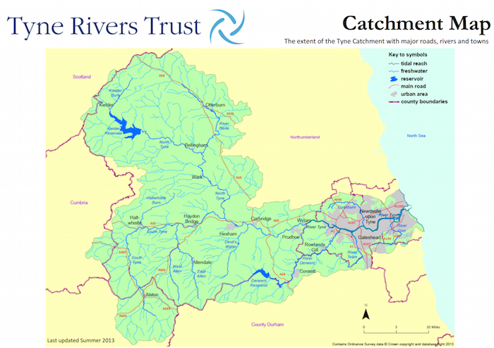
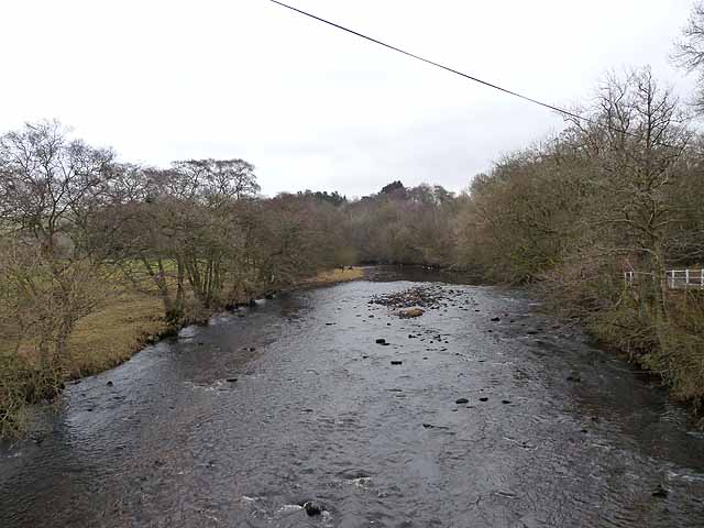
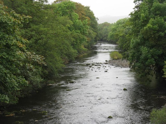
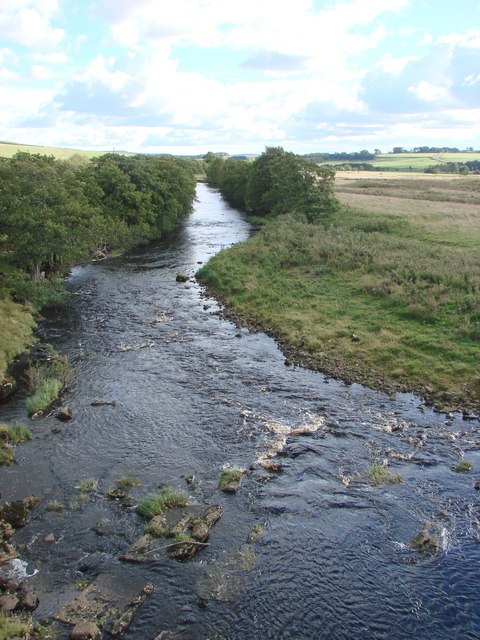
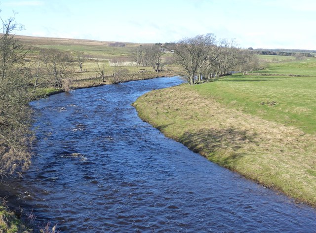
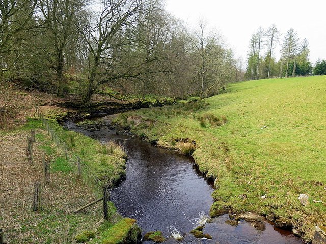
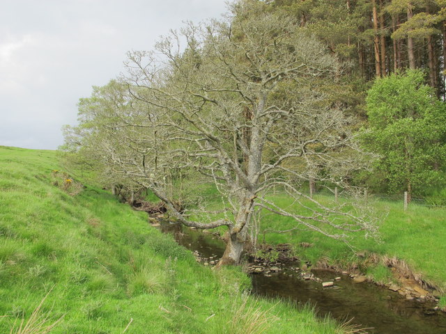
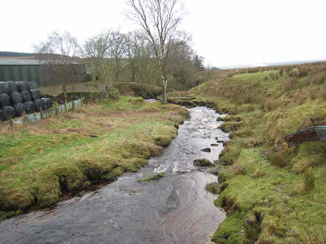
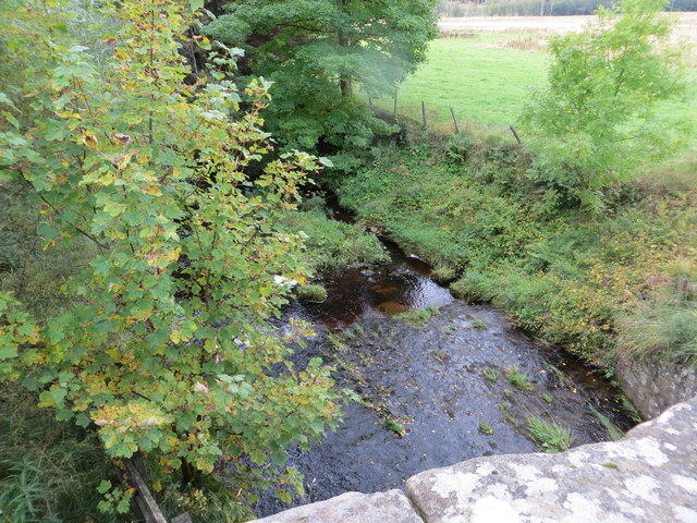
The River Rede in Northumberland is a major tributary of thr River North Tyne. The Rede is roughly 42km long and rises on Carter Fell near the boarder with Scotland. It feeds into Catcleugh Reservoir and flows past Rochester and Otterburn before joining the River North Tyne near Redesmouth.
The Rede is a river in Northumberland, England. The river rises on Carter Fell on the Anglo-Scottish border feeding Catcleugh Reservoir and joins the River North Tyne below the village of Redesmouth. The Rede is one of only two rivers in the North East of England that has the freshwater pearl mussel in its waters.
Course and toponymy
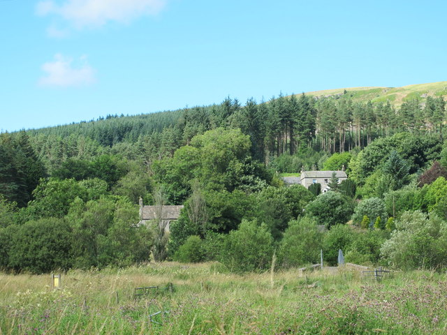
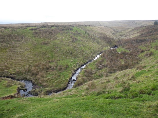
The source of the river is on Carter Fell, part of the Whitelee National Nature Reserve. It flows in a south-easterly direction and is the main feeder for the Catcleugh Reservoir which was impounded in 1901 and completed in 1905. It flows south east through Redesdale alongside the A68 road before meeting with the Otter Burn in Otterburn and heading south, before turning west at East and West Woodburn. It then heads south through Redesmouth before emptying into the River North Tyne.
The name of the river derives from the Old English Rēade, meaning the red one. The river lends its name to Redesmouth, the point where the mouth is.
Catchment and hydrometry
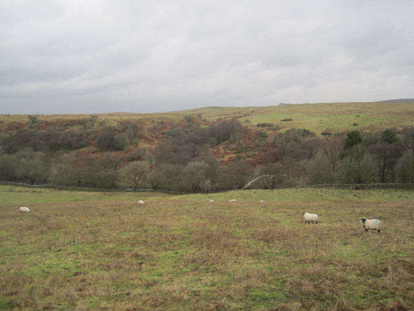
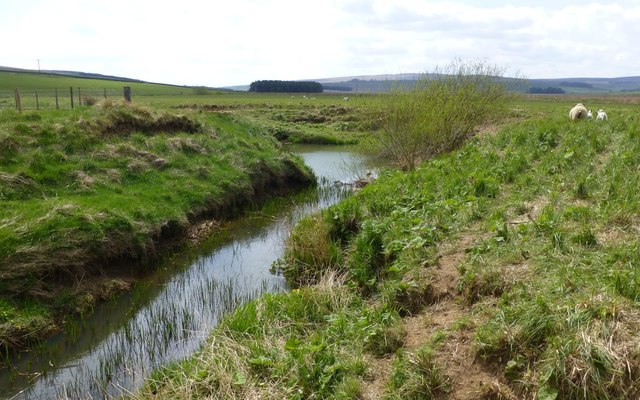
The river measures from source to Redesmouth and drains an area of . In the upper reaches, the catchment is mostly upland and is partly in the Kielder Forest Park. In the lower reaches, the landscape changes slightly to grassland and upland heath with underlying boulder clay, alluvium and peat.
Wildlife
The Rede is known for its salmon, trout and otter, which are commonly seen within its waters. The river is notable for being one of the few places in England to have a freshwater pearl mussel population, which in 2006, was estimated at 50,000 mussels across the Rede and the North Tyne. Several projects have been undertaken to help the mussel population including limiting sediment flow in the river and the introduction of freshwater trout into the river. Previously, water that was piped from Catcleugh Reservoir to Whittle Dene Reservoir (at Harlow Hill), was cleaned annual of its harmless sediment, but the waste water was pumped into the Rede. A remedial programme costing £500,000 was implemented in 2019 to stop this from happening.
The use of trout, of which 11,000 were released in 2011, is to help with the pearl mussel's life cycle. The fish were bred at the Kielder hatchery and had microscopic pearl mussel larvae attached to their gills. The programme is hopeful for repopulating parts of the river with new mussels.
Tributaries
The River Rede is the principal tributary of the North Tyne, but the watercourses listed below are the main tributaries of the River Rede
- Bateinghope Burn (r)
- Coomsden Burn (r)
- Ramsden Burn (l)
- Chattlehope Burn (r)
- Cottonshope Burn (l)
- Blakehope Burn (r)
- Bellshiel Burn (l)
- Sills Burn (l)
- Rattenraw Burn (r)
- Durtrees Burn (l)
- Dargues Burn (r)
- Otter Burn (l)
- Raylees Burn (l)
- Miller Burn (r)
- Brigg Burn (r)
- Lisles Burn (l)
- Chesterhope Burn (l)
- Broomhope Burn (l)
Visit the page: River Rede for references and further details. You can contribute to this article on Wikipedia.
from http://tyneriverstrust.org/
Tyne Rivers Trust
- "Tyne Rivers Trust has a unique role as guardian of the River Tyne Catchment, overseeing the continuing conservation and regeneration of the river from the impacts of its industrial past. …
Added by
Simon Cotterill
Co-Curate Page
River North Tyne
- Overview Bridges The River North Tyne rises near the Scottish border, north of Kielder Water. It flows through Kielder Forest, Falstone and Bellingham. It converges with the River South Tyne at Warden …

Co-Curate Page
Otterburn
- Overview About Otterburn Map Street View Otterburn is a historic village in Northumberland, on the A696 road and 50 km north west of Newcastle and 26 km from the border …
Co-Curate Page
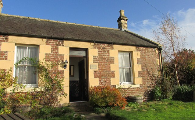
Redesmouth
- Overview About Redesmouth Map Street View Redesmouth is a village in Northumberland, England, just over 1 mile to the south-east of Bellingham. Governance Redesmouth is in the parliamentary constituency …
Co-Curate Page
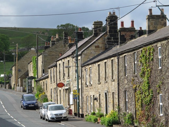
Rochester
- Overview About Rochester Map Street View Rochester is a village in Northumberland, located on the A68 road, about 5 miles north-west of Otterburn and 9½ miles south-east of the border …
Co-Curate Page
Byrness
- Overview About Byrness Map BYRNESS, a chapelry, in the parish of Elsdon, union of Rothbury, S. division of Coquetdale ward, N. division of Northumberland, 13¾ miles (N.N.W.) from Bellingham. This …
Co-Curate Page
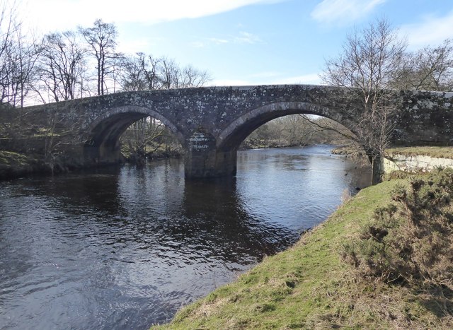
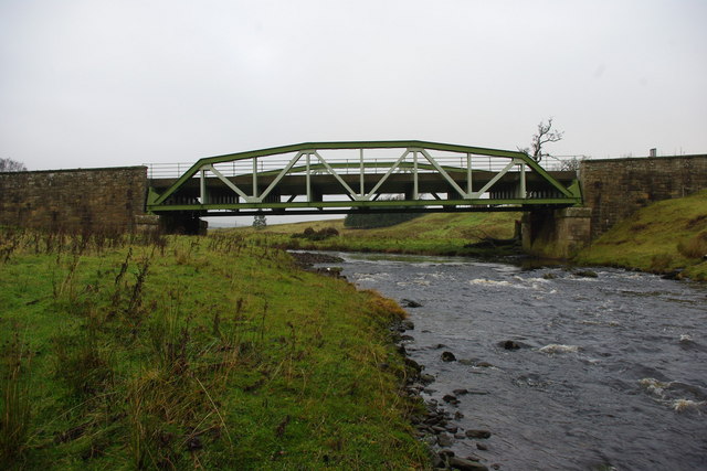
Rede Bridge, Redesmouth
- Overview Map Rede Bridge over the River Rede, is located about half a mile north of Redesmouth in Northumberland (not to be confused with the downstream Redesmouth Bridge). The stone …
Co-Curate Page
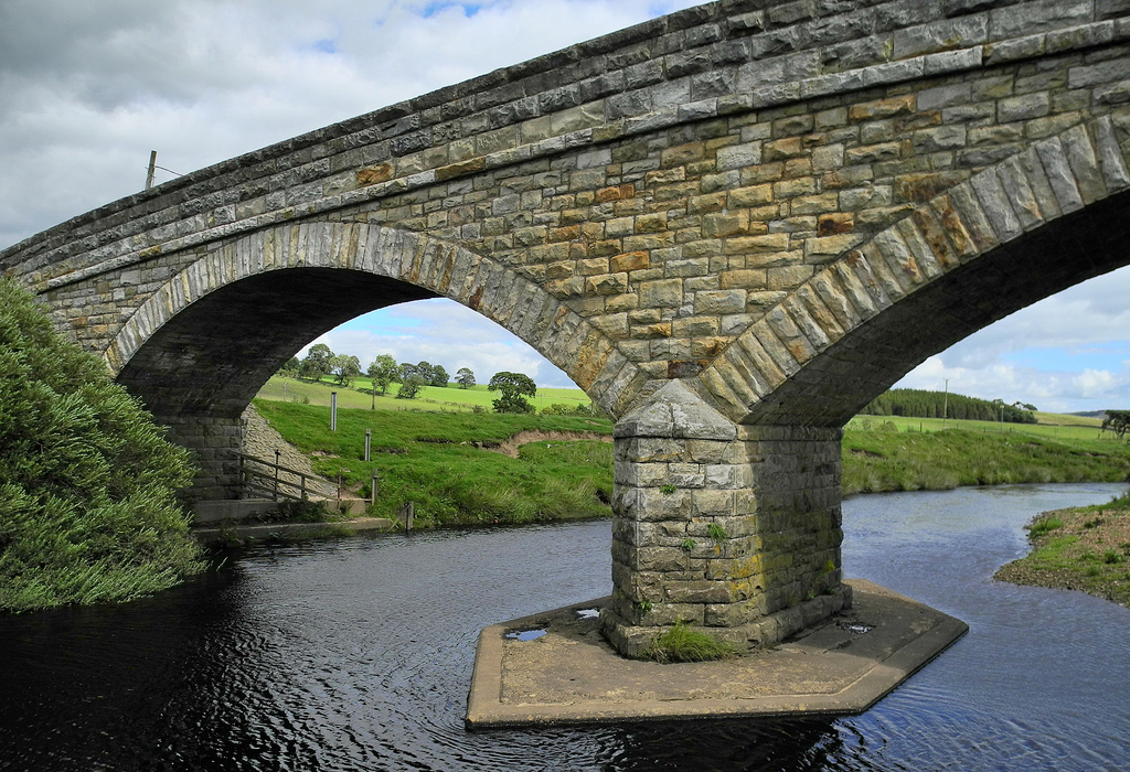
Elishaw Bridge
- Overview Map Street View Elishaw Bridge carries the A68 road over the River Rede at Elishaw in Northumberland..
Co-Curate Page
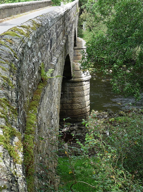
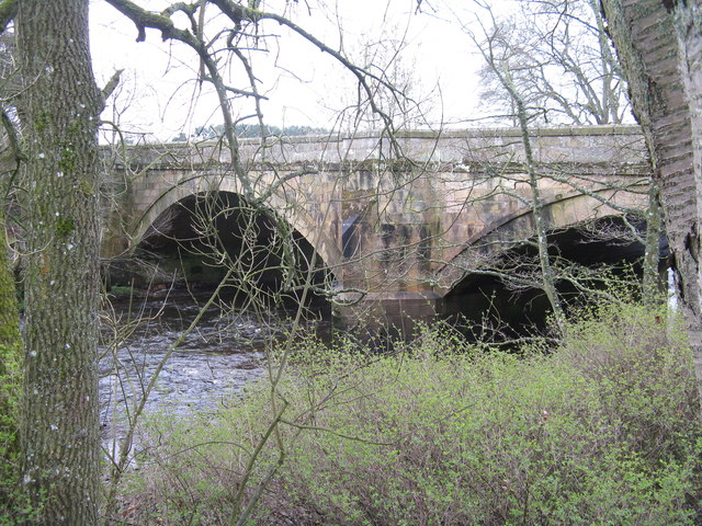
West Woodburn Bridge
- Overview Map Street View This stone bridge carries the A68 road over the River Rede at West Woodburn. The bridge was originally built in the early 19th century. It was …

from https://environment.data.gov.…
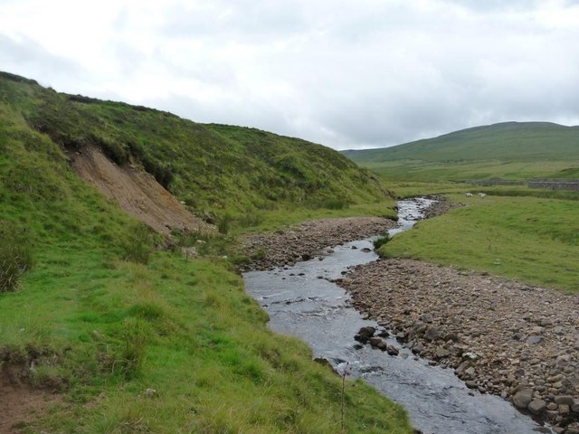
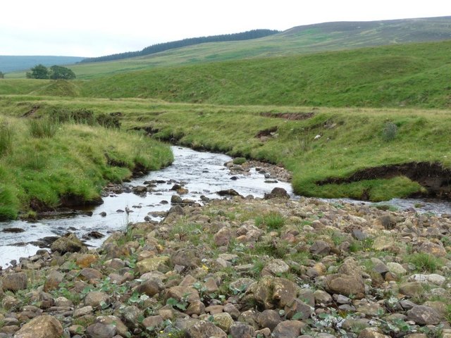
Rede from Cottonshope Burn to Bellshiel Burn
Added by
Peter Smith
Co-Curate Page
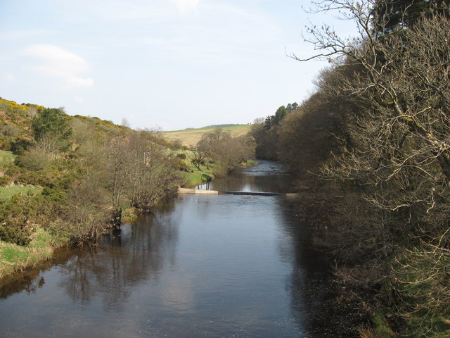
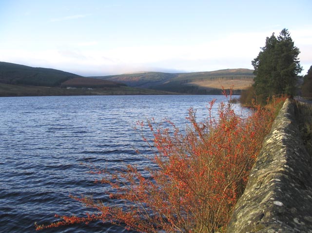
Catcleugh Reservoir
- Overview Map Street View Catcleugh Reservoir is located by the A68 road at Catcleugh, about 40 miles north-west of Newcastle. The reservoir was constructed between 1884 and 1905 for the …
Co-Curate Page
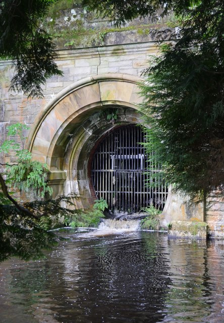
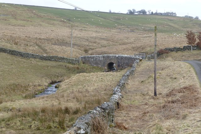
Compensation Arch, Catcleugh Reservoir
- Overview Map The compensation arch and basin carrying the River Rede at the base of the dam of Catcleugh Reseviour was built in 1899 by T. & C. Hawksley for …

Co-Curate Page
Remains of Railway Bridge, Catcleugh
- There are the remains of a bridge over the River Rede a short distance east of Catcleugh Resevoir. These are the remnants of bridge bases for a 3' gauge railway …

Co-Curate Page
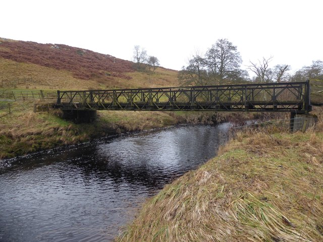
Bridge over the River Rede, Blakehopeburnhaugh
- Overview Map Street View This bridge carryies the Pennine Way over the River Rede, north of the farm at Blakehopeburnhaugh.


from http://tyneriverstrust.org/
Tyne Rivers Trust
- "Tyne Rivers Trust has a unique role as guardian of the River Tyne Catchment, overseeing the continuing conservation and regeneration of the river from the impacts of its industrial past. …
Added by
Simon Cotterill
Co-Curate Page
River North Tyne
- Overview Bridges The River North Tyne rises near the Scottish border, north of Kielder Water. It flows through Kielder Forest, Falstone and Bellingham. It converges with the River South Tyne at Warden …
Co-Curate Page
Otterburn
- Overview About Otterburn Map Street View Otterburn is a historic village in Northumberland, on the A696 road and 50 km north west of Newcastle and 26 km from the border …
Co-Curate Page
Redesmouth
- Overview About Redesmouth Map Street View Redesmouth is a village in Northumberland, England, just over 1 mile to the south-east of Bellingham. Governance Redesmouth is in the parliamentary constituency …
Co-Curate Page
Rochester
- Overview About Rochester Map Street View Rochester is a village in Northumberland, located on the A68 road, about 5 miles north-west of Otterburn and 9½ miles south-east of the border …
Co-Curate Page
Byrness
- Overview About Byrness Map BYRNESS, a chapelry, in the parish of Elsdon, union of Rothbury, S. division of Coquetdale ward, N. division of Northumberland, 13¾ miles (N.N.W.) from Bellingham. This …
Co-Curate Page
Rede Bridge, Redesmouth
- Overview Map Rede Bridge over the River Rede, is located about half a mile north of Redesmouth in Northumberland (not to be confused with the downstream Redesmouth Bridge). The stone …
Co-Curate Page
Elishaw Bridge
- Overview Map Street View Elishaw Bridge carries the A68 road over the River Rede at Elishaw in Northumberland..
Co-Curate Page
West Woodburn Bridge
- Overview Map Street View This stone bridge carries the A68 road over the River Rede at West Woodburn. The bridge was originally built in the early 19th century. It was …
from https://environment.data.gov.…
Rede from Cottonshope Burn to Bellshiel Burn
Added by
Peter Smith
Co-Curate Page
Catcleugh Reservoir
- Overview Map Street View Catcleugh Reservoir is located by the A68 road at Catcleugh, about 40 miles north-west of Newcastle. The reservoir was constructed between 1884 and 1905 for the …
Co-Curate Page
Compensation Arch, Catcleugh Reservoir
- Overview Map The compensation arch and basin carrying the River Rede at the base of the dam of Catcleugh Reseviour was built in 1899 by T. & C. Hawksley for …
Co-Curate Page
Remains of Railway Bridge, Catcleugh
- There are the remains of a bridge over the River Rede a short distance east of Catcleugh Resevoir. These are the remnants of bridge bases for a 3' gauge railway …
Co-Curate Page
Bridge over the River Rede, Blakehopeburnhaugh
- Overview Map Street View This bridge carryies the Pennine Way over the River Rede, north of the farm at Blakehopeburnhaugh.

Geography

Rivers
Bellshiel Burn

Blakehope Burn

Chattlehope Burn
Chesterhope Burn
Cleughbrae Burn

Cottonshope Burn
Dargues Burn
Durtrees Burn
Elsdon Burn
Lisles Burn
Lumsdon Burn
Miller Burn (Rede)
Otter Burn (river)

Rattenraw Burn
Sills Burn
Spithope Burn
Wind Burn (Rede)