Topics > County Durham > Cornriggs > Heatherycleugh Bridge
Heatherycleugh Bridge
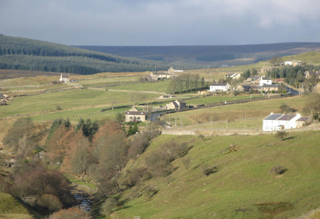
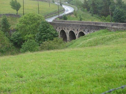
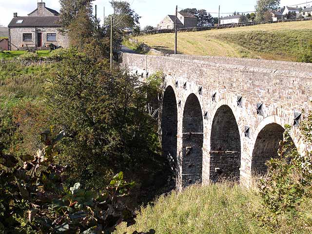
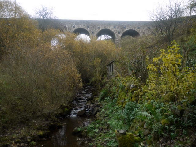
Heatherycleugh Bridge carries School Hill road (part of the A689) over the steep valley of the Heathery Cleugh (a stream), shortly before it flow into Killhope Burn. The arched stone bridge is located between Lanehead and Cornriggs in Upper Weardale. The bridge was built c.1810 and is Grade II listed.

from https://www.historicengland.o…
HEATHERY CLEUGH BRIDGE, OVER HEATHERY CLEUGH - List Entry
- "Bridge over Heathery Cleugh. Circa 1810. Irregular courses of squared sandstone with ashlar dressings and rubble coping. 5 very tall segmental- headed arches on tapered piers have 2 rows of …
Added by
Simon Cotterill
Co-Curate Page
Lanehead
- Overview About Lanehead Map Street View Lanehead is a village in County Durham, located by Killhope Burn, near the top of Weardale, and close to the county border with Cumbria. …

from https://www.historicengland.o…
HEATHERY CLEUGH BRIDGE, OVER HEATHERY CLEUGH - List Entry
- "Bridge over Heathery Cleugh. Circa 1810. Irregular courses of squared sandstone with ashlar dressings and rubble coping. 5 very tall segmental- headed arches on tapered piers have 2 rows of …
Added by
Simon Cotterill