Topics > Northumberland > Kielder > Kielder Viaduct

Kielder Viaduct


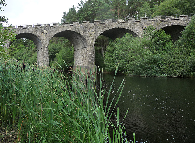
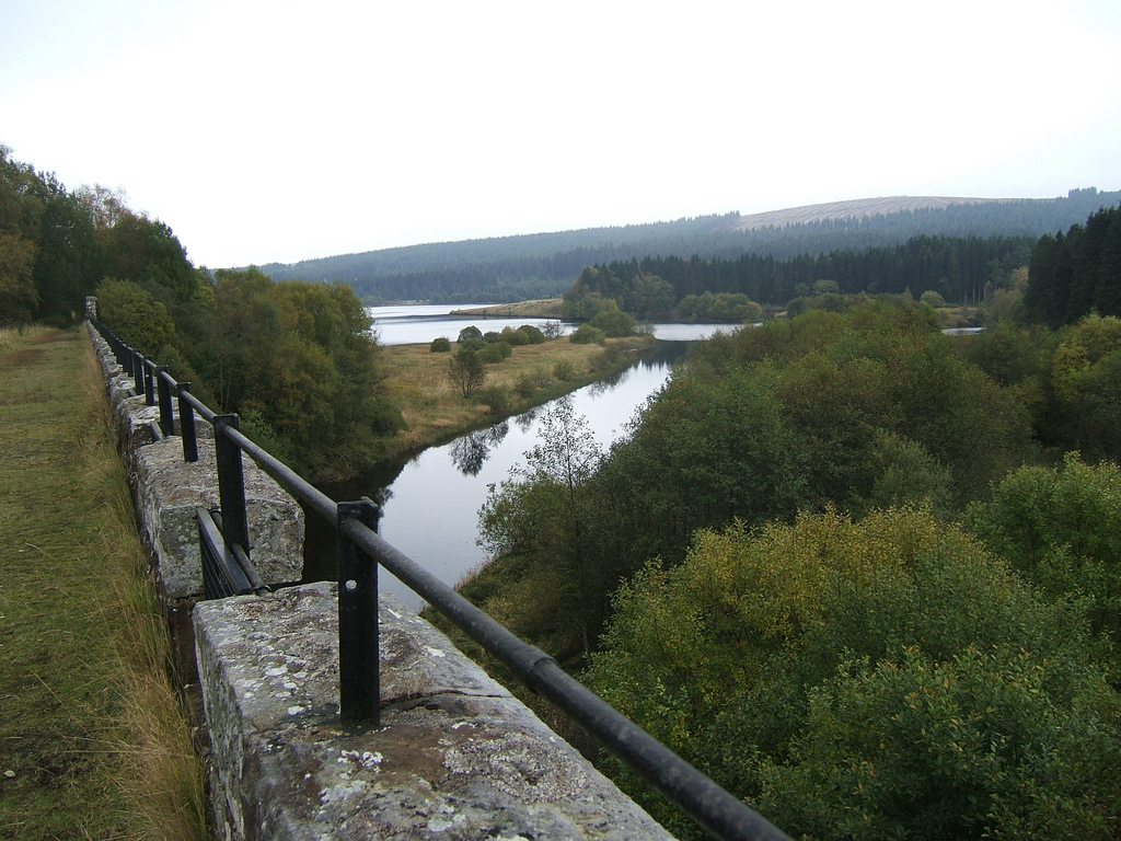
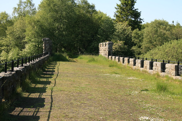
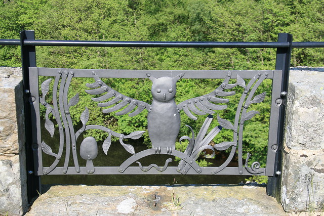
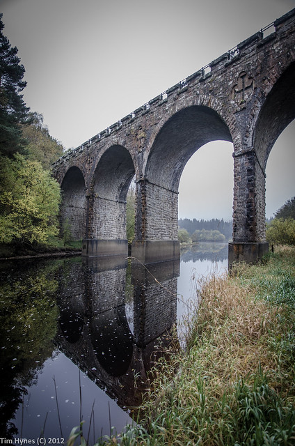
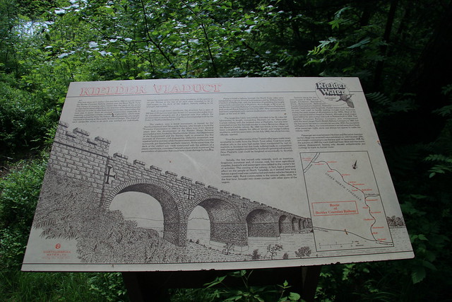
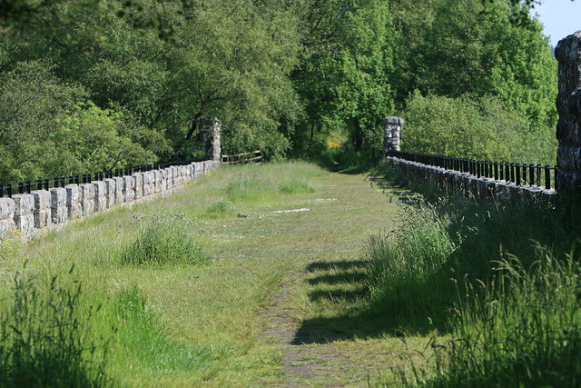
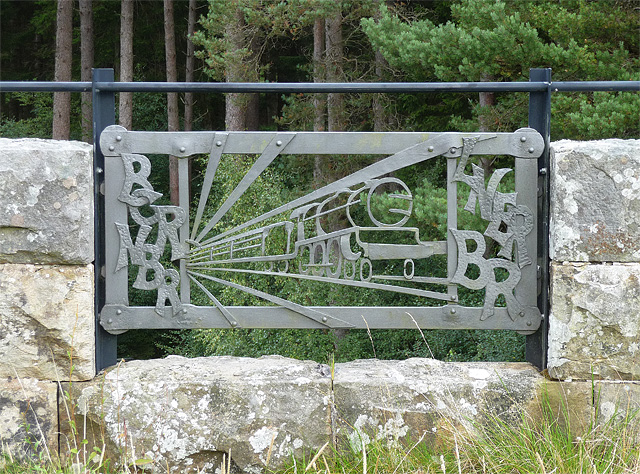
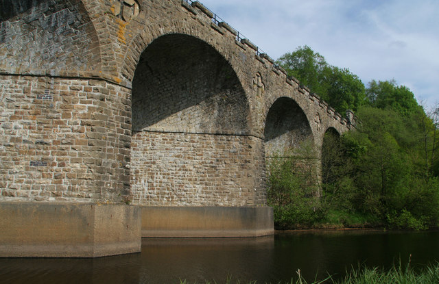
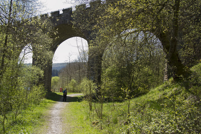
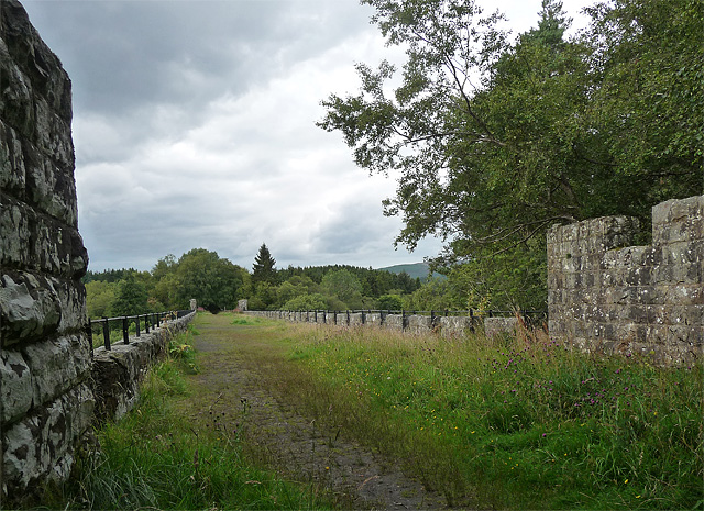
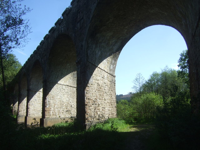
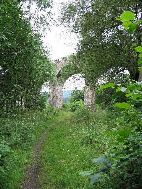
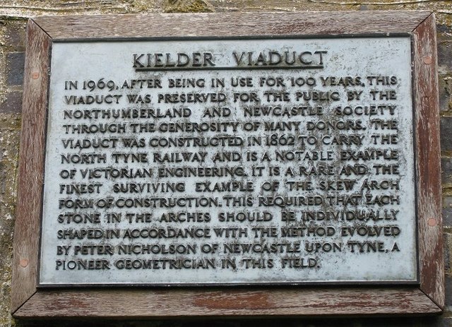
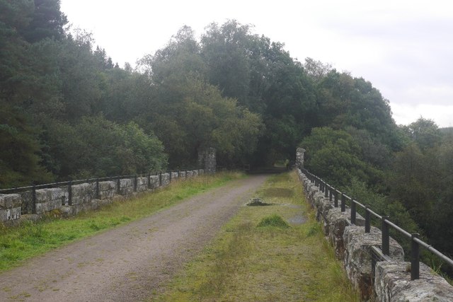
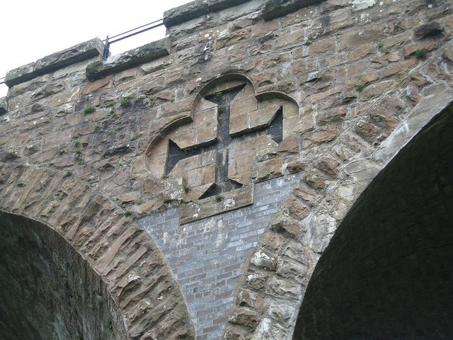
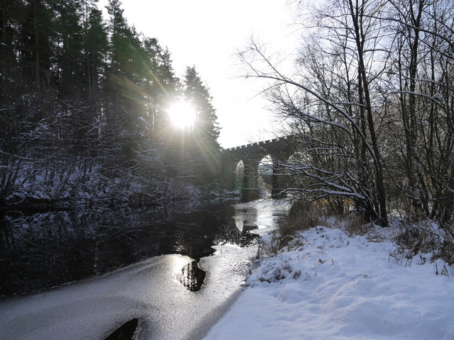
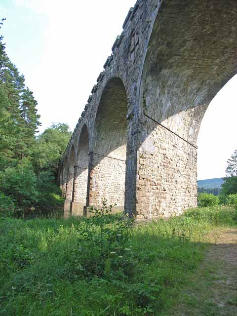
Kielder Viaduct spans the River North Tyne just north of Bakethin Reservoir and Kielder Water. It once carried the Border Counties Railway. The viaduct was completed in 1862 and designed by John Furness Tone, with Peter Nicholson devising the method for shaping the stone for the skew arch, with William Hutchison as the contractor. The railway over the viaduct was closed to passengers in 1956 and to freight in 1958. The viaduct is a listed structure.

Kielder 1862 Historic Buildings and Monuments in Kielder Civil Parish River North Tyne Bridges
from Geograph (geograph)
Kielder Viaduct near Kielder (1)

Pinned by Simon Cotterill
from Flickr (flickr)
Kielder 300

Pinned by Simon Cotterill
from Flickr (flickr)
IMG_5400

Pinned by Simon Cotterill
from Flickr (flickr)
IMG_5398

Pinned by Simon Cotterill
from Flickr (flickr)
Kielder Viaduct

Pinned by Simon Cotterill
from Flickr (flickr)
Kielder Viaduct

Pinned by Simon Cotterill
from Flickr (flickr)
IMG_5408

Pinned by Simon Cotterill
from Flickr (flickr)
IMG_5387

Pinned by Simon Cotterill
from https://historicengland.org.u…
Kielder Viaduct - List Entry
- "The monument includes the remains of a mid 19th century railway viaduct which spans the River North Tyne shortly before it enters Bakethin Reservoir. The multi span viaduct which once …

Added by
Simon Cotterill
from Geograph (geograph)
Kielder Viaduct

Pinned by Peter Smith
from Geograph (geograph)
Detail of Kielder Viaduct near Kielder

Pinned by Peter Smith
from Geograph (geograph)
Artwork, Kielder Viaduct

Pinned by Peter Smith
from Geograph (geograph)
Kielder Viaduct

Pinned by Peter Smith
from Geograph (geograph)
The Kielder Viaduct

Pinned by Peter Smith
from Geograph (geograph)
Panel on the Kielder Viaduct

Pinned by Peter Smith
from Geograph (geograph)
Panel, Kielder Viaduct

Pinned by Peter Smith
from Geograph (geograph)
Kielder Viaduct near Kielder (2)

Pinned by Peter Smith
from Geograph (geograph)
Kielder Viaduct

Pinned by Peter Smith
from Geograph (geograph)
Kielder Forest, Butteryhaugh

Pinned by Peter Smith
from Geograph (geograph)
Kielder Viaduct

Pinned by Peter Smith
from Geograph (geograph)
Trackbed, Border Counties Railway

Pinned by Peter Smith
from Geograph (geograph)
Kielder Viaduct Information Plaque

Pinned by Peter Smith
from Geograph (geograph)
Kielder Viaduct

Pinned by Peter Smith
from Geograph (geograph)
Kielder Viaduct Detail

Pinned by Peter Smith
from Geograph (geograph)
Kielder Viaduct

Pinned by Peter Smith
from Geograph (geograph)
Kielder Viaduct

Pinned by Peter Smith
from Geograph (geograph)
Not this way please!

Pinned by Peter Smith
River North Tyne
  Co-Curate Page
River North Tyne
- Overview Bridges The River North Tyne rises near the Scottish border, north of Kielder Water. It flows through Kielder Forest, Falstone and Bellingham. It converges with the River South Tyne at Warden …

Comments

Add a comment or share a memory.

Login to add a comment. Sign-up if you don't already have an account.


ABOUT US

Co-Curate is a project which brings together online collections, museums, universities, schools and community groups to make and re-make stories and images from North East England and Cumbria. Co-Curate is a trans-disciplinary project that will open up 'official' museum and 'un-officia'l co-created community-based collections and archives through innovative collaborative approaches using social media and open archives/data.

LATEST SHARED RESOURCES