Topics > Geography > Rivers > River Tees
River Tees
|
|
Major Tributaries: |
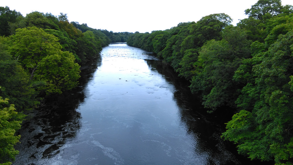
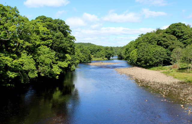
 The Tees is one of the major rivers in the North of England. It rises on Cross Fell in the North Pennines, and flows 137 km to the North Sea between
 | Bridge | Type / Road | Place(s) | Opened | Note. |
| Moor House Bridge | Footbridge | |||
| Birkdale Footbridge | Footbridge | 1966 | ||
| Cronkley Bridge | Road (private) | |||
| Holwick Head Footbridge | Footbridge | |||
| Winch Footbridge | Footbridge | Holwick | c.1820 | Grade II* Listed |
| Scoberry Footbridge | Footbridge | |||
| Middleton Bridge | B6277 road | Middleton-in-Teesdale | c.1800 | Grade II* Listed |
| Beckstones Wath Footbridge | Footbridge | |||
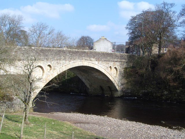
| Eggleston Bridge | B6281 road | Eggleston | C17th | Grade II* Listed |
| Cotherstone Footbridge | Footbridge | Cotherstone | 1932 | |
| Deepdale Footbridge | Footbridge & Water pipes | Barnard Castle | 1898 | Grade II Listed |
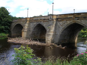
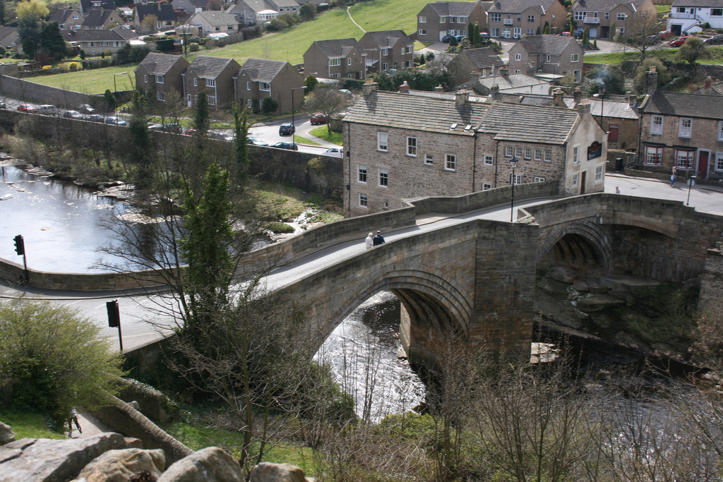
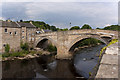
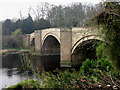
| Barnard Castle Bridge | A67 road | Barnard Castle | C14th | Grade I Listed |
| Thorngate Footbridge | Footbridge | |||
| Abbey Bridge | Road | nr Egglestone Abbey | 1773 | Grade II* Listed |
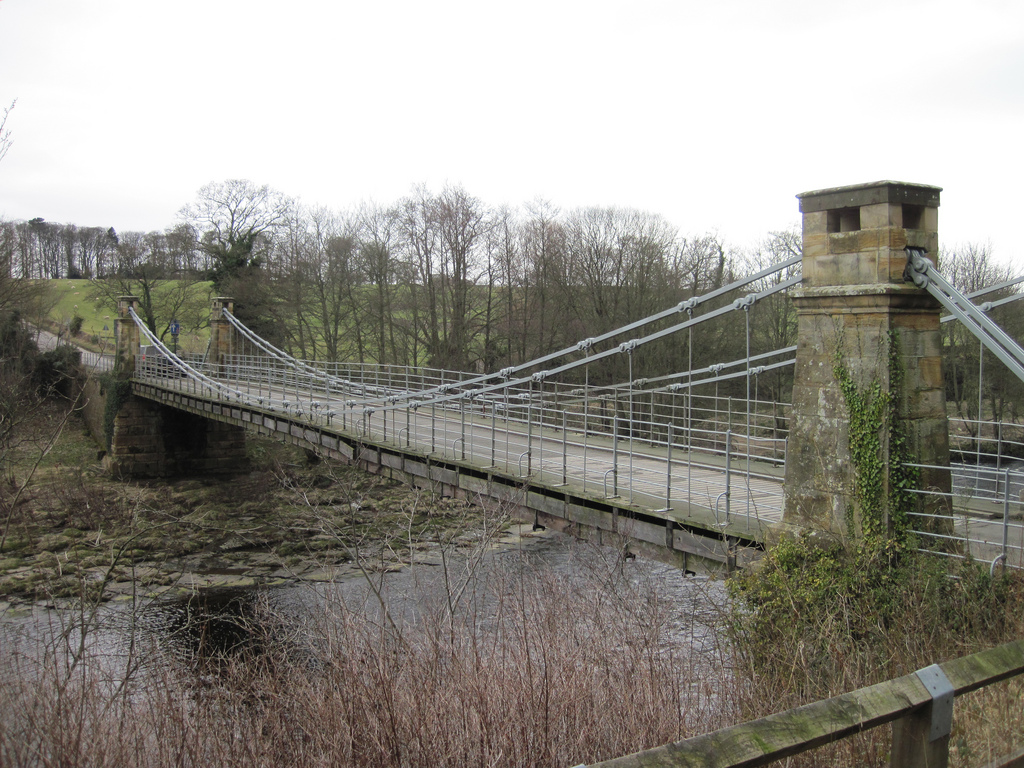
| Whorlton Suspension Bridge | Road | Whorlton | 1831 | Grade II* Listed |
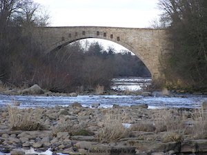
| Winston Bridge | B6274 road | Winston |
1763 | Grade II* Listed |
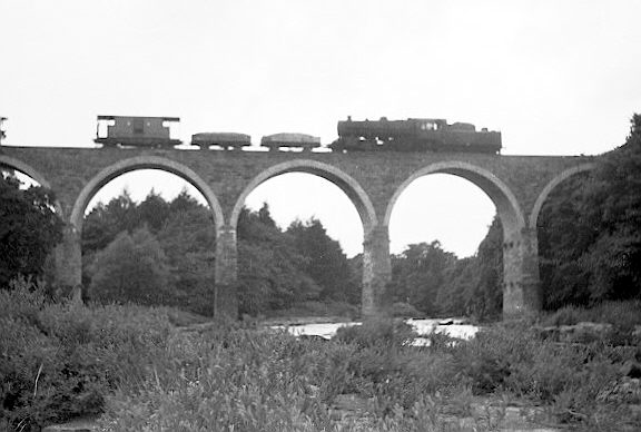
| West Tees Railway Bridge | Rail (disused) | |||
| Gainford Railway Bridge | Rail (disused) | |||
| Barforth Hall Bridge | Road (private) | |||
| Piercebridge Pipe Bridge | Water pipe | Piercebridge | ||
| Piercebridge Bridge | B6275 road | Cliffe - Piercebridge | C16th | |
| Roman Bridge (remains) | Dere Street (Roman road) | Piercebridge | C3rd | Remains only |
| A1(M) Bridge | A1 road | Low Coniscliffe | ||
| Blackwell Bridge | A66 road | |||
| Croft Road Bridge | A167 road | |||
| Tees Bridge | Rail (East Coast Mainline) | |||
| Low Hail Bridge | Road (private) | |||
| Neasham Hall Bridge | Footbridge (private) | |||
| Girsby Bridge | Footbridge | |||
| Fishlocks Bridge | Footbridge (private) | |||
| Over Dinsdale Bridge | Road | |||
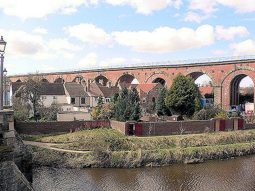
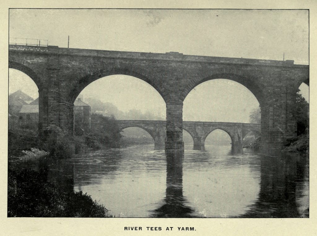
| Yarm Railway Viaduct | Rail (North TransPennine Line) | Yarm | 1851 | Grade II Listed |
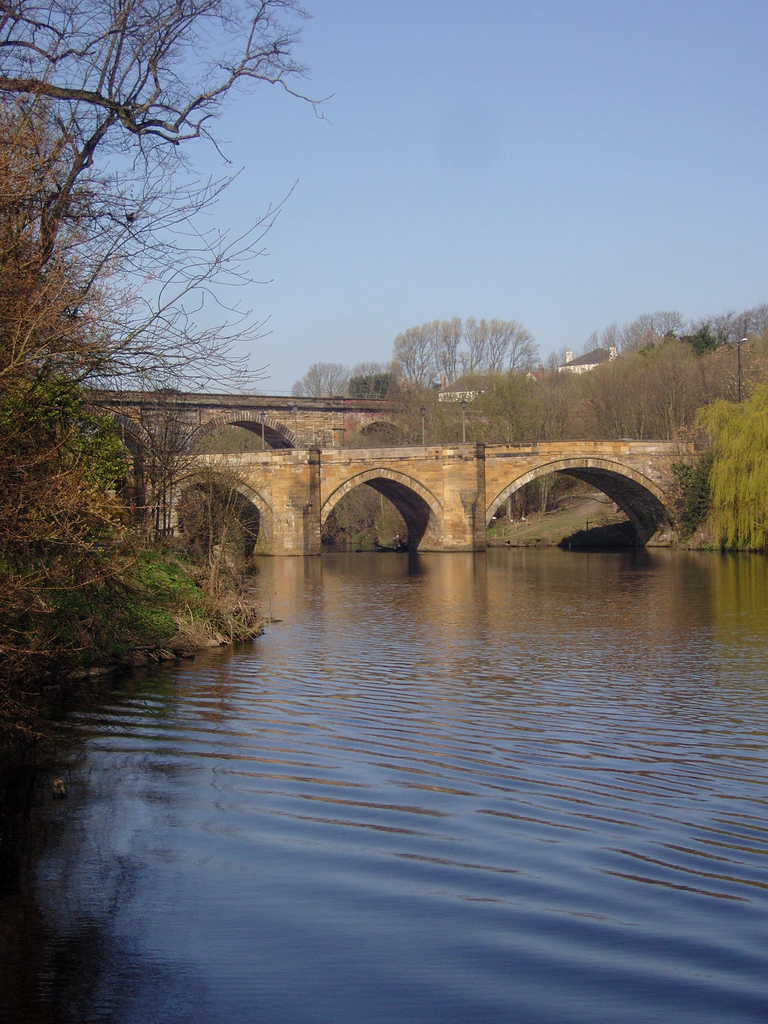
| Yarm Road Bridge | A67 road | Yarm - Egglescliffe | c.1400 | Grade II* Listed |
| Preston Pipe Bridge | water pipe | |||
| Jubilee Bridge | Queen Elizabeth Way | |||
| Surtees Bridge | A66 road | |||
| Surtees Rail Bridge | Rail (Tees Valley line) | |||
| Victoria Bridge | A1130 road | |||
| Teesquay Millennium Footbridge | ||||
| Princess of Wales Bridge | Teesdale Boulevard | |||
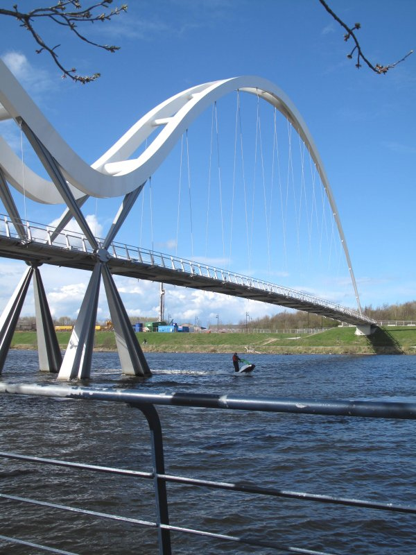
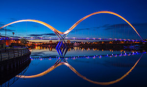
| Infinity Bridge | Foot & Cycle | Thornaby - Stockton-on-Tees | 2008 | |
| Tees Barrage | ||||
| Tees Viaduct | A19 road | |||
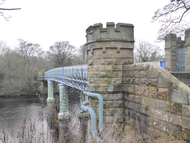
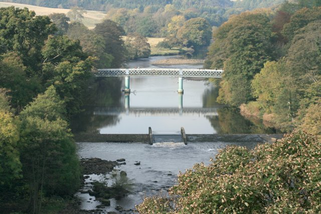
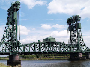
| Tees Newport Bridge | A1032 road | Middlesbrough - Stockton Brgh. | 1934 | Grade II Listed |
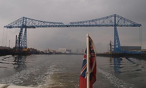
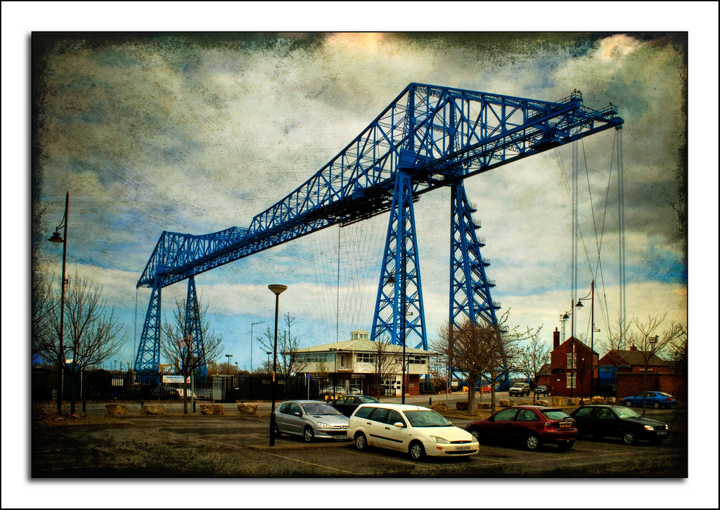
| Tees Transporter Bridge | A178 road (by gondola) | Middlesbrough - Port Clarence | 1911 | Grade II* Listed |
The River Tees is in northern England. It rises on the eastern slope of Cross Fell in the North Pennines, and flows eastwards for 85 miles (137 km) to reach the North Sea between Hartlepool and Redcar near Middlesbrough.
Geography
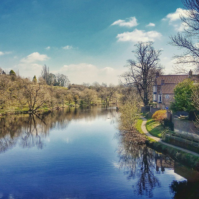
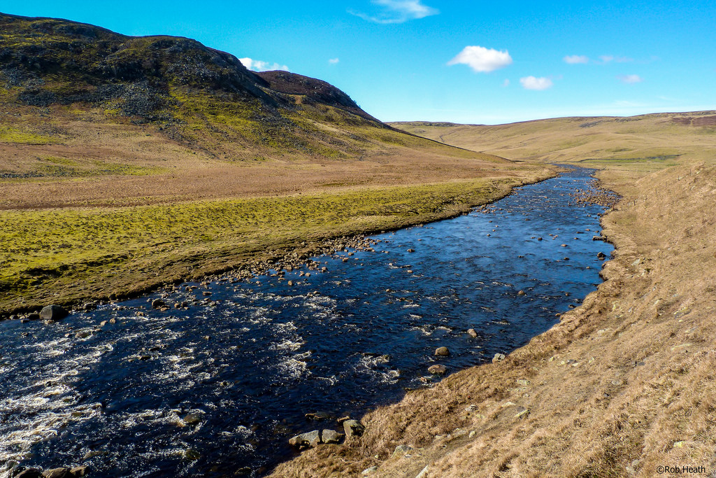
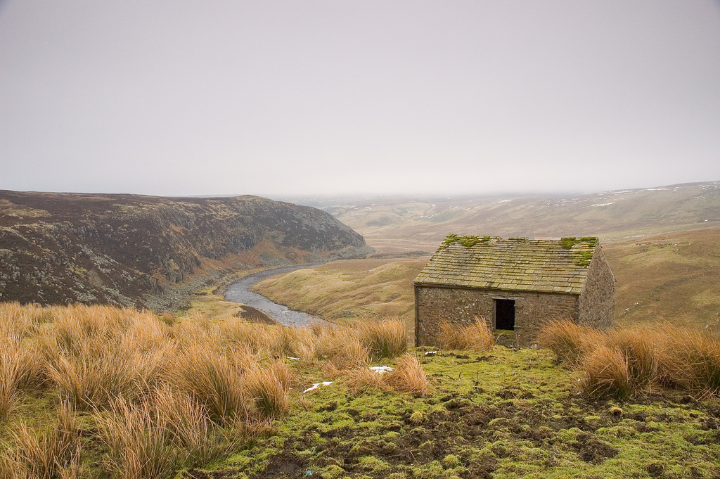
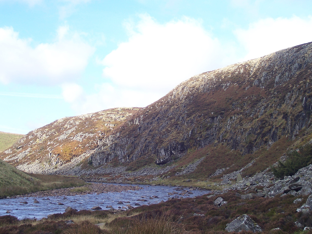
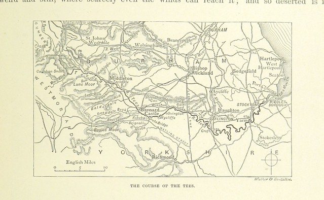
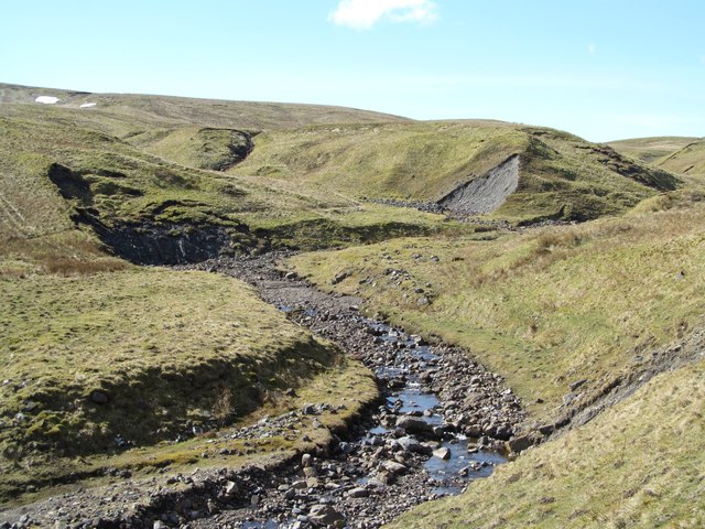
The river drains 710 square miles (1834 km2) and has a number of tributaries including the River Greta, River Lune, River Balder, River Leven and River Skerne. Before the reorganisation of the historic English counties, the river formed the boundary between County Durham and Yorkshire. In its lower reaches it now forms the boundary between the ceremonial counties of County Durham and North Yorkshire, while in the highest part of its course it forms the boundary between the historic counties of Westmorland and Durham. The head of the valley, whose upper portion is known as Teesdale, has a desolate grandeur, surrounded by moorland and hills, some exceeding 2,500 feet (762 m). This area is part of the North Pennine Area of Outstanding Natural Beauty.
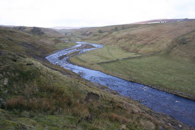
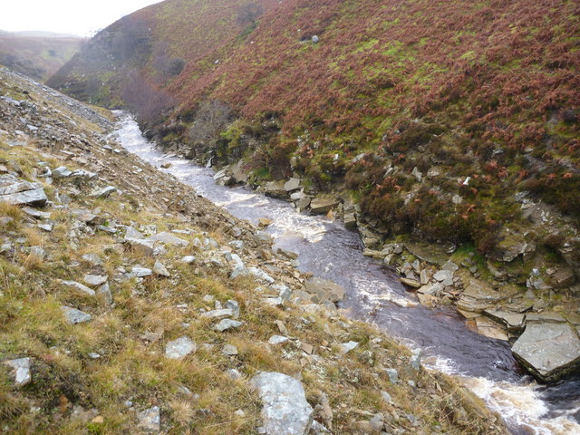
The source of the river at Teeshead just below Cross Fell lies at an elevation of approximately . It flows east-north-east through an area of shake holes through Carboniferous Limestone. Below Viewing Hill, it turns south to the Cow Green Reservoir constructed to store water to be released in dry conditions to satisfy the industrial need for water on Teesside.
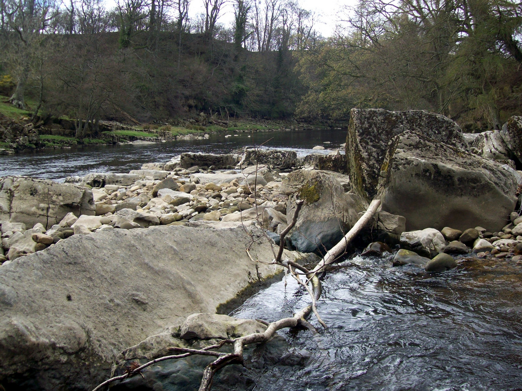
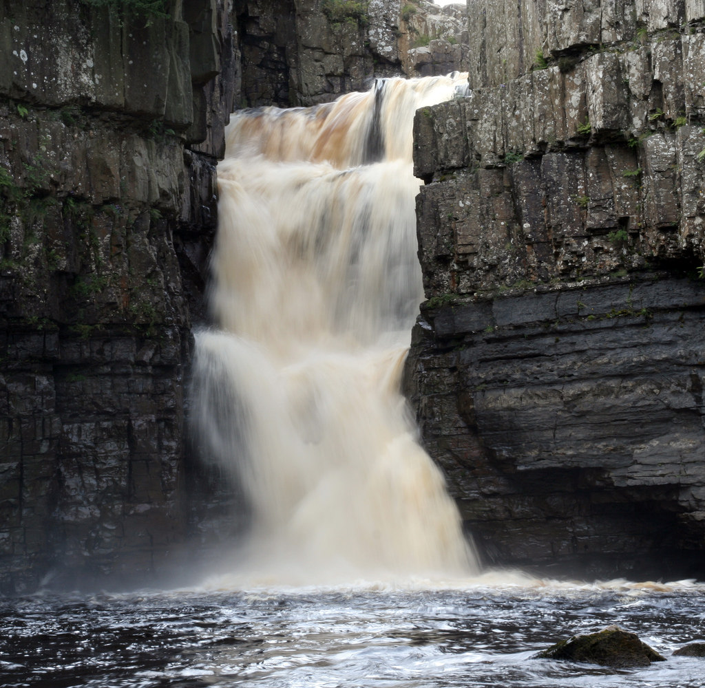
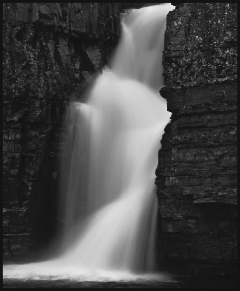
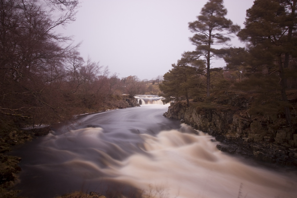
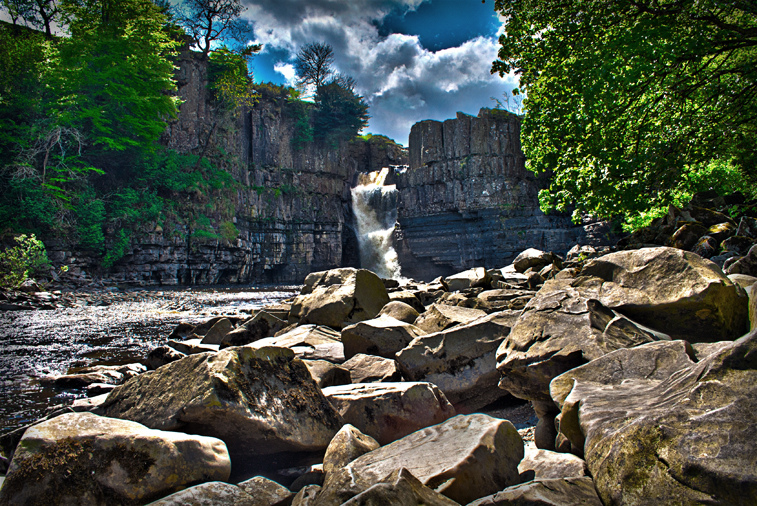
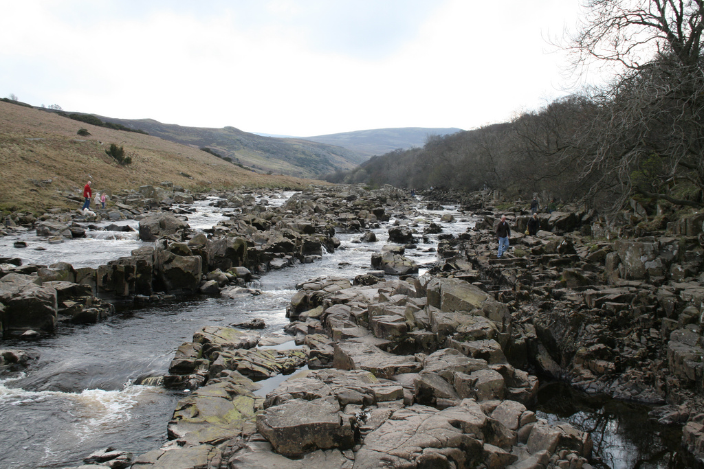
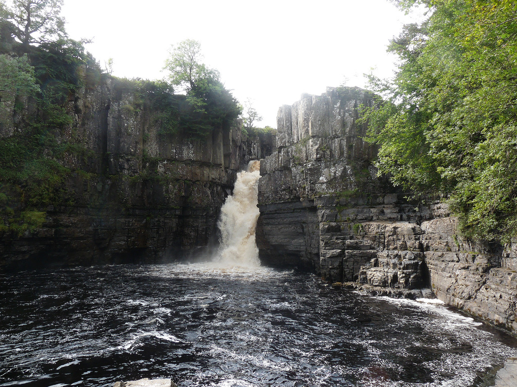
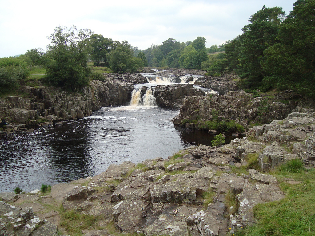
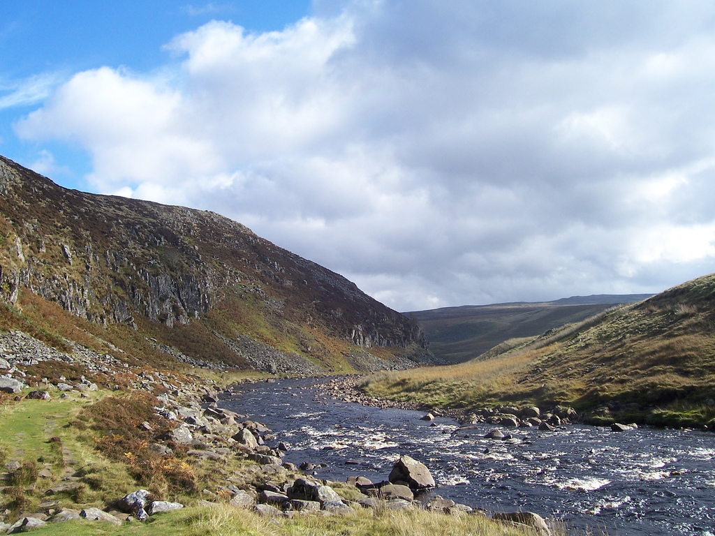
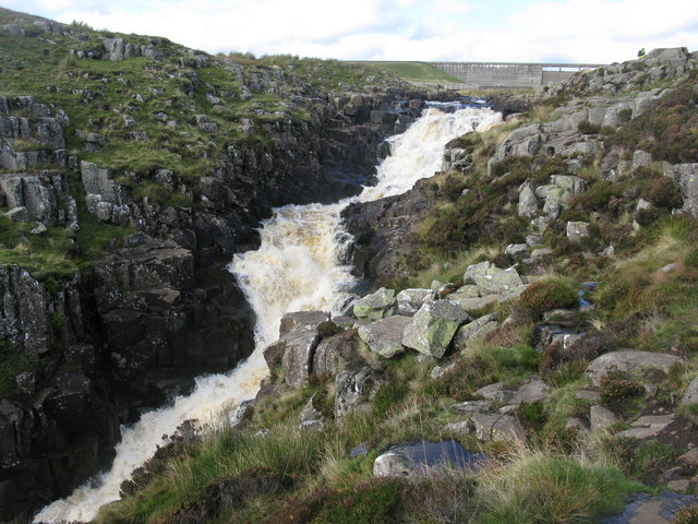
Emerging from the reservoir at Cauldron Snout the river traverses a series of hard black basalt and dolerite rocks that intrude through the softer limestone, in a succession of falls or rapids. From this point downstream the Tees forms the boundary between the traditional counties of Durham and Yorkshire almost without a break, although since 1974 much of it lies wholly in Durham. The dale widens below Cauldron Snout, and trees appear, contrasting with the broken rocks where the water descends over High Force. After a short turn northwards, the river continues to meander south-easterly. Close to where the B6277 road begins to run parallel to the river is the High Force waterfall. About downstream is the smaller Low Force waterfall.
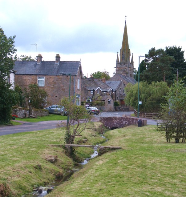
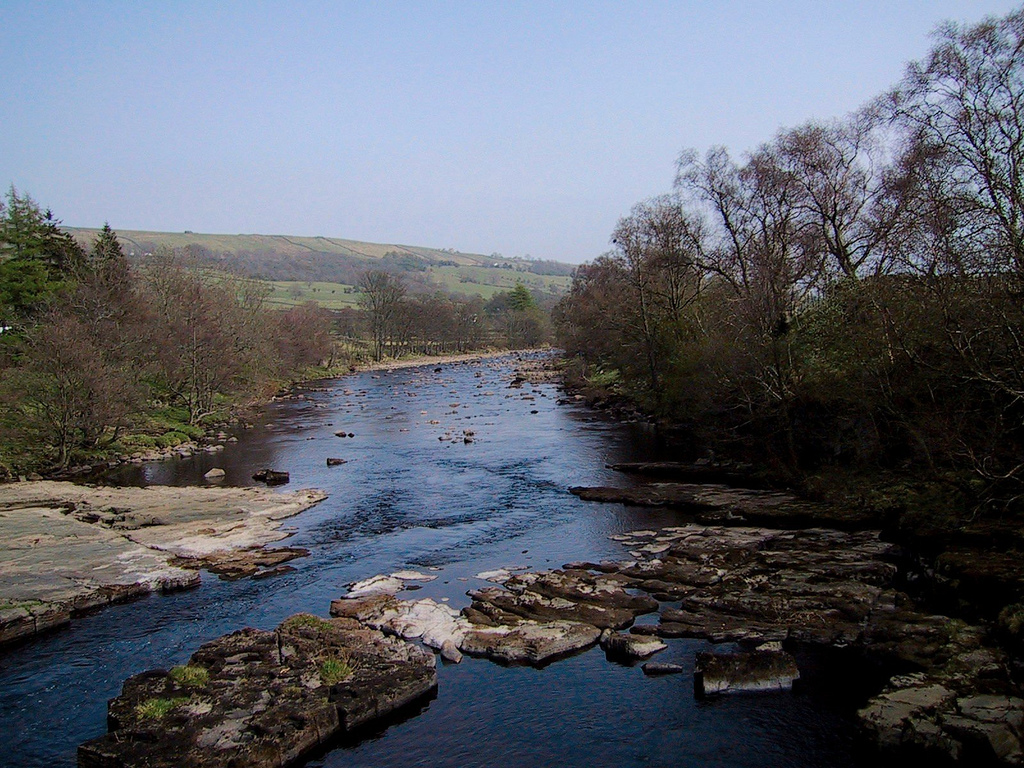
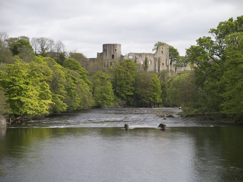
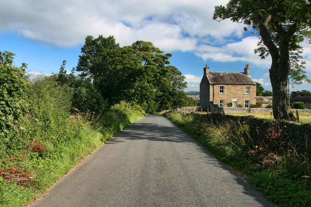
The scenery becomes gentler and more picturesque as the river descends past Middleton-in-Teesdale (Durham). This locality has lead and ironstone resources. Just to the east of Middleton-in-Teesdale, the River Lune joins the Tees. After passing the village of Romaldkirk to the west, the river is joined by the River Balder at Cotherstone. The ancient town of Barnard Castle, Egglestone Abbey, and Rokeby Park, well known through Sir Walter Scott's poem, are all passed. At Rokeby the Tees is joined by the River Greta. From the area near Eggleston, the river is crossing over millstone grit. From here the valley begins to open out, and traverses the rich plain east and south of Darlington in large meandering curves.
The course of the valley down to here has been generally east-south-east, but it now turns north-east near the village of Whorlton. Passing Ovington and Winston it runs parallel to the A67 south-east past Gainford and Piercebridge to Darlington, passing under the A1 and A66. The section from Piercebridge to Hurworth flows over magnesian limestone. It is at Croft-on-Tees that the River Skerne joins the Tees. The river now flows south past Croft-on-Tees before swinging northwards past Hurworth-on-Tees. A series of large meanders takes the course past Neasham, Low Dinsdale and Sockburn to Middleton St George. In the lower reaches of the river valley the water flows over bunter sandstone and pebble beds.
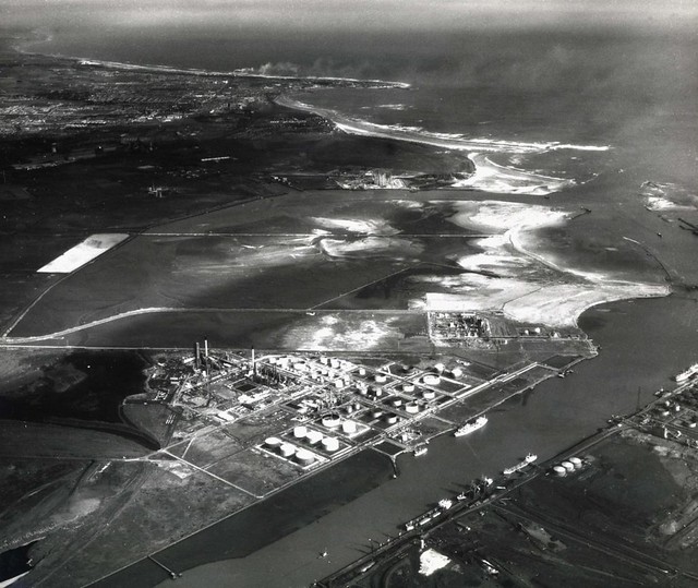
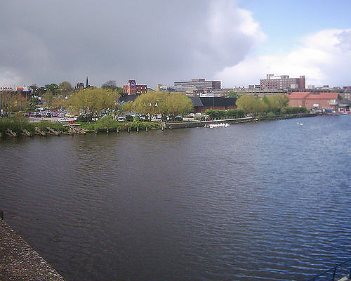
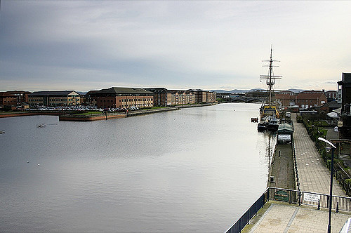
Just past Yarm, the River Leven joins the Tees, before passing the settlements of Eaglescliffe, Ingleby Barwick and Thornaby-on-Tees. Now nearing the sea, the Tees becomes an important commercial waterway, with the ports of Stockton-on-Tees and Middlesbrough on its banks. It passes through the Tees Barrage between these ports, turning tidal downstream from the barrage.
Teesport is built on reclaimed land on the south side of the Tees estuary below Middlesbrough.
Seal Sands
Before the heavy industrialisation of the Tees, the flats at Seal Sands in the estuary were home to common seals. For around 100 years this species was absent from the estuary but have now returned and can be seen on the flats at Seal Sands. The Seal Sands area is now designated as the Teesmouth National Nature Reserve.
Alterations
In the early 19th century the river was straightened, thus saving time and money in navigation. Between Stockton-on-Tees and Middlesbrough, the river previously meandered first south and then north of its current channel. Two "cuts", known as the Mandale Cut and the Portrack Cut, were made to straighten its course. Before these cuts were made, the journey by sailing barge from Thornaby to Middlesbrough, allowing for tides and other factors, could take as long as the journey from the mouth of the Tees to London. The Mandale Cut was the shorter of the two, at about , with the Portrack Cut being considerably longer, although the northern meander it removed was smaller than the southern meander. Neither meander is visible today, except for the flow of Stainsby Beck into a waterway which is marked on maps first as "The Fleet" and then "Old River Tees". The current Tees Barrage is close to the site of the Mandale Cut.
Since the cuts were made, the river has continued to undergo alterations to its bed and banks to make it deeper and more navigable. The channel has been made considerably narrower by dumping ship's ballast and ironworks slag along the former banks, increasing the scouring due to its natural flow. Maps made prior to 1900 show that between Stockton and Middlesbrough the river flowed in a channel up to wide in places, with many shoals and sandbars. The modern channel varies between about and .
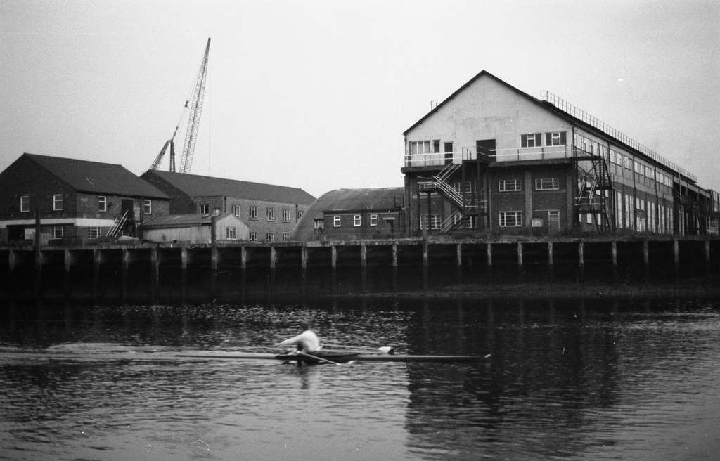
Industrialisation of the River Tees
The River Tees has been used for transporting industrial goods since the Industrial Revolution, particularly for the shipment of coal form the Durham Coalfields and also for the steel industries that later developed around Middlesbrough. In the early years merchant ships left the River Tees after loading in Yarm and Stockton on Tees; but as merchant ships became bigger, these smaller docks were suprseded by bigger and deeper docks in Middlesbrough, and later even further downstream at Teesport close to the mouth of the River Tees. In the 20th century the river also became important to the developing chemical industry, contributing particularly to the development of Imperial Chemical Industries (ICI).
The move to loading coal on bigger ships in Middlesbrough was the economic driver for the development not only of the town of Middlesbrough itself but also of the railway between Stockton and Darlington. This is where George Stephenson developed his railway engine "Locomotion" and this railway was the first steam railway to carry passengers, as well as industrial materials. The Stockton and Darlington Railway was founded after an initial shareholders' meeting in a room in a public house in Yarm on Tees.
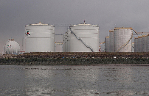
Today Teesport is owned by PD Ports; it is located from the North Sea and east of Middlesbrough. Teesport is currently the third largest port in the United Kingdom, and among the ten biggest in Western Europe, handling over 56 million tonnes of domestic and international cargo per year. The vast majority of these products are still related to the steel and chemical industries made by companies that are members of the Northeast of England Process Industry Cluster (NEPIC). The areas where large scale commodity chemical industry continues to be based are Billingham and Seal Sands, both on the north bank of the River Tees, and Wilton on the south bank. The Teesside Steelworks at Redcar operated until closure in 2015.
Other industrial companies that use the River Tees are manufacturing and servicing the North Sea oil and gas industry as well as the renewable energy industry sector, including offshore wind turbines. The south bank of the mouth of the River Tees has the 62MW Teesside Offshore Wind Farm, built 2011-13
Near the mouth of the River Tees is the large dry dock facility of ABLE UK, named TERRC (Teesside Environmental Reclamation and Recycling Centre), used to dismantle or oil rigs and other large vessels. Hartlepool Nuclear Power Station is adjacent to the east.
Legends and folklore
Peg Powler is a hag in English folklore who is said to inhabit the River Tees.
In popular culture
The River Tees was featured in the television series Seven Natural Wonders as one of the wonders of the North, and in the post-apocalyptic drama The Last Train having blown its banks.
Visit the page: River Tees for references and further details. You can contribute to this article on Wikipedia.
from Geograph (geograph)
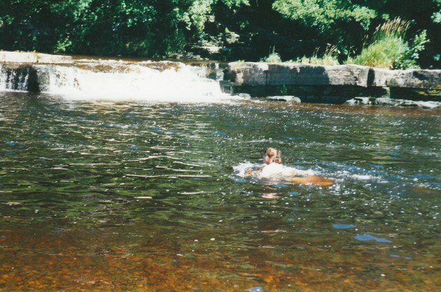
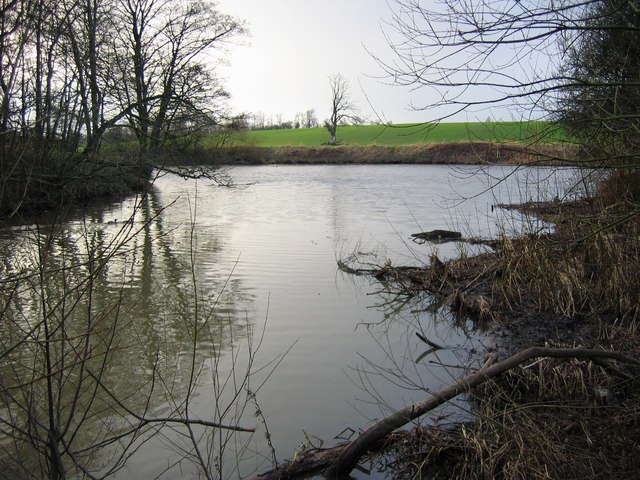
River Tees swimming area at Whorlton Lido in 2001
Pinned by Simon Cotterill
from Flickr (flickr)
Gorgeous weather in the North East for the last few days! Bliss in a little town called Yarm...
Pinned by Simon Cotterill

from https://ih-igcse-geography.wi…
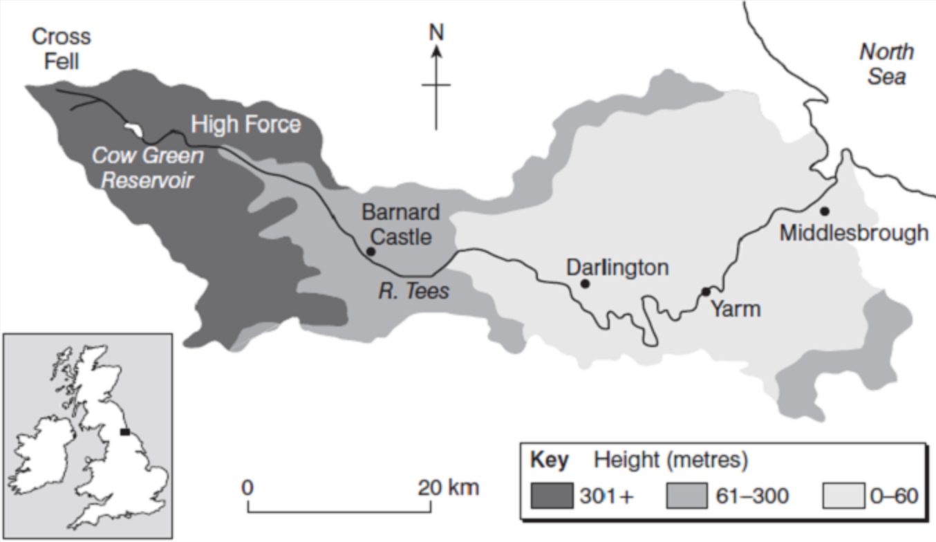
River Tees Drainage Basin
- Diagram from InterHigh IGCSE Geography wiki available under a Creative Commons Attribution Share-Alike 3.0 License.
Added by
Simon Cotterill
from Flickr (flickr)
37. Abbey Bridge near Barnard Castle, Durham by James Wilson (c.1869)
Pinned by Pat Thomson
Co-Curate Page
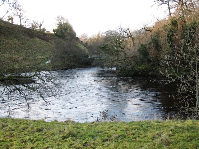
Hurworth-on-Tees
- Hurworth-on-Tees is a village in the borough of Darlington in County Durham. It is located on the banks of the River Tees, close to its meeting point with the River …
Co-Curate Page
Hurworth Place
- Hurworth Place is a village in the Borough of Darlington in County Durham, on the boundry with North Yorkshire. It is situated on the northern bank of the River Tees, …
Co-Curate Page
Barnard Castle Bridge
- Overview Map Street View The stone Bridge over the River Tees connects the town of Barnard Castle with Startforth. It dates from the 14th Century and is overlooked by the castle. It …
Co-Curate Page
Startforth
- Overview About Startforth Map Street View Startforth is a village on the banks of the River Tees opposite Barnard Castle. Startforth is in County Durham, but had historically been in …
Co-Curate Page
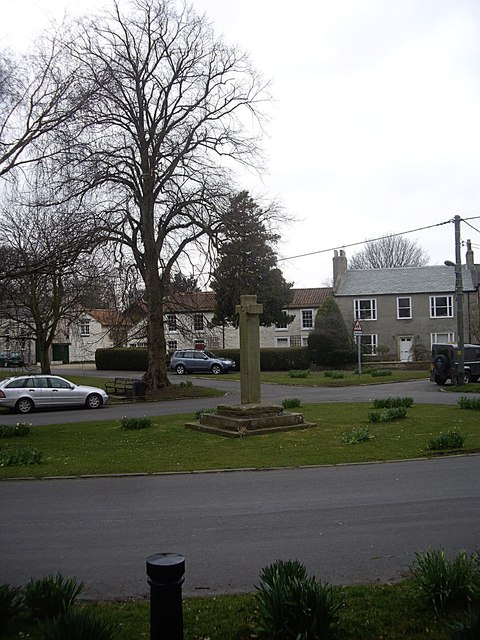
Winston
- Overview About Winston Map Street View Winston is a village in County Durham, located by the River Tees, about 6 miles east of Barnard Castle and 9 miles west of …
Co-Curate Page
Gainford
- Overview About Gainford History Map Street View Gainford is a village in County Durham located by the River Tees and about 6 miles West of Darlington and a similar distance East …
Co-Curate Page
Winston Bridge
- Overview Map Street View The bridge over the River Tees near Winston in Counry Durham was built in 1762-1763, designed by Sir Thomas Robinson[1]. The bridge is notable for its …
Co-Curate Page
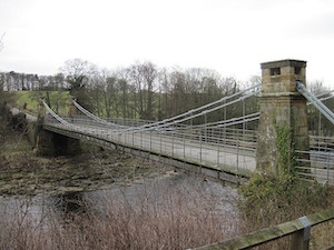
Whorlton Suspension Bridge
- Overview Map Street View The toll bridge over the River Tees at Whorlton, County Durham, was opened in 1831. It was designed by John and Benjamin Green of Newcastle, who …
Co-Curate Page
Wycliffe
- Overview Map Street View Wycliffe, County Durham, is a hamlet on the south bank of the River Tees, located 4 miles south east of Barnard Castle. The village is part …
from Flickr (flickr)
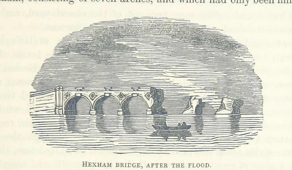
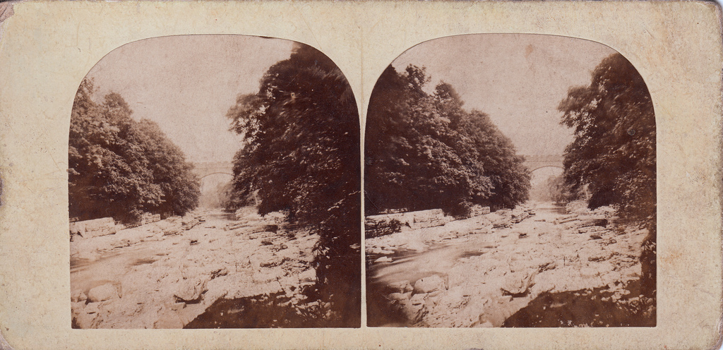
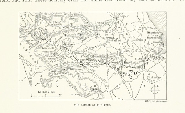
Image taken from page 595 of 'The rivers of Great Britain. The Thames, from source to sea, etc. [With “Rivers of the east coast”.]'
Pinned by Peter Smith
from Flickr (flickr)
Image taken from page 213 of 'The rivers of Great Britain. Descriptive, historical, pictorial. Rivers of the east coast'
Pinned by Simon Cotterill
Co-Curate Page
Cotherstone Footbridge
- Overview Map The footbridge over the River Tees just north of Cortherstone, County Durham, was built in 1932 by Joseph L Thompson and Sons Ltd of Sunderland. It replaced two …
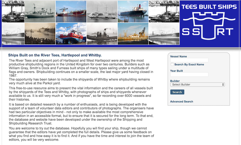
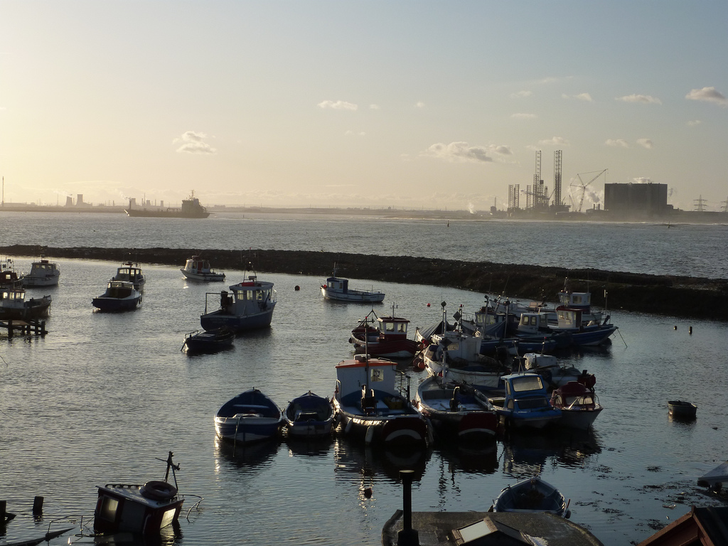
from http://www.teesbuiltships.co.…
Tees Built Ships
- "The River Tees and adjacent port of Hartlepool and West Hartlepool were among the most productive shipbuilding regions in the United Kingdom for over two centuries. Builders such as William …
Added by
Simon Cotterill

Co-Curate Page
Piercebridge Bridge
- Overview Map Street View The stone bridge over the River Tees at Piercebridge was built in 1673. The bridge was widened on its downstream side in 1781.[1] Today the bridge …
Co-Curate Page
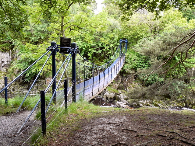
Winch Bridge, nr Holwick
- Overview Map Street View An iron suspension footbridge with planked walkway, over the River Tees, by the Low Force waterfalls, near Holwick and Newbiggin. The bridge was built c.1820 for the …
Co-Curate Page
Deepdale Aqueduct
- Overview Map Street View This combined aquaduct and footbridge over the River Tees was built in 1898. The aqueduct is Grade II listed on the National Heritage List for England.
Co-Curate Page
Tees Newport Bridge
- Overview History Map Street View The Tees Newport Bridge was the first large vertical lift bridge in Europe, and opened by Prince Albert (later King George VI) on 28 February, …
Co-Curate Page
Middlesbrough
- Overview Landmarks & Places to Visit History Timeline People "Middlesbrough is an almost unparalleled example of rapid growth...It dates from 1829, when its site was occupied by a solitary farmhouse, …
Co-Curate Page
Stockton Infinity Bridge
- Overview About the Infinity Bridge Map Street View The Infinity Bridge is a pedestrian and cycle bridge over the River Tees, linking the North Shore development (Stockton-on-Tees) with the University …
Co-Curate Page
Stockton-on-Tees
- Overview About Stockton-on-Tees Map Street View Stockton-on-Tees is a market town in the ceremonial county of County Durham, North East England. It is the major settlement in the borough …
Co-Curate Page
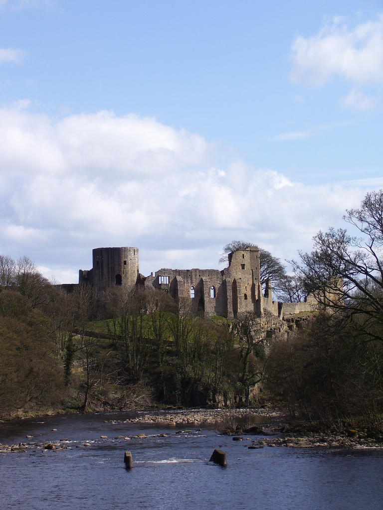
Barnard Castle (town)
- Overview History Map Street View Barnard Castle is a market town in Teesdale, County Durham. The town is named after the castle around which it developed. It is located on …
Co-Curate Page
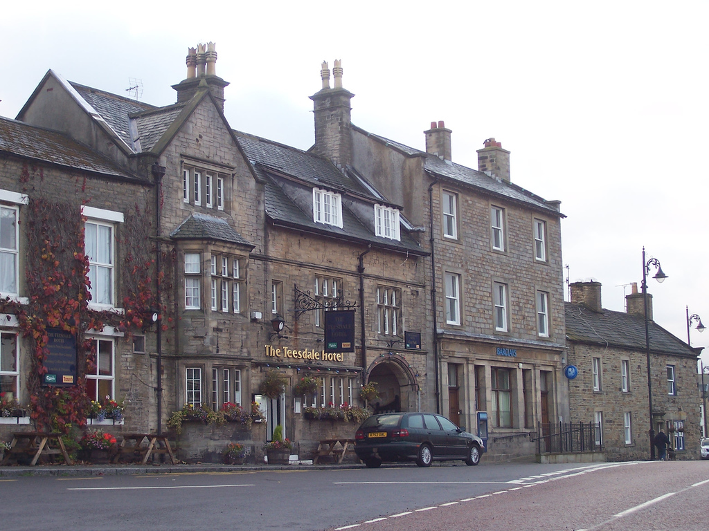
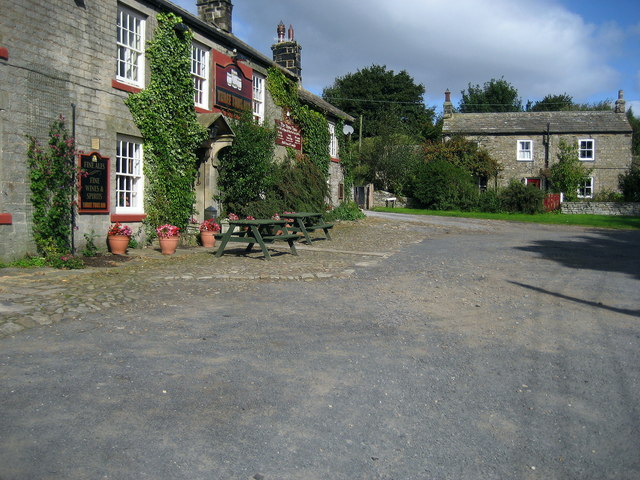
Yarm
- Overview History Map Street View Yarm is a town on the south bank of the River Tees in North Yorkshire, and became part of the unitary authority of Stockton-on-Tees in 1996. Yarm …
Co-Curate Page
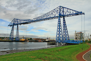
Tees Transporter Bridge
- Overview History Facts & Figures Map Street View The Tees Transporter Bridge was opened on the 17th October 1911 by Prince Arthur of Connaught. The bridge over the River Tees connects Middlesbrough, on the south bank, …
Co-Curate Page
Thornaby
- Overview About Thornaby Map Street View Thornaby-on-Tees is town situated on the south banks of the River Tees, within the Borough of Stockton-on-Tees. It is located about a mile south …
Co-Curate Page
Eaglescliffe
- Overview About Eaglescliffe Map Street View Eaglescliffe is a small town in the borough of Stockton-on-Tees in North East England. It is on the north bank of the River …
Co-Curate Page
Piercebridge
- Overview About Piercebridge Map Street View Piercebridge is a village and civil parish in County Durham located by the River Tees. A Roman bridge, which carried Dere Street over the …
Co-Curate Page
Middleton-in-Teesdale
- Overview About Middleton-in-Teesdale Map Street View Middleton-in-Teesdale ia a market town in County Durham, about 9 miles north-west of Barnard Castle. Middleton is located by the River Tees in Upper …
Co-Curate Page
Ovington
- Overview About Ovington Map Street View Ovington is a village in County Durham, situated by the River Tees, just over 4 miles south-east of Barnard Castle. Historically, Ovington was part …
Co-Curate Page
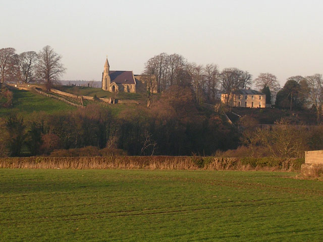
Whorlton
- Overview About Whorton Map Street View Whorlton in County Durham is a village located on the North banks of the River Tees, about 3.5 miles South East of Barnard Castle. Whorlton …
Co-Curate Page
Bowlees
- Overview Map Street View Bowlees is a hamlet in County Durham, located in Upper Teesdale, about 3 miles north-west of Middleton-in-Teesdale. It is situated by Bow Lee Beck, which joins the …
Co-Curate Page
Eggleston
- Overview About Eggleston Map Street View Eggleston is a village in County Durham, in England. The population of the civil parish taken at the 2011 Census was 448. It …
Co-Curate Page
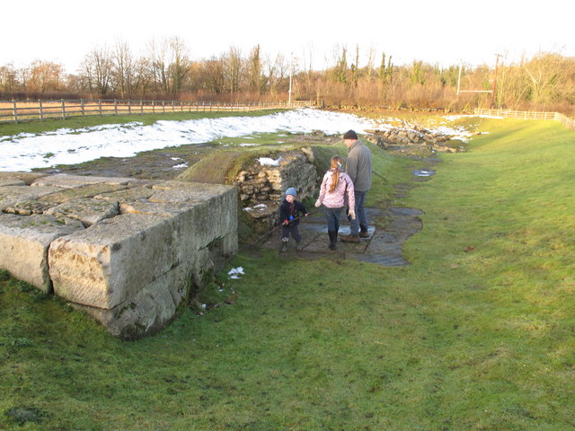
Piercebridge Roman Bridge
- Overview About the Roman Bridge Map Street View The Roman bridge at Piercebridge crossed the River Tees, carrying Dere Street, the Roman road that linked York with Corbridge, near Hadrian’s …
Co-Curate Page
Ingleby Barwick
- Overview About Ingleby Barwick Map Street View Ingleby Barwick is in the ceremonial county of North Yorkshire, but part of the unitary authority of Stockton-on-Tees, with close links to Teesside and …
Co-Curate Page
River Lune (County Durham)
- The Lune is a river in County Durham which is a tributary to the River Tees. The Lune at Grains o' th' Beck, east of Lune Head Farm, at the …
Co-Curate Page
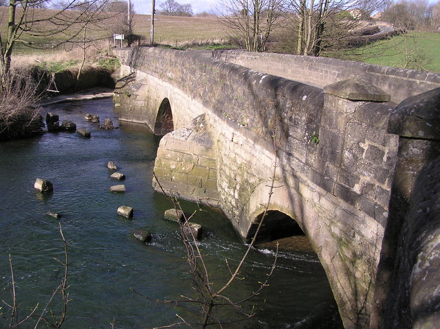
Eggleston Bridge
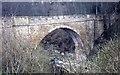
- Overview Map Street View Eggleston Bridge is a single track road bridge across the River Tees near Eggleston in County Durham. The bridge here can be traced back to the 15th …
Co-Curate Page
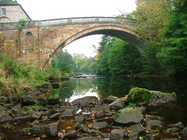
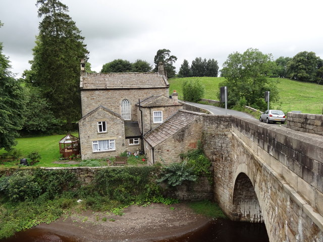
Abbey Bridge, near Egglestone Abbey
- Overview Map Street View Abbey Bridge crosses the River Tees about a quater of a mile south-east of Egglestone Abbey, near Barnard Castle in County Durham. The road bridge was built …
Co-Curate Page
Middleton Bridge
- Overview Map Street View Middleton Bridge carries the B6277 road over the River Tees at Middleton-in-Teesdale. The stone bridge has a single high segmental arch. It was built in c.1800, …
Co-Curate Page
Preston-on-Tees
- Overview About Preston-on_Tees Map Street View Preston-on-Tees is a settlement located at the northern edge of Eaglescliffe, in the borough of Stockton-on-Tees. Historically it was a township in the ancient …
Co-Curate Page
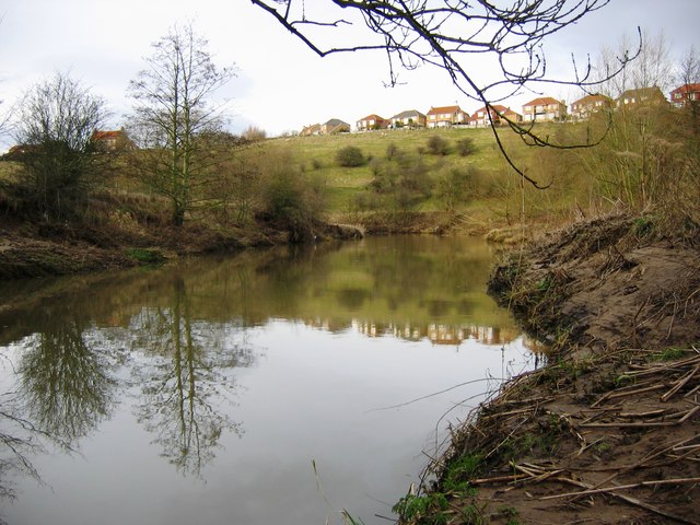
Neasham
- Overview About Neasham Map Street View Neasham is a village located on the north bank of the River Tees, located about 3½ miles south-east from the centre of Darlington and …


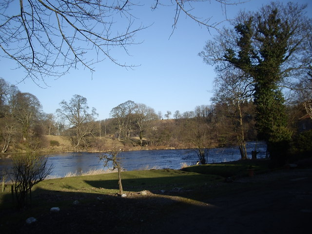
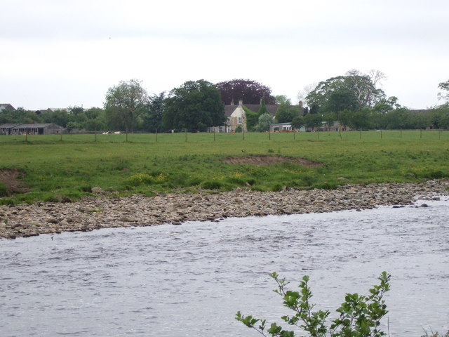
from Geograph (geograph)
River Tees swimming area at Whorlton Lido in 2001
Pinned by Simon Cotterill
from Flickr (flickr)
Gorgeous weather in the North East for the last few days! Bliss in a little town called Yarm...
Pinned by Simon Cotterill
from https://ih-igcse-geography.wi…
River Tees Drainage Basin
- Diagram from InterHigh IGCSE Geography wiki available under a Creative Commons Attribution Share-Alike 3.0 License.
Added by
Simon Cotterill
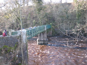
from Flickr (flickr)
37. Abbey Bridge near Barnard Castle, Durham by James Wilson (c.1869)
Pinned by Pat Thomson
Co-Curate Page
Hurworth-on-Tees
- Hurworth-on-Tees is a village in the borough of Darlington in County Durham. It is located on the banks of the River Tees, close to its meeting point with the River …
Co-Curate Page
Hurworth Place
- Hurworth Place is a village in the Borough of Darlington in County Durham, on the boundry with North Yorkshire. It is situated on the northern bank of the River Tees, …
Co-Curate Page
Barnard Castle Bridge
- Overview Map Street View The stone Bridge over the River Tees connects the town of Barnard Castle with Startforth. It dates from the 14th Century and is overlooked by the castle. It …
Co-Curate Page
Startforth
- Overview About Startforth Map Street View Startforth is a village on the banks of the River Tees opposite Barnard Castle. Startforth is in County Durham, but had historically been in …
Co-Curate Page
Winston
- Overview About Winston Map Street View Winston is a village in County Durham, located by the River Tees, about 6 miles east of Barnard Castle and 9 miles west of …
Co-Curate Page
Gainford
- Overview About Gainford History Map Street View Gainford is a village in County Durham located by the River Tees and about 6 miles West of Darlington and a similar distance East …
Co-Curate Page
Winston Bridge
- Overview Map Street View The bridge over the River Tees near Winston in Counry Durham was built in 1762-1763, designed by Sir Thomas Robinson[1]. The bridge is notable for its …
Co-Curate Page
Whorlton Suspension Bridge
- Overview Map Street View The toll bridge over the River Tees at Whorlton, County Durham, was opened in 1831. It was designed by John and Benjamin Green of Newcastle, who …
Co-Curate Page
Wycliffe
- Overview Map Street View Wycliffe, County Durham, is a hamlet on the south bank of the River Tees, located 4 miles south east of Barnard Castle. The village is part …
from Flickr (flickr)
Image taken from page 595 of 'The rivers of Great Britain. The Thames, from source to sea, etc. [With “Rivers of the east coast”.]'
Pinned by Peter Smith
from Flickr (flickr)
Image taken from page 213 of 'The rivers of Great Britain. Descriptive, historical, pictorial. Rivers of the east coast'
Pinned by Simon Cotterill
Co-Curate Page
Cotherstone Footbridge
- Overview Map The footbridge over the River Tees just north of Cortherstone, County Durham, was built in 1932 by Joseph L Thompson and Sons Ltd of Sunderland. It replaced two …
from http://www.teesbuiltships.co.…
Tees Built Ships
- "The River Tees and adjacent port of Hartlepool and West Hartlepool were among the most productive shipbuilding regions in the United Kingdom for over two centuries. Builders such as William …
Added by
Simon Cotterill
Co-Curate Page
Piercebridge Bridge
- Overview Map Street View The stone bridge over the River Tees at Piercebridge was built in 1673. The bridge was widened on its downstream side in 1781.[1] Today the bridge …
Co-Curate Page
Winch Bridge, nr Holwick
- Overview Map Street View An iron suspension footbridge with planked walkway, over the River Tees, by the Low Force waterfalls, near Holwick and Newbiggin. The bridge was built c.1820 for the …
Co-Curate Page
Deepdale Aqueduct
- Overview Map Street View This combined aquaduct and footbridge over the River Tees was built in 1898. The aqueduct is Grade II listed on the National Heritage List for England.
Co-Curate Page
Tees Newport Bridge
- Overview History Map Street View The Tees Newport Bridge was the first large vertical lift bridge in Europe, and opened by Prince Albert (later King George VI) on 28 February, …
Co-Curate Page
Middlesbrough
- Overview Landmarks & Places to Visit History Timeline People "Middlesbrough is an almost unparalleled example of rapid growth...It dates from 1829, when its site was occupied by a solitary farmhouse, …
Co-Curate Page
Stockton Infinity Bridge
- Overview About the Infinity Bridge Map Street View The Infinity Bridge is a pedestrian and cycle bridge over the River Tees, linking the North Shore development (Stockton-on-Tees) with the University …
Co-Curate Page
Stockton-on-Tees
- Overview About Stockton-on-Tees Map Street View Stockton-on-Tees is a market town in the ceremonial county of County Durham, North East England. It is the major settlement in the borough …
Co-Curate Page
Barnard Castle (town)
- Overview History Map Street View Barnard Castle is a market town in Teesdale, County Durham. The town is named after the castle around which it developed. It is located on …
Co-Curate Page
Yarm
- Overview History Map Street View Yarm is a town on the south bank of the River Tees in North Yorkshire, and became part of the unitary authority of Stockton-on-Tees in 1996. Yarm …
Co-Curate Page
Tees Transporter Bridge
- Overview History Facts & Figures Map Street View The Tees Transporter Bridge was opened on the 17th October 1911 by Prince Arthur of Connaught. The bridge over the River Tees connects Middlesbrough, on the south bank, …
Co-Curate Page
Thornaby
- Overview About Thornaby Map Street View Thornaby-on-Tees is town situated on the south banks of the River Tees, within the Borough of Stockton-on-Tees. It is located about a mile south …
Co-Curate Page
Eaglescliffe
- Overview About Eaglescliffe Map Street View Eaglescliffe is a small town in the borough of Stockton-on-Tees in North East England. It is on the north bank of the River …
Co-Curate Page
Piercebridge
- Overview About Piercebridge Map Street View Piercebridge is a village and civil parish in County Durham located by the River Tees. A Roman bridge, which carried Dere Street over the …
Co-Curate Page
Middleton-in-Teesdale
- Overview About Middleton-in-Teesdale Map Street View Middleton-in-Teesdale ia a market town in County Durham, about 9 miles north-west of Barnard Castle. Middleton is located by the River Tees in Upper …
Co-Curate Page
Ovington
- Overview About Ovington Map Street View Ovington is a village in County Durham, situated by the River Tees, just over 4 miles south-east of Barnard Castle. Historically, Ovington was part …
Co-Curate Page
Whorlton
- Overview About Whorton Map Street View Whorlton in County Durham is a village located on the North banks of the River Tees, about 3.5 miles South East of Barnard Castle. Whorlton …
Co-Curate Page
Bowlees
- Overview Map Street View Bowlees is a hamlet in County Durham, located in Upper Teesdale, about 3 miles north-west of Middleton-in-Teesdale. It is situated by Bow Lee Beck, which joins the …
Co-Curate Page
Eggleston
- Overview About Eggleston Map Street View Eggleston is a village in County Durham, in England. The population of the civil parish taken at the 2011 Census was 448. It …
Co-Curate Page
Piercebridge Roman Bridge
- Overview About the Roman Bridge Map Street View The Roman bridge at Piercebridge crossed the River Tees, carrying Dere Street, the Roman road that linked York with Corbridge, near Hadrian’s …
Co-Curate Page
Ingleby Barwick
- Overview About Ingleby Barwick Map Street View Ingleby Barwick is in the ceremonial county of North Yorkshire, but part of the unitary authority of Stockton-on-Tees, with close links to Teesside and …
Co-Curate Page
River Lune (County Durham)
- The Lune is a river in County Durham which is a tributary to the River Tees. The Lune at Grains o' th' Beck, east of Lune Head Farm, at the …
Co-Curate Page
Eggleston Bridge
- Overview Map Street View Eggleston Bridge is a single track road bridge across the River Tees near Eggleston in County Durham. The bridge here can be traced back to the 15th …
Co-Curate Page
Abbey Bridge, near Egglestone Abbey
- Overview Map Street View Abbey Bridge crosses the River Tees about a quater of a mile south-east of Egglestone Abbey, near Barnard Castle in County Durham. The road bridge was built …
Co-Curate Page
Middleton Bridge
- Overview Map Street View Middleton Bridge carries the B6277 road over the River Tees at Middleton-in-Teesdale. The stone bridge has a single high segmental arch. It was built in c.1800, …
Co-Curate Page
Preston-on-Tees
- Overview About Preston-on_Tees Map Street View Preston-on-Tees is a settlement located at the northern edge of Eaglescliffe, in the borough of Stockton-on-Tees. Historically it was a township in the ancient …
Co-Curate Page
Neasham
- Overview About Neasham Map Street View Neasham is a village located on the north bank of the River Tees, located about 3½ miles south-east from the centre of Darlington and …

Geography

Rivers
Billingham Beck
Cauldron Snout, River Tees
Clow Beck
Eggleston Burn
Harwood Beck
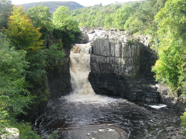
High Force Waterfall
Langley Beck
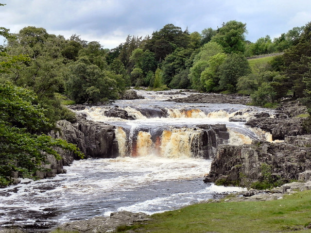
Low Force Waterfalls
Piercebridge Beck
Scur Beck
Stainsby Beck