Topics > Carlisle
Carlisle

Carlisle is a city and the county town of Cumbria. Historically in Cumberland, it is also the administrative centre of the City of Carlisle district in North West England. Carlisle is located at the confluence of the rivers Eden, Caldew and Petteril, 10 miles (16 km) south of the Scottish border. It is the largest settlement in the county of Cumbria, and serves as the administrative centre for both Carlisle City Council and Cumbria County Council. At the time of the 2001 census, the population of Carlisle was 71,773, with 100,734 living in the wider city. Ten years later, at the 2011 census, the city's population had risen to 75,306, with 107,524 in the wider city.
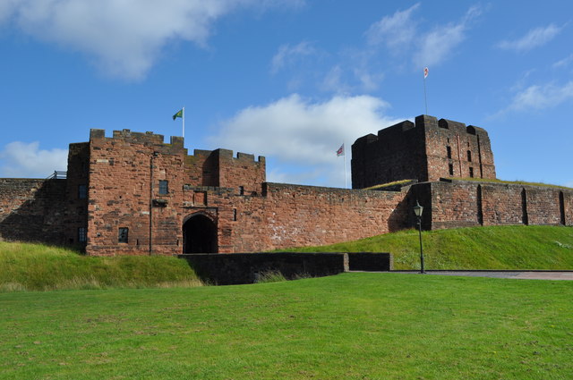
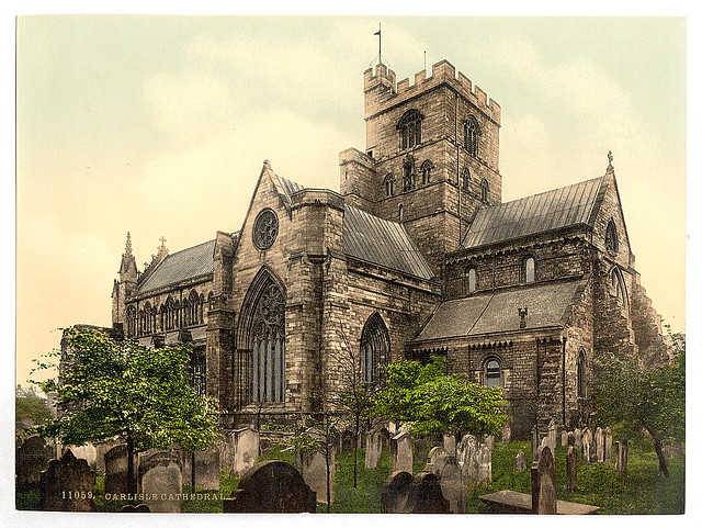
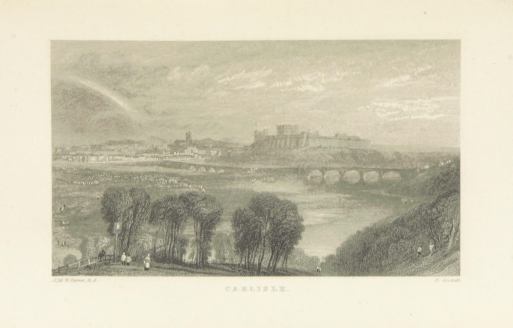
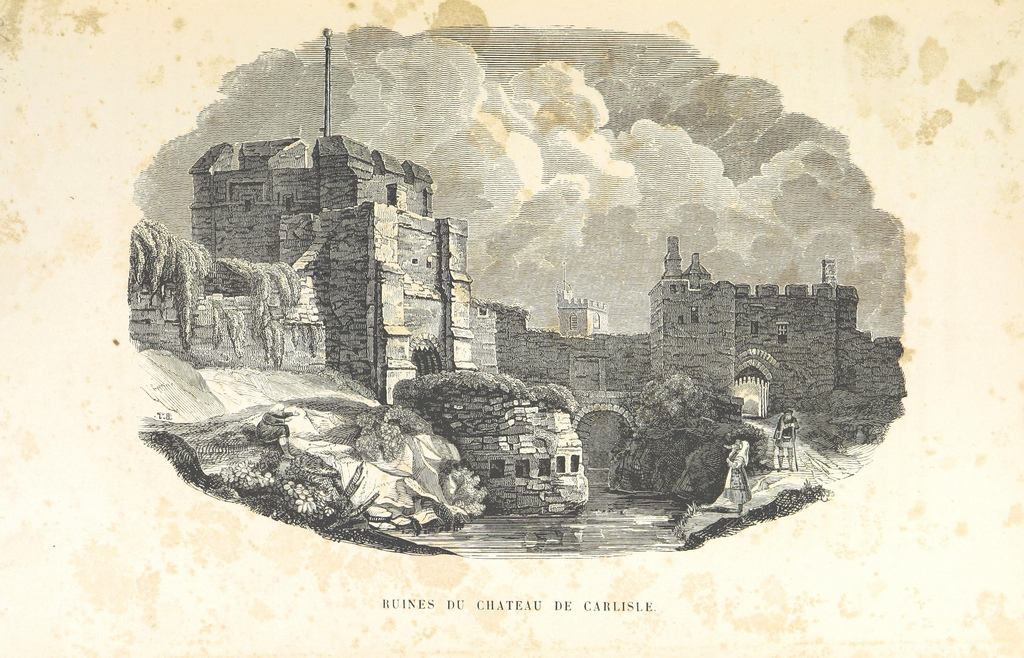
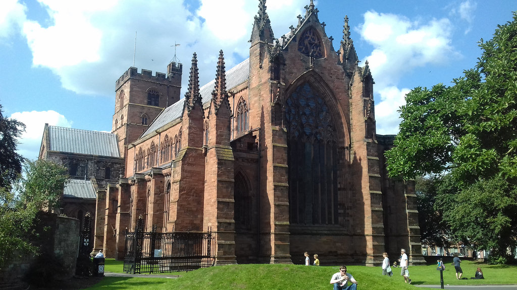
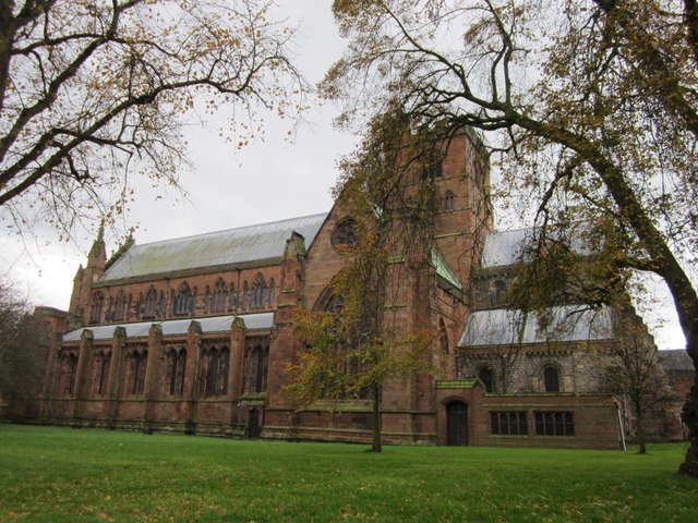
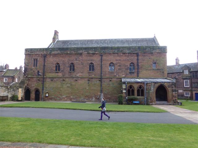
The early history of Carlisle is marked by its status as a Roman settlement, established to serve the forts on Hadrian's Wall. During the Middle Ages, because of its proximity to the Kingdom of Scotland, Carlisle became an important military stronghold; Carlisle Castle, still relatively intact, was built in 1092 by William Rufus, and once served as a prison for Mary, Queen of Scots. The castle now houses the Duke of Lancaster's Regiment and the Border Regiment Museum. In the early 12th century, Henry I allowed the foundation of a priory in Carlisle. The town gained the status of a city when its diocese was formed in 1133, and the priory became Carlisle Cathedral.
The introduction of textile manufacture during the Industrial Revolution began a process of socioeconomic transformation in Carlisle, which developed into a densely populated mill town. This, combined with its strategic position, allowed for the development of Carlisle as an important railway town, with seven railway companies sharing Carlisle railway station.
Nicknamed the Great Border City, Carlisle today is the main cultural, commercial and industrial centre for north Cumbria. It is home to the main campuses of the University of Cumbria and a variety of museums and heritage centres. The former County Borough of Carlisle had held city status until the Local Government Act 1972 was enacted in 1974.
History
Ancient Carlisle
What is known of the ancient history of Carlisle is derived mainly from archaeological evidence and the works of the Roman historian Tacitus. The earliest recorded inhabitants were the Carvetii tribe of Britons who made up the main population of ancient Cumbria and North Lancashire.
According to Boethius and John of Fordun, Carlisle existed before the arrival of the Romans in Britain and was one of the strongest British towns at the time. In the time of the emperor Nero, it was said to have burned down.
The Roman settlement was named Luguvalium, based on a native name that has been reconstructed as Brittonic *Luguwaljon, "[city] of Luguwalos", a masculine Celtic given name meaning "strength of Lugus".
Excavations undertaken along Annetwell Street in the 1970s dated the Roman timber fort constructed at the site of present Carlisle Castle to the winter of 73,
protecting a strategic location overlooking the confluence of the Caldew and Eden rivers.
This walled civitas, possibly the only one in northwest Britain, presumably served as the tribal centre of the Carvetii on the model of other such sites in Roman Britain.
In 79, the two Roman generals Gnaeus Julius Agricola and Quintus Petillius Cerialis advanced through Solway as they continued their campaign further north.
As a result, it is likely that greater control was achieved at Carlisle over anti-imperial groups. This is possibly indicated from the reconstruction of the fort at Carlisle in 83 using oak timbers from further afield, rather than local alder. At this time the Roman fort was garrisoned by a 500-strong cavalry regiment, the Ala Gallorum Sebosiana.
By the early 2nd century, Carlisle was established as a prominent stronghold. The 'Stanegate' frontier, which consisted of Luguvalium and several other forts in a line east to Corbridge, was proving a more stable frontier against the Picts than those established deeper into Caledonia. In 122, the province was visited by Hadrian, who approved a plan to build a wall the length of the frontier. A new fort, Petriana, was built at Carlisle in the Stanwix area of the city north of the river. It was the largest fort along the length of Hadrian's Wall and was completed in stone by around 130. Like Luguvalium, which lay within sight, Petriana housed a 1,000-strong cavalry regiment, the Ala Gallorum Petriana, the sole regiment of this size along the wall. Hadrian's successor Antoninus Pius abandoned the frontier and attempted to move further north; he built the Antonine Wall between the firths of Forth and Clyde. It was not a success and, after 20 years, the garrisons returned to Hadrian's Wall.
Until 400, the Roman occupation fluctuated in importance. At one time, it broke off from Rome when Marcus Carausius assumed power over the territory. He was assassinated and suffered damnatio memoriae, but a surviving reference to him has been uncovered in Carlisle. Coins excavated in the area suggest that Romans remained in Carlisle until the reign of Emperor Valentinian II, from 375 to 392.
Medieval and Middle Ages
The period of late antiquity after Roman rule saw Cumbria organised as the native British kingdom of Rheged. It is likely that the kingdom took its name from a major stronghold within it; this has been suggested to have been broadly coterminous with the la, Carlisle. King Urien and his son and successor Owain became the subjects of a great deal of Arthurian legend. Their capital has been identified as the listed by Nennius among the 28 cities of Britain, which later developed into , whence the city's modern Welsh name Caerliwelydd. Rheged came under Northumbrian control before 730, probably by inheritance after Rienmelth, daughter of Royth and great-granddaughter of Urien, married Oswy, King of Northumbria. For the rest of the first millennium, Carlisle was an important stronghold contested by several entities who warred over the area, including the Brythonic Kingdom of Strathclyde and the Anglian kingdom of Northumbria. In 685, St Cuthbert, visiting the Queen of Northumbria in her sister's monastery at Carlisle, was taken to see the city walls and a marvellously constructed Roman fountain.
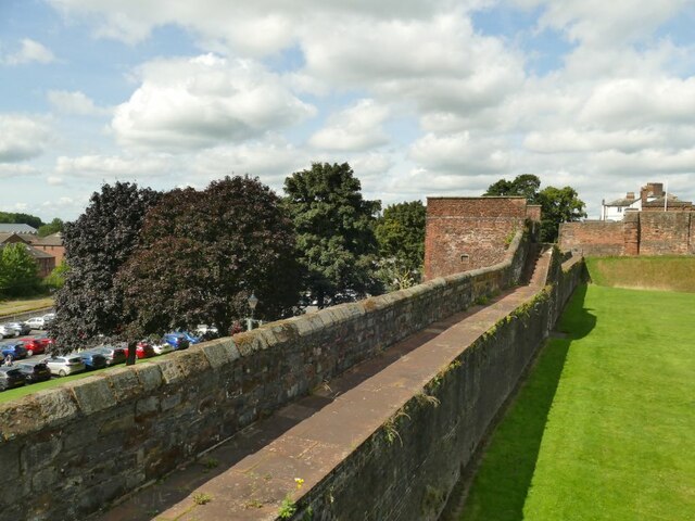
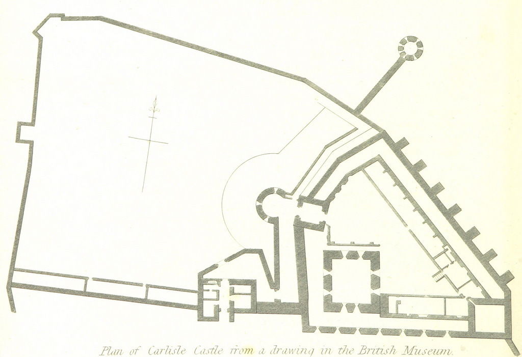
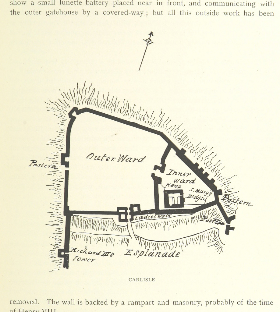
By the time of the Norman conquest in 1066, Carlisle was part of Scotland. It was not recorded in the 1086 Domesday Book. This changed in 1092, when William the Conqueror's son William Rufus invaded the region and incorporated Cumberland and Carlisle into England. The construction of Carlisle Castle began in 1093 on the site of the Roman fort, south of the River Eden. The castle was rebuilt in stone in 1112, with a keep and the city walls. The walls enclosed the city south of the castle and included three gates to the west, south, and east called the Irish or Caldew Gate, the English or Botcher Gate, and the Scotch Gate respectively. The names of the gates exist in road names in Carlisle today. Carlisle Cathedral was built in 1133.
The conquest of Cumberland was the beginning of a war between Scotland and England which saw the region centred around Carlisle change hands a number of times. It was a major stronghold after the construction of the castle. During the wars, the livelihood of the people on the borders was devastated by armies from both sides. Even when the countries were not at war, tension remained high, and royal authority in one or the other kingdom was often weak. The uncertainty of existence meant that communities or peoples kindred to each other sought security through their own strength and cunning, and they improved their livelihoods at their enemies' expense. These peoples were known as the Border Reivers and Carlisle was the major city within their territories.
The Reivers became so much of a nuisance to the Scottish and English governments that, in 1525, the Archbishop of Glasgow Gavin Dunbar cursed all the reivers of the borderlands. The curse was detailed in 1,069 words, beginning: "I curse their head and all the hairs of their head; I curse their face, their brain (innermost thoughts), their mouth, their nose, their tongue, their teeth, their forehead, their shoulders, their breast, their heart, their stomach, their back, their womb, their arms, their leggs, their hands, their feet and every part of their body, from the top of their head to the soles of their feet, before and behind, within and without."
Early Modern era
After the Pilgrimage of Grace, Henry VIII, concerned at the weakness of his hold on the North, employed (1539) the engineer Stefan von Haschenperg to modernise the defences of Carlisle. von Haschenperg was sacked in 1543 for having "spent great treasures to no purpose"; but (by him and his successors) at the north end the castle towers were converted to artillery platforms, at the south the mediaeval Bochard gate was converted into the Citadel, an artillery fortification with two massive artillery towers. The death of Queen Elizabeth I in 1603 and her succession by James VI of Scotland as King James I of England allowed more determined and coordinated efforts to suppress reiving. The borderers were not quick to change their ways and many were hanged and whole families were exiled to Ireland. It was not until 1681 that the problem of the reivers was acknowledged as no longer an issue.
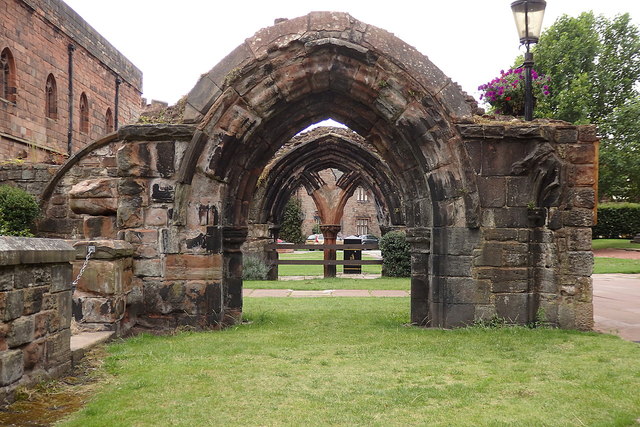
Following the personal union of the crowns Carlisle Castle should have become obsolete as a frontier fortress, but the two kingdoms continued as separate states. In 1639, with war between the two kingdoms looming, the castle was refortified using stone from the cathedral cloisters. In 1642 the English Civil War broke out and the castle was garrisoned for the king. It endured a long siege from October 1644 until June 1645 when the Royalist forces surrendered after the Battle of Naseby. The city was occupied by a parliamentary garrison, and subsequently by their Scots allies. In 1646, the Scots, now holding Carlisle pending payment of monies owed them by the English Parliament, improved its fortifications, destroying the cathedral's nave to obtain the stone to rebuild the castle. Carlisle continued to remain a barracks thereafter. In 1698 travel writer Celia Fiennes wrote of Carlisle as having most of the trappings of a military town and was rife with alcohol and prostitutes.
In 1707 an act of union was passed between England and Scotland, creating Great Britain, and Carlisle ceased to be a frontier town. Carlisle remained a garrison town. The tenth, and most recent siege in the city's history took place after Charles Edward Stuart took Carlisle in the Jacobite Rising of 1745. When the Jacobites retreated across the border to Scotland they left a garrison of 400 men in Carlisle Castle. Ten days later Prince William, Duke of Cumberland took the castle and executed 31 Jacobites on the streets of Carlisle.
Industrial Revolution
Although Carlisle continued to garrison soldiers, becoming the headquarters of the Border Regiment, the city's importance as a military town decreased as the industrial age took over. The post of Governor of Carlisle as garrison commander was abolished in 1838.
In the early 19th century textile mills, engineering works and food manufacturers built factories in the city mostly in the Denton Holme, Caldewgate and Wapping suburbs in the Caldew Valley. These included Carr's of Carlisle, Kangol, Metal Box and Cowans Sheldon. Shaddon Mill, in Denton Holme, became famous for having the worlds 8th tallest chimney and was the largest cotton mill in England.
The expanding industries brought about an increase in population as jobs shifted from rural farms towards the cities. This produced a housing shortage where at one point 25,000 people in the city only had 5,000 houses to live in. People were said to be herded together with animal houses, slaughter houses and communal lavatories with open drains running between them. Living conditions were so bad that riots were common and some people emigrated. The problem wasn't solved until the end of the 19th century when mass housing was built west of the city walls.
In 1823 a canal was built to Fisher's Cross (Port Carlisle) to transport goods produced in the city. This enabled other industrial centres such as Liverpool to link with Carlisle via the Solway. This was short-lived and when the canal operators ran into financial difficulty the waterway was filled in. A railway was built in place of the canal.
Carlisle became a major railway centre on the West Coast Main Line with connections to the east. At one time seven companies used Carlisle Citadel railway station. Before the building of the Citadel railway station the city had several other railway stations, including London Road railway station. Carlisle had the largest railway marshalling yard in Europe, Kingmoor, which, reduced in size, is operational and used by railfreight companies.
The Strand Road drill hall opened in 1874.
Modern history
At the start of the 20th century, the population had grown to over 45,000. Transport was improved by the City of Carlisle Electric Tramways from 1900 until 1931, and the first cinema was built in 1906. In 1912, the boundaries of Carlisle were extended to include Botcherby in the east and Stanwix in the north.
Carlisle was subject to the decline in the textile industry experienced throughout Britain as new machinery made labour unnecessary. In 1916, during the First World War, the government took over the public houses and breweries in Carlisle because of drunkenness among construction and munitions workers from the munitions factory at Gretna. This experiment nationalised brewing. As the Carlisle Board of Control, and subsequently the Carlisle & District State Management Scheme, it lasted until 1971.
During the Second World War, Carlisle hosted over 5,000 evacuees, many of whom arrived from Newcastle upon Tyne and the surrounding towns.
In the 1920s and 1930s the first council houses were built in the city, many of them in the Raffles suburb to the west of the city. Initially Raffles contained the most sought after housing in the city by council tenants. In the 1990s it became infamous with high crime rates and impoverished living standards. A report from April 1994 in The Independent on Sunday branded the estate a no-go area. One resident was reported to have said "If you've got a problem in Raffles, get a shotgun". The estate was redeveloped in 2004 by replacing some housing.
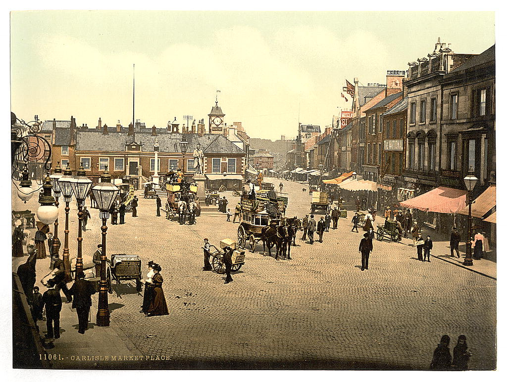
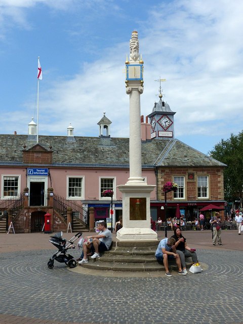
A shopping centre (including a new central library) was built to the east and north-east of the market cross and opened in 1986. The area east of the market cross had formerly been occupied by narrow alleyways of housing and small shops (on a layout which had not changed much since medieval times) and referred to locally as The Lanes. Carlisle city centre was pedestrianised in 1989.
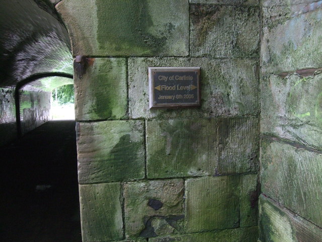
On the evening of Friday 7 January 2005, the rivers Eden, Caldew and Petteril burst their banks due to as much as 180 mm rainfall up stream that day. 2,700 homes were flooded and three people died. The city's police and fire stations were flooded along with Brunton Park football stadium. The police, fire service and Carlisle United F.C. were moved, the latter as far as Morecambe. At the time of the flood emergency services also had to respond to cases of car-related arson in the city.
City centre
Carlisle is the only city in Cumbria. The city centre is largely pedestrianised and the Lanes shopping centre is home to around 75 stores.
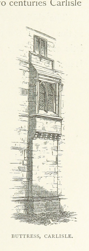
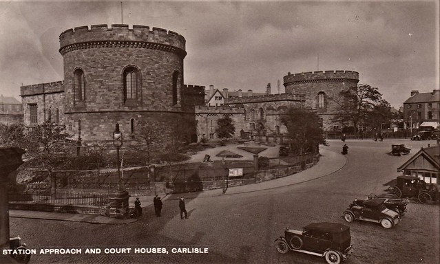
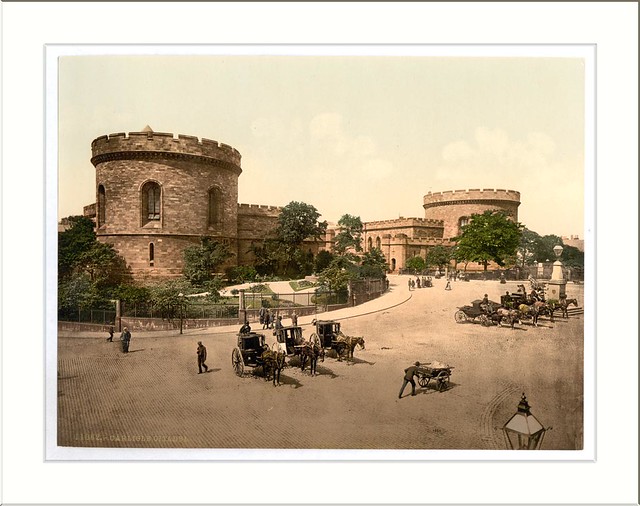
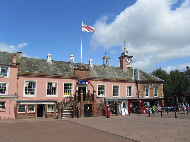
Carlisle has a compact historic centre with a castle, cathedral and semi-intact city walls, as well as other medieval buildings including the Guildhall and Tithe Barn. The former law courts or citadel towers which until 2016 also served as offices for Cumbria County Council were designed by Thomas Telford, with the eastern tower incorporating part of the 16th century building. The first Citadel building was a Tudor fortification replacing the medieval Englishgate, designed by the Moravian military engineer Stefan von Haschenperg in 1541. Next to the Citadel is Carlisle railway station, designed by William Tite in the neo-Tudor style, considered by Historic England to be among the most important early railway stations in England.
Governance
Historical
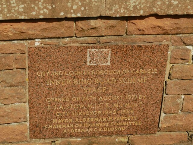
Carlisle has held city status since the Middle Ages and a borough constituency or parliamentary borough for centuries, at one time returning two MPs. In 1835 it became a municipal borough which was promoted to county borough status in 1914. The city's boundaries have changed several times since 1835 the final time in 1974 when under the Local Government Act 1972 the city and county borough merged with the Border Rural District to become the new enlarged City of Carlisle, a non-metropolitan district of Cumbria.
The municipal borough contained several civil parishes or parts of parishes but these were merged into a single civil parish of Carlisle in 1904. The present day urban area is classed as an unparished area except for the fringes which are in Stanwix Rural, Kingmoor and St Cuthbert Without parishes. Carlisle unsuccessfully applied to become a Lord Mayoralty in 2002.
Carlisle City Council has headquarters in the 1960s Civic Centre in Rickergate. An iconic building and tallest in Carlisle, it may be demolished and the surrounding area regenerated.
The current member of Parliament is John Stevenson – Conservative.
Carlisle is within the North West England constituency of the European Parliament; the North West's MEPs elected in the 2014 election are:
County Council
Carlisle elects 12 county councillors to the Cumbria County Council.
District Council
Carlisle is governed by a district council, Carlisle City Council and as of the 2015 election the Labour party has a majority on the council. The council covers a large rural area with many villages and small towns including Dalston, Brampton, Longtown, Wetheral, Bewcastle and Scotby.
Geography
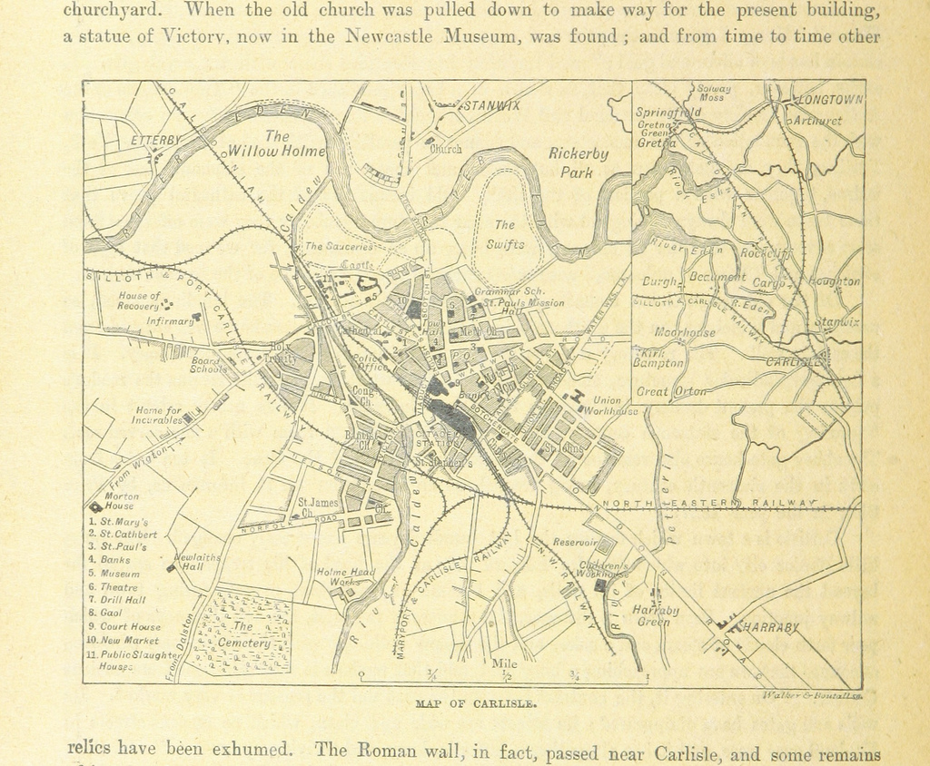
Carlisle is situated on a slight rise, in the Cumberland Ward, at the confluence of the rivers Eden, Caldew and Petteril.
An important centre for trade, it is located west of Newcastle upon Tyne, north of Lancaster, south-east of Glasgow, south of Edinburgh, north-west of York, and north-north-west of London, at 54°52'N, 2°50'W. Nearby towns and villages include Longtown (north), Penrith (south) Brampton (east), Wigton (west), Haggbeck, Harker, Carwinley, Blackford, Houghton, Scotby, Wreay and Rockcliffe.
Climate
Carlisle experiences an oceanic climate (Köppen climate classification Cfb). In January 2005 Carlisle was hit by strong gales and heavy rain, and on Saturday 8 January 2005 all roads into Carlisle were closed owing to severe flooding, the worst since 1822, which caused three deaths. Less serious but still significant flooding happened in 2009, but due to Storm Desmond, even worse flooding than 2005 badly affected Carlisle between Friday 4 and Sunday 6 December 2015. During this time, nearly 36 hours of incessant rainfall breached flood defences and left several areas submerged - including Bitts Park, Hardwicke Circus and Warwick Road. This left the famous Sands Centre (and the nearby Shell petrol station and Bitts Park), marooned from the rest of the city. As several other areas of Cumbria were also badly affected (particularly Appleby and Wigton), all trains to Scotland were postponed indefinitely, with trains on the West Coast Mainline going no further than Preston, as nearby Lancaster suffered flooding and problems with electricity supply. Prime Minister David Cameron visited the city on 7 December 2015 to assess the damage, having earlier called an emergency Cobra meeting.
Divisions and suburbs
In the north of Carlisle are the suburbs of Kingstown, Lowry Hill and Moorville, formerly part of the parish of Kingmoor. To the south of them are Stanwix, Edentown, Etterby, St Ann's Hill and Belah which were added to Carlisle in 1912. The parish of Stanwix Rural exists but only includes a small part of Carlisle's urban area, Whiteclosegate.
To the immediate south of Stanwix is the River Eden. On the opposite bank is the city centre bounded on the west by the West Coast Main Railway line and the River Caldew. In the past industry flourished on the banks of the River Caldew, especially Denton Holme and Caldewgate on the west bank and Wapping, around the former Metal Box works, on the east. West of Caldewgate and north of Denton Holme the suburbs of Newtown, Morton, Sandsfield Park, Longsowerby, Raffles and Belle Vue developed in the late 19th and 20th centuries.
The eastern side of the city centre developed in the 19th century into a more affluent area along the main A69 road. It links with the former village of Botcherby to which a large council estate was added in the mid-20th century and later still Durranhill Housing Estate.
South of the city centre is the Botchergate/St Nicholas area of late Victorian terraced housing similar to that found in Denton Holme and Caldewgate. The Botchergate East area until recently had older slum dwellings.
To the south west of Botchergate and St Nicholas are the former villages now suburbs of Upperby and Currock. The urban area spills over the former county borough boundary into Blackwell and Durdar in the civil parish of St Cuthbert Without.
Between Upperby and Botcherby is Harraby a former village once part of St Cuthbert Without and the largest suburb of Carlisle. Harraby is subdivided into Harraby East, New Harraby, Harraby Green, Old Harraby, Petteril Bank and the Durranhill Industrial Estate. Adjoining Harraby to the south but outside the former borough boundary is the hamlet of Carleton.
Transport
Carlisle is linked to the rest of England via the M6 motorway to the south, and to Scotland via the M74/A74 towards Glasgow and the north. Many trunk roads begin or terminate in Carlisle, including the A6 to Penrith and Luton (historically the main road to the south) , the A595 to western Cumbria, the A69 to Newcastle upon Tyne and the A7 to Edinburgh. The city of Carlisle is the only city in Great Britain other than London and Edinburgh with more than one single numbered 'A' road - A6 and A7 (although at one time the A5 and A6 met in St Albans).
The nearest commercial airport is found in Newcastle Airport near the east coast around away from Carlisle.
Traffic in the Carlisle area, especially at rush hour, is a significant problem and in 2012 a bypass opened to take traffic from west Cumbria heading to the M6 away from the city centre.
Carlisle railway station is a principal station on the West Coast Main Line. Other lines branch off to Newcastle along the Tyne Valley line, Leeds along the Settle and Carlisle line, Glasgow Central via Dumfries along the Glasgow South Western Line which connects Ayr and Stranraer for the Stena Line ferry to Port of Belfast or P&O Ferries to Larne Harbour, and west Cumbria along the Cumbrian Coast line to Whitehaven, Barrow-in-Furness and Lancaster. Services operated by Abellio ScotRail, Northern, TransPennine Express and Virgin Trains West Coast. Kingmoor Traction Maintenance Depot is a major facility north of Carlisle operated by Direct Rail Services.
Local bus services are run by Stagecoach Cumbria & North Lancashire, Reay's and Arriva North East. Following the flooding of Carlisle bus depot on 8 January 2005 Stagecoach announced the purchase of a fleet of low-floor buses for Carlisle city routes. These were launched on 30 June 2005, with "Carlisle Citi" branding, and most buses carry route branding for individual routes both internally and externally. In 2009 locally based coach operator Reay's started a City Hopper bus services on routes formerly operated by Stagecoach but has since expanded with similar routes to Stagecoach and also connects parts of the city that previously did not have a service.
Carlisle bus station
Carlisle bus station' is owned and managed by Stagecoach Cumbria & North Lancashire.
The bus station, of seven stands and a travel centre is situated on Drury Lane just off Lonsdale Street in the city centre. The present station was built in the 1990s to replace a larger station that was partially on the same site and had access from Lowther Street where the Earls Lane shopping area is now.
The main operators at the bus station are Arriva North East Borders Buses, National Express and Stagecoach Cumbria & North Lancashire.
Trade and industry
Carlisle became an industrial city in the 19th and early 20th centuries with many textile mills, engineering works and food manufacturers opening up mostly in the Denton Holme, Caldewgate and Wapping areas which lie in the Caldew Valley area of Carlisle. (One such manufacturer located in the Denton Holme area was Ferguson Printers, a large textile printing factory that had stood for many years before its unfortunate closure in the early 1990s). In the early 19th century, a canal was dug connecting Caldewgate with the sea at Port Carlisle. The canal was later filled in and became a railway line.
Famous firms that were founded or had factories in Carlisle included Carr's of Carlisle (now part of United Biscuits), Kangol, Metal Box (now part of Crown Holdings) and Cowans Sheldon. Cowans Sheldon originated in the city in the mid 19th century and became one of the world's most important railway and marine engineering firms, manufacturing finally ceased in Carlisle in 1987. The Carr's and Metal Box factories are still going. The construction firm of John Laing and Story Construction. The hauliers Eddie Stobart Logistics who were founded in nearby Hesket Newmarket and were once part of the Stobart Group, had their HQ in Carlisle, although they no longer have their HQ in Carlisle they still employ staff in the city. Robsons Border Transport Limited, J & W Watt Limited and F Brown (Carlisle) Limited all substantial road hauliers had their HQ in Carlisle.
Until 2004, Carlisle's biggest employer was Cavaghan & Gray, which became part of Northern Foods and was subsequently acquired by 2 Sisters Food Group which operated from two sites in the Harraby area of Carlisle producing chilled foods for major supermarket chains. The London Road site closed in 2005 with the loss of almost 700 jobs as production was transferred to the nearby Eastern Way site or other factories around the UK.
Carlisle also became a major railway centre with at one time 7 different companies using Carlisle Citadel railway station. Prior to the building of the Citadel railway station, Carlisle had several railway stations, including London Road railway station. Carlisle also used to have the largest railway marshaling yard in Europe at Kingmoor which, although reduced in size, is still very much operational and used by railfreight companies like Colas Rail Freight, Freightliner Heavy Haul, DB Schenker Rail UK (formerly EWS) and very occasionally Direct Rail Services.
There are various light industrial estates and business parks located on the fringes of Carlisle and on former industrial sites close to the city centre. The largest being the Kingstown Industrial Estate, which is located just off the A7 road near to the M6 motorway.
On 28 March 2005 Carlisle was granted Fairtrade City status.
Education
The University of Cumbria has four campuses in Carlisle on Fusehill Street, Brampton Road, Paternoster Row and Newcastle Street. The university provides a wide range of degree courses in higher education such as Information technology, Applied Psychology, Art, Business, Law, Media, Social Work and Teacher Education.
Carlisle College is the further education establishment based in the town.
The secondary schools within the city of Carlisle are: Richard Rose Central Academy, Richard Rose Morton Academy, Austin Friars St Monicas (Roman Catholic Private School), Trinity School, Newman Catholic School. Other secondary schools in the wider Carlisle district are: Caldew School, (Dalston) and William Howard School (Brampton).
Richard Rose Central Academy replaced St Aidan's County High School and Specialist Sports and Science College, and North Cumbria Technology College (NCTC, formerly Harraby School). It is sponsored by Eddie Stobart owner Andrew Tinkler, and local businessman Brian Scowcroft. It opened in September 2008. In January 2009, there were protests by parents and pupils regarding poor quality education and school facilities. The school was found to be failing and was placed in Special Measures, with the headmaster and chief executive being immediately replaced.
Culture
Art and history
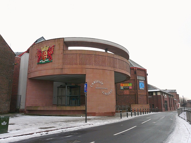
The Tullie House Museum and Art Gallery was opened in 1893 by the Carlisle Corporation. The museum features resident exhibits detailing the history of Roman occupancy of the region, Hadrian's Wall and the Border Reivers. Tullie House, named after the Jacobean mansion in which it is located, hosts travelling exhibitions. The museum has received many awards and was expanded in 1990 and 2000.
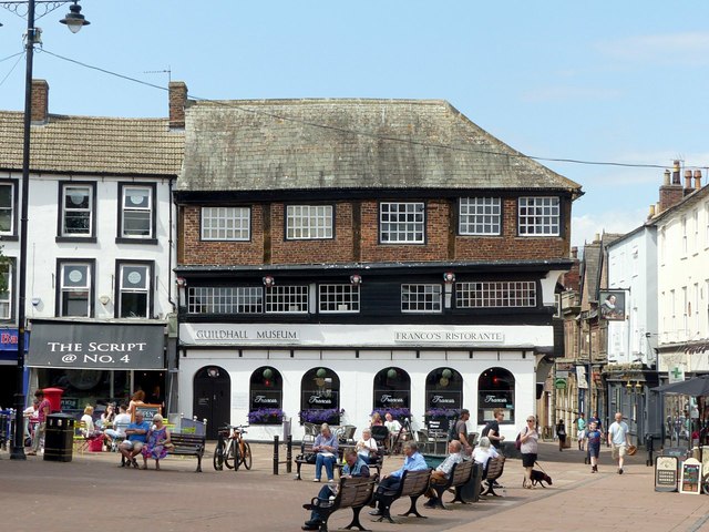
The city's Guildhall Museum is based in a 14th-century house and the Border Regiment Military Museum is in the castle.
Music and theatre
Sands Centre Sports Hall is Carlisle's main entertainment venue which sometimes hosts touring musicians, theatre and comedians. The West Walls Theatre is situated in the city centre, an amateur theatre. There's also the Old Fire Station which opened in the city in 2015 which hosts touring bands, live stand up comedy, dramas and lots more. Brunton Park stadium has hosted live music including an Elton John concert in 2007.
Carlisle Music Festival takes place in Carlisle Cathedral each year and the defunct Brampton Live, the largest folk festival in the north of England, formerly took place in Brampton. Over the weekend of 14/15 May 2011, Carlisle Lake District Airport hosted Europe's largest free music festival, Radio 1's Big Weekend. The festival's headline acts included Lady Gaga and the Foo Fighters. St Cuthbert's Church hosts an annual series of instrumental and chamber music concerts organised by North Cumbria Recitals.
The one notable band to have origins in Carlisle is '70s rock outfit Spooky Tooth who formed from the ashes of the less successful V.I.P.s in 1967. NWOBHM band Wolf are also from Carlisle.
Gastronomy
Every August the Carlisle Food Fair is held in the pedestrianised area of the city centre. It plays host to produce from across the continent and features local produce including Cumberland sausage, Cumberland sauce and Cumberland Mustard.
Carlisle is approximately 25 miles north of the northern edge of the Lake District, which is home to some of Britain's best restaurants.
Media
From 1961 to 2009 Carlisle was home to Border Television which served the ITV Border region. Border TV suffered a period of decline in the range and quantity of its output after its 1970s heyday. After the closure its premises were demolished in 2010.
No regular TV news programmes were made in North Cumbria from 2010 to 2014. A 15-minute news opt-out was provided by ITV Tyne Tees in Gateshead. In 2014, Border Television announced that its newsroom for the area would return to Carlisle. The Cumberland News is the local broadsheet paper published on Fridays.
The News and Star is the evening paper. Both are published by Carlisle-based CN Group.
In radio Carlisle is home to BBC Radio Cumbria, CFM Radio and Hospital Radio Echo, it was established in 1965 and is the hospital radio station to Cumberland Infirmary, 24 hours a day.
The film Here We Go Around The Mulberry Bush was based on Carlisle in the 1960s.
Sport
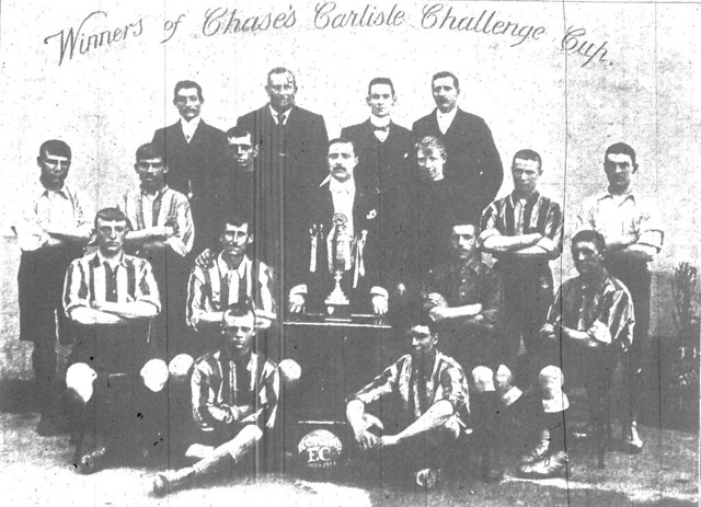
Football
Carlisle is represented in English football by Carlisle United, Currently in the fourth tier of English football after being relegated from the Football League One. The club has played at Brunton Park on Warwick Road (A69) since 1909. In November 2011 plans were unveiled for the club to move to a 12,000-seat stadium in Kingmoor Park.
The club's first Football League tenure began in 1928 when it was elected to the northern section of the Football League Third Division, replacing Durham City. Its past achievements include reaching the Football League Cup semi-finals (its best run in either of the two domestic cups) in 1969, and winning promotion to the top flight (then the Football League First Division) in 1974. The club topped the English league after winning its first three games of the 1974-75 season, but failed to keep up its good form and was relegated after just one season. In 1987 the club returned to the Football League Fourth Division, and in 2004 was relegated to the Football Conference - the first former top division club to do so - only to regain their Football League place after one year.
In 1999, Carlisle United escaped relegation from the Football League on the final day of the season when on-loan goalkeeper Jimmy Glass scored an injury time winner against Plymouth Argyle. The 2-1 win meant that Scarborough was relegated.
Though Carlisle United has rarely attracted the national football headlines, the club has fielded high-profile players. Some have achieved fame at bigger clubs after spending their early careers at the club. These include Peter Beardsley, Stan Bowles, Steve Harkness, Matt Jansen, Rory Delap, Danny Graham. Many older players spent their later years at Carlisle United after playing for bigger clubs. These include Michael Bridges, Mervyn Day, Kevin Gray and David McCreery. Former managers include Bill Shankly, Alan Ashman, Bob Stokoe, Harry Gregg, Mick Wadsworth, Nigel Pearson and Paul Simpson.
Since Workington was voted out of the Football League in 1977, Carlisle United has been the only Cumbrian team to play senior football.
Celtic Nation F.C. was a Carlisle-based semi-professional club who played in the Northern Football League Division One. They folded in April 2015 after a season of financial problems. Nation started out in 2004 as Gillford Park F.C. and played in the Northern Football Alliance league and won four promotions in 8 years. In 2012 Scottish millionaire Frank Lynch who is based in America, started putting money into the club and changed its name to Celtic Nation. After two years, Lynch withdrew his financial support and the club struggled before folding.
Carlisle City are a semi professional side who play in the North West Counties Football League. After spending 40 years in the Northern Football Alliance league, they were promoted in 2016. They play at Gillford Park after taking over the lease from Celtic Nation in the summer of 2015.
Northbank Carlisle was a club which played it's football in the Northern Football Alliance Premier Division. After forty years, the club decided to fold it's senior team. Northbank still operates as a thriving youth academy.
Rugby
Carlisle has two rugby union clubs: Carlisle RFC and Creighton RUFC. Carlisle RFC play at Warwick Road, alongside Carlisle United Football Club. Creighton RUFC originally played near Cumberland Infirmary but sold its ground to housing development company Story Homes in 2004 in exchange for new facilities off Cumwhinton Road, near Junction 42 of the M6. Former England rugby union captain Steve Borthwick is a native of Carlisle.
The rugby league team, Carlisle merged with Barrow and left Carlisle. Amateur rugby league club, Carlisle Centurions play in the National Division of the Rugby League Conference. The club's ground, Gillford Park has covered accommodation on three sides and nearly 1,000 seats.
Other sport
Cumberland County Cricket Club play at the Edenside Ground north of the city centre. Cumberland is classed as a minor county by the ECB. The club has won the Minor Counties Championship twice.
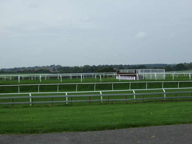
Horse racing has been held in Carlisle for centuries. In 1904 Carlisle Racecourse was established to the south of the city, it is now a first class racecourse.
Carlisle has several golf clubs including Stoneyholme within the city, and Carlisle Golf Club which hosts regional qualifying to the Open Championship.
In 2012 Carlisle was one of the official stop off points for the Olympic torch before it made its way down to the Olympic Games opening ceremony in London's Olympic Stadium.
Armed forces
As a frontier town for over a millennium and a half, Carlisle is a military city. It is the most besieged place in the British Isles, having been besieged at least ten times, and has garrisoned troops for most of its history. Cumbria's County regiment, the Border Regiment made its headquarters at Carlisle Castle. The regiment was amalgamated with the King's Own Royal Regiment (Lancaster) to become the King's Own Royal Border Regiment and subsequently the Duke of Lancaster's Regiment where its lineage continues. From 1720 to 1959 the regiment fought in many campaigns including the French and Indian War, the Battle of Culloden, the First World War and the Second World War.
RAF Carlisle
RAF Carlisle also known as 14 MU was located at Kingstown near the present-day Asda. The station closed in 1996 after nearly sixty years in a variety of roles. First established as RAF Kingstown in 1938, it was originally a bomber station, then one of the RAF's Elementary Flying Training Schools and latterly a post-war storage facility.
Royal Observer Corps, Carlisle Group
During the Second World War the air raid warning organisation No 32 Group Carlisle Royal Observer Corps operated in the city centre controlled from RAF Kingstown. The association with Kingstown developed further in 1962 when the ROC ceased its aircraft spotting role for the RAF and took on a new role plotting nuclear explosions and warning the public of radioactive fallout for the United Kingdom Warning and Monitoring Organisation (UKWMO). A new administration building and a protected, hardened Nuclear Reporting bunker was built at RAF Carlisle. The nuclear bunker was a standard above-ground structure and both the bunker and headquarters hutting were on a separate site at Crindledyke outside the main gates of RAF Carlisle. The Carlisle group was redesignated no 22 Group ROC.
The ROC constructed a smaller nuclear reporting post, Kingstown post (OS ref:NY 3837 5920), on the main RAF Carlisle site. The post was an underground protected bunker for a crew of three observers. The headquarters bunker accommodated an operational crew of around 100 with dormitory and canteen facilities an operations room and life support plant.
The Royal Observer Corps was stood down and its parent organisation the UKWMO was disbanded in December 1995 after the end of the Cold War and as a result of recommendations in the governments Options for Change review of UK defence. The ROC buildings were demolished in 1996 and replaced by a cellphone communications mast. The foundations of the nuclear bunker can still be partially seen outlined in the concreted yard, which also contains the Air Training Corps hut during recent further development of the site.
Curse of Carlisle
The Curse of Carlisle is a 16th-century curse that was first invoked by Archbishop Dunbar of Glasgow in 1525 against cross-border families, known as the Border Reivers, who lived by stealing cattle and pillage. For the millennium celebrations, the local council commissioned a 14-tonne granite artwork inscribed with all 1,069 words of the curse. Following the installation of the stone, Carlisle suffered floods, foot-and-mouth disease, job losses and a goal famine for the football team.
The City Council was considering whether to remove the stone in order to try and stop the bad luck which had struck the city. However Kevin Carlyon, the self-titled "high priest of the British white witches" proclaimed that such actions would give the curse more power. He commented that: "A curse can only work if people believe in it. I think at the moment the sculpture is a nice piece of history, but if the council destroys it, they would be showing their belief in the curse."
from Flickr (flickr)
Image taken from page 284 of 'Magna Britannia; being a concise topographical account of the several counties of Great Britain. [With copious illustrations.] vol. 1-6. L.P'
Pinned by Simon Cotterill
from Flickr (flickr)
Image taken from page 61 of 'The Poetical Works of Sir Walter Scott, Bart. ... With all his introductions and notes, etc. [With plates, including a portrait.]'
Pinned by Simon Cotterill
from Flickr (flickr)
Image taken from page 359 of 'Ancient Streets and Homesteads of England ... Introduction by ... J. S. Howson ... With ... illustrations, etc'
Pinned by Simon Cotterill
from Flickr (flickr)
Image taken from page 69 of 'Histoire d'Angleterre ... Nouvelle édition, augmentée de plus d'un tiers, et enrichie ... de gravures, etc'
Pinned by Simon Cotterill
from Flickr (flickr)
Image taken from page 296 of '[Our own country. Descriptive, historical, pictorial.]'
Pinned by Simon Cotterill
from Flickr (flickr)
Image taken from page 349 of 'The Castles of England: their story and structure ... With ... illustrations and ... plans'
Pinned by Simon Cotterill

from Flickr (flickr)
Image taken from page 395 of 'Magna Britannia; being a concise topographical account of the several counties of Great Britain. [With copious illustrations.] vol. 1-6. L.P'
Pinned by Simon Cotterill

from Flickr (flickr)
Image taken from page 7 of 'The Border City. Carlisle and its associations, etc'
Pinned by Simon Cotterill
Co-Curate Page
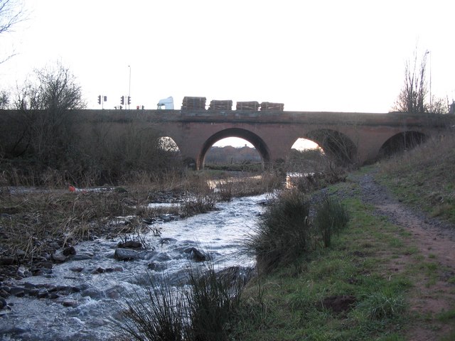
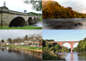
River Eden (Cumbria)
- Overview About the River Eden The River Eden is a major river in Cumbria, which discharges into the Solway Firth. The settlements along the river include Kirkby Stephen, Appleby-in-Westmorland, Bolton, Wetheral, …

from https://www.cumbriacountyhist…
Carlisle
- "Cathedral city and county town of Cumberland....This entry covers four ancient territories: city of Carlisle itself and townships of Rickergate, Botchergate and Caldewgate, which together formed Carlisle CP, created 1904, …
Added by
Simon Cotterill
from Flickr (flickr)
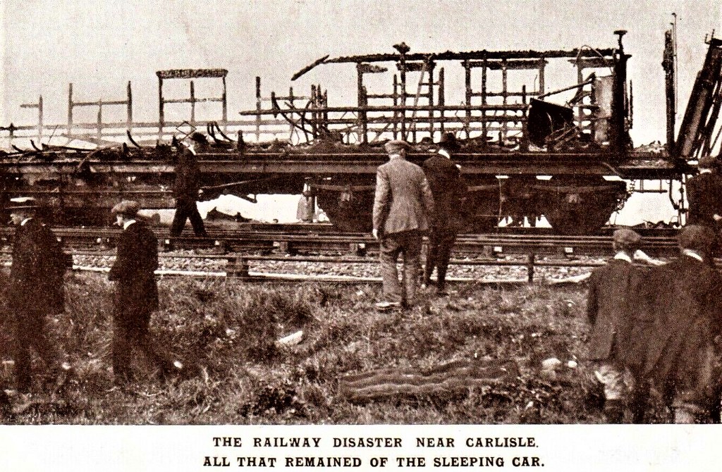
1915 CARLISLE RAILWAY DISASTER TRAIN CARRIAGE PEOPLE POSTCARD CUMBRIA
Pinned by Peter Smith
from Flickr (flickr)
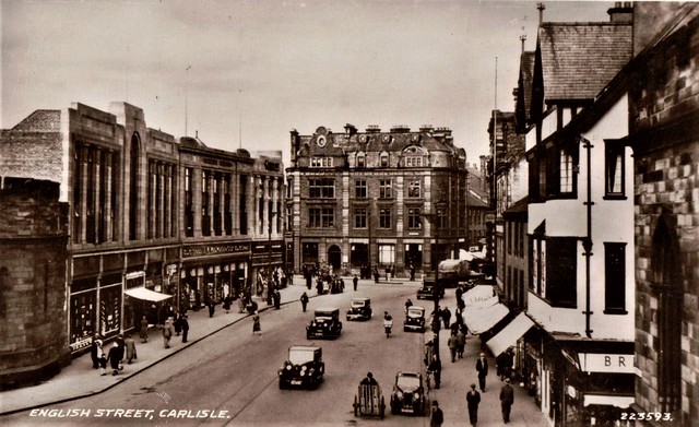
CARLISLE Cumbria - Law Courts and English Street vintage pc with cars & phonebox
Pinned by Peter Smith
from Flickr (flickr)
CARLISLE Cumbria English Street By the City Picture House
Pinned by Peter Smith
from Flickr (flickr)
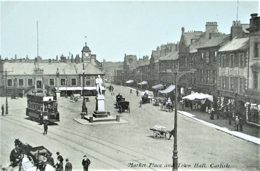
CARLISLE, MARKET PLACE, TOWN HALL, OPEN TOP TRAM, HORSE TRAFFIC, FOLK, LOCAL
Pinned by Peter Smith
from Flickr (flickr)
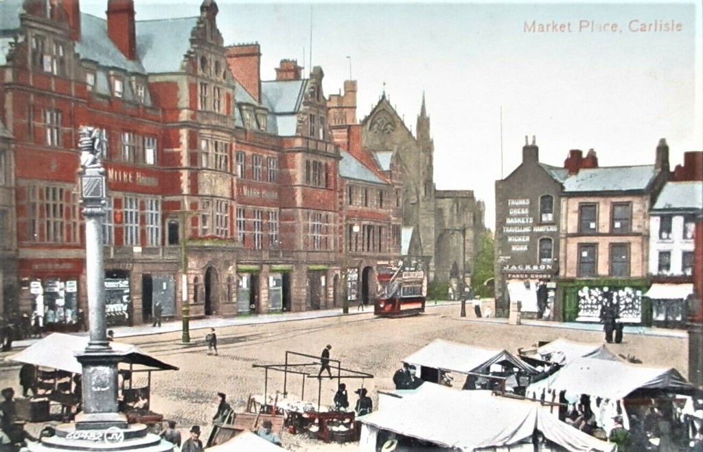
CARLISLE, MARKET PLACE, TRAM, STALLS, FOLK, SHOPS AND SIGNS
Pinned by Peter Smith
from Flickr (flickr)
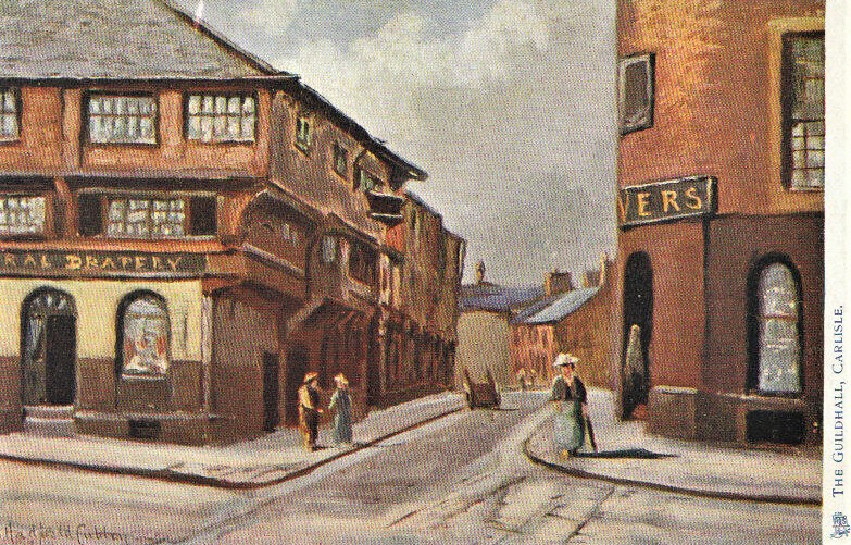
Cumbria Postcard - The Guildhall - Carlisle - Cumbria - Ref 8470A
Pinned by Peter Smith

from Flickr (flickr)
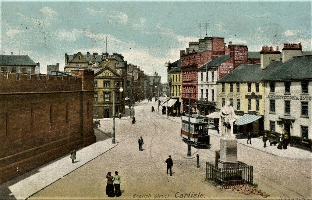
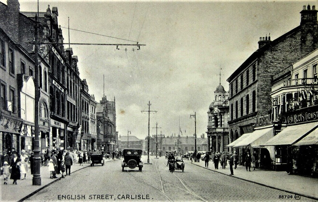
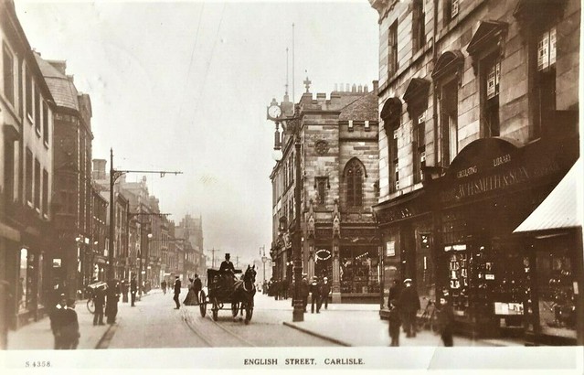
English Street Carlisle 1900's RP Postcard ~ SUPER IMAGE ~ TOP QUALITY CARD
Pinned by Peter Smith
from Flickr (flickr)
ENGLISH STREET, CARLISLE 98704 'Bromotype Series, Valentine's
Pinned by Peter Smith
from Flickr (flickr)
GB 1920s CARLISLE ENGLISH STREET RP POSTCARD POSTED TO ARGYLL
Pinned by Peter Smith
from Flickr (flickr)
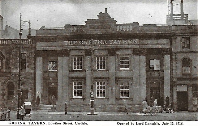
Gretna Tavern Lowther Street Carlisle Cumbria Postcard Sanbride
Pinned by Peter Smith
from Flickr (flickr)
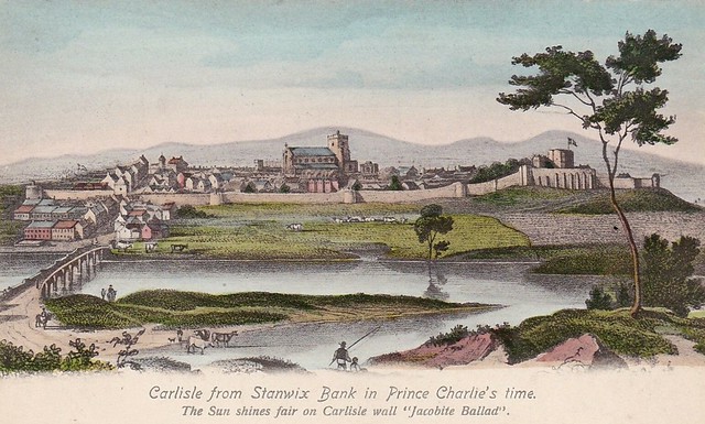
In The Times Of Prince Charlie, View From Stanwix Bank, CARLISLE, Cumberland
Pinned by Peter Smith
from Flickr (flickr)
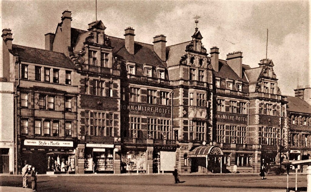
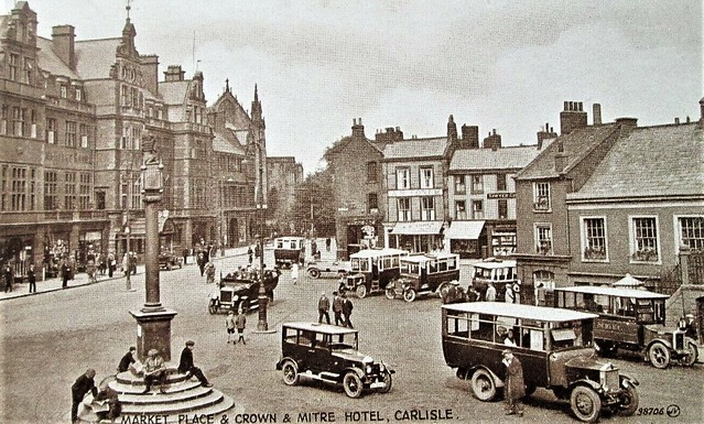
MARKET PLACE AND CROWN & MITRE HOTEL, CARLISLE, CHARABANCS - VALENTINE (1920s)
Pinned by Peter Smith
from Flickr (flickr)
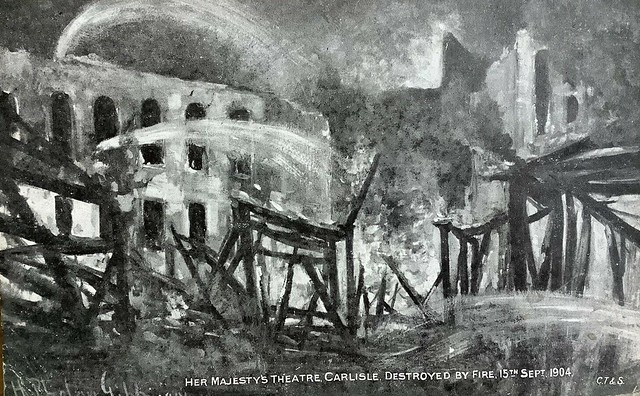
Vintage Postcard, Carlisle, Her Majesty’s Theatre, Fire, 1904, Phelan Gibb
Pinned by Peter Smith


from Youtube (youtube)
Marshalling Yards Under Construction - Carlisle (1961)
Pinned by Simon Cotterill


Co-Curate Page
Carlisle Racecourse
- Overview Map Street View Carlisle Racecourse has been located in Blackwell since 1904, with it's main entrance on Durdar Road, just south of Carlisle. At that time stables were built …

Co-Curate Page
Whiteclosegate, Carlisle
- Overview Map Street View Whiteclosegate is a hamlet and area at the north-east of Carlisle, between Tarraby and Rickerby. Whiteclosegate (road) forms part of the B6264 route from Carlisle towards …
Co-Curate Page
Carlisle Canal
- The Carlisle Canal was an 11¼ mile long waterway built from 1819-1823, to connect Carlisle to the Solway Firth at Port Carlisle. It was built to provide Carlisle with sea …

from Flickr (flickr)
Image taken from page 284 of 'Magna Britannia; being a concise topographical account of the several counties of Great Britain. [With copious illustrations.] vol. 1-6. L.P'
Pinned by Simon Cotterill
from Flickr (flickr)
Image taken from page 61 of 'The Poetical Works of Sir Walter Scott, Bart. ... With all his introductions and notes, etc. [With plates, including a portrait.]'
Pinned by Simon Cotterill
from Flickr (flickr)
Image taken from page 359 of 'Ancient Streets and Homesteads of England ... Introduction by ... J. S. Howson ... With ... illustrations, etc'
Pinned by Simon Cotterill
from Flickr (flickr)
Image taken from page 69 of 'Histoire d'Angleterre ... Nouvelle édition, augmentée de plus d'un tiers, et enrichie ... de gravures, etc'
Pinned by Simon Cotterill
from Flickr (flickr)
Image taken from page 296 of '[Our own country. Descriptive, historical, pictorial.]'
Pinned by Simon Cotterill
from Flickr (flickr)
Image taken from page 349 of 'The Castles of England: their story and structure ... With ... illustrations and ... plans'
Pinned by Simon Cotterill
from Flickr (flickr)
Image taken from page 395 of 'Magna Britannia; being a concise topographical account of the several counties of Great Britain. [With copious illustrations.] vol. 1-6. L.P'
Pinned by Simon Cotterill
from Flickr (flickr)
Image taken from page 7 of 'The Border City. Carlisle and its associations, etc'
Pinned by Simon Cotterill
Co-Curate Page
River Eden (Cumbria)
- Overview About the River Eden The River Eden is a major river in Cumbria, which discharges into the Solway Firth. The settlements along the river include Kirkby Stephen, Appleby-in-Westmorland, Bolton, Wetheral, …
from https://www.cumbriacountyhist…
Carlisle
- "Cathedral city and county town of Cumberland....This entry covers four ancient territories: city of Carlisle itself and townships of Rickergate, Botchergate and Caldewgate, which together formed Carlisle CP, created 1904, …
Added by
Simon Cotterill
from Flickr (flickr)
1915 CARLISLE RAILWAY DISASTER TRAIN CARRIAGE PEOPLE POSTCARD CUMBRIA
Pinned by Peter Smith
from Flickr (flickr)
CARLISLE Cumbria - Law Courts and English Street vintage pc with cars & phonebox
Pinned by Peter Smith
from Flickr (flickr)
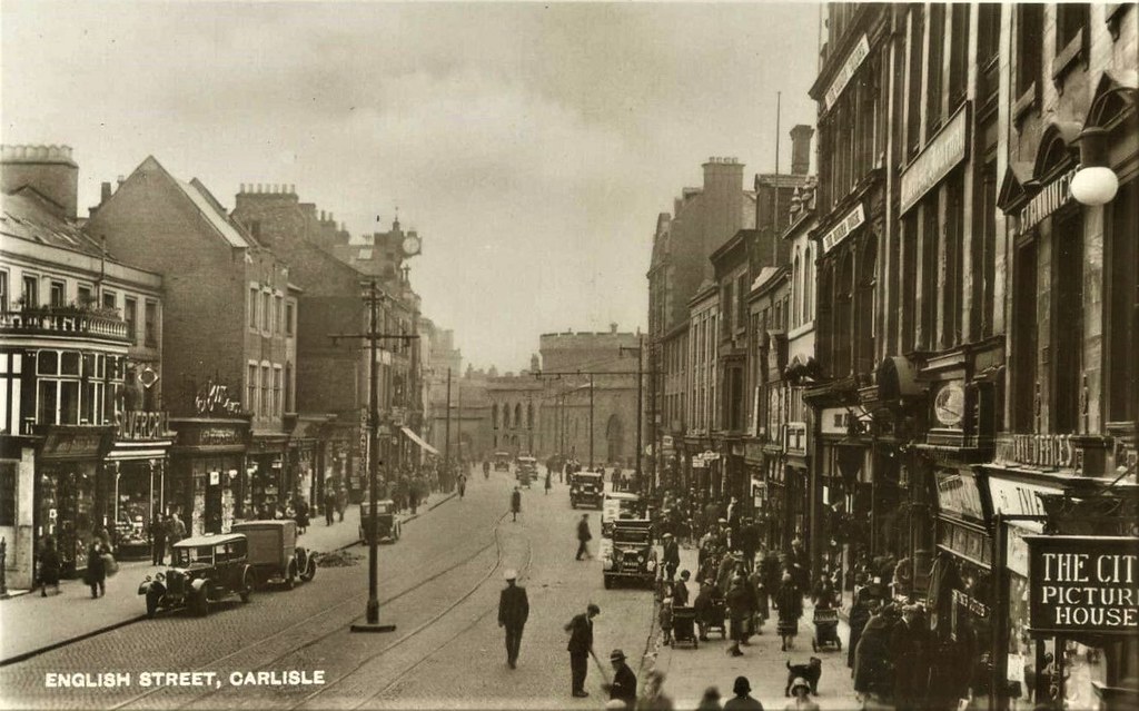
CARLISLE Cumbria English Street By the City Picture House
Pinned by Peter Smith
from Flickr (flickr)
CARLISLE, MARKET PLACE, TOWN HALL, OPEN TOP TRAM, HORSE TRAFFIC, FOLK, LOCAL
Pinned by Peter Smith
from Flickr (flickr)
CARLISLE, MARKET PLACE, TRAM, STALLS, FOLK, SHOPS AND SIGNS
Pinned by Peter Smith
from Flickr (flickr)
Cumbria Postcard - The Guildhall - Carlisle - Cumbria - Ref 8470A
Pinned by Peter Smith
from Flickr (flickr)
English Street Carlisle 1900's RP Postcard ~ SUPER IMAGE ~ TOP QUALITY CARD
Pinned by Peter Smith
from Flickr (flickr)
ENGLISH STREET, CARLISLE 98704 'Bromotype Series, Valentine's
Pinned by Peter Smith
from Flickr (flickr)
GB 1920s CARLISLE ENGLISH STREET RP POSTCARD POSTED TO ARGYLL
Pinned by Peter Smith
from Flickr (flickr)
Gretna Tavern Lowther Street Carlisle Cumbria Postcard Sanbride
Pinned by Peter Smith
from Flickr (flickr)
In The Times Of Prince Charlie, View From Stanwix Bank, CARLISLE, Cumberland
Pinned by Peter Smith
from Flickr (flickr)
MARKET PLACE AND CROWN & MITRE HOTEL, CARLISLE, CHARABANCS - VALENTINE (1920s)
Pinned by Peter Smith
from Flickr (flickr)
Vintage Postcard, Carlisle, Her Majesty’s Theatre, Fire, 1904, Phelan Gibb
Pinned by Peter Smith
from Youtube (youtube)
Marshalling Yards Under Construction - Carlisle (1961)
Pinned by Simon Cotterill
Co-Curate Page
Carlisle Racecourse
- Overview Map Street View Carlisle Racecourse has been located in Blackwell since 1904, with it's main entrance on Durdar Road, just south of Carlisle. At that time stables were built …
Co-Curate Page
Whiteclosegate, Carlisle
- Overview Map Street View Whiteclosegate is a hamlet and area at the north-east of Carlisle, between Tarraby and Rickerby. Whiteclosegate (road) forms part of the B6264 route from Carlisle towards …
Co-Curate Page
Carlisle Canal
- The Carlisle Canal was an 11¼ mile long waterway built from 1819-1823, to connect Carlisle to the Solway Firth at Port Carlisle. It was built to provide Carlisle with sea …
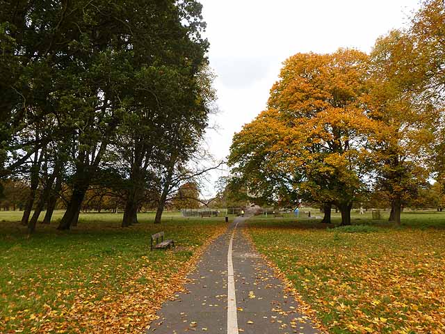
Bitts Park, Carlisle
Botcherby, Carlisle
Botchergate, Carlisle

Brunton Park, Carlisle
Caldewgate

Carlisle at War
Carlisle Castle
Carlisle Cathedral
Carlisle Citadel

Carlisle City Centre Conservation Area
Carlisle Railway Station

Carlisle United F.C.

Carlisle, Historical Account, 1848
Chatsworth Square and Portland Square Conservation Area
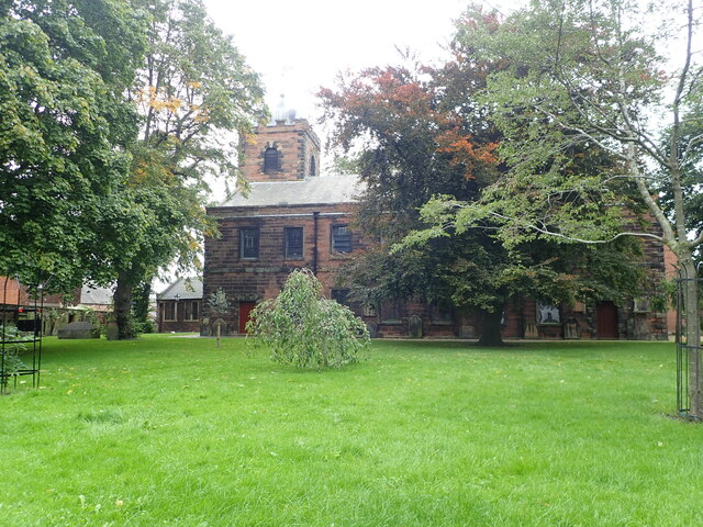
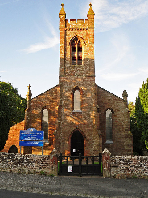
Church of St Cuthbert, Carlisle
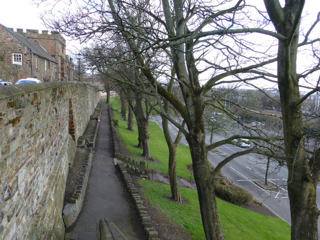
City Walls, Carlisle
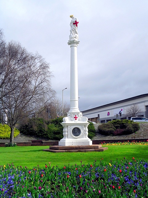
Creighton Memorial, Carlisle
Currock, Carlisle
Denton Holme, Carlisle
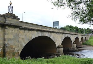
Eden Bridge, Carlisle
Etterby, Carlisle
Floods, January 2005, Carlisle
Guildhall Museum, Carlisle
Harraby, Carlisle
Historic Buildings and Monuments in Carlisle
Holme Head, Carlisle
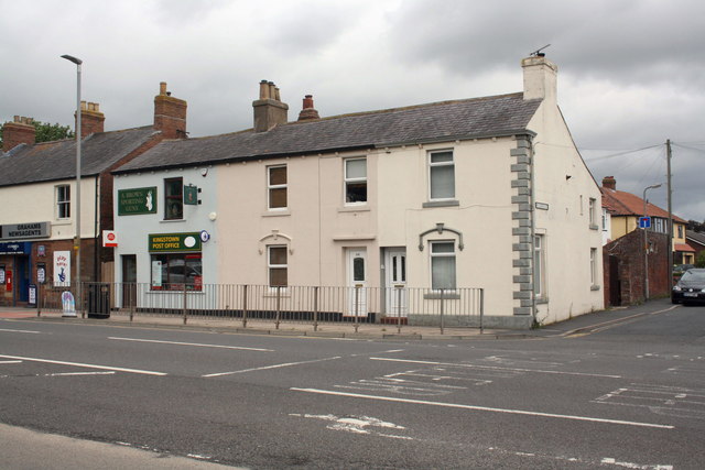
Kingstown, Carlisle
Longsowerby, Carlisle
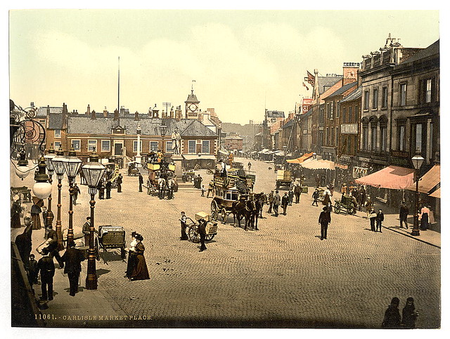
Market Cross, Carlisle
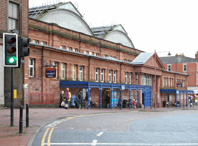
Market Hall, Carlisle
Market Place & Greenmarket, Carlisle
Old Cumberland Infirmary
Old Town Hall, Carlisle
Rickerby Park, Carlisle
Rickergate, Carlisle
Schools in Carlisle
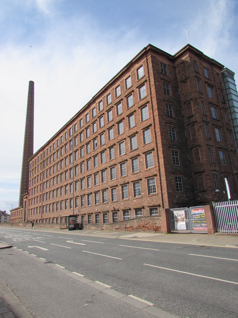
Shaddon Mill, Carlisle
Stanwix
State Management of Public Houses (1916 - 1971)
Streets of Carlisle
The Abbey and Cathedral Precinct, Carlisle

Tullie museum and gallery, Carlisle
Upperby
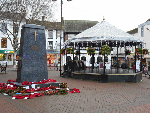
War Memorial, Greenmarket, Carlisle

Waverley Viaduct, Carlisle