Topics > Geography > Rivers > River Wear
River Wear
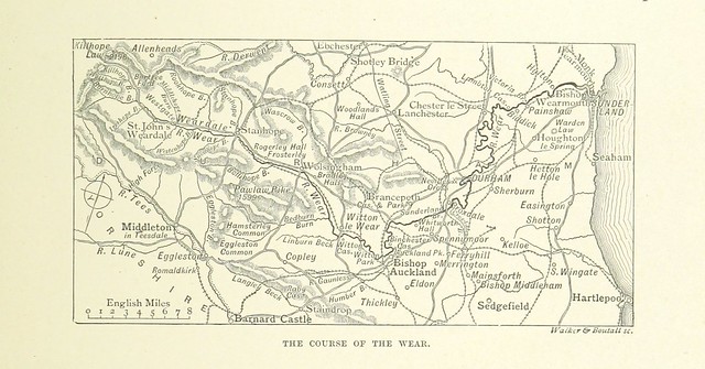
The Wear is a major river in County Durham. It rises in the East Penines at Wearhead at the confluence of Burnhope Burn and Killhope Burn. The river flows eastwards through Bishop Auckland, Durham and Chester-le-Street until reaching the North Sea at Sunderland.
The Wear rises in the east Pennines, an upland area raised up during the Caledonian orogeny. Specifically, the Weardale Granite underlies the headwaters of the Wear. Devonian Old Red Sandstone in age, this Weardale Granite does not outcrop but was surmised by early geologists, and subsequently proven to exist as seen in the Rookhope borehole. It is the presence of this granite that has retained the high upland elevations of this area (less through its relative hardness, and more due to isostatic equilibrium) and accounts for heavy local mineralisation, although it is considered that most of the mineralisation occurred during the Carboniferous period.
It is thought that the course of the River Wear, prior to the last Ice Age, was much as it is now as far as Chester-le-Street. This can be established as a result of boreholes, of which there have been many in the Wear valley due to coal mining. However, northwards from Chester-le-Street, the Wear may have originally followed the current route of the lower River Team. The last glaciation reached its peak about 18,500 years ago, from which time it also began a progressive retreat, leaving a wide variety of glacial deposits in its wake, filling existing river valleys with silt, sand and other glacial till. At about 14,000 years ago, retreat of the ice paused for maybe 500 years at the city of Durham. This can be established by the types of glacial deposits in the vicinity of Durham City. The confluence of the River Browney was pushed from Gilesgate (the abandoned river valley still exists in Pelaw Woods), several miles south to Sunderland Bridge (Croxdale). At Chester-le-Street, when glacial boulder clay was deposited blocking its northerly course, the River Wear was diverted eastwards towards Sunderland where it was forced to cut a new, shallower valley. The gorge cut by the river through the Permian Magnesian Limestone can be seen most clearly at Ford Quarry. In the 17th edition of Encyclopædia Britannica (1990), reference is made to a pre-Ice Age course of the River Wear outfalling at Hartlepool.
The upland area of Upper Weardale retains a flora that relates, almost uniquely in England, to the end of the last Ice Age, although it almost or entirely lacks the particular rarities that make up the unique "Teesdale Assemblage" of post-glacial plants. This may, in part, be due to the Pennine areas of Upper Weardale and Upper Teesdale being the site of the shrinking ice cap. The glaciation left behind many indications of its presence, including lateral moraines and material from the Lake District and Northumberland, although surprisingly few drumlins. After the Ice Age, the Wear valley became thickly forested, however during the Neolithic period and increasingly in the Bronze Age, were largely deforested for agriculture.
Visit the page: River Wear for references and further details. You can contribute to this article on Wikipedia.
Upper Wear:
- Bollihope Burn
- Burnhope Burn
- Killhope Burn
- Middlehope Burn
- Rookhope Burn
- Stanhope Burn
- Swinhope Burn
- Waskerley Beck
- Westernhope Burn
Middle Wear:
- Bedburn Beck
- Beechburn Beck
- Houselop Beck
- Linburn Beck
- River Gaunless
Lower Wear:
- Blackdene Burn
- Brancepeth Beck
- Cong Burn
- Croxdale Beck
- Lumley Park Burn
- Old Durham Beck
- River Browney
- South Burn
- Valley Burn
Much of the River Wear is associated with the history of the Industrial Revolution. Its upper end runs through lead mining country, until this gives way to coal seams of the Durham coalfield for the rest of its length. As a result of limestone quarrying, lead mining and coal mining, the Wear valley was amongst the first places to see the development of railways. The Weardale Railway continues to run occasional services between Stanhope and Wolsingham.
Mining of lead ore has been known in the area of the headwaters of the Wear since the Roman occupation and continued into the nineteenth century. Spoil heaps from the abandoned lead mines can still be seen, and since the last quarter of the twentieth century have been the focus of attention for the recovery of gangue minerals in present mining, such as fluorspar for the smelting of aluminium. However, abandoned mines and their spoil heaps continue to contribute to heavy metal mineral pollution of the river and its tributaries. This has significance to fishing in times of low flow and infrastructure costs as the River Wear is an important source of drinking water for many of the inhabitants along its course.
Fluorspar is another mineral sporadically co-present with Weardale Granite and became important in the manufacture of steel from the late 19th century into the 20th century. In many cases the steel industries were able to take fluorspar from old excavation heaps. Fluorspar explains why iron and steel manufacture flourished in the Wear valley, Consett and Teesside during the nineteenth century. Overlying are three Carboniferous minerals: limestone, Coal Measures as raw materials for iron and steel manufacture, and sandstone, useful as a refractory material. The last remaining flourspar mine closed in 1999 following legislation re water quality. A mine at Rogerley Quarry, Frosterley, is operated by an American consortium who occasionally work it for specimen minerals.
Minco are currently exploring the North Pennines and the upper Wear catchment for potential reserves of zinc at lower levels.
Ironstone which was important as the ore was won from around Consett and Tow Law, then around Rookhope, while greater quantities were imported from just south of the southerly Tees in North Yorkshire. These sources were in due course depleted or became uneconomic.
The former cement works at Eastgate, until recently run by Lafarge, was based on an inlier of limestone. The site recently gained planning permission to form a visitor complex showcasing an eco-village using alternative technology, including a "hot rocks" water heating system. The underlying granite has been drilled and reports confirm their presence. Bardon Aggregates continue to quarry at Heights near Westgate and operate a tarmac "blacktop" plant on site.
Mineral extraction has also occurred above St John's Chapel with the extraction of ganister which was used in the steel process at Consett. Around Frosterley, limestone, sand (crushed sandstone) and Frosterley Marble have been worked and the Broadwood Quarry recently expanded into ground held on an old licence. The crushing plant continues to operate. A quarry at Bollihope was also mooted on a similar basis but plans seem to have been discontinued. Frosterley Marble was used extensively in church architecture, there are local examples in St Michael's church Frosterley and Durham Cathedral.
Visit the page: River Wear for references and further details. You can contribute to this article on Wikipedia.
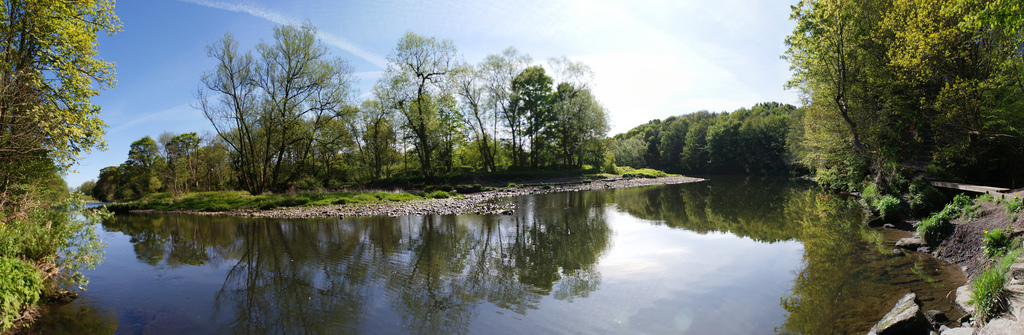
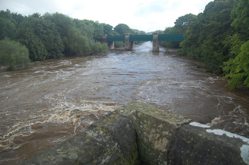
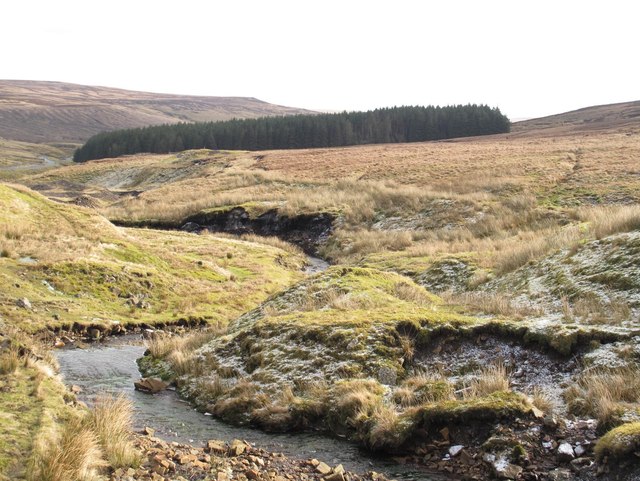
Rising in the east Pennines, its head waters consisting of several streams draining from the hills between Killhope Law and Burnhope Seat, the head of the river is held to be in Wearhead, County Durham at the confluence of Burnhope Burn and Killhope Burn. This is shown on Ordnance Survey maps, and on the County Durham GIS online. However, a map produced by Durham County Council, and used on an interpretation board at Cowshill shows the River Wear taking in the northwest Killhope Burn from Wearhead up to Killhope. Excepting that this apparent extension of the Wear is an error, it can be assumed that there are attempts to reclassify Killhope Burn as the River Wear - on some analyses this practice of backtracking is common in the study of rivers as it gives the River Wear an issue as the source instead of a confluence, to which this article's Geology relates. The River Wear is a spate river and has been heavily influenced by previous government funded drainage schemes (gripping) with a view to improving marginal agricultural land. The river rises very quickly and has experienced much heavy flooding resulting in enhanced river bank erosion
The river flows eastwards through Weardale, one of the larger valleys of west County Durham, subsequently turning south-east, and then north-east, meandering its way through the Wear Valley still in County Durham to the North Sea where it outfalls at Wearmouth in the main locality of Monkwearmouth on Wearside in the City of Sunderland. The from head to mouth. Prior to the creation of Tyne and Wear, the Wear had been the longest river in England with a course entirely within one county. The Weardale Way, a long-distance public footpath, roughly follows the entire route, including the length of Killhope Burn.
Wearhead to Bishop Auckland
There are several towns, sights and tourist places along the length of the river. The market town of Stanhope is known in part for the ford across the river. From here the river is followed by the line of the Weardale Railway, which crosses the river several times, through Frosterley, Wolsingham, and Witton-le-Wear to Bishop Auckland.
Bishop Auckland to Durham
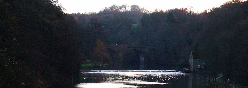
On the edge of Bishop Auckland the Wear passes below Auckland Park and Auckland Castle, the official residence of the Bishop of Durham and its deer park. A mile or so downstream from here, the Wear passes Binchester Roman Fort, Vinovia, having been crossed by Dere Street, the Roman road running from Eboracum (now York) to Coria (now Corbridge) close to Hadrian's Wall. From Bishop Auckland the River Wear meanders in a general northeasterly direction, demonstrating many fluvial features of a mature river, including wide valley walls, fertile flood plains and ox-bow lakes. Bridges over the river become more substantial, such as those at Sunderland Bridge (near Croxdale), and Shincliffe. At Sunderland Bridge the River Browney joins the River Wear.
Durham
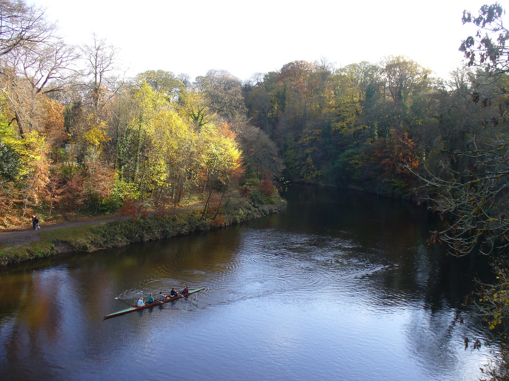
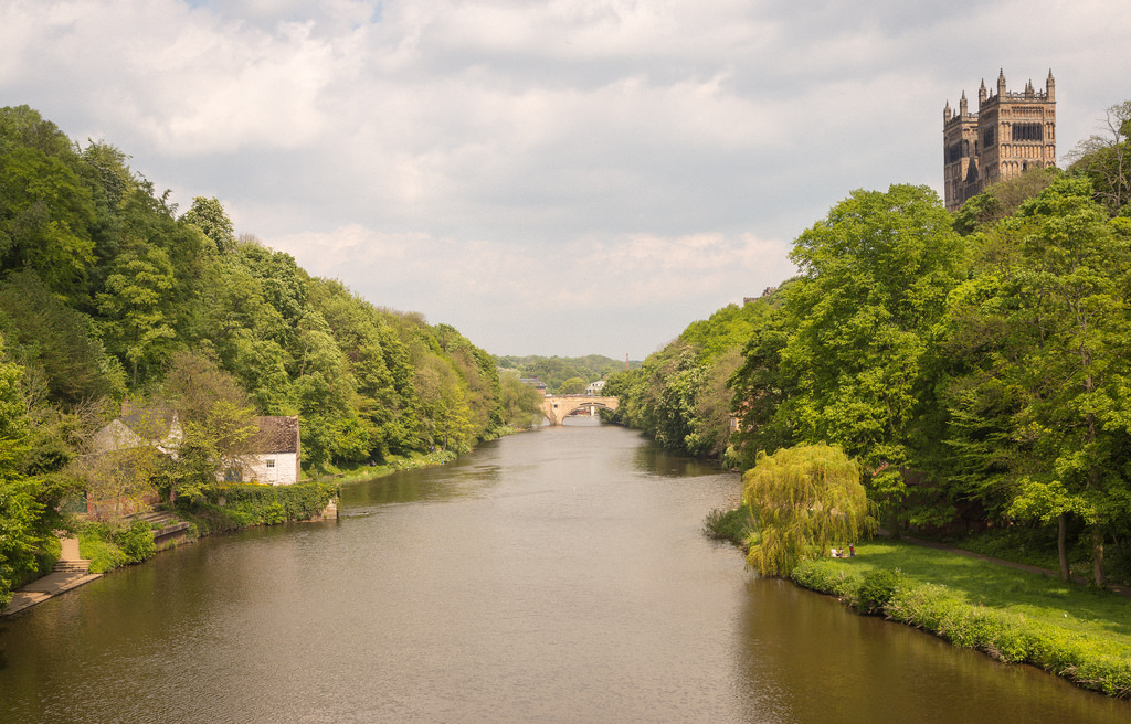
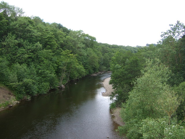
River wear at durham.jpg|thumb|left|240px|The wooded riverbanks of the Wear as it flows through Durham.
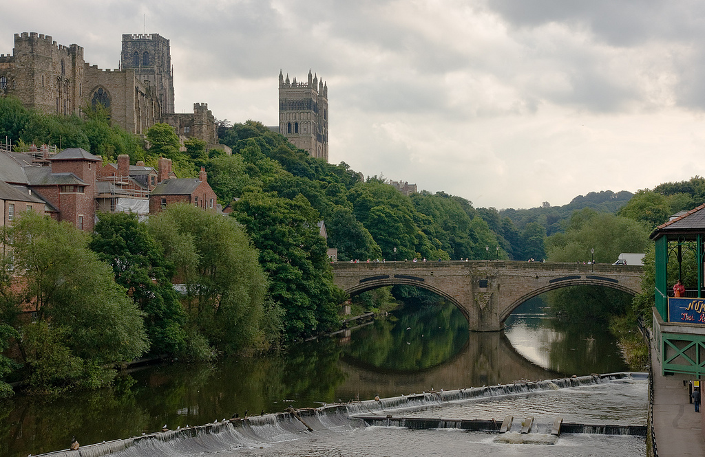
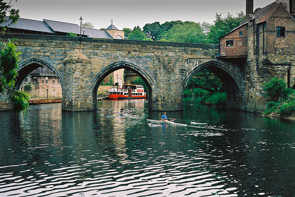
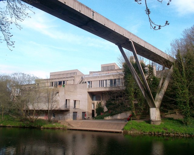
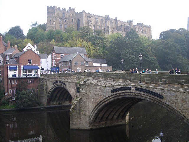
When it reaches the city of Durham the River Wear passes through a deep, wooded gorge, from which several springs emerge, historically used as sources of potable water. A few coal seams are visible in the banks. Twisting sinuously in an incised meander, the river has cut deeply into the "Cathedral Sandstone" bedrock. The high ground (bluffs) enclosed by this meander is known as the Peninsula, forming a defensive enclosure, at whose heart lies Durham Castle and Durham Cathedral and which developed around the Bailey into Durham city. That area is now a UN World Heritage Site. Beneath Elvet Bridge are Brown's Boats (rowing boats for hire) and the mooring for the Prince Bishop, a pleasure cruiser.
The River Wear at Durham was featured on a television programme Seven Natural Wonders as one of the wonders of Northern England.
In June each year, the Durham Regatta, which predates that at Henley, attracts rowing crews from around the region for races along the river's course through the city. Seven smaller Regattas and Head Races are held throughout the rest of the year, which attract a lower number of competitors. There are 14 boathouses and 20 boat clubs based on the Wear in Durham.
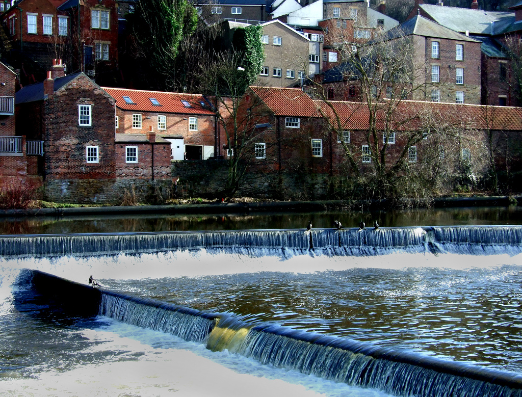
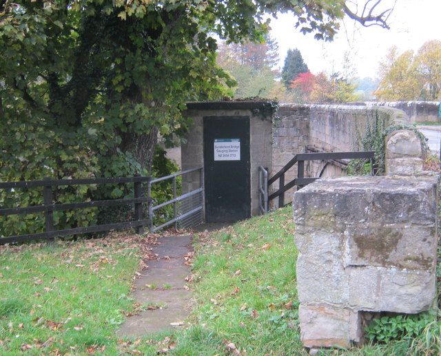
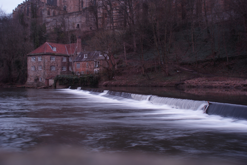
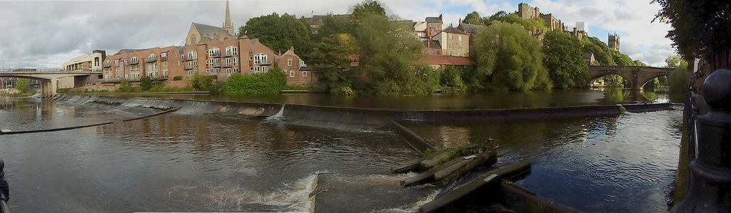
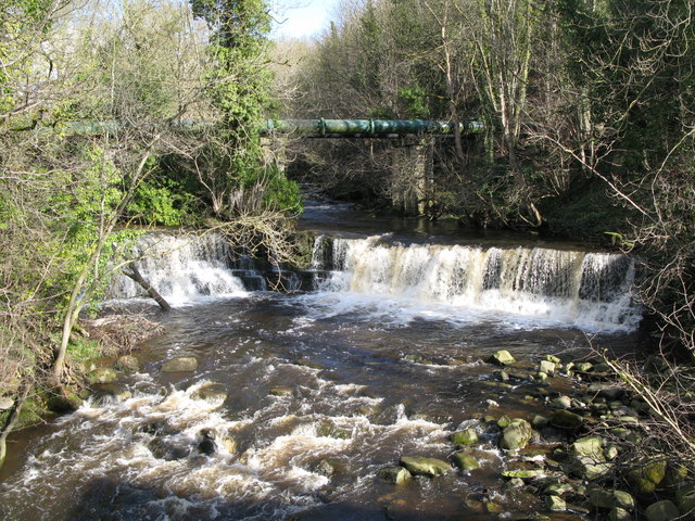
Two weirs impede the flow of the river at Durham, both originally created for industrial activities. The Old Fulling Mill is now an archaeological museum. The second weir, beneath Milburngate Bridge, now includes a salmon leap and fish counter, monitoring sea trout and salmon, and is on the site of a former ford. Considering that 138,000 fish have been counted migrating upriver since 1994, it may not be surprising that a family of cormorants live on this weir, and can frequently be watched stretching their wings in an attempt to dry off after feeding (as they lack the waterproofing oils present in most other waterbirds).
The river's banks also lend their name to a hymn tune Elvet Banks in the LCMS 2006 hymnbook, used (appropriately) for a hymn for baptism.
Durham to Chester-le-Street
Between Durham City and Chester-le-Street, due north, the River Wear changes direction repeatedly, flowing south westwards several miles downstream having passed the medieval site of Finchale Priory, a former chapel and later a satellite monastery depending on the abbey church of Durham Cathedral. Two miles downstream, the river is flowing south eastwards. The only road bridge over the Wear between Durham and Chester-le-Street is Cocken Bridge. As it passes Chester-le-Street, where the river is overlooked by Lumley Castle, its flood plain has been developed into The Riverside, the home pitch of Durham County Cricket Club. Passing through the Lambton Estate and near Lambton Castle the river becomes tidal, and navigable.
Chester-le-Street to Sunderland
On exiting the Lambton estate the river leaves County Durham and enters the City of Sunderland, specifically the southern/south-eastern edge of the new town of Washington. At Fatfield the river passes beneath Worm Hill, around which the Lambton Worm is reputed to have curled its tail.
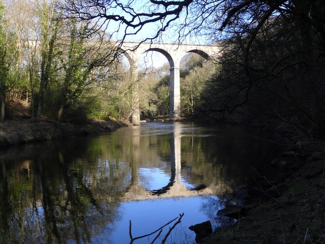
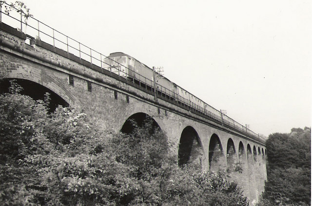
Already the riverbanks are showing evidence of past industrialisation, with former collieries and chemical works. A little further downstream the river passes beneath the Victoria Viaduct, (formally called the Victoria Bridge). Named after the newly crowned queen, the railway viaduct opened in 1838, was the crowning achievement of the Leamside Line, then carrying what was to become the East Coast Main Line. A mile to the east is Penshaw Monument, a local iconic landmark. As the river leaves the environs of Washington, it forms the eastern boundary of Washington Wildfowl Trust.
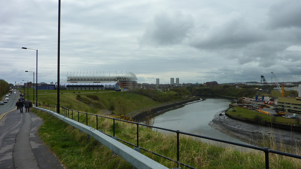
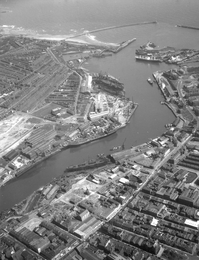
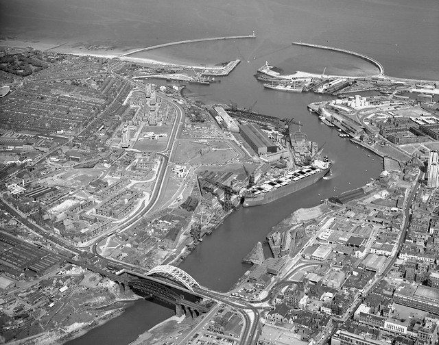
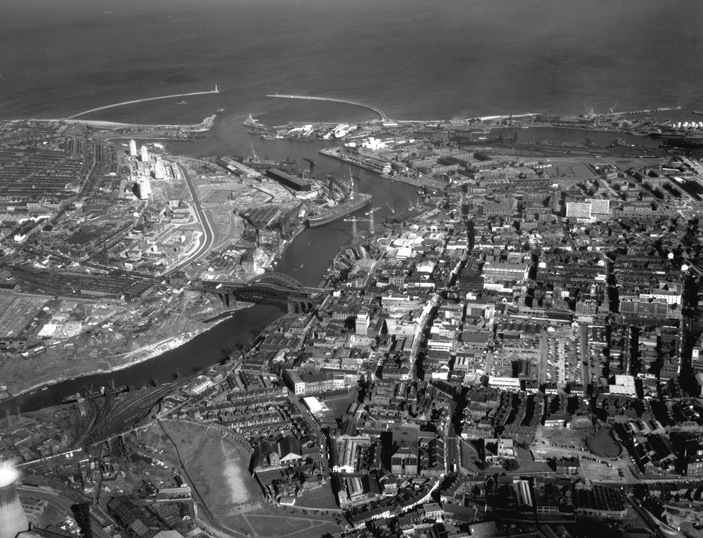
Sunderland
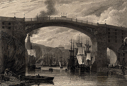
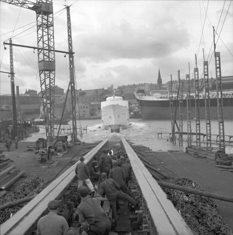
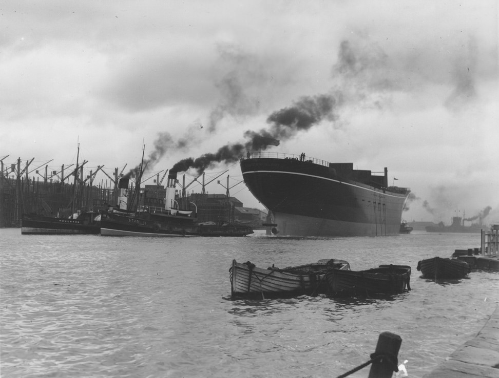
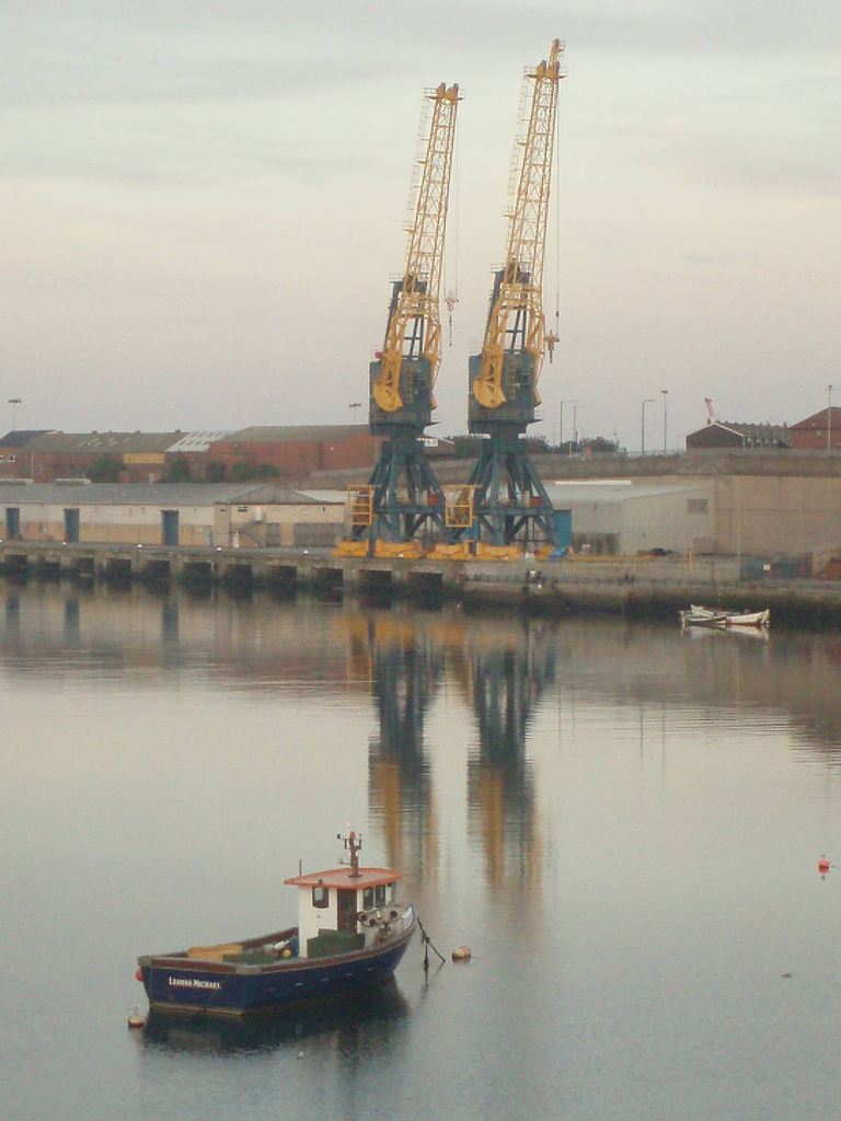
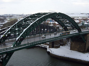
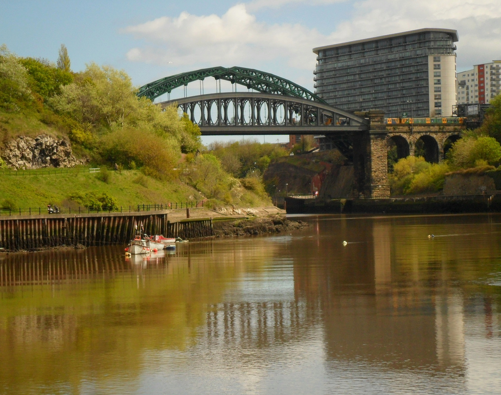
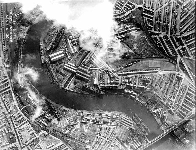
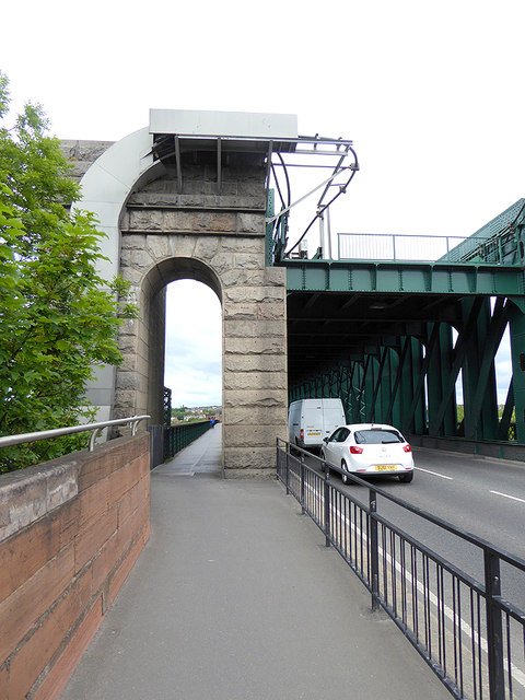
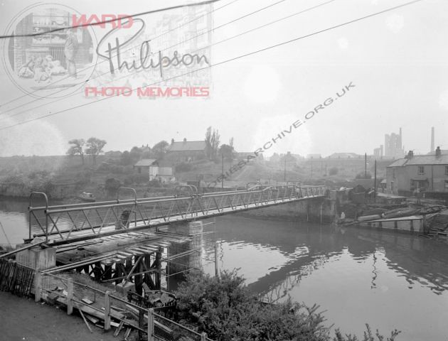
Having flowed beneath the A19 trunk road, the river enters the suburbs of Sunderland. The riverbanks show further evidence of past industrialisation, with former collieries, engineering works and dozens of shipyards. In their time, Wearside shipbuilders were some of the most famous and productive shipyards in the world. The artist L. S. Lowry visited Sunderland repeatedly and painted pictures of the industrial landscape around the river. Three bridges cross the Wear in Sunderland: the Queen Alexandra Bridge to the west, and the Wearmouth rail and road bridges in the city centre.
On both banks at this point there are modern developments, some belonging to the University of Sunderland (St. Peter's Campus; Scotia Quay residences) and to the National Glass Centre. A riverside sculpture trail runs alongside this final section of its north bank. The St Peter's Riverside Sculpture Project was created by Colin Wilbourn, with crime novelist and ex-poet Chaz Brenchley. They worked closely with community groups, residents and schools.
As the river approaches the sea, the north bank (Roker) has a substantial residential development and marina. A dolphin nicknamed Freddie was a frequent visitor to the marina, attracting much local publicity. However, concern was expressed that acclimatising the dolphin to human presence might put at risk the safety of the dolphin regarding the propellors of marine craft. The south bank of the river is occupied by what remains of the Port of Sunderland, once thriving and now almost gone.
The River Wear flows out of Sunderland between Roker Pier and South Pier, and into the North Sea.
Visit the page: River Wear for references and further details. You can contribute to this article on Wikipedia.
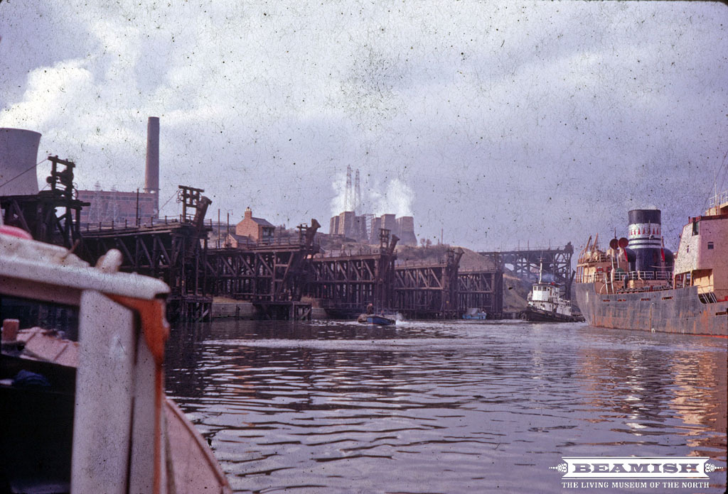
from Beamish (flickr)
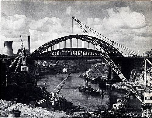
Looking towards Wearmouth Colliery, Sunderland - 1968
Pinned by Simon Cotterill

from https://en.wikipedia.org/wiki…
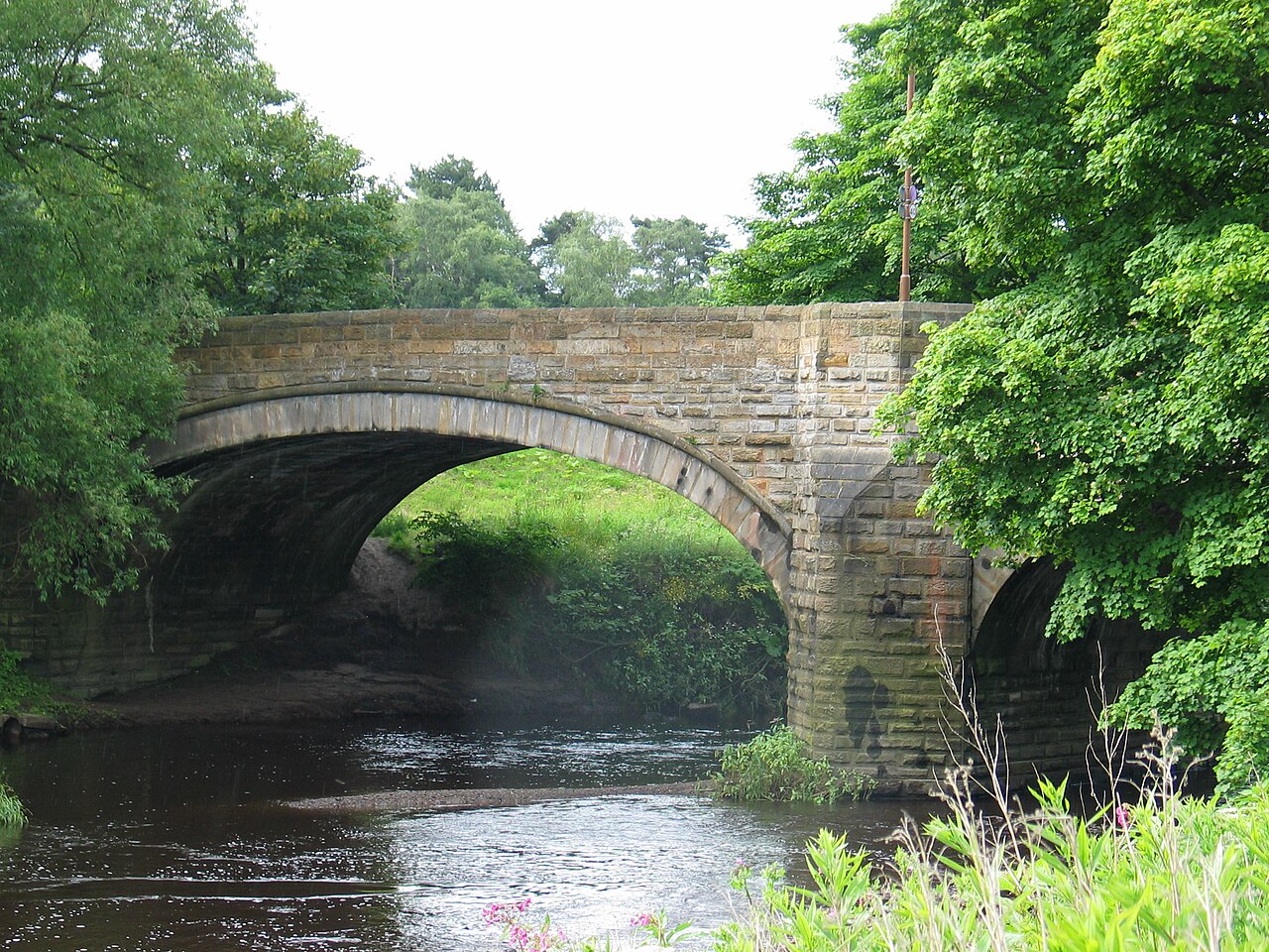
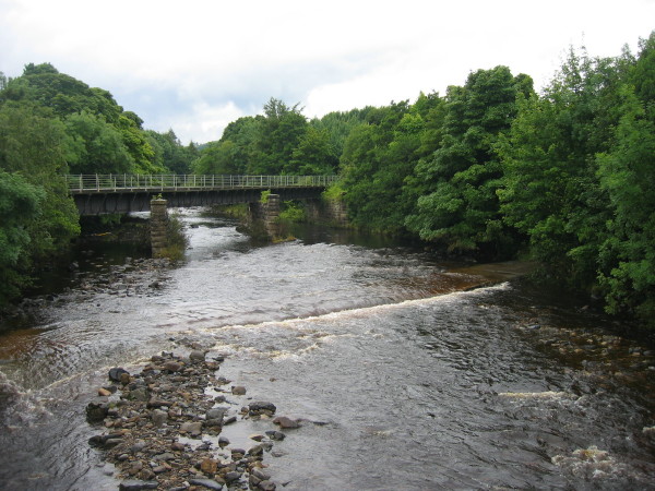
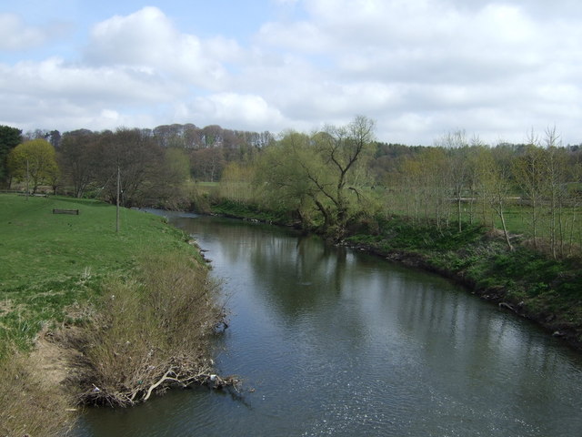
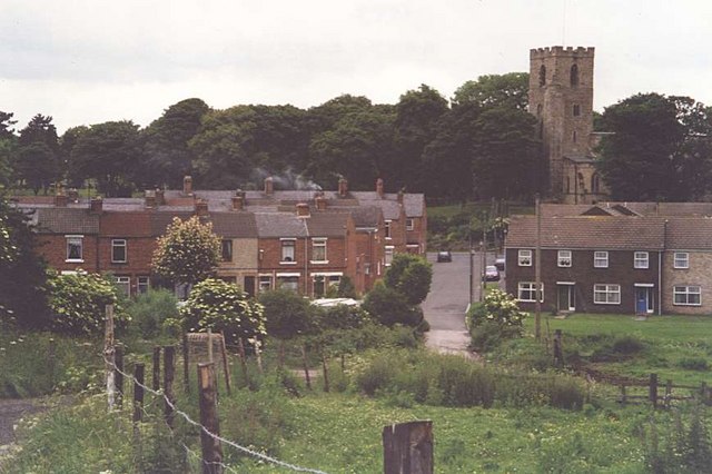
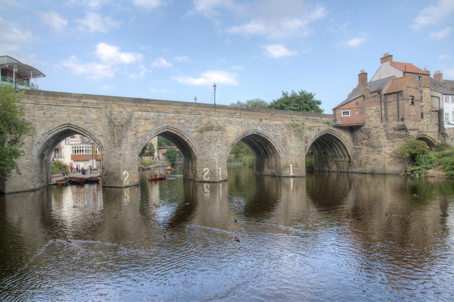
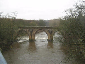
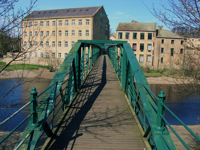
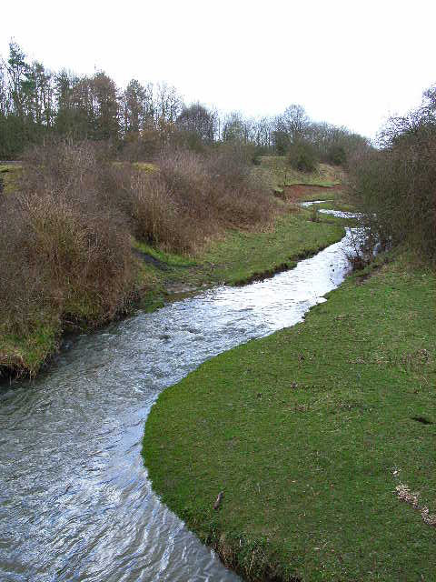
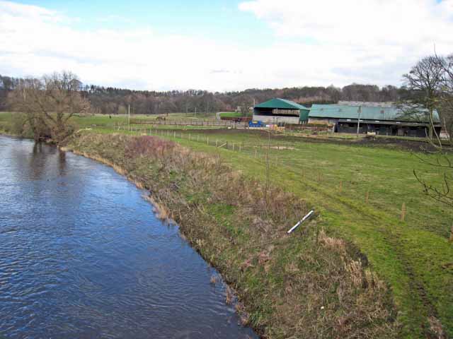
The River Wear at Shincliffe Bridge
- The River Wear at Shincliffe Bridge, taken by Peter Hughes on Saturday 30 June 2007. This work is licensed under the Creative Commons Attribution-ShareAlike 3.0 License.
Added by
Pat Thomson
Co-Curate Page
Shincliffe & High Shincliffe
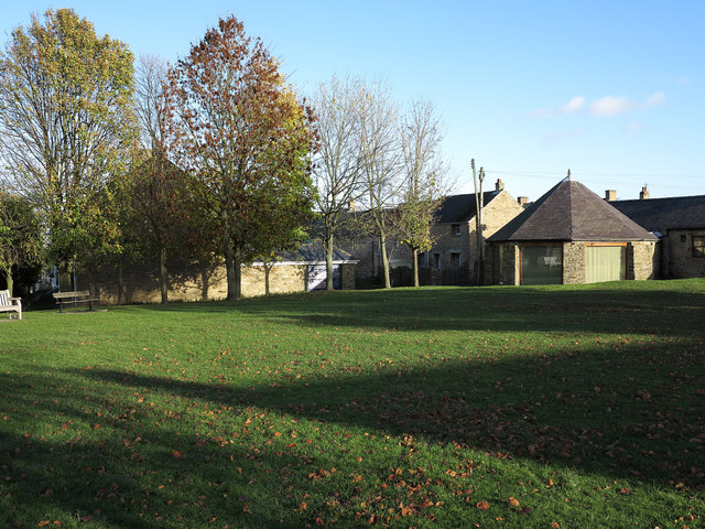
- Shincliffe is a village in the County Durham located by the River Wear just over a mile from the City of Durham. In the Middle Ages Shincliffe was an agricultural …
Co-Curate Page
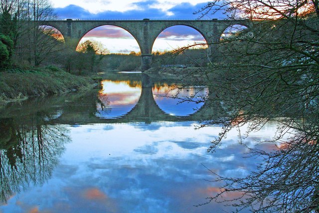
Victoria Viaduct
- Overview About the Victoria Viaduct Map Victoria Bridge is a 810 ft long rail viaduct over the River Wear near Fatfield, Washington. It was built for the Durham Junction Railway and opened …
Co-Curate Page
Sunderland Marina
- Sunderland Marina is situated at the mouth of the River Wear in Sunderland. The Marina is it owned and operated by an independent Charitable Trust. SR6 0PW
Co-Curate Page
Sunderland
- Overview About the City of Sunderland Timeline Map Street View The City of Sunderland is located in Tyne and Wear, in the North East England. The former Metropolitan Borough of …
Co-Curate Page
Durham (City)
- Overview History of Durham Timeline Map Street View Early history Archeological evidence suggests a history of settlement in the area since roughly 2000 BC. The present city can clearly …
Co-Curate Page
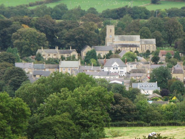
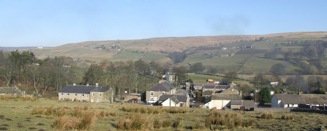
Wolsingham
- Overview History Map Street View Wolsingham sits at the confluence of the River Wear and Waskerley Beck. It is a small settlement and one of the first market towns …
Co-Curate Page
Stanhope
- Overview About Stanhope Map Street View Stanhope (pronounced in the regional dialect "Stanup") is a small market town in County Durham, in England. It is situated on the River …
Co-Curate Page
Chester-le-Street
- Overview About Chester-le-Street Map Street View Chester-le-Street is a historic market town in County Durham, located about 4 miles north of Durham (city). It is situated on the River Wear, at …
Co-Curate Page
Bishop Auckland
- Overview About Bishop Auckland Map Street View Bishop Auckland is a market town in County Durham in north located between Darlington and Durham at the confluence of the River Wear …
Co-Curate Page
Wearmouth Bridge
- Overview History Timeline Map Street View The Wearmouth Bridge crosses the River Wear in Sunderland. The current bridge was built 1927 to 1929 and replaced an earlier cast-iron bridge in the same …
Co-Curate Page
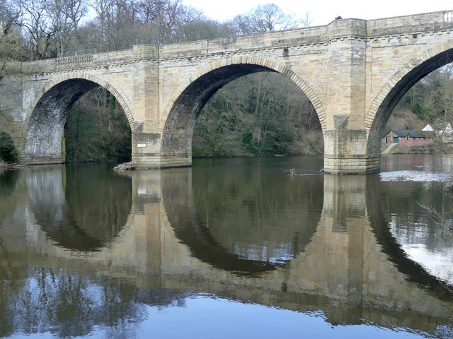
Elvet Bridge
- Overview Further Information Map Street View Elvet Bridge is a stone bridge which crosses the River Wear connecting the peninsula in central Durham and the Elvet area of the city. …
from Geograph (geograph)
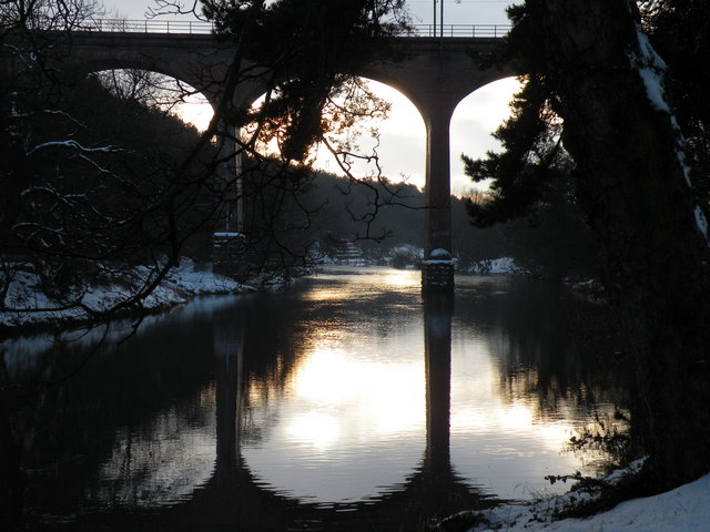
River Wear from road bridge at Wearhead looking East
Pinned by Simon Cotterill
Co-Curate Page
Wearhead
- Overview About Wearhead Map Wearhead is a picturesque village in County Durham, located at the start of Weardale where the River Wear is begins at the confluence of Burnhope Burn …

Co-Curate Page
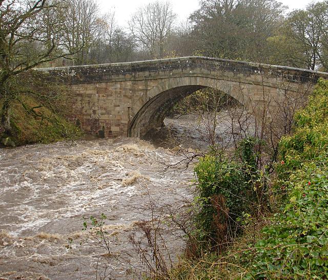
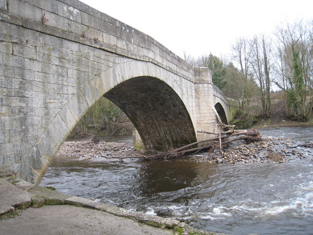
Sunderland Bridge (bridge)
- Overview Map Street View This stone bridge across the River Wear near the village of Sunderland Bridge, Croxdale, dates from the 14th Century. The bridge has undergone several modifications, with …

Co-Curate Page
Newton Cap Viaduct
- Overview Map Street View Newton Cap Viaduct was built in 1857 to carry the Bishop Auckland to Durham City railway across the River Wear and Newton Cap Bank, which leads …

Co-Curate Page
Newton Cap Bridge
- Overview Map Street View Newton Cap Bridge is a stone bridge across the River Wear at Bishop Auckland, County Durham. Reputedly it was built in the late 14th century for …
Co-Curate Page
Ireshopeburn
- Overview About Ireshopeburn Map Street View Ireshopeburn is a village in County Durham, located in Weardale on the A689 road between Wearhead and St John's Chapel. Ireshopeburn is a village …
Co-Curate Page
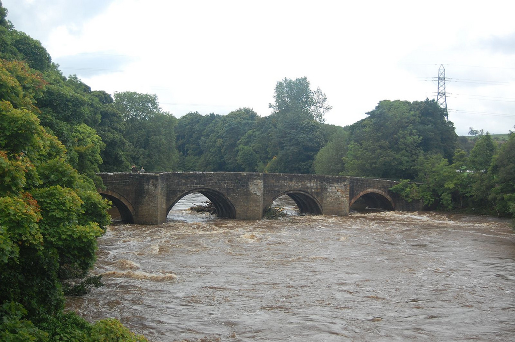
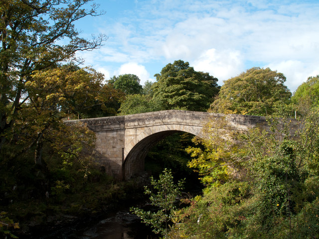
Bridge over the Wear
- Overview Map Street View This stone bridge over the River Wear just west of Stanhope dates from medieval times. The bridge now carries the B6278 road. It is Grade II* …
Co-Curate Page
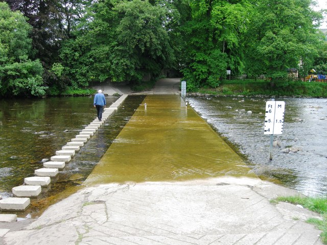
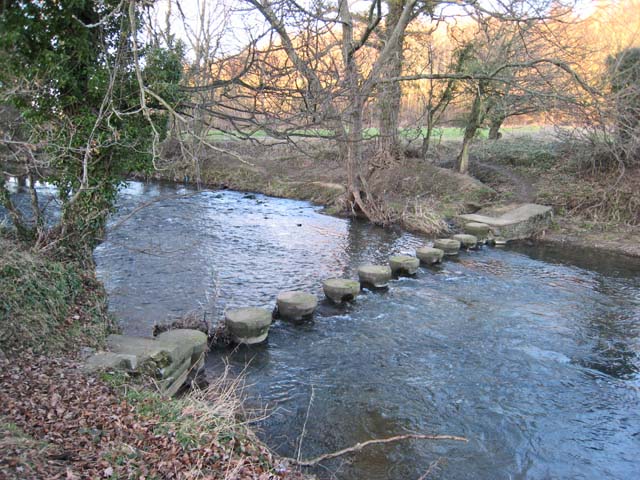
Stanhope Ford and Stepping Stones
- Overview Map Street View In 2012 a public enquiry recommended the permanent closure of Stanhope Ford to vehicles. The ford through the River Wear at Stanhope was closed by police …
from Flickr (flickr)
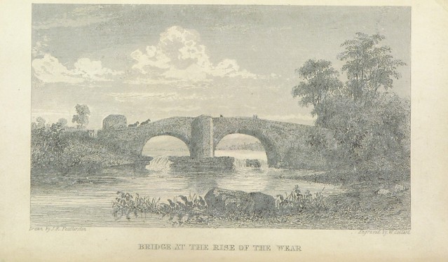
Image taken from page 10 of 'Weardale men and manners'
Pinned by Simon Cotterill
Co-Curate Page
Fatfield
- Overview About Fatfield Map Street View Fatfield is a village by the River Wear, which is part of Washington new town in the City of Sunderland. Fatfield's history is linked …

from Flickr (flickr)
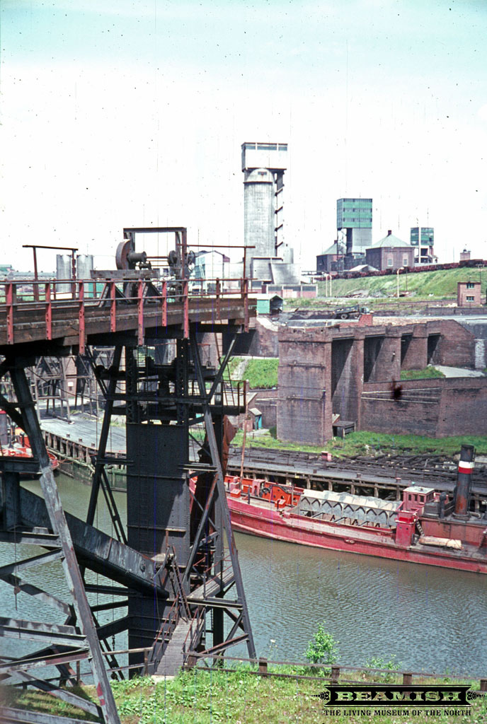
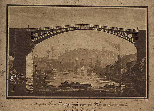
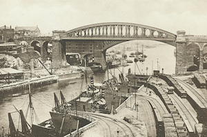
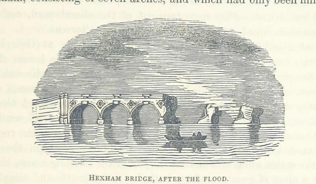
Image taken from page 189 of 'The rivers of Great Britain. Descriptive, historical, pictorial. Rivers of the east coast'
Pinned by Simon Cotterill
from Flickr (flickr)
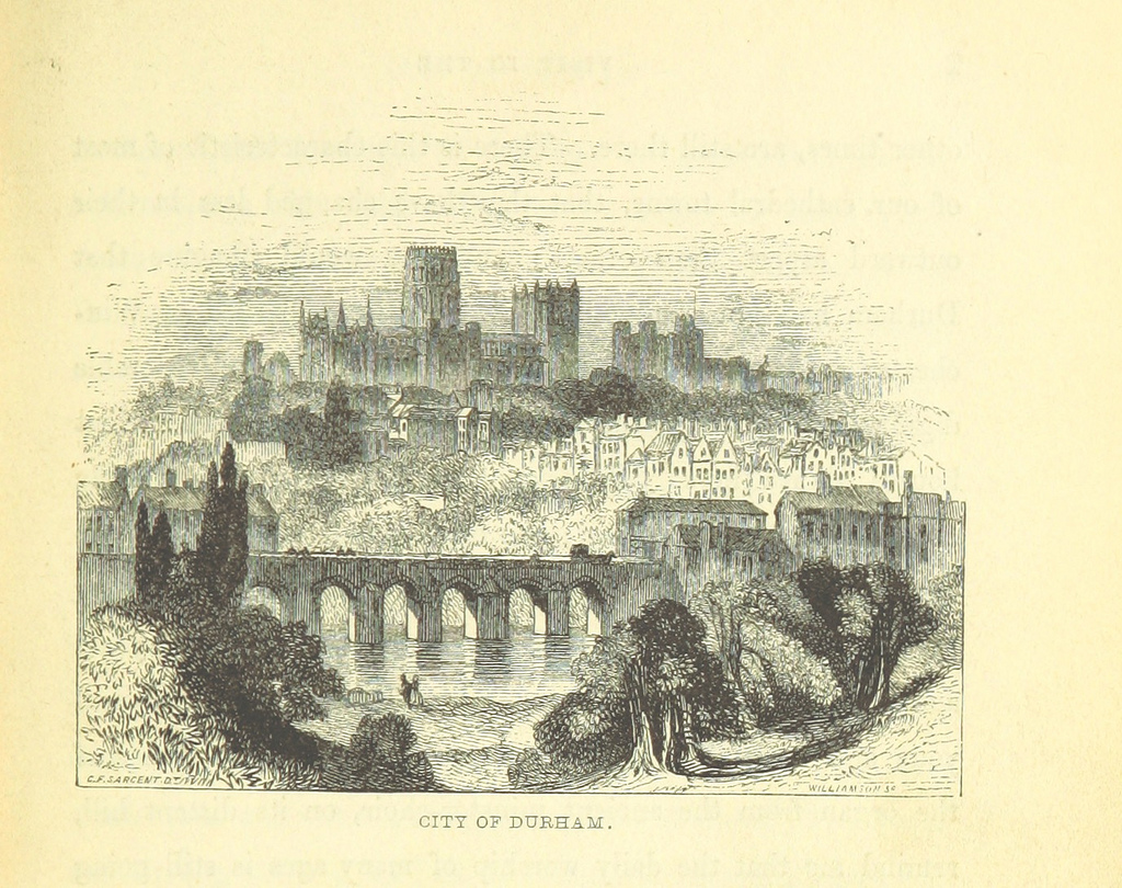
Image taken from page 571 of 'The rivers of Great Britain. The Thames, from source to sea, etc. [With “Rivers of the east coast”.]'
Pinned by Simon Cotterill
Co-Curate Page
Queen Alexandra Bridge
- Overview About the Bridge Map Street View The Queen Alexandra Bridge over the River Wear links the Southwick and Deptford areas of Sunderland. The bridge was built 1907-1909, originally as a double-decker …
Co-Curate Page
Kingsgate Bridge
- Overview About Kingsgate Bridge Map Street View Kingsgate Bridge is a footbridge over the River Wear, which was built in 1965. The bridge connects Bow Lane in the centre old of …
Co-Curate Page
Framwellgate Bridge
- Overview About Framwellgate Bridge Map Street View Framwellgate Bridge is a medieval stone bridge over the River Wear in Durham. The bridge was built in the 15th century and replaced …
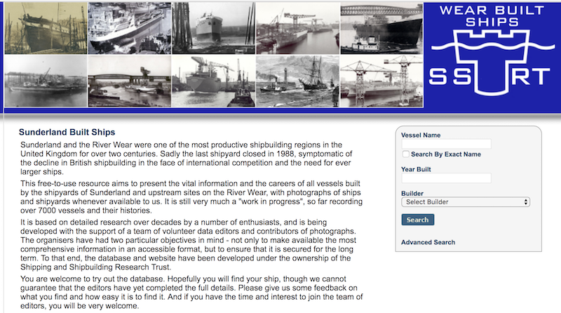
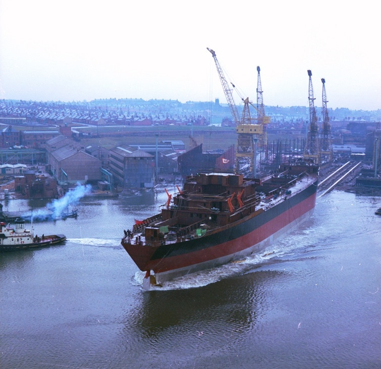
from http://www.sunderlandships.co…
Wear Built Ships
- "....This free-to-use resource aims to present the vital information and the careers of all vessels built by the shipyards of Sunderland and upstream sites on the River Wear, with photographs …
Added by
Simon Cotterill

Co-Curate Page
Hunwick
- Overview About Hunwick Map Street View Hunwick is a semi-rural village in County Durham, England. There are actually two villages that are often referred to collectively as Hunwick, Hunwick …
Co-Curate Page
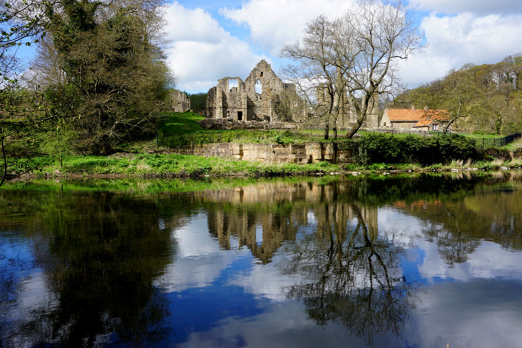
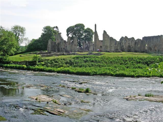
Finchale Priory
- Overview About Finchale Priory Map Street View Finchale Priory was a Benedictine priory built in the 13th-century. The ruins of the Priory are located by the River Wear, 3 miles …
Co-Curate Page
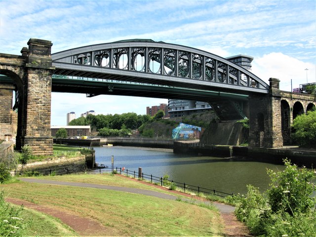
Monkwearmouth Railway Bridge
- Overview About Monkwearmouth Railway Bridge Map Street View Monkwearmouth Railway Bridge (officially Monkwearmouth Bridge, also called Wearmouth Railway Bridge or Sunderland Railway Bridge) is a railway bridge built in …
Co-Curate Page
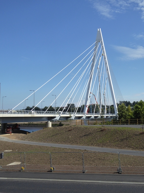
Northern Spire Bridge
- Overview About the Northern Spire Bridge Map Street View The bridge was opened on the 28th of August 2018 - the first bridge to be built over the River Wear in …
Co-Curate Page
Prebends Bridge
- Overview About Prebends Bridge Map Street View Prebends Bridge over the River Wear at Durham was built for the Dean and Chapter of Durham to provide access to Durham Cathedral …
Co-Curate Page
Witton Bridge
- Overview Map Street View Witton Bridge crosses the River Wear about a quarter of a mile south of Witton-le-Wear and a similar distance north-west of Witton Castle. The bridge was formerly …
Co-Curate Page
Witton-le-Wear
- Overview About Witton-le-Wear Map Street View Witton-le-Wear is a small village in County Durham, North East England. It is situated on the north bank of the River Wear, to …
Co-Curate Page
Chester New Bridge, near Lambton Castle
- Overview Map Street View Chester New Bridge is a single-track road bridge over the River Wear, located to the east of Chester-le-Street and about 1 mile west of Lambton Castle. …
Co-Curate Page
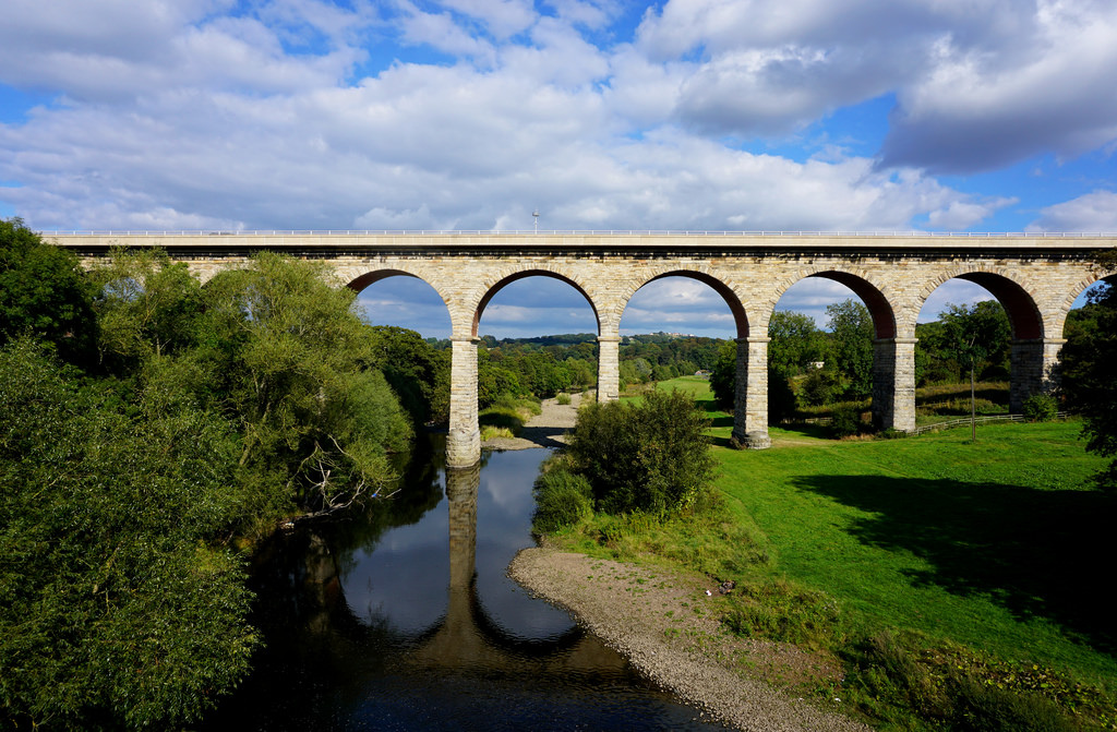
Belmont Viaduct
- Overview Map Belmont Viaduct is a railway viaduct over the River Wear, built in 1856 for the Auckland branch line of the North Eastern Railway. It is located north of the …
Co-Curate Page
Cox Green, Sunderland
- Cox Green (aka Coxgreen) is a village near Washington in Sunderland, located on the south banks of the River Wear. The Cox Green Footbridge links the village to Washington Staithes …
Co-Curate Page
Washington Staithes
- Washington Staithes was an area of County Durham prior to the development of the new town of Washington from 1964. Located on the north banks of the River Wear, there …
Co-Curate Page
Thorngate Footbridge
- This footbridge over the River Tees, in Barnard Castle, was constructed in 1882 for workers of the nearby mills, and it allowed access, on foot, from across the river to …

Co-Curate Page
West Blackdene Bridge
- Overview Map Street View The stone bridge over the River Wear in West Blackdene dates from the 18th century. The bridge, with two segmental arches, is Grade II listed on …

from Beamish (flickr)
Looking towards Wearmouth Colliery, Sunderland - 1968
Pinned by Simon Cotterill
from https://en.wikipedia.org/wiki…
The River Wear at Shincliffe Bridge
- The River Wear at Shincliffe Bridge, taken by Peter Hughes on Saturday 30 June 2007. This work is licensed under the Creative Commons Attribution-ShareAlike 3.0 License.
Added by
Pat Thomson
Co-Curate Page
Shincliffe & High Shincliffe
- Shincliffe is a village in the County Durham located by the River Wear just over a mile from the City of Durham. In the Middle Ages Shincliffe was an agricultural …
Co-Curate Page
Victoria Viaduct
- Overview About the Victoria Viaduct Map Victoria Bridge is a 810 ft long rail viaduct over the River Wear near Fatfield, Washington. It was built for the Durham Junction Railway and opened …
Co-Curate Page
Sunderland Marina
- Sunderland Marina is situated at the mouth of the River Wear in Sunderland. The Marina is it owned and operated by an independent Charitable Trust. SR6 0PW
Co-Curate Page
Sunderland
- Overview About the City of Sunderland Timeline Map Street View The City of Sunderland is located in Tyne and Wear, in the North East England. The former Metropolitan Borough of …
Co-Curate Page
Durham (City)
- Overview History of Durham Timeline Map Street View Early history Archeological evidence suggests a history of settlement in the area since roughly 2000 BC. The present city can clearly …
Co-Curate Page
Wolsingham
- Overview History Map Street View Wolsingham sits at the confluence of the River Wear and Waskerley Beck. It is a small settlement and one of the first market towns …
Co-Curate Page
Stanhope
- Overview About Stanhope Map Street View Stanhope (pronounced in the regional dialect "Stanup") is a small market town in County Durham, in England. It is situated on the River …
Co-Curate Page
Chester-le-Street
- Overview About Chester-le-Street Map Street View Chester-le-Street is a historic market town in County Durham, located about 4 miles north of Durham (city). It is situated on the River Wear, at …
Co-Curate Page
Bishop Auckland
- Overview About Bishop Auckland Map Street View Bishop Auckland is a market town in County Durham in north located between Darlington and Durham at the confluence of the River Wear …
Co-Curate Page
Wearmouth Bridge
- Overview History Timeline Map Street View The Wearmouth Bridge crosses the River Wear in Sunderland. The current bridge was built 1927 to 1929 and replaced an earlier cast-iron bridge in the same …
Co-Curate Page
Elvet Bridge
- Overview Further Information Map Street View Elvet Bridge is a stone bridge which crosses the River Wear connecting the peninsula in central Durham and the Elvet area of the city. …
from Geograph (geograph)
River Wear from road bridge at Wearhead looking East
Pinned by Simon Cotterill
Co-Curate Page
Wearhead
- Overview About Wearhead Map Wearhead is a picturesque village in County Durham, located at the start of Weardale where the River Wear is begins at the confluence of Burnhope Burn …
Co-Curate Page
Sunderland Bridge (bridge)
- Overview Map Street View This stone bridge across the River Wear near the village of Sunderland Bridge, Croxdale, dates from the 14th Century. The bridge has undergone several modifications, with …
Co-Curate Page
Newton Cap Viaduct
- Overview Map Street View Newton Cap Viaduct was built in 1857 to carry the Bishop Auckland to Durham City railway across the River Wear and Newton Cap Bank, which leads …
Co-Curate Page
Newton Cap Bridge
- Overview Map Street View Newton Cap Bridge is a stone bridge across the River Wear at Bishop Auckland, County Durham. Reputedly it was built in the late 14th century for …
Co-Curate Page
Ireshopeburn
- Overview About Ireshopeburn Map Street View Ireshopeburn is a village in County Durham, located in Weardale on the A689 road between Wearhead and St John's Chapel. Ireshopeburn is a village …
Co-Curate Page
Bridge over the Wear
- Overview Map Street View This stone bridge over the River Wear just west of Stanhope dates from medieval times. The bridge now carries the B6278 road. It is Grade II* …
Co-Curate Page
Stanhope Ford and Stepping Stones
- Overview Map Street View In 2012 a public enquiry recommended the permanent closure of Stanhope Ford to vehicles. The ford through the River Wear at Stanhope was closed by police …
from Flickr (flickr)
Image taken from page 10 of 'Weardale men and manners'
Pinned by Simon Cotterill
Co-Curate Page
Fatfield
- Overview About Fatfield Map Street View Fatfield is a village by the River Wear, which is part of Washington new town in the City of Sunderland. Fatfield's history is linked …
from Flickr (flickr)
Image taken from page 189 of 'The rivers of Great Britain. Descriptive, historical, pictorial. Rivers of the east coast'
Pinned by Simon Cotterill
from Flickr (flickr)
Image taken from page 571 of 'The rivers of Great Britain. The Thames, from source to sea, etc. [With “Rivers of the east coast”.]'
Pinned by Simon Cotterill
Co-Curate Page
Queen Alexandra Bridge
- Overview About the Bridge Map Street View The Queen Alexandra Bridge over the River Wear links the Southwick and Deptford areas of Sunderland. The bridge was built 1907-1909, originally as a double-decker …
Co-Curate Page
Kingsgate Bridge
- Overview About Kingsgate Bridge Map Street View Kingsgate Bridge is a footbridge over the River Wear, which was built in 1965. The bridge connects Bow Lane in the centre old of …
Co-Curate Page
Framwellgate Bridge
- Overview About Framwellgate Bridge Map Street View Framwellgate Bridge is a medieval stone bridge over the River Wear in Durham. The bridge was built in the 15th century and replaced …
from http://www.sunderlandships.co…
Wear Built Ships
- "....This free-to-use resource aims to present the vital information and the careers of all vessels built by the shipyards of Sunderland and upstream sites on the River Wear, with photographs …
Added by
Simon Cotterill
Co-Curate Page
Hunwick
- Overview About Hunwick Map Street View Hunwick is a semi-rural village in County Durham, England. There are actually two villages that are often referred to collectively as Hunwick, Hunwick …
Co-Curate Page
Finchale Priory
- Overview About Finchale Priory Map Street View Finchale Priory was a Benedictine priory built in the 13th-century. The ruins of the Priory are located by the River Wear, 3 miles …
Co-Curate Page
Monkwearmouth Railway Bridge
- Overview About Monkwearmouth Railway Bridge Map Street View Monkwearmouth Railway Bridge (officially Monkwearmouth Bridge, also called Wearmouth Railway Bridge or Sunderland Railway Bridge) is a railway bridge built in …
Co-Curate Page
Northern Spire Bridge
- Overview About the Northern Spire Bridge Map Street View The bridge was opened on the 28th of August 2018 - the first bridge to be built over the River Wear in …
Co-Curate Page
Prebends Bridge
- Overview About Prebends Bridge Map Street View Prebends Bridge over the River Wear at Durham was built for the Dean and Chapter of Durham to provide access to Durham Cathedral …
Co-Curate Page
Witton Bridge
- Overview Map Street View Witton Bridge crosses the River Wear about a quarter of a mile south of Witton-le-Wear and a similar distance north-west of Witton Castle. The bridge was formerly …
Co-Curate Page
Witton-le-Wear
- Overview About Witton-le-Wear Map Street View Witton-le-Wear is a small village in County Durham, North East England. It is situated on the north bank of the River Wear, to …
Co-Curate Page
Chester New Bridge, near Lambton Castle
- Overview Map Street View Chester New Bridge is a single-track road bridge over the River Wear, located to the east of Chester-le-Street and about 1 mile west of Lambton Castle. …
Co-Curate Page
Belmont Viaduct
- Overview Map Belmont Viaduct is a railway viaduct over the River Wear, built in 1856 for the Auckland branch line of the North Eastern Railway. It is located north of the …
Co-Curate Page
Cox Green, Sunderland
- Cox Green (aka Coxgreen) is a village near Washington in Sunderland, located on the south banks of the River Wear. The Cox Green Footbridge links the village to Washington Staithes …
Co-Curate Page
Washington Staithes
- Washington Staithes was an area of County Durham prior to the development of the new town of Washington from 1964. Located on the north banks of the River Wear, there …
Co-Curate Page
Thorngate Footbridge
- This footbridge over the River Tees, in Barnard Castle, was constructed in 1882 for workers of the nearby mills, and it allowed access, on foot, from across the river to …
Co-Curate Page
West Blackdene Bridge
- Overview Map Street View The stone bridge over the River Wear in West Blackdene dates from the 18th century. The bridge, with two segmental arches, is Grade II listed on …

Geography

Rivers
Bedburn Beck

Beechburn Beck / Crook Beck
Burnhope Burn (Upper Wear)
Chester Burn (aka Cong Burn)
Croxdale Beck
Killhope Burn
Moors Burn
Old Durham Beck
Rookhope Burn
Shittlehope Burn


