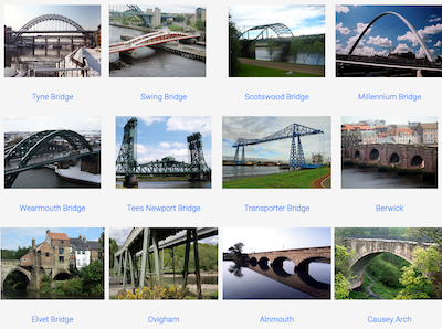
Topics > County Durham > Durham (City) > Elvet Bridge
Elvet Bridge
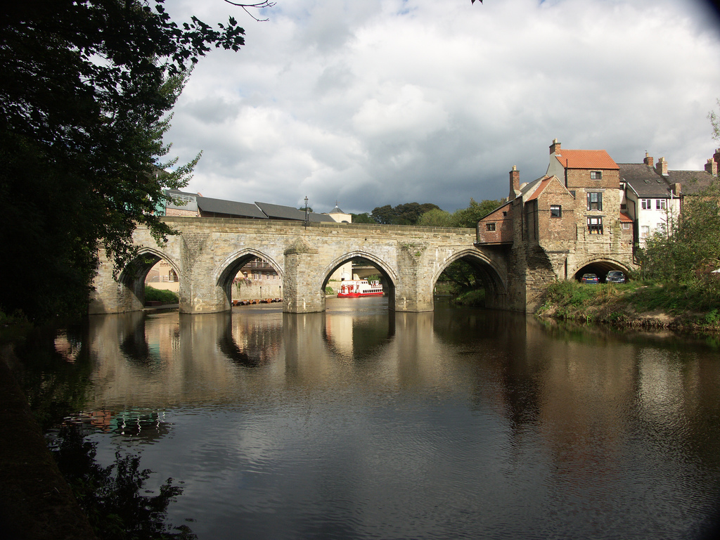
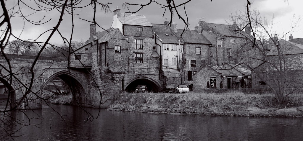
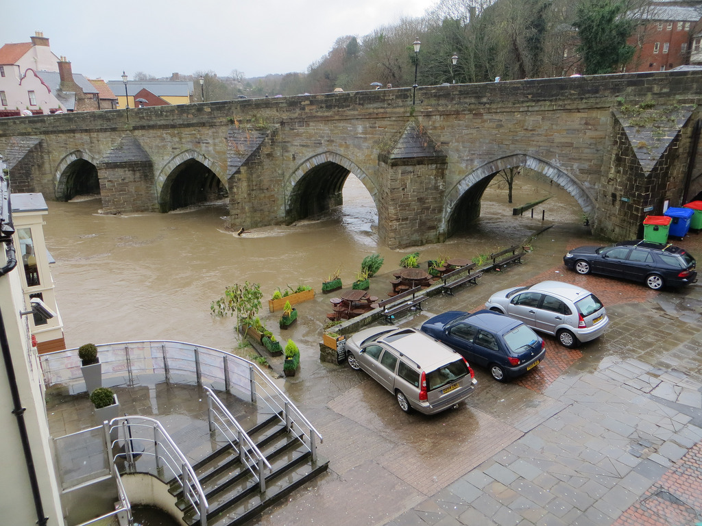
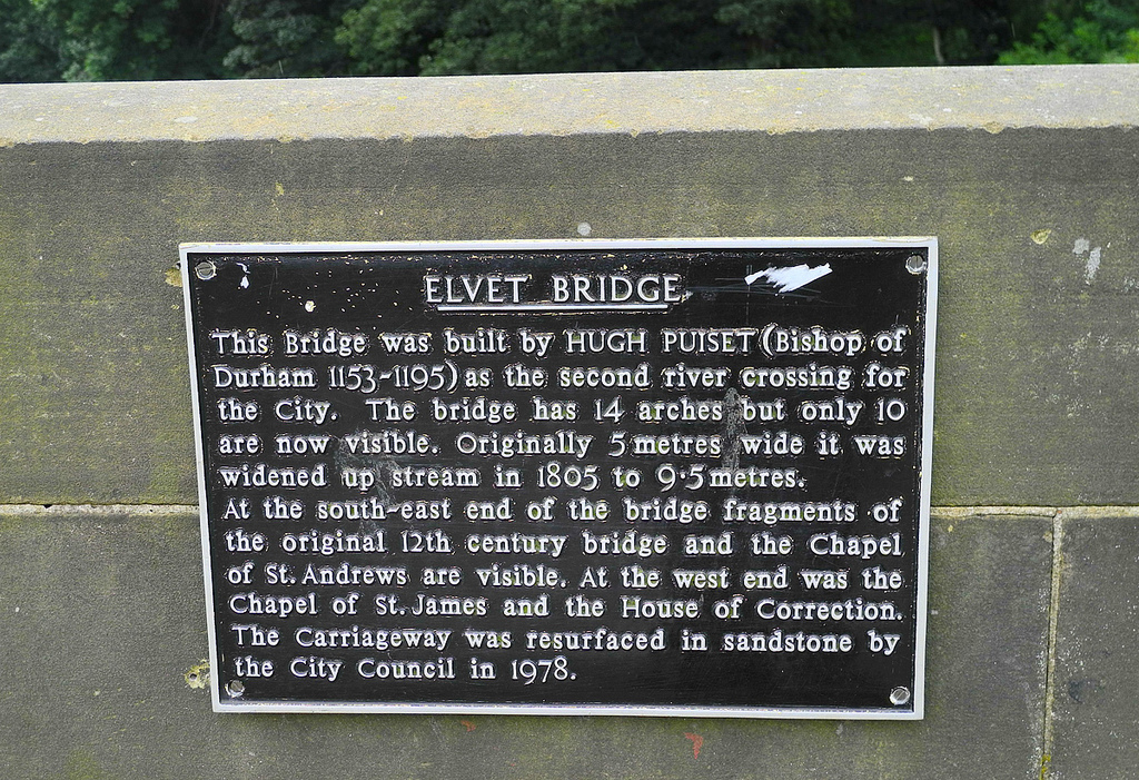
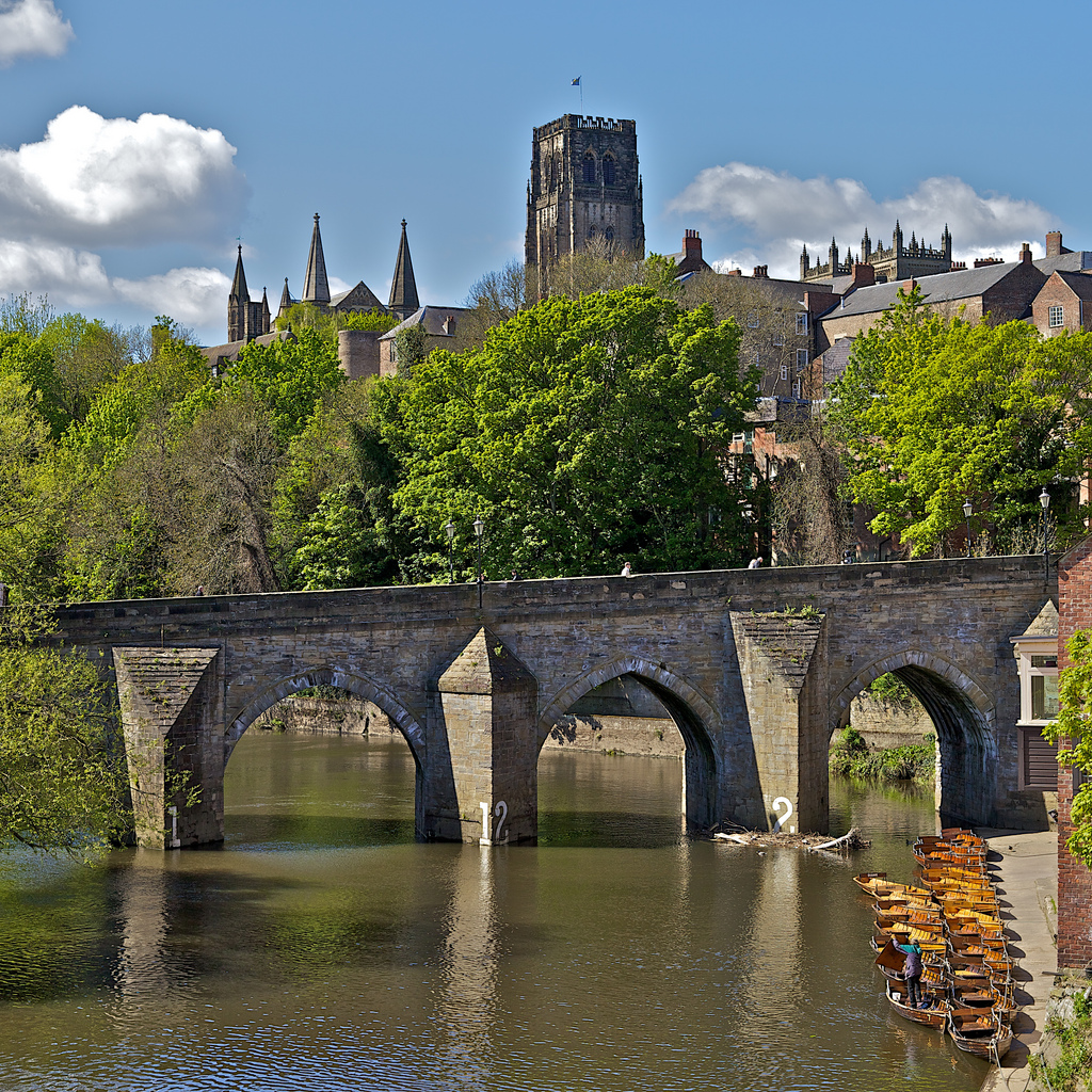
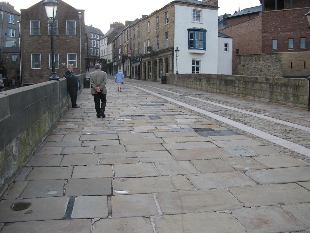
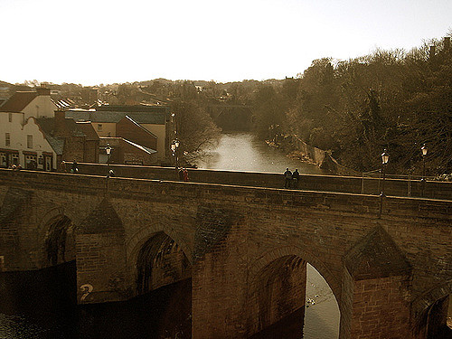
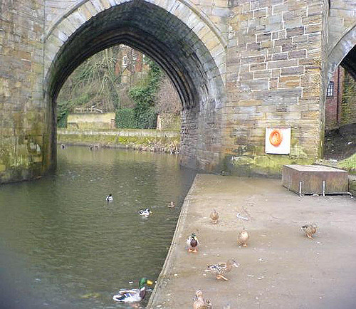
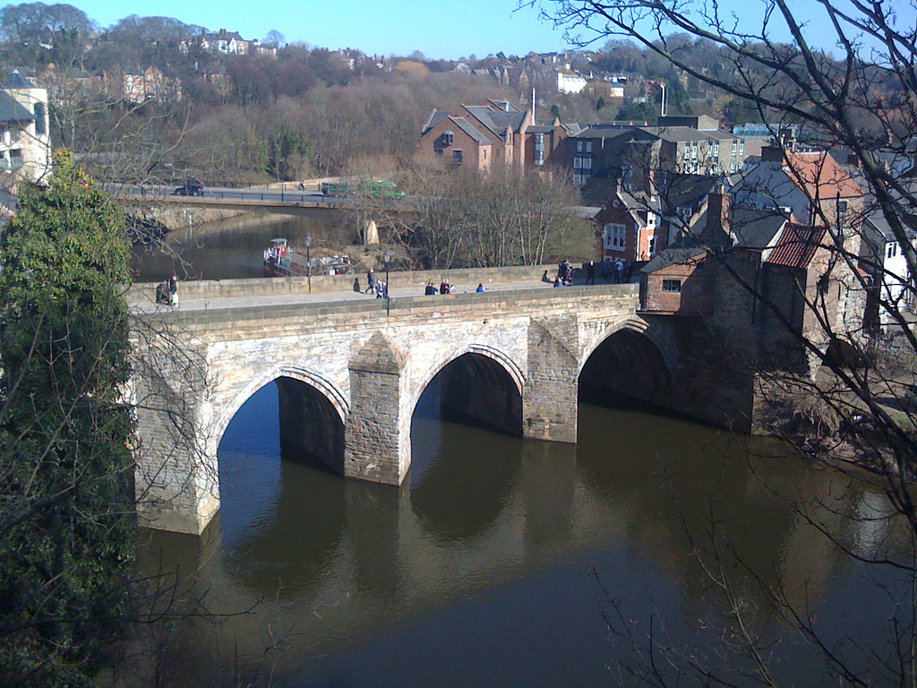
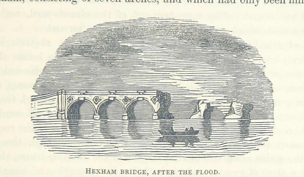
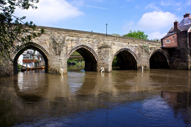
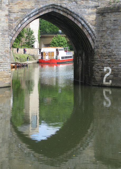
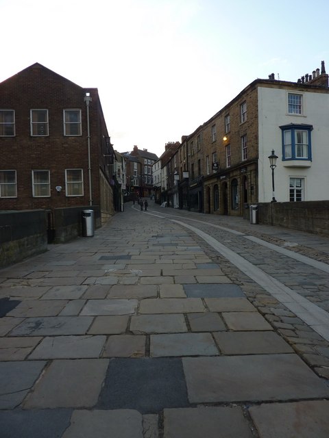
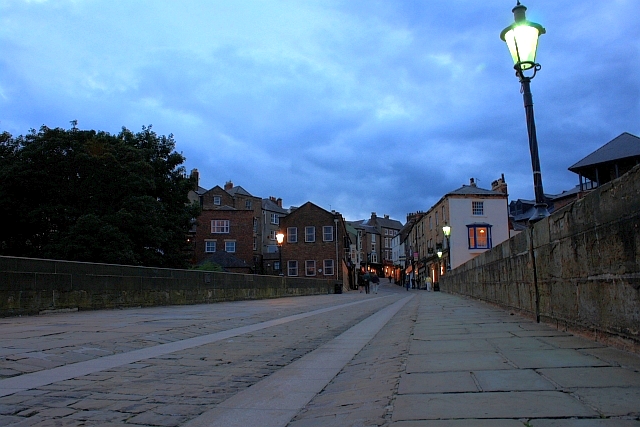
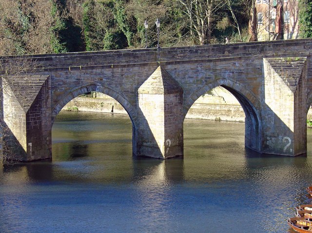
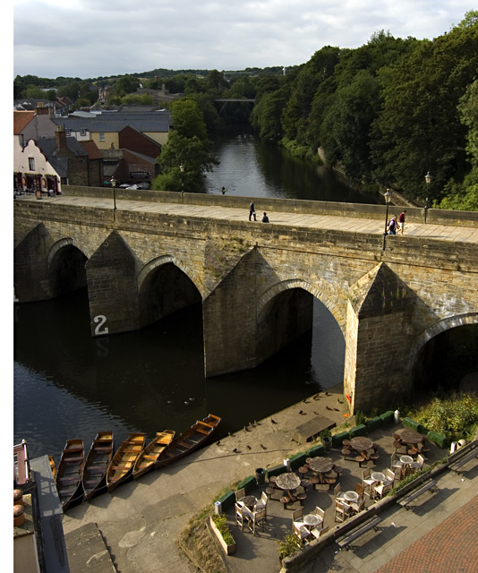
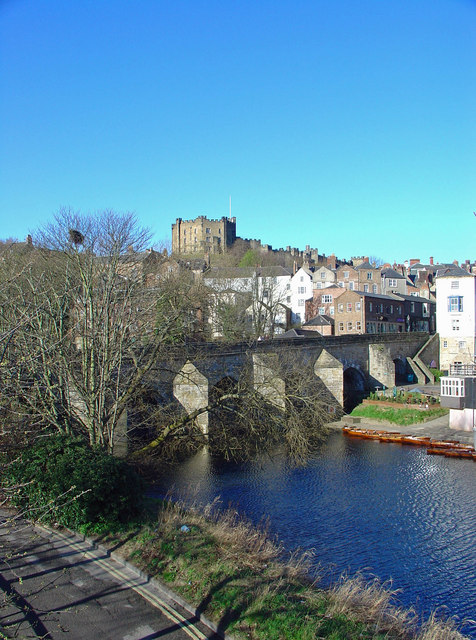
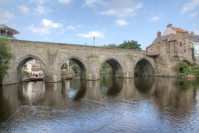
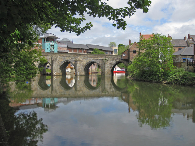
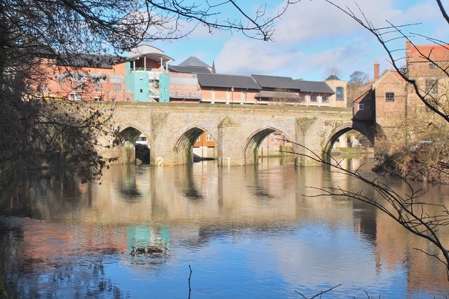
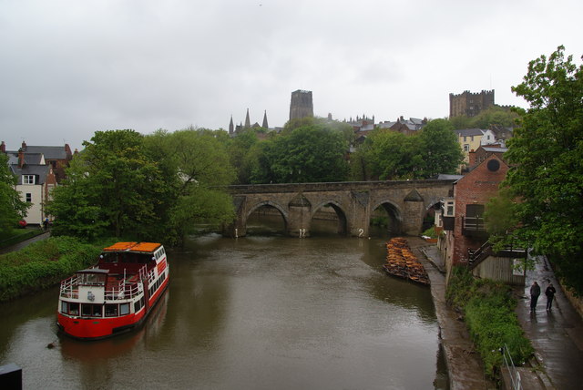
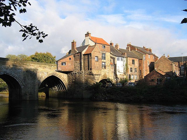
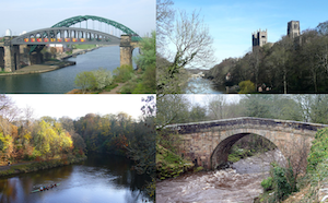
Elvet Bridge is a stone bridge which crosses the River Wear connecting the peninsula in central Durham and the Elvet area of the city. The bridge has 10 visible arches and further arches hidden under the road. Building of the bridge began in 1160 and was commissioned by Bishop Hugh de Puiset. The bridge was damaged by the Great Flood of 1771, after which 3 of the central arches had to be renewed. The bridge was widened by 3ft in 1804-5. Elvet Bridge is a Scheduled Ancient Monument and a Grade I listed building. Many of the buildings along Evlet bridge date from the 17th & 18th century; 17 of the buildings are listed, including Nos. 96-7, which are built on the site of the medieval chapel of St. Andrew.
Elvet Bridge is a mediaeval masonry arch bridge across the River Wear in the city of Durham, in County Durham, England. It links the peninsula in central Durham and the Elvet area of the city, and is Grade I listed on the National Heritage List for England.
Building
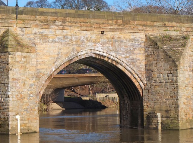
Building of the bridge began in AD 1160 in the time of Bishop Hugh de Puiset (1153–95). De Puiset, also known as "Bishop Pudsey" was a powerful Prince Bishop who instigated a significant amount of building work in northern England. A key reason for building the bridge was the urban development taking place in what was the then Elvet borough. The bridge took many years to complete: in 1225 and 1228 indulgences were still being granted to people who contributed to "the building of the new bridge at Elvet". Of the current arches only one is late 12th century; the remainder are 13th century.
Elvet bridge was not Durham's first bridge over the Wear. The Foedarium of Durham Cathedral Priory, compiled early in the 15th century, records:
Bishop Hugo built the bridge of Elvit, called the New Bridge to distinguish it from the other bridge, already built, which is called the Old Bridge.
The bridge has 10 visible arches, but there is some dispute over how many arches exist in total. The early 16th-century antiquary John Leland believed there were 14 arches, but this has never been proven. The river flows through four full arches – the remaining are dry or partly so. The early 19th-century antiquary Robert Surtees wrote that there were 10 arches, and this number has been verified. Others may be hidden beneath the street on the Elvet side or beneath Souter Peth.
Subsequent history
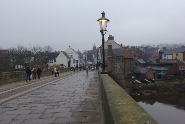
The bridge was repaired extensively in the time of Bishop Foxe between 1495 and 1501, and again in 1601. In 1771 a flood badly damaged the bridge and the three central arches were renewed. The bridge was 15 feet (4.6 m) wide until 1804–05, when it was widened by 18 feet (5.5 m) on its upstream (northern) side.
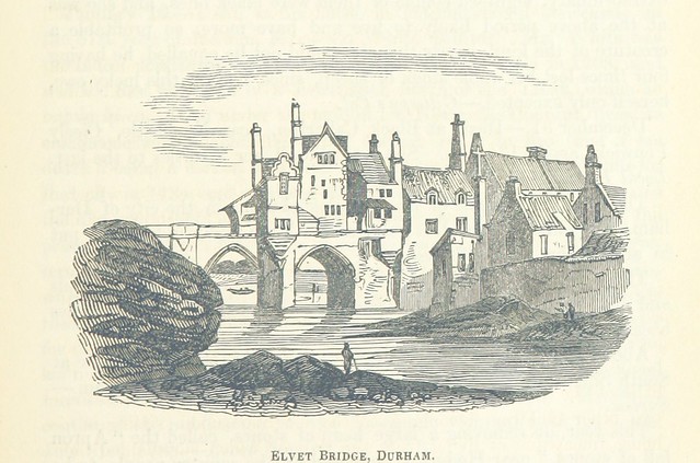
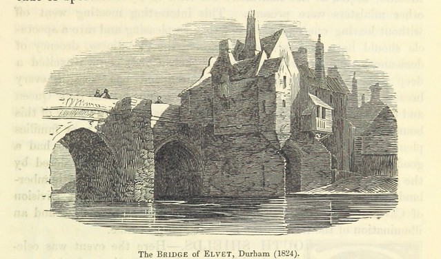
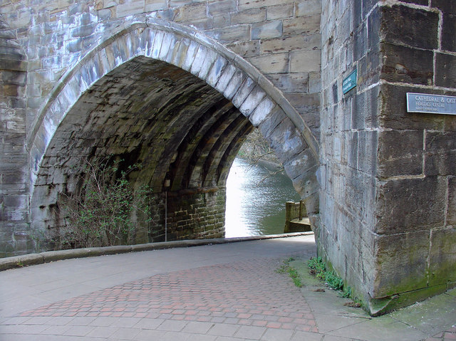
In the Middle Ages Elvet Bridge was guarded by a gate and towers, and there was a number of buildings on the bridge. They included a chapel at either end: St James' at the western end and St Andrew's on a pier at the eastern end. St Andrew's may have been the larger of the two, as an inventory compiled in 1549 in the Edwardine Reformation measured the lead on their roofs as 36 square yards (30 m2) at St James' but 88 square yards (74 m2) at St Andrew's. St James' chapel was replaced with a House of Correction (prison) in 1632. In the 18th century the House of Correction and many buildings at the north end of the bridge were demolished.
The chapel on the eastern, Elvet, side of the bridge has partially survived and is particularly visible from the riverbanks to the south. A number of buildings incorporate part of the bridge, and 18 Elvet Bridge is also Grade I listed as a result.
The bridge is reputed to be the narrowest row-through bridge in Europe.
Visit the page: Elvet Bridge for references and further details. You can contribute to this article on Wikipedia.


Co-Curate Page
Great Flood of 1771
- Great Flood on the Rivers Tyne, Tees, Wear, Eden and other rivers in the region, on the 16th and 17th November 1771. On the 17th of November 1771, after torrential …

from https://historicengland.org.u…
ELVET BRIDGE - List Entry
- "Bridge. Early C13 incorporating one arch of late C12 work. Central 3 arches renewed after 1771 flood; north side (upstream) doubled in width in 1804-5. Coursed squared sandstone with ashlar …
Added by
Pat Thomson

from Flickr (flickr)
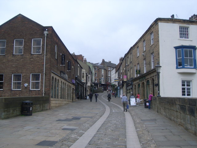
Corner of Elvet Bridge and Saddler Street, Durham, Durham, England
Pinned by Simon Cotterill

from Flickr (flickr)
Corner of Elvet Bridge and Saddler Street, Durham, Durham, England
Pinned by Simon Cotterill

Co-Curate Page
Great Flood of 1771
- Great Flood on the Rivers Tyne, Tees, Wear, Eden and other rivers in the region, on the 16th and 17th November 1771. On the 17th of November 1771, after torrential …
from https://historicengland.org.u…
ELVET BRIDGE - List Entry
- "Bridge. Early C13 incorporating one arch of late C12 work. Central 3 arches renewed after 1771 flood; north side (upstream) doubled in width in 1804-5. Coursed squared sandstone with ashlar …
Added by
Pat Thomson
from Flickr (flickr)
Corner of Elvet Bridge and Saddler Street, Durham, Durham, England
Pinned by Simon Cotterill
from Flickr (flickr)
Corner of Elvet Bridge and Saddler Street, Durham, Durham, England
Pinned by Simon Cotterill


List number: 1121355
County: County Durham
Keys to the Past HER: D34562
Wikipedia: Elvet Bridge
Grid ref: NZ2753642424


