Topics > Landmarks, Parks and Buildings > Public Houses
Public Houses
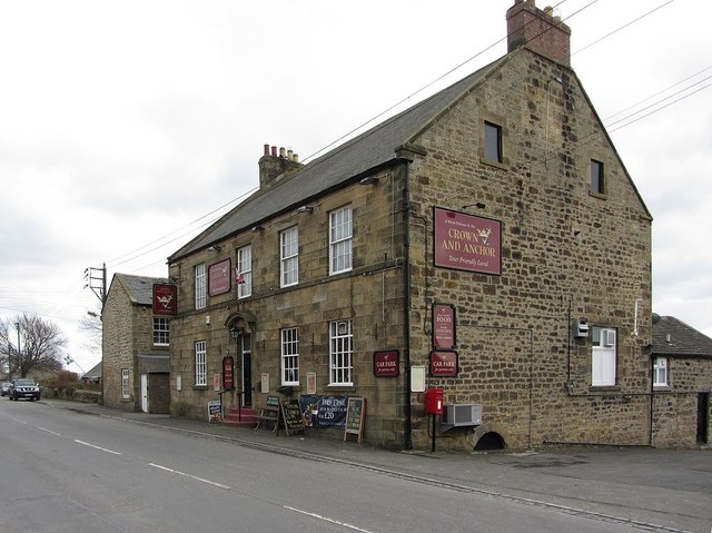
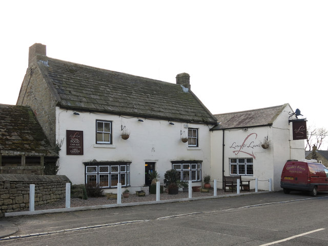
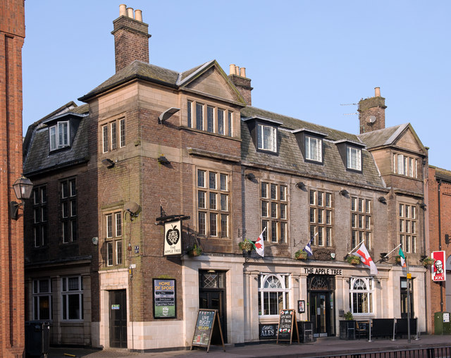
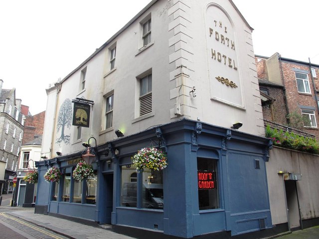
Just a few of the wonderful pubs in the North East and Cumbria.
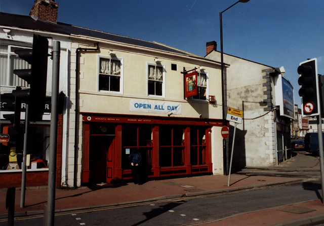
from Newcastle libraries (flickr)
061858:Scotswood Road, Newcastle upon Tyne; Malcolm Maybury; 1995
Pinned by Simon Cotterill
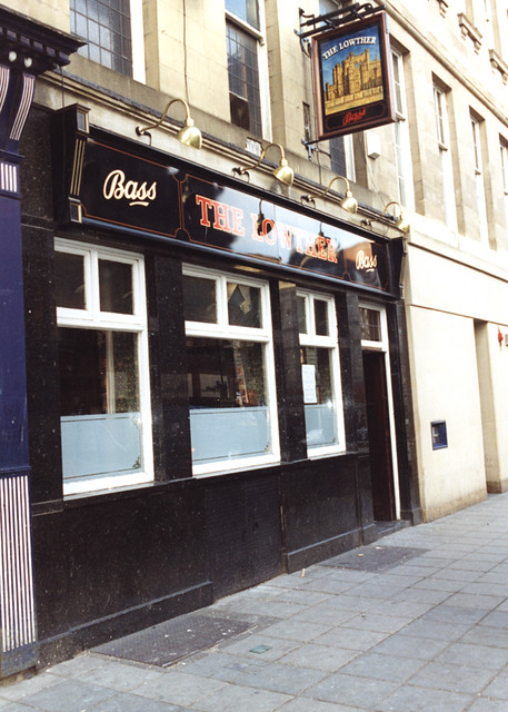
from Newcastle libraries (flickr)
061819:The Lowther, Newgate Street, Newcastle upon Tyne, Maybury Malcolm 1995
Pinned by Simon Cotterill
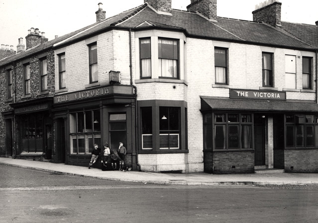
from Newcastle libraries (flickr)
046991:The Victoria North Shields unknown 1949-50
Pinned by Simon Cotterill
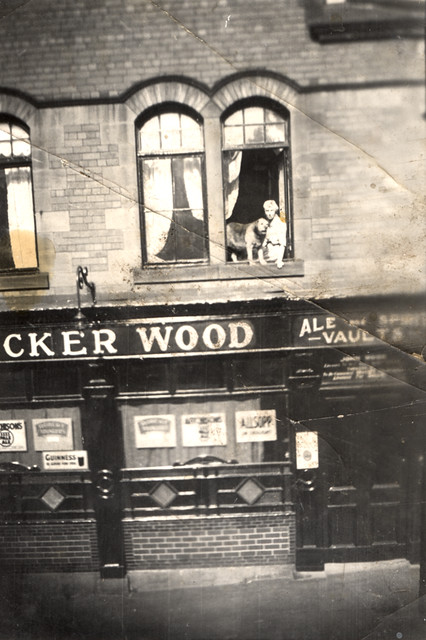
from Newcastle libraries (flickr)
052566:Jocker Wood Back Maling Street? Byker Unknown Undated
Pinned by Simon Cotterill
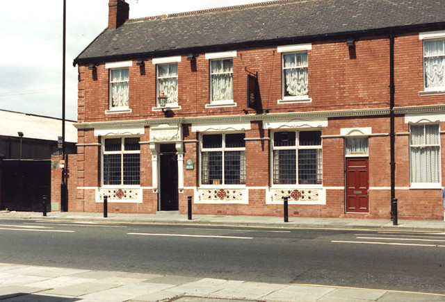
from Newcastle libraries (flickr)
065761:Wolsington Hotel Shields Road Unknown Undated
Pinned by Simon Cotterill
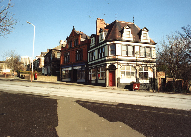
from Newcastle libraries (flickr)
061904:Villa Victoria Westmorland Road/Victoria Street Maybury Malcolm 1995
Pinned by Simon Cotterill
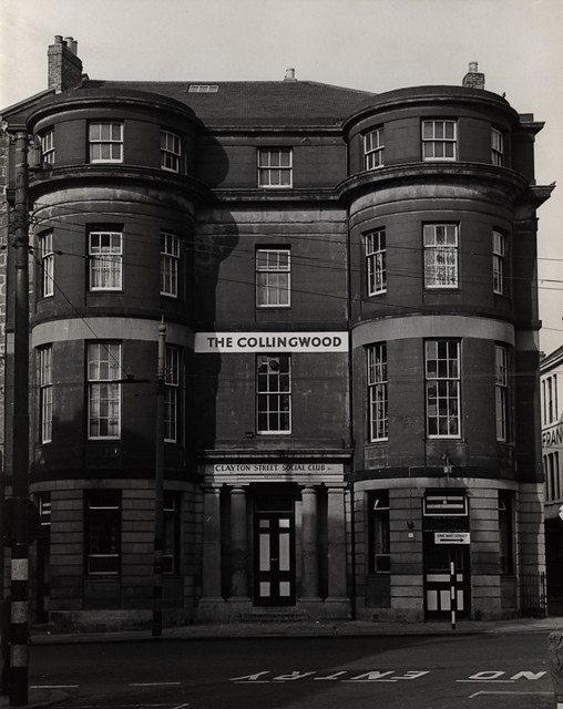
from Newcastle libraries (flickr)
013754:The Collingwood Clayton Street Newcastle upon Tyne
Pinned by Simon Cotterill
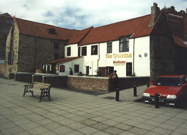
from Newcastle libraries (flickr)
061200:The Quayside Newcastle upon Tyne Malcolm Maybury 1995
Pinned by Simon Cotterill
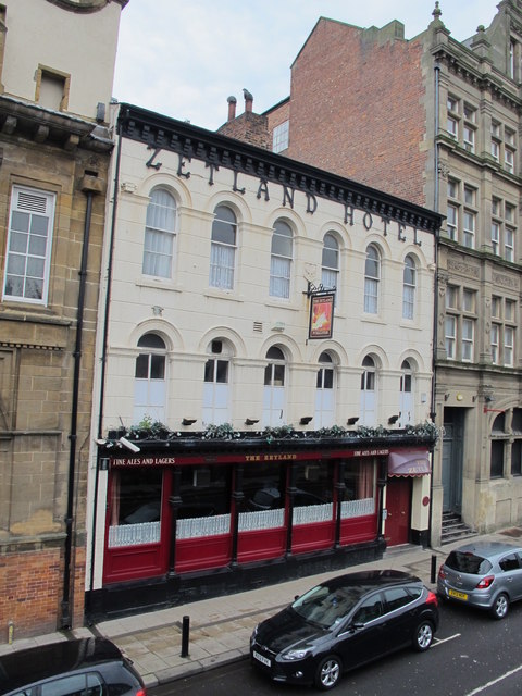
Co-Curate Page
Zetland Hotel
- The Zetland Hotel is a Grade 2 Listed Building which was built c.1860 and located on Zetland Road, close to Middlesbrough Station. Threatened with closure as a pub in 2015. …
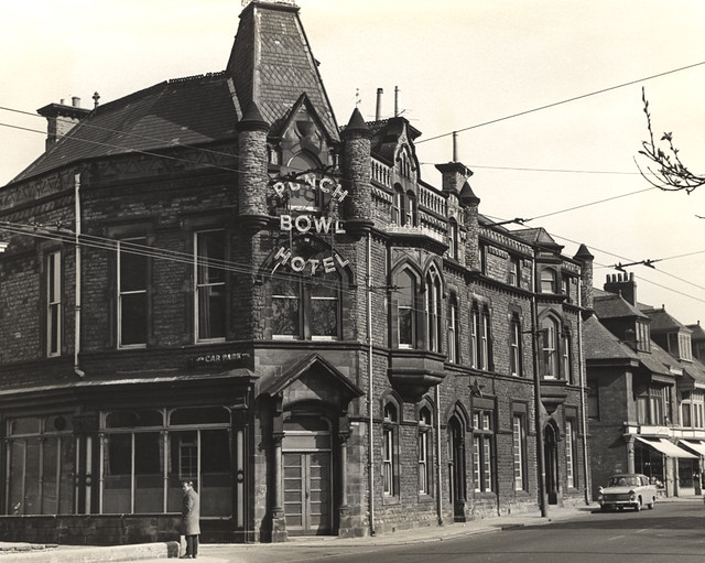
Co-Curate Page
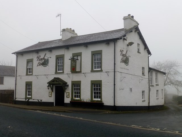
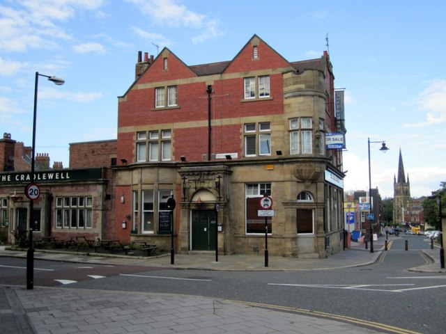
Punch Bowl - Public House
- History Map Street View The Punch Bowl Hotel pub and eatery, located on Jesmond Road in Jesmond, Newcastle. Built in a "Scottish Baronial Style" the current Punch Bowl building dates …
Co-Curate Page
Robert Deuchar (1831-1904)
- Born on 18th June 1831. "Robert, with his three younger brothers, arrived in Newcastle from Forfarshire in the 1860s and from small beginnings as an innkeeper in Newgate Street (the …
Co-Curate Page
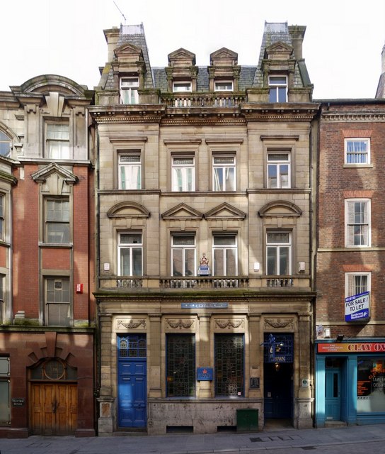
Crown Posada
- Overview Map Street View The Crown Posada is a traditional public house located on The Side, Newcastle. It was built in 1880 by WL Newcombe. [1] The building is Grade …
Co-Curate Page
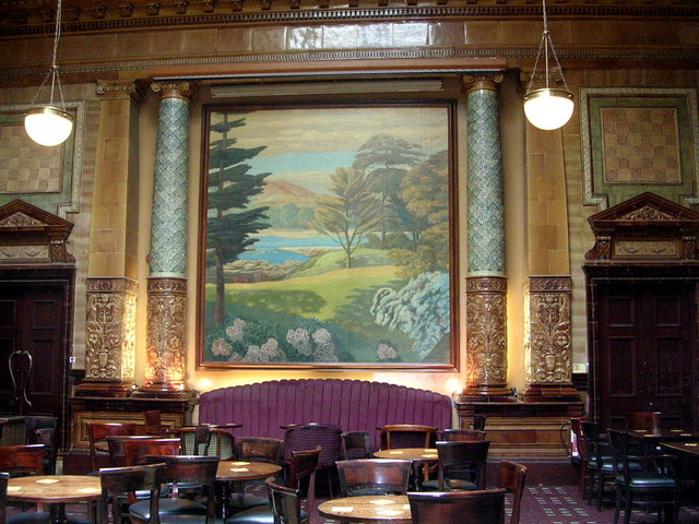
Centurion Bar, Newcastle Central Station
- Overview Map Street View The Centurion Bar was originally built in 1893 as a grand waiting lounge and bar for first class passengers, designed by John Dobson as part of Newcastle …
Co-Curate Page
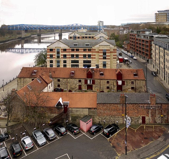
Close, No. 35 (Quayside Bar)
- Overview Map Street View The Quayside (Wetherspoons, previously No 1 Llyods Bar) is a public house and restaurant at no. 35 Close, by the Newcastle Quayside. The building dates back …
Co-Curate Page
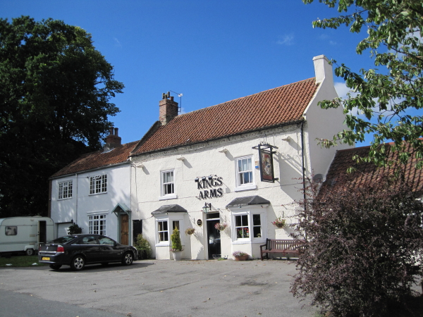
Kings Arms, Great Stainton
- Overview Map Street View The Kings Arms in Grait Stainton was built in the early 18th century, with 19th century alterations. It is a Grade 2 listed building on the …
Co-Curate Page
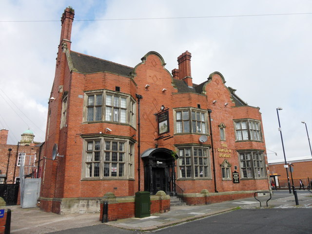
Coach & Horses
- Overview Map Street View The Coach and Horses in Wallsend is a public house located on the junction of High Street East and Coach Road. The pub was built c.1907 …
Co-Curate Page
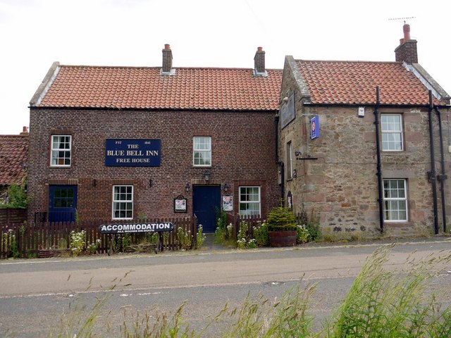
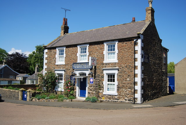
Bluebell Inn
- The Bluebell Inn, Embleton, was built c.1840 and is a Grade II listed building on the National Heritage List for England..
Co-Curate Page
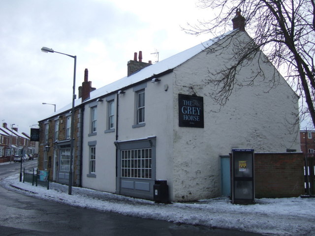
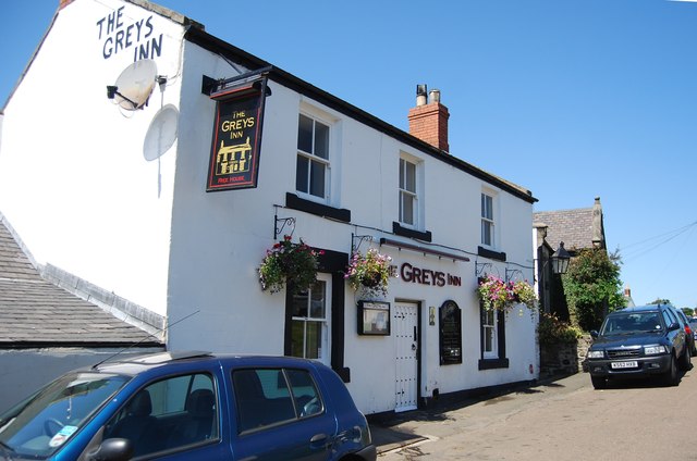
Greys Inn
- Overview Map Street View The Greys Inn is located on Stanley Terrace, by the green in Embleton, Northumberland. The inn was built in the 19th century using local Whinstone. The …
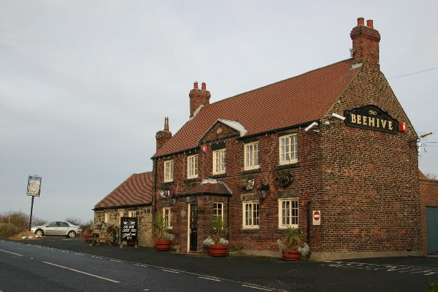
Co-Curate Page
Beehive Inn, nr Earsdon
- Overview Map Street View The Beehive is a pub near Whitley Bay. It is located on Hartley Lane (the B1325) half a mile north east of Earsdon and 2.5 miles …
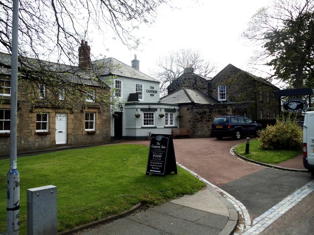
Co-Curate Page
Cannon Inn
- Overview Map Street View The Cannon Inn is a public house, located on Front Street, Earsdon. Several French prisoners were held in Earsdon village during the Napoleonic Wars (1803–1815) after a French …
Co-Curate Page
Wallaw
- Overview Map The Wallaw Cinema on Union Street in Blyth opened on 16th November 1937 with 1,600 seats. It was designed by Percy Lindsay Browne, Son & Harding, for the …
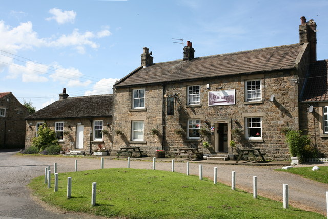
Co-Curate Page
Fernaville's Rest, Whorlton
- Overview Map Street View The Fernaville's Rest (formerly known as the Bridge Inn) at Whorlton, County Durham, dates from the early 19th Century. The pub is Grade II listed on …
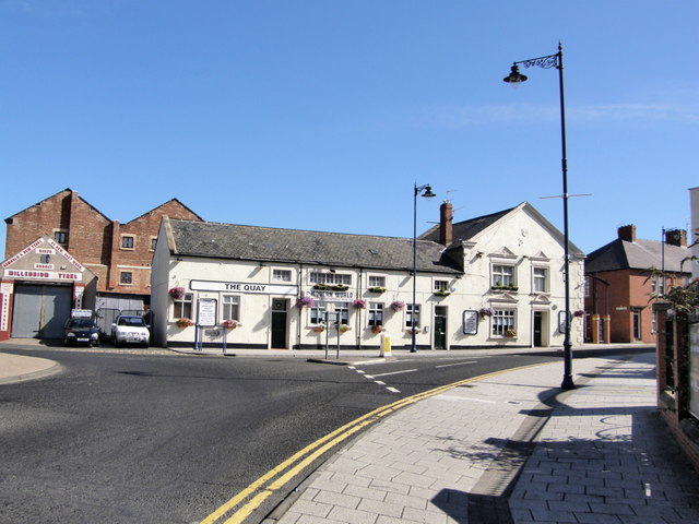
Co-Curate Page
The Quay (Pub)
- Overview Map Street View The Quay is a public house on Bridge Street, by the junction with Quay Road in Blyth. It was formerly known as the Boathouse Tavern and …
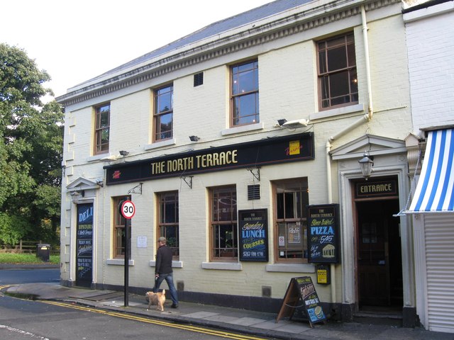
Co-Curate Page
North Terrace (pub), Spital Tongues
- Overview Map Street View The North Terrace is a public house located on Claremont Road in Newcastle, close to the Medical School.
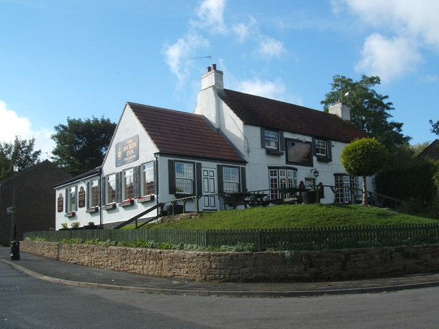
Co-Curate Page
Saxon Inn
- Overview Map Street View The pub is loacted in Escomb and takes its name from the nearby Saxon Church.
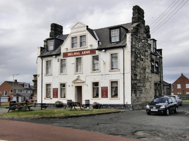
Co-Curate Page
Delaval Arms
- Overview Map Street View The Delaval Arms is a public house in Old Hartley, located off the main road between Whitley Bay and Seaton Sluice. It was originally built as …
Co-Curate Page
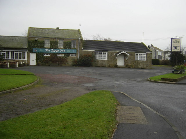
Forge Inn, Ulgham
- Overview Map Street View Public house in Ulgham off the B1337, Northumberland.
Co-Curate Page
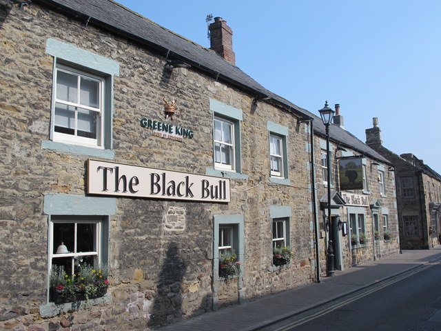
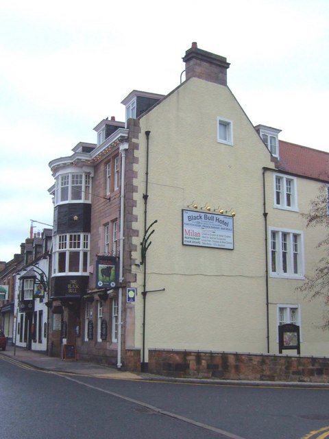
The Black Bull
- Overview Map Street View The Black Bull Hotel is located on the High Street, Wooler. It was a coaching inn from the 19th century and was substantially remodelled in 1910. …
Co-Curate Page
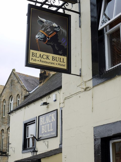
Black Bull
- Overview Map Street View The Black Bull public house in the Market Place in Wolsingham was an inn built in the mid 18th century. The pub is Grade II listed …
from Newcastle libraries (flickr)
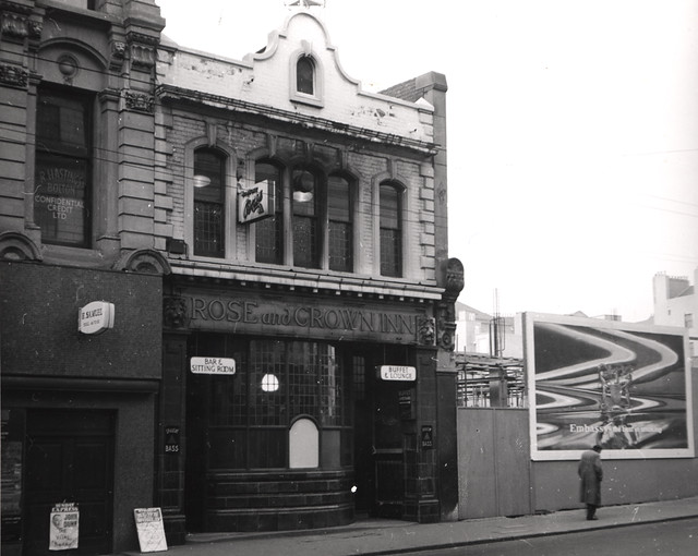
030407:Rose and Crown Inn Newgate Street 1966
Pinned by Simon Cotterill
Co-Curate Page
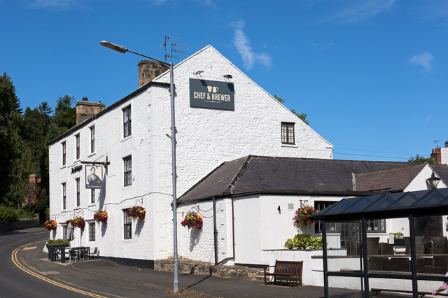
Wellington Inn
- Overview Map Street View The Wellington Inn is a public house in Riding Mill. It was originally built in 1660 as a house by Thomas Errington, postmaster of Newcastle - …
Co-Curate Page
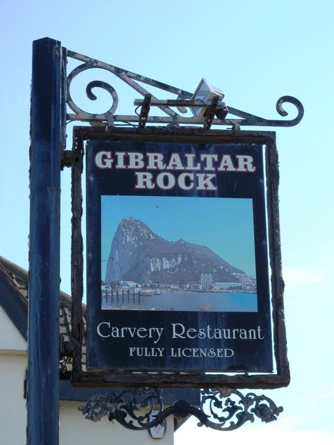
Gibraltar Rock
- Overview Map Street The Gibraltar Rock pub is located on East Street in Tynemouth, overlooking King Edward's Bay and close to Tynemouth Priory. It dates back to at least 1822 …
Co-Curate Page
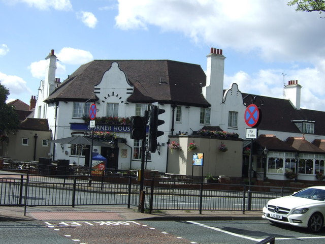
Corner House
- Overview Map Street View The Corner House Hotel in Heaton was built by James Deuchar in 1934.[1] The hotel/pub is located on the corner of Heaton Road and Stephenson Road …
Co-Curate Page
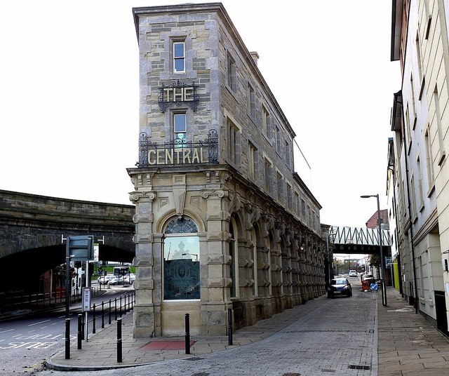
The Central
- Overview Map Street View The Central is a public house on Half Moon Lane and Hills Street in Gateshead. It was built in 1856, designed by M. Thompson for Alderman Potts, wine merchant, …
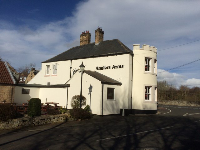
Co-Curate Page
The Anglers Arms, Weldon Bridge
- Overview Map Street View The Angler's Arms in Weldon Bridge was built in the mid 18th century as a coaching inn, located on what was then, one of the main …
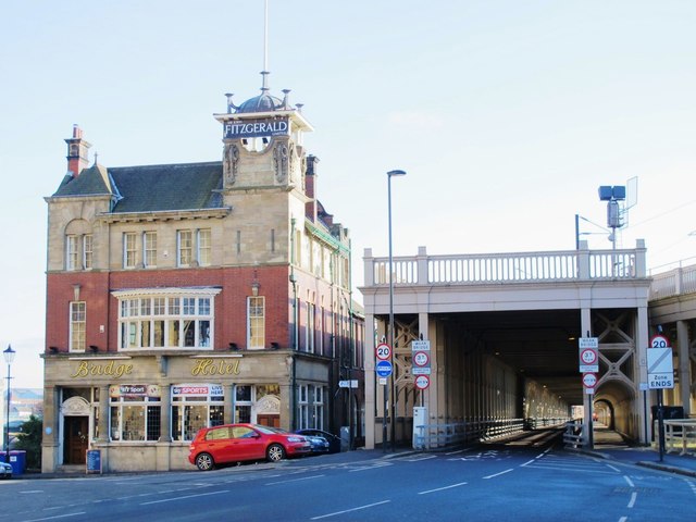
Co-Curate Page
Bridge Hotel
- Overview Map Street View The Bridge Hotel on Castle Garth in Newcastle was built in c.1899, designed by Cackett, Burns Dick for J. Fitzgerald.[1] It is located next to the …
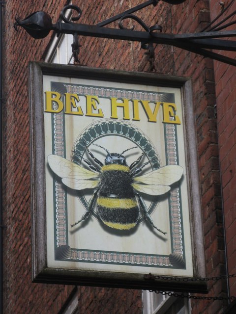
Co-Curate Page
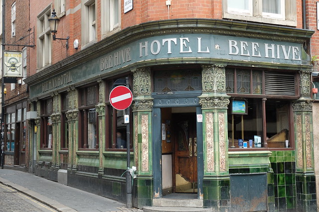
Beehive Hotel
- Overview Map Street View The Beehive is a public house on the corner of the Cloth Market and High Bridge in Newcastle. It was built in 1902 and has a traditional …
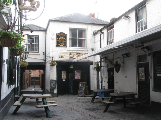
Co-Curate Page
Old George Inn
- Overview Map Street View A public house located on Old George Yard, just off the Cloth Market, in Newcastle. Charles I was reportedly allowed to drink in this pub in 1646, …
Co-Curate Page
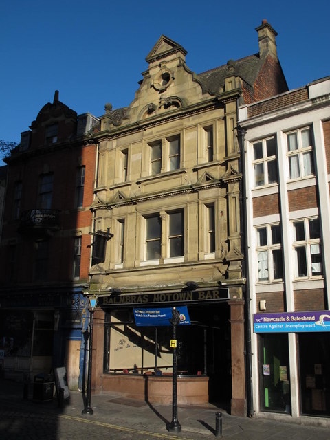
Balmbra's
- Overview About Balmbra's Music Hall Map Street View Balmbra's, No 6., the Cloth Market, Newcastle, was built 1902 by A. Stockwell, as a public house and billiard hall, originally called …
Co-Curate Page
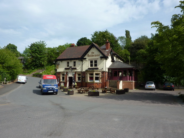
Golden Lion, South Hylton
- The Golden Lion was a public house in South Hylton, dating from c.1910. The entrance reused an early 18th century stone surround, said to have come from the north wing …

Co-Curate Page
The Ship, Public House
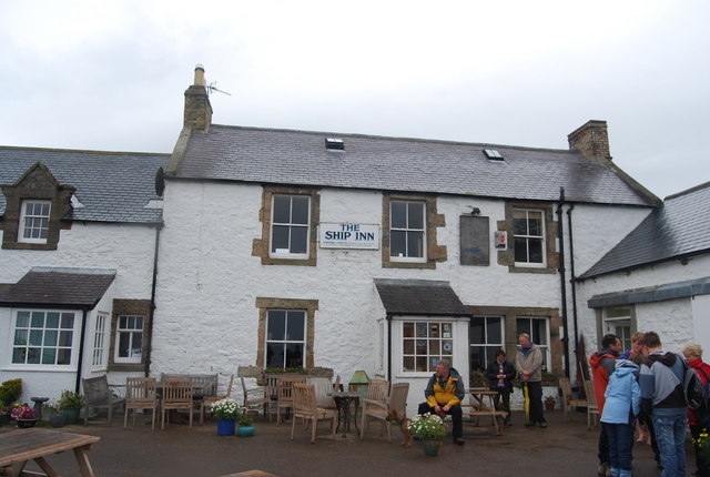
- An 18th century inn on Holy Island. Formerly the Northumberland Arms, it was renamed "The Ship", after renovations in 1995. The Ship is a Grade II Listed building.
Co-Curate Page
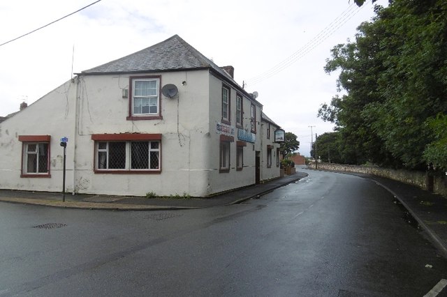
Railway Inn
- Overview Map Street View There are several public houses in Ryhope - the Railway Inn, on Robson Place, is notable as a Grade II listed building. It was built in …
Co-Curate Page
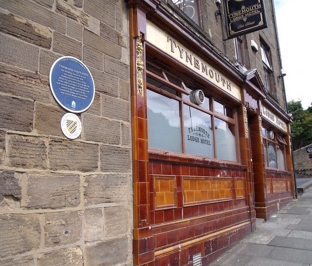
Tynemouth Lodge Hotel
- Overview Map Street View Inside The Tynemouth Lodge Hotel is a traditional pub on Tynemouth Road in North Shields (non residential), located by Northumberland Park, close to Tynemouth. "This building …
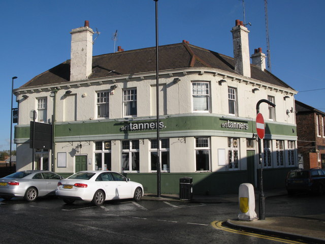
Co-Curate Page
Tanners Arms
- Overview Map Street View The Tanners Arms (also known as "The Tanners") is a public house/eatery which located on the junction of New Bridge Street and Crawhall Road, in the …
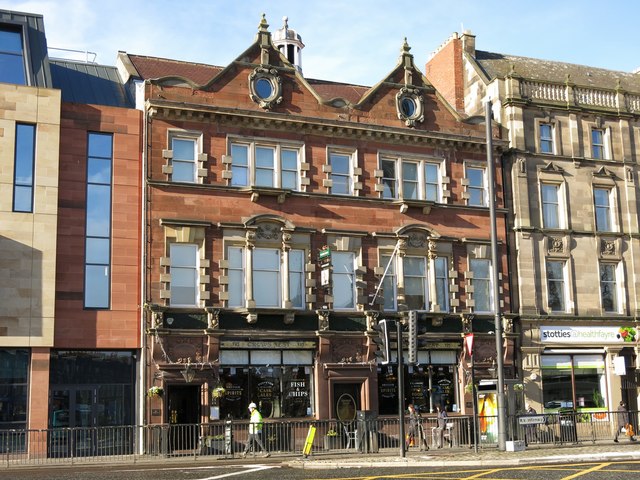
Co-Curate Page
Crows Nest, Percy Street
- Overview Map Street View The Crows Nest is a pub located at no. 137 Percy Street in Newcastle. The current building is dated 1902 and called the Crows Nest Hotel. …
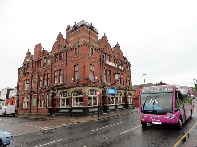
Co-Curate Page
Mountain Daisy Public House
- Overview Map Street View The Mountain Daisy is a pub located on Hylton Road in the Millfield area of Sunderland. In addition to its 'Modified Queen Anne style.' exterior, the …
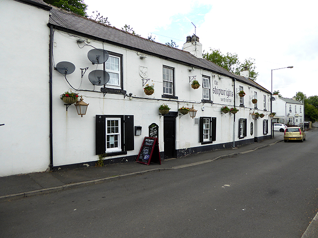
Co-Curate Page
The Shipwrights, North Hylton
- Overview Map Street View The Shipwrights is a pub and resturant located on Ferryboat Lane in North Hylton, by the River Wear. The building dates from the 18th century; and …
Co-Curate Page
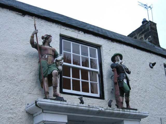
Shepherd & Shepherdess, Beamish
- Overview Map Street View The Shepherd & Shepherdess is a public house and resturant in the village of Beamish in County Durham, close to Beamish Museum. The building dates from …
Co-Curate Page
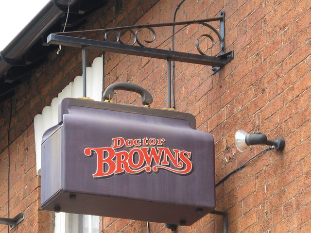
Dr Brown's, Corporation Road
- Overview Map Street View Doctor Brown's pub is located on the junction of Corporation Road and Marton Road in the centre of Middlesbrough. The triangular building was originally built as …
Co-Curate Page
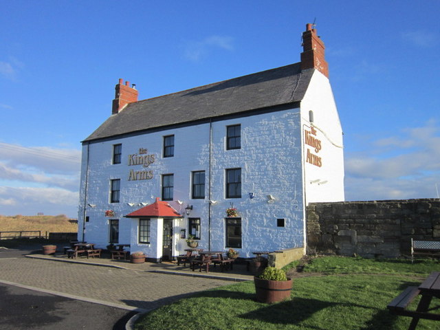
Kings Arms
- The Kings Arms is a public house located by the harbour in Seaton Sluice. Originally, the King's Arms Hotel and coach-house was built in the 18th century. The coach-house was …
Co-Curate Page
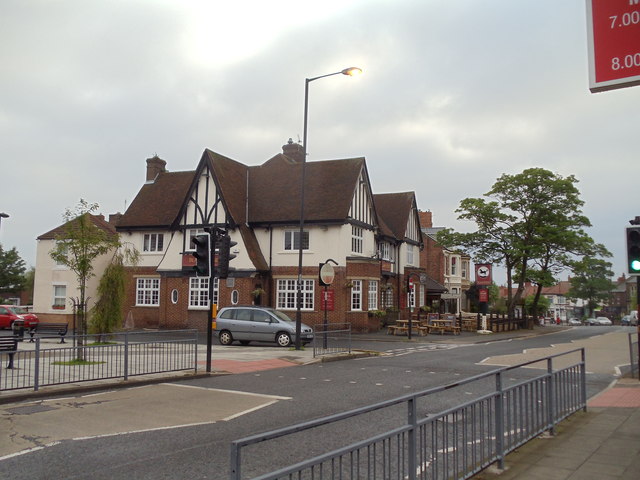
Black Horse
- The original Black Horse Inn in Monkseaton was built in 1793 as a two-storey stone building, with a third floor added later. In 1936 Monkseaton Urban District Council granted permission …
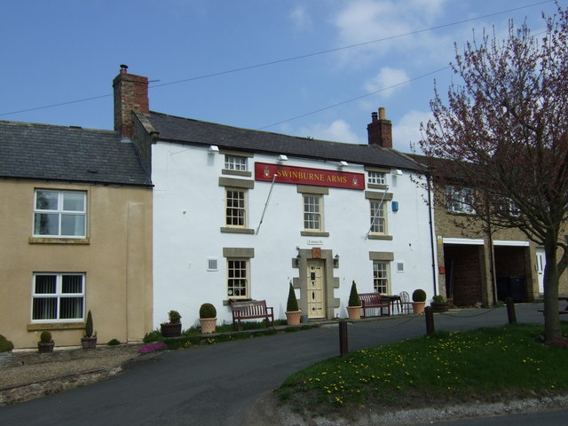
Co-Curate Page
Swinburne Arms
- Overview Map Street View The Swinburne Arms is a public house located on North Side in Stamfordham, Northumberland. It was built as an inn in the mid 18th Century and …
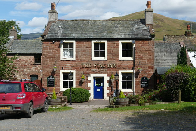
Co-Curate Page
Stag Inn, Dufton
- Overview Map Street View The inn was built in 1703 and overlooks the village green in Dufton.[1]
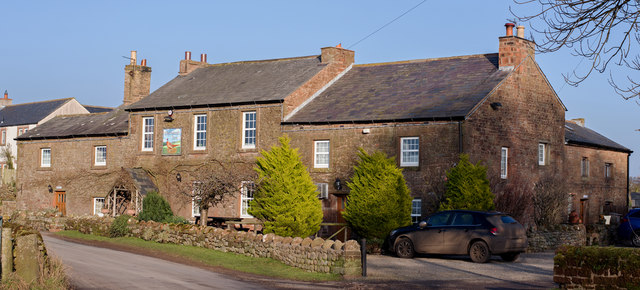
Co-Curate Page
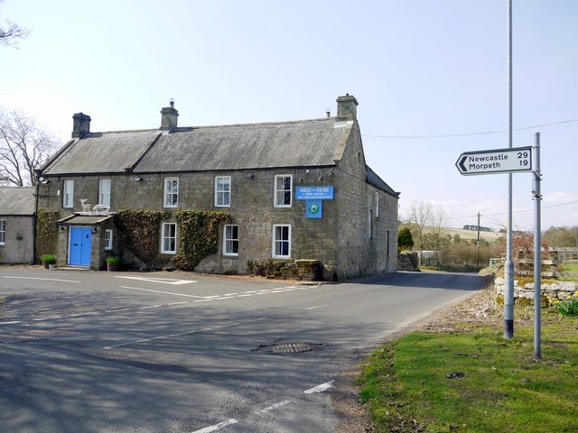
Pheasant Inn, Cumwhitton
- Overview Map Street View The Pheasant Inn public house is located at the south end of the village of Cumwhitton in Cumbria. Parts of the building date from the 17th Century …
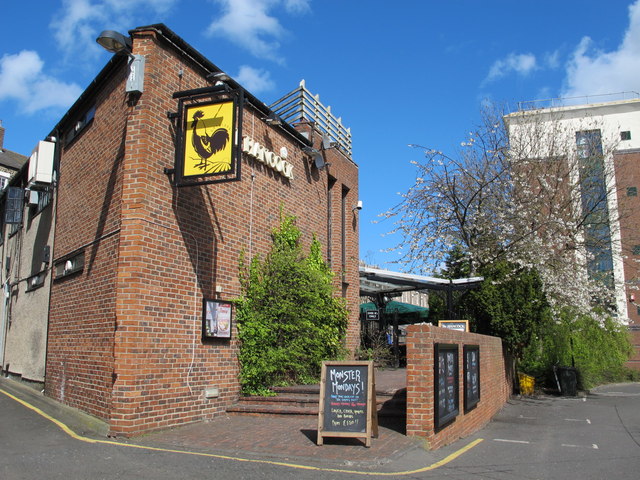
Co-Curate Page
The Hancock
- Overview Map Street View The Hancock is a public house located on Hancock Street in Newcastle. Formerly known as Bierrex, the pub is located by the north side of the …
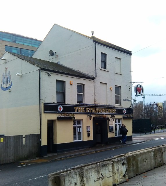
Co-Curate Page
The Strawberry
- Overview Map Street View Public house on Strawberry Place, in close proximity to St James' Park in Newcastle. There has been a pub on the site since 1859.
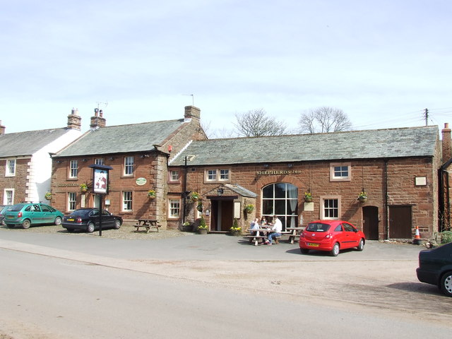
Co-Curate Page
Shepherd's Inn, Melmerby
- The Shepherd's Inn public house in Melmerby, Cumbria, dates from 1789.[1] The pub now extends into the former stables on the inn. The Shepherd's Inn is Grade II listed on …
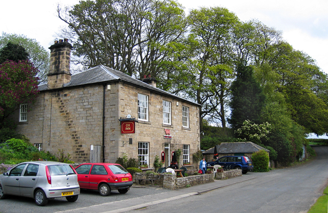
Co-Curate Page
Ox Inn, Middleton (Morpeth)
- Overview Map Street View The Ox Inn in Middleton is a Grade II listed building; a former house, dating from the early 19th century.
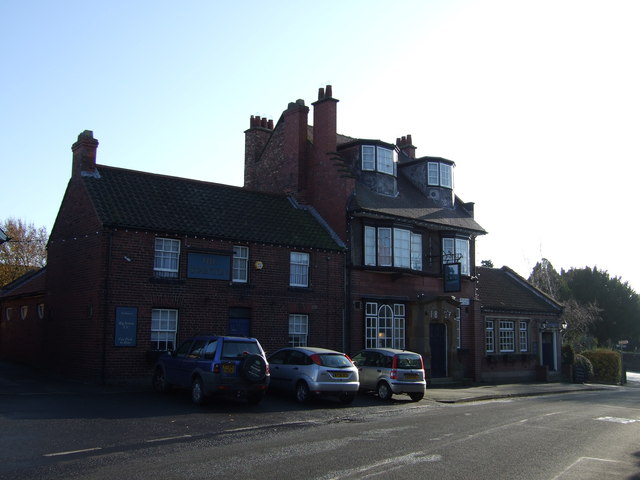
Co-Curate Page
The Stainton public house
- Overview Map Street View The Stainton Inn and Tea Rooms (aka'The Stainton') is located on Meldyke Lane in Stainton, Middlesbrough. Built in 1897, the pub is Grade II listed on …
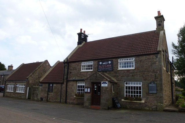
Co-Curate Page
Pack Horse Inn, Ellingham
- Overview Map Street View The Pack Horse is a traditional country pub in Ellingham, Northumberland. The building is documented on a tithe map in 1809, but may be older. It …
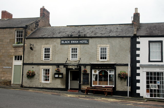
Co-Curate Page
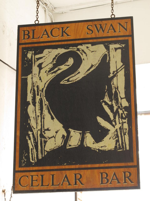
The Black Swan Hotel
- Overview Map Street View The Black swan Hotel is located at the north end of the Market Place in Belford. The inn was built in the early 19th century and …
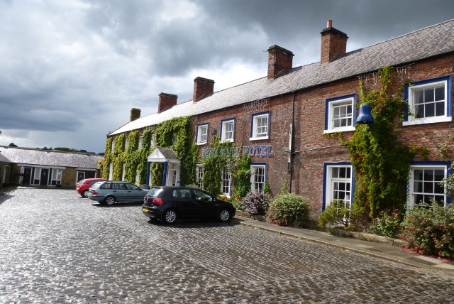
Co-Curate Page
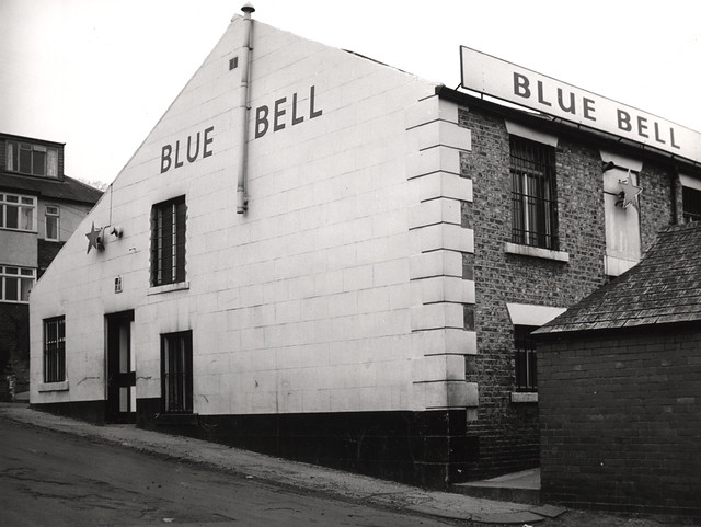
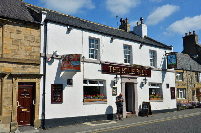
The Blue Bell Hotel
- Overview Map Street View The Blue Bell Hotel is located in the Market Place in Belford. It was built in the 18th century as a coaching inn. The Blue Bell …
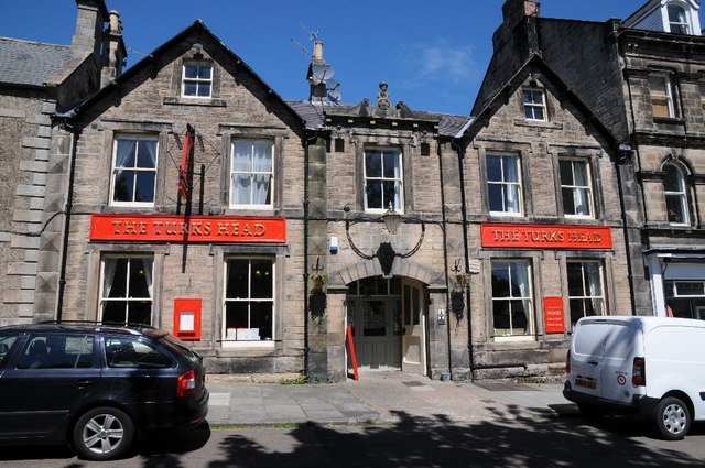
Co-Curate Page
The Turks Head
- Overview Map Street View The Turks Head is located on the High Street in Rothbury. It was built in the c.17th century as a coaching inn. Parts of the inn …
Co-Curate Page
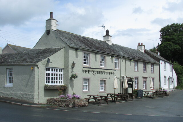
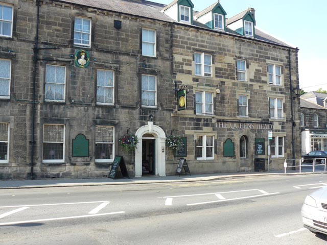
The Queens Head
- Overview Map Street View The Queens Head is located on the High Street in Rothbury. It was built in 1792 and originally known as the Golden Fleece. In 1837 it …
Co-Curate Page
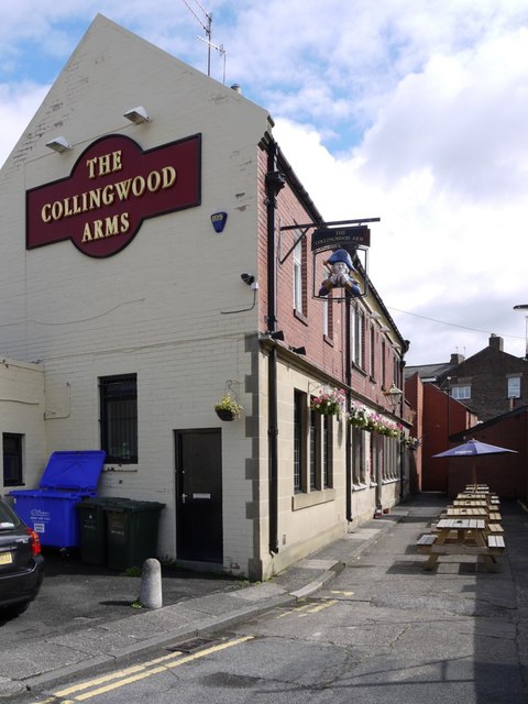
Collingwood Arms, Brandling Village
- Overview Map Street View The Collingwood Arms is a public house in Brandling Village, Jesmond. It first opened in 1836. The first landlord, Robert Hewlitt, named the pub after Newcastle-born …
Co-Curate Page
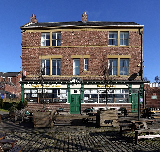
Cumberland Arms
- Overview Map Street View The Cumberland Arms is located on James Place Street in Ouseburn, Byker (rear to Back Stephen Street). The Cumberland Arms was first licensed as a beer …
Co-Curate Page
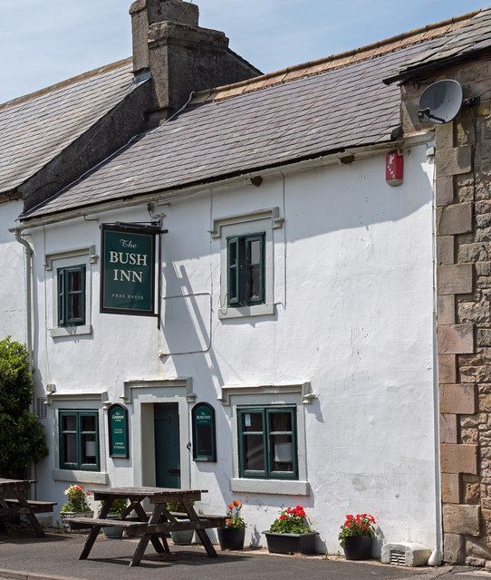
The Bush Inn
- Overview Map Street View The Bush Inn is a pub and resturant located on Main Street in Tallentire, in the Allerdale district of Cumbria. It was built in the late …
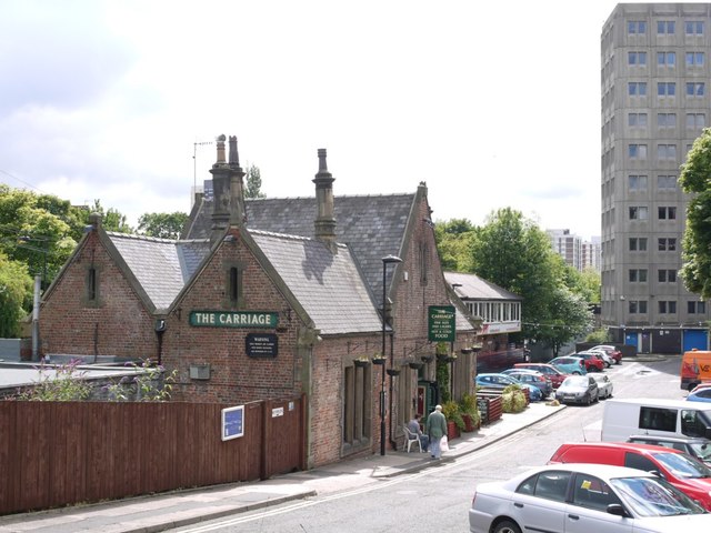
Co-Curate Page
The Carriage
- Overview Map Street View The Carriage is a public house in Jesmond. It was originally Jesmond Station, which was opened in 1864 by the Blyth & Tyne Railway. It was …
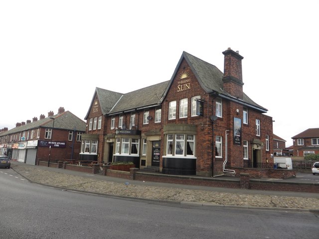
Co-Curate Page
Rising Sun Inn
- Overview Map Street View The Rising Sun is a public house by the Coast Road in Wallsend. It was built in the 1930's to serve the new community in the …
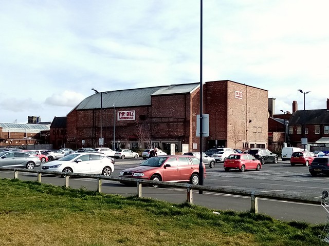
Co-Curate Page
The Ritz, Wallsend
- Overview Map Street View The Ritz is a public house on High Street West in Wallsend. It was originally the Ritz Cinema, which opened on the 15th of May 1939 …
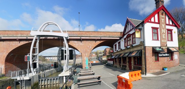
Co-Curate Page
Tyne Bar, Ouseburn
- Overview Map Street View The Tyne Bar is a public house, located on Maling Street, by Glasshouse Bridge in Ouseburn, near the eastern end of the Quayside in Newcastle. It …
Co-Curate Page
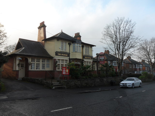
Plough Inn, Killingworth
- Overview Map Street View The Plough Inn is located on West Lane, Killingworth Village. Henry Punshon was noted as the proprietor of the Plough Inn, in Whellan's directory of 1855.
Co-Curate Page
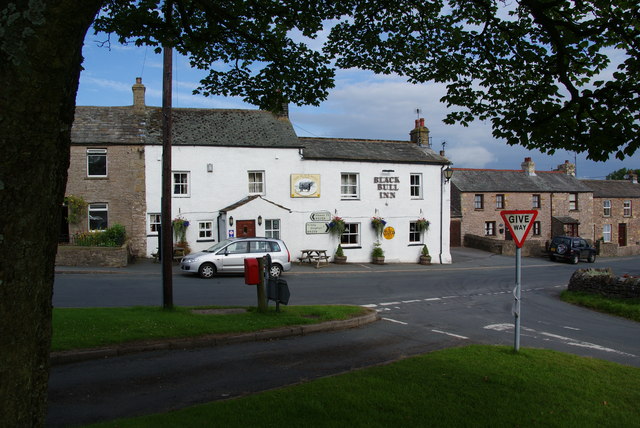
Black Bull Inn, Nateby
- Overview Map Street View The Black Bull Inn at Nateby is a public house also providing dining and accommodation (5 ensuite bedrooms).
Co-Curate Page
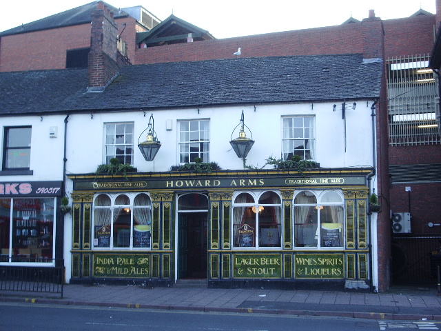
Howard Arms, Carlisle
- Overview Map Street View The Howard Arms is a public house on the west side of Lowther Street in Carlisle. Originally, it was one of 2 adjoining houses built in …
Co-Curate Page
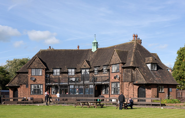
The Redfern, Etterby
- Overview Map Street View The Redfern is a public house located on Kingmoor Road, in the Etterby area of Carlisle. It was opened on the 1st of October 1940 and …
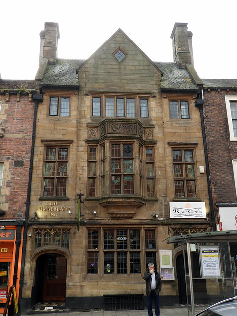
Co-Curate Page
Cumberland Inn, Carlisle
- Overview Map Street View The Cumberland Inn, no. 22 Botchergate in Carlsile is public house built under the Carlisle and District State Management Scheme. Designed by Harry Redfern in a 'Tudor …
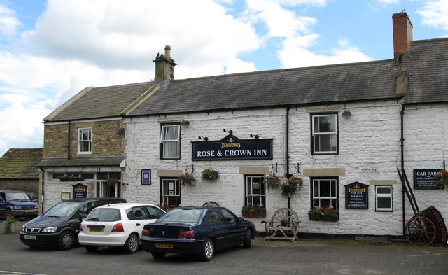
Co-Curate Page
Rose and Crown Inn, Slaley
- Overview Map Street View The Rose and Crown Inn, on Main Street in the village of Slaley dates from the mid 18th century. Along with two adjacent houses, the inn …
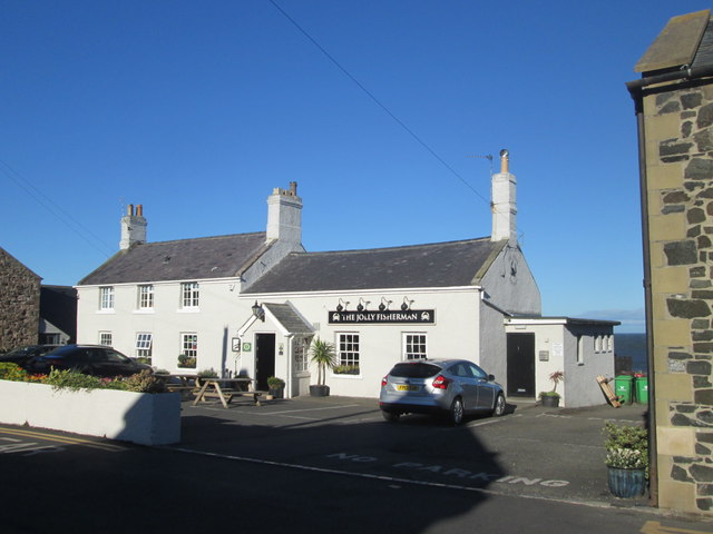
Co-Curate Page
Jolly Fisherman, Craster
- Overview Map Street View The Jolly Fisherman is a pub and restaurant located on Haven Hill in Craster. It was established by Charles Archbold in 1847. In 1955, the Jolly …
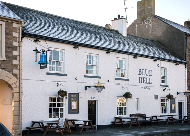
Co-Curate Page
The Blue Bell, Dalston
- Overview Map Street View The Blue Bell is a public house on the east side of The Square in Dalston. It dates from the early 18th century and is a …
Co-Curate Page
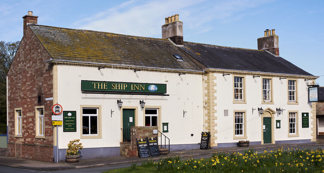
The Ship Inn, Thursby
- Overview Map Street View The Ship Inn is located by The Green in Thursby. The inn probably dates from the late 18th century and has former stable buildings; it was …
Co-Curate Page
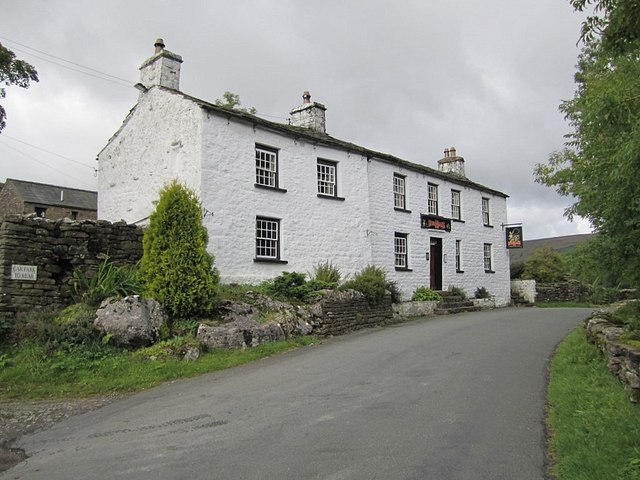
Sportsmans Inn, Upper Dentdale
- Overview Map Street View The Sportsmans Inn is a public House situated by the River Dee at Cow Dub, near Stone House in Upper Dentdale. It is a former farmhouse, …
Co-Curate Page
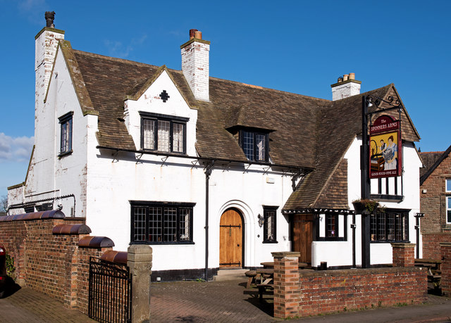
The Spinners Arms, Cummersdale
- Overview Map Street View The Spinners Arms is a public house in Cummersdale. It was built from 1929-1930 by Harry Redfern for the Carlisle District State Management Scheme. The pub …
Co-Curate Page
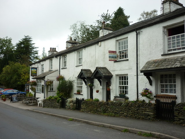
Sun Inn, Crook
- Overview Map Street View The Sun Inn is a public house in Crook, South Lakeland. It dates from the 19th century and was originally an Inn and cottages, with the …

Co-Curate Page
State Management of Public Houses (1916 - 1971)
- Overview About the Scheme List of Carlisle Pubs (selected) The Carlisle and District State Management Scheme operated from 1916 to 1971. The scheme, sometimes called the "Carlise Experiment", was initially …
Co-Curate Page
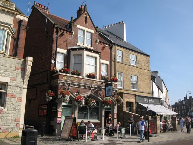
Cumberland Arms, Tynemouth
- Overview Map Street View The Cumberland Arms is located at 17 Front Street, Tynemouth. It is a red brick and faience Victorian gothic-style public house, which was built in 1898 …
Co-Curate Page
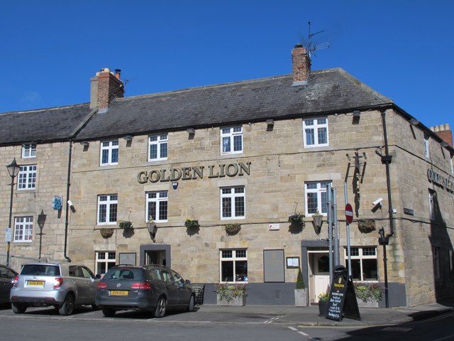
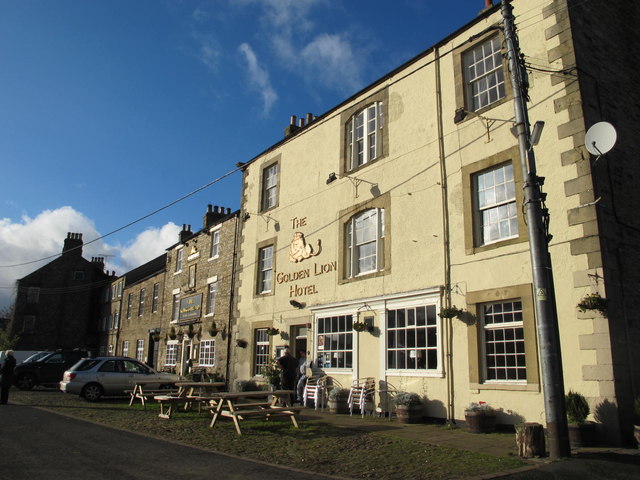
Golden Lion, Allendale
- Overview Map Street View The Golden Lion is an inn and resturant located on the north side of the Market Place in Allendale Town. "The '1839 Restaurant' is named after …
Co-Curate Page
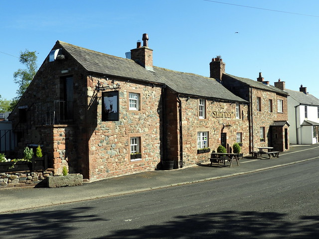
The Stag Inn, Low Crosby
- Overview Map Street View The Stag Inn at Low Crosby dates from the 17th century, and was extended in the 20th century. The building is Grade II listed on the …
Co-Curate Page
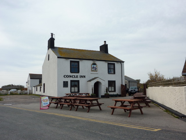
Concle Inn
- Overview Map Street View The Concle Inn is a public house located on Roa Island Road in Rampside. The pub dates from the early 19th century and is situated close …
Co-Curate Page
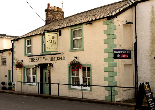
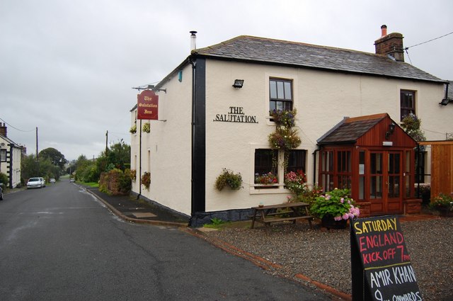
Salutation Inn, High Hesket
- Overview Map Street View The Salutation Inn at High Hesket dates from the late 18th or early 19th century and is Grade II listed on the National Heritage List for …
Co-Curate Page
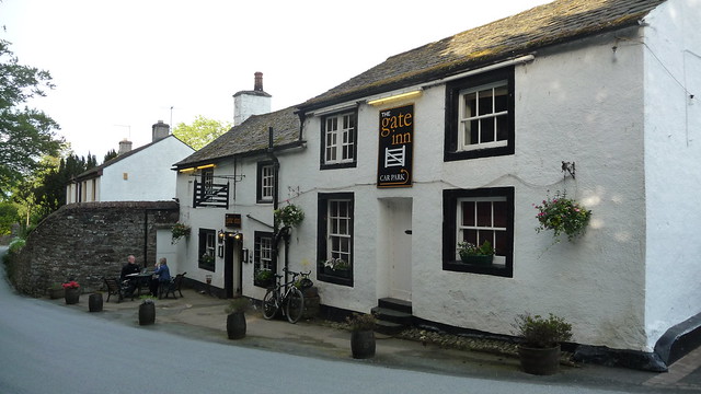
The Gate Inn, Yanwath
- Overview Map Street View The Gate Inn (aka 'The Yanwath Gate') is a public house and resturant in at Yanwath. The pub was originally two seperate houses, which were altered …
Co-Curate Page
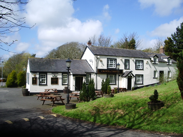
The Crown and Thistle, Rockcliffe
- Overview Map Street View The Crown and Thistle is a public house and resturant in Rockcliffe, Cumbria. The building dates from the 19th century, with a 20th century extention.[1] The …
Co-Curate Page
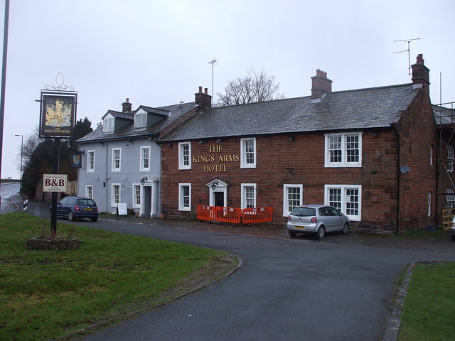
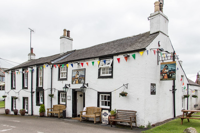
The Kings Arms, Temple Sowerby
- Overview Map Street View The Kings Arms is a public house, resturant and B&B in Temple Sowerby. The pub dates from the 18th century and was originally a coaching in …
Co-Curate Page
The Shepherd's Inn, Langwathby
- Overview Map Street View The Shepherd's Inn, located at the southern end of the Village green in Langwathby, was originally two houses built in the early 18th and late 18th century, …
Co-Curate Page
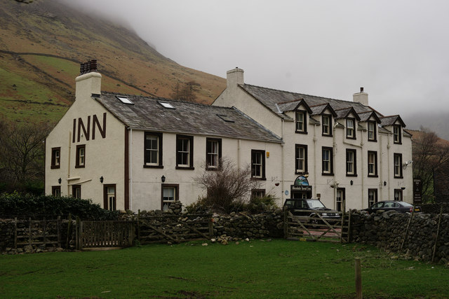
Wasdale Head Inn
- Overview Map Street View The Wasdale Head Inn (previously known as the Wastwater Hotel) had been built by 1860, with later alterations. Wasdale Head was known as a centre for …
Co-Curate Page
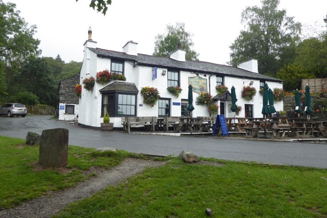
The Britannia Inn, Elterwater
- Overview Map Street View The Britannia Inn at Elterwater is a public house, restaurant and provides accommodation. The building dates from around the 17th century, with substantial modifications over the …
Co-Curate Page
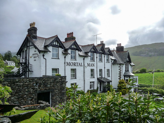
Mortal Man Inn, Troutbeck
- Overview Map Street View The Mortal Man Inn in Troutbeck is a pub, restaurant and provides accommodation. The inn is located on the old coaching route between Windermere and Ullswater, …
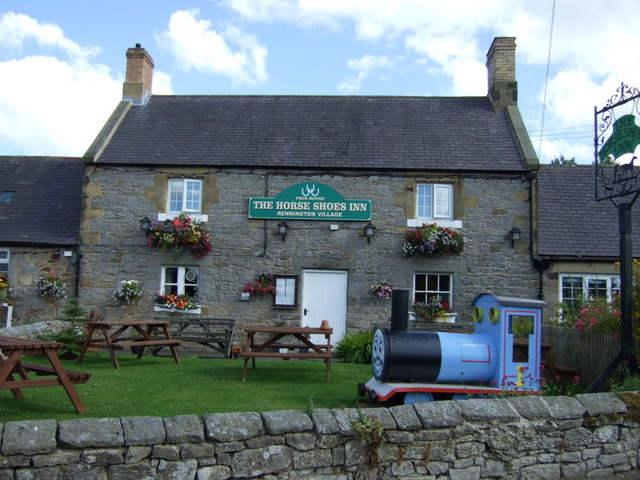
Co-Curate Page
The Horseshoes Inn, Rennington
- Overview Map Street View "The pub itself dates back to 1841 and as the name suggests used to house the local blacksmiths, many of the features still remain inside." (The …
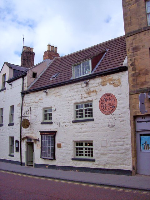
Co-Curate Page
The Dirty Bottles
- Overview Map Street View The Dirty Bottles is a freehouse pub on Narrowgate in Alnwick. The right-hand part of the building has 2 windows and dates from the 17th century; …
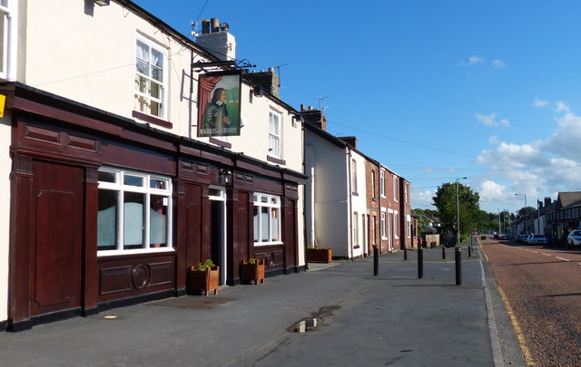
Co-Curate Page
Marquis of Granby, Framwellgate Moor
- Overview Map Street View The Marquis of Granby is a public house on Front Street in Framwellgate Moor. The pub was built in the mid 19th century and is a …
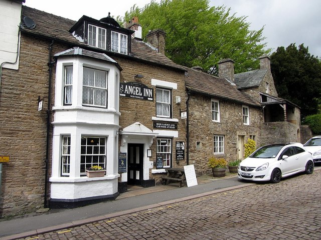
Co-Curate Page
The Angel Inn, Alston
- Overview Map Street View The Angel Inn on Front Street in Alston dates from 1611, with later additions and modifications. The Inn is a Grade II listed building on the …
Co-Curate Page
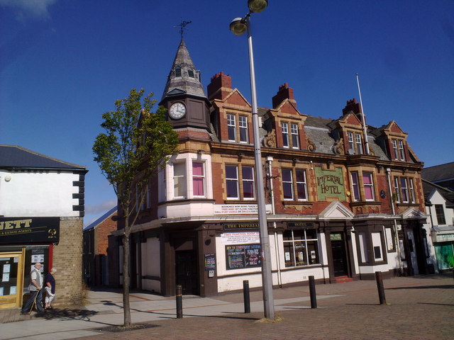
Imperial Hotel, Stanley
- Overview Map The Imperial Hotel on Front Street in Stanley was built in 1905. The Baroque style building has a wood corner turret with a clock (the building is locally known …
Co-Curate Page
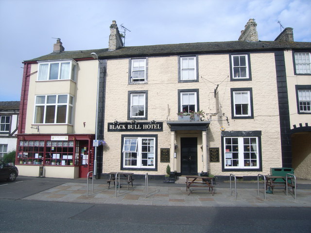
Black Bull Hotel, Kirkby Stephen
- Overview Map Street View The Black Bull is located on Market Street in Kirkby Stephen. The hotel dates from the early 19th century and is a Grade II listed building …
Co-Curate Page
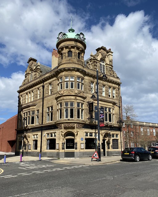
The Dun Cow, Sunderland
- Overview Map Street View The Dun Cow public house is located on High Street West in Sunderland. It was built in 1901 by Benjamin F. Simpson, for Robert Deuchar Ltd.[1] The Dun …
Co-Curate Page
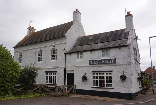
The Ship, Redmarshall
- Overview Map Street View The Ship is a public house located on Church Lane in Redmarshall. The building dates from the late 17th or early 18th century. The Ship is a …
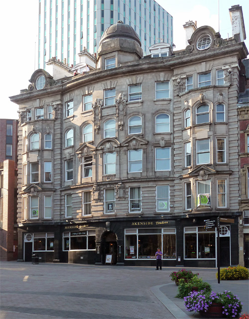
Co-Curate Page
Akenside House, Newcastle
- Overview Map Street View Akenside House on Akenside Hill in Newcastle was built as offices in 1902. It has a polished dark granite ground floor which is now home to …
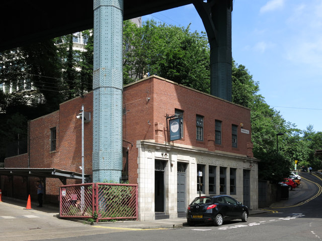
Co-Curate Page
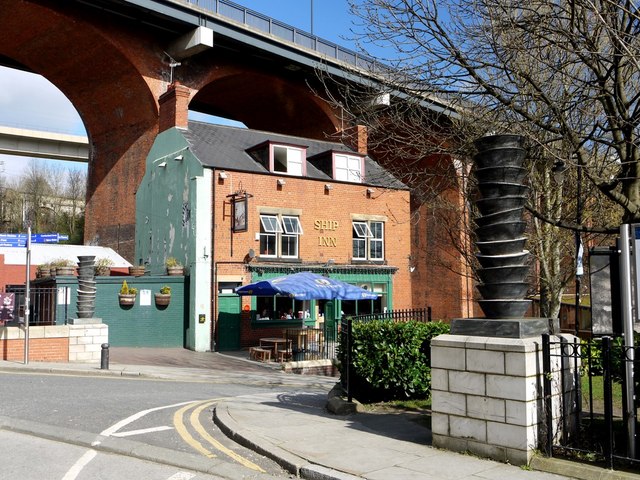
The Bridge Tavern, Akenside Hill
- Overview Map Street View The Bridge Tavern is a public house on Akenside Hill in Newcastle. It occupies a dramatic position under the viaduct of the Tyne Bridge; there are supports …
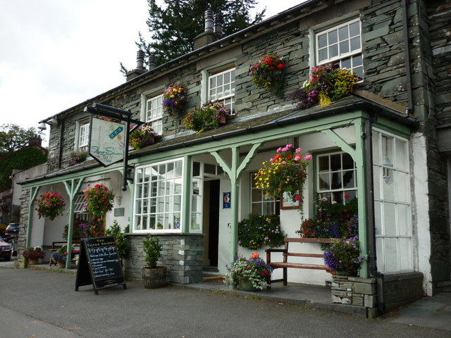
Co-Curate Page
Three Shires Inn, Little Langdale
- Overview Map Street View Inside The Three Shires Inn is a hotel, restaurant and public bar in Little Langdale. It is named after the historic boundary of the old counties of …
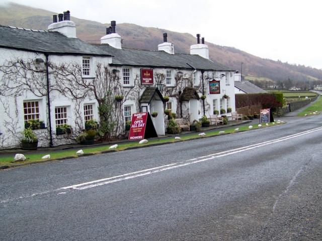
Co-Curate Page
The Travellers Rest, nr Grasmere
- Overview Map Street View The Travellers Rest Inn is a hotel, restaurant and bar located on the A591 road by the foot of Dunmail Raise, at the northern edge of …
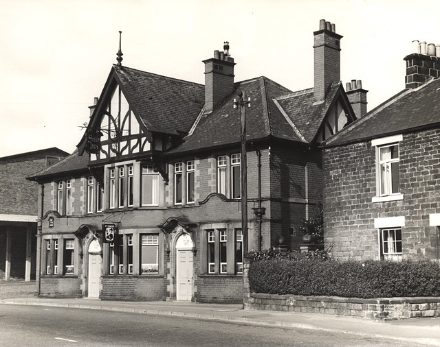
Co-Curate Page
The Ship Inn, Benton
- Overview Map Street View Inside The Ship Inn on Front Street in Benton dates from 1904. The Ship Inn is listed on North Tyneside Council's register of buildings and parks …
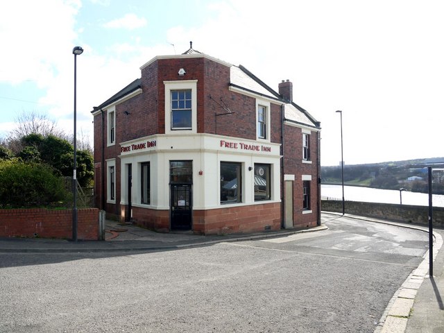
Co-Curate Page
Free Trade Inn, St Lawrence Road
- Overview Map Street View Inside The Free Trade Inn is located on St Lawrence Road in the Ouseburn area of Newcastle. The Inn was rebuilt in 1896, with alterations in …
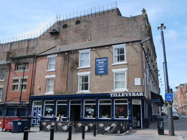
Co-Curate Page
Tilley's Bar, Westgate Road
- Overview Map Street View Tilley's Bar is located next to the Tyne Theatre, on the corner of Westgate Road and Thornton Street in Newcastle. The building dates from the mid …
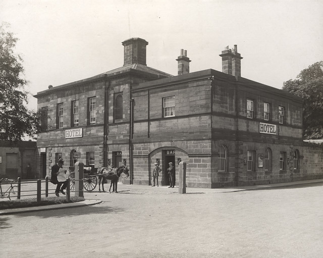
Co-Curate Page
The Border Minstrel, Gosforth Park
- Overview Map Street View Border Minstrel public house is located in Gosforth Park, to the north west of Brandling House. It was built in 1757 as an ancillary pavilion to …
Co-Curate Page
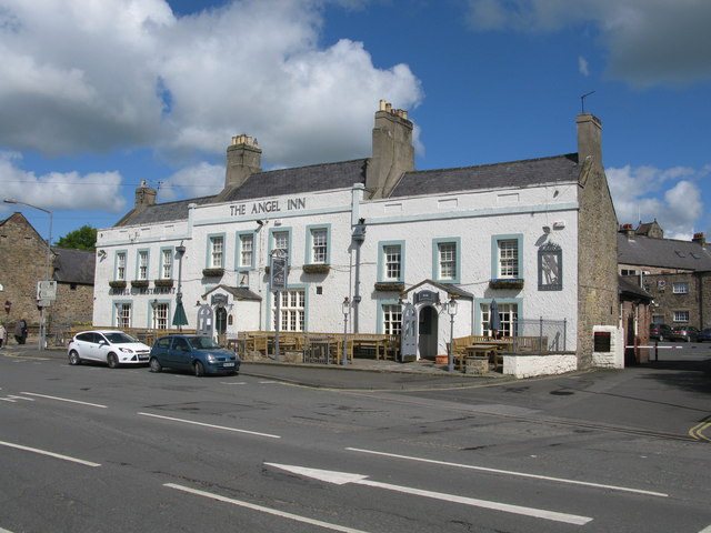
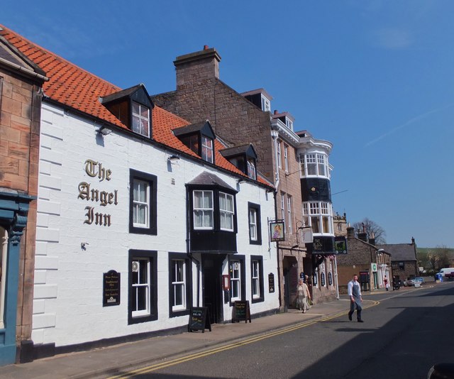
The Angel Inn, Wooler
- Overview Map Street View The Angel Inn on the High Street in Wooler dates from the 18th century. It is a Grade II listed building on the National Heritage List …
Co-Curate Page
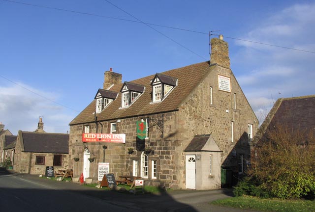
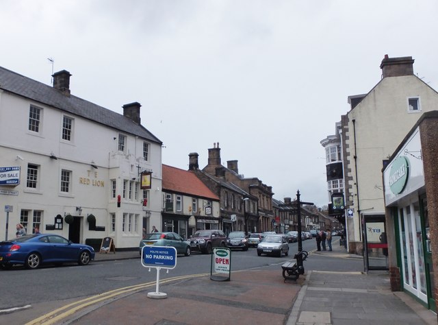
No.1, High Street, Wooler
- Overview Map Street View No.1 Hotel & Wine Lounge is located on the High Street in Wooler. It was formerly known as the Red Lion. The inn dates from the …
Co-Curate Page
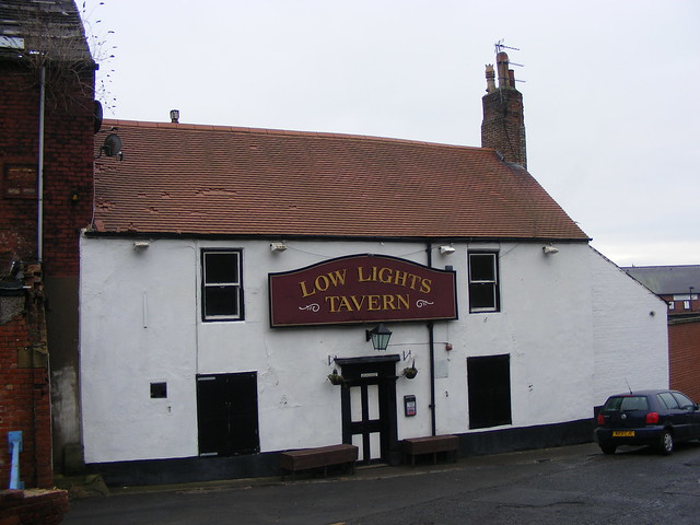
Low Lights Tavern, North Shields
- Overview Map Street View Low Lights Tavern is located on Brewhouse Bank, North Shields. It was originally built as a house in the late 18th Century, and later converted for …
Co-Curate Page
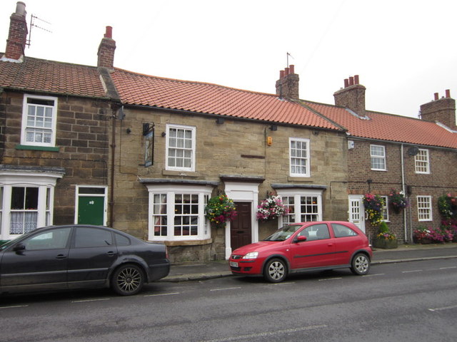
The Anchor Inn, Guisborough
- The Anchor Inn is a public house located on Belmangate in Guisborough. The inn dates from the early 19th century and is Grade II listed on the National Heritage List …
Co-Curate Page
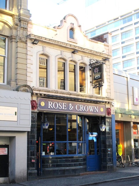
Rose and Crown, Newgate Street
- Overview Map Street View The Rose and Crown is a public house located on Newgate Street in Newcastle. It was built for Duncan and Dalglish in c.1914, designed by Simpson and …
Co-Curate Page
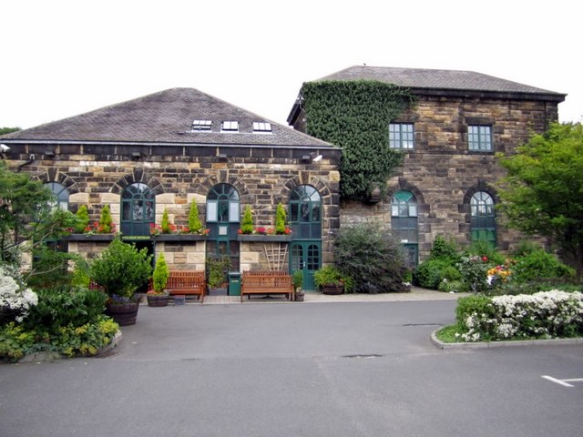
The Keelman & Big Lamp Brewery, Newburn
- Overview Map Street View The Keelman public house & Big Lamp Brewery are located on Grange Road in Newburn. The buildings are a former Victorian water pumping station. The Big …
Co-Curate Page
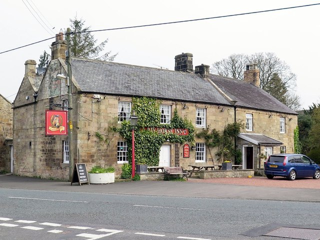
Bay Horse Inn, West Woodburn
- Overview Map Street View The Bay Horse Inn is located on the A68 road in West Woodburn. The former coaching inn dates from the 18th century, with later alterations, and …
Co-Curate Page
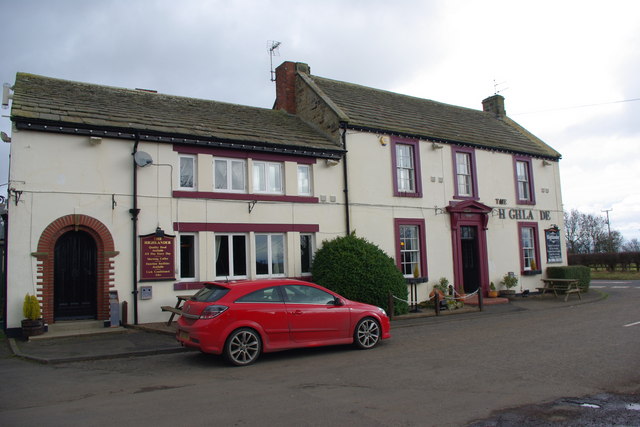
The Highlander, near Belsay
- Overview Map Street View The Highlander is a public house and restaurant, located on the A696 road, about 2 miles south-east of Belsay and 2 miles north-west of Ponteland. It …
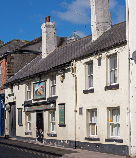
Co-Curate Page
Hare & Hounds, Wigton
- Overview Map Street View The Hare & Hounds is a public house on West Street in Wigton. The public house and former shop, now consolidated into one property, date from …
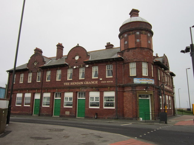
Co-Curate Page
The Hendon Grange, Sunderland
- Overview Map Street View The Hendon Grange is a public house loacted on Ocean Road, by the junction with the A1018 road, in Hendon, Sunderland. The Hendon Grange public house …
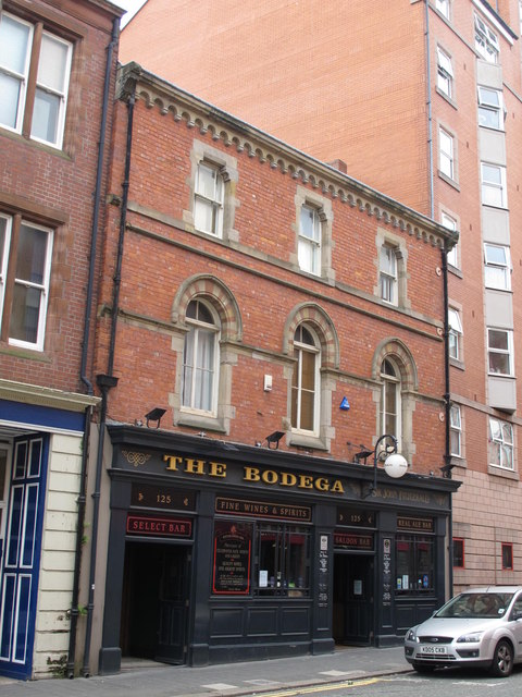
Co-Curate Page
The Bodega, Westgate Road
- Overview Map Street View The Bodega is a public house on Westgate Road (no. 125), in Newcastle. Local List. "Designed by Septimus Oswald c.1872. This was a rebuild of the …
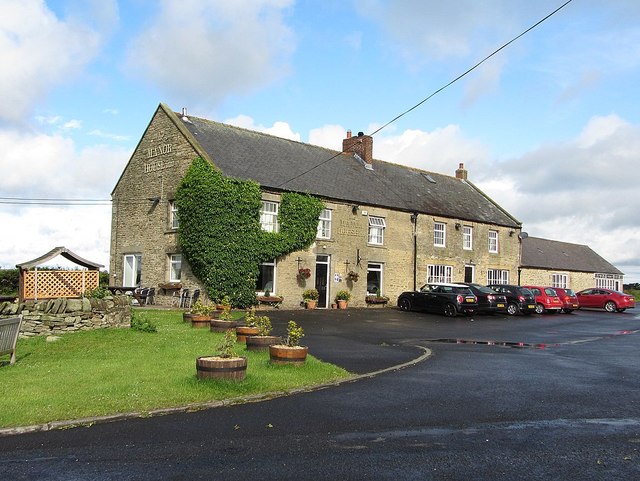
Co-Curate Page
Manor House Inn, Carterway Heads
- Overview Map Street View The Manor House Inn is a resturant, hotel and public house at Carterway Heads. It is a former coaching inn. The stone building has a low-beamed …
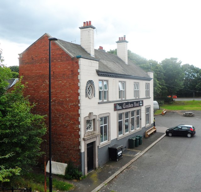
Co-Curate Page
The Crockets Hotel, Walker
- Overview Map Street View The Crockets Hotel is a public house by the junction of Mitchell Street and Forster Street in the Wincomblee area of Walker. it was originally named …
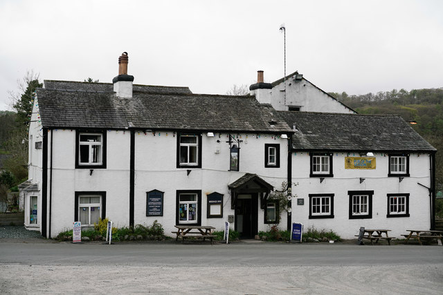
Co-Curate Page
Bridge Inn, Santon Bridge
- Overview Map Street View The Bridge Inn is located immediately west of the bridge over the River Irt at Santon Bridge. The inn was originally a mail coach halt; it …
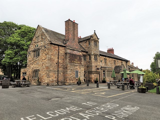
Co-Curate Page
The Blackbird Inn, Ponteland
- Overview Map Street View The Blackbird Inn is located on North Road in Ponteland. It was formerly a manor house, incorporating a medieval tower. A tower (sometimes reffered to as …
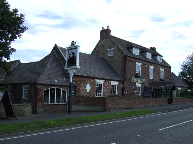
Co-Curate Page
The Badger, Street Houses, Ponteland
- Overview Map Street View The Badger is a public house and restaurant, situated by the A696 road, at Street Houses, just south of Ponteland. Built in the late 18th century, …

Co-Curate Page
The Seven Stars, Ponteland
- Overview Map Street View The Seven Stars is a public house, located on Main Street in Ponteland. The building dates from the early 19th century and is Grade II listed …
Co-Curate Page
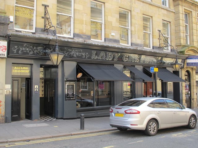
Lady Greys / No 20, Shakespeare Street, Newcastle
- Overview Map Street View No. 20, Shakespeare Street in Newcastle was built c.1836, probably by John Wardle, for Richard Grainger as part of the redevelopment of the centre of Newcastle, …
Co-Curate Page
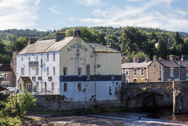
Anchor Hotel, Haydon Bridge
- Overview Map Street View Anchor Hotel is located on John Martin Street, next to the old bridge in Haydon Bridge. The building dates from the 18th century, with later alterations. …
Co-Curate Page
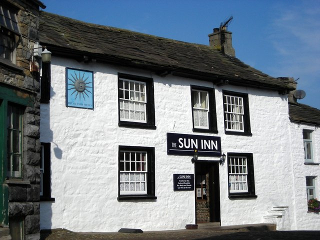
Sun Inn, Dent
- Overview Map Street View The Sun Inn is located on Main street in Dent. Originally an 18th century inn, it is said to have been "newly erected" in 1758, with …
Co-Curate Page
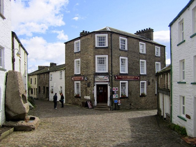
The George and Dragon, Dent
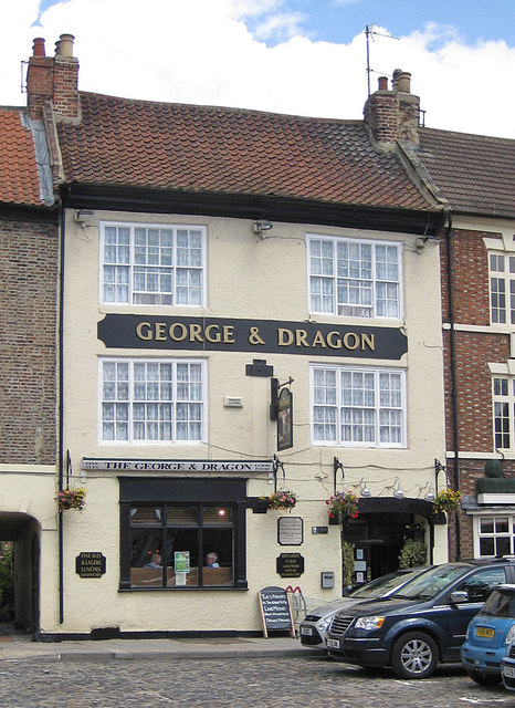
- Overview Map Street View The George and Dragon is a public house, restaurant, with accommodation, located on Main Street in Dent. The George and Dragon was rebuilt in the 19th …
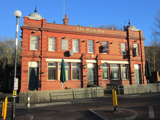
Co-Curate Page
Rose Inn, Rosehill Bank
- Overview Map Street View The Rose Inn is a public house located on Rosehill Bank in the Rosehill area of Wallsend. The ornate terracotta two storey public house opened in …
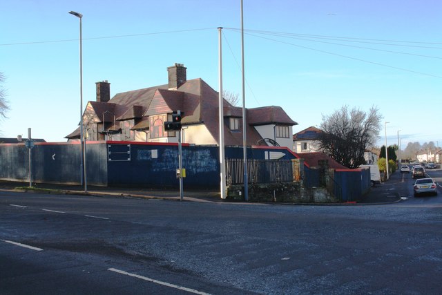
Co-Curate Page
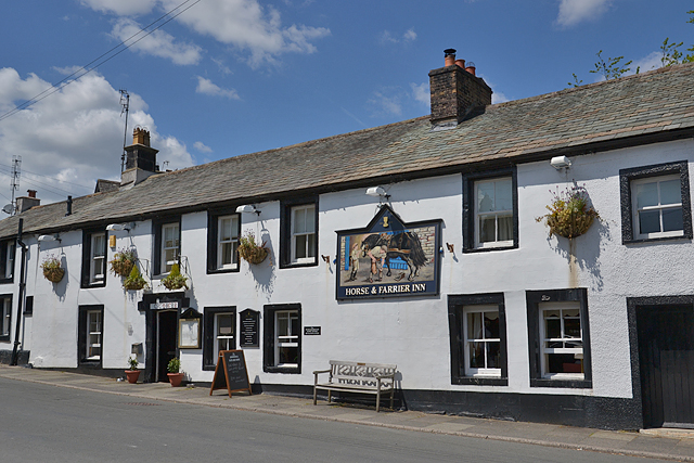
The Horse and Farrier, Wigton Road, Carlisle
- Overview Map Street View The Horse and Farrier is a public house at the junction of Wigton Road and Orton Road in Carlisle. The pub is dated 1928, built for …

Co-Curate Page
Gallaghers Bar (former Golden Lion), Carlisle
- Overview Map Street View Gallaghers Bar is located at the junction of St Nicholas Street and Botchergate in Carlisle. It is thought to have originally been 3 houses, built in …
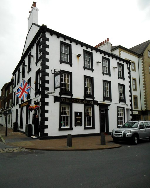
Co-Curate Page
The Boardroom, Carlisle
- Overview Map Street View The Boardroom is a public house, located on the corner of Castle Street and Paternoster Row in Carlisle. The building dates from at least the late …
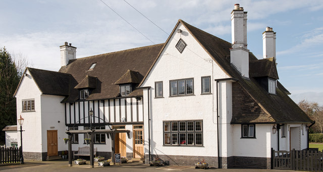
Co-Curate Page
Magpie Inn, Carlisle
- Overview Map Street View The Magpie Inn is located by the junction of Victoria Road and Banks Lane in Botcherby, Carlisle. The public house was built in 1933 to designs …

Co-Curate Page
The Rock (former Currock Inn), Carlisle
- Overview Map Street View The Rock is a public house, previously known as 'The Currock', located at the junction of Robinson Avenue and Boundary Road in Currock, Carlisle. It was …
Co-Curate Page
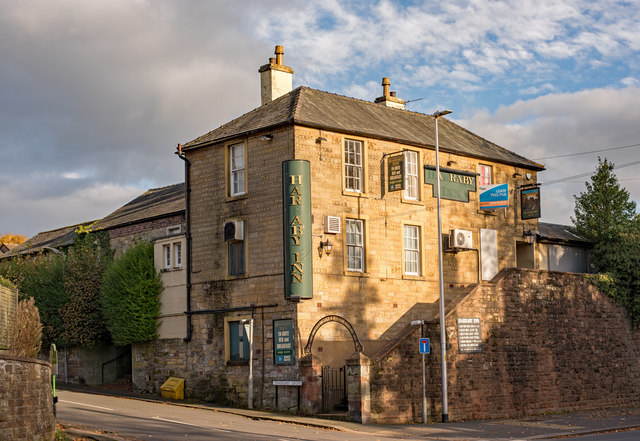
Harraby Inn, London Road, Carlisle
- Overview Map Street View Harraby Pub and Kitchen is located on London Road, by the junction with Harraby Grove, in the Harraby area of Carlisle. It opened as a public …
Co-Curate Page
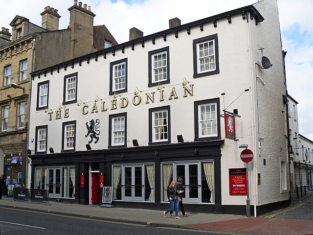
The Caledonian, Botchergate, Carlisle
- Overview Map Street View The Caledonian is a public house on Botchergate, at the junction with Mary Street, in Carlisle. The first reference to this pub is found in 1852 …
Co-Curate Page
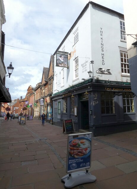
The Kings Head, Carlisle
- Overview Map Street View The Kings Head on Fisher Street is reputed to be the oldest public house in Carlisle. The present building dates from the 17th Century (with later …
Co-Curate Page
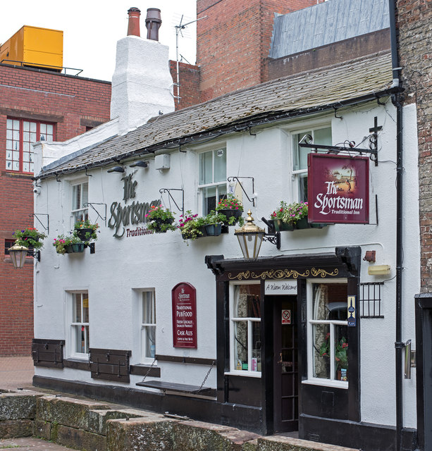
The Sportsman Inn, Carlisle
- Overview Map Street View The Sportsman is a public house located on Heads Lane, by the junction with Blackfriars Street in Carlise. The inn originates from the early 18th century. …
Co-Curate Page
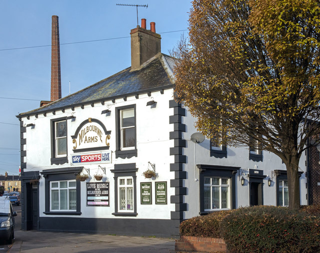
Milbourne Arms, Denton Holme
- Overview Map Street View The Milbourne Arms is a public house located at the south end of Milbourne Street by Junction Street, in Denton Holme, Carlisle. It was built 1852-1853.[1] …

Co-Curate Page
Kings Head, Allendale
- The Kings Head is a public house located on the north side of the Market Place in Allendale Town. The former inn dates from the early 18th century. It was …
Co-Curate Page
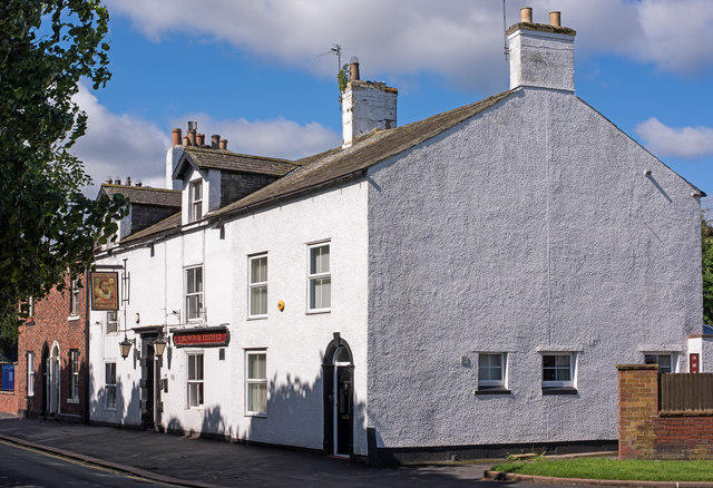
Crown & Thistle, Stanwix
- Overview Map Street View The Crown & Thistle is a public house on Church Street in Stanwix, Carlisle. The pub, located north of St Michael's Church, dates from the late …
Co-Curate Page
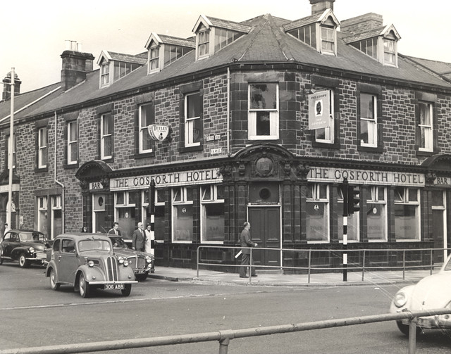
The Gosforth Hotel
- Overview Map Street View The Gosforth Hotel is a public house, located on the High Street, by the junction with Salters Road in Gosforth. It was built in 1878 and …
Co-Curate Page
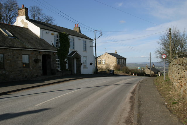
Anchor Inn, Whittonstall
- Overview Map Street View The Anchor Inn is located in Whittonstall. The proprietors note the inn was "originally built as a Coach House in the 1700's it has been renovated …
Co-Curate Page
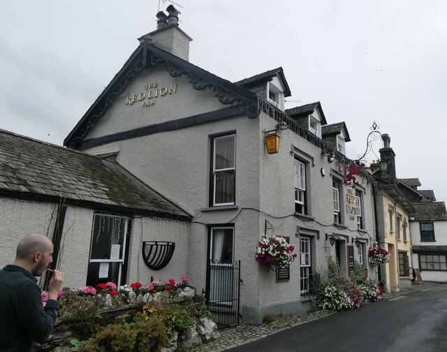
The Red Lion Inn, Hawkshead
- Overview Map Street View The Red Lion is an inn and public house on Main Street in Hawkshead. The building is thought to date from at least the 17th century …
Co-Curate Page
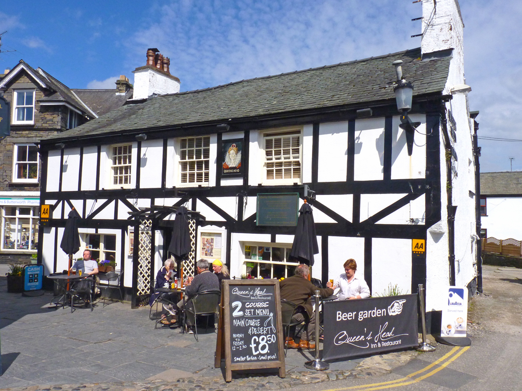
The Queen's Head Inn, Hawkshead
- Overview Map Street View The Queen's Head Inn and resturant is located on Main Street in Hawkshead. The building dates from the 17th century, with later alterations. The Queen's Head …
Co-Curate Page
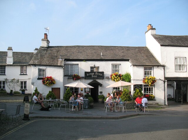
The King's Arms, Hawkshead
- Overview Map Street View The King's Head is located on The Square in Hawkshead. The public house dates from the 17th century. The King's Head is a Grade II listed …
Co-Curate Page
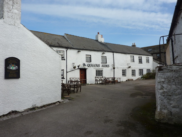
The Queens Arms, Biggar
- Overview Map Street View The Queens Arms is a public house located in Biggar Village on Walney Island. The building dates from the 17th century, with later additions. The Queens …
Co-Curate Page
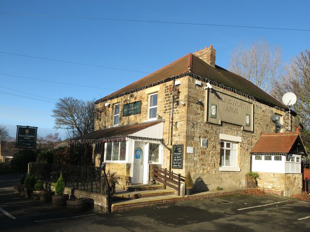
Killingworth Arms
- Overview Map Street View The Killingworth Arms is a public house and kitchen in Killingworth Village. It is located on West Lane, by the junction with Killingworth Road. George Mallaburn …

Co-Curate Page
The Station, Killingworth Drive
- Overview Map Street View The Station is a public house and resturant on station Road / Killingworth Drive, in Killingworth. It is located near the level crossing and former site …
Co-Curate Page
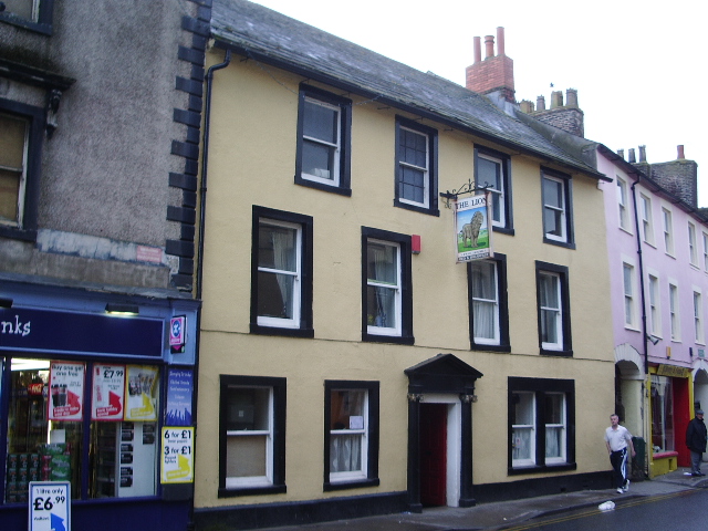
The Lion, Wigton
- Overview Map Street View The Lion is a public house at Nos. 29 & 31, High Street, in Wigton. The building dates from the late 18th century; it was previously …

Co-Curate Page
The Dock, Amble
- Overview Map Street View The Dock is a public house and hotel on Queen Street in Amble. It was built in 1837 as part of the original planned development along …

Co-Curate Page
The Waterloo, Amble
- Overview Map Street View The Waterloo is a public house and hotel on Queen Street in Amble. It was built in 1837 as part of the original planned development along …
Co-Curate Page
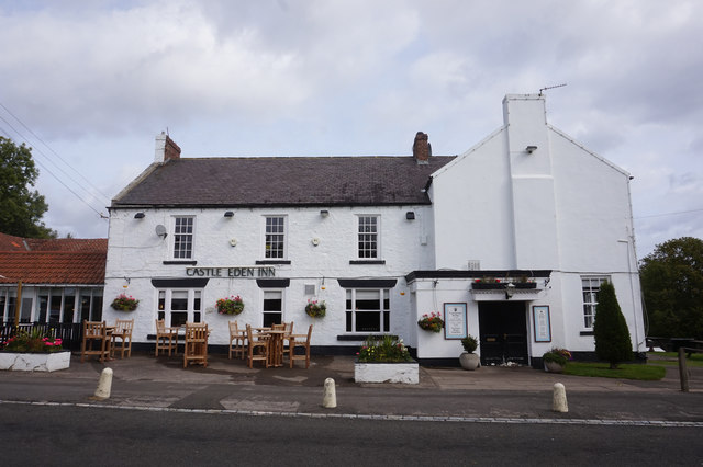
Castle Eden Inn, Stockton Road
- Overview Map Street View The Castle Eden Inn is a public house and resturant located on Stockton Road at the south of Castle Eden. The inn dates from c.1840, with …
Co-Curate Page
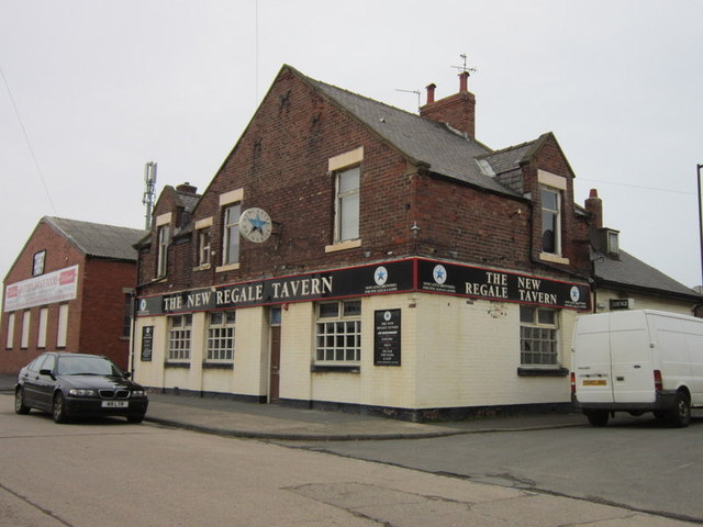
The Regale Tavern, Sunderland
- Overview Map Street View The Regale Tavern is located on Hendon Road East in Hendon, Sunderland. The public house is said to date from 1834 and was previously known as …
Co-Curate Page
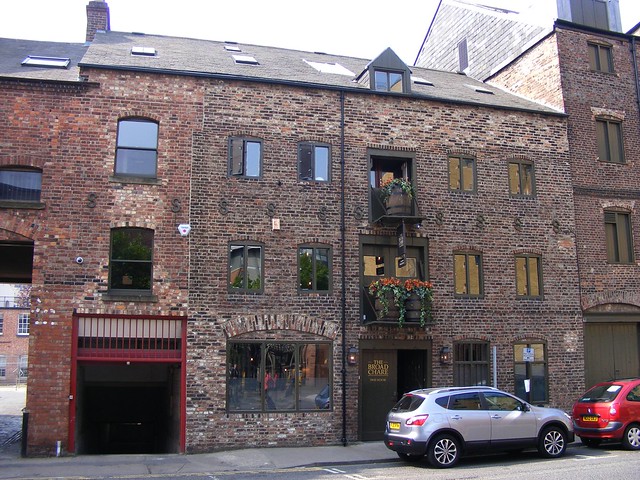
The Broad Chare (public house)
- Overview Map Street View No. 25B, Broad Chare, Newcastle was originally built as a warehouse in the late 18th or early 19th century. The building, with 3 storeys and 5 …
Co-Curate Page
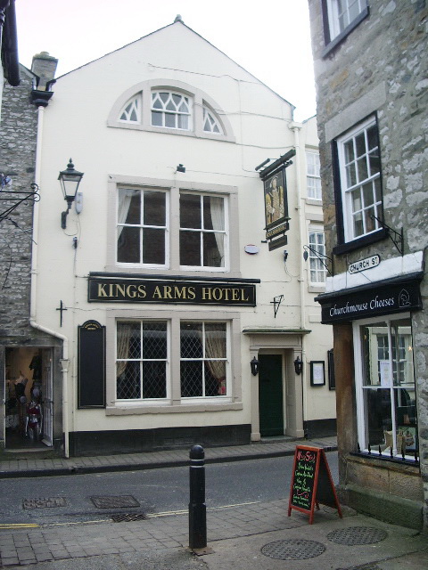
Kings Arms Hotel, Kirkby Lonsdale
- Kings Arms Hotel, Market Street, Kirkby Lonsdale. C16 or early C17 inn, refaced C18, now three properties. Although an inn since Cl7, this group was built as the manor house …
Co-Curate Page
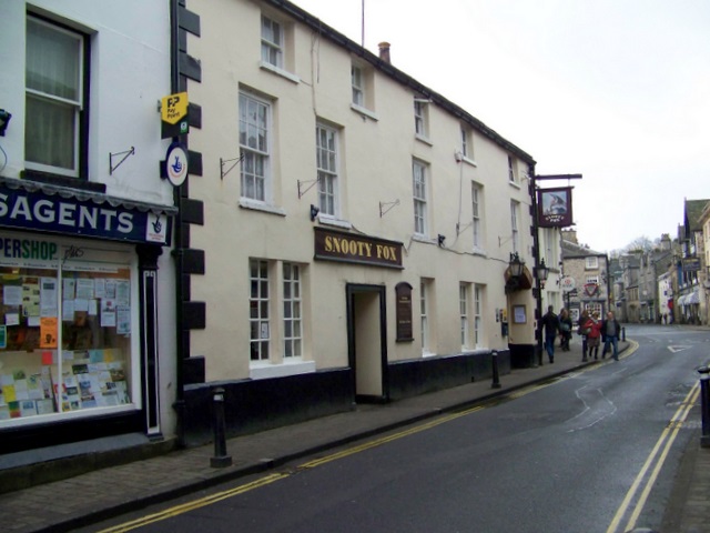
The Snooty Fox, Kirkby Lonsdale
- Overview Map Street View The Snooty Fox is a public house and inn, located on Main Street in Kirkby Lonsdale. Prior to the 1990s it was known as the Green …
Co-Curate Page
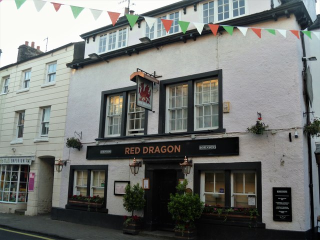
The Red Dragon, Kirkby Lonsdale
- Overview Map Street View The Red Dragon is a public house and inn, located on Main Street in Kirkby Lonsdale. The building dates back to the 17th or early 18th …
Co-Curate Page
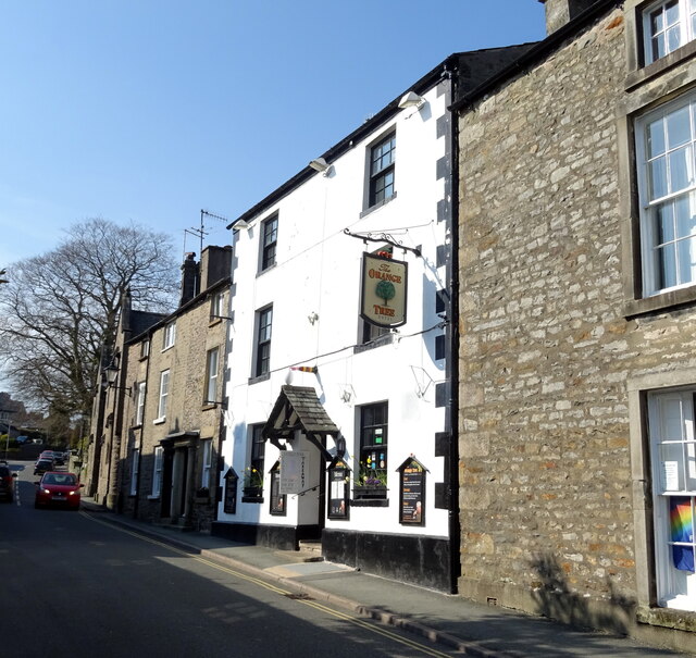
The Orange Tree, Kirkby Lonsdale
- Overview Map Street View The Orange Tree is an inn located on Fairbank on Kirkby Lonsdale. The inn dates from the mid 18th century and was previously named The Fleece …
Co-Curate Page
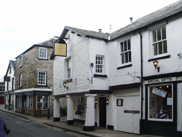
The Sun Inn, Kirkby Lonsdale
- Overview Map Street View The Sun Inn is located on Market Street (No. 6) in Kirkby Lonsdale. The inn dates from the 17th century and incorporates the 18th century block …
Co-Curate Page
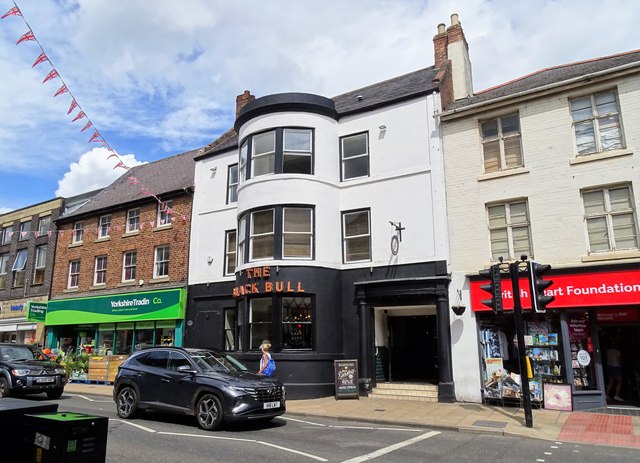
The Black Bull, Morpeth
- Overview Map Street View The Black Bull is an inn on Bridge Street in Morpeth. It dates from the early 19th century and its right bay has an old carriage …
Co-Curate Page
The Andalusian, Carlisle
- Overview Map Street View The Andalusian is a bar and resurant on Warwick Road, by the junction with The Cresent, in Carlisle. Originally it was "The Crescent Inn", built in …
Co-Curate Page
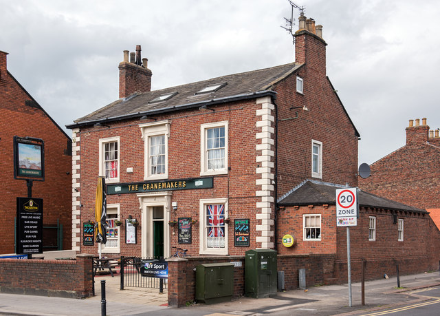
The Cranemakers, Carlisle
- Overview Map Street View The Cranemakers is a public house on London Road, by the junction of Grey Street, in Carlisle. The building was originally constructed as a house in …

Co-Curate Page
St Nicholas Arms, London Road, Carlisle
- Overview Map Street View St Nicholas Arms is a public house located on London Road, by the junction with Grey Street, in Carlisle. Originally a large house, (shown on the …
Co-Curate Page
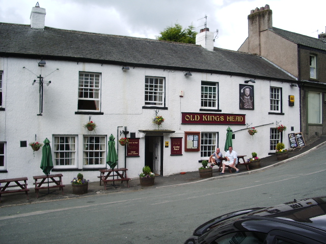
Old Kings Head, Broughton in Furness
- Overview Map Street View The Old Kings Head is an inn located on Station Road in Broughton-in-Furness. The building was first mentioned as Church House in 1666, but was likely …
Co-Curate Page
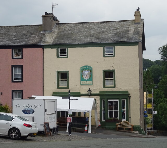
Manor Arms Hotel, Broughton-in-Furness
- Overview Map Street View The Manor Arms Hotel is located on the east side of The Square in Broughton-in-Furness. It is part of a terrace, including 7 houses, built in …
Co-Curate Page
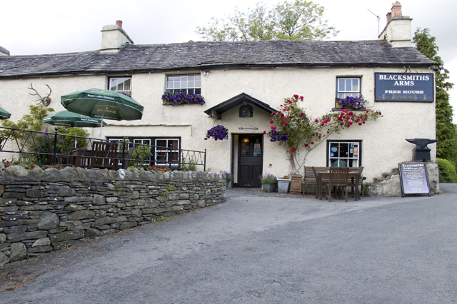
Blacksmiths Arms, Broughton Mills
- Overview Map Street View The Blacksmiths Arms is a public house and resturant located in Broughton Mills. The pub has a datestone inscribed WE 1748. The Blacksmiths Arms is Grade …
Co-Curate Page
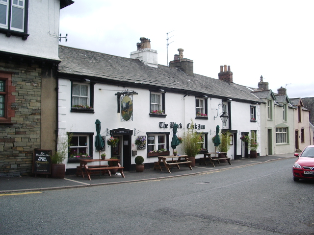
Black Cock Inn, Broughton-in-Furness
- The Black Cock Inn is a public house on Princes Street in Broughton-in-Furness. The building dates from the 17th century, with later alterations.[1] It is a Grade II listed building …
Co-Curate Page
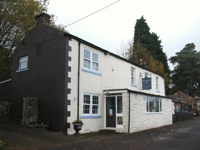
The Kirkstyle Inn and Sportsman’s Rest, Knarsdale
- Overview Map Street View The Kirkstyle Inn and Sportsman’s Rest is located in Knarsdale, a short distance off the A689. "It is believed that it was originally the rectory, and …
Co-Curate Page
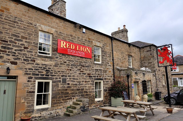
The Red Lion, Newbrough
- Overview Map Street View The Red Lion is an inn on Stanegate in Newbrough, with bar, restaurant, and B&B accommodation. The inn dates from the 18th century, incorporating the fabric …

Co-Curate Page
Travellers Rest, near Slaley
- Overview Map Street View The Travellers Rest is an inn, located on the B6306 road, about 1 mile north-west of the village of Slaley. The inn dates from the early …

Co-Curate Page
Hotels, Inns, and Taverns - Newcastle, 1855
- Extracted from: History, Topography, and Directory of Northumberland...Whellan, William, & Co, 1855. < Newcastle Directory, 1855 Hotels, Inns, and Taverns See also Beerhouses Aberdeen Arms, Ann Wilson, 27, Broad-chare Adelaide …
Co-Curate Page
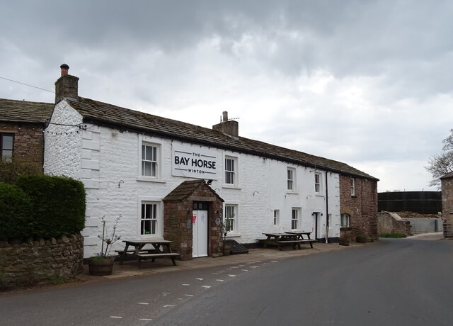
The Bay Horse, Winton
- Overview Map Street View The Bay Horse public house is located a short distance south of the village green in Winton. The building dates from the 18th century. It was …

Co-Curate Page
Market Tavern, Chester-le-Street
- Overview Map Street View The Market Tavern is located on South Burns (street), by the Market Place in Chester-le-Street. The public house was associated with what was once a large …

Co-Curate Page
Greyhounds Inn, Burgh by Sands
- Overview Map Street View The Greyhounds Inn is a public house in Burgh by Sands. It was originally a house built in the late 18th century. The pub was taken …
Co-Curate Page
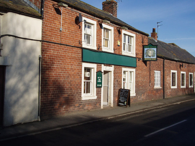
The Royal Oak, Moorhouse
- Overview Map Street View The Royal Oak is a public house in Moorhouse, situated on the B5307 road. The pub was taken over by the State Management Scheme in c.1916 …
Co-Curate Page
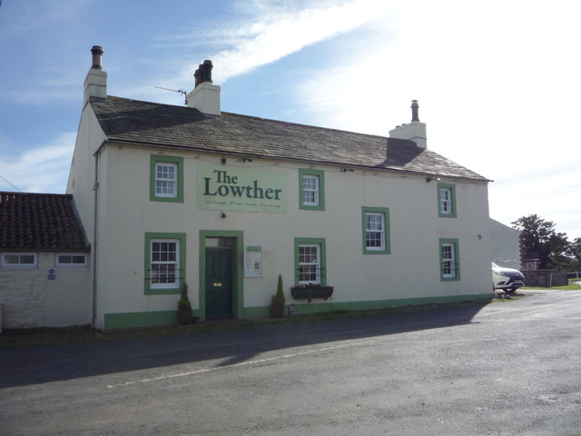
The Lowther Arms, Mawbray
- Overview Map Street View The Lowther Arms is a public house in Mawbray, Cumbria. The first record of the pub was in the 1847 Cumberland Directory. It is now a …

Co-Curate Page
The Ancient Unicorn, Bowes
- Overview Map Street View The Ancient Unicorn is located on The Street in Bowes. The front block dates from the mid-18th century, and there is an altered and refronted 17th …

Co-Curate Page
Bebside Inn
- Overview Map Street View The Bebside Inn (affectionately known as "The Bebby") is a public house located on Front Street in Bebside, Blyth. The inn was redeveloped and reopened in …


from Newcastle libraries (flickr)
061858:Scotswood Road, Newcastle upon Tyne; Malcolm Maybury; 1995
Pinned by Simon Cotterill

from Newcastle libraries (flickr)
061819:The Lowther, Newgate Street, Newcastle upon Tyne, Maybury Malcolm 1995
Pinned by Simon Cotterill

from Newcastle libraries (flickr)
046991:The Victoria North Shields unknown 1949-50
Pinned by Simon Cotterill

from Newcastle libraries (flickr)
052566:Jocker Wood Back Maling Street? Byker Unknown Undated
Pinned by Simon Cotterill

from Newcastle libraries (flickr)
065761:Wolsington Hotel Shields Road Unknown Undated
Pinned by Simon Cotterill

from Newcastle libraries (flickr)
061904:Villa Victoria Westmorland Road/Victoria Street Maybury Malcolm 1995
Pinned by Simon Cotterill

from Newcastle libraries (flickr)
013754:The Collingwood Clayton Street Newcastle upon Tyne
Pinned by Simon Cotterill

from Newcastle libraries (flickr)
061200:The Quayside Newcastle upon Tyne Malcolm Maybury 1995
Pinned by Simon Cotterill

Co-Curate Page
Zetland Hotel
- The Zetland Hotel is a Grade 2 Listed Building which was built c.1860 and located on Zetland Road, close to Middlesbrough Station. Threatened with closure as a pub in 2015. …

Co-Curate Page
Punch Bowl - Public House
- History Map Street View The Punch Bowl Hotel pub and eatery, located on Jesmond Road in Jesmond, Newcastle. Built in a "Scottish Baronial Style" the current Punch Bowl building dates …

Co-Curate Page
Robert Deuchar (1831-1904)
- Born on 18th June 1831. "Robert, with his three younger brothers, arrived in Newcastle from Forfarshire in the 1860s and from small beginnings as an innkeeper in Newgate Street (the …

Co-Curate Page
Crown Posada
- Overview Map Street View The Crown Posada is a traditional public house located on The Side, Newcastle. It was built in 1880 by WL Newcombe. [1] The building is Grade …

Co-Curate Page
Centurion Bar, Newcastle Central Station
- Overview Map Street View The Centurion Bar was originally built in 1893 as a grand waiting lounge and bar for first class passengers, designed by John Dobson as part of Newcastle …

Co-Curate Page
Close, No. 35 (Quayside Bar)
- Overview Map Street View The Quayside (Wetherspoons, previously No 1 Llyods Bar) is a public house and restaurant at no. 35 Close, by the Newcastle Quayside. The building dates back …

Co-Curate Page
Kings Arms, Great Stainton
- Overview Map Street View The Kings Arms in Grait Stainton was built in the early 18th century, with 19th century alterations. It is a Grade 2 listed building on the …

Co-Curate Page
Coach & Horses
- Overview Map Street View The Coach and Horses in Wallsend is a public house located on the junction of High Street East and Coach Road. The pub was built c.1907 …

Co-Curate Page
Bluebell Inn
- The Bluebell Inn, Embleton, was built c.1840 and is a Grade II listed building on the National Heritage List for England..

Co-Curate Page
Greys Inn
- Overview Map Street View The Greys Inn is located on Stanley Terrace, by the green in Embleton, Northumberland. The inn was built in the 19th century using local Whinstone. The …

Co-Curate Page
Beehive Inn, nr Earsdon
- Overview Map Street View The Beehive is a pub near Whitley Bay. It is located on Hartley Lane (the B1325) half a mile north east of Earsdon and 2.5 miles …

Co-Curate Page
Cannon Inn
- Overview Map Street View The Cannon Inn is a public house, located on Front Street, Earsdon. Several French prisoners were held in Earsdon village during the Napoleonic Wars (1803–1815) after a French …

Co-Curate Page
Wallaw
- Overview Map The Wallaw Cinema on Union Street in Blyth opened on 16th November 1937 with 1,600 seats. It was designed by Percy Lindsay Browne, Son & Harding, for the …

Co-Curate Page
Fernaville's Rest, Whorlton
- Overview Map Street View The Fernaville's Rest (formerly known as the Bridge Inn) at Whorlton, County Durham, dates from the early 19th Century. The pub is Grade II listed on …

Co-Curate Page
The Quay (Pub)
- Overview Map Street View The Quay is a public house on Bridge Street, by the junction with Quay Road in Blyth. It was formerly known as the Boathouse Tavern and …

Co-Curate Page
North Terrace (pub), Spital Tongues
- Overview Map Street View The North Terrace is a public house located on Claremont Road in Newcastle, close to the Medical School.

Co-Curate Page
Saxon Inn
- Overview Map Street View The pub is loacted in Escomb and takes its name from the nearby Saxon Church.

Co-Curate Page
Delaval Arms
- Overview Map Street View The Delaval Arms is a public house in Old Hartley, located off the main road between Whitley Bay and Seaton Sluice. It was originally built as …

Co-Curate Page
Forge Inn, Ulgham
- Overview Map Street View Public house in Ulgham off the B1337, Northumberland.

Co-Curate Page
The Black Bull
- Overview Map Street View The Black Bull Hotel is located on the High Street, Wooler. It was a coaching inn from the 19th century and was substantially remodelled in 1910. …

Co-Curate Page
Black Bull
- Overview Map Street View The Black Bull public house in the Market Place in Wolsingham was an inn built in the mid 18th century. The pub is Grade II listed …

from Newcastle libraries (flickr)
030407:Rose and Crown Inn Newgate Street 1966
Pinned by Simon Cotterill

Co-Curate Page
Wellington Inn
- Overview Map Street View The Wellington Inn is a public house in Riding Mill. It was originally built in 1660 as a house by Thomas Errington, postmaster of Newcastle - …

Co-Curate Page
Gibraltar Rock
- Overview Map Street The Gibraltar Rock pub is located on East Street in Tynemouth, overlooking King Edward's Bay and close to Tynemouth Priory. It dates back to at least 1822 …

Co-Curate Page
Corner House
- Overview Map Street View The Corner House Hotel in Heaton was built by James Deuchar in 1934.[1] The hotel/pub is located on the corner of Heaton Road and Stephenson Road …

Co-Curate Page
The Central
- Overview Map Street View The Central is a public house on Half Moon Lane and Hills Street in Gateshead. It was built in 1856, designed by M. Thompson for Alderman Potts, wine merchant, …

Co-Curate Page
The Anglers Arms, Weldon Bridge
- Overview Map Street View The Angler's Arms in Weldon Bridge was built in the mid 18th century as a coaching inn, located on what was then, one of the main …

Co-Curate Page
Bridge Hotel
- Overview Map Street View The Bridge Hotel on Castle Garth in Newcastle was built in c.1899, designed by Cackett, Burns Dick for J. Fitzgerald.[1] It is located next to the …

Co-Curate Page
Beehive Hotel
- Overview Map Street View The Beehive is a public house on the corner of the Cloth Market and High Bridge in Newcastle. It was built in 1902 and has a traditional …

Co-Curate Page
Old George Inn
- Overview Map Street View A public house located on Old George Yard, just off the Cloth Market, in Newcastle. Charles I was reportedly allowed to drink in this pub in 1646, …

Co-Curate Page
Balmbra's
- Overview About Balmbra's Music Hall Map Street View Balmbra's, No 6., the Cloth Market, Newcastle, was built 1902 by A. Stockwell, as a public house and billiard hall, originally called …

Co-Curate Page
Golden Lion, South Hylton
- The Golden Lion was a public house in South Hylton, dating from c.1910. The entrance reused an early 18th century stone surround, said to have come from the north wing …

Co-Curate Page
The Ship, Public House
- An 18th century inn on Holy Island. Formerly the Northumberland Arms, it was renamed "The Ship", after renovations in 1995. The Ship is a Grade II Listed building.

Co-Curate Page
Railway Inn
- Overview Map Street View There are several public houses in Ryhope - the Railway Inn, on Robson Place, is notable as a Grade II listed building. It was built in …

Co-Curate Page
Tynemouth Lodge Hotel
- Overview Map Street View Inside The Tynemouth Lodge Hotel is a traditional pub on Tynemouth Road in North Shields (non residential), located by Northumberland Park, close to Tynemouth. "This building …

Co-Curate Page
Tanners Arms
- Overview Map Street View The Tanners Arms (also known as "The Tanners") is a public house/eatery which located on the junction of New Bridge Street and Crawhall Road, in the …

Co-Curate Page
Crows Nest, Percy Street
- Overview Map Street View The Crows Nest is a pub located at no. 137 Percy Street in Newcastle. The current building is dated 1902 and called the Crows Nest Hotel. …

Co-Curate Page
Mountain Daisy Public House
- Overview Map Street View The Mountain Daisy is a pub located on Hylton Road in the Millfield area of Sunderland. In addition to its 'Modified Queen Anne style.' exterior, the …

Co-Curate Page
The Shipwrights, North Hylton
- Overview Map Street View The Shipwrights is a pub and resturant located on Ferryboat Lane in North Hylton, by the River Wear. The building dates from the 18th century; and …

Co-Curate Page
Shepherd & Shepherdess, Beamish
- Overview Map Street View The Shepherd & Shepherdess is a public house and resturant in the village of Beamish in County Durham, close to Beamish Museum. The building dates from …

Co-Curate Page
Dr Brown's, Corporation Road
- Overview Map Street View Doctor Brown's pub is located on the junction of Corporation Road and Marton Road in the centre of Middlesbrough. The triangular building was originally built as …

Co-Curate Page
Kings Arms
- The Kings Arms is a public house located by the harbour in Seaton Sluice. Originally, the King's Arms Hotel and coach-house was built in the 18th century. The coach-house was …

Co-Curate Page
Black Horse
- The original Black Horse Inn in Monkseaton was built in 1793 as a two-storey stone building, with a third floor added later. In 1936 Monkseaton Urban District Council granted permission …

Co-Curate Page
Swinburne Arms
- Overview Map Street View The Swinburne Arms is a public house located on North Side in Stamfordham, Northumberland. It was built as an inn in the mid 18th Century and …

Co-Curate Page
Stag Inn, Dufton
- Overview Map Street View The inn was built in 1703 and overlooks the village green in Dufton.[1]

Co-Curate Page
Pheasant Inn, Cumwhitton
- Overview Map Street View The Pheasant Inn public house is located at the south end of the village of Cumwhitton in Cumbria. Parts of the building date from the 17th Century …

Co-Curate Page
The Hancock
- Overview Map Street View The Hancock is a public house located on Hancock Street in Newcastle. Formerly known as Bierrex, the pub is located by the north side of the …

Co-Curate Page
The Strawberry
- Overview Map Street View Public house on Strawberry Place, in close proximity to St James' Park in Newcastle. There has been a pub on the site since 1859.

Co-Curate Page
Shepherd's Inn, Melmerby
- The Shepherd's Inn public house in Melmerby, Cumbria, dates from 1789.[1] The pub now extends into the former stables on the inn. The Shepherd's Inn is Grade II listed on …

Co-Curate Page
Ox Inn, Middleton (Morpeth)
- Overview Map Street View The Ox Inn in Middleton is a Grade II listed building; a former house, dating from the early 19th century.

Co-Curate Page
The Stainton public house
- Overview Map Street View The Stainton Inn and Tea Rooms (aka'The Stainton') is located on Meldyke Lane in Stainton, Middlesbrough. Built in 1897, the pub is Grade II listed on …

Co-Curate Page
Pack Horse Inn, Ellingham
- Overview Map Street View The Pack Horse is a traditional country pub in Ellingham, Northumberland. The building is documented on a tithe map in 1809, but may be older. It …

Co-Curate Page
The Black Swan Hotel
- Overview Map Street View The Black swan Hotel is located at the north end of the Market Place in Belford. The inn was built in the early 19th century and …

Co-Curate Page
The Blue Bell Hotel
- Overview Map Street View The Blue Bell Hotel is located in the Market Place in Belford. It was built in the 18th century as a coaching inn. The Blue Bell …

Co-Curate Page
The Turks Head
- Overview Map Street View The Turks Head is located on the High Street in Rothbury. It was built in the c.17th century as a coaching inn. Parts of the inn …

Co-Curate Page
The Queens Head
- Overview Map Street View The Queens Head is located on the High Street in Rothbury. It was built in 1792 and originally known as the Golden Fleece. In 1837 it …

Co-Curate Page
Collingwood Arms, Brandling Village
- Overview Map Street View The Collingwood Arms is a public house in Brandling Village, Jesmond. It first opened in 1836. The first landlord, Robert Hewlitt, named the pub after Newcastle-born …

Co-Curate Page
Cumberland Arms
- Overview Map Street View The Cumberland Arms is located on James Place Street in Ouseburn, Byker (rear to Back Stephen Street). The Cumberland Arms was first licensed as a beer …

Co-Curate Page
The Bush Inn
- Overview Map Street View The Bush Inn is a pub and resturant located on Main Street in Tallentire, in the Allerdale district of Cumbria. It was built in the late …

Co-Curate Page
The Carriage
- Overview Map Street View The Carriage is a public house in Jesmond. It was originally Jesmond Station, which was opened in 1864 by the Blyth & Tyne Railway. It was …

Co-Curate Page
Rising Sun Inn
- Overview Map Street View The Rising Sun is a public house by the Coast Road in Wallsend. It was built in the 1930's to serve the new community in the …

Co-Curate Page
The Ritz, Wallsend
- Overview Map Street View The Ritz is a public house on High Street West in Wallsend. It was originally the Ritz Cinema, which opened on the 15th of May 1939 …

Co-Curate Page
Tyne Bar, Ouseburn
- Overview Map Street View The Tyne Bar is a public house, located on Maling Street, by Glasshouse Bridge in Ouseburn, near the eastern end of the Quayside in Newcastle. It …

Co-Curate Page
Plough Inn, Killingworth
- Overview Map Street View The Plough Inn is located on West Lane, Killingworth Village. Henry Punshon was noted as the proprietor of the Plough Inn, in Whellan's directory of 1855.

Co-Curate Page
Black Bull Inn, Nateby
- Overview Map Street View The Black Bull Inn at Nateby is a public house also providing dining and accommodation (5 ensuite bedrooms).

Co-Curate Page
Howard Arms, Carlisle
- Overview Map Street View The Howard Arms is a public house on the west side of Lowther Street in Carlisle. Originally, it was one of 2 adjoining houses built in …

Co-Curate Page
The Redfern, Etterby
- Overview Map Street View The Redfern is a public house located on Kingmoor Road, in the Etterby area of Carlisle. It was opened on the 1st of October 1940 and …

Co-Curate Page
Cumberland Inn, Carlisle
- Overview Map Street View The Cumberland Inn, no. 22 Botchergate in Carlsile is public house built under the Carlisle and District State Management Scheme. Designed by Harry Redfern in a 'Tudor …

Co-Curate Page
Rose and Crown Inn, Slaley
- Overview Map Street View The Rose and Crown Inn, on Main Street in the village of Slaley dates from the mid 18th century. Along with two adjacent houses, the inn …

Co-Curate Page
Jolly Fisherman, Craster
- Overview Map Street View The Jolly Fisherman is a pub and restaurant located on Haven Hill in Craster. It was established by Charles Archbold in 1847. In 1955, the Jolly …

Co-Curate Page
The Blue Bell, Dalston
- Overview Map Street View The Blue Bell is a public house on the east side of The Square in Dalston. It dates from the early 18th century and is a …

Co-Curate Page
The Ship Inn, Thursby
- Overview Map Street View The Ship Inn is located by The Green in Thursby. The inn probably dates from the late 18th century and has former stable buildings; it was …

Co-Curate Page
Sportsmans Inn, Upper Dentdale
- Overview Map Street View The Sportsmans Inn is a public House situated by the River Dee at Cow Dub, near Stone House in Upper Dentdale. It is a former farmhouse, …

Co-Curate Page
The Spinners Arms, Cummersdale
- Overview Map Street View The Spinners Arms is a public house in Cummersdale. It was built from 1929-1930 by Harry Redfern for the Carlisle District State Management Scheme. The pub …

Co-Curate Page
Sun Inn, Crook
- Overview Map Street View The Sun Inn is a public house in Crook, South Lakeland. It dates from the 19th century and was originally an Inn and cottages, with the …

Co-Curate Page
State Management of Public Houses (1916 - 1971)
- Overview About the Scheme List of Carlisle Pubs (selected) The Carlisle and District State Management Scheme operated from 1916 to 1971. The scheme, sometimes called the "Carlise Experiment", was initially …

Co-Curate Page
Cumberland Arms, Tynemouth
- Overview Map Street View The Cumberland Arms is located at 17 Front Street, Tynemouth. It is a red brick and faience Victorian gothic-style public house, which was built in 1898 …

Co-Curate Page
Golden Lion, Allendale
- Overview Map Street View The Golden Lion is an inn and resturant located on the north side of the Market Place in Allendale Town. "The '1839 Restaurant' is named after …

Co-Curate Page
The Stag Inn, Low Crosby
- Overview Map Street View The Stag Inn at Low Crosby dates from the 17th century, and was extended in the 20th century. The building is Grade II listed on the …

Co-Curate Page
Concle Inn
- Overview Map Street View The Concle Inn is a public house located on Roa Island Road in Rampside. The pub dates from the early 19th century and is situated close …

Co-Curate Page
Salutation Inn, High Hesket
- Overview Map Street View The Salutation Inn at High Hesket dates from the late 18th or early 19th century and is Grade II listed on the National Heritage List for …

Co-Curate Page
The Gate Inn, Yanwath
- Overview Map Street View The Gate Inn (aka 'The Yanwath Gate') is a public house and resturant in at Yanwath. The pub was originally two seperate houses, which were altered …

Co-Curate Page
The Crown and Thistle, Rockcliffe
- Overview Map Street View The Crown and Thistle is a public house and resturant in Rockcliffe, Cumbria. The building dates from the 19th century, with a 20th century extention.[1] The …

Co-Curate Page
The Kings Arms, Temple Sowerby
- Overview Map Street View The Kings Arms is a public house, resturant and B&B in Temple Sowerby. The pub dates from the 18th century and was originally a coaching in …

Co-Curate Page
The Shepherd's Inn, Langwathby
- Overview Map Street View The Shepherd's Inn, located at the southern end of the Village green in Langwathby, was originally two houses built in the early 18th and late 18th century, …

Co-Curate Page
Wasdale Head Inn
- Overview Map Street View The Wasdale Head Inn (previously known as the Wastwater Hotel) had been built by 1860, with later alterations. Wasdale Head was known as a centre for …

Co-Curate Page
The Britannia Inn, Elterwater
- Overview Map Street View The Britannia Inn at Elterwater is a public house, restaurant and provides accommodation. The building dates from around the 17th century, with substantial modifications over the …

Co-Curate Page
Mortal Man Inn, Troutbeck
- Overview Map Street View The Mortal Man Inn in Troutbeck is a pub, restaurant and provides accommodation. The inn is located on the old coaching route between Windermere and Ullswater, …

Co-Curate Page
The Horseshoes Inn, Rennington
- Overview Map Street View "The pub itself dates back to 1841 and as the name suggests used to house the local blacksmiths, many of the features still remain inside." (The …

Co-Curate Page
The Dirty Bottles
- Overview Map Street View The Dirty Bottles is a freehouse pub on Narrowgate in Alnwick. The right-hand part of the building has 2 windows and dates from the 17th century; …

Co-Curate Page
Marquis of Granby, Framwellgate Moor
- Overview Map Street View The Marquis of Granby is a public house on Front Street in Framwellgate Moor. The pub was built in the mid 19th century and is a …

Co-Curate Page
The Angel Inn, Alston
- Overview Map Street View The Angel Inn on Front Street in Alston dates from 1611, with later additions and modifications. The Inn is a Grade II listed building on the …

Co-Curate Page
Imperial Hotel, Stanley
- Overview Map The Imperial Hotel on Front Street in Stanley was built in 1905. The Baroque style building has a wood corner turret with a clock (the building is locally known …

Co-Curate Page
Black Bull Hotel, Kirkby Stephen
- Overview Map Street View The Black Bull is located on Market Street in Kirkby Stephen. The hotel dates from the early 19th century and is a Grade II listed building …

Co-Curate Page
The Dun Cow, Sunderland
- Overview Map Street View The Dun Cow public house is located on High Street West in Sunderland. It was built in 1901 by Benjamin F. Simpson, for Robert Deuchar Ltd.[1] The Dun …

Co-Curate Page
The Ship, Redmarshall
- Overview Map Street View The Ship is a public house located on Church Lane in Redmarshall. The building dates from the late 17th or early 18th century. The Ship is a …

Co-Curate Page
Akenside House, Newcastle
- Overview Map Street View Akenside House on Akenside Hill in Newcastle was built as offices in 1902. It has a polished dark granite ground floor which is now home to …

Co-Curate Page
The Bridge Tavern, Akenside Hill
- Overview Map Street View The Bridge Tavern is a public house on Akenside Hill in Newcastle. It occupies a dramatic position under the viaduct of the Tyne Bridge; there are supports …

Co-Curate Page
Three Shires Inn, Little Langdale
- Overview Map Street View Inside The Three Shires Inn is a hotel, restaurant and public bar in Little Langdale. It is named after the historic boundary of the old counties of …

Co-Curate Page
The Travellers Rest, nr Grasmere
- Overview Map Street View The Travellers Rest Inn is a hotel, restaurant and bar located on the A591 road by the foot of Dunmail Raise, at the northern edge of …

Co-Curate Page
The Ship Inn, Benton
- Overview Map Street View Inside The Ship Inn on Front Street in Benton dates from 1904. The Ship Inn is listed on North Tyneside Council's register of buildings and parks …

Co-Curate Page
Free Trade Inn, St Lawrence Road
- Overview Map Street View Inside The Free Trade Inn is located on St Lawrence Road in the Ouseburn area of Newcastle. The Inn was rebuilt in 1896, with alterations in …

Co-Curate Page
Tilley's Bar, Westgate Road
- Overview Map Street View Tilley's Bar is located next to the Tyne Theatre, on the corner of Westgate Road and Thornton Street in Newcastle. The building dates from the mid …

Co-Curate Page
The Border Minstrel, Gosforth Park
- Overview Map Street View Border Minstrel public house is located in Gosforth Park, to the north west of Brandling House. It was built in 1757 as an ancillary pavilion to …

Co-Curate Page
The Angel Inn, Wooler
- Overview Map Street View The Angel Inn on the High Street in Wooler dates from the 18th century. It is a Grade II listed building on the National Heritage List …

Co-Curate Page
No.1, High Street, Wooler
- Overview Map Street View No.1 Hotel & Wine Lounge is located on the High Street in Wooler. It was formerly known as the Red Lion. The inn dates from the …

Co-Curate Page
Low Lights Tavern, North Shields
- Overview Map Street View Low Lights Tavern is located on Brewhouse Bank, North Shields. It was originally built as a house in the late 18th Century, and later converted for …

Co-Curate Page
The Anchor Inn, Guisborough
- The Anchor Inn is a public house located on Belmangate in Guisborough. The inn dates from the early 19th century and is Grade II listed on the National Heritage List …

Co-Curate Page
Rose and Crown, Newgate Street
- Overview Map Street View The Rose and Crown is a public house located on Newgate Street in Newcastle. It was built for Duncan and Dalglish in c.1914, designed by Simpson and …

Co-Curate Page
The Keelman & Big Lamp Brewery, Newburn
- Overview Map Street View The Keelman public house & Big Lamp Brewery are located on Grange Road in Newburn. The buildings are a former Victorian water pumping station. The Big …

Co-Curate Page
Bay Horse Inn, West Woodburn
- Overview Map Street View The Bay Horse Inn is located on the A68 road in West Woodburn. The former coaching inn dates from the 18th century, with later alterations, and …

Co-Curate Page
The Highlander, near Belsay
- Overview Map Street View The Highlander is a public house and restaurant, located on the A696 road, about 2 miles south-east of Belsay and 2 miles north-west of Ponteland. It …

Co-Curate Page
Hare & Hounds, Wigton
- Overview Map Street View The Hare & Hounds is a public house on West Street in Wigton. The public house and former shop, now consolidated into one property, date from …

Co-Curate Page
The Hendon Grange, Sunderland
- Overview Map Street View The Hendon Grange is a public house loacted on Ocean Road, by the junction with the A1018 road, in Hendon, Sunderland. The Hendon Grange public house …

Co-Curate Page
The Bodega, Westgate Road
- Overview Map Street View The Bodega is a public house on Westgate Road (no. 125), in Newcastle. Local List. "Designed by Septimus Oswald c.1872. This was a rebuild of the …

Co-Curate Page
Manor House Inn, Carterway Heads
- Overview Map Street View The Manor House Inn is a resturant, hotel and public house at Carterway Heads. It is a former coaching inn. The stone building has a low-beamed …

Co-Curate Page
The Crockets Hotel, Walker
- Overview Map Street View The Crockets Hotel is a public house by the junction of Mitchell Street and Forster Street in the Wincomblee area of Walker. it was originally named …

Co-Curate Page
Bridge Inn, Santon Bridge
- Overview Map Street View The Bridge Inn is located immediately west of the bridge over the River Irt at Santon Bridge. The inn was originally a mail coach halt; it …

Co-Curate Page
The Blackbird Inn, Ponteland
- Overview Map Street View The Blackbird Inn is located on North Road in Ponteland. It was formerly a manor house, incorporating a medieval tower. A tower (sometimes reffered to as …

Co-Curate Page
The Badger, Street Houses, Ponteland
- Overview Map Street View The Badger is a public house and restaurant, situated by the A696 road, at Street Houses, just south of Ponteland. Built in the late 18th century, …

Co-Curate Page
The Seven Stars, Ponteland
- Overview Map Street View The Seven Stars is a public house, located on Main Street in Ponteland. The building dates from the early 19th century and is Grade II listed …

Co-Curate Page
Lady Greys / No 20, Shakespeare Street, Newcastle
- Overview Map Street View No. 20, Shakespeare Street in Newcastle was built c.1836, probably by John Wardle, for Richard Grainger as part of the redevelopment of the centre of Newcastle, …

Co-Curate Page
Anchor Hotel, Haydon Bridge
- Overview Map Street View Anchor Hotel is located on John Martin Street, next to the old bridge in Haydon Bridge. The building dates from the 18th century, with later alterations. …

Co-Curate Page
Sun Inn, Dent
- Overview Map Street View The Sun Inn is located on Main street in Dent. Originally an 18th century inn, it is said to have been "newly erected" in 1758, with …

Co-Curate Page
The George and Dragon, Dent
- Overview Map Street View The George and Dragon is a public house, restaurant, with accommodation, located on Main Street in Dent. The George and Dragon was rebuilt in the 19th …

Co-Curate Page
Rose Inn, Rosehill Bank
- Overview Map Street View The Rose Inn is a public house located on Rosehill Bank in the Rosehill area of Wallsend. The ornate terracotta two storey public house opened in …

Co-Curate Page
The Horse and Farrier, Wigton Road, Carlisle
- Overview Map Street View The Horse and Farrier is a public house at the junction of Wigton Road and Orton Road in Carlisle. The pub is dated 1928, built for …

Co-Curate Page
Gallaghers Bar (former Golden Lion), Carlisle
- Overview Map Street View Gallaghers Bar is located at the junction of St Nicholas Street and Botchergate in Carlisle. It is thought to have originally been 3 houses, built in …

Co-Curate Page
The Boardroom, Carlisle
- Overview Map Street View The Boardroom is a public house, located on the corner of Castle Street and Paternoster Row in Carlisle. The building dates from at least the late …

Co-Curate Page
Magpie Inn, Carlisle
- Overview Map Street View The Magpie Inn is located by the junction of Victoria Road and Banks Lane in Botcherby, Carlisle. The public house was built in 1933 to designs …

Co-Curate Page
The Rock (former Currock Inn), Carlisle
- Overview Map Street View The Rock is a public house, previously known as 'The Currock', located at the junction of Robinson Avenue and Boundary Road in Currock, Carlisle. It was …

Co-Curate Page
Harraby Inn, London Road, Carlisle
- Overview Map Street View Harraby Pub and Kitchen is located on London Road, by the junction with Harraby Grove, in the Harraby area of Carlisle. It opened as a public …

Co-Curate Page
The Caledonian, Botchergate, Carlisle
- Overview Map Street View The Caledonian is a public house on Botchergate, at the junction with Mary Street, in Carlisle. The first reference to this pub is found in 1852 …

Co-Curate Page
The Kings Head, Carlisle
- Overview Map Street View The Kings Head on Fisher Street is reputed to be the oldest public house in Carlisle. The present building dates from the 17th Century (with later …

Co-Curate Page
The Sportsman Inn, Carlisle
- Overview Map Street View The Sportsman is a public house located on Heads Lane, by the junction with Blackfriars Street in Carlise. The inn originates from the early 18th century. …

Co-Curate Page
Milbourne Arms, Denton Holme
- Overview Map Street View The Milbourne Arms is a public house located at the south end of Milbourne Street by Junction Street, in Denton Holme, Carlisle. It was built 1852-1853.[1] …

Co-Curate Page
Kings Head, Allendale
- The Kings Head is a public house located on the north side of the Market Place in Allendale Town. The former inn dates from the early 18th century. It was …

Co-Curate Page
Crown & Thistle, Stanwix
- Overview Map Street View The Crown & Thistle is a public house on Church Street in Stanwix, Carlisle. The pub, located north of St Michael's Church, dates from the late …

Co-Curate Page
The Gosforth Hotel
- Overview Map Street View The Gosforth Hotel is a public house, located on the High Street, by the junction with Salters Road in Gosforth. It was built in 1878 and …

Co-Curate Page
Anchor Inn, Whittonstall
- Overview Map Street View The Anchor Inn is located in Whittonstall. The proprietors note the inn was "originally built as a Coach House in the 1700's it has been renovated …

Co-Curate Page
The Red Lion Inn, Hawkshead
- Overview Map Street View The Red Lion is an inn and public house on Main Street in Hawkshead. The building is thought to date from at least the 17th century …

Co-Curate Page
The Queen's Head Inn, Hawkshead
- Overview Map Street View The Queen's Head Inn and resturant is located on Main Street in Hawkshead. The building dates from the 17th century, with later alterations. The Queen's Head …

Co-Curate Page
The King's Arms, Hawkshead
- Overview Map Street View The King's Head is located on The Square in Hawkshead. The public house dates from the 17th century. The King's Head is a Grade II listed …

Co-Curate Page
The Queens Arms, Biggar
- Overview Map Street View The Queens Arms is a public house located in Biggar Village on Walney Island. The building dates from the 17th century, with later additions. The Queens …

Co-Curate Page
Killingworth Arms
- Overview Map Street View The Killingworth Arms is a public house and kitchen in Killingworth Village. It is located on West Lane, by the junction with Killingworth Road. George Mallaburn …

Co-Curate Page
The Station, Killingworth Drive
- Overview Map Street View The Station is a public house and resturant on station Road / Killingworth Drive, in Killingworth. It is located near the level crossing and former site …

Co-Curate Page
The Lion, Wigton
- Overview Map Street View The Lion is a public house at Nos. 29 & 31, High Street, in Wigton. The building dates from the late 18th century; it was previously …

Co-Curate Page
The Dock, Amble
- Overview Map Street View The Dock is a public house and hotel on Queen Street in Amble. It was built in 1837 as part of the original planned development along …

Co-Curate Page
The Waterloo, Amble
- Overview Map Street View The Waterloo is a public house and hotel on Queen Street in Amble. It was built in 1837 as part of the original planned development along …

Co-Curate Page
Castle Eden Inn, Stockton Road
- Overview Map Street View The Castle Eden Inn is a public house and resturant located on Stockton Road at the south of Castle Eden. The inn dates from c.1840, with …

Co-Curate Page
The Regale Tavern, Sunderland
- Overview Map Street View The Regale Tavern is located on Hendon Road East in Hendon, Sunderland. The public house is said to date from 1834 and was previously known as …

Co-Curate Page
The Broad Chare (public house)
- Overview Map Street View No. 25B, Broad Chare, Newcastle was originally built as a warehouse in the late 18th or early 19th century. The building, with 3 storeys and 5 …

Co-Curate Page
Kings Arms Hotel, Kirkby Lonsdale
- Kings Arms Hotel, Market Street, Kirkby Lonsdale. C16 or early C17 inn, refaced C18, now three properties. Although an inn since Cl7, this group was built as the manor house …

Co-Curate Page
The Snooty Fox, Kirkby Lonsdale
- Overview Map Street View The Snooty Fox is a public house and inn, located on Main Street in Kirkby Lonsdale. Prior to the 1990s it was known as the Green …

Co-Curate Page
The Red Dragon, Kirkby Lonsdale
- Overview Map Street View The Red Dragon is a public house and inn, located on Main Street in Kirkby Lonsdale. The building dates back to the 17th or early 18th …

Co-Curate Page
The Orange Tree, Kirkby Lonsdale
- Overview Map Street View The Orange Tree is an inn located on Fairbank on Kirkby Lonsdale. The inn dates from the mid 18th century and was previously named The Fleece …

Co-Curate Page
The Sun Inn, Kirkby Lonsdale
- Overview Map Street View The Sun Inn is located on Market Street (No. 6) in Kirkby Lonsdale. The inn dates from the 17th century and incorporates the 18th century block …

Co-Curate Page
The Black Bull, Morpeth
- Overview Map Street View The Black Bull is an inn on Bridge Street in Morpeth. It dates from the early 19th century and its right bay has an old carriage …

Co-Curate Page
The Andalusian, Carlisle
- Overview Map Street View The Andalusian is a bar and resurant on Warwick Road, by the junction with The Cresent, in Carlisle. Originally it was "The Crescent Inn", built in …

Co-Curate Page
The Cranemakers, Carlisle
- Overview Map Street View The Cranemakers is a public house on London Road, by the junction of Grey Street, in Carlisle. The building was originally constructed as a house in …

Co-Curate Page
St Nicholas Arms, London Road, Carlisle
- Overview Map Street View St Nicholas Arms is a public house located on London Road, by the junction with Grey Street, in Carlisle. Originally a large house, (shown on the …

Co-Curate Page
Old Kings Head, Broughton in Furness
- Overview Map Street View The Old Kings Head is an inn located on Station Road in Broughton-in-Furness. The building was first mentioned as Church House in 1666, but was likely …

Co-Curate Page
Manor Arms Hotel, Broughton-in-Furness
- Overview Map Street View The Manor Arms Hotel is located on the east side of The Square in Broughton-in-Furness. It is part of a terrace, including 7 houses, built in …

Co-Curate Page
Blacksmiths Arms, Broughton Mills
- Overview Map Street View The Blacksmiths Arms is a public house and resturant located in Broughton Mills. The pub has a datestone inscribed WE 1748. The Blacksmiths Arms is Grade …

Co-Curate Page
Black Cock Inn, Broughton-in-Furness
- The Black Cock Inn is a public house on Princes Street in Broughton-in-Furness. The building dates from the 17th century, with later alterations.[1] It is a Grade II listed building …

Co-Curate Page
The Kirkstyle Inn and Sportsman’s Rest, Knarsdale
- Overview Map Street View The Kirkstyle Inn and Sportsman’s Rest is located in Knarsdale, a short distance off the A689. "It is believed that it was originally the rectory, and …

Co-Curate Page
The Red Lion, Newbrough
- Overview Map Street View The Red Lion is an inn on Stanegate in Newbrough, with bar, restaurant, and B&B accommodation. The inn dates from the 18th century, incorporating the fabric …

Co-Curate Page
Travellers Rest, near Slaley
- Overview Map Street View The Travellers Rest is an inn, located on the B6306 road, about 1 mile north-west of the village of Slaley. The inn dates from the early …

Co-Curate Page
Hotels, Inns, and Taverns - Newcastle, 1855
- Extracted from: History, Topography, and Directory of Northumberland...Whellan, William, & Co, 1855. < Newcastle Directory, 1855 Hotels, Inns, and Taverns See also Beerhouses Aberdeen Arms, Ann Wilson, 27, Broad-chare Adelaide …

Co-Curate Page
The Bay Horse, Winton
- Overview Map Street View The Bay Horse public house is located a short distance south of the village green in Winton. The building dates from the 18th century. It was …

Co-Curate Page
Market Tavern, Chester-le-Street
- Overview Map Street View The Market Tavern is located on South Burns (street), by the Market Place in Chester-le-Street. The public house was associated with what was once a large …

Co-Curate Page
Greyhounds Inn, Burgh by Sands
- Overview Map Street View The Greyhounds Inn is a public house in Burgh by Sands. It was originally a house built in the late 18th century. The pub was taken …

Co-Curate Page
The Royal Oak, Moorhouse
- Overview Map Street View The Royal Oak is a public house in Moorhouse, situated on the B5307 road. The pub was taken over by the State Management Scheme in c.1916 …

Co-Curate Page
The Lowther Arms, Mawbray
- Overview Map Street View The Lowther Arms is a public house in Mawbray, Cumbria. The first record of the pub was in the 1847 Cumberland Directory. It is now a …

Co-Curate Page
The Ancient Unicorn, Bowes
- Overview Map Street View The Ancient Unicorn is located on The Street in Bowes. The front block dates from the mid-18th century, and there is an altered and refronted 17th …

