Topics > Heritage Sites > Scheduled Monument > Scheduled Monuments in Northumberland
Scheduled Monuments in Northumberland
Some of the Scheduled Monuments on this Website which are located in Northumberland. Not an exhaustive list!
Scheduled Monuments are sites of national significance which have been given the top-level of legal protection under the Ancient Monuments and Archaeological Areas Act 1979. They range from archaeological sites (prehistoric, Roman, Medieval etc) to ruins or surviving structures (including some 19th/20th century industrial and military sites).

Co-Curate Page
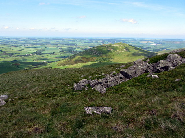
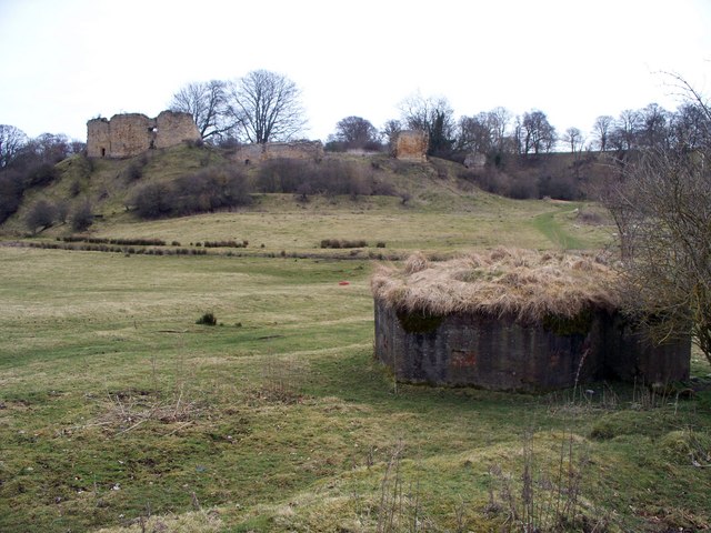
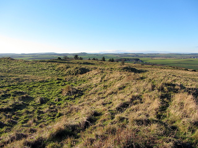
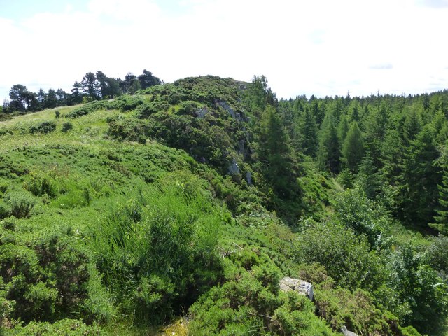
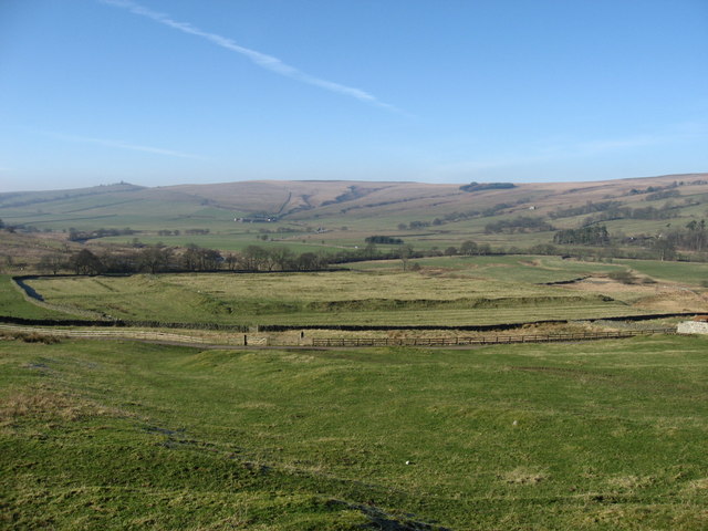
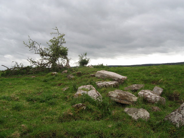
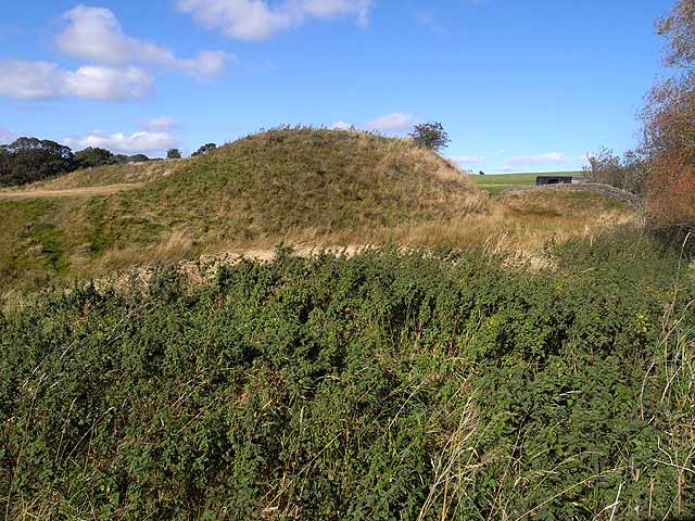
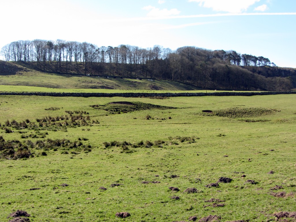
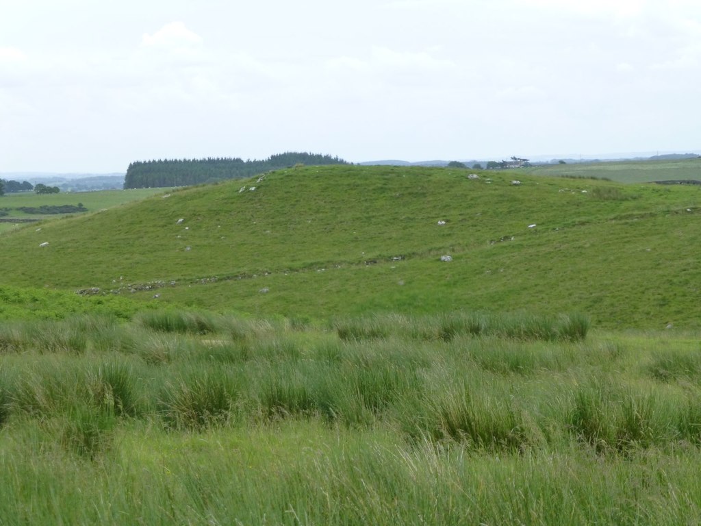
Bewick Hill Camp
- Scheduled Monument area - based on Historic England data (Open Government Licence). Bewick Hill Camp is a hillfort, located to the east of Old Bewick in Northumberland. It is presumed …
Co-Curate Page
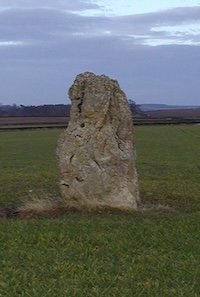
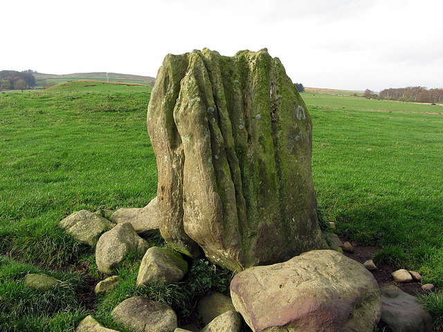
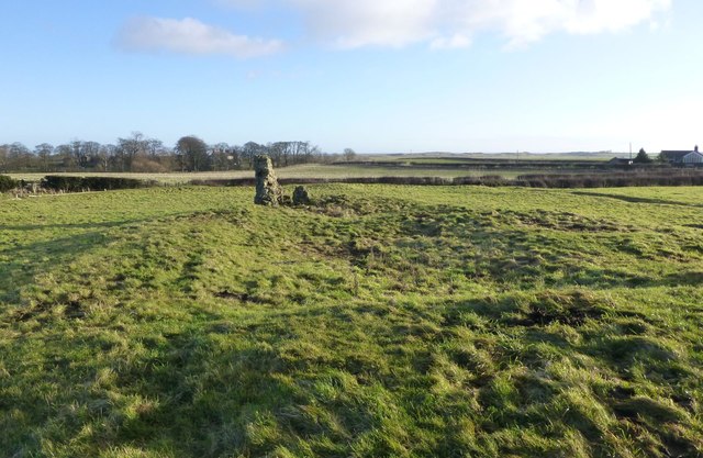
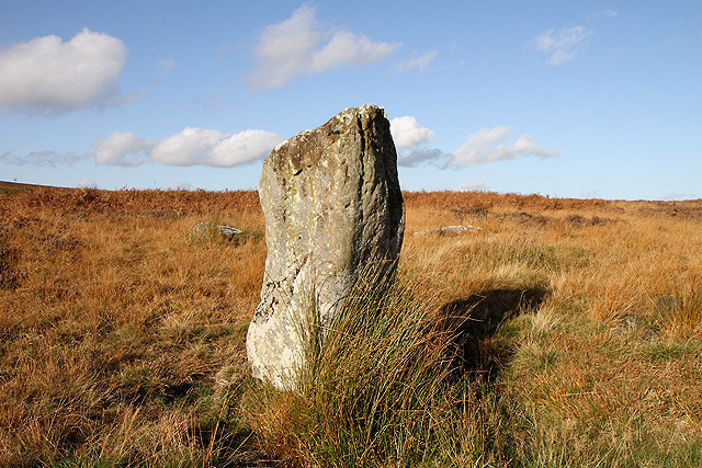
The King's Stone NW of Crookham Westfield
- The King's Stone, to the north-west of Crookham Westfield in Northumberland, is a standing stone of either late Neolithic or early Bronze Age date. It is formed from cherty magnesium …
Co-Curate Page
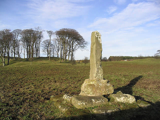
The Hurl Stone
- Overview Map Tthe Hurl Stone is a Medieval standing cross located near Newtown and Lilburn Tower in Northumberland. The stone is a Scheduled Monument.
Co-Curate Page
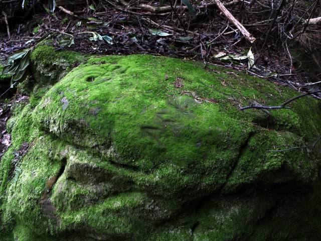
Prehistoric Rock Art in Lemmington Wood
- Deep in Lemmington Woods is a rock with 'cup and rings' carvings, thought to date from the early Bronze Age. The rock is very unusual as it also has later Anglo-Saxon …
Co-Curate Page
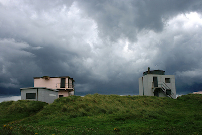
Blyth Battery
- Overview Map Street View Blyth Battery is a Military and Local Heritage museum which is free to visit. The artillery battery was originally built in 1916 to defend the port …
Co-Curate Page
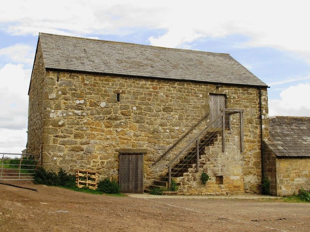
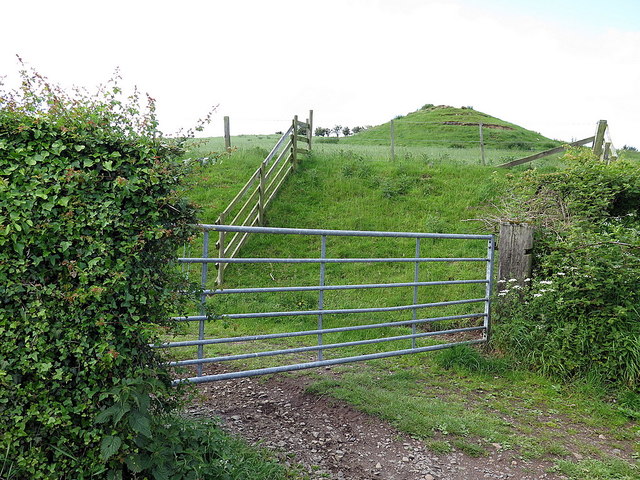
Slate Hill Settlement Earthworks, Bolam
- Overview Map Remains of a defended Iron Age settlement around the top of Slate Hill, just north of Bolam Lake in Northumberland. The ruins are a Sheduled Monument.
Co-Curate Page
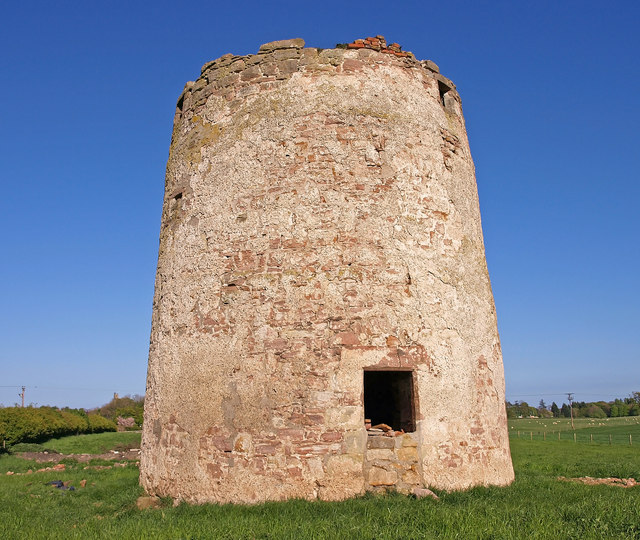
Wooler Tower (remains)
- Overview Map Street View There was a fortified stone tower, built in the early 16th century, on Tower Hill in Wooler. Only 3 large blocks of masonary survive, one near …
Co-Curate Page
Kettles Hillfort, near Wooler
- The Kettles is the earwork remains of an Iron Age and Roman hill fort and settlement near Earle and Wooler in Northumberland.[1] The fort occupies a natural ridge protected on …
Co-Curate Page
Hillfort, Yeavering Bell
- Overview Map Aerial view of Yeavering Bell hillfort on Google Maps. The walls (originally 2+m high, now collapsed with a spread of 8-9m) are clearly visible. The remains of a …
Co-Curate Page
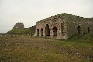
Lime Kilns
- Overview Map Street View The lime kilns at Castle Point on Lindisfarne are amongst the largest and best preserved lime kilns in Northumberland. They have a complex layout compared to …
Co-Curate Page
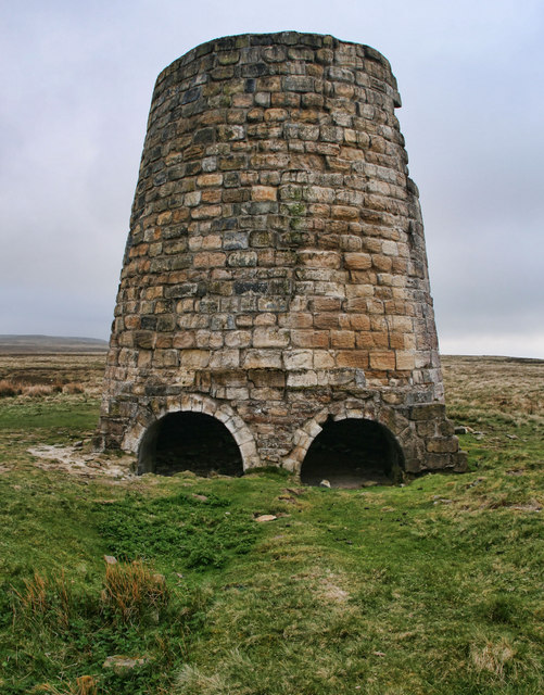
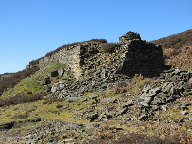
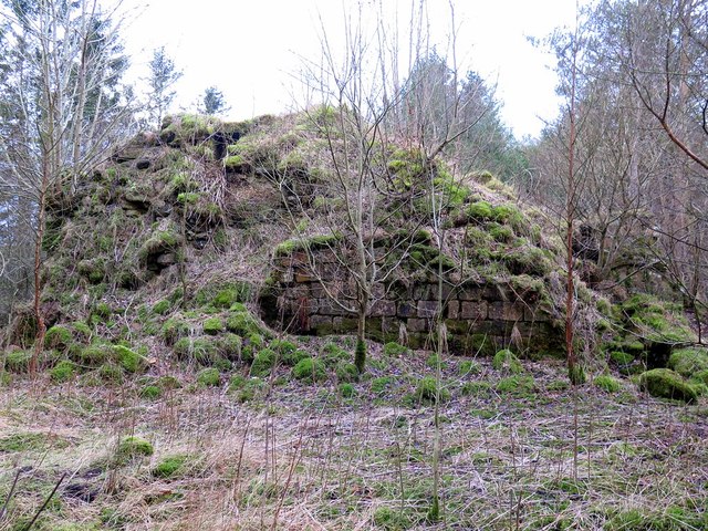
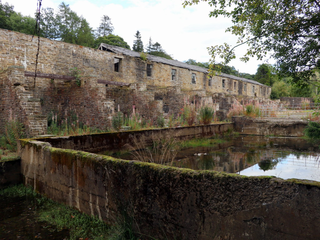
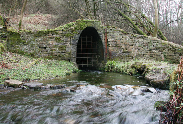
Ridsdale Iron Works
- Overview Map Street View Scheduled Monument area of Risdale Iron Works - based on Historic England data (Open Government Licence). The remains of Ridsdale Iron Works are to the north …
Co-Curate Page
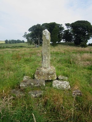
Percy's Cross (between Powburn & Wooperton)
- Overview Map This is a 15th century wayside cross, located close to the A697 road between Powburn and Wooperton in Northumberland. The cross commemorates Sir Ralph Percy who was killed near …
Co-Curate Page
Castle Hill camp, near Alnham
- Overview Map Castle Hill is located about ¼ mile north-east of Old Hazeltonrig and 1½ miles west of the hamlet of Alnham in Northumberland. At the summit of the hill …

Co-Curate Page
Bivallate Defended Settlement WNW of Craghead
- Scheduled Monument area - based on Historic England data (Open Government Licence). The site of this bivallate (two line of ramparts) hillfort, located to the south-east of Wagtail Farm, about …
Co-Curate Page
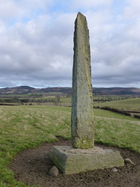
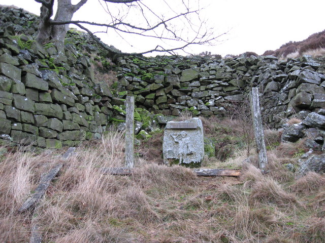
Stob Stone
- Overview Map Street View Stob Stone is a Bronze Age standing stone, located by the roadside at Standing Stone Farm, about half a mile south of Matfen in Northumberland. The …
Co-Curate Page
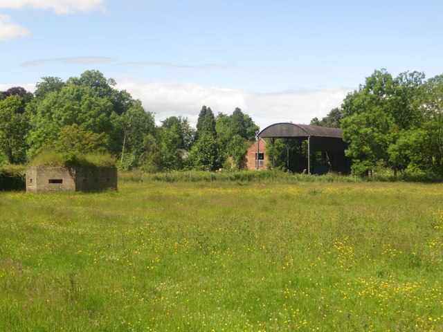
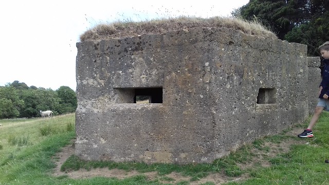
Pillbox, near Mitford Castle
- This Second World War pillbox is located near Mitford Castle, 718m south-west of Mitford Bridge. It was built by the Northern Command as part of the River Wansbeck Stop Line …
Co-Curate Page
Site of Iron Age Settlement, Houghton
- Overview Aerial View To the south-west of Houghton in Northumberland, by Broomy Hill, are the remains of an Iron Age defended settlement. The remains are not easily visible as most of the defensive …
Co-Curate Page
Pillbox near Spittal Hill Farm
- This Second World War pillbox is located near Spittal Hill Farm, 320m north-west of Mitford Bridge. It was built by the Northern Command as part of the River Wansbeck Stop …
Co-Curate Page
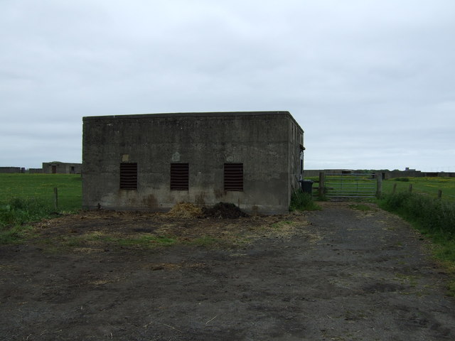
Gloucester Lodge Heavy Anti-Aircraft Battery
- Gloucester Lodge Battery, just south of Blyth, was a Second World War heavy anti-aircraft gun battery and radar site. It is one of only a handful of complete or near …

Co-Curate Page
Gunnerton Crag camps
- Scheduled Monument area - based on Historic England data (Open Government Licence). Gunnerton Crags, located to the east of the village of Gunnerton in Northumberland, are the site of a …
Co-Curate Page
Humbleton Chapel (ruins)
- Overview Map Street View A knoll, known as 'Chapel Hill', is located to the south of Humbleton. This is the reamins of Humbleton Chapel and it's associated burial ground. The earliest …
Co-Curate Page
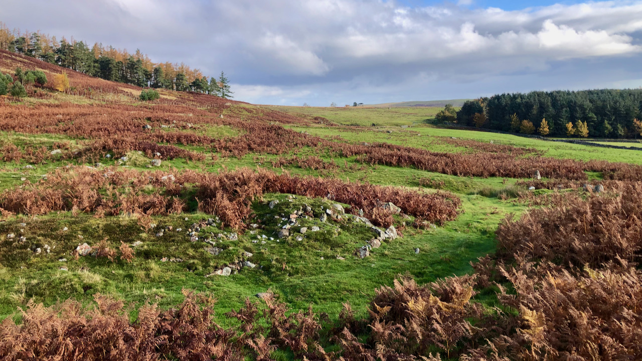
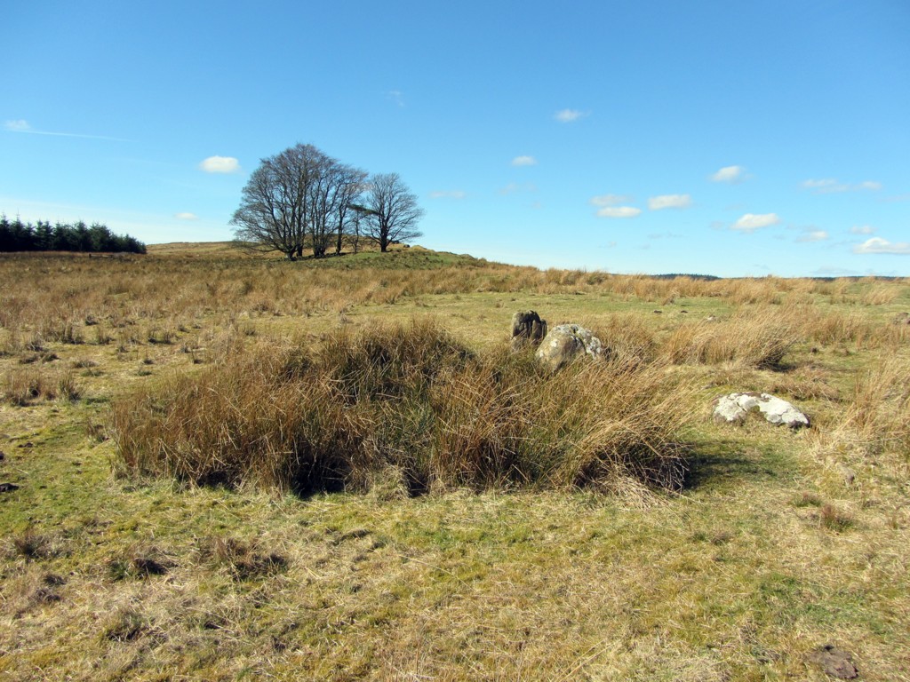
The Poind & His Man
- "The monument includes a standing stone and an adjacent round cairn of Late Neolithic/Early Bronze Age date situated in a prominent position on the top of a small knoll.....The cairn …

Co-Curate Page
Ringses multivallate hillfort, Doddington Moor
- Scheduled Monument area - based on Historic England data (Open Government Licence). The Ringses is the site of a multivallate hillfort, located on Doddington Moor, about 1 mile ENE of …
Co-Curate Page
Beldon lead mine and ore works
- Overview Map The remains of Beldon lead mine and ore works are situated on two levels in the valley of Beldon Burn at Beldon Shield. The visible remains of the …
Co-Curate Page
Kyloe Hills promontory fort
- "The monument includes the remains of an Iron Age promontory fort abutting a steep cliff to the south. The promontory fort is visible as a semi-circular enclosure measuring about 109m …

Co-Curate Page
Dod Law Hillforts
- Scheduled Monument area - based on Historic England data (Open Government Licence). Dod Law is a prominent ridge, which rises to the highest point of Doddington Moor (trig point at …
Co-Curate Page
Greaves Ash camp
- Scheduled Monument area - based on Historic England data (Open Government Licence). Greaves Ash camp is the site of a large Iron Age and Romano-British settlement, situated onhigh ground by …

Co-Curate Page
The Ringses camp, burial mounds and cairns, Beanley Moor
- Scheduled Monument areas - based on Historic England data (Open Government Licence). The Ringses is located on Beanley Moor in Northumberland, about east of Beanley and 1km south-west of Eglingham. …
Co-Curate Page
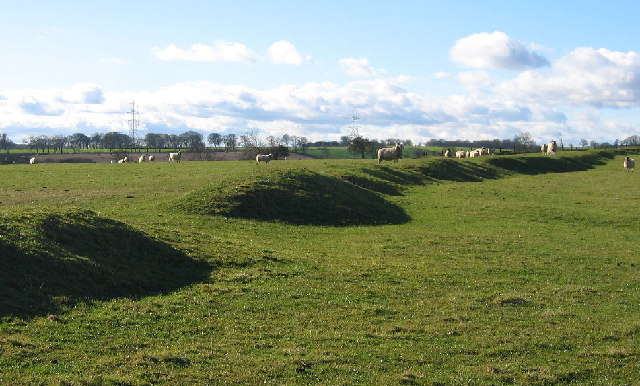
East Matfen medieval village
- Map showing the Scheduled Monument area of East Matfen medieval village, with Matfen to the west. The site of East Matfen medieval village is located about a mile ESE of …

Co-Curate Page
Halton Medieval Settlement
- Scheduled Monument areas - based on Historic England data (Open Government Licence). In Medieval times, there was a larger settlement at Halton (classed as a shrunken Medieval village). In the …
Co-Curate Page
Welton Medieval Settlement
- Scheduled Monument areas - based on Historic England data (Open Government Licence). Welton in Northumberland, situated to the south of Whittle Burn, is the site of a deserted medieval village. …
Co-Curate Page
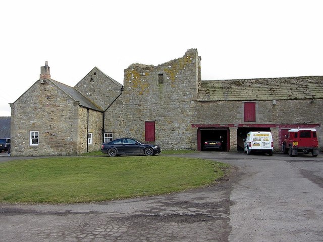
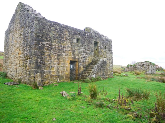
Welton Tower House
- Overview Map Street View The remains of a 15th century tower house are located within the farm complex at Welton. The tower house was originally on the street line at …

Co-Curate Page
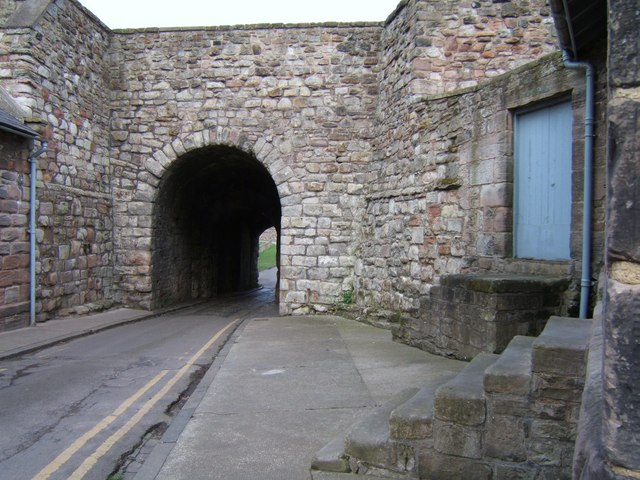
Scotsgate
- Overview Map Street View Scotsgate is part of the defensive Town Walls in Berwick-upon-Tweed. It dates from Elizabethan times, altered in 1815 and again in 1858.[1] Scotsgate, between the streets …
Co-Curate Page
Chesters Roman Fort
- Overview About Chesters (Cilurnum) Map Chesters Roman Fort and Museum, managed by English Heritage, is located near Walwick and Chollerford in Northumberland. The Roman cavalry fort (Cilurnum) was built in …
Co-Curate Page
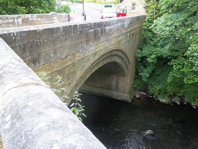
Old Bridge
- Overview Map Street View The old stone bridge over the River Aln at Lesbury dates from the 15th century, though substantially altered in the 19th century. The bridge is Grade …
Co-Curate Page
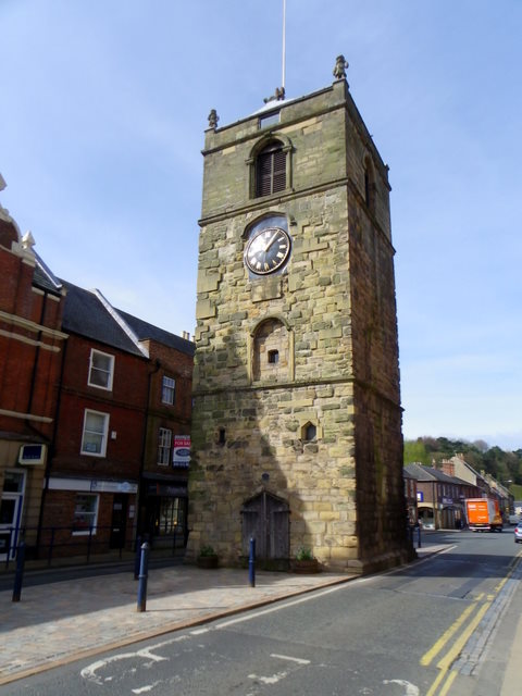
Clock Tower
- Overview About the Clock Tower Map Street View The Clock Tower on Old Gate in Morpeth was built in the early 17th century, using stone from an earlier Medieval building. …
Co-Curate Page
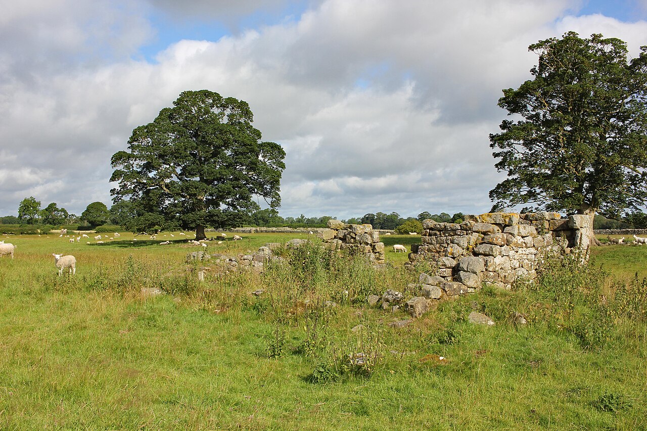
Medieval Preceptory, Low Chibburn
- In Low Chibburn, near Widdrington, are the remains of a preceptory (monestary) of the Knights Hospitallers. The buildings stood beside the Dunbar Burn, a small stream, used to feed a …
Co-Curate Page
Habitancum Roman Fort
- Overview About Habitancum Habitancum was an ancient Roman fort (castra) located at Risingham, Northumberland, England. The fort was one of the defensive structures built along Dere Street, a Roman road …
Co-Curate Page
Simonburn Castle
- Ruins of a 13th century tower house near Simonburn in Northumberland.
Co-Curate Page
Deserted Medieval Village and Chapel, Tughall
- The village of Tughall was recorded as being part of the barony of Alnwick in 1242. The ruins of its 12th century chapel and its graveyard are located at the …
Co-Curate Page
Duddo Stone Circle
- Overview About Duddo Stone Circle Map Street View Northumberland's answer to Stonehenge! The stone circle is located just under a mile north of Duddo, close to the border with Scotland. …
Co-Curate Page
Haggerston Dovecote
- Overview Map Street View This round stone dovecote is located a quarter mile west of Haggerston Castle in Northumberland. It is thought to have been originally been built as a …

Co-Curate Page
Grindon School Roman Camp
- Map showing Grindon School temporary camp, to the south-east of Milecastle 35 on Hadrian's Wall, and north-west of Grindon Farm. There was a Roman temporary camp at Grindon, just south …
Co-Curate Page
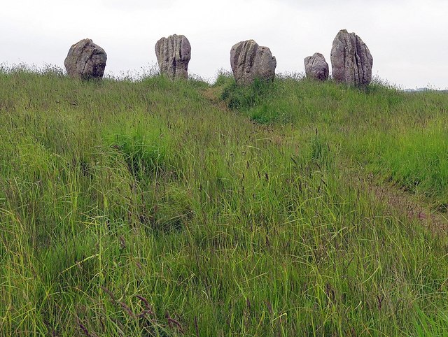
Standing Stones, Doddington Moor
- Map showing Doddington (village) and the Standing Stones (to the south-east). Zoom in to see the Scheduled Monument area. This group of standing stones are located on the high moorland, …
Co-Curate Page
Poltross Burn Milecastle, Hadrian's Wall
- Overview About Milecastle 48 Map Street View Poltross Burn, located near Gilsland, is one of the best-preserved milecastles on Hadrian's Wall. It is larger than most other milecastles, housing two …
Co-Curate Page
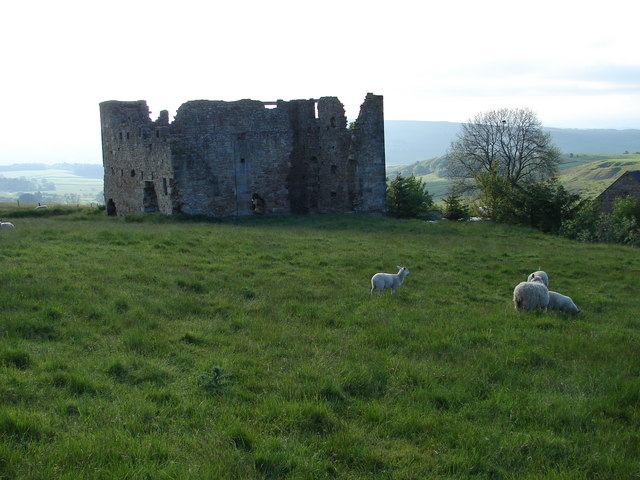
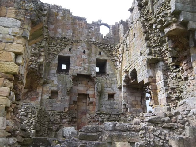
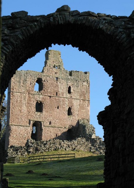
Edlingham Castle
- Overview About Edlingham Castle Map Street View The ruins of Edlingham Castle are located to the north-east of the village of Edlingham, about 6 miles north-east of Rothbury. The 'castle' was …
Co-Curate Page
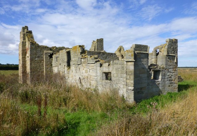
Fenham Monastic Grange (ruins)
- Overview Map Aerial View % There are ruins of a monastic grange at Fenham in Northumberland - a farm complex owned by the Benedictine priory of Lindisfarne, on nearby Holy …
Co-Curate Page
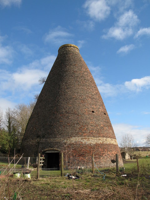
Bottle kilns
- Overview Map Street View Walker's Pottery on Milkwell Lane in Corbridge operated from the early 19th century until 1910. The pottery produced pipes, tiles and low-grade pottery for agricultural use, …
Co-Curate Page
Mohope Lead Mines
- Scheduled Monument area - based on Historic England data (Open Government Licence). Mohope Head is located about 1½ miles south-west of Ninebanks in Northumberland. The Mohope Head Lead Mine and …

Co-Curate Page
Pawston Hill - Iron Age Hillfort
- The remains of an Iron Age hillfort are located on Pawston Hill, located to the south-west of the hamlet of Pawston and just to the north-west of Pawston Lake in …
Co-Curate Page
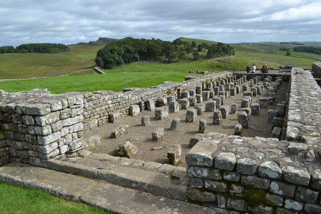
Housesteads
- Overview About Howsteads Fort Map Street View Interactive Glossary Housesteads (Roman name: "Vercovicium") is one of the best preserved forts on Hadrian's Wall, built around 124 AD. The fort covers …
Co-Curate Page
Black Middens Bastle House
- Overview About Black Middens Bastle Map Street View Black Middens Bastle House is at an isolated location on the north side of the Tarset Valley, about 2 miles north-west of …
Co-Curate Page
Norham Castle
- Overview About Norham Castle Map Street View Norham Castle is a castle in Northumberland, England, overlooking the River Tweed, on the border between England and Scotland. It is a …
Co-Curate Page
Newminster Abbey (ruins)
- The ruins of Newminster Abbey are located on the west side of Morpeth, near the south banks of the River Wansbeck. This Cistercian abbey was founded in 1137; most of …
Co-Curate Page
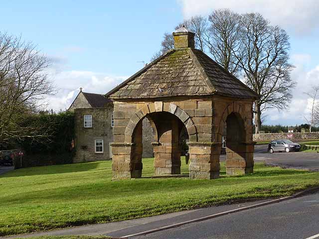
Market Cross
- Overview Map Street View The Market Cross (aka "Butter Cross") is located on the western side of the village green in Stamfordham. It is a small square, single-storey building, with …
Co-Curate Page
Mote Hills (Elsdon Castle)
- Overview About Elsdon Castle Map Street View Mote Hills at the village of Elsdon are the earthwork remains of a medieval motte and bailey castle. The castle was built on …
Co-Curate Page
Robin of Risingham
- "Robin of Risingham" is a Roman rock carving located between Ridsdale and West Woodburn, and about ½ mile south-east of Habitancum Roman Fort. The carving of a figure holding a …
Co-Curate Page
St Leonard's Hospital (ruins), Denwick
- Overview Map Street View The remains of the medieval St Leonard's Hospital are beside the B6341 road, about ¾ mile north of Alnwick and a mile west of the village of …
Co-Curate Page
Learchild Roman fort (Alavna)
- The shallow earthwork remains of a large Roman fort (thought to be 'Alavna') near High Learchild were discovered by arial photography in 1945, and confirmed by subsequent archaeological digs. The fort …
Co-Curate Page
Bolton Leper Hospital
- Overview Map A leper hopital was established in Bolton, Northumberland, in the 13th century. The site covers a large area to the north of the modern village. There are few …
Co-Curate Page
The Norse Camp, Alnmouth
- The Norse Camp is a Scheduled Monument at the north of Alnmouth. It is also known traditionally as Night Folds; the county Conservation team list it as Mount Pleasant Enclosure, …
Co-Curate Page
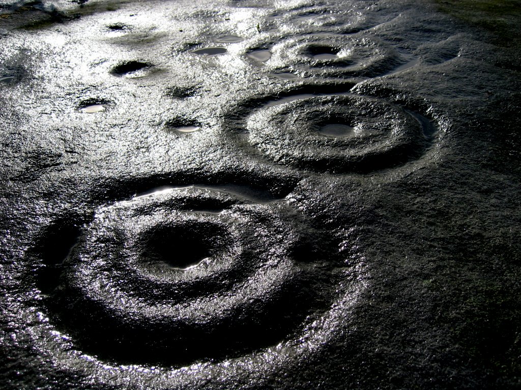
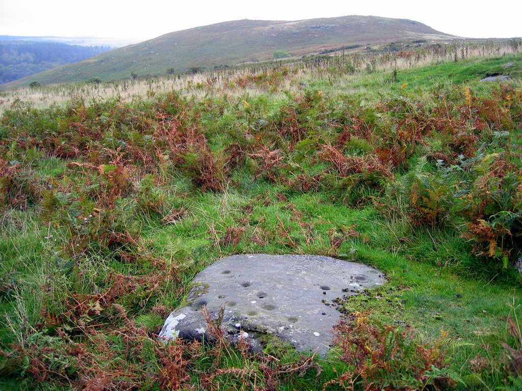
Bewick Hill cup and ring marked rocks
- Located to the east of Bewick Hill Camp (hillfort). Scheduled Monument (legally protected). "A series of seven cup and ring marked stones or possible cup marked stones were recorded during …
Co-Curate Page
Standing Stones Camp, Horton Moor
- Map showing Doddington (village) and the site of Standing Stones Camp (to the south-east). Zoom in to see the Scheduled Monument area. Standing Stones Camp is located on the edge …
Co-Curate Page
Defended settlement, SW of Nesbit, Northumberland
- Scheduled Monument area - based on Historic England data (Open Government Licence). The buried remains of an Iron Age multivallate defended settlement are located to the south-west of Nesbit, near …
Co-Curate Page
Defended settlement, SW of Sandy House
- Scheduled Monument area - based on Historic England data (Open Government Licence). The site of an Iron Age defended settlement is located south-owest of Sandy House, about 1km north-east of …
Co-Curate Page
Ewart Park Henge
- Map showing Ewart Newton and the site of Ewart Park Henge to the east. This site, preserved as an oval cropmark, has the remains of a late Neolithic henge. It …

Co-Curate Page
Settlement on SE slope of Ewe Hill
- Map showing Ingram and the Scheduled Monument area on Ewe Hill, to the north-west. Ewe Hill is located along the valley of the River Breamish, about 1km west of Ingram …
Co-Curate Page
Rosebrough Moor round cairns
- Map showing Rosebrough to the east and the two cairns on Rosebrough to the west. Scheduled Monument (#1002911): Rosebrough Moor round cairns Click the headings below to expand (selected extracts …
Co-Curate Page
Bellister Castle - uninhabited parts
- Scheduled Monument areas - based on Historic England data (Open Government Licence). Scheduled Monument (#1002910): Bellister Castle (uninhabited parts) Click the headings below to expand (selected extracts from the Historic …
Co-Curate Page
Camphill Iron Age Settlement
- On Camp Hill, to the north-west of Berwick-upon-Tweed, are the remains of an Iron Age defended settlement. The site, which is heavily farmed, is a Scheduled Monument (legally protected). Nearby, …

Co-Curate Page
Halidon Hill Iron Age Settlement
- Scheduled Monument areas - based on Historic England data (Open Government Licence). To the north-west of Berwick-upon-Tweed is Halidon Hill; by its summit, on it's south-facing slope is the site …
Co-Curate Page
Edlingham Deserted Medieval Village
- Scheduled Monument areas - based on Historic England data (Open Government Licence). To the south of St John's Church in Edlingham is the probable site of the deserted medieval village …
Co-Curate Page
Camp NW of Chesterhill
- Scheduled Monument area - based on Historic England data (Open Government Licence). Scheduled Monument (#1003764): Camp 500yds (460m) NW of Chesterhill Click the headings below to expand (selected extracts from …
Co-Curate Page
Defended settlement SW of Broomhouse
- Map showing Broomhouse and the Scheduled Monument area to the south-west. To the south-west of Broomhouse in Tillside are the buried remains of an Iron Age defended settlement. It is …
Co-Curate Page
Defended settlement on White Hill, SE of Kimmerston
- Map showing Kimmerson with the Scheduled Monument area to the south east. The cropmarked remains of a multivallate defended settlement are located 590m south-east of Kimmerston in Northumberland. Situated on …
Co-Curate Page
Enclosed settlement, SE of Cornhill Castle
- Map showing the enclosed settlement Scheduled Monument area, with Cornhill-on-Tweed to the south and Cornhill Castle to the north-west. About 700m north of Cornhill-on-Tweed is the site on an enclosed …

Co-Curate Page
Roughting Linn camp
- Map showing the Scheduled Monument area of the camp (Historic England data), with Roughting Linn Waterfall to the west and Cup & Ring marke stone to the east. Roughting Linn …

Co-Curate Page
Langley Barony Lead Mines
- Overview Map Scheduled Monument areas - based on Historic England data (Open Government Licence). The remains of Langley Barony Mines are located about 2½ miles north-west of Haydon Bridge. The …

Co-Curate Page
Ford Colliery
- Scheduled Monument areas - based on Historic England data (Open Government Licence). Ford Colliery was located by Ford Moss, to the east of the village of Ford, in Northumberland. It …
Co-Curate Page
Allenheads lead ore works
- Scheduled Monument areas - based on Historic England data (Open Government Licence). Scheduled Monument (#1016348): Allenheads lead ore works Click the headings below to expand (selected extracts from the Historic …
Co-Curate Page
Alnhamsheles medieval settlement
- Map showing Alnhammoor and the two areas of the Scheduled Monument of Alnhamsheles medieval settlement The site of Alnhamsheles deserted medieval village is located on either side of Rowhope Burn, …
Co-Curate Page
Enclosures on Meggrim's Knowe
- Map showing the Scheduled Monument area of Meggrim's Knowe enclosure, with Linhope and the site of Greaves Ash, to the north. Meggrim's Knowe, located south of Linhope in Northumberland, has …
Co-Curate Page
Cup and ring marked rock on Tod Crag
- Tod Crag is a sandstone outcrop, located about 2km north of Rochester and 5km south-east of Elsdon in Northumberland. There are a series of relatively well preserved cup and ring …
Co-Curate Page
Murton High Crags Settlements
- Scheduled Monument area - based on Historic England data (Open Government Licence). Murton High Crags are located between Murton and Longridge in Northumberland. The earthwork remains of an Iron Age …

Co-Curate Page
Palisaded settlement, NW of Northfieldhead
- Scheduled Monument area, to the north-west of Alnham - based on Historic England data (Open Government Licence). On Northfield Hill, near Northfieldhead, about 1½km north-west of Alnham in Northumberland, is …
Co-Curate Page
Palisaded settlement on Hart Law
- Hart Law is a hill in the Cheviots, located about 1¼km noeth-west of Prendwick in Northumberland. On the hill are the earthwork remains of a palisaded settlement, featuring rock-cut trenches …
Co-Curate Page
Middle Newham deserted medieval village
- Scheduled Monument areas - based on Historic England data (Open Government Licence). Middle Newham was a much larger village during Medieval times. There are earthwork remains of at least eight …
Co-Curate Page
Uplaw Knowe palisaded settlement
- Map showing Uplaw Knowe palisaded settlement, to the NW of Clennell (zoom-in to view the Scheduled Monument area). Uplaw Knowe is a modest hill of 370m height in the Cheviots …
Co-Curate Page
Alnwick Moor bell pits
- Scheduled Monument area - based on Historic England data (Open Government Licence). On Alnwick Moor, north-east of Edlingham in Northumberland, are the remains of over 100 bell pits of 16th-17th …
Co-Curate Page
Prehistoric hut circles and field enclosure SW of Cowboy's Cairn
- Scheduled Monument areas - based on Historic England data (Open Government Licence). This site, about 3½ miles WNW of the village of Ilderton, has the archaeological remains two prehistoric hut …
Co-Curate Page
Allensford blast furnace
- Scheduled Monument area - based on Historic England data (Open Government Licence). The remains of a late 17th or early 18th century blast furnace are located in the woods by …
Co-Curate Page
Ditched enclosure West of Chatton
- Scheduled Monument area - based on Historic England data (Open Government Licence). The site of a prehistoric circular ditched enclosure of ~85m diameter is located about 2½km west of Chatton …
Co-Curate Page
Lady's Well
- Overview Map Street View Lady's Well (aka St Ninian's Well) is a holy well located to the north-west of the village of Holystone in Northumberland. The course of the Roman …
Co-Curate Page
Walwick Fell Roman temporary camp
- Map showing the Scheduled Monument area to the south of Black Carts Turret. The site of Walwick Fell Roman temporary camp is located about 1.5 km north-west of the village …
Co-Curate Page
Blackett Level
- Map showing the location of the Blackett Level Portal in Allendale Town. The Blackett Level is a historic 4½ mile-long subterranean lead mine drainage tunnel and exploration adit in the …
Co-Curate Page
Brown Dikes Roman temporary camp
- Map showing Brown Dikes temporary camp to the south-west of Carraw Farm, and south of Hadrian's Wall (running in parallel to, and just north of, the B6318). The Brown Dikes …
Co-Curate Page
Springhill Camp
- Scheduled Monument areas - based on Historic England data (Open Government Licence). This site is located close to Spring Hill, to the south of Tweedmouth in Northumberland. It is scheduled …
Co-Curate Page
Roman aqueduct to Great Chesters from Caw Burn
- Scheduled Monument areas - based on Historic England data (Open Government Licence). The Romans constructed an extensive aqueduct to carry water from Caw Burn westwards to supply Great Chesters fort …
Co-Curate Page
Chesters Pike Roman temporary camp
- Chesters Pike temporary camp is located to the north-east of Chesters Roman Fort (Aecia), and about 5 km north-east of Greenhead in Northumberland. The camp probably pre-dated Hadrian's Wall. The …
Co-Curate Page
Section of Stanegate Roman road, NE of Greenhead
- Map showing the Scheduled Monument area for the section of Stanegate, with a Roman cemetery at it's west end. A surviving section of the Stanegate Roman road, located north-east of …
Co-Curate Page
Coesike East Roman temporary camp
- Map showing the Scheduled Monument area to the north of Grindon Farm and east of Milecastle 35 on Hadrian's Wall. Scheduled Monument (#1010937): Coesike East Roman temporary camp Click the …
Co-Curate Page
Coesike West Roman temporary camps
- Map showing the Scheduled Monument area of Coesike West Roman temporary camps to the north-west of Grindon Farm. Scheduled Monument (#1010938): Coesike West Roman temporary camps 1 and 2 Click …
Co-Curate Page
Haltwhistle Burn 1 temporary camp, fortlet, and section of Stanegate
- Scheduled Monument (#1010945): Haltwhistle Burn 1 Roman temporary camp, fortlet and section of the Stanegate Click the headings below to expand (selected extracts from the Historic England scheduling) Significance The …
Co-Curate Page
Haltwhistle Burn Roman temporary camps 2 and 3 and area of cord rig cultivation
- Scheduled Monument (#1010946): Haltwhistle Burn Roman temporary camps 2 and 3 and area of cord rig cultivation Click the headings below to expand (selected extracts from the Historic England scheduling) …
Co-Curate Page
Stone circle, east of King's Crags
- Scheduled Monument (#1011076): Stone circle, 380m east of King's Crags Click the headings below to expand (selected extracts from the Historic England scheduling) Significance The stone circle east of King's …
Co-Curate Page
Brown Moor Roman temporary camp
- Scheduled Monument (#1010981): Brown Moor Roman temporary camp Click the headings below to expand (selected extracts from the Historic England scheduling) Significance Over 40 temporary camps of many different sizes, …
Co-Curate Page
Fell End Roman temporary camp and section of Stanegate
- Scheduled Monument (#1010953): Fell End Roman temporary camp and section of the Stanegate Roman road Click the headings below to expand (selected extracts from the Historic England scheduling) Significance The …
Co-Curate Page
Moated site and fishpond on Fozy Moss
- Scheduled Monument (#1011080): Moated site and fishpond, 1km ENE of Sewingshields on Fozy Moss Click the headings below to expand (selected extracts from the Historic England scheduling) Significance The moated …
Co-Curate Page
Seatsides 1 Roman temporary camp and section of Stanegate
- Map showing the Scheduled Monument area for the Seatsides 1 temporary camp and section of the Stanegate Roman road. Scheduled Monument (#1010940): Seatsides 1 Roman temporary camp and section of …
Co-Curate Page
Seatsides 2 Roman temporary camp
- Map showing the Scheduled Monument area for Seatsides 2 Roman temporary camp. Scheduled Monument (#1010941): Seatsides 2 Roman temporary camp Click the headings below to expand (selected extracts from the …
Co-Curate Page
Bean Burn 1 Roman temporary camp
- Map showing the Scheduled Monument area of Bean Burn 1 Roman temporary camp. Scheduled Monument (#1010942): Bean Burn 1 Roman temporary camp Click the headings below to expand (selected extracts …
Co-Curate Page
Bean Burn 2 Roman temporary camp
- Map showing the Scheduled Monument area of Bean Burn 2 Roman temporary camp. Scheduled Monument (#1010943): Bean Burn 2 Roman temporary camp Click the headings below to expand (selected extracts …
Co-Curate Page
Sunny Rigg 1 Roman temporary camp
- Map showing the Scheduled Monument area of Sunny Rigg 1 Roman temporary camp Scheduled Monument (#1010950): Sunny Rigg 1 Roman temporary camp Click the headings below to expand (selected extracts …

Co-Curate Page
Sunny Rigg 2 Roman temporary camp
- Map showing the Scheduled Monument area of Sunny Rigg 2 Roman temporary camp Scheduled Monument (#1010951): Sunny Rigg 2 Roman temporary camp Click the headings below to expand (selected extracts …
Co-Curate Page
Sunny Rigg 3 Roman temporary camp
- Map showing the Scheduled Monument area of Sunny Rigg 3 Roman temporary camp Scheduled Monument (#1010952): Sunny Rigg 3 Roman temporary camp Click the headings below to expand (selected extracts …
Co-Curate Page
Chapel Rigg Roman temporary camp
- Map showing the Scheduled Monument area of Chapel Rigg Roman temporary camp Scheduled Monument (#1010954): Chapel Rigg Roman temporary camp Click the headings below to expand (selected extracts from the …
Co-Curate Page
Crooks Roman temporary camp
- Map showing the Scheduled Monument area of Crooks Roman temporary camp Scheduled Monument (#1010955): Crooks Roman temporary camp Click the headings below to expand (selected extracts from the Historic England …
Co-Curate Page
Romano-British farmstead, NE of Sharpley
- Map showing the Scheduled Monument area of the Romano-British farmstead, 400m north-east of the farm at Sharpley. Scheduled Monument (#1011082): Romano-British farmstead, 400m north-east of Sharpley Click the headings below …
Co-Curate Page
Romano-British farmstead, east of King's Crags
- Map showing the Scheduled Monument area for the Romano-British farmstead, 250m east of King's Crags Scheduled Monument (#1011074): Romano-British farmstead, 250m east of King's Crags Click the headings below to …
Co-Curate Page
Fishponds, NE of Sewingshields
- Map showing the Scheduled Monument area for the Fishponds, 450m north-east of Sewingshields Scheduled Monument (#1011081): Fishponds, 450m north-east of Sewingshields Click the headings below to expand (selected extracts from …
Co-Curate Page
Linnels Bridge
- Overview Map Street View The stone bridge over Devil's Water in Linnels in Northumberland is thought to have been built in 1698.[1] It incorporate and inscribed tablet from an earlier bridge …
Co-Curate Page
Grasslees Water Mill (site)
- Map showing the Scheduled Monument area for the Grasslees watermill complex (ruins). Grasslees Mill, located about ¼mile north-east of Grasslees farm, is a ruined watermill complex, dating from the 18th …

Co-Curate Page
Capheaton Tilery
- Map showing the Scheduled Monument area of Capheaton Tilery. Capheaton Tilery was an early 19th‑century tile works, located about ¾ mile north-west of the village of Capheaton and 1 mile …
Co-Curate Page
Shildon Engine House
- Scheduled Monument (#1006415): Shildon Cornish engine house Click the headings below to expand (selected extracts from the Historic England scheduling) Significance The engine house and chimney WSW of Shildon is …
Co-Curate Page
Woolfe Kennel cave shieling at Kennel Crags
- Map showing Woolfe Kennel cave shieling at Kennel Crags, north of Paddaburn. Scheduled Monument (#1013514): Woolfe Kennel cave shieling at Kennel Crags Click the headings below to expand (selected extracts …

Co-Curate Page
Univallate hillfort and medieval tower, East of Callaly Castle
- Scheduled Monument area - based on Historic England data (Open Government Licence) - to the east of Callaly. Castle Hill to the east of Callaly in Northumberland, is a well-preserved …

Co-Curate Page
Tosson Burgh univallate hillfort
- Scheduled Monument area - based on Historic England data (Open Government Licence) - to the west of Great Tosson. LIDAR - Image from opendata.hillforts.eu (CC-BY-SA), based on data from the …

Co-Curate Page
Tinkler's Dene univallate hillfort
- Scheduled Monument area - based on Historic England data (Open Government Licence) LIDAR - Image from opendata.hillforts.eu (CC-BY-SA), based on data from the Environment Agency - National LIDAR programme. Scheduled …

Co-Curate Page
Multivallate hillfort, north of Callaly
- Scheduled Monument area - based on Historic England data (Open Government Licence) - to the north of Callaly. LIDAR - Image from opendata.hillforts.eu (CC-BY-SA), based on data from the Environment …
Co-Curate Page
Multivallate hillfort, Catcherside (Camp Hill)
- Scheduled Monument area - based on Historic England data (Open Government Licence) . Scheduled Monument (#1011100): Multivallate hillfort, 420m SSW of Catcherside Click the headings below to expand (selected extracts …

Co-Curate Page
Univallate hillfort on Great Wanney Crag
- Scheduled Monument area - based on Historic England data (Open Government Licence) LIDAR - Image from opendata.hillforts.eu (CC-BY-SA), based on data from the Environment Agency - National LIDAR programme. Scheduled …
Co-Curate Page
Ferneyrigg moated site
- Scheduled Monument area - based on Historic England data (Open Government Licence) Scheduled Monument (#1011101): Ferneyrigg moated site Click the headings below to expand (selected extracts from the Historic England …
Co-Curate Page
Moated site at Fawns Farm
- Scheduled Monument area - based on Historic England data (Open Government Licence) Scheduled Monument (#1011105): Moated site at Fawns Farm Click the headings below to expand (selected extracts from the …
Co-Curate Page
Cup and ring marked rock, SW of Wagtail Farm
- Scheduled Monument (#1011289): Cup and ring marked rock, 940m south-west of Wagtail Farm Click the headings below to expand (selected extracts from the Historic England scheduling) Significance All positively identified …
Co-Curate Page
Bastle Ruins, Ray Demesne
- Scheduled Monument (#1011107): Bastle, 100m south-west of Ray Cottages Click the headings below to expand (selected extracts from the Historic England scheduling) Significance Although the bastle at Ray Cottages is …
Co-Curate Page
Wheelbirks Furnace
- Map showing the Scheduled Monument areas of Wheelbirks Furnace, to the south-east of Wheelbirks. By the west banks of Stocksfield Burn, about half mile south-east of the farm at Wheelbirks, …
Co-Curate Page
Chollerford Bridge
- Overview Street View The stone bridge over the River North Tyne at Chollerford in Northumberland was built in 1785 by Robert Mylne. It replaced an earlier medieval bridge which had been …
Co-Curate Page
Multivallate hillfort, E of Campville
- Scheduled Monument (#1011394): Multivallate hillfort, 70m east of Campville Click the headings below to expand (selected extracts from the Historic England scheduling) Significance The hillfort at Campville is reasonably well …

Co-Curate Page
Multivallate hillfort, west of Harehaugh
- Scheduled Monument area - based on Historic England data (Open Government Licence) LIDAR - Image from opendata.hillforts.eu (CC-BY-SA), based on data from the Environment Agency - National LIDAR programme. Scheduled …

Co-Curate Page
Blue Crags hillfort, NW of Colwell
- Scheduled Monument area - based on Historic England data (Open Government Licence) - to the north-west of Colwell. LIDAR - Image from opendata.hillforts.eu (CC-BY-SA), based on data from the Environment …

Co-Curate Page
Bewick Hill Camp
- Scheduled Monument area - based on Historic England data (Open Government Licence). Bewick Hill Camp is a hillfort, located to the east of Old Bewick in Northumberland. It is presumed …
Co-Curate Page
The King's Stone NW of Crookham Westfield
- The King's Stone, to the north-west of Crookham Westfield in Northumberland, is a standing stone of either late Neolithic or early Bronze Age date. It is formed from cherty magnesium …
Co-Curate Page
The Hurl Stone
- Overview Map Tthe Hurl Stone is a Medieval standing cross located near Newtown and Lilburn Tower in Northumberland. The stone is a Scheduled Monument.
Co-Curate Page
Prehistoric Rock Art in Lemmington Wood
- Deep in Lemmington Woods is a rock with 'cup and rings' carvings, thought to date from the early Bronze Age. The rock is very unusual as it also has later Anglo-Saxon …
Co-Curate Page
Blyth Battery
- Overview Map Street View Blyth Battery is a Military and Local Heritage museum which is free to visit. The artillery battery was originally built in 1916 to defend the port …
Co-Curate Page
Slate Hill Settlement Earthworks, Bolam
- Overview Map Remains of a defended Iron Age settlement around the top of Slate Hill, just north of Bolam Lake in Northumberland. The ruins are a Sheduled Monument.
Co-Curate Page
Wooler Tower (remains)
- Overview Map Street View There was a fortified stone tower, built in the early 16th century, on Tower Hill in Wooler. Only 3 large blocks of masonary survive, one near …
Co-Curate Page
Kettles Hillfort, near Wooler
- The Kettles is the earwork remains of an Iron Age and Roman hill fort and settlement near Earle and Wooler in Northumberland.[1] The fort occupies a natural ridge protected on …
Co-Curate Page
Hillfort, Yeavering Bell
- Overview Map Aerial view of Yeavering Bell hillfort on Google Maps. The walls (originally 2+m high, now collapsed with a spread of 8-9m) are clearly visible. The remains of a …
Co-Curate Page
Lime Kilns
- Overview Map Street View The lime kilns at Castle Point on Lindisfarne are amongst the largest and best preserved lime kilns in Northumberland. They have a complex layout compared to …
Co-Curate Page
Ridsdale Iron Works
- Overview Map Street View Scheduled Monument area of Risdale Iron Works - based on Historic England data (Open Government Licence). The remains of Ridsdale Iron Works are to the north …
Co-Curate Page
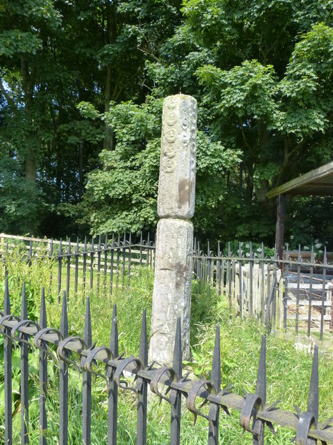
Percy's Cross (between Powburn & Wooperton)
- Overview Map This is a 15th century wayside cross, located close to the A697 road between Powburn and Wooperton in Northumberland. The cross commemorates Sir Ralph Percy who was killed near …
Co-Curate Page
Castle Hill camp, near Alnham
- Overview Map Castle Hill is located about ¼ mile north-east of Old Hazeltonrig and 1½ miles west of the hamlet of Alnham in Northumberland. At the summit of the hill …
Co-Curate Page
Bivallate Defended Settlement WNW of Craghead
- Scheduled Monument area - based on Historic England data (Open Government Licence). The site of this bivallate (two line of ramparts) hillfort, located to the south-east of Wagtail Farm, about …
Co-Curate Page
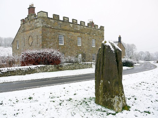
Stob Stone
- Overview Map Street View Stob Stone is a Bronze Age standing stone, located by the roadside at Standing Stone Farm, about half a mile south of Matfen in Northumberland. The …
Co-Curate Page
Pillbox, near Mitford Castle
- This Second World War pillbox is located near Mitford Castle, 718m south-west of Mitford Bridge. It was built by the Northern Command as part of the River Wansbeck Stop Line …
Co-Curate Page
Site of Iron Age Settlement, Houghton
- Overview Aerial View To the south-west of Houghton in Northumberland, by Broomy Hill, are the remains of an Iron Age defended settlement. The remains are not easily visible as most of the defensive …
Co-Curate Page
Pillbox near Spittal Hill Farm
- This Second World War pillbox is located near Spittal Hill Farm, 320m north-west of Mitford Bridge. It was built by the Northern Command as part of the River Wansbeck Stop …
Co-Curate Page
Gloucester Lodge Heavy Anti-Aircraft Battery
- Gloucester Lodge Battery, just south of Blyth, was a Second World War heavy anti-aircraft gun battery and radar site. It is one of only a handful of complete or near …
Co-Curate Page
Gunnerton Crag camps
- Scheduled Monument area - based on Historic England data (Open Government Licence). Gunnerton Crags, located to the east of the village of Gunnerton in Northumberland, are the site of a …
Co-Curate Page
Humbleton Chapel (ruins)
- Overview Map Street View A knoll, known as 'Chapel Hill', is located to the south of Humbleton. This is the reamins of Humbleton Chapel and it's associated burial ground. The earliest …
Co-Curate Page
The Poind & His Man
- "The monument includes a standing stone and an adjacent round cairn of Late Neolithic/Early Bronze Age date situated in a prominent position on the top of a small knoll.....The cairn …
Co-Curate Page
Ringses multivallate hillfort, Doddington Moor
- Scheduled Monument area - based on Historic England data (Open Government Licence). The Ringses is the site of a multivallate hillfort, located on Doddington Moor, about 1 mile ENE of …
Co-Curate Page
Beldon lead mine and ore works
- Overview Map The remains of Beldon lead mine and ore works are situated on two levels in the valley of Beldon Burn at Beldon Shield. The visible remains of the …
Co-Curate Page
Kyloe Hills promontory fort
- "The monument includes the remains of an Iron Age promontory fort abutting a steep cliff to the south. The promontory fort is visible as a semi-circular enclosure measuring about 109m …
Co-Curate Page
Dod Law Hillforts
- Scheduled Monument area - based on Historic England data (Open Government Licence). Dod Law is a prominent ridge, which rises to the highest point of Doddington Moor (trig point at …
Co-Curate Page
Greaves Ash camp
- Scheduled Monument area - based on Historic England data (Open Government Licence). Greaves Ash camp is the site of a large Iron Age and Romano-British settlement, situated onhigh ground by …
Co-Curate Page
The Ringses camp, burial mounds and cairns, Beanley Moor
- Scheduled Monument areas - based on Historic England data (Open Government Licence). The Ringses is located on Beanley Moor in Northumberland, about east of Beanley and 1km south-west of Eglingham. …
Co-Curate Page
East Matfen medieval village
- Map showing the Scheduled Monument area of East Matfen medieval village, with Matfen to the west. The site of East Matfen medieval village is located about a mile ESE of …
Co-Curate Page
Halton Medieval Settlement
- Scheduled Monument areas - based on Historic England data (Open Government Licence). In Medieval times, there was a larger settlement at Halton (classed as a shrunken Medieval village). In the …
Co-Curate Page
Welton Medieval Settlement
- Scheduled Monument areas - based on Historic England data (Open Government Licence). Welton in Northumberland, situated to the south of Whittle Burn, is the site of a deserted medieval village. …
Co-Curate Page
Welton Tower House
- Overview Map Street View The remains of a 15th century tower house are located within the farm complex at Welton. The tower house was originally on the street line at …
Co-Curate Page
Scotsgate
- Overview Map Street View Scotsgate is part of the defensive Town Walls in Berwick-upon-Tweed. It dates from Elizabethan times, altered in 1815 and again in 1858.[1] Scotsgate, between the streets …
Co-Curate Page
Chesters Roman Fort
- Overview About Chesters (Cilurnum) Map Chesters Roman Fort and Museum, managed by English Heritage, is located near Walwick and Chollerford in Northumberland. The Roman cavalry fort (Cilurnum) was built in …
Co-Curate Page
Old Bridge
- Overview Map Street View The old stone bridge over the River Aln at Lesbury dates from the 15th century, though substantially altered in the 19th century. The bridge is Grade …
Co-Curate Page
Clock Tower
- Overview About the Clock Tower Map Street View The Clock Tower on Old Gate in Morpeth was built in the early 17th century, using stone from an earlier Medieval building. …
Co-Curate Page
Medieval Preceptory, Low Chibburn
- In Low Chibburn, near Widdrington, are the remains of a preceptory (monestary) of the Knights Hospitallers. The buildings stood beside the Dunbar Burn, a small stream, used to feed a …
Co-Curate Page
Habitancum Roman Fort
- Overview About Habitancum Habitancum was an ancient Roman fort (castra) located at Risingham, Northumberland, England. The fort was one of the defensive structures built along Dere Street, a Roman road …
Co-Curate Page
Simonburn Castle
- Ruins of a 13th century tower house near Simonburn in Northumberland.
Co-Curate Page
Deserted Medieval Village and Chapel, Tughall
- The village of Tughall was recorded as being part of the barony of Alnwick in 1242. The ruins of its 12th century chapel and its graveyard are located at the …
Co-Curate Page
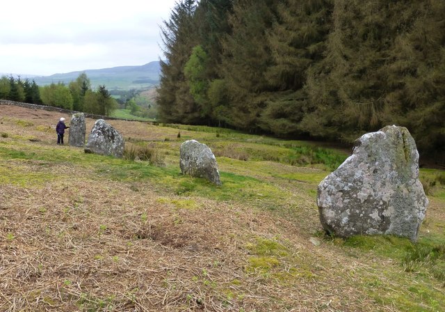
Duddo Stone Circle
- Overview About Duddo Stone Circle Map Street View Northumberland's answer to Stonehenge! The stone circle is located just under a mile north of Duddo, close to the border with Scotland. …
Co-Curate Page
Haggerston Dovecote
- Overview Map Street View This round stone dovecote is located a quarter mile west of Haggerston Castle in Northumberland. It is thought to have been originally been built as a …
Co-Curate Page
Grindon School Roman Camp
- Map showing Grindon School temporary camp, to the south-east of Milecastle 35 on Hadrian's Wall, and north-west of Grindon Farm. There was a Roman temporary camp at Grindon, just south …
Co-Curate Page
Standing Stones, Doddington Moor
- Map showing Doddington (village) and the Standing Stones (to the south-east). Zoom in to see the Scheduled Monument area. This group of standing stones are located on the high moorland, …
Co-Curate Page
Poltross Burn Milecastle, Hadrian's Wall
- Overview About Milecastle 48 Map Street View Poltross Burn, located near Gilsland, is one of the best-preserved milecastles on Hadrian's Wall. It is larger than most other milecastles, housing two …
Co-Curate Page
Edlingham Castle
- Overview About Edlingham Castle Map Street View The ruins of Edlingham Castle are located to the north-east of the village of Edlingham, about 6 miles north-east of Rothbury. The 'castle' was …
Co-Curate Page
Fenham Monastic Grange (ruins)
- Overview Map Aerial View % There are ruins of a monastic grange at Fenham in Northumberland - a farm complex owned by the Benedictine priory of Lindisfarne, on nearby Holy …
Co-Curate Page
Bottle kilns
- Overview Map Street View Walker's Pottery on Milkwell Lane in Corbridge operated from the early 19th century until 1910. The pottery produced pipes, tiles and low-grade pottery for agricultural use, …
Co-Curate Page
Mohope Lead Mines
- Scheduled Monument area - based on Historic England data (Open Government Licence). Mohope Head is located about 1½ miles south-west of Ninebanks in Northumberland. The Mohope Head Lead Mine and …
Co-Curate Page
Pawston Hill - Iron Age Hillfort
- The remains of an Iron Age hillfort are located on Pawston Hill, located to the south-west of the hamlet of Pawston and just to the north-west of Pawston Lake in …
Co-Curate Page
Housesteads
- Overview About Howsteads Fort Map Street View Interactive Glossary Housesteads (Roman name: "Vercovicium") is one of the best preserved forts on Hadrian's Wall, built around 124 AD. The fort covers …
Co-Curate Page
Black Middens Bastle House
- Overview About Black Middens Bastle Map Street View Black Middens Bastle House is at an isolated location on the north side of the Tarset Valley, about 2 miles north-west of …
Co-Curate Page
Norham Castle
- Overview About Norham Castle Map Street View Norham Castle is a castle in Northumberland, England, overlooking the River Tweed, on the border between England and Scotland. It is a …
Co-Curate Page
Newminster Abbey (ruins)
- The ruins of Newminster Abbey are located on the west side of Morpeth, near the south banks of the River Wansbeck. This Cistercian abbey was founded in 1137; most of …
Co-Curate Page
Market Cross
- Overview Map Street View The Market Cross (aka "Butter Cross") is located on the western side of the village green in Stamfordham. It is a small square, single-storey building, with …
Co-Curate Page
Mote Hills (Elsdon Castle)
- Overview About Elsdon Castle Map Street View Mote Hills at the village of Elsdon are the earthwork remains of a medieval motte and bailey castle. The castle was built on …
Co-Curate Page
Robin of Risingham
- "Robin of Risingham" is a Roman rock carving located between Ridsdale and West Woodburn, and about ½ mile south-east of Habitancum Roman Fort. The carving of a figure holding a …
Co-Curate Page
St Leonard's Hospital (ruins), Denwick
- Overview Map Street View The remains of the medieval St Leonard's Hospital are beside the B6341 road, about ¾ mile north of Alnwick and a mile west of the village of …
Co-Curate Page
Learchild Roman fort (Alavna)
- The shallow earthwork remains of a large Roman fort (thought to be 'Alavna') near High Learchild were discovered by arial photography in 1945, and confirmed by subsequent archaeological digs. The fort …
Co-Curate Page
Bolton Leper Hospital
- Overview Map A leper hopital was established in Bolton, Northumberland, in the 13th century. The site covers a large area to the north of the modern village. There are few …
Co-Curate Page
The Norse Camp, Alnmouth
- The Norse Camp is a Scheduled Monument at the north of Alnmouth. It is also known traditionally as Night Folds; the county Conservation team list it as Mount Pleasant Enclosure, …
Co-Curate Page
Bewick Hill cup and ring marked rocks
- Located to the east of Bewick Hill Camp (hillfort). Scheduled Monument (legally protected). "A series of seven cup and ring marked stones or possible cup marked stones were recorded during …
Co-Curate Page
Standing Stones Camp, Horton Moor
- Map showing Doddington (village) and the site of Standing Stones Camp (to the south-east). Zoom in to see the Scheduled Monument area. Standing Stones Camp is located on the edge …
Co-Curate Page
Defended settlement, SW of Nesbit, Northumberland
- Scheduled Monument area - based on Historic England data (Open Government Licence). The buried remains of an Iron Age multivallate defended settlement are located to the south-west of Nesbit, near …
Co-Curate Page
Defended settlement, SW of Sandy House
- Scheduled Monument area - based on Historic England data (Open Government Licence). The site of an Iron Age defended settlement is located south-owest of Sandy House, about 1km north-east of …
Co-Curate Page
Ewart Park Henge
- Map showing Ewart Newton and the site of Ewart Park Henge to the east. This site, preserved as an oval cropmark, has the remains of a late Neolithic henge. It …
Co-Curate Page
Settlement on SE slope of Ewe Hill
- Map showing Ingram and the Scheduled Monument area on Ewe Hill, to the north-west. Ewe Hill is located along the valley of the River Breamish, about 1km west of Ingram …
Co-Curate Page
Rosebrough Moor round cairns
- Map showing Rosebrough to the east and the two cairns on Rosebrough to the west. Scheduled Monument (#1002911): Rosebrough Moor round cairns Click the headings below to expand (selected extracts …
Co-Curate Page
Bellister Castle - uninhabited parts
- Scheduled Monument areas - based on Historic England data (Open Government Licence). Scheduled Monument (#1002910): Bellister Castle (uninhabited parts) Click the headings below to expand (selected extracts from the Historic …
Co-Curate Page
Camphill Iron Age Settlement
- On Camp Hill, to the north-west of Berwick-upon-Tweed, are the remains of an Iron Age defended settlement. The site, which is heavily farmed, is a Scheduled Monument (legally protected). Nearby, …
Co-Curate Page
Halidon Hill Iron Age Settlement
- Scheduled Monument areas - based on Historic England data (Open Government Licence). To the north-west of Berwick-upon-Tweed is Halidon Hill; by its summit, on it's south-facing slope is the site …
Co-Curate Page
Edlingham Deserted Medieval Village
- Scheduled Monument areas - based on Historic England data (Open Government Licence). To the south of St John's Church in Edlingham is the probable site of the deserted medieval village …
Co-Curate Page
Camp NW of Chesterhill
- Scheduled Monument area - based on Historic England data (Open Government Licence). Scheduled Monument (#1003764): Camp 500yds (460m) NW of Chesterhill Click the headings below to expand (selected extracts from …
Co-Curate Page
Defended settlement SW of Broomhouse
- Map showing Broomhouse and the Scheduled Monument area to the south-west. To the south-west of Broomhouse in Tillside are the buried remains of an Iron Age defended settlement. It is …
Co-Curate Page
Defended settlement on White Hill, SE of Kimmerston
- Map showing Kimmerson with the Scheduled Monument area to the south east. The cropmarked remains of a multivallate defended settlement are located 590m south-east of Kimmerston in Northumberland. Situated on …
Co-Curate Page
Enclosed settlement, SE of Cornhill Castle
- Map showing the enclosed settlement Scheduled Monument area, with Cornhill-on-Tweed to the south and Cornhill Castle to the north-west. About 700m north of Cornhill-on-Tweed is the site on an enclosed …
Co-Curate Page
Roughting Linn camp
- Map showing the Scheduled Monument area of the camp (Historic England data), with Roughting Linn Waterfall to the west and Cup & Ring marke stone to the east. Roughting Linn …
Co-Curate Page
Langley Barony Lead Mines
- Overview Map Scheduled Monument areas - based on Historic England data (Open Government Licence). The remains of Langley Barony Mines are located about 2½ miles north-west of Haydon Bridge. The …
Co-Curate Page
Ford Colliery
- Scheduled Monument areas - based on Historic England data (Open Government Licence). Ford Colliery was located by Ford Moss, to the east of the village of Ford, in Northumberland. It …
Co-Curate Page
Allenheads lead ore works
- Scheduled Monument areas - based on Historic England data (Open Government Licence). Scheduled Monument (#1016348): Allenheads lead ore works Click the headings below to expand (selected extracts from the Historic …
Co-Curate Page
Alnhamsheles medieval settlement
- Map showing Alnhammoor and the two areas of the Scheduled Monument of Alnhamsheles medieval settlement The site of Alnhamsheles deserted medieval village is located on either side of Rowhope Burn, …
Co-Curate Page
Enclosures on Meggrim's Knowe
- Map showing the Scheduled Monument area of Meggrim's Knowe enclosure, with Linhope and the site of Greaves Ash, to the north. Meggrim's Knowe, located south of Linhope in Northumberland, has …
Co-Curate Page
Cup and ring marked rock on Tod Crag
- Tod Crag is a sandstone outcrop, located about 2km north of Rochester and 5km south-east of Elsdon in Northumberland. There are a series of relatively well preserved cup and ring …
Co-Curate Page
Murton High Crags Settlements
- Scheduled Monument area - based on Historic England data (Open Government Licence). Murton High Crags are located between Murton and Longridge in Northumberland. The earthwork remains of an Iron Age …
Co-Curate Page
Palisaded settlement, NW of Northfieldhead
- Scheduled Monument area, to the north-west of Alnham - based on Historic England data (Open Government Licence). On Northfield Hill, near Northfieldhead, about 1½km north-west of Alnham in Northumberland, is …
Co-Curate Page
Palisaded settlement on Hart Law
- Hart Law is a hill in the Cheviots, located about 1¼km noeth-west of Prendwick in Northumberland. On the hill are the earthwork remains of a palisaded settlement, featuring rock-cut trenches …
Co-Curate Page
Middle Newham deserted medieval village
- Scheduled Monument areas - based on Historic England data (Open Government Licence). Middle Newham was a much larger village during Medieval times. There are earthwork remains of at least eight …
Co-Curate Page
Uplaw Knowe palisaded settlement
- Map showing Uplaw Knowe palisaded settlement, to the NW of Clennell (zoom-in to view the Scheduled Monument area). Uplaw Knowe is a modest hill of 370m height in the Cheviots …
Co-Curate Page
Alnwick Moor bell pits
- Scheduled Monument area - based on Historic England data (Open Government Licence). On Alnwick Moor, north-east of Edlingham in Northumberland, are the remains of over 100 bell pits of 16th-17th …
Co-Curate Page
Prehistoric hut circles and field enclosure SW of Cowboy's Cairn
- Scheduled Monument areas - based on Historic England data (Open Government Licence). This site, about 3½ miles WNW of the village of Ilderton, has the archaeological remains two prehistoric hut …
Co-Curate Page
Allensford blast furnace
- Scheduled Monument area - based on Historic England data (Open Government Licence). The remains of a late 17th or early 18th century blast furnace are located in the woods by …
Co-Curate Page
Ditched enclosure West of Chatton
- Scheduled Monument area - based on Historic England data (Open Government Licence). The site of a prehistoric circular ditched enclosure of ~85m diameter is located about 2½km west of Chatton …
Co-Curate Page
Lady's Well
- Overview Map Street View Lady's Well (aka St Ninian's Well) is a holy well located to the north-west of the village of Holystone in Northumberland. The course of the Roman …
Co-Curate Page
Walwick Fell Roman temporary camp
- Map showing the Scheduled Monument area to the south of Black Carts Turret. The site of Walwick Fell Roman temporary camp is located about 1.5 km north-west of the village …
Co-Curate Page
Blackett Level
- Map showing the location of the Blackett Level Portal in Allendale Town. The Blackett Level is a historic 4½ mile-long subterranean lead mine drainage tunnel and exploration adit in the …
Co-Curate Page
Brown Dikes Roman temporary camp
- Map showing Brown Dikes temporary camp to the south-west of Carraw Farm, and south of Hadrian's Wall (running in parallel to, and just north of, the B6318). The Brown Dikes …
Co-Curate Page
Springhill Camp
- Scheduled Monument areas - based on Historic England data (Open Government Licence). This site is located close to Spring Hill, to the south of Tweedmouth in Northumberland. It is scheduled …
Co-Curate Page
Roman aqueduct to Great Chesters from Caw Burn
- Scheduled Monument areas - based on Historic England data (Open Government Licence). The Romans constructed an extensive aqueduct to carry water from Caw Burn westwards to supply Great Chesters fort …
Co-Curate Page
Chesters Pike Roman temporary camp
- Chesters Pike temporary camp is located to the north-east of Chesters Roman Fort (Aecia), and about 5 km north-east of Greenhead in Northumberland. The camp probably pre-dated Hadrian's Wall. The …
Co-Curate Page
Section of Stanegate Roman road, NE of Greenhead
- Map showing the Scheduled Monument area for the section of Stanegate, with a Roman cemetery at it's west end. A surviving section of the Stanegate Roman road, located north-east of …
Co-Curate Page
Coesike East Roman temporary camp
- Map showing the Scheduled Monument area to the north of Grindon Farm and east of Milecastle 35 on Hadrian's Wall. Scheduled Monument (#1010937): Coesike East Roman temporary camp Click the …
Co-Curate Page
Coesike West Roman temporary camps
- Map showing the Scheduled Monument area of Coesike West Roman temporary camps to the north-west of Grindon Farm. Scheduled Monument (#1010938): Coesike West Roman temporary camps 1 and 2 Click …
Co-Curate Page
Haltwhistle Burn 1 temporary camp, fortlet, and section of Stanegate
- Scheduled Monument (#1010945): Haltwhistle Burn 1 Roman temporary camp, fortlet and section of the Stanegate Click the headings below to expand (selected extracts from the Historic England scheduling) Significance The …
Co-Curate Page
Haltwhistle Burn Roman temporary camps 2 and 3 and area of cord rig cultivation
- Scheduled Monument (#1010946): Haltwhistle Burn Roman temporary camps 2 and 3 and area of cord rig cultivation Click the headings below to expand (selected extracts from the Historic England scheduling) …
Co-Curate Page
Stone circle, east of King's Crags
- Scheduled Monument (#1011076): Stone circle, 380m east of King's Crags Click the headings below to expand (selected extracts from the Historic England scheduling) Significance The stone circle east of King's …
Co-Curate Page
Brown Moor Roman temporary camp
- Scheduled Monument (#1010981): Brown Moor Roman temporary camp Click the headings below to expand (selected extracts from the Historic England scheduling) Significance Over 40 temporary camps of many different sizes, …
Co-Curate Page
Fell End Roman temporary camp and section of Stanegate
- Scheduled Monument (#1010953): Fell End Roman temporary camp and section of the Stanegate Roman road Click the headings below to expand (selected extracts from the Historic England scheduling) Significance The …
Co-Curate Page
Moated site and fishpond on Fozy Moss
- Scheduled Monument (#1011080): Moated site and fishpond, 1km ENE of Sewingshields on Fozy Moss Click the headings below to expand (selected extracts from the Historic England scheduling) Significance The moated …
Co-Curate Page
Seatsides 1 Roman temporary camp and section of Stanegate
- Map showing the Scheduled Monument area for the Seatsides 1 temporary camp and section of the Stanegate Roman road. Scheduled Monument (#1010940): Seatsides 1 Roman temporary camp and section of …
Co-Curate Page
Seatsides 2 Roman temporary camp
- Map showing the Scheduled Monument area for Seatsides 2 Roman temporary camp. Scheduled Monument (#1010941): Seatsides 2 Roman temporary camp Click the headings below to expand (selected extracts from the …
Co-Curate Page
Bean Burn 1 Roman temporary camp
- Map showing the Scheduled Monument area of Bean Burn 1 Roman temporary camp. Scheduled Monument (#1010942): Bean Burn 1 Roman temporary camp Click the headings below to expand (selected extracts …
Co-Curate Page
Bean Burn 2 Roman temporary camp
- Map showing the Scheduled Monument area of Bean Burn 2 Roman temporary camp. Scheduled Monument (#1010943): Bean Burn 2 Roman temporary camp Click the headings below to expand (selected extracts …
Co-Curate Page
Sunny Rigg 1 Roman temporary camp
- Map showing the Scheduled Monument area of Sunny Rigg 1 Roman temporary camp Scheduled Monument (#1010950): Sunny Rigg 1 Roman temporary camp Click the headings below to expand (selected extracts …
Co-Curate Page
Sunny Rigg 2 Roman temporary camp
- Map showing the Scheduled Monument area of Sunny Rigg 2 Roman temporary camp Scheduled Monument (#1010951): Sunny Rigg 2 Roman temporary camp Click the headings below to expand (selected extracts …
Co-Curate Page
Sunny Rigg 3 Roman temporary camp
- Map showing the Scheduled Monument area of Sunny Rigg 3 Roman temporary camp Scheduled Monument (#1010952): Sunny Rigg 3 Roman temporary camp Click the headings below to expand (selected extracts …
Co-Curate Page
Chapel Rigg Roman temporary camp
- Map showing the Scheduled Monument area of Chapel Rigg Roman temporary camp Scheduled Monument (#1010954): Chapel Rigg Roman temporary camp Click the headings below to expand (selected extracts from the …
Co-Curate Page
Crooks Roman temporary camp
- Map showing the Scheduled Monument area of Crooks Roman temporary camp Scheduled Monument (#1010955): Crooks Roman temporary camp Click the headings below to expand (selected extracts from the Historic England …
Co-Curate Page
Romano-British farmstead, NE of Sharpley
- Map showing the Scheduled Monument area of the Romano-British farmstead, 400m north-east of the farm at Sharpley. Scheduled Monument (#1011082): Romano-British farmstead, 400m north-east of Sharpley Click the headings below …
Co-Curate Page
Romano-British farmstead, east of King's Crags
- Map showing the Scheduled Monument area for the Romano-British farmstead, 250m east of King's Crags Scheduled Monument (#1011074): Romano-British farmstead, 250m east of King's Crags Click the headings below to …
Co-Curate Page
Fishponds, NE of Sewingshields
- Map showing the Scheduled Monument area for the Fishponds, 450m north-east of Sewingshields Scheduled Monument (#1011081): Fishponds, 450m north-east of Sewingshields Click the headings below to expand (selected extracts from …
Co-Curate Page
Linnels Bridge
- Overview Map Street View The stone bridge over Devil's Water in Linnels in Northumberland is thought to have been built in 1698.[1] It incorporate and inscribed tablet from an earlier bridge …
Co-Curate Page
Grasslees Water Mill (site)
- Map showing the Scheduled Monument area for the Grasslees watermill complex (ruins). Grasslees Mill, located about ¼mile north-east of Grasslees farm, is a ruined watermill complex, dating from the 18th …
Co-Curate Page
Capheaton Tilery
- Map showing the Scheduled Monument area of Capheaton Tilery. Capheaton Tilery was an early 19th‑century tile works, located about ¾ mile north-west of the village of Capheaton and 1 mile …
Co-Curate Page
Shildon Engine House
- Scheduled Monument (#1006415): Shildon Cornish engine house Click the headings below to expand (selected extracts from the Historic England scheduling) Significance The engine house and chimney WSW of Shildon is …
Co-Curate Page
Woolfe Kennel cave shieling at Kennel Crags
- Map showing Woolfe Kennel cave shieling at Kennel Crags, north of Paddaburn. Scheduled Monument (#1013514): Woolfe Kennel cave shieling at Kennel Crags Click the headings below to expand (selected extracts …
Co-Curate Page
Univallate hillfort and medieval tower, East of Callaly Castle
- Scheduled Monument area - based on Historic England data (Open Government Licence) - to the east of Callaly. Castle Hill to the east of Callaly in Northumberland, is a well-preserved …
Co-Curate Page
Tosson Burgh univallate hillfort
- Scheduled Monument area - based on Historic England data (Open Government Licence) - to the west of Great Tosson. LIDAR - Image from opendata.hillforts.eu (CC-BY-SA), based on data from the …
Co-Curate Page
Tinkler's Dene univallate hillfort
- Scheduled Monument area - based on Historic England data (Open Government Licence) LIDAR - Image from opendata.hillforts.eu (CC-BY-SA), based on data from the Environment Agency - National LIDAR programme. Scheduled …
Co-Curate Page
Multivallate hillfort, north of Callaly
- Scheduled Monument area - based on Historic England data (Open Government Licence) - to the north of Callaly. LIDAR - Image from opendata.hillforts.eu (CC-BY-SA), based on data from the Environment …
Co-Curate Page
Multivallate hillfort, Catcherside (Camp Hill)
- Scheduled Monument area - based on Historic England data (Open Government Licence) . Scheduled Monument (#1011100): Multivallate hillfort, 420m SSW of Catcherside Click the headings below to expand (selected extracts …
Co-Curate Page
Univallate hillfort on Great Wanney Crag
- Scheduled Monument area - based on Historic England data (Open Government Licence) LIDAR - Image from opendata.hillforts.eu (CC-BY-SA), based on data from the Environment Agency - National LIDAR programme. Scheduled …
Co-Curate Page
Ferneyrigg moated site
- Scheduled Monument area - based on Historic England data (Open Government Licence) Scheduled Monument (#1011101): Ferneyrigg moated site Click the headings below to expand (selected extracts from the Historic England …
Co-Curate Page
Moated site at Fawns Farm
- Scheduled Monument area - based on Historic England data (Open Government Licence) Scheduled Monument (#1011105): Moated site at Fawns Farm Click the headings below to expand (selected extracts from the …
Co-Curate Page
Cup and ring marked rock, SW of Wagtail Farm
- Scheduled Monument (#1011289): Cup and ring marked rock, 940m south-west of Wagtail Farm Click the headings below to expand (selected extracts from the Historic England scheduling) Significance All positively identified …
Co-Curate Page
Bastle Ruins, Ray Demesne
- Scheduled Monument (#1011107): Bastle, 100m south-west of Ray Cottages Click the headings below to expand (selected extracts from the Historic England scheduling) Significance Although the bastle at Ray Cottages is …
Co-Curate Page
Wheelbirks Furnace
- Map showing the Scheduled Monument areas of Wheelbirks Furnace, to the south-east of Wheelbirks. By the west banks of Stocksfield Burn, about half mile south-east of the farm at Wheelbirks, …
Co-Curate Page
Chollerford Bridge
- Overview Street View The stone bridge over the River North Tyne at Chollerford in Northumberland was built in 1785 by Robert Mylne. It replaced an earlier medieval bridge which had been …
Co-Curate Page
Multivallate hillfort, E of Campville
- Scheduled Monument (#1011394): Multivallate hillfort, 70m east of Campville Click the headings below to expand (selected extracts from the Historic England scheduling) Significance The hillfort at Campville is reasonably well …
Co-Curate Page
Multivallate hillfort, west of Harehaugh
- Scheduled Monument area - based on Historic England data (Open Government Licence) LIDAR - Image from opendata.hillforts.eu (CC-BY-SA), based on data from the Environment Agency - National LIDAR programme. Scheduled …


