Topics > Northumberland > Middle Newham > Middle Newham deserted medieval village
Middle Newham deserted medieval village
Scheduled Monument areas - based on Historic England data (Open Government Licence).
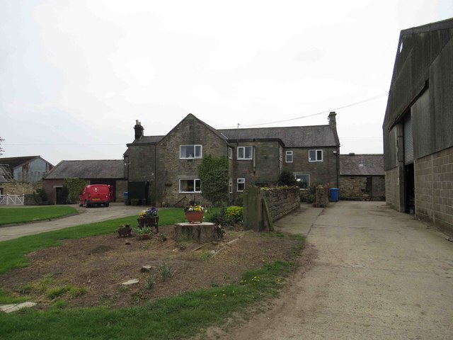
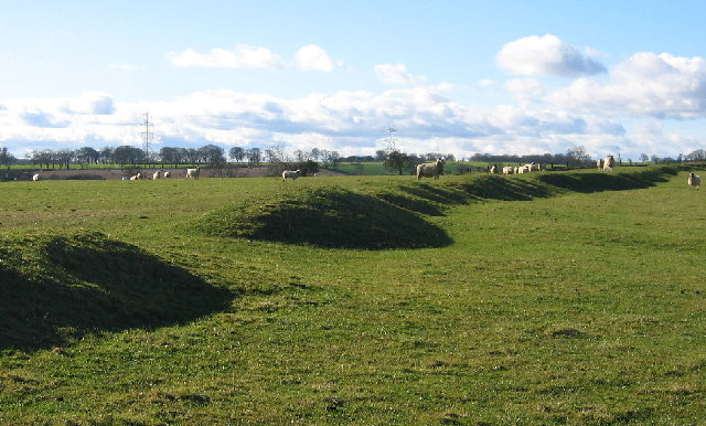
Middle Newham was a much larger village during Medieval times. There are earthwork remains of at least eight properties; the village is bounded on the north and south by ridge and furrow (medieval ploughing). The remains of the deserted medieval village are a Scheduled Monument (legally protected).
Scheduled Monument (#1006421): Middle Newham deserted village
Click the headings below to expand (selected extracts from the Historic England scheduling)
The remains of Middle Newham medieval settlement are well-preserved as earthworks which include a significant proportion of the layout of the village. The degree of preservation indicates that the monument will contain archaeological deposits relating to the construction, use and abandonment of the village. The monument provides insight into the character of village life during the medieval period.
The monument includes the remains of a deserted village of medieval date, situated on a slight ridge over looking Cadgers Burn to the south. The monument is divided into two separate areas of protection located on either side of the road which runs through Middle Newham. To the north of the road and aligned on it are remains of a row of crofts with associated buildings representing about eight tenements, all of which are preserved as earthworks. The crofts are bounded on the north side by a continuous bank. To the south of the road are further earthwork remains, which include the route of a disused trackway that acted as a back lane for the village.
During 1242 the area of Middle Newham lay within the barony of Whalton. In 1296 the Lay Subsidy recorded ten taxpayers within the village and in 1569 historical records show that Newham comprised seven tenements and an eighth that had either fallen out of use or had been amalgamated with another. By 1594 customary tenure had been abolished and the township converted into two demesne holdings. Soon after 1608 the tenants were enfranchised at freeholders.

from https://historicengland.org.u…
Middle Newham deserted village - List Entry
- "...The remains of Middle Newham medieval settlement are well-preserved as earthworks which include a significant proportion of the layout of the village. The degree of preservation indicates that the monument …
Added by
Simon Cotterill

from https://keystothepast.info/se…
Middle Newham deserted village (Belsay)
- "Middle Newham was once a much larger village. Today it only exists as a few farms. The village was next to Middle Newham farmhouse. Earthworks can be seen running parallel …
Added by
Simon Cotterill

from https://historicengland.org.u…
Middle Newham deserted village - List Entry
- "...The remains of Middle Newham medieval settlement are well-preserved as earthworks which include a significant proportion of the layout of the village. The degree of preservation indicates that the monument …
Added by
Simon Cotterill
from https://keystothepast.info/se…
Middle Newham deserted village (Belsay)
- "Middle Newham was once a much larger village. Today it only exists as a few farms. The village was next to Middle Newham farmhouse. Earthworks can be seen running parallel …
Added by
Simon Cotterill