Topics > Northumberland > Allendale Town > Blackett Level
Blackett Level
Map showing the location of the Blackett Level Portal in Allendale Town.
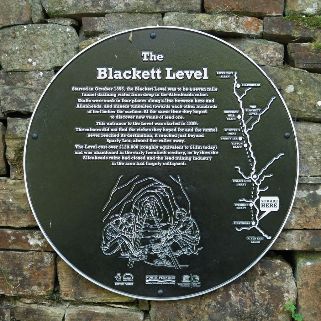
The Blackett Level is a historic 4½ mile-long subterranean lead mine drainage tunnel and exploration adit in the valley of the River East Allen. The driving of the level was started in 1854 by the London Lead Company and was designed to drain and explore the valley from Allendale Town to Allenheads. It was driven from Sipton shaft, from special shafts at Studdon Dene and Holmes Linn, and from a portal at Allendale Town. Although 7½ miles were planned to reach Allenheads, construction was abandoned in 1903 at 4½ miles due to falling lead prices and limited ore discoveries along the level. However, the Blackett Level was successful in lowering the water table, making it possible for other local mines to continue operating longer.
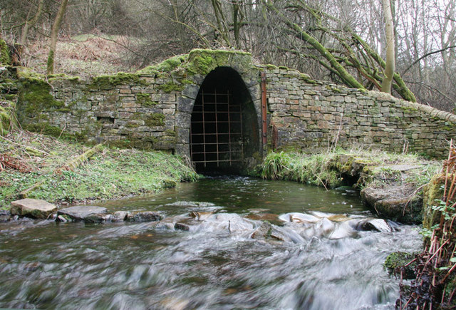
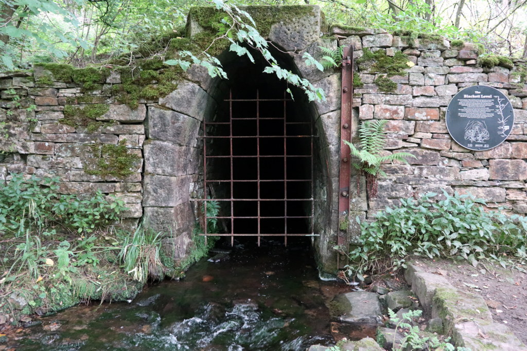
The Blackett Level still discharges water, by it's portal near St. Cuthbert’s Church in Allendale Town, into Philip Burn close to it's confluence with the River East Allen. The portal is Grade II listed on the National Heritage List for England and also a Scheduled Monument (legally protected).
Scheduled Monument (#1006414): Blackett Level portal
Click the headings below to expand (selected extracts from the Historic England scheduling)
Adits, also known as levels, are a prominent type of field monument produced by the surface workings of underground mining. Most adits are rock-cut, but sometimes possess built portals or arched entrances. They take the form of horizontal tunnels excavated into a hillside to give entrance to a mine for access to working surfaces, haulage of mined material, and/or drainage. Occasionally, drainage adits were developed at coal mines in order to provide access for coal transportation using tub-boats and the visible site feature is that of the entrance or boat-level.
The Blackett Level portal is well-preserved and still functioning. The portal represent a remaining portion of what was once an extensive network of structures associated with an important series of lead mines in the East Allendale Valley. As such the monument provides insight into the technological development of ore mining during the Industrial Revolution.
The monument includes the remains of an adit portal for a drainage level for lead mines in the East Allendale Valley of late 19th century date, situated at the confluence of the River East Allen and Philipburn Dean. The scheduled part of the level includes the portal which accommodated the outflow of water into the river. The portal is built from coursed stone blocks with the entrance consisting of a narrow horseshoe arch with dressed stone voussoirs set in a squared rubble wall. There is an iron girder bolted to the right jamb which is part of the fittings for the original iron gate. The mouth of the portal is covered by an iron grille which is a 20th century addition and is excluded from the scheduling, however, the remaining structure of the portal is covered.
Construction began on the level in 1854 and it continued to be worked on and extended until 1903 by which time 4.5 miles of the intended 7.5 miles had been completed. The level drained a number of mines and continues to do so, although the mines are now disused.
from https://www.geograph.org.uk/p…
Plaque re the Blackett Level
- Photo by Mike Quinn, 6 July, 2018, Geograph, CC-BY-SA
Added by
Simon Cotterill
from https://www.geograph.org.uk/p…
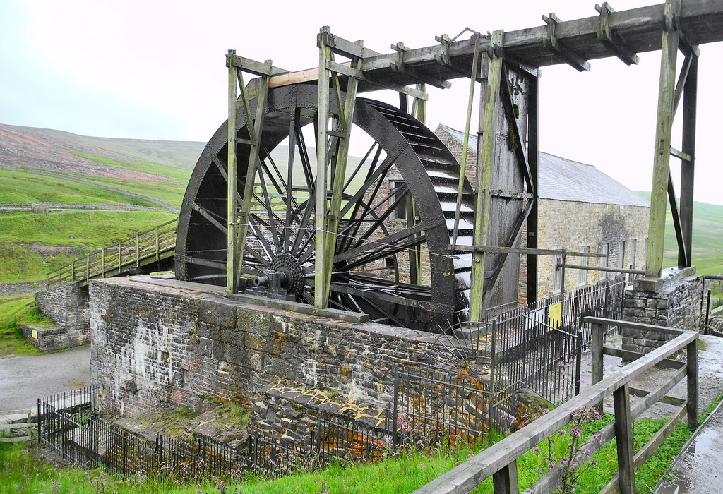
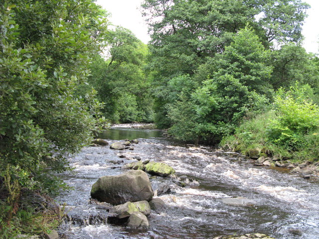
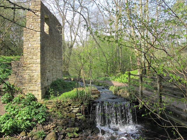
Water from the Blackett Level entering Philip Burn
- The entrance to the Blackett Level is just beyond and to the left of the ruined building. Photo by Mike Quinn, 30 April, 2017, Geograph, CC-BY-SA 2.0
Added by
Simon Cotterill
from https://www.geograph.org.uk/p…
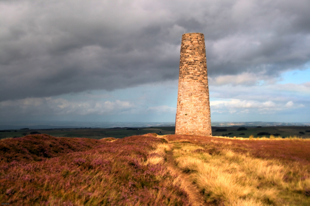
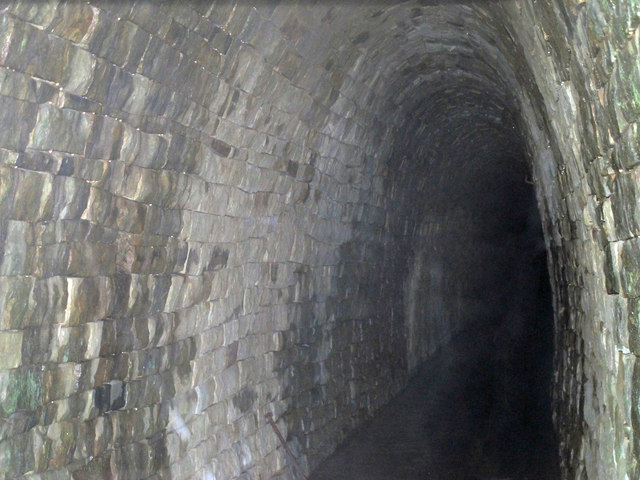
The Blackett Level
- Photo by Mike Quinn, 23 November, 2016, Geograph, CC-BY-SA 2.0
Added by
Simon Cotterill
from https://www.geograph.org.uk/p…
Blackett Level Portal
- WB Lead's Blackett Level Project was designed to explore lead veins along the East Allen valley and also to provide drainage of the mines at Allenheads. From its entrance in …
Added by
Simon Cotterill
from https://web.archive.org/web/2…
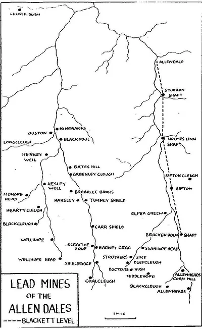
Map of the lead mines in the Allen Dales following the rivers and the site of the Blackett level.
- The ‘Blackett Level’ is a tunnel built to help drain the local mines (known as an ‘adit’), it was also hoped that the tunnel would help to discover further lead …
Added by
Simon Cotterill

from https://historicengland.org.u…
Blackett Level portal
- ....The Blackett Level portal is well-preserved and still functioning. The portal represent a remaining portion of what was once an extensive network of structures associated with an important series of …
Added by
Simon Cotterill
from https://historicengland.org.u…
Blackett Level, 100 Metres North-west of Parish Church - Allendale - List Entry
- Adit portal to lead mine, 1854. Stone, iron fittings. Narrow horseshoe arch, with dressed stone voussoirs, set in squared rubble wall; iron girder bolted to right jamb is part of …
Added by
Simon Cotterill

from https://www.geograph.org.uk/p…
Plaque re the Blackett Level
- Photo by Mike Quinn, 6 July, 2018, Geograph, CC-BY-SA
Added by
Simon Cotterill
from https://www.geograph.org.uk/p…
Water from the Blackett Level entering Philip Burn
- The entrance to the Blackett Level is just beyond and to the left of the ruined building. Photo by Mike Quinn, 30 April, 2017, Geograph, CC-BY-SA 2.0
Added by
Simon Cotterill
from https://www.geograph.org.uk/p…
The Blackett Level
- Photo by Mike Quinn, 23 November, 2016, Geograph, CC-BY-SA 2.0
Added by
Simon Cotterill
from https://www.geograph.org.uk/p…
Blackett Level Portal
- WB Lead's Blackett Level Project was designed to explore lead veins along the East Allen valley and also to provide drainage of the mines at Allenheads. From its entrance in …
Added by
Simon Cotterill
from https://web.archive.org/web/2…
Map of the lead mines in the Allen Dales following the rivers and the site of the Blackett level.
- The ‘Blackett Level’ is a tunnel built to help drain the local mines (known as an ‘adit’), it was also hoped that the tunnel would help to discover further lead …
Added by
Simon Cotterill
from https://historicengland.org.u…
Blackett Level portal
- ....The Blackett Level portal is well-preserved and still functioning. The portal represent a remaining portion of what was once an extensive network of structures associated with an important series of …
Added by
Simon Cotterill
from https://historicengland.org.u…
Blackett Level, 100 Metres North-west of Parish Church - Allendale - List Entry
- Adit portal to lead mine, 1854. Stone, iron fittings. Narrow horseshoe arch, with dressed stone voussoirs, set in squared rubble wall; iron girder bolted to right jamb is part of …
Added by
Simon Cotterill