Topics > Northumberland > Catcherside > Multivallate hillfort, Catcherside (Camp Hill)
Multivallate hillfort, Catcherside (Camp Hill)
Scheduled Monument area - based on Historic England data (Open Government Licence)
Scheduled Monument (#1011100): Multivallate hillfort, 420m SSW of Catcherside
Click the headings below to expand (selected extracts from the Historic England scheduling)
Despite the fact that much of the hillfort SSW of Catcherside has been levelled by ploughing, it retains significant archaeological deposits, particularly in the infilled ditches and beneath the overlying riggs. It is one of a group of settlements of broadly the same period and will contribute to our knowledge and understanding of the range and nature of later prehistoric settlement in the area.
The monument includes a hillfort of Iron Age date situated on the top of a small hillock, with a steep drop to the north. The hillfort has a central oval platform measuring 48m by 35m with artificial scarps on all sides. The surrounding ditch has been much infilled but is visible as a shallow depression, except on the north-west side where it is a pronounced feature 12.5m wide and 1.2m in depth below the interior ground level. Outside the ditch, on the north-west side, there is a well preserved rampart 9m wide and 2m high above the bottom of the ditch. On all other sides the rampart has been reduced to a slight scarp. The levelling and infilling of the earthworks at this site is partly the result of ridge and furrow ploughing which surrounds and overlies the monument.
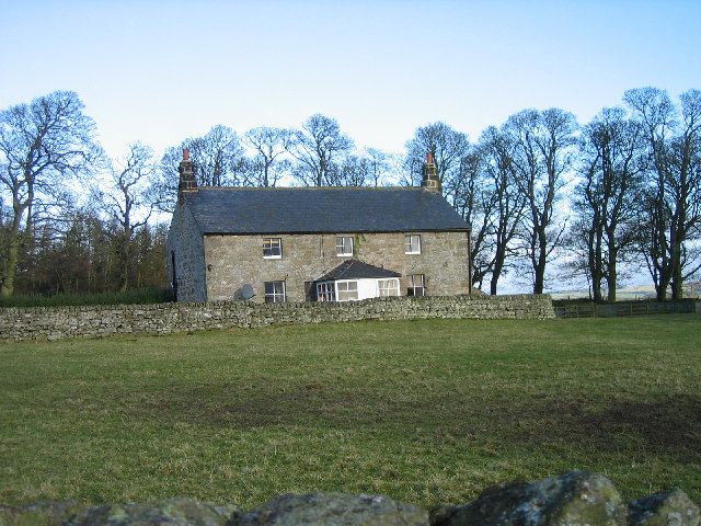
Catcherside Camp, Northumberland (Camp Hill) #EN2699
Click the headings below to expand (selected extracts from the Atlas of Hillforts of Britain and Ireland)
A small hillfort of 0.28ha lying 420m SSW of Catcherside, now mutilated and ploughed-down. It is sited on a small hillock which drops away steeply to the N and survives as a sub-oval platform 48m by 35m artificially scarped on all sides. A ditch can be observed as a shallow depression but where surviving in the NW it measures 12.5m wide and 1.2m deep. A 9m wide and 2m high rampart or counterscarp lies beyond this. Ridge and furrow ploughing overlies and surrounds the hillfort. Hodgson (1827) reports the ploughing and removing of stones in 1778-9 by the tenant farmer, including those from circular paved huts, implying the site once had secondary, probably Romano-British, occupation. Recorded on 1885-1900 OS mapping. Scheduled but undated.
Source: Lock, Gary and Ralston, Ian. 2024. Atlas of Hillforts of Britain and Ireland. Available at: https://hillforts.arch.ox.ac.uk (CC BY-SA 4.0)
from https://www.geograph.org.uk/p…
Camp Hill
- Iron Age defended settlement near Catcherside. Photo by Russel Wills, 28 June, 2016, Geograph, CC-BY-SA 2.0
Added by
Simon Cotterill

from https://historicengland.org.u…
Multivallate hillfort, 420m SSW of Catcherside - List Entry
- "....Despite the fact that much of the hillfort SSW of Catcherside has been levelled by ploughing, it retains significant archaeological deposits, particularly in the infilled ditches and beneath the overlying …
Added by
Simon Cotterill

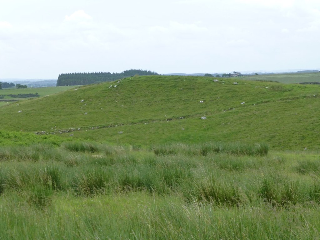
from https://www.geograph.org.uk/p…
Camp Hill
- Iron Age defended settlement near Catcherside. Photo by Russel Wills, 28 June, 2016, Geograph, CC-BY-SA 2.0
Added by
Simon Cotterill
from https://historicengland.org.u…
Multivallate hillfort, 420m SSW of Catcherside - List Entry
- "....Despite the fact that much of the hillfort SSW of Catcherside has been levelled by ploughing, it retains significant archaeological deposits, particularly in the infilled ditches and beneath the overlying …
Added by
Simon Cotterill