Topics > Northumberland > Callaly > Univallate hillfort and medieval tower, East of Callaly Castle
Univallate hillfort and medieval tower, East of Callaly Castle
Scheduled Monument area - based on Historic England data (Open Government Licence) - to the east of Callaly.
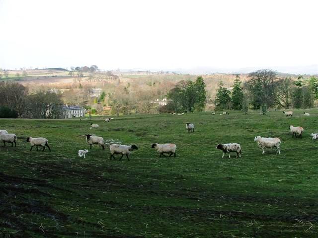
Castle Hill to the east of Callaly in Northumberland, is a well-preserved prehistoric hillfort and medieval site, located on a summit, which commands extensive views in all directions. It originated as an Iron Age univallate hillfort, featuring a sub-rectangular main enclosure protected by steep scarped banks, a rock-cut ditch measuring up to 17 metres wide, and outer counterscarp bank. In addition to the main fort, there were two large western walled annexes. The overall complex covered an area of 2.6 hectares. The site is now heavily wooded.

LIDAR - Image from opendata.hillforts.eu (CC-BY-SA), based on data from the Environment Agency - National LIDAR programme.
Taking advantage of it's natural defensive positioning, the site was utilised during the medieval era, evidenced by the foundations of two rectangular stone buildings believed to be a 12th-century motte castle or a later medieval tower. The site is a Scheduled Monument (legally protected).
The Legend of the Callaly Boar
It is said that the Lord of Callaly decided to build his fortress on Castle Hill, on the site of the Iron Age hillfort here. However, his lady preferred the comfort of the vale below and plotted to change his mind on where the castle should be built. She instructed a servant to dress in a wild boar skin and knock down each day's newly laid stones. A watch party witnessed the "monstrous beast" ripping down the masonry, the boar allegedly cried out the now-famous rhyme:
Callaly Castle built on the hight,
Up in the day and down in the night.
Builded down in the Shepherd's Shaw
It shall stand for aye and never fa'.
Terrified by the omen, the Lord and his superstitious workmen abandoned the summit and switched to building in the valley, establishing what eventually became the grand, Callaly Castle country house.
Scheduled Monument (#1011090): Univallate hillfort and medieval tower, 750m East of Callaly Castle
Click the headings below to expand (selected extracts from the Historic England scheduling)
The hillfort on Castle Hill is exceptionally well preserved. Its situation and the scale of its defences show that it was a settlement of some importance in the region. It will contribute to our understanding of the range and nature of prehistoric settlement in the area at this time. The good defensive nature of the site led to its re-use during the medieval period; subsequently the medieval tower was abandoned in favour of a new location at the foot and to the west of the hill. Hence the site will retain significant and largely undisturbed remains of this early medieval activity and will contribute to any study of the development of the adjacent castle.
The monument includes a hillfort of Iron Age date and a later medieval tower situated on Castle Hill, commanding extensive views in all directions. The irregularly shaped hillfort measures a total of 225m east to west by 115m north to south and exhibits several phases of activity. The main enclosure on the hilltop is roughly sub-rectangular in shape and is 80m east-west by 50m north-south; it is surrounded on three sides by a rock cut ditch 12-17m wide and 3m-7m deeper than the internal ground level. There is a counterscarp bank 4m wide which rises 2m-3m above the external ground level and an internal bank 3m wide and 0.8m high. The northern side of the enclosure is defended by a strongly scarped bank. Two opposing entrances in the east and west sides are carried on causeways across the ditch.
Within the enclosure there are the remains of two rectangular buildings in the north-west corner. They measure 15m by 13m and 15m by 8m. These are interpreted as the remains of Old Callaly Castle known from documentary sources to have been held by Sir John Clavering in 1415. The use of the term Old Callaly suggests that the later tower, around which the present castle was built, was already standing in 1415 and that this earlier tower on Castle Hill was retained as a place of defence or a lookout. West of the main enclosure there are two contiguous annexes, the inner one defended by a bank 7m wide giving access to the second defended by a bank 4m wide. More than one period may be represented by the remains on Castle Hill and the strong ditch may be a later medieval feature associated with the medieval tower, this being constructed within the earlier defensive system. In the late 19th century several Bronze Age stone coffins were discoverd during quarrying on the north side of Castle Hill.
EN0504 Castle Hill Callaly, Northumberland (Callaly Hill)
Click the headings below to expand (selected extracts from the Atlas of Hillforts of Britain and Ireland)
Lying within woodland at 213m OD in a dominant position on Castle Hill, Callaly, a univallate hillfort and medieval tower. The main earthwork is sub-rectangular measuring 80m E-W by 50m N-S enclosing 0.4ha. It is defended in the N by a steeply scarped bank and elsewhere by a bank, rock-cut ditch and counterscarp bank. The internal bank is 3m wide and 0.8m high showing walling in places, the ditch 12-17m wide and 3-7m deep, and the counterscarp banks 4m wide and 2-3 high. It was proposed during a scheduling amendment in 1994 that the strong ditch might be a later medieval feature associated with the castle. Opposing entrances in the E and W allow access to the interior via a causeway across the ditch. Within the interior two rectangular buildings 15m by 13m and 15m by 8m are possibly the remains of old Callaly Castle. Two contiguous annexes lie to the W of the main enclosure. The innermost annex has a bank 7m wide with a central gap that provides access between the annexes and the hillfort. The outer annex has a 4m wide bank. The combined measurement of the hillfort and annexes is 225m E-W by 115m N-S (2.6ha). It is recorded on 1856-65 OS mapping and is unexcavated and undated.
Source: Lock, Gary and Ralston, Ian. 2024. Atlas of Hillforts of Britain and Ireland. Available at: https://hillforts.arch.ox.ac.uk (CC BY-SA 4.0)
from https://www.geograph.org.uk/p…
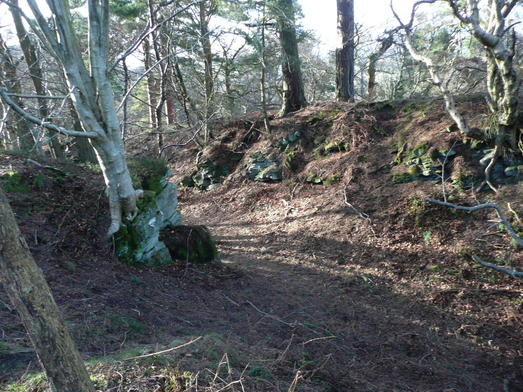
Hill fort on Castle Hill, Callaly
- A deep ditch sub-dividing the hill fort. Photo by Russel Wills, 15 January, 2015, Geograph, CC-BY-SA 2.0
Added by
Simon Cotterill
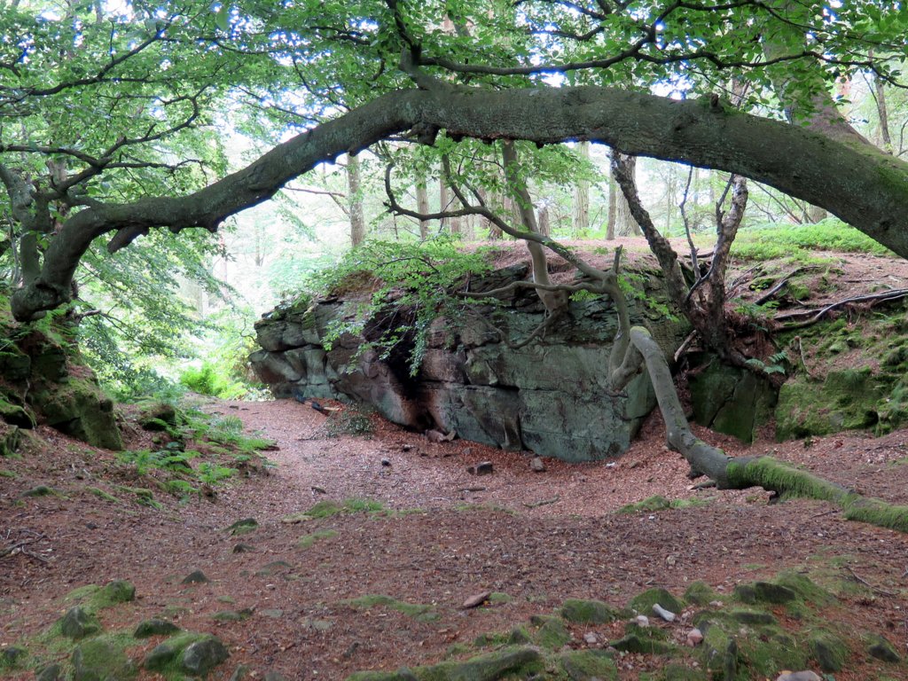
from https://www.geograph.org.uk/p…
Rock-cut ditch, Castle Hill
- Photo by Andrew Curtis, 28 August, 2015, Geograph, CC-BY-SA 2.0
Added by
Simon Cotterill

from https://www.geograph.org.uk/p…
Castle Hill
- Beneath the trees there is a rather good hill fort. Photo by Richard Webb, 6 May, 2026, Geograph, CC-BY-SA 2.0
Added by
Simon Cotterill
Co-Curate Page
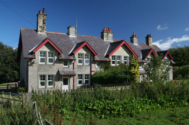
Callaly Castle
- Overview About Callaly Castle Aerial View Callaly Castle is a Grade I listed building and a substantial country house to the north of the village of Callaly, which is …
from https://www.megalithic.co.uk/…
Callaly Castle Hillfort
- Includes photos
Added by
Simon Cotterill

from https://www.geograph.org.uk/p…
Hill fort on Castle Hill, Callaly
- A deep ditch sub-dividing the hill fort. Photo by Russel Wills, 15 January, 2015, Geograph, CC-BY-SA 2.0
Added by
Simon Cotterill
from https://www.geograph.org.uk/p…
Rock-cut ditch, Castle Hill
- Photo by Andrew Curtis, 28 August, 2015, Geograph, CC-BY-SA 2.0
Added by
Simon Cotterill
from https://www.geograph.org.uk/p…
Castle Hill
- Beneath the trees there is a rather good hill fort. Photo by Richard Webb, 6 May, 2026, Geograph, CC-BY-SA 2.0
Added by
Simon Cotterill
Co-Curate Page
Callaly Castle
- Overview About Callaly Castle Aerial View Callaly Castle is a Grade I listed building and a substantial country house to the north of the village of Callaly, which is …
from https://www.megalithic.co.uk/…
Callaly Castle Hillfort
- Includes photos
Added by
Simon Cotterill