Topics > Heritage Sites > Listed Buildings > Scheduled Monument
Co-Curate Page
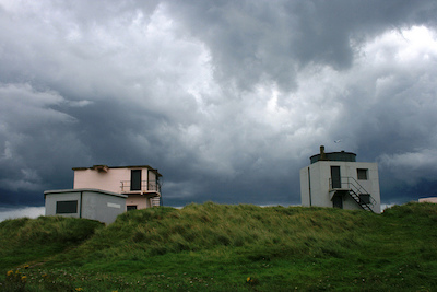
Blyth Battery
- Overview Map Street View Blyth Battery is a Military and Local Heritage museum which is free to visit. The artillery battery was originally built in 1916 to defend the port …
Co-Curate Page
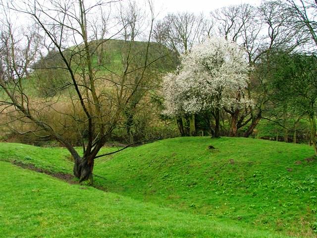
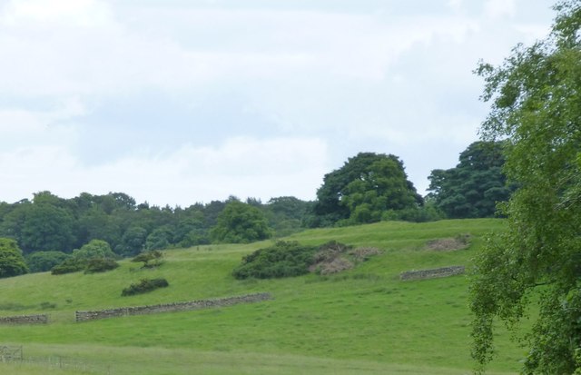
Slate Hill Settlement Earthworks, Bolam
- Overview Map Remains of a defended Iron Age settlement around the top of Slate Hill, just north of Bolam Lake in Northumberland. The ruins are a Sheduled Monument.
Co-Curate Page
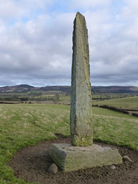
The Hurl Stone
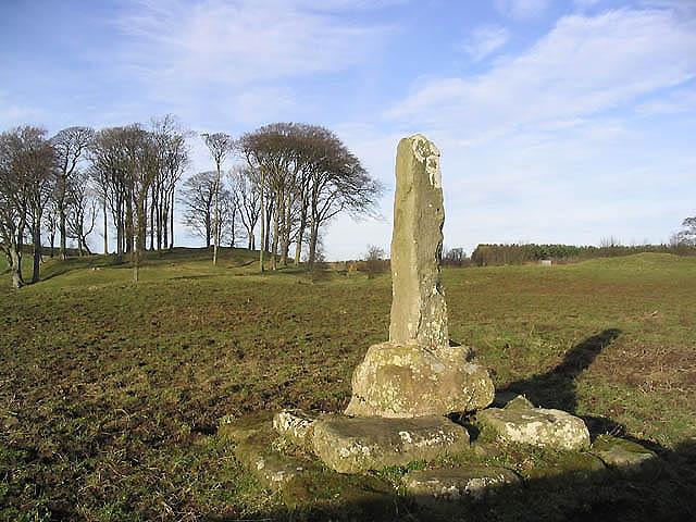
- Overview Map Tthe Hurl Stone is a Medieval standing cross located near Newtown and Lilburn Tower in Northumberland. The stone is a Scheduled Monument.
Co-Curate Page
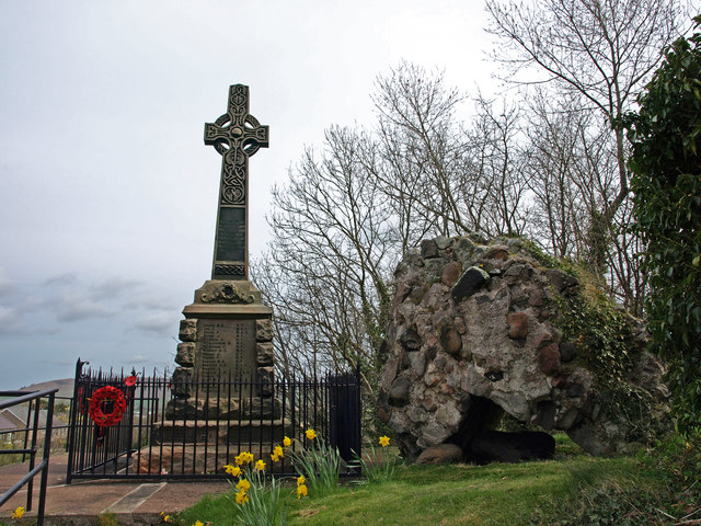
Wooler Tower (remains)
- Overview Map Street View There was a fortified stone tower, built in the early 16th century, on Tower Hill in Wooler. Only 3 large blocks of masonary survive, one near …
Co-Curate Page
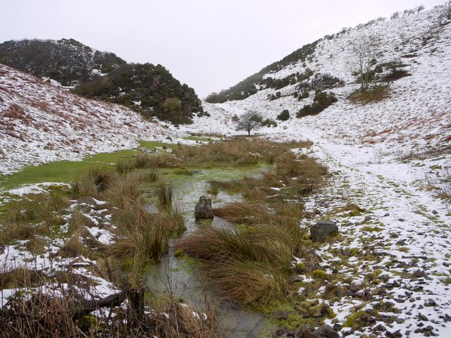
Kettles Hillfort, near Wooler
- The Kettles is the earwork remains of an Iron Age and Roman hill fort and settlement near Earle and Wooler in Northumberland.[1] The fort occupies a natural ridge protected on …
Co-Curate Page
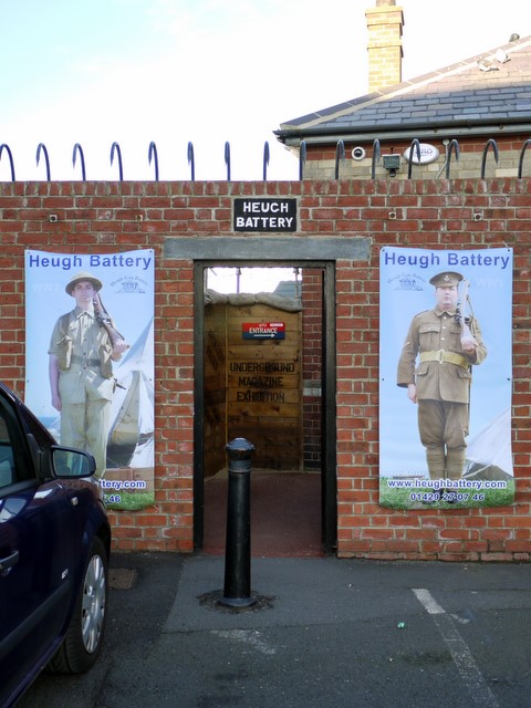
Heugh Battery
- Overview About Heugh Battery Map Street View The Heugh Gun Battery was built on the Headland in 1860 to protect the fast growing port of Hartlepool. The Battery guns were …
Co-Curate Page
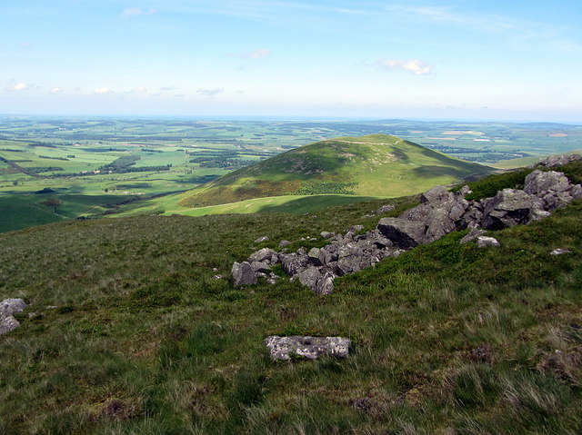
Hillfort, Yeavering Bell
- The remains of an Iron Age Hillfort are located on Yeavering Bell, a hill near Yeavering and Kirknewton in Northumberland. It was one of the largest known Iron Age hillforts in …
Co-Curate Page
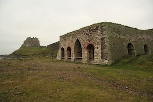
Lime Kilns
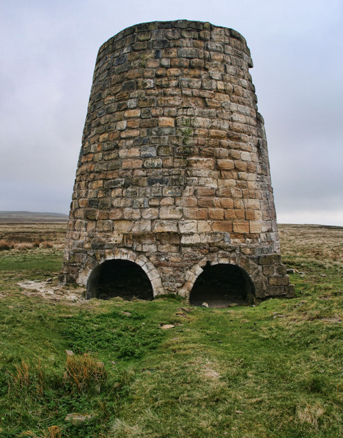
- Overview Map Street View The lime kilns at Castle Point on Lindisfarne are amongst the largest and best preserved lime kilns in Northumberland. They have a complex layout compared to …
Co-Curate Page
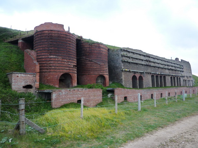
Lime Kilns, Marsden
- Overview Map Street View Marsden Lime Kilns are located off the Coast Road near Marsden Quarry in South Shields. The massive battery of 15 lime kilns were built in the …
Co-Curate Page
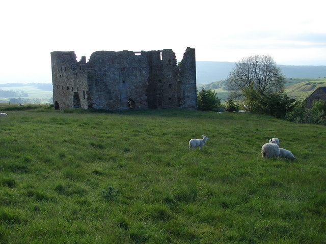
Engine House, Ridsdale Iron Works
- Overview Map Street View The remains of Ridsdale Iron Works are to the north of Ridsdale in Northumberland. Established in 1836, the works consisted of 3 furnaces, an engine house, coke …
Co-Curate Page
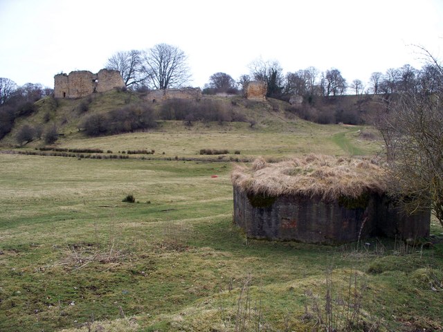
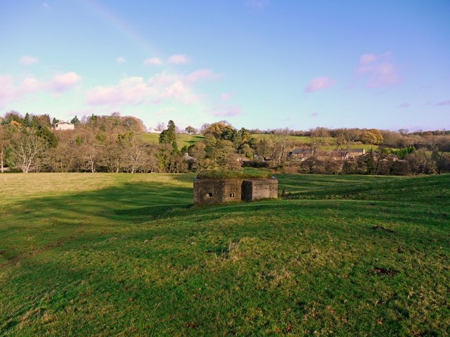
Pillbox, near Mitford Castle
- This Second World War pillbox is located near Mitford Castle, 718m south-west of Mitford Bridge. It was built by the Northern Command as part of the River Wansbeck Stop Line …
Co-Curate Page
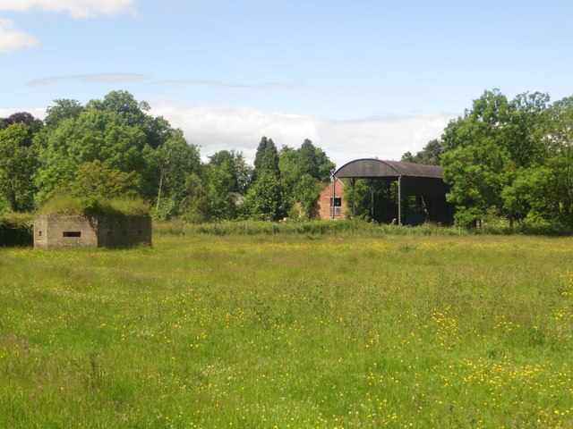
Pillbox, Adders Haugh
- This Second World War pillbox is located on Adders Haugh, 301m south of Mitford Bridge. It was built by the Northern Command as part of the River Wansbeck Stop Line …
Co-Curate Page
Pillbox near Spittal Hill Farm
- This Second World War pillbox is located near Spittal Hill Farm, 320m north-west of Mitford Bridge. It was built by the Northern Command as part of the River Wansbeck Stop …
Co-Curate Page
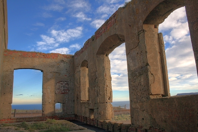
Huntcliff Ironstone Mine
- Overview Map Street View Inside Huntcliffe Mine, near the cliffs about 1 mile north-east of Brotton, was opened by Bell Bros., Ltd.in 1871 (nearby Cliff Mines had been opened by …
Co-Curate Page
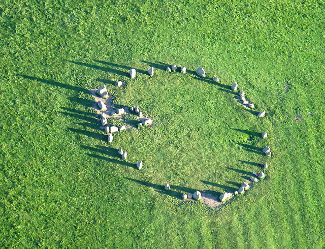
Castlerigg Stone Circle
- Overview About Castlerigg Stone Circle Map Street View Castlerigg Stone Circle, located just over a mile east of Keswick, is one of the earliest stone circles in the UK, thought …
Co-Curate Page
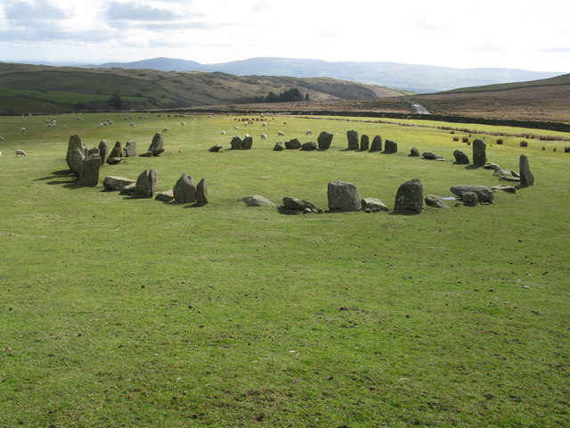
Swinside Stone Circle
- Overview About Swinside Stone Circle Map Street View Swinside Stone Circle (also known as Sunkenkirk Stone Circle) is a stone circle from either the Neolithic or Bronze Age date, located …

Co-Curate Page
Long Meg and Her Daughters (stone circle)
- Overview About Long Meg and Her Daughters Map Street View Long Meg and Her Daughters is a stone circle in Cumbria, located about half a mile north-east of the village …
Co-Curate Page
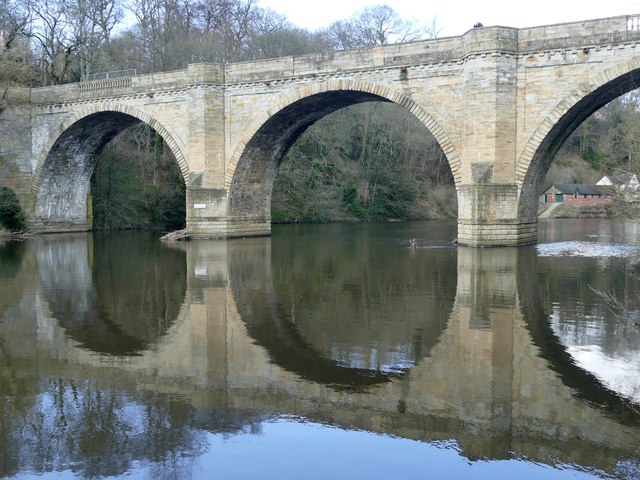
Prebends Bridge
- Overview About Prebends Bridge Map Street View Prebends Bridge over the River Wear at Durham was built for the Dean and Chapter of Durham to provide access to Durham Cathedral …
Co-Curate Page
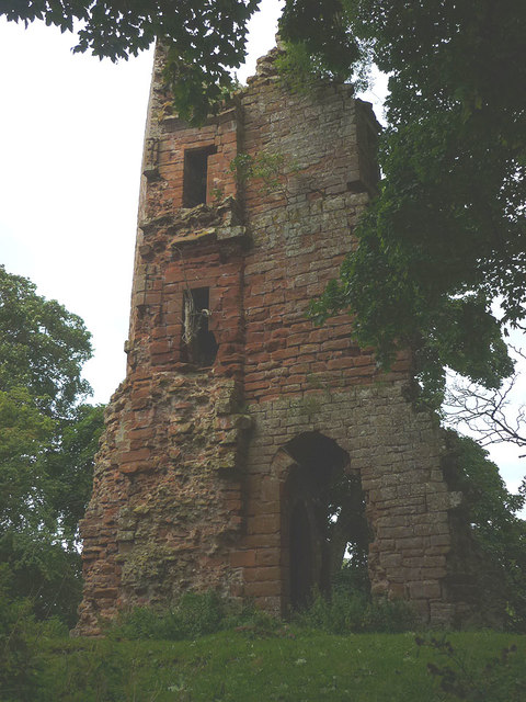
Kirkoswald Castle
- Overview About Kirkoswald Castle Map Street View The ruins of Kirkoswald Castle are located to the south-east of Kirkoswald in Cumbria. A licence to crenellate (fortify) an existing building was granted …
Co-Curate Page
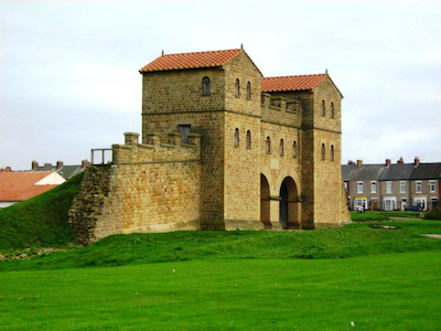
Arbeia - Roman Fort
- Overview About Arbeia Map Street View The fort stood on the Lawe Top in South Shields, overlooking the River Tyne. It was built around 120 AD, guarded the main sea …
Co-Curate Page
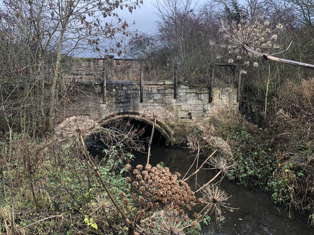
Sherburnhouse Bridge
- Overview Map Street View The old Sherburnhouse Bridge, located to the north-west of the hamlet of Sherburn House in County Durham, dates from 1335, with the upper part of the …
Co-Curate Page
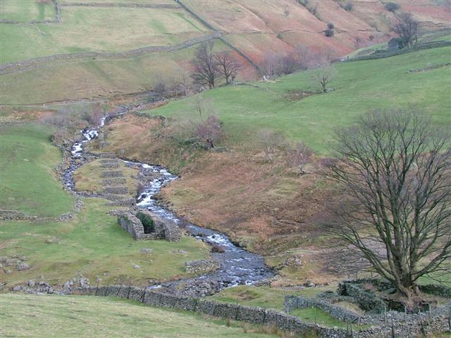
Myers Head Lead Mine
- The remains of Myers Head Lead Mine are located by the confluence of Pasture Beck and Hayeswater Gill, south-east of Hartsop in the Eden district of Cumbria.
Co-Curate Page
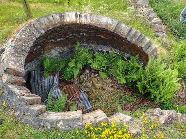
Coke Ovens at Inkerman Farm
- "The beehive coke ovens are some of the last remaining examples of this type of oven left in County Durham. At one time there were over 100,000 in the County. …
Co-Curate Page
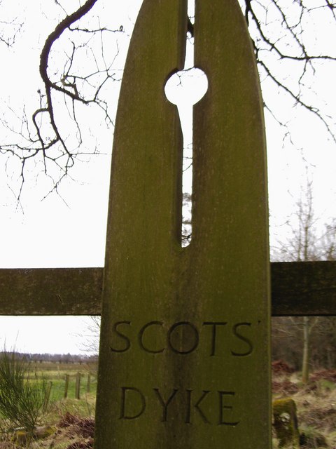
Scots Dyke
- Scots Dyke (aka Scots' dike) is a 3½ mile long earthwork, constructed by the English and the Scots in 1552 to mark the division of the 'Debatable Lands' which had …
Co-Curate Page
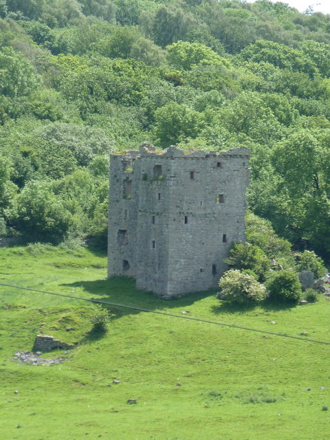
Arnside Tower
- Overview About Arnside Tower Map Street View Arnside Tower is a late-medieval tower house located about half a mile south of the village of Arnside and a similar distance north-east …

Co-Curate Page
Learchild Roman fort (Alavna)
- The shallow earthwork remains of a large Roman fort (thought to be 'Alavna') near High Learchild were discovered by arial photography in 1945, and confirmed by subsequent archaeological digs. The fort …
Co-Curate Page
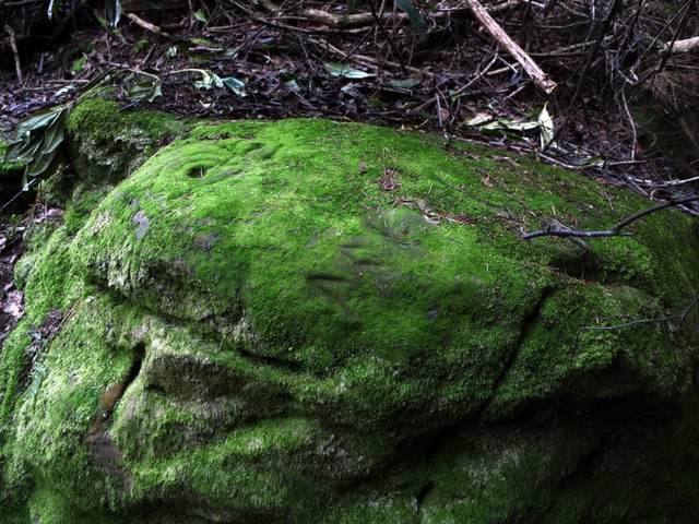
Prehistoric Rock Art in Lemmington Wood
- Deep in Lemmington Woods is a rock with 'cup and rings' carvings, thought to date from the early Bronze Age. The rock is very unusual as it also has later Anglo-Saxon …

Co-Curate Page
Gardner's Houses Prehistoric Settlement
- There is evidence of a prehistoric settlement near Gardener's House Farm, which is located to the north of Dinnington village.
Co-Curate Page
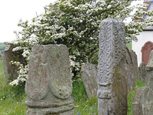
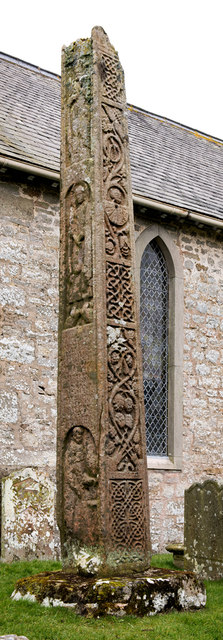
Medieval Bewcastle Cross
- The high cross shaft in the churchyard of St Cuthbert's Church in Bewcastle dates from the 7th century. The Bewcastle Cross is a scheduled monument. The Stone Cross at St …
Co-Curate Page
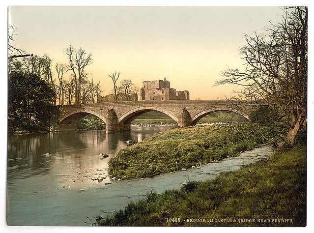
Brougham Castle
- Overview About Brougham Castle Map Street View Located about a mile south-east of Penrith in Cumbria. Brougham Castle (pronounced /ˈbruːm/) is a medieval building about 2 miles (3.2 km) south-east …
Co-Curate Page
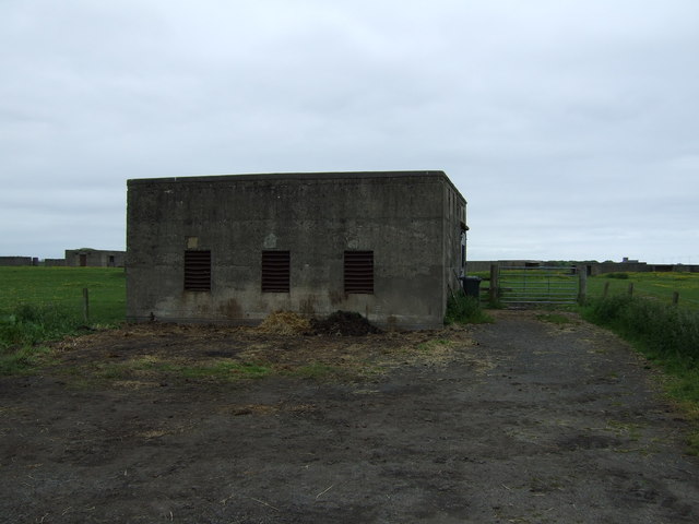
Gloucester Lodge Heavy Anti-Aircraft Battery
- Gloucester Lodge Battery, just south of Blyth, was a Second World War heavy anti-aircraft gun battery and radar site. It is one of only a handful of complete or near …
Co-Curate Page
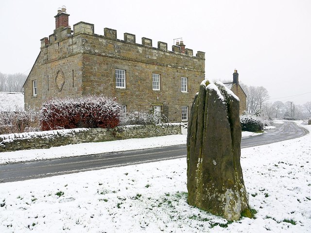
Stob Stone
- Overview Map Street View Stob Stone is a Bronze Age standing stone, located by the roadside at Standing Stone Farm, about half a mile south of Matfen in Northumberland. The …
Co-Curate Page
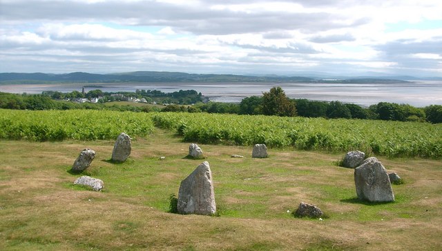
Birkrigg Stone Circle
- Overview About Birkrigg Stone Circle Map Street View Birkrigg Stone Circle (also known as the Druid's Circle) is located on Birkrigg Common in Cumbria, located about 2 miles south of …
Co-Curate Page
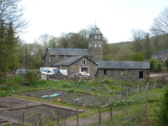
Low Wood Gunpowder Works
- Overview About Low Wood Gunpowder Works Map Street View The Low Wood Gunpowder Works, located on the east banks of the River Leven at Low Wood, were in operation from …
Co-Curate Page
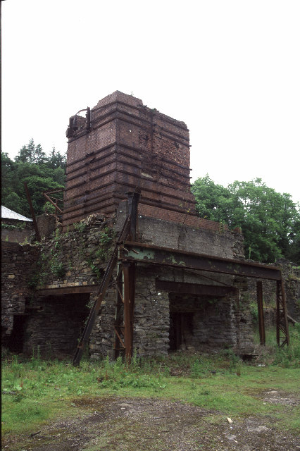
Backbarrow Ironworks
- Established in 1711. Isaac Wilkinson worked here, he developed a furnace fuelled by charcoal and was one of the first of its kind in the UK.The main products of the …
Co-Curate Page
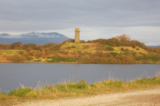
Hodbarrow Old Lighthouse
- The old lighthouse (aka Hodbarrow Beacon) is located 380m north-west of Hodbarrow Point, to the south of Millom. Built in the 19th Century, it is one of the last surviving …
Co-Curate Page
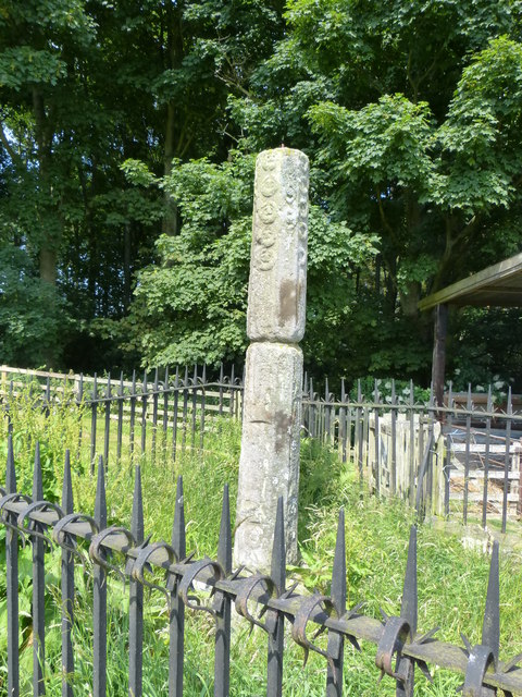
Percy's Cross (between Powburn & Wooperton)
- This is a 15th century wayside cross, located close to the A697 road between Powburn and Wooperton in Northumberland. The cross commemorates Sir Ralph Percy who was killed near here in …
Co-Curate Page
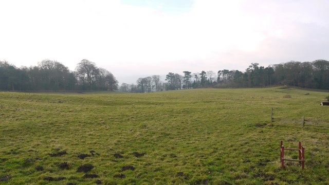
Site of Iron Age Settlement, Houghton
- Overview Aerial View To the south-west of Houghton in Northumberland, by Broomy Hill, are the remains of an Iron Age defended settlement. The remains are not easily visible as most of the defensive …
Co-Curate Page
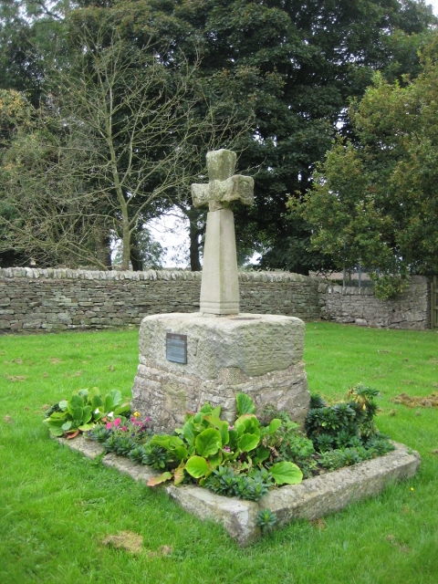
Village Cross, Esh
- Overview Map Street View Esh Cross is located in its original position on a raised area at the southern end of the village green in Esh. It is an important …
Co-Curate Page
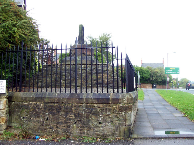
Neville's Cross (monument)
- Overview Map Street View The remains of the medieval Neville's Cross are located on the north side of Crossgate Peth, opposite St John's Church in the Nevil's Cross area of …
Co-Curate Page
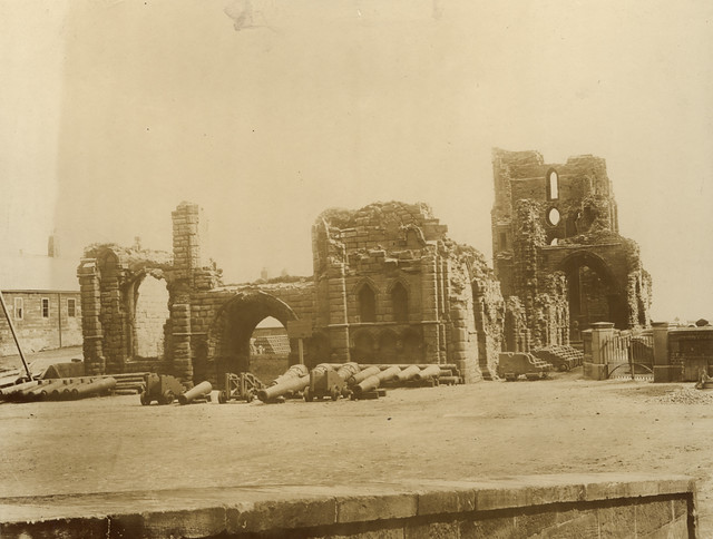
Tynemouth Priory and Castle
- Overview History Aerial View Street View Tynemouth Castle is located on a rocky headland (known as Pen Bal Crag) at Tynemouth, overlooking Tynemouth Pier and the mouth of the River …
Co-Curate Page
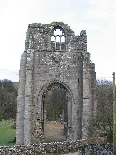
Shap Abbey (ruins)
- Overview About Shap Abbey Map Street View Shap Abbey is located about 1½ miles west of the village of Shap in Cumbria. The Abbey was founded in c.1200 by local …
Co-Curate Page
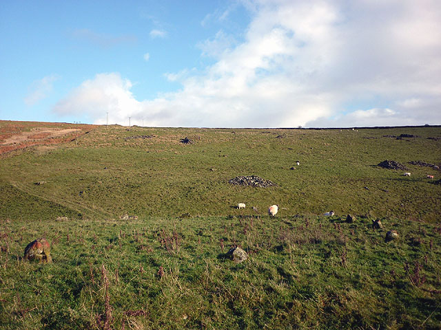
Casterton Stone Circle
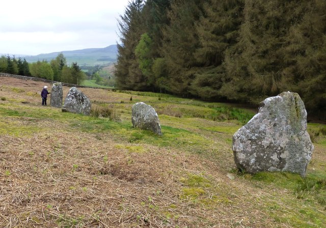
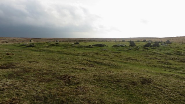
- Overview Map An embanked circle of 17 relatively small stones, probably dating from the Bronze Age. The stone circle is located near Langthwaite Gill Plantation and about 1 mile east …
Co-Curate Page
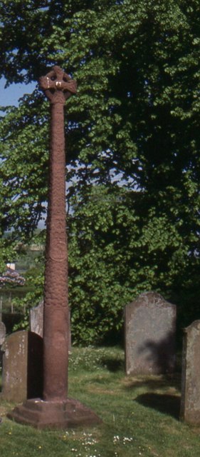
The Gosforth Cross
- Overview About the Gosforth Cross Map Street View The Gosforth Cross is a 10th century high cross standing in the churchyard of St Mary's Church in Gosforth, Cumbria. The carvings …
Co-Curate Page
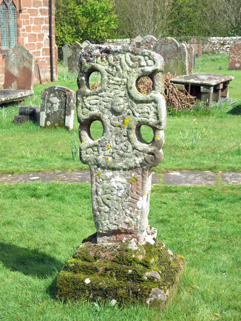
Addingham Cross
- The 'Addingham Cross' is a late 10th or early 11th century Saxon stone cross in the churchyard of St Michael's Church, Glassonby. The cross was originally located in the churchyard …
Co-Curate Page
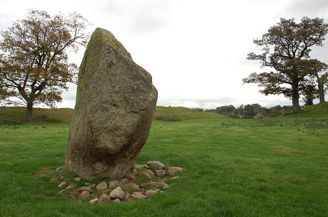
Mayburgh Henge
- Overview About Mayburgh Henge Map Street View Henges are ritual or ceremonial sites which date to the Late Neolithic period (2800-2000 BC). Mayburgh Henge is located close to the confluence …
Co-Curate Page
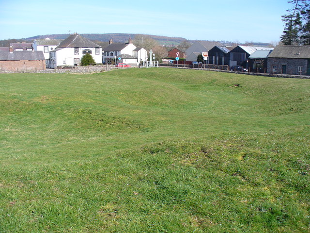
King Arthur's Round Table Henge
- Overview About King Arthur's Round Table Map Street View King Arthur's Round Table Henge is located at the south of the village of Eamont Bridge in Cumbria. It is thought …
Co-Curate Page
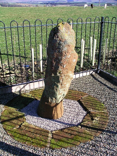
Roman milestone near Spitals Farm
- There is Roman milestone near Spitals Farm, on the side of the old A66 road between the villages of Kirkby Thore and Temple Sowerby in Cumbria. The milestone, carved from red …
Co-Curate Page
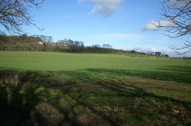
Coxhoe Medieval Settlement
- Overview Map The buried remains of the Medieval village of Coxhoe are located to the south-west of East House Farm, roughly half way between the modern villages of Coxhoe and …
Co-Curate Page
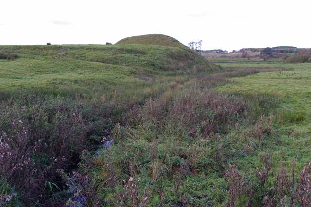
Castle Howe motte and bailey castle
- Overview Map Street View The remains of Castle Howe, a motte and bailey castle, is located by the confluence of Birk Beck with the River Lune, to the west of …
Co-Curate Page
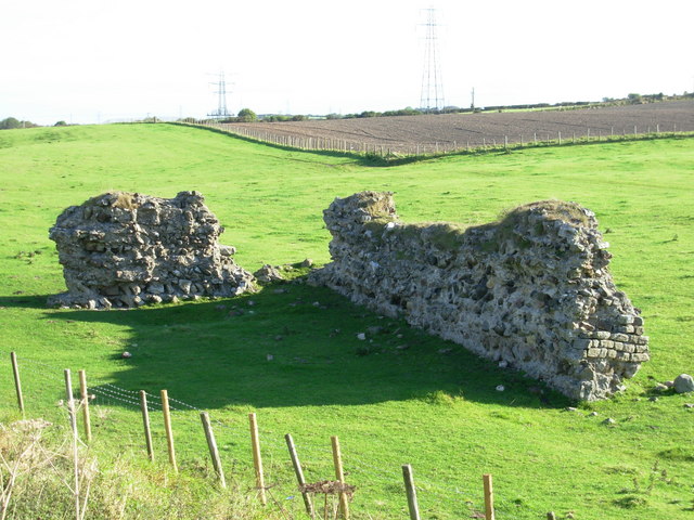
Burrow Walls Roman Fort
- Overview Map Burrow Walls is located between Workington and Seaton in Cumbria. This Scheduled Monument includes the buried remains of a Roman fort and also visible sections of a wall made …
Co-Curate Page
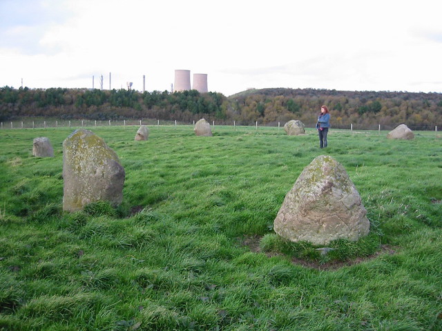
Grey Croft Stone Circle, near Seascale
- Overview About Grey Croft Stone Circle Map Aerial View Grey Croft Stone Circle (aka Greycroft) is located about half a mile north of the village of Seascale. It was originally …

Co-Curate Page
Bolton Leper Hospital
- Overview Map A leper hopital was established in Bolton, Northumberland, in the 13th century. The site covers a large area to the north of the modern village. There are few …
Co-Curate Page
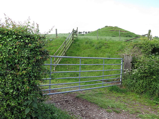
Humbleton Chapel (ruins)
- Overview Map Street View A knoll, known as 'Chapel Hill', is located to the south of Humbleton. This is the reamins of Humbleton Chapel and it's associated burial ground. The earliest …
Co-Curate Page
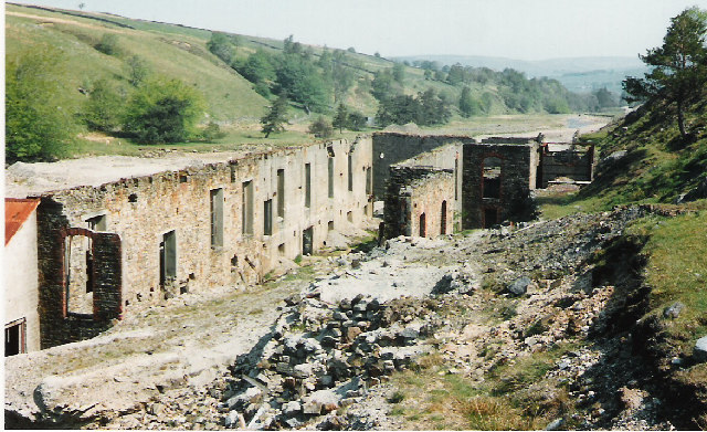
Rotherhope Fell Mine
- Overview Map (area 1) Map (area 2) "...The monument, which is divided into two areas, is situated on the north east side of Rotherhope Fell above Black Burn. It includes …
Co-Curate Page
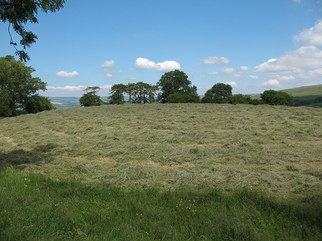
Croglam Castle (Iron Age site)
- Overview Map This is a Scheduled Monument at the south-west of Kirkby Stephen. It includes the earthwork and buried remains of a defended settlement of Iron Age date, situated on …
Co-Curate Page
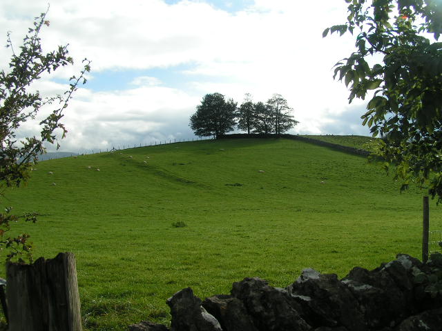
Waitby Castle (Romano-British settlement)
- Overview Map Castle Hill is located about ¼ mile east of the village of Waitby and 1 mile west of Kirkby Stephen. Waitby Castle is an oval-shaped Romano-British hilltop enclosure situated …
Co-Curate Page
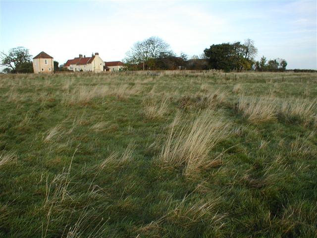
Newsham deserted medieval village
- Newsham (the place name means 'the new dwelling') was a substantial village around the 12th century, but the settlement had been deserted by 1600. The few visible remains would be …
Co-Curate Page
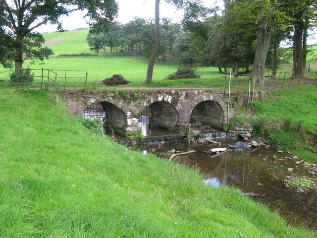
Bow Bridge, near Furness Abbey
- Overview Map Street View Bow Bridge is a 15th Century multi-span bridge over Mill Beck, located about ¼ mile south east of Furness Abbey. It was built by the monks …
Co-Curate Page
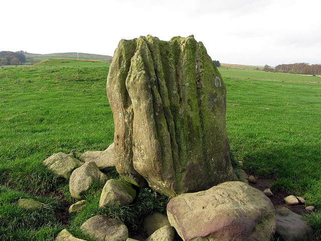
The Poind & His Man
- "The monument includes a standing stone and an adjacent round cairn of Late Neolithic/Early Bronze Age date situated in a prominent position on the top of a small knoll.....The cairn …
Co-Curate Page
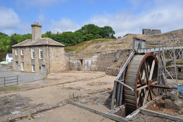
Nenthead Mines
- Overview Map Street View "Nenthead Mines is a historic place at Nenthead, near Alston, in Cumbria, UK. This remote valley is covered by remains from the lead and zinc mining …
Co-Curate Page
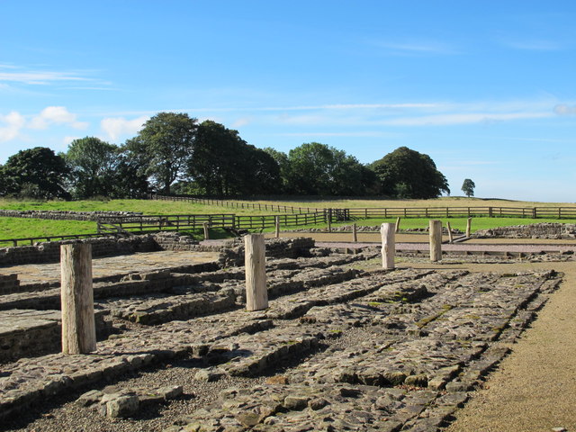
Birdoswald Roman Fort (Banna)
- Overview Map Street View Hadrian's Wall Glossary Birdoswald Roman Fort (known as Banna) is situated on the western part of Hadrian's Wall, about 1 mile west of Gilsland in Cumbria. …
Co-Curate Page
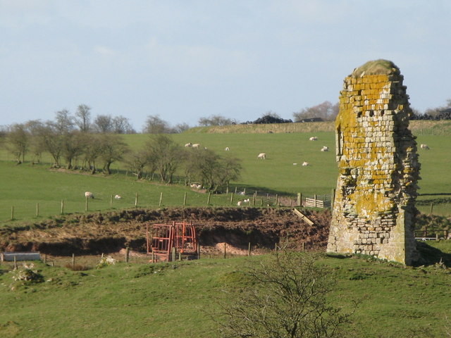
Triermain Castle (remains)
- Overview Map Street View The remains of a medieval enclosure castle are situated immediately to the east of Triermain Farm and stand on a small glacial mound. The castle was …
Co-Curate Page
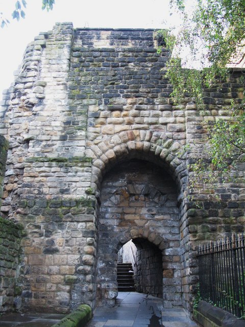
South Postern Tower, Newcastle Castle
- Overview Map Street View The south postern tower, from the outer walls of Newcastle Castle, is located on Castle Garth (road). The tower has a gateway leading on to Castle …
Co-Curate Page
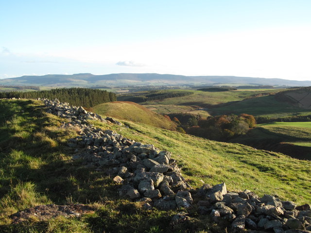
Castle Hill camp, near Alnham
- Overview Map Castle Hill is located about ¼ mile north-east of Old Hazeltonrig and 1½ miles west of the hamlet of Alnham in Northumberland. At the summit of the hill …
Co-Curate Page
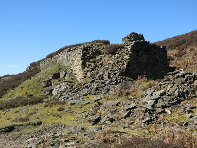
Beldon lead mine and ore works
- Overview Map The remains of Beldon lead mine and ore works are situated on two levels in the valley of Beldon Burn at Beldon Shield. The visible remains of the …
Co-Curate Page
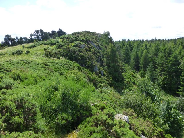
Kyloe Hills promontory fort
- "The monument includes the remains of an Iron Age promontory fort abutting a steep cliff to the south. The promontory fort is visible as a semi-circular enclosure measuring about 109m …

Co-Curate Page
Bastle at Upper Denton
- There is roofless bastle standing two storeys high located at the northern end of the village of Upper Denton. It is constructed of squared coursed rubble with red sandstone dressings. …
Co-Curate Page
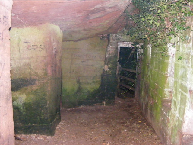
St Constantine's Cells (Wetheral Caves) and rock-cut Roman Graffiti
- Overview Map St Constantine's Cells (aka Wetheral Caves, Wetheral Safeguard, or Constantine's Hermitage) are three chambers cut into the cliff face about 40ft above the River Eden, south of Wetheral. …

Co-Curate Page
The Castles (camp)
- Overview Map 'The Castles' (camp) a large stone-built enclosure, located near West Shipley Farm, Hamsterley, in County Durham. It is believed to be the remains of a fortified site of …
Co-Curate Page
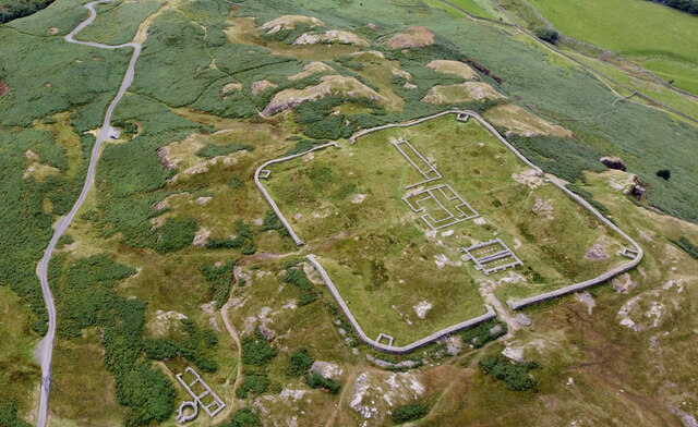
Hardknott Roman Fort
- Overview Map Street View Aerial View The well-preserved remains of Hardknott Roman Fort (Mediobogdum) are located about 5 miles east of the village of Eskdale Green in Cumbria. It was …
Co-Curate Page
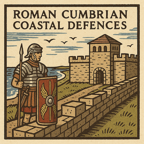
Beckfoot Roman Fort
- The site of Beckfoot Roman Fort (Bibra) is located on the Solway Firth coast, about ½ mile south of the hamlet of Beckford. It formed part of the Roman Cumbrian …
Co-Curate Page
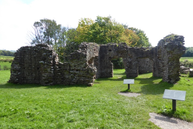
Roman Bath House, Ravenglass
- Overview Map Street View The remains of the bath house of Ravenglass Roman Fort, established around AD 130, are among the tallest Roman structures surviving in northern Britain. The bath …

Co-Curate Page
Roman Tile Kilns, near Birks Coppice
- The site of two Roman tile kilns is located by Birks Coppice in Eskdale, just over 2 miles north-east of Muncaster. The remains of the kilns were first found in …

Co-Curate Page
Ebchester Roman Fort (Vindomora)
- Map of the Vindomora Scheduled Monument area. The site of Vindomora Roman Fort is located in the heart of Ebchester in County Durham. There are no obvious visible remains, however, …


Co-Curate Page
Blyth Battery
- Overview Map Street View Blyth Battery is a Military and Local Heritage museum which is free to visit. The artillery battery was originally built in 1916 to defend the port …

Co-Curate Page
Slate Hill Settlement Earthworks, Bolam
- Overview Map Remains of a defended Iron Age settlement around the top of Slate Hill, just north of Bolam Lake in Northumberland. The ruins are a Sheduled Monument.

Co-Curate Page
The Hurl Stone
- Overview Map Tthe Hurl Stone is a Medieval standing cross located near Newtown and Lilburn Tower in Northumberland. The stone is a Scheduled Monument.

Co-Curate Page
Wooler Tower (remains)
- Overview Map Street View There was a fortified stone tower, built in the early 16th century, on Tower Hill in Wooler. Only 3 large blocks of masonary survive, one near …

Co-Curate Page
Kettles Hillfort, near Wooler
- The Kettles is the earwork remains of an Iron Age and Roman hill fort and settlement near Earle and Wooler in Northumberland.[1] The fort occupies a natural ridge protected on …

Co-Curate Page
Heugh Battery
- Overview About Heugh Battery Map Street View The Heugh Gun Battery was built on the Headland in 1860 to protect the fast growing port of Hartlepool. The Battery guns were …

Co-Curate Page
Hillfort, Yeavering Bell
- The remains of an Iron Age Hillfort are located on Yeavering Bell, a hill near Yeavering and Kirknewton in Northumberland. It was one of the largest known Iron Age hillforts in …

Co-Curate Page
Lime Kilns
- Overview Map Street View The lime kilns at Castle Point on Lindisfarne are amongst the largest and best preserved lime kilns in Northumberland. They have a complex layout compared to …

Co-Curate Page
Lime Kilns, Marsden
- Overview Map Street View Marsden Lime Kilns are located off the Coast Road near Marsden Quarry in South Shields. The massive battery of 15 lime kilns were built in the …

Co-Curate Page
Engine House, Ridsdale Iron Works
- Overview Map Street View The remains of Ridsdale Iron Works are to the north of Ridsdale in Northumberland. Established in 1836, the works consisted of 3 furnaces, an engine house, coke …

Co-Curate Page
Pillbox, near Mitford Castle
- This Second World War pillbox is located near Mitford Castle, 718m south-west of Mitford Bridge. It was built by the Northern Command as part of the River Wansbeck Stop Line …

Co-Curate Page
Pillbox, Adders Haugh
- This Second World War pillbox is located on Adders Haugh, 301m south of Mitford Bridge. It was built by the Northern Command as part of the River Wansbeck Stop Line …

Co-Curate Page
Pillbox near Spittal Hill Farm
- This Second World War pillbox is located near Spittal Hill Farm, 320m north-west of Mitford Bridge. It was built by the Northern Command as part of the River Wansbeck Stop …

Co-Curate Page
Huntcliff Ironstone Mine
- Overview Map Street View Inside Huntcliffe Mine, near the cliffs about 1 mile north-east of Brotton, was opened by Bell Bros., Ltd.in 1871 (nearby Cliff Mines had been opened by …

Co-Curate Page
Castlerigg Stone Circle
- Overview About Castlerigg Stone Circle Map Street View Castlerigg Stone Circle, located just over a mile east of Keswick, is one of the earliest stone circles in the UK, thought …

Co-Curate Page
Swinside Stone Circle
- Overview About Swinside Stone Circle Map Street View Swinside Stone Circle (also known as Sunkenkirk Stone Circle) is a stone circle from either the Neolithic or Bronze Age date, located …

Co-Curate Page
Long Meg and Her Daughters (stone circle)
- Overview About Long Meg and Her Daughters Map Street View Long Meg and Her Daughters is a stone circle in Cumbria, located about half a mile north-east of the village …

Co-Curate Page
Prebends Bridge
- Overview About Prebends Bridge Map Street View Prebends Bridge over the River Wear at Durham was built for the Dean and Chapter of Durham to provide access to Durham Cathedral …

Co-Curate Page
Kirkoswald Castle
- Overview About Kirkoswald Castle Map Street View The ruins of Kirkoswald Castle are located to the south-east of Kirkoswald in Cumbria. A licence to crenellate (fortify) an existing building was granted …

Co-Curate Page
Arbeia - Roman Fort
- Overview About Arbeia Map Street View The fort stood on the Lawe Top in South Shields, overlooking the River Tyne. It was built around 120 AD, guarded the main sea …

Co-Curate Page
Sherburnhouse Bridge
- Overview Map Street View The old Sherburnhouse Bridge, located to the north-west of the hamlet of Sherburn House in County Durham, dates from 1335, with the upper part of the …

Co-Curate Page
Myers Head Lead Mine
- The remains of Myers Head Lead Mine are located by the confluence of Pasture Beck and Hayeswater Gill, south-east of Hartsop in the Eden district of Cumbria.

Co-Curate Page
Coke Ovens at Inkerman Farm
- "The beehive coke ovens are some of the last remaining examples of this type of oven left in County Durham. At one time there were over 100,000 in the County. …

Co-Curate Page
Scots Dyke
- Scots Dyke (aka Scots' dike) is a 3½ mile long earthwork, constructed by the English and the Scots in 1552 to mark the division of the 'Debatable Lands' which had …

Co-Curate Page
Arnside Tower
- Overview About Arnside Tower Map Street View Arnside Tower is a late-medieval tower house located about half a mile south of the village of Arnside and a similar distance north-east …

Co-Curate Page
Learchild Roman fort (Alavna)
- The shallow earthwork remains of a large Roman fort (thought to be 'Alavna') near High Learchild were discovered by arial photography in 1945, and confirmed by subsequent archaeological digs. The fort …

Co-Curate Page
Prehistoric Rock Art in Lemmington Wood
- Deep in Lemmington Woods is a rock with 'cup and rings' carvings, thought to date from the early Bronze Age. The rock is very unusual as it also has later Anglo-Saxon …

Co-Curate Page
Gardner's Houses Prehistoric Settlement
- There is evidence of a prehistoric settlement near Gardener's House Farm, which is located to the north of Dinnington village.

Co-Curate Page
Medieval Bewcastle Cross
- The high cross shaft in the churchyard of St Cuthbert's Church in Bewcastle dates from the 7th century. The Bewcastle Cross is a scheduled monument. The Stone Cross at St …

Co-Curate Page
Brougham Castle
- Overview About Brougham Castle Map Street View Located about a mile south-east of Penrith in Cumbria. Brougham Castle (pronounced /ˈbruːm/) is a medieval building about 2 miles (3.2 km) south-east …

Co-Curate Page
Gloucester Lodge Heavy Anti-Aircraft Battery
- Gloucester Lodge Battery, just south of Blyth, was a Second World War heavy anti-aircraft gun battery and radar site. It is one of only a handful of complete or near …

Co-Curate Page
Stob Stone
- Overview Map Street View Stob Stone is a Bronze Age standing stone, located by the roadside at Standing Stone Farm, about half a mile south of Matfen in Northumberland. The …

Co-Curate Page
Birkrigg Stone Circle
- Overview About Birkrigg Stone Circle Map Street View Birkrigg Stone Circle (also known as the Druid's Circle) is located on Birkrigg Common in Cumbria, located about 2 miles south of …

Co-Curate Page
Low Wood Gunpowder Works
- Overview About Low Wood Gunpowder Works Map Street View The Low Wood Gunpowder Works, located on the east banks of the River Leven at Low Wood, were in operation from …

Co-Curate Page
Backbarrow Ironworks
- Established in 1711. Isaac Wilkinson worked here, he developed a furnace fuelled by charcoal and was one of the first of its kind in the UK.The main products of the …

Co-Curate Page
Hodbarrow Old Lighthouse
- The old lighthouse (aka Hodbarrow Beacon) is located 380m north-west of Hodbarrow Point, to the south of Millom. Built in the 19th Century, it is one of the last surviving …

Co-Curate Page
Percy's Cross (between Powburn & Wooperton)
- This is a 15th century wayside cross, located close to the A697 road between Powburn and Wooperton in Northumberland. The cross commemorates Sir Ralph Percy who was killed near here in …

Co-Curate Page
Site of Iron Age Settlement, Houghton
- Overview Aerial View To the south-west of Houghton in Northumberland, by Broomy Hill, are the remains of an Iron Age defended settlement. The remains are not easily visible as most of the defensive …

Co-Curate Page
Village Cross, Esh
- Overview Map Street View Esh Cross is located in its original position on a raised area at the southern end of the village green in Esh. It is an important …

Co-Curate Page
Neville's Cross (monument)
- Overview Map Street View The remains of the medieval Neville's Cross are located on the north side of Crossgate Peth, opposite St John's Church in the Nevil's Cross area of …

Co-Curate Page
Tynemouth Priory and Castle
- Overview History Aerial View Street View Tynemouth Castle is located on a rocky headland (known as Pen Bal Crag) at Tynemouth, overlooking Tynemouth Pier and the mouth of the River …

Co-Curate Page
Shap Abbey (ruins)
- Overview About Shap Abbey Map Street View Shap Abbey is located about 1½ miles west of the village of Shap in Cumbria. The Abbey was founded in c.1200 by local …

Co-Curate Page
Casterton Stone Circle
- Overview Map An embanked circle of 17 relatively small stones, probably dating from the Bronze Age. The stone circle is located near Langthwaite Gill Plantation and about 1 mile east …

Co-Curate Page
The Gosforth Cross
- Overview About the Gosforth Cross Map Street View The Gosforth Cross is a 10th century high cross standing in the churchyard of St Mary's Church in Gosforth, Cumbria. The carvings …

Co-Curate Page
Addingham Cross
- The 'Addingham Cross' is a late 10th or early 11th century Saxon stone cross in the churchyard of St Michael's Church, Glassonby. The cross was originally located in the churchyard …

Co-Curate Page
Mayburgh Henge
- Overview About Mayburgh Henge Map Street View Henges are ritual or ceremonial sites which date to the Late Neolithic period (2800-2000 BC). Mayburgh Henge is located close to the confluence …

Co-Curate Page
King Arthur's Round Table Henge
- Overview About King Arthur's Round Table Map Street View King Arthur's Round Table Henge is located at the south of the village of Eamont Bridge in Cumbria. It is thought …

Co-Curate Page
Roman milestone near Spitals Farm
- There is Roman milestone near Spitals Farm, on the side of the old A66 road between the villages of Kirkby Thore and Temple Sowerby in Cumbria. The milestone, carved from red …

Co-Curate Page
Coxhoe Medieval Settlement
- Overview Map The buried remains of the Medieval village of Coxhoe are located to the south-west of East House Farm, roughly half way between the modern villages of Coxhoe and …

Co-Curate Page
Castle Howe motte and bailey castle
- Overview Map Street View The remains of Castle Howe, a motte and bailey castle, is located by the confluence of Birk Beck with the River Lune, to the west of …

Co-Curate Page
Burrow Walls Roman Fort
- Overview Map Burrow Walls is located between Workington and Seaton in Cumbria. This Scheduled Monument includes the buried remains of a Roman fort and also visible sections of a wall made …

Co-Curate Page
Grey Croft Stone Circle, near Seascale
- Overview About Grey Croft Stone Circle Map Aerial View Grey Croft Stone Circle (aka Greycroft) is located about half a mile north of the village of Seascale. It was originally …

Co-Curate Page
Bolton Leper Hospital
- Overview Map A leper hopital was established in Bolton, Northumberland, in the 13th century. The site covers a large area to the north of the modern village. There are few …

Co-Curate Page
Humbleton Chapel (ruins)
- Overview Map Street View A knoll, known as 'Chapel Hill', is located to the south of Humbleton. This is the reamins of Humbleton Chapel and it's associated burial ground. The earliest …

Co-Curate Page
Rotherhope Fell Mine
- Overview Map (area 1) Map (area 2) "...The monument, which is divided into two areas, is situated on the north east side of Rotherhope Fell above Black Burn. It includes …

Co-Curate Page
Croglam Castle (Iron Age site)
- Overview Map This is a Scheduled Monument at the south-west of Kirkby Stephen. It includes the earthwork and buried remains of a defended settlement of Iron Age date, situated on …

Co-Curate Page
Waitby Castle (Romano-British settlement)
- Overview Map Castle Hill is located about ¼ mile east of the village of Waitby and 1 mile west of Kirkby Stephen. Waitby Castle is an oval-shaped Romano-British hilltop enclosure situated …

Co-Curate Page
Newsham deserted medieval village
- Newsham (the place name means 'the new dwelling') was a substantial village around the 12th century, but the settlement had been deserted by 1600. The few visible remains would be …

Co-Curate Page
Bow Bridge, near Furness Abbey
- Overview Map Street View Bow Bridge is a 15th Century multi-span bridge over Mill Beck, located about ¼ mile south east of Furness Abbey. It was built by the monks …

Co-Curate Page
The Poind & His Man
- "The monument includes a standing stone and an adjacent round cairn of Late Neolithic/Early Bronze Age date situated in a prominent position on the top of a small knoll.....The cairn …

Co-Curate Page
Nenthead Mines
- Overview Map Street View "Nenthead Mines is a historic place at Nenthead, near Alston, in Cumbria, UK. This remote valley is covered by remains from the lead and zinc mining …

Co-Curate Page
Birdoswald Roman Fort (Banna)
- Overview Map Street View Hadrian's Wall Glossary Birdoswald Roman Fort (known as Banna) is situated on the western part of Hadrian's Wall, about 1 mile west of Gilsland in Cumbria. …

Co-Curate Page
Triermain Castle (remains)
- Overview Map Street View The remains of a medieval enclosure castle are situated immediately to the east of Triermain Farm and stand on a small glacial mound. The castle was …

Co-Curate Page
South Postern Tower, Newcastle Castle
- Overview Map Street View The south postern tower, from the outer walls of Newcastle Castle, is located on Castle Garth (road). The tower has a gateway leading on to Castle …

Co-Curate Page
Castle Hill camp, near Alnham
- Overview Map Castle Hill is located about ¼ mile north-east of Old Hazeltonrig and 1½ miles west of the hamlet of Alnham in Northumberland. At the summit of the hill …

Co-Curate Page
Beldon lead mine and ore works
- Overview Map The remains of Beldon lead mine and ore works are situated on two levels in the valley of Beldon Burn at Beldon Shield. The visible remains of the …

Co-Curate Page
Kyloe Hills promontory fort
- "The monument includes the remains of an Iron Age promontory fort abutting a steep cliff to the south. The promontory fort is visible as a semi-circular enclosure measuring about 109m …

Co-Curate Page
Bastle at Upper Denton
- There is roofless bastle standing two storeys high located at the northern end of the village of Upper Denton. It is constructed of squared coursed rubble with red sandstone dressings. …

Co-Curate Page
St Constantine's Cells (Wetheral Caves) and rock-cut Roman Graffiti
- Overview Map St Constantine's Cells (aka Wetheral Caves, Wetheral Safeguard, or Constantine's Hermitage) are three chambers cut into the cliff face about 40ft above the River Eden, south of Wetheral. …

Co-Curate Page
The Castles (camp)
- Overview Map 'The Castles' (camp) a large stone-built enclosure, located near West Shipley Farm, Hamsterley, in County Durham. It is believed to be the remains of a fortified site of …

Co-Curate Page
Hardknott Roman Fort
- Overview Map Street View Aerial View The well-preserved remains of Hardknott Roman Fort (Mediobogdum) are located about 5 miles east of the village of Eskdale Green in Cumbria. It was …

Co-Curate Page
Beckfoot Roman Fort
- The site of Beckfoot Roman Fort (Bibra) is located on the Solway Firth coast, about ½ mile south of the hamlet of Beckford. It formed part of the Roman Cumbrian …

Co-Curate Page
Roman Bath House, Ravenglass
- Overview Map Street View The remains of the bath house of Ravenglass Roman Fort, established around AD 130, are among the tallest Roman structures surviving in northern Britain. The bath …

Co-Curate Page
Roman Tile Kilns, near Birks Coppice
- The site of two Roman tile kilns is located by Birks Coppice in Eskdale, just over 2 miles north-east of Muncaster. The remains of the kilns were first found in …

