Topics > Northumberland > Yeavering > Hillfort, Yeavering Bell
Hillfort, Yeavering Bell
Aerial view of Yeavering Bell hillfort on Google Maps. The walls (originally 2+m high, now collapsed with a spread of 8-9m) are clearly visible.
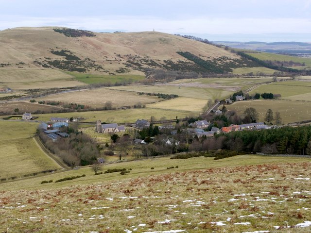
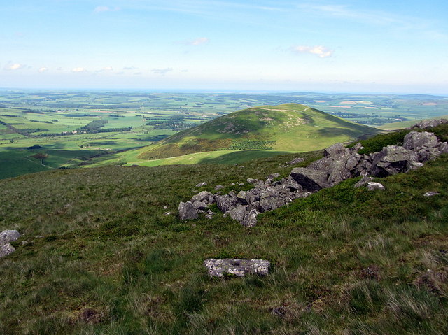
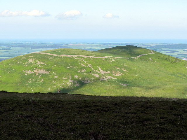
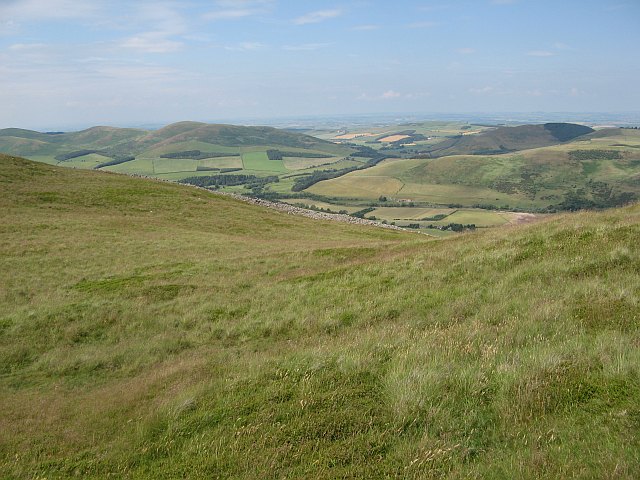
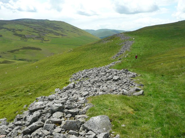
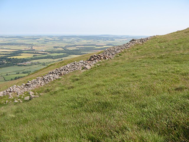
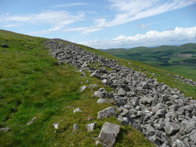
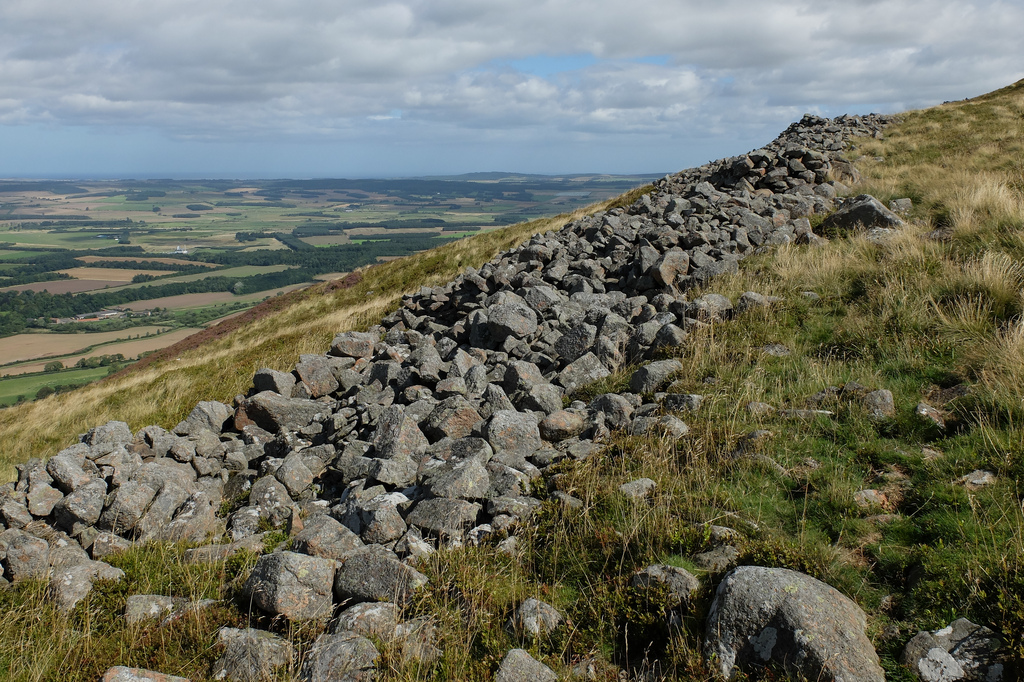
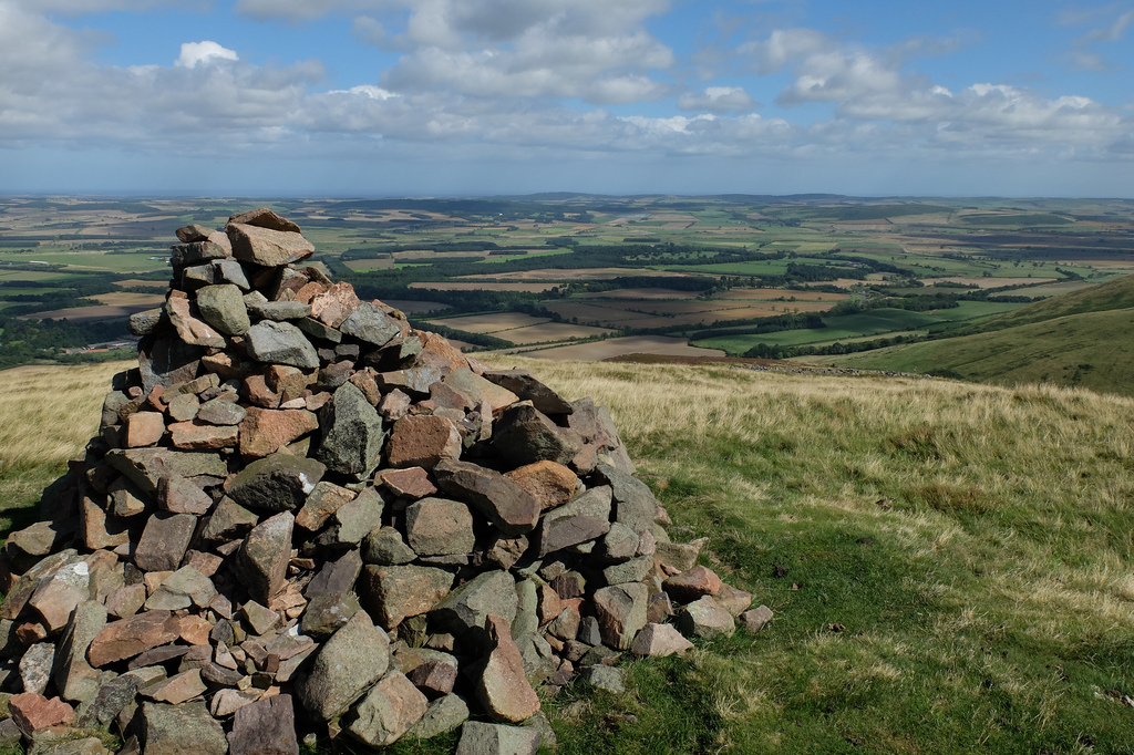
The remains of a large Iron Age Hillfort are located on Yeavering Bell, a hill near Yeavering and Kirknewton in Northumberland. It was one of the largest known Iron Age hillforts in Britain, surrounded by a large oval enclosure of huge rough stones, with an inner enclosure surrounded by a defensive ditch. Over 100 hut circles have been found in the outer enclosure. It's scale suggests that it was an important tribal capital; there were also settlements on the sout and north slopes of the hill. The discovery of Roman pottery and coins on the site suggest that the fort was still being used after the Iron Age.[1] The hillfort is a Scheduled Monument (legally protected).

LIDAR - Image from opendata.hillforts.eu (CC-BY-SA), based on data from the Environment Agency - National LIDAR programme
Yeavering Bell Camp, Northumberland (#EN0468)
Click the headings below to expand (selected extracts from the Atlas of Hillforts of Britain and Ireland)
To the SE of KIrknewton in the Cheviot Hills, a large univallate stone-built hillfort, oval in form, with an internal area of 5.6ha.The site lies on the twin-peaked hill of Yeavering Bell at 355m OD, overlooking the River Glen. It is the largest hillfort in Northumberland and is conjectured to have been a tribal capital. A substantial, but now collapsed wall of rough stones encloses the summit of the hill. Excavation (Tate 1862) showed the wall was originally 3-3.5m thick, with a probable height of 2-2.5m which has now collapsed with a spread of 8-9m. There is some evidence that the bank was faced externally with a drystone wall. No ditch is evident. External crescent-shaped banks 102m long in the E and 130m long in the W, may represent an earlier line of defence, abandoned when the main enclosure was constructed. Stone walled shelters adjacent to and within the fort and gaps in the rampart are probably medieval or post medieval. There are four breaks within the enclosure wall with the slightly in-turned entrance in the S considered to be the only original entrance. In the region of 125 timber built roundhouse platforms have been identified within the interior, with further sub-surface features expected to survive. The stone for the walling was probably sourced from the hill as suggested by quarry hollows within the interior. A natural, but artificially levelled mound at the eastern summit of the hillfort with an encircling rock cut ditch enclosing 1.9ha has been shown to cut through roundhouse platforms (Oswald and Pearson, 2005) confirming it to be a later feature. Within it a mound of reddened stones has been interpreted by investigators variously as a beacon or cairn. The hillfort has seen a number of investigations, the earliest in the 19th century (Tate 1862) when a quernstone, jasper ball of around 7.5cm diameter, charred wood, coarse pottery, unworked flints and polished oak rings described as armlets were recovered. An excavation in 1958 (Hope-Taylor 1977) investigated the N side of the eastern summit as well as the southern entrance and what was considered at the time to be the northern entrance. A plan was published by Jobey in 1965 and description in 1966 and further surveys were carried out by RCHME in 1986 and 1998 including a geophysical survey. The main phase of the hillfort is thought to date to the third century BC, with possible short-lived or transitory Roman activity. The site is shown on Armstrong's map of Northumberland 1769 and recorded on 1882-1900 1st edition OS mapping
Source: Lock, Gary and Ralston, Ian. 2024. Atlas of Hillforts of Britain and Ireland. Available at: https://hillforts.arch.ox.ac.uk (CC BY-SA 4.0)

from https://keystothepast.info/se…
Yeavering Bell (Kirknewton)
- "These are the remains of the important hillfort on top of Yeavering Bell. It is surrounded by a large oval enclosure of huge rough stones formed into a rampart. Near …
Added by
Simon Cotterill

from https://hillforts.arch.ox.ac.…
EN0468 Yeavering Bell Camp, Northumberland
- ....A large univallate contour fort situated at 355m OD enclosing the twin summits of Yeavering Bell. The name 'Yeavering' derives from Gefrin 'the hill of the goats'.
...The form of …
Added by
Simon Cotterill

from https://keystothepast.info/se…
Yeavering Bell (Kirknewton)
- "These are the remains of the important hillfort on top of Yeavering Bell. It is surrounded by a large oval enclosure of huge rough stones formed into a rampart. Near …
Added by
Simon Cotterill
from https://hillforts.arch.ox.ac.…
EN0468 Yeavering Bell Camp, Northumberland
- ....A large univallate contour fort situated at 355m OD enclosing the twin summits of Yeavering Bell. The name 'Yeavering' derives from Gefrin 'the hill of the goats'.
...The form of …
Added by
Simon Cotterill