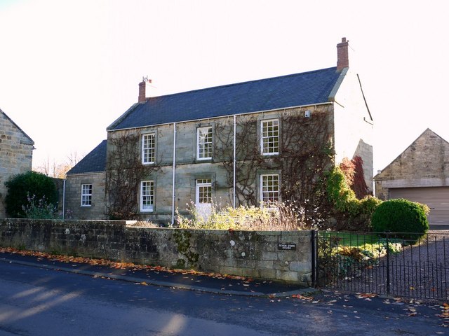
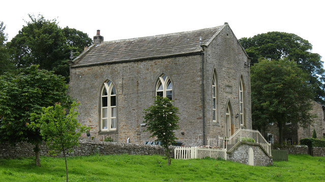
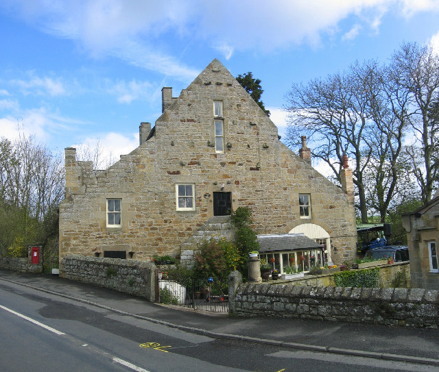
Topics > Landmarks, Parks and Buildings > Buildings > Private Residence
Private Residence
A private residence - generally not somewhere you can visit and go inside! The building may have been added to this Website because of it being a Listed Building or having local or historical interest. This tag has been added to remind everyone to respect the privacy of the residents and to make it clear that it is not somewhere you can routinely visit (some larger properties do have occasional open days).
Co-Curate Page
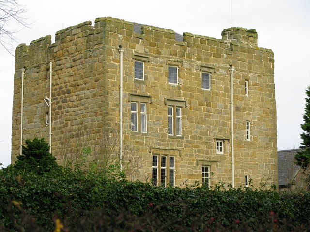
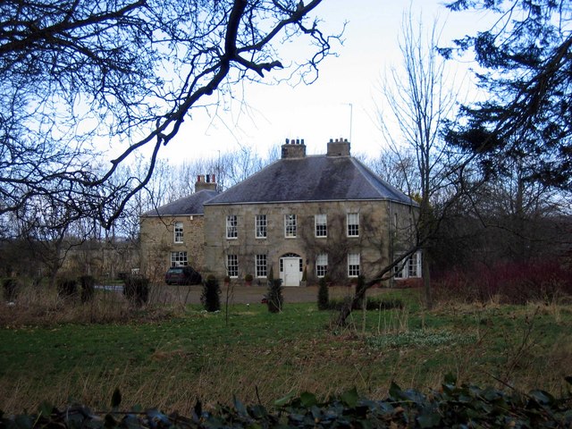
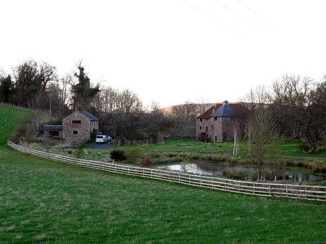
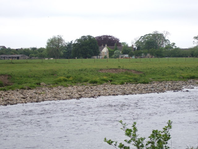
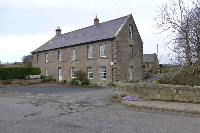
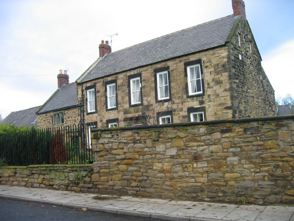
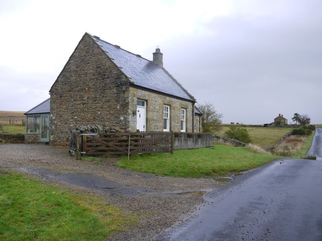
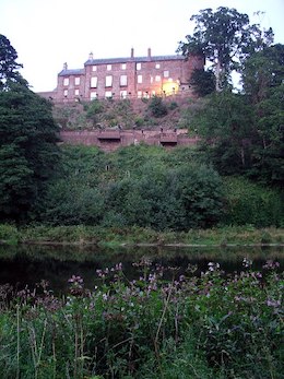
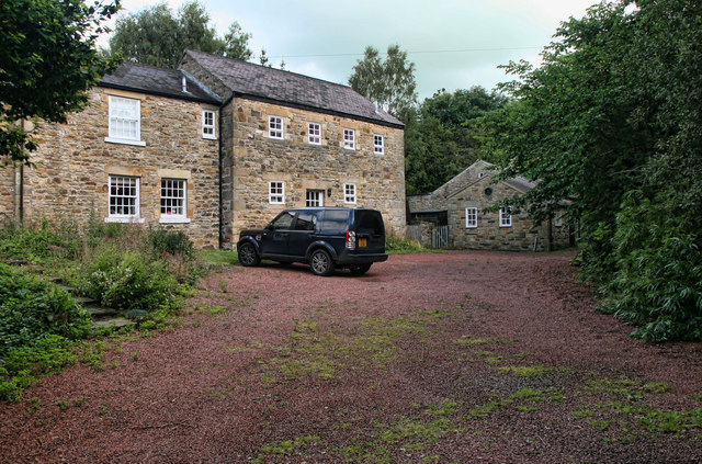
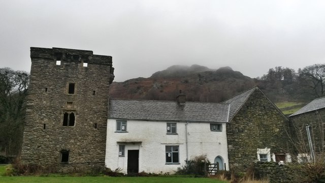
Horsley Tower
- Overview Street View The fortified towerhouse in Longhorsley was built by the Horsley family in the 16th century at a time when there were frequent boarder raids and hostilities with …

Co-Curate Page
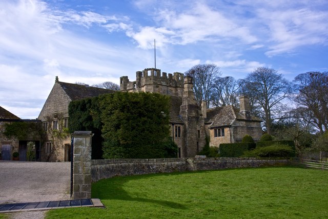
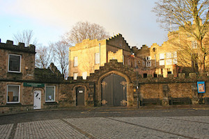
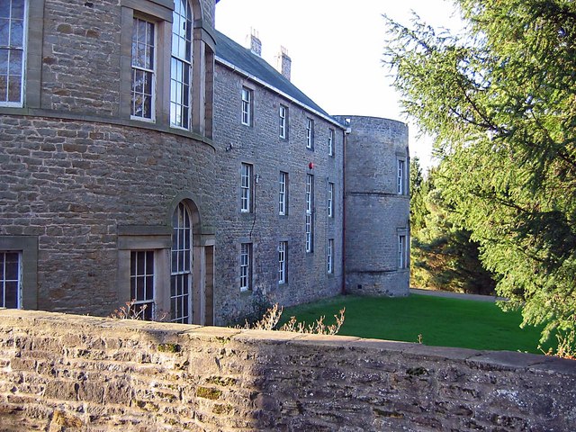
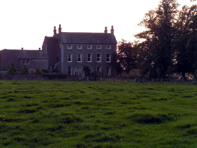
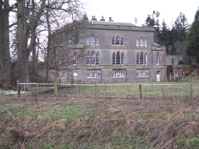
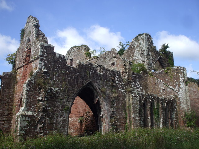
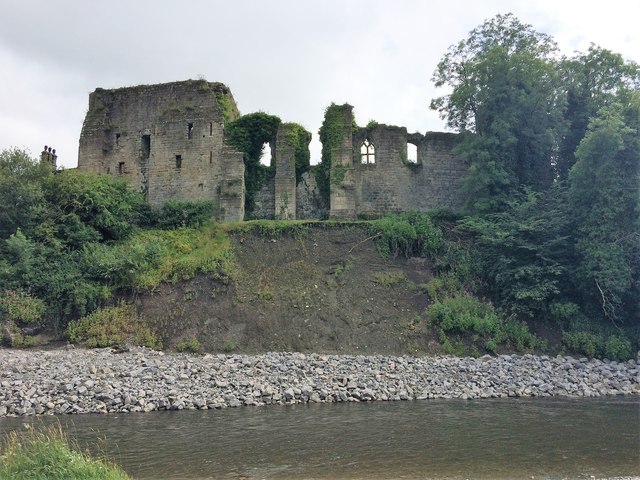
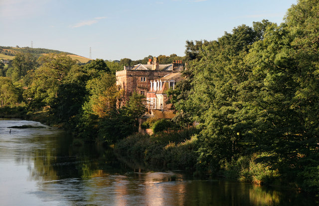
Blenkinsopp Castle
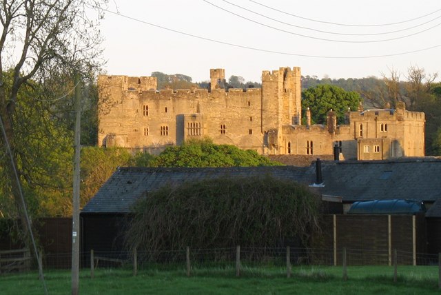
- Overview About Blenkinsopp Castle Map Blenkinsopp Castle is a fire-damaged, partly demolished 19th-century country mansion, incorporating the ruinous remains of a 14th-century tower house, which is located above the …
Co-Curate Page
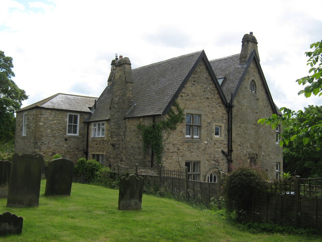
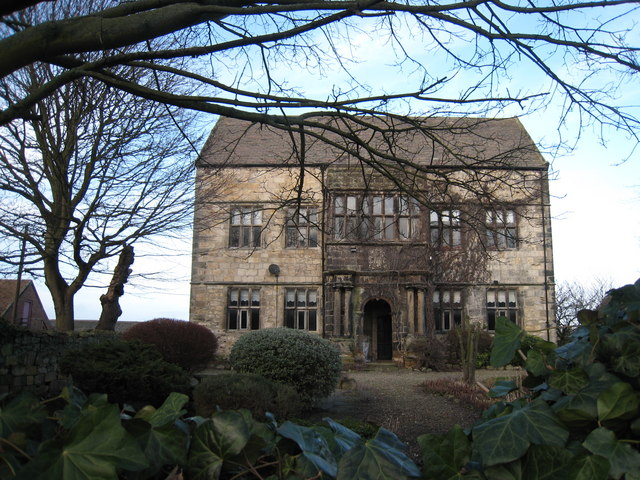
Mortham Tower
- Mortham Tower, near Greta Bridge, is a Grade I listed fortified courtyard house and pele tower which dates from the reign of King Henry VII (1485-1509). The estate was the …
Co-Curate Page
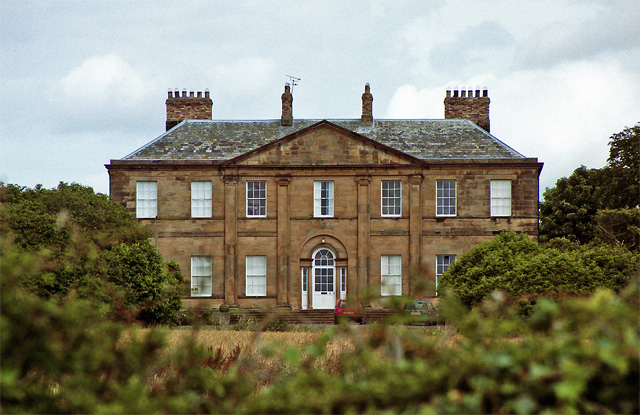
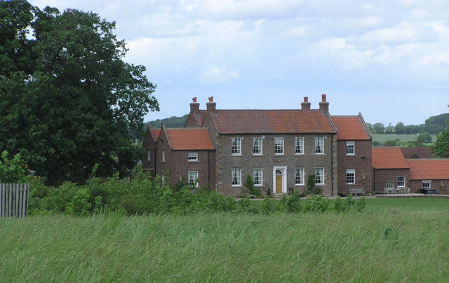
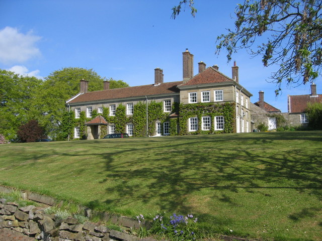
Etal Manor
- Overview Map A large country house in Etal, Northumberland, built in 1748. It was extended in 1767 for William Carr, and again in 1888 for James Laing. The Manor is …
Co-Curate Page
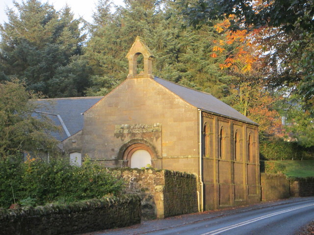
Old Vicarage
- Overview Map Street View The former Vicarage and pele tower, is located next to the Church of the Holy Trinity in Embleton. In 1332 Merton College, patron of Embleton, agreed to …
Co-Curate Page
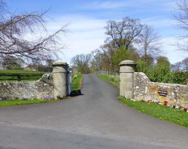
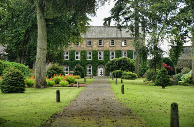
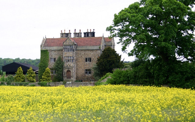
Bolam Hall
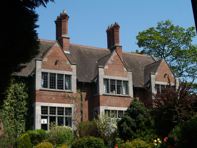
- Overview Map Bolam Hall was built in 1810 for Robert Horsley for his daughter Charlotte Philadelphia on her marriage to John Beresford, the Baron Decies. In 1816 John Dobson was …
Co-Curate Page
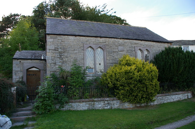
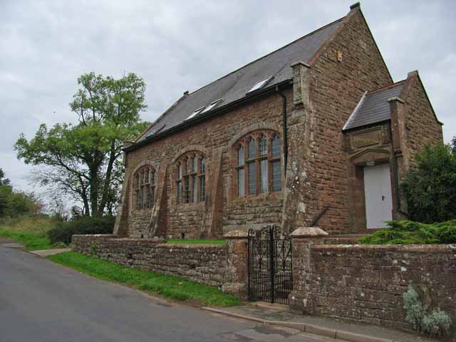
Leamside Chapel
- Overview Map Street View The former Primitive Methodist Chapel on Station Road in Leamside was built in 1867. The Chapel closed in 1973 and later sold for use by the scouting …

Co-Curate Page
Former Ebenezer Chapel
- Map Street View "John Wesley himself is believed to have twice preached to the miners of West Rainton in April 1747. Services were held in the homes of members until …
Co-Curate Page
Roberts Battery
- Robert's Battery at Old Hartley was a defensive site dating from the First World War. When a battleship which had been permanently based on the river Tyne was redeployed in …
Co-Curate Page
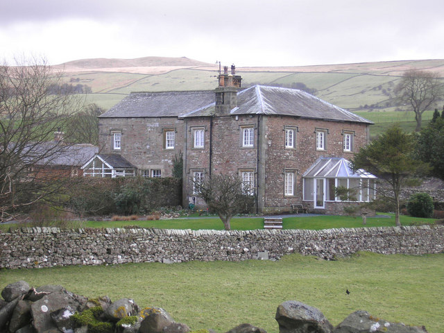
Thornton Hall
- Thornton Hall is a 16th century Manor House (now a farmhouse) located within the Civil Parish of High Coniscliffe in County Durham. It lies off the B6279 road near Ulnaby. The …
Co-Curate Page
Old Vicarage, High Coniscliffe
- Overview Map The former Vicarage of St Edwin's Church in High Coniscliffe dates from the 18th century, with the main building built c.1860. It is now private house and is …
Co-Curate Page
Mill House, High Coniscliffe
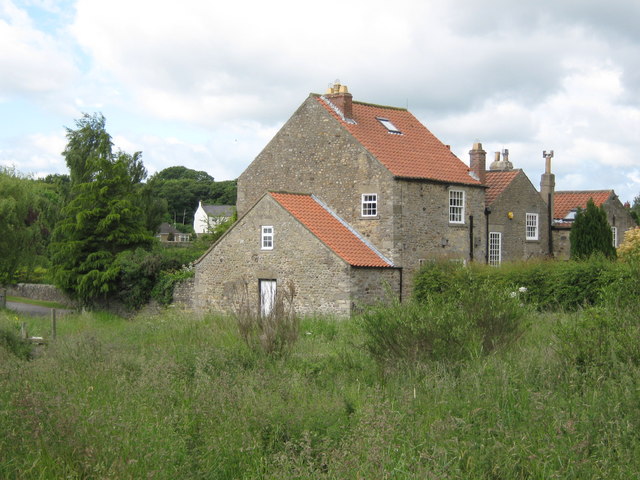
- Overview Map The former water mill by Unalby Beck on Mill Lane in High Coniscliffe was built in the late 18th and early 19th century. Now a house, this is …
Co-Curate Page
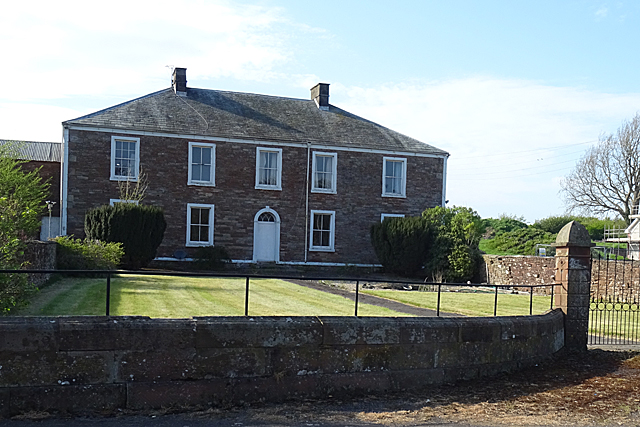
Ormesby House, Church Lane
- The former home of Lady Caroline Brown, on Church Lane in Ormesby. The Elizabethan style mansion was built in 1904 and is located close to Ormesby Hall and St Cuthbert's …
Co-Curate Page
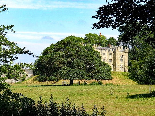
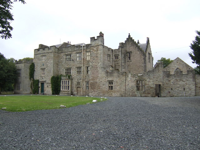
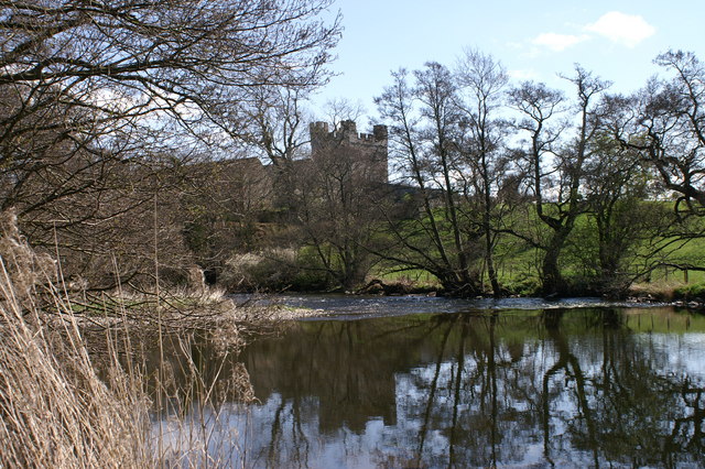
Haughton Castle
- Overview About Haughton Castle Map Haughton Castle is a privately owned country house in Northumberland located a mile north of Humshaugh and on the south side of the River North …
Co-Curate Page
Wester Hall
- Overview Map Wester Hall in Haughton, near Humshaugh, was built in 1732. The Hall is Grade II listed on the National Heritage List for England.
Co-Curate Page
Former School, Carrshield
- Overview Map Street View A former school for miners’ children was built in Carrshield in 1851, paid for by WB Beaumont. The boys school was in the right-hand of the …
Co-Curate Page
Bastle House, Cambo
- Overview Street View A 16th century bassle house in Cambo, Northumberland. In 1818 it was converted into shop and still has a lintel above the former shop window inscribed "J.T. …
Co-Curate Page
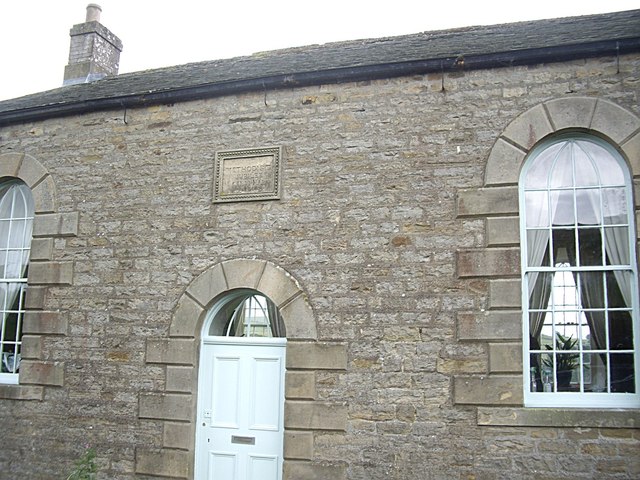
Pele Tower, Shilbottle
- Overview Map Street View This former vicarage in Shilbottle incorporates a 15th century pele tower. The tower was heightened in 1863. The main part of the house, and outbuildings, were …
Co-Curate Page
Surrey House, Haugh Head
- Overview Map Surrey House in Haugh Head lis located beside the A697 road about a mile from Wooler. It was was built in the mid-19th century. The building is a former coaching …
Co-Curate Page
Earle Mill Cottage
- Overview Map The cottage by Earle Mill dates from the 18th century and is Grade II listed on the National Heritage List for England. The cottage is close to Wooler …
Co-Curate Page
Earle Mill
- Overview Map Earle Mill is a watermill located by Wooler Water. It was built in the 18th century and has a distinctive 19th century drying kiln attached. It is aproximately …
Co-Curate Page
Horden Hall
- Overview Map Street View Horden Hall is a manor house built in the mid 17th century located at the north end of Horden in County Durham. The building is thought …
Co-Curate Page
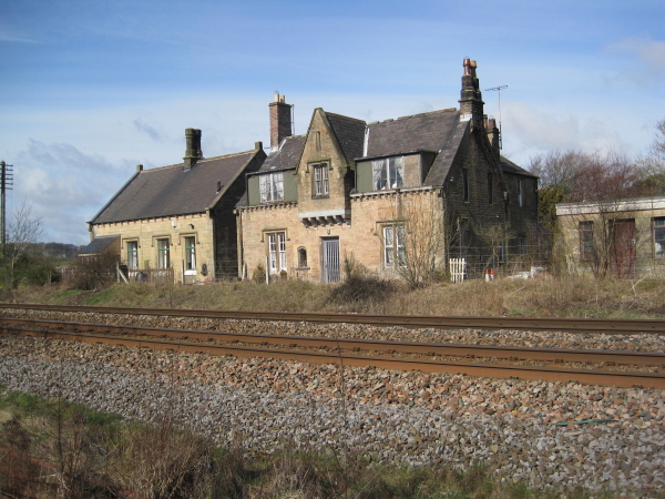
Former Station Building
- Overview Map Street View The former station building in Wolsingham is Grade II listed on the National Heritage List for England. It was built in 1847 for the for the Wear …
Co-Curate Page
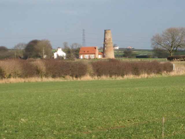
Elwick Windmill
- Overview Map Street View Elwick Windmill was built in the mid 19th century and is located about half a mile south west of Elwick, and is visible from the A19 …
Co-Curate Page
Fatfield House
- Overview Map Street View A 19th century house on Vigo Lane in Harraton - which had been in Fatfield before the boundaries changed with the creation of Washingon new town. …
Co-Curate Page
Longhirst Hall
- Overview Map Street View Longhirst Hall near Morpeth in Northumberland was built in 1824. It was designed by John Dobson for the land owner, William Lawson, who became wealthy from …
Co-Curate Page
Hebburn Hall
- Overview About Hebburn Hall Map Hebburn Hall (aslo known as Ellison Hall) is a 17th century manor house in Hebburn, largely rebuilt in 1790-1792.[1] It was built on the site …
Co-Curate Page
Allenheads Hall
- Overview Map Allenshead Hall is a country house, built in 1847 by E.B. Lamb for Thomas Sopwith, engineer and mine agent to the Beaumont family. Some sources indicate it was …
Co-Curate Page
Methodist Chapel, Sinderhope
- Overview Map Street View Now converted for a private residence, the Primitive Methodist Jubilee Chapel in Sinderhope was built in 1860. It is Grade II listed on the National Heritage …
Co-Curate Page
Callerton Hall
- Overview Map Street Callerton Hall is located in High Callerton, Ponteland. It was built in the early 18th century, and extensively altered in 1892 by R. Norman Shaw.[1] The hall …
Co-Curate Page
Hilton Hall
- Overview Map Street View Hilton Hall is a house in Hilton Village in County Durham. The bulk of the house dates from the 16th century, with 17th and 18th century …
Co-Curate Page
Barforth Hall
- Overview Map Barforth Hall is a farmhouse which was once the manor house of Barforth. The Barforth estate came into the possession of the Pudsey family during the reign of Edward …
Co-Curate Page
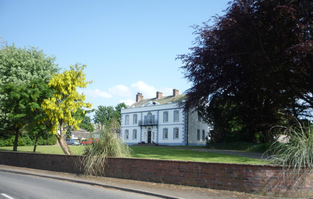
Croxdale Hall
- Overview About Croxdale Hall Map Croxdale Hall is a privately owned country mansion located about half a mile north of the modern village Croxdale in County Durham. The Hall has …
Co-Curate Page
Tuggal Hall
- Overview Map Street View Tuggal Hall is a large country house located in Tughall, near Beadnell, in Northumberland. The house dates from the 17th/early 18th century and is Grade II …
Co-Curate Page
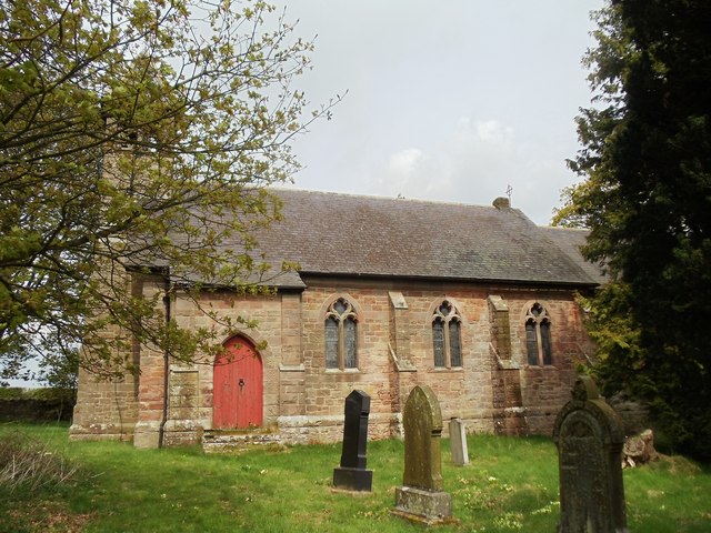
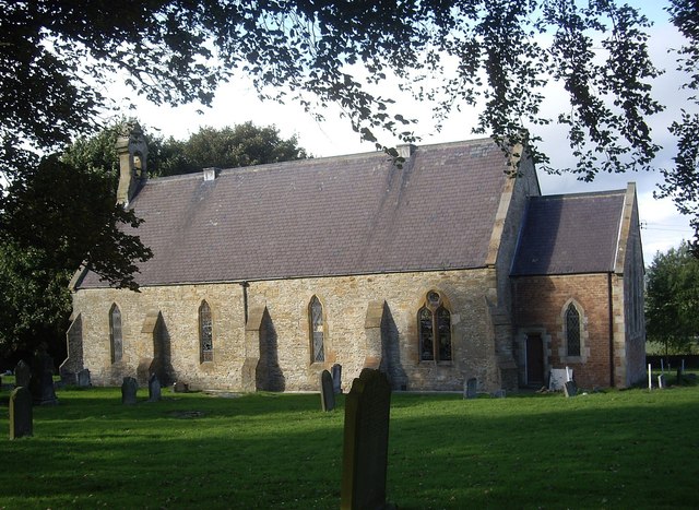
Former Church of All Saints, Duddo
- Overview Map Street View The former Parish Church of Duddo is located approximately half a mile north-west of the village. It was built in 1879 by F.R. Wilson of Alnwick.[1] The …
Co-Curate Page
Twizell North Lodge
- Overview Map Street View Lodge by the north entrance to the estate of the Twizell House. Built in the mid 19th century, the lodge is Grade II listed on the …
Co-Curate Page
Tow House Bastle
- There is a 16th century bastle (fortified tower house) in Tow House, near Henshaw, built at a time of hostilities with Scotland and frequent border raids. The building has altered …
Co-Curate Page
The Hermitage
- Overview Map Street View The 'Hermitage' is a large mid 17th century house, with c1930 alterations and additions. The Hermitage is Grade II listed on the National Heritage List for …
Co-Curate Page
Former Church of St John the Baptist, Quebec
- Overview Map Street View Former Parish Church of St John the Baptist - now a private dwelling. The church was built in 1875 and located next to the former school‐house …
Co-Curate Page
Bridge Mill, Haggerston
- Overview Map Street View Bridge Mill is a former water mill located by Allerdalemill Burn, just north-west of Haggerston, and about a mile and a half south-east of Ancroft. The …
Co-Curate Page
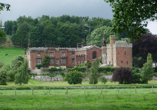
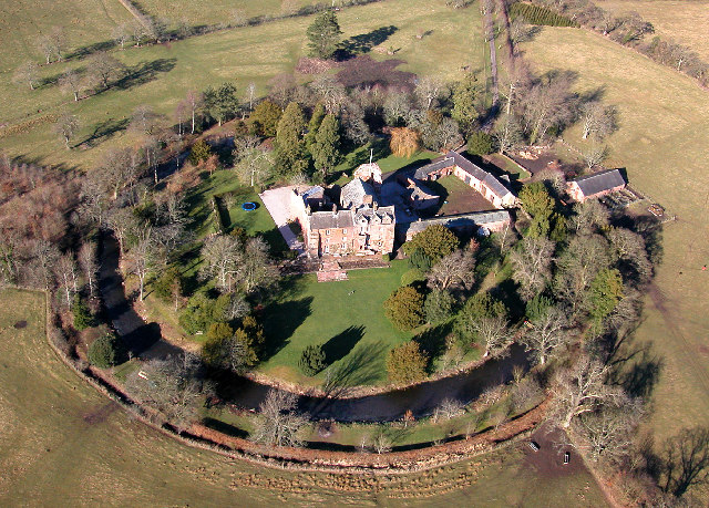
Beaufront Castle
- Overview About Beaufront Castle Map Aerial View Beaufront Castle is an extensive privately owned country house, located about a mile and a half north-east of Hexham, situated between the villages …
Co-Curate Page
Wooperton Hall
- Overview Map Street View Wooperton House was built in c.1840 and is located in the hamlet of Wooperton in Northumberland, located about 5 miles south of Wooler. Sometimes also referred to …
Co-Curate Page
Urpeth Hall
- Overview Map Street View Urpeth Hall in High Urpeth was built in the mid 18th century, with the addition of flanking and rear wings in the late 19th century. The …

Co-Curate Page
Old Primitive Methodist Chapel, Lanehead
- Overview Map Street View There is a former Primitive Methodist chapel on School Hill in Lanehead, now converted into a house. The church was built in 1858, and replaced a …
Co-Curate Page
Sledwhich Hall
- Sledwich Hall is a large manor house located about half a mile west of Whorlton in County Durham. The Hall dates from the late 16th century, with restoration work done …
Co-Curate Page
Bede Cottage
- Overview Map Street View Bede Cottage and Bede House are adjoining houses located on Monkton Lane in Monkton. They date from the early or mid 17th century and are Grade …
Co-Curate Page
Bavington Hall
- Overview About Bavington Hall Map Street View Bavington Hall is a 17th-century privately owned country house at Little Bavington in Northumberland. It is Grade II* listed on the National …
Co-Curate Page
Former Station, Gilsland
- Overview Map Street View The railway station at Gilsland opened on the 9th July 1836 as Rose Hill (renamed Gilsland in 1869). It was built by the Newcastle and Carlisle …
Co-Curate Page
Croxdale Wood House
- Overview Map Croxdale Wood House is an 18th century farmhouse located by Croxdale Woods, about a mile north-east of Sunderland Bridge and Croxdale. It was extended in the mid 19th …
Co-Curate Page
Tursdale House Farm
- Overview Map Tursdale House, was the manor house of the medieval village of Tursdale in the 12th century.[1] The current building at Tursdale House Farm dates from the 17th century, with …
Co-Curate Page
Tudhoe Old Hall
- Overview Map Street View Tudhoe Hall, off the village green in Tudhoe, dates from the early 17th century, probably incorporating the fabric of an earlier building. The building was altered …
Co-Curate Page
Shoreswood Hall
- Overview Map Street View Shoreswood Hall was built in the early 18th century. It is a Gtade II listed building.
Co-Curate Page
Shoreswood National School
- Overview Map Street View The former Shoreswood National School was built c.1836 for 70 pupils. The school closed in 1962 and it's 17 pupils were transferred to a new county …
Co-Curate Page
Seven Stars House
- Overview Map Street View Seven Stars House in Whalton was built in the late 18th century as a coaching inn. It became a private house c.1945. The house is Grade …
Co-Curate Page
Former Wesleyan Methodist Chapel
- Overview Map Street View The Wesleyan Methodist Chapel in Barningham is dated 1815 and was converted to a residential house in c.1980. "The building is said to have been a …
Co-Curate Page
Old School House, Hartburn
- Overview Map Street View The Old School House in Hartburn was built in 1762 by Dr. John Sharpe, vicar of Hartburn. It was also used as the 'Parish Stable' (hearse house).[1] Now …
Co-Curate Page
Former Fox and Hounds Inn
- The former Fox and Hounds Inn in Whitley Chapel dates from the 18th century and is Grade II listed on the National Heritage List for England.[1] It is now a private …
Co-Curate Page
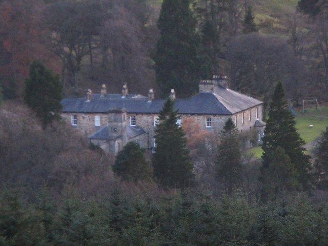
Hesleyside Hall
- Overview About Hesleyside Hall Map Hesleyside Hall is a large country house, located about a mile and a half north-west of Bellingham in Northumberland. It was built in 1719 on or …
Co-Curate Page
Warnell Hall, nr Sebergham
- Overview Map Street View Warnell Hall, is a large farmhouse to the south-west of Sebergham, It was built as a fortified house, dated 1683, and incorporating part of a 14th century …
Co-Curate Page
Hewthwaite Hall, nr Cockermouth
- Overview Map Street View Hewthwaite Hall is a farmhouse on Isel Road, located about two and a half miles north west of Cockermouth. The house in inscribed with the date 1581 …
Co-Curate Page
Corby Castle
- Overview About Corby Castle Map Street View Corby Castle has at its core a medieval tower house, which was altered in the 17th century and the significantly remodelled and extended …
Co-Curate Page
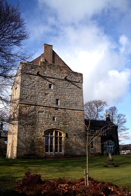
Elsdon Tower
- Overview About Elsdon Tower Map Street View "Elsdon Tower is a medieval towerhouse, now converted for residential use. It was recorded as a 'Vicar's Pele' in 1415 and thought to …
Co-Curate Page
Bacchus House
- Bacchus House in Elsdon is a former coaching inn, built in the early 18th century. It is Grade II listed on the National Heritage List for England.
Co-Curate Page
Arkleby Hall
- Overview Map Arkleby Hall is a large farmhouse in the village of Arkleby, built in c.1740, incorporating earlier house of 1725. It has the Thompson coat-of-arms over front entrance, and …
Co-Curate Page
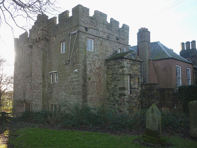
Bellister Castle
- Overview Map Street View Bellister Castle is a ruined tower house dating from the 13th century with an attached occupied house which is dated 1669.[1] It is located about half …
Co-Curate Page
5 Ravensworth Terrace
- Overview History Map Street View No. 5. This five story Georgian house on Ravensworth Terrace in the Summerhill area off Westgate Road in Newcastle was built by local developer William …
Co-Curate Page
6-8 Ravensworth Terrace
- Overview Map Street View Nos. 6-8 on Ravensworth Terrace in the Summerhill area of Newcastle was originally built as private residences in the early 1820s. By April 1884, No.6 had …
Co-Curate Page
Fowberry Tower
- Overview About Fowberry Tower Map Street View Fowberry Tower is a Grade II* listed mansion house, situated on the banks of the River Till, near Chatton, Northumberland. The Manor …
Co-Curate Page
Flass Hall, Esh Winning
- Overview Map Flass Hall, on Flasshall Lane in Esh Winning dates from the early 16th century. It was once the home of the agent who looked after the ancient Esh Estate. There …
Co-Curate Page
Calder Abbey House
- Overview Map Street View Calder Abbey House is an 18th century mansion house which adjoins the ruins of Calder Abbey. The Abbeey was founded in 1134, but became ruinous after the …
Co-Curate Page
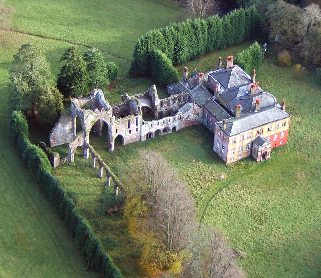
Calder Abbey
- Overview About Calder Abbey Map Street View The ruins of Calder Abbey are located by the River Calder, about half a mile north-east of the village of Calderbridge in Cumbria. …
Co-Curate Page
Rock Hall
- Overview About Rock Hall Map The Hall at Rock in Northumberland was originally built in the 13th or early 14th century. It's south wing was converted into a tower in …
Co-Curate Page
Rose Castle
- Overview About Rose Castle Map Street View Rose Castle is a fortified house, located about 6 miles south-west of Carlisle and just over 2 miles south of Dalston in Cumbria. …
Co-Curate Page
Old Vicarage, Bridekirk
- The Old Vicarage and Bridekirk House are located close to St Bridget's Church in Bridekirk. The vicarage was built in the early 19th century and is Grade II listed on …
Co-Curate Page
Helton Methodist Chapel
- Overview Map Street View This former Wesleyan Chapel in Helton in Cumbria was built in the mid 19th Century. In 1873 it had 120 sittings; by 1940 these had been …
Co-Curate Page
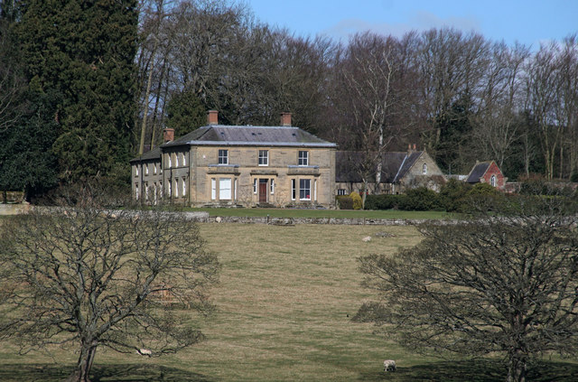
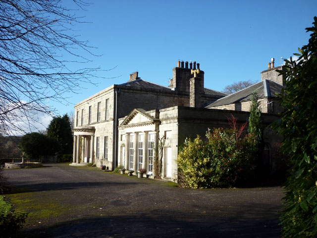
Gainford Hall
- Overview About Gainford Hall Map Street View Gainford Hall is a Jacobean manor house located at the west of Gainford, County Durham. The hall was built in c.1603 for John …
Co-Curate Page
Titlington Hall
- Overview Map Street View Tiltington Hall is a large country house at Titlington, built in 1824 for W.M. Pawson.[1] This replaced an earlier house here which was built in 1745 …
Co-Curate Page
Eggleston Hall
- Overview About Eggleston Hall Map Eggleston Hall is a large country house by the north banks of the River Tees at Eggleston in County Durham. It was built on the site …
Co-Curate Page
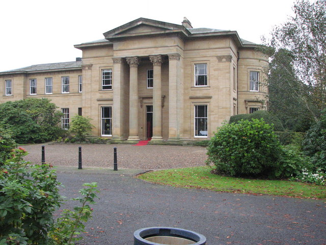
Milbourne Hall
- Overview About Milbourne Hall Map Milbourne Hall is a privately owned mansion house at Milbourne, near Ponteland, Northumberland, England, which has Grade I listed building status. The Bates family …
Co-Curate Page
Howgill Castle, Milburn
- Overview About Howgill Castle Map Howgill Castle is a fortified manor house located about half a mile east of the village of Milburn in Cumbria. It was built in the 14th …
Co-Curate Page
King's Meaburn Mill
- Overview Map Former corn mill by the River Lyvennet a short distance south-west of the village of King's Meaburn. The water powered mill was built in 1811. It has now been converted …
Co-Curate Page
Moorhouse Hall
- Overview Map Street View Moorhouse Hall in Moorhouse, Burgh-by-Sands, was built in the mid 18th century. It was marked on Hodgskinson & Donald's map of Cumberland, surveyed 1770, as house …
Co-Curate Page
Scaleby Castle
- Overview About Scaleby Castle Map Scaleby Castle, in the village of Scaleby, dates from the 13th century. The castle was damaged during the English Civil War (1642–1651). It was later …
Co-Curate Page
Old Wesleyan Chapel, Hethersgill
- This former Wesleyan (Methodist) Chapel in Hethersgill was built in 1901, replacing an earlier Wesleyan chapel of 1833 at nearby Ullermire.[1] The chapel closed in 1979 and has subsequently been …
Co-Curate Page
Casterton Hall
- Overview Map Street View Casterton Hall is located in woodland by the River Lune at the south-west of Casterton. It is a neo-classical style country house built in 1811, thought …
Co-Curate Page
Old Manor, High Casterton
- Overview Map Street View The Old Manor in High Casterton is the former manor house. The current building was largely rebuilt in the 19th century, but retains it's 17th century …
Co-Curate Page
Hawksdale Hall
- Overview Map Street View Hawksdale Hall is a large country house in Hawksdale which dates from the late 17th century; it was extended and inscribed over rear entrance "1704 J. …
Co-Curate Page
Manor House, Gainford
- Overview Map Street View No. 5 Tees View, 'The Manor House', in Gainford was built in the early 19th century. The building is Grade II listed on the National Heritage …
Co-Curate Page
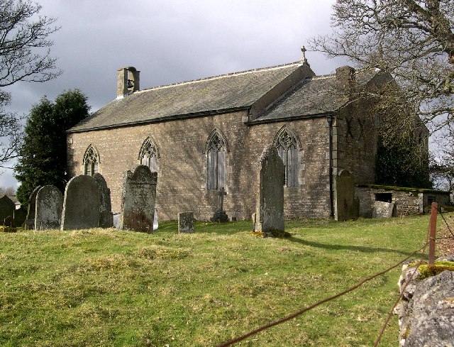
Church of St Peter in The Forest, Spartylea
- St Peter's Church in Spartylea, now converted into a private residence, was built in 1825. It replaced an earlier church of 1701. The church was known as St Peter's in The …
Co-Curate Page
Armathwaite Castle
- Overview About Armathwaite Castle Map Street View Armathwaite Castle is a mid 15th century fortified house with later alerations, including 18th century extensions to make it into a substantial mansion. …
Co-Curate Page
Yanwath Hall
- Overview Map Street View Yanwath Hall and farm is situated by the River Eamont to the north of the village of Yanwath in Cumbria. The hall incorporates a 14th century fortified …
Co-Curate Page
Friends Meeting House, Allonby
- Overview Map Street View This 17th century cottage in Allonby was converted into a meeting house by the Religious Society of Friends (Quakers) in 1703 and extended in 1732.[1] The …
Co-Curate Page
Friends Meeting House, Moorhouse
- Overview Map Street View A former Friends Meeting House (Quakers) is located in Moorhouse. The meeting house was built 1733, replacing an earlier meeting house of 1681. The Meeting closed in …
Co-Curate Page
Kentmere Hall
- Overview Map Street View Kentmere Hall (now known as Pele Tower House) is located in the Kentmere valley to the west of St Cuthbert's Church. The pele tower dates from …
Co-Curate Page
Bolton Hall, Northumberland
- Overview Map Bolton Hall is located in West Bolton in Northumberland. It is a country house, now divided into 2 dwellings. The Hall's north-east range dates from the late 17th …
Co-Curate Page
Clarghyll Hall
- Overview Map Clarghyll Hall is a country house located about 2 miles north east of Alston in Cumbria, close to the county border with Northumberland. The house incorporates a 16th …
Co-Curate Page
Nentsberry Chapel
- Overview Map Street View The Old Chapel in Nentsberry, was built in 1825 at a time when there was an active mining community in the area. The former chapel, on …
Co-Curate Page
Meldon Railway Station
- The former railway station in Meldon was on the Wansbeck Railway, which ran between Reedsmouth and Morpeth. The line closed in 1966.
Co-Curate Page
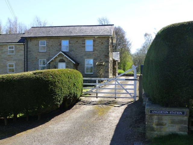
Angerton Railway Station
- The former railway station in Low Angerton is now a private residence. The station was on the Wansbeck Railway, a single-track line which ran from Morpeth to Reedsmouth. The station …
Co-Curate Page
Jesmond Towers
- Overview Map Jesmond Towers is a Gothic-style mansion house located to the north of Bemersyde Drive, off Jesmond Dene Road, in Jesmond. It was built in the early 19th century …
Co-Curate Page
Dunnerdale Hall
- Overview Map Street View Dunnerdale Hall farmhouse is located in the hamlet of Hall Dunnerdale in the Dunnerdale valley. The house was built in the mid/late 18th century. Byres were …
Co-Curate Page
Church of St John, Dipton
- Overview Map Street View St Joh's is a former church on Front Street in Dipton. St John the Evangelist Church was built 1885-1886 to the designs of Oliver and Leeson. …
Co-Curate Page
Dalegarth Hall, Eskdale
- Overview Map Street View Dalegarth Hall, near Boot in Eskdale is a former manor house, on a site occupied since the 14th century. The present building dates from the 16th …
Co-Curate Page
Houghton Hall
- Overview Map Street View Houghton Hall is located near the head of Hall Lane, by the junction with Nesham Place, in Houghton-le-Spring. The building dates from the early 17th century. …
Co-Curate Page
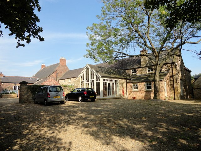
Batt Cottage, Stocksfield
- Overview Map Street View Batt Cottage on Batt House Road in Stocksfield was built in the 18th century. It was originallay a farmhouse known as Batt House. The building is …
Co-Curate Page
Westnewton Hall
- Overview Map Street View Westnewton Hall is a house in Westnewton, Cumbria, which dates from the early 19th century. It is a Grade II listed building on the National Heritage …
Co-Curate Page
Vale House, Stannington Vale
- Overview Map Street View Vale House is located in Stannington Vale, by the River Blyth and a short distance west of Stannington Bridge. The house was built in the late …
Co-Curate Page
Wesleyan Providence Chapel, Baybridge
- Overview Map This former Wesleyan Providence Chapel is located in Baybridge, Northumberland. The Gothic-style chapel was built in 1867, and is thought to have been designed by the distinguished architect …
Co-Curate Page
Coledale Hall, Carlisle
- Overview Map Street View Coledale Hall is located on Newtown Road in Carlisle. It was originally built in 1810 as a house and stable range for Henry Fawcett, MP for …
Co-Curate Page
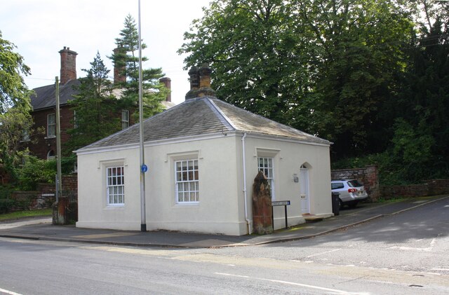
Harraby Toll Cottage
- Overview Map Street View No.258, London Road in Carlisle is the former cottage for the Harraby Toll Gate of the Carlisle to Eamont Bridge Turnpike (established 1752). The cottage was …
Co-Curate Page
Former Board School, Catton
- Overview Map Street View Catton Board School was built in 1879, for the Allendale and West Allen School Board, and funded by the Beaumont family who were local land owners.[1] …
Co-Curate Page
Jasmine House, The Green, Wallsend
- Overview Map Street View Jasmine House is located on The Green, by the junction with Crow Bank, in Wallsend. It dates from the mid to late 18th century and is …
Co-Curate Page
Cross House, The Green, Wallsend
- Overview Map Street View Cross House is located on The Green in Wallsend. Dame Eleanor Allan (founder of Dame Allan's school in Newcastle) taught for short period in the house. …
Co-Curate Page
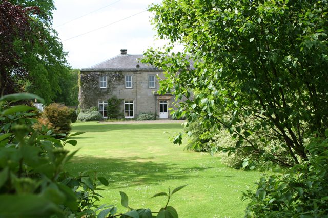
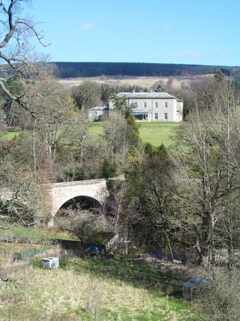
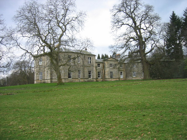
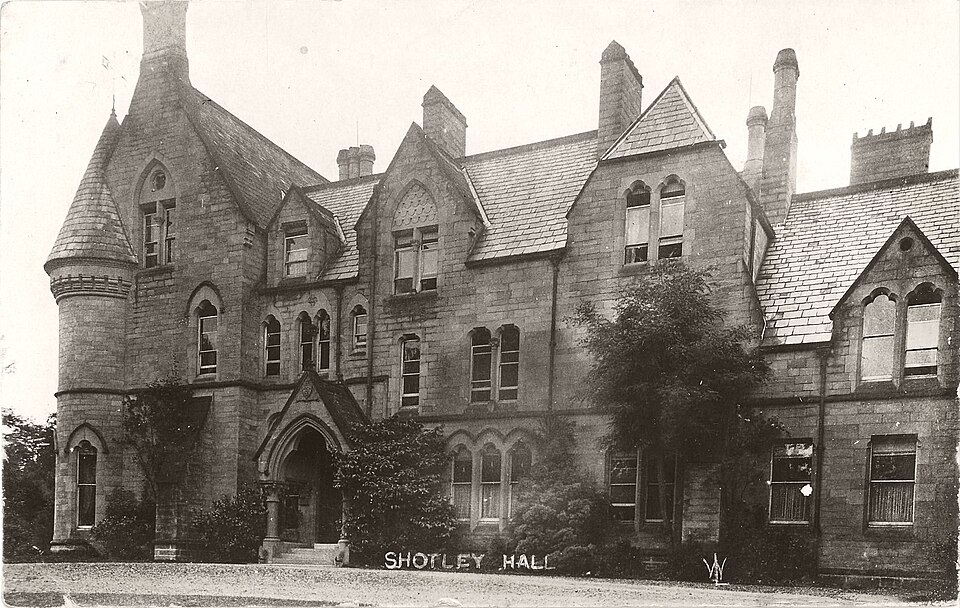
Shotley Hall
- Overview Map Shotley Hall is located about ¼ mile west of Shotley Bridge. The Hall is in Northumberland, close to the border with County Durham. The house was built in …
Co-Curate Page
Killingworth Hall
- Overview Map Street View Killingworth Hall, is a large residence on West Lane in Killingworth Village. The Hall was the historical home of the Killingworth family. It was rebuilt in …

Co-Curate Page
Horsley Tower
- Overview Street View The fortified towerhouse in Longhorsley was built by the Horsley family in the 16th century at a time when there were frequent boarder raids and hostilities with …
Co-Curate Page
Blenkinsopp Castle
- Overview About Blenkinsopp Castle Map Blenkinsopp Castle is a fire-damaged, partly demolished 19th-century country mansion, incorporating the ruinous remains of a 14th-century tower house, which is located above the …
Co-Curate Page
Mortham Tower
- Mortham Tower, near Greta Bridge, is a Grade I listed fortified courtyard house and pele tower which dates from the reign of King Henry VII (1485-1509). The estate was the …
Co-Curate Page
Etal Manor
- Overview Map A large country house in Etal, Northumberland, built in 1748. It was extended in 1767 for William Carr, and again in 1888 for James Laing. The Manor is …
Co-Curate Page
Old Vicarage
- Overview Map Street View The former Vicarage and pele tower, is located next to the Church of the Holy Trinity in Embleton. In 1332 Merton College, patron of Embleton, agreed to …
Co-Curate Page
Bolam Hall
- Overview Map Bolam Hall was built in 1810 for Robert Horsley for his daughter Charlotte Philadelphia on her marriage to John Beresford, the Baron Decies. In 1816 John Dobson was …
Co-Curate Page
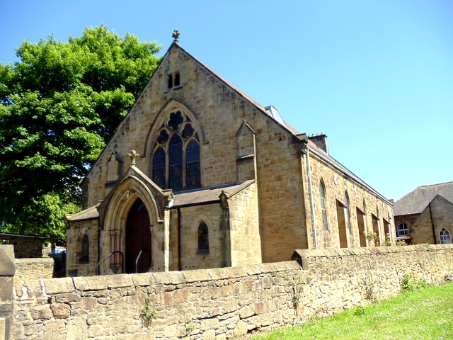
Leamside Chapel
- Overview Map Street View The former Primitive Methodist Chapel on Station Road in Leamside was built in 1867. The Chapel closed in 1973 and later sold for use by the scouting …
Co-Curate Page
Former Ebenezer Chapel
- Map Street View "John Wesley himself is believed to have twice preached to the miners of West Rainton in April 1747. Services were held in the homes of members until …
Co-Curate Page
Roberts Battery
- Robert's Battery at Old Hartley was a defensive site dating from the First World War. When a battleship which had been permanently based on the river Tyne was redeployed in …
Co-Curate Page
Thornton Hall
- Thornton Hall is a 16th century Manor House (now a farmhouse) located within the Civil Parish of High Coniscliffe in County Durham. It lies off the B6279 road near Ulnaby. The …
Co-Curate Page
Old Vicarage, High Coniscliffe
- Overview Map The former Vicarage of St Edwin's Church in High Coniscliffe dates from the 18th century, with the main building built c.1860. It is now private house and is …
Co-Curate Page
Mill House, High Coniscliffe
- Overview Map The former water mill by Unalby Beck on Mill Lane in High Coniscliffe was built in the late 18th and early 19th century. Now a house, this is …
Co-Curate Page
Ormesby House, Church Lane
- The former home of Lady Caroline Brown, on Church Lane in Ormesby. The Elizabethan style mansion was built in 1904 and is located close to Ormesby Hall and St Cuthbert's …
Co-Curate Page
Haughton Castle
- Overview About Haughton Castle Map Haughton Castle is a privately owned country house in Northumberland located a mile north of Humshaugh and on the south side of the River North …
Co-Curate Page
Wester Hall
- Overview Map Wester Hall in Haughton, near Humshaugh, was built in 1732. The Hall is Grade II listed on the National Heritage List for England.
Co-Curate Page
Former School, Carrshield
- Overview Map Street View A former school for miners’ children was built in Carrshield in 1851, paid for by WB Beaumont. The boys school was in the right-hand of the …
Co-Curate Page
Bastle House, Cambo
- Overview Street View A 16th century bassle house in Cambo, Northumberland. In 1818 it was converted into shop and still has a lintel above the former shop window inscribed "J.T. …
Co-Curate Page
Pele Tower, Shilbottle
- Overview Map Street View This former vicarage in Shilbottle incorporates a 15th century pele tower. The tower was heightened in 1863. The main part of the house, and outbuildings, were …
Co-Curate Page
Surrey House, Haugh Head
- Overview Map Surrey House in Haugh Head lis located beside the A697 road about a mile from Wooler. It was was built in the mid-19th century. The building is a former coaching …
Co-Curate Page
Earle Mill Cottage
- Overview Map The cottage by Earle Mill dates from the 18th century and is Grade II listed on the National Heritage List for England. The cottage is close to Wooler …
Co-Curate Page
Earle Mill
- Overview Map Earle Mill is a watermill located by Wooler Water. It was built in the 18th century and has a distinctive 19th century drying kiln attached. It is aproximately …
Co-Curate Page
Horden Hall
- Overview Map Street View Horden Hall is a manor house built in the mid 17th century located at the north end of Horden in County Durham. The building is thought …
Co-Curate Page
Former Station Building
- Overview Map Street View The former station building in Wolsingham is Grade II listed on the National Heritage List for England. It was built in 1847 for the for the Wear …
Co-Curate Page
Elwick Windmill
- Overview Map Street View Elwick Windmill was built in the mid 19th century and is located about half a mile south west of Elwick, and is visible from the A19 …
Co-Curate Page
Fatfield House
- Overview Map Street View A 19th century house on Vigo Lane in Harraton - which had been in Fatfield before the boundaries changed with the creation of Washingon new town. …
Co-Curate Page
Longhirst Hall
- Overview Map Street View Longhirst Hall near Morpeth in Northumberland was built in 1824. It was designed by John Dobson for the land owner, William Lawson, who became wealthy from …
Co-Curate Page
Hebburn Hall
- Overview About Hebburn Hall Map Hebburn Hall (aslo known as Ellison Hall) is a 17th century manor house in Hebburn, largely rebuilt in 1790-1792.[1] It was built on the site …
Co-Curate Page
Allenheads Hall
- Overview Map Allenshead Hall is a country house, built in 1847 by E.B. Lamb for Thomas Sopwith, engineer and mine agent to the Beaumont family. Some sources indicate it was …
Co-Curate Page
Methodist Chapel, Sinderhope
- Overview Map Street View Now converted for a private residence, the Primitive Methodist Jubilee Chapel in Sinderhope was built in 1860. It is Grade II listed on the National Heritage …
Co-Curate Page
Callerton Hall
- Overview Map Street Callerton Hall is located in High Callerton, Ponteland. It was built in the early 18th century, and extensively altered in 1892 by R. Norman Shaw.[1] The hall …
Co-Curate Page
Hilton Hall
- Overview Map Street View Hilton Hall is a house in Hilton Village in County Durham. The bulk of the house dates from the 16th century, with 17th and 18th century …
Co-Curate Page
Barforth Hall
- Overview Map Barforth Hall is a farmhouse which was once the manor house of Barforth. The Barforth estate came into the possession of the Pudsey family during the reign of Edward …
Co-Curate Page
Croxdale Hall
- Overview About Croxdale Hall Map Croxdale Hall is a privately owned country mansion located about half a mile north of the modern village Croxdale in County Durham. The Hall has …
Co-Curate Page
Tuggal Hall
- Overview Map Street View Tuggal Hall is a large country house located in Tughall, near Beadnell, in Northumberland. The house dates from the 17th/early 18th century and is Grade II …
Co-Curate Page
Former Church of All Saints, Duddo
- Overview Map Street View The former Parish Church of Duddo is located approximately half a mile north-west of the village. It was built in 1879 by F.R. Wilson of Alnwick.[1] The …
Co-Curate Page
Twizell North Lodge
- Overview Map Street View Lodge by the north entrance to the estate of the Twizell House. Built in the mid 19th century, the lodge is Grade II listed on the …
Co-Curate Page
Tow House Bastle
- There is a 16th century bastle (fortified tower house) in Tow House, near Henshaw, built at a time of hostilities with Scotland and frequent border raids. The building has altered …
Co-Curate Page
The Hermitage
- Overview Map Street View The 'Hermitage' is a large mid 17th century house, with c1930 alterations and additions. The Hermitage is Grade II listed on the National Heritage List for …
Co-Curate Page
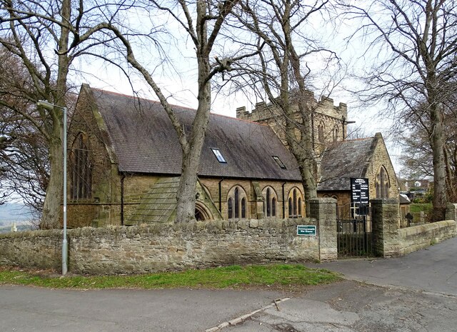
Former Church of St John the Baptist, Quebec
- Overview Map Street View Former Parish Church of St John the Baptist - now a private dwelling. The church was built in 1875 and located next to the former school‐house …
Co-Curate Page
Bridge Mill, Haggerston
- Overview Map Street View Bridge Mill is a former water mill located by Allerdalemill Burn, just north-west of Haggerston, and about a mile and a half south-east of Ancroft. The …
Co-Curate Page
Beaufront Castle
- Overview About Beaufront Castle Map Aerial View Beaufront Castle is an extensive privately owned country house, located about a mile and a half north-east of Hexham, situated between the villages …
Co-Curate Page
Wooperton Hall
- Overview Map Street View Wooperton House was built in c.1840 and is located in the hamlet of Wooperton in Northumberland, located about 5 miles south of Wooler. Sometimes also referred to …
Co-Curate Page
Urpeth Hall
- Overview Map Street View Urpeth Hall in High Urpeth was built in the mid 18th century, with the addition of flanking and rear wings in the late 19th century. The …
Co-Curate Page
Old Primitive Methodist Chapel, Lanehead
- Overview Map Street View There is a former Primitive Methodist chapel on School Hill in Lanehead, now converted into a house. The church was built in 1858, and replaced a …
Co-Curate Page
Sledwhich Hall
- Sledwich Hall is a large manor house located about half a mile west of Whorlton in County Durham. The Hall dates from the late 16th century, with restoration work done …
Co-Curate Page
Bede Cottage
- Overview Map Street View Bede Cottage and Bede House are adjoining houses located on Monkton Lane in Monkton. They date from the early or mid 17th century and are Grade …
Co-Curate Page
Bavington Hall
- Overview About Bavington Hall Map Street View Bavington Hall is a 17th-century privately owned country house at Little Bavington in Northumberland. It is Grade II* listed on the National …
Co-Curate Page
Former Station, Gilsland
- Overview Map Street View The railway station at Gilsland opened on the 9th July 1836 as Rose Hill (renamed Gilsland in 1869). It was built by the Newcastle and Carlisle …
Co-Curate Page
Croxdale Wood House
- Overview Map Croxdale Wood House is an 18th century farmhouse located by Croxdale Woods, about a mile north-east of Sunderland Bridge and Croxdale. It was extended in the mid 19th …
Co-Curate Page
Tursdale House Farm
- Overview Map Tursdale House, was the manor house of the medieval village of Tursdale in the 12th century.[1] The current building at Tursdale House Farm dates from the 17th century, with …
Co-Curate Page
Tudhoe Old Hall
- Overview Map Street View Tudhoe Hall, off the village green in Tudhoe, dates from the early 17th century, probably incorporating the fabric of an earlier building. The building was altered …
Co-Curate Page
Shoreswood Hall
- Overview Map Street View Shoreswood Hall was built in the early 18th century. It is a Gtade II listed building.
Co-Curate Page
Shoreswood National School
- Overview Map Street View The former Shoreswood National School was built c.1836 for 70 pupils. The school closed in 1962 and it's 17 pupils were transferred to a new county …
Co-Curate Page
Seven Stars House
- Overview Map Street View Seven Stars House in Whalton was built in the late 18th century as a coaching inn. It became a private house c.1945. The house is Grade …
Co-Curate Page
Former Wesleyan Methodist Chapel
- Overview Map Street View The Wesleyan Methodist Chapel in Barningham is dated 1815 and was converted to a residential house in c.1980. "The building is said to have been a …
Co-Curate Page
Old School House, Hartburn
- Overview Map Street View The Old School House in Hartburn was built in 1762 by Dr. John Sharpe, vicar of Hartburn. It was also used as the 'Parish Stable' (hearse house).[1] Now …
Co-Curate Page
Former Fox and Hounds Inn
- The former Fox and Hounds Inn in Whitley Chapel dates from the 18th century and is Grade II listed on the National Heritage List for England.[1] It is now a private …
Co-Curate Page
Hesleyside Hall
- Overview About Hesleyside Hall Map Hesleyside Hall is a large country house, located about a mile and a half north-west of Bellingham in Northumberland. It was built in 1719 on or …
Co-Curate Page
Warnell Hall, nr Sebergham
- Overview Map Street View Warnell Hall, is a large farmhouse to the south-west of Sebergham, It was built as a fortified house, dated 1683, and incorporating part of a 14th century …
Co-Curate Page
Hewthwaite Hall, nr Cockermouth
- Overview Map Street View Hewthwaite Hall is a farmhouse on Isel Road, located about two and a half miles north west of Cockermouth. The house in inscribed with the date 1581 …
Co-Curate Page
Corby Castle
- Overview About Corby Castle Map Street View Corby Castle has at its core a medieval tower house, which was altered in the 17th century and the significantly remodelled and extended …
Co-Curate Page
Elsdon Tower
- Overview About Elsdon Tower Map Street View "Elsdon Tower is a medieval towerhouse, now converted for residential use. It was recorded as a 'Vicar's Pele' in 1415 and thought to …
Co-Curate Page
Bacchus House
- Bacchus House in Elsdon is a former coaching inn, built in the early 18th century. It is Grade II listed on the National Heritage List for England.
Co-Curate Page
Arkleby Hall
- Overview Map Arkleby Hall is a large farmhouse in the village of Arkleby, built in c.1740, incorporating earlier house of 1725. It has the Thompson coat-of-arms over front entrance, and …
Co-Curate Page
Bellister Castle
- Overview Map Street View Bellister Castle is a ruined tower house dating from the 13th century with an attached occupied house which is dated 1669.[1] It is located about half …
Co-Curate Page
5 Ravensworth Terrace
- Overview History Map Street View No. 5. This five story Georgian house on Ravensworth Terrace in the Summerhill area off Westgate Road in Newcastle was built by local developer William …
Co-Curate Page
6-8 Ravensworth Terrace
- Overview Map Street View Nos. 6-8 on Ravensworth Terrace in the Summerhill area of Newcastle was originally built as private residences in the early 1820s. By April 1884, No.6 had …
Co-Curate Page
Fowberry Tower
- Overview About Fowberry Tower Map Street View Fowberry Tower is a Grade II* listed mansion house, situated on the banks of the River Till, near Chatton, Northumberland. The Manor …
Co-Curate Page
Flass Hall, Esh Winning
- Overview Map Flass Hall, on Flasshall Lane in Esh Winning dates from the early 16th century. It was once the home of the agent who looked after the ancient Esh Estate. There …
Co-Curate Page
Calder Abbey House
- Overview Map Street View Calder Abbey House is an 18th century mansion house which adjoins the ruins of Calder Abbey. The Abbeey was founded in 1134, but became ruinous after the …
Co-Curate Page
Calder Abbey
- Overview About Calder Abbey Map Street View The ruins of Calder Abbey are located by the River Calder, about half a mile north-east of the village of Calderbridge in Cumbria. …
Co-Curate Page
Rock Hall
- Overview About Rock Hall Map The Hall at Rock in Northumberland was originally built in the 13th or early 14th century. It's south wing was converted into a tower in …
Co-Curate Page
Rose Castle
- Overview About Rose Castle Map Street View Rose Castle is a fortified house, located about 6 miles south-west of Carlisle and just over 2 miles south of Dalston in Cumbria. …
Co-Curate Page
Old Vicarage, Bridekirk
- The Old Vicarage and Bridekirk House are located close to St Bridget's Church in Bridekirk. The vicarage was built in the early 19th century and is Grade II listed on …
Co-Curate Page
Helton Methodist Chapel
- Overview Map Street View This former Wesleyan Chapel in Helton in Cumbria was built in the mid 19th Century. In 1873 it had 120 sittings; by 1940 these had been …
Co-Curate Page
Gainford Hall
- Overview About Gainford Hall Map Street View Gainford Hall is a Jacobean manor house located at the west of Gainford, County Durham. The hall was built in c.1603 for John …
Co-Curate Page
Titlington Hall
- Overview Map Street View Tiltington Hall is a large country house at Titlington, built in 1824 for W.M. Pawson.[1] This replaced an earlier house here which was built in 1745 …
Co-Curate Page
Eggleston Hall
- Overview About Eggleston Hall Map Eggleston Hall is a large country house by the north banks of the River Tees at Eggleston in County Durham. It was built on the site …
Co-Curate Page
Milbourne Hall
- Overview About Milbourne Hall Map Milbourne Hall is a privately owned mansion house at Milbourne, near Ponteland, Northumberland, England, which has Grade I listed building status. The Bates family …
Co-Curate Page
Howgill Castle, Milburn
- Overview About Howgill Castle Map Howgill Castle is a fortified manor house located about half a mile east of the village of Milburn in Cumbria. It was built in the 14th …
Co-Curate Page
King's Meaburn Mill
- Overview Map Former corn mill by the River Lyvennet a short distance south-west of the village of King's Meaburn. The water powered mill was built in 1811. It has now been converted …
Co-Curate Page
Moorhouse Hall
- Overview Map Street View Moorhouse Hall in Moorhouse, Burgh-by-Sands, was built in the mid 18th century. It was marked on Hodgskinson & Donald's map of Cumberland, surveyed 1770, as house …
Co-Curate Page
Scaleby Castle
- Overview About Scaleby Castle Map Scaleby Castle, in the village of Scaleby, dates from the 13th century. The castle was damaged during the English Civil War (1642–1651). It was later …
Co-Curate Page
Old Wesleyan Chapel, Hethersgill
- This former Wesleyan (Methodist) Chapel in Hethersgill was built in 1901, replacing an earlier Wesleyan chapel of 1833 at nearby Ullermire.[1] The chapel closed in 1979 and has subsequently been …
Co-Curate Page
Casterton Hall
- Overview Map Street View Casterton Hall is located in woodland by the River Lune at the south-west of Casterton. It is a neo-classical style country house built in 1811, thought …
Co-Curate Page
Old Manor, High Casterton
- Overview Map Street View The Old Manor in High Casterton is the former manor house. The current building was largely rebuilt in the 19th century, but retains it's 17th century …
Co-Curate Page
Hawksdale Hall
- Overview Map Street View Hawksdale Hall is a large country house in Hawksdale which dates from the late 17th century; it was extended and inscribed over rear entrance "1704 J. …
Co-Curate Page
Manor House, Gainford
- Overview Map Street View No. 5 Tees View, 'The Manor House', in Gainford was built in the early 19th century. The building is Grade II listed on the National Heritage …
Co-Curate Page
Church of St Peter in The Forest, Spartylea
- St Peter's Church in Spartylea, now converted into a private residence, was built in 1825. It replaced an earlier church of 1701. The church was known as St Peter's in The …
Co-Curate Page
Armathwaite Castle
- Overview About Armathwaite Castle Map Street View Armathwaite Castle is a mid 15th century fortified house with later alerations, including 18th century extensions to make it into a substantial mansion. …
Co-Curate Page
Yanwath Hall
- Overview Map Street View Yanwath Hall and farm is situated by the River Eamont to the north of the village of Yanwath in Cumbria. The hall incorporates a 14th century fortified …
Co-Curate Page
Friends Meeting House, Allonby
- Overview Map Street View This 17th century cottage in Allonby was converted into a meeting house by the Religious Society of Friends (Quakers) in 1703 and extended in 1732.[1] The …
Co-Curate Page
Friends Meeting House, Moorhouse
- Overview Map Street View A former Friends Meeting House (Quakers) is located in Moorhouse. The meeting house was built 1733, replacing an earlier meeting house of 1681. The Meeting closed in …
Co-Curate Page
Kentmere Hall
- Overview Map Street View Kentmere Hall (now known as Pele Tower House) is located in the Kentmere valley to the west of St Cuthbert's Church. The pele tower dates from …
Co-Curate Page
Bolton Hall, Northumberland
- Overview Map Bolton Hall is located in West Bolton in Northumberland. It is a country house, now divided into 2 dwellings. The Hall's north-east range dates from the late 17th …
Co-Curate Page
Clarghyll Hall
- Overview Map Clarghyll Hall is a country house located about 2 miles north east of Alston in Cumbria, close to the county border with Northumberland. The house incorporates a 16th …
Co-Curate Page
Nentsberry Chapel
- Overview Map Street View The Old Chapel in Nentsberry, was built in 1825 at a time when there was an active mining community in the area. The former chapel, on …
Co-Curate Page
Meldon Railway Station
- The former railway station in Meldon was on the Wansbeck Railway, which ran between Reedsmouth and Morpeth. The line closed in 1966.
Co-Curate Page
Angerton Railway Station
- The former railway station in Low Angerton is now a private residence. The station was on the Wansbeck Railway, a single-track line which ran from Morpeth to Reedsmouth. The station …
Co-Curate Page
Jesmond Towers
- Overview Map Jesmond Towers is a Gothic-style mansion house located to the north of Bemersyde Drive, off Jesmond Dene Road, in Jesmond. It was built in the early 19th century …
Co-Curate Page
Dunnerdale Hall
- Overview Map Street View Dunnerdale Hall farmhouse is located in the hamlet of Hall Dunnerdale in the Dunnerdale valley. The house was built in the mid/late 18th century. Byres were …
Co-Curate Page
Church of St John, Dipton
- Overview Map Street View St Joh's is a former church on Front Street in Dipton. St John the Evangelist Church was built 1885-1886 to the designs of Oliver and Leeson. …
Co-Curate Page
Dalegarth Hall, Eskdale
- Overview Map Street View Dalegarth Hall, near Boot in Eskdale is a former manor house, on a site occupied since the 14th century. The present building dates from the 16th …
Co-Curate Page
Houghton Hall
- Overview Map Street View Houghton Hall is located near the head of Hall Lane, by the junction with Nesham Place, in Houghton-le-Spring. The building dates from the early 17th century. …
Co-Curate Page
Batt Cottage, Stocksfield
- Overview Map Street View Batt Cottage on Batt House Road in Stocksfield was built in the 18th century. It was originallay a farmhouse known as Batt House. The building is …
Co-Curate Page
Westnewton Hall
- Overview Map Street View Westnewton Hall is a house in Westnewton, Cumbria, which dates from the early 19th century. It is a Grade II listed building on the National Heritage …
Co-Curate Page
Vale House, Stannington Vale
- Overview Map Street View Vale House is located in Stannington Vale, by the River Blyth and a short distance west of Stannington Bridge. The house was built in the late …
Co-Curate Page
Wesleyan Providence Chapel, Baybridge
- Overview Map This former Wesleyan Providence Chapel is located in Baybridge, Northumberland. The Gothic-style chapel was built in 1867, and is thought to have been designed by the distinguished architect …
Co-Curate Page
Coledale Hall, Carlisle
- Overview Map Street View Coledale Hall is located on Newtown Road in Carlisle. It was originally built in 1810 as a house and stable range for Henry Fawcett, MP for …
Co-Curate Page
Harraby Toll Cottage
- Overview Map Street View No.258, London Road in Carlisle is the former cottage for the Harraby Toll Gate of the Carlisle to Eamont Bridge Turnpike (established 1752). The cottage was …
Co-Curate Page
Former Board School, Catton
- Overview Map Street View Catton Board School was built in 1879, for the Allendale and West Allen School Board, and funded by the Beaumont family who were local land owners.[1] …
Co-Curate Page
Jasmine House, The Green, Wallsend
- Overview Map Street View Jasmine House is located on The Green, by the junction with Crow Bank, in Wallsend. It dates from the mid to late 18th century and is …
Co-Curate Page
Cross House, The Green, Wallsend
- Overview Map Street View Cross House is located on The Green in Wallsend. Dame Eleanor Allan (founder of Dame Allan's school in Newcastle) taught for short period in the house. …
Co-Curate Page
Shotley Hall
- Overview Map Shotley Hall is located about ¼ mile west of Shotley Bridge. The Hall is in Northumberland, close to the border with County Durham. The house was built in …


