Topics > Tyne and Wear > Gateshead > Historic Buildings and Monuments in Gateshead
Historic Buildings and Monuments in Gateshead
This page includes historic buildings, monuments, parks and sites in the Borough of Gateshead, compiled from two sources: a) Listed buildings and scheduled monuments, from the National Heritage List for England[1]. b) the List of Buildings, Parks and Gardens of Special Local Architectural or Historic Interest ('Local List') from Gateshead Council.[2] Use the Search in the data table (below) if looking for a specific building / monument, or to filter on a particular area e.g. type: Birtley.
| Structure | List No. | Grade | Built~ | Ward | Note |
|---|---|---|---|---|---|
| Wardley Moated Site | 1017054 | n/a | Medieval | Wardley. Scheduled Monument. Visible earthworks | |
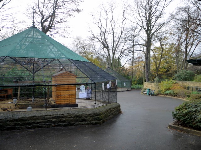
| Saltwell Park | 1001182 | II | 1850s | Saltwell | Saltwell. Listed Park and Garden |
| Bradley Park | 1001179 | II | C18th | Crawcrook & Greenside | Listed Park and Garden |
| Site of Ravensworth coalmill, 600m north east of Ravensworth Castle | 1015922 | n/a | C17th | Lamesley | Scheduled Monument. |
| Winlaton Mill ironworks, south east of Winlaton Mill village | 1021272 | n/a | 1691 | Winlaton & High Spen | Scheduled Monument. |
| Washingwells Roman fort, Whickham | 1018645 | n/a | Roman | Scheduled Monument. | |
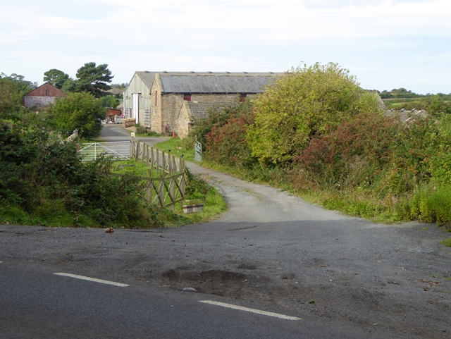
| Motte, 50m north of Holycross Church, Ryton | 1018677 | n/a | Norman | Ryton | Scheduled Monument. |
| Whinfield coking ovens, 850m south east of Low Spen Farm | 1018226 | n/a | C19th | Scheduled Monument. | |
| Coal mining remains at Dunston Hill | 1018227 | n/a | C18th | Scheduled Monument. | |
| Enclosures near Damhead Wood, Whickham | 1005913 | n/a | Scheduled Monument. | ||
| Ditched enclosure S of North View, Coalburns | 1005917 | n/a | Roman? | Ryton | Scheduled Monument. |
| Bowes Railway | 1003723 | n/a | C19th | Scheduled Monument. | |
| Battle of Newburn Ford 1640 | 1000025 | n/a | 1640 | Historic Battlefield. Ryton, Newburn | |
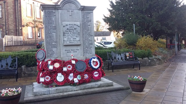
| Birtley Cenotaph, memorial shelters, and garden wall including gate piers and railings. | 1433563 | II | 1923 | Birtley | Birtley |
| Church of St John the Evangelist | 1355096 | II | 1849 | Birtley | Birtley |
| Church of St Joseph including attached presbytery and stone wall to S and SW | 1431020 | II | 1843 | Birtley | Birtley. By John Dobson. |
| Co-Operative Buildings | 1025205 | II | Birtley | ||
| School House | 1025204 | II | Birtley | ||
| Statue of EM Perkins at North End of Monument Terrace | 1025203 | II | 1874 | Birtley | Birtley |
| Vigo and Garden Wall to West | 1355097 | II | Birtley | ||
| Axwell Park and Steps and Balustrades to South | 1025206 | II* | 1758 | Blaydon | Blaydon |
| Axwell Park Dower House | 1184875 | II* | C18th | Blaydon | |
| Blaydon West Infant School | 1025209 | II | Blaydon | ||
| Blaydon West Junior School and Walls, Piers and Railings to East | 1184770 | II | Blaydon | ||
| Bridge 280 Metres South of Axwell Park | 1025208 | II | Blaydon | ||
| Church of St Cuthbert | 1355120 | II | 1844 | Blaydon | Blaydon |
| Church of St Joseph and Presbytery Adjoining | 1025177 | II | 1905 | Blaydon | Blaydon |
| Dovecot at Axwell Park House Farm | 1355098 | II | Blaydon | ||
| Memorial to Thomas Ramsay About 42 Metres South of Mortuary Chapels in Blaydon Cemetery | 1025178 | II | Blaydon | ||
| Retaining Wall, Balustrade, Piers and Steps to Terrace South of Axwell Park | 1025207 | II | Blaydon | ||
| Walls, Piers and Railings to West of Blaydon West Junior School | 1355100 | II | Blaydon | ||
| War Memorial about 7 metres north of mortuary chapels | 1355121 | II | 1923 | Blaydon | Blaydon |
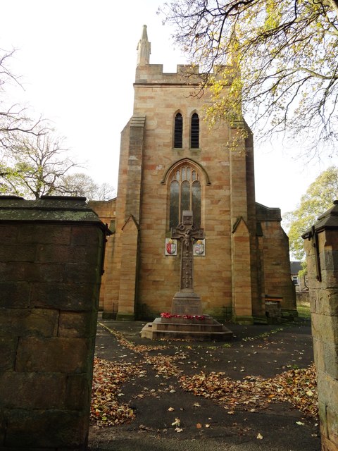
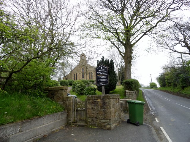
| Carr House | 1355099 | II | Chopwell & Rowlands Gill | ||
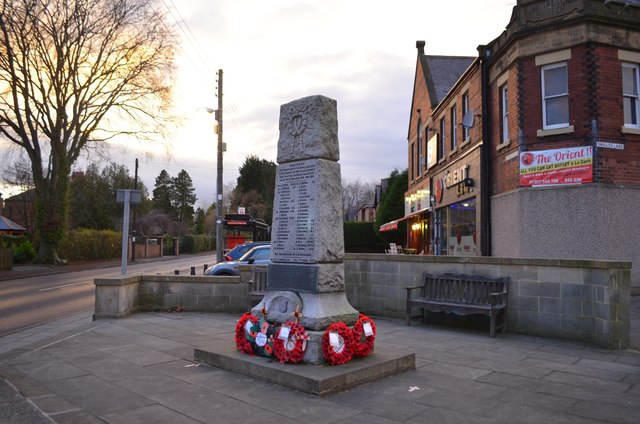
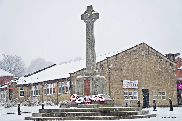
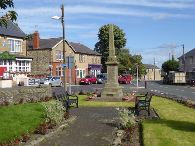
| High Spen War Memorial | 1438098 | II | 1920 | Chopwell & Rowlands Gill | High Spen |
| Rowlands Gill War Memorial | 1439955 | II | 1921 | Chopwell & Rowlands Gill | Rowlands Gill |
| War Memorial located at junction of Hall Road and Monument Court | 1025171 | II | 1923 | Chopwell & Rowlands Gill | Chopwell |
| Bradley Hall | 1355110 | II* | c1760 | Crawcrook & Greenside | Near Crawcrook |
| Clara Vale War Memorial | 1435730 | II | 1921 | Crawcrook & Greenside | Clara Vale |
| Dents Hall Farmhouse | 1185241 | II | Crawcrook & Greenside | ||
| Greenside War Memorial | 1437172 | II | 1921 | Crawcrook & Greenside | Greenside |
| Ha-Ha to South of Bradley Hall | 1025156 | II | Crawcrook & Greenside | ||
| Ice House to West of Bradbury Hall | 1025157 | II | Crawcrook & Greenside | ||
| Orangery to West of Bradley Hall | 1355111 | II | Crawcrook & Greenside | ||
| Stephens Hall | 1355113 | II* | 1635 | Crawcrook & Greenside | Fortified manor house |
| Wall to West of Bradley Hall | 1185195 | II | Crawcrook & Greenside | ||
| Nos. 33 and 35, Fife Street | 1248556 | II | Deckham | ||
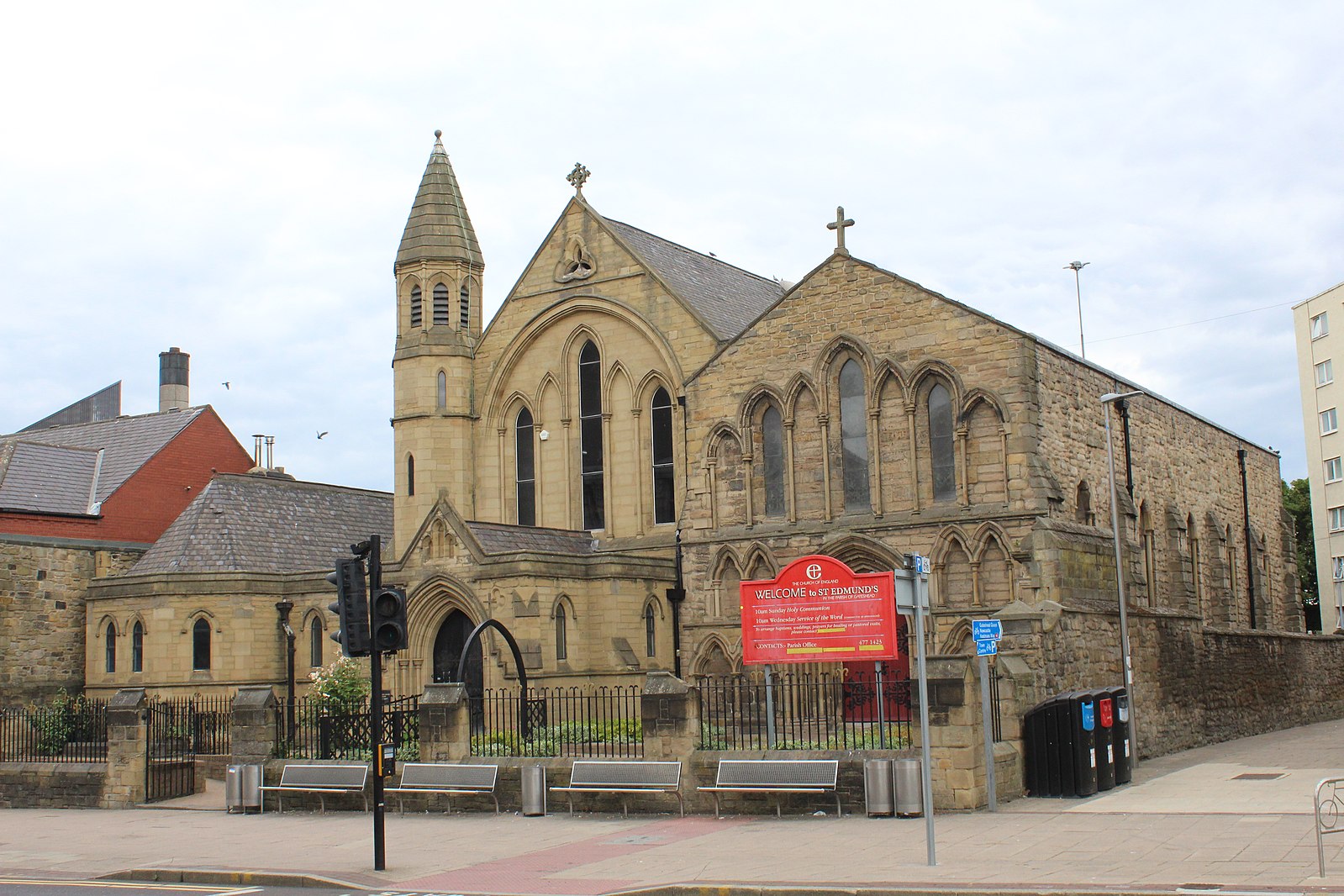
| Church of St George | 1248725 | II | Deckham | ||
| War Memorial | 1277766 | II | Deckham | ||
| Nos. 11 and 13, Front Street | 1025141 | II | Dunston Hill & Whickham East | ||
| No. 11, Church Chare | 1355140 | II | Dunston Hill & Whickham East | ||
| Nos. 12 and 14, Front Street | 1025139 | II | Dunston Hill & Whickham East | ||
| No. 20, Front Street | 1185397 | II | Dunston Hill & Whickham East | ||
| Church of St Mary | 1185359 | I | C12th | Dunston Hill & Whickham East | Whickham. Church restored by John Dobson |
| Dunston Hill Hospital | 1366097 | II* | C18th | Dunston Hill & Whickham East | Now 'The Mansion House' |
| Dunston Hill War Memorial | 1425084 | II | 1923 | Dunston Hill & Whickham East | Dunston Hill |
| Duston Hill Hospital Outpatients Department | 1299642 | II | Dunston Hill & Whickham East | ||
| Farm Building to East of Whickham Riding School House | 1355107 | II | Dunston Hill & Whickham East | ||
| K6 Telephone Kiosk Adjacent to Council Offices | 1025148 | II | Dunston Hill & Whickham East | ||
| Oak Villa | 1299664 | II | Dunston Hill & Whickham East | ||
| Park Cottage | 1025144 | II | Dunston Hill & Whickham East | ||
| Restaurant and House Opposite Number 11 | 1025170 | II | Dunston Hill & Whickham East | ||
| Stables North of Dunston Hill Hospital | 1025145 | II | Dunston Hill & Whickham East | ||
| Tomb of Henry Clasper About 13 Metres North of Church of St Mary | 1355139 | II | Dunston Hill & Whickham East | ||
| Tomb of Jane Clasper About 13 Metres North of Church of St Mary | 1025136 | II | Dunston Hill & Whickham East | ||
| Whickam Park | 1025140 | II | Dunston Hill & Whickham East | ||
| Whickham Lodge and Wing at Right | 1355104 | II | Dunston Hill & Whickham East | ||
| Whickham Riding School | 1366093 | II | Dunston Hill & Whickham East | ||
| Whickham Thorns Farmhouse | 1025143 | II | Dunston Hill & Whickham East | ||
| Whickham War Memorial | 1442959 | II | 1922 | Dunston Hill & Whickham East | Church Green, Whickham |
| Windmill in King Georges Field (Chase Park) 180 Metres South of Street | 1299676 | II | Dunston Hill & Whickham East | ||
| Former Parish School | 1355141 | II | Dunston & Teams | ||
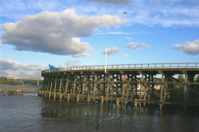
| River Tyne Dunston Coal Staithes | 1248994 | II | Dunston & Teams | Dunston. Sheduled Monument (1005898) | |
| White Gate | 1025138 | II | Dunston & Teams | ||
| No. 2 Gate Piers South of Crow Hall | 1184918 | II | Felling | ||
| No. 35, Davison Street | 1184922 | II | Felling | ||
| Ardallan | 1184953 | II | Felling | ||
| Christ Church | 1184901 | II | 1866 | Felling | Felling. By Austin and Johnson |
| Church of St Patrick | 1184932 | II | 1895 | Felling | Felling |
| Crow Hall | 1355083 | II* | C18th | Felling | Felling |
| Crow Hall Cottage and Garden Wall Attached to Left Corner of House | 1025181 | II | Felling | ||
| Engine House of Former Tyne Main Colliery | 1248567 | II | 1820 | Felling | Felling. Friars Goose Pumping Station |
| Felling Post Office | 1025187 | II | Felling | ||
| Gate, Gate Piers to and Wall Around Ardallan | 1355085 | II | Felling | ||
| Gateshead District Housing Offices | 1299836 | II | 1902 | Felling | Felling. Former Council Offices, Sunderland Road. |
| New Imperial Bingo Club | 1185123 | II | Felling | ||
| Piers and Lamp Holders North of Gateshead Housing Offices | 1355088 | II | Felling | ||
| Presbytery of Church of St Patrick | 1025182 | II | Felling | ||
| Urban Studies Centre | 1299895 | II | 1842 | Felling | Old railway station. |
| Church of St John, Gateshead Fell | 1277868 | II | 1825 | High Fell | |
| Field House | 1249077 | II | High Fell | ||
| Thornlea (Part of the Former Sherriff Hill Hall) | 1248672 | II | High Fell | ||
| Arch and Walls Adjoining South Lodge | 1025189 | II | Lamesley | ||
| Arch, Walls and Towers to West of Ravensworth Castle | 1025150 | II | Lamesley | ||
| Butler Cross | 1185149 | II | Lamesley | ||
| Church of St Andrew | 1025154 | II | 1759 | Lamesley | Lamesley. Built on site od C13th church. |
| East Farmhouse | 1025152 | II | Lamesley | ||
| Eighton Banks War Memorial | 1464125 | II | Lamesley | ||
| Kenmore | 1355108 | II | Lamesley | ||
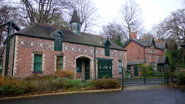
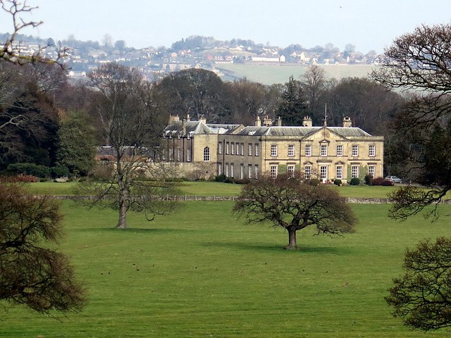
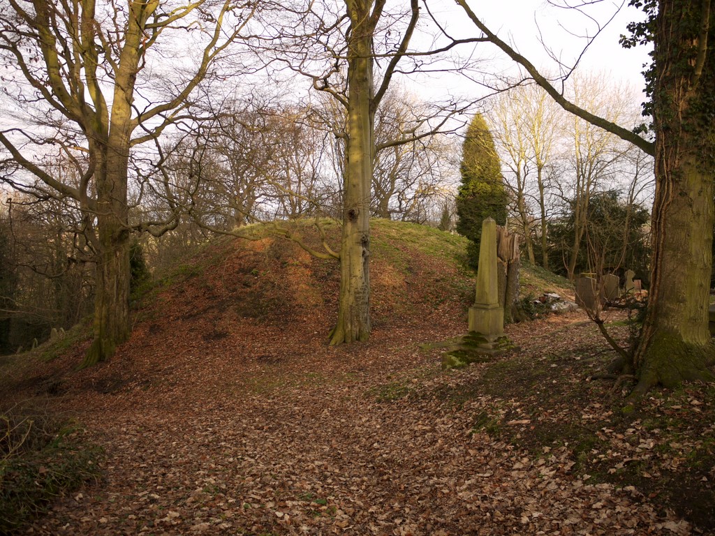
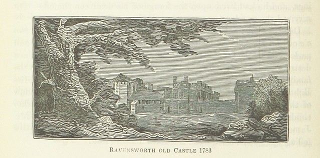
| Ravensworth Castle | 1025151 | II* | Lamesley | Lamesley | |
| Ravensworth Castle | 1025190 | II* | C12th | Lamesley | Lamesley. 2 eastern towers & curtain wall. Scheduled Monument (1016975) |
| Ravensworth Park Farmhouse | 1185135 | II | Lamesley | ||
| South Lodge | 1025188 | II | Lamesley | ||
| Stable Block and Gatehouses to East of Ravensworth Castle | 1185160 | II | Lamesley | ||
| Temple Meads | 1025153 | II | Lamesley | ||
| Tomb of Robert Moscrop About 4 Metres South and 5 Metres East of West End of Church of St Andrew | 1355109 | II | Lamesley | ||
| Upper Forge Bridge | 1025155 | II | Lamesley | ||
| Well in Stable Yard of Ravensworth Castle | 1025191 | II | Lamesley | ||
| Nos. 1-17, Claremont Place | 1277797 | II | Lobley Hill & Bensham | ||
| Nos. 2-5, Barrington Place | 1248530 | II | Lobley Hill & Bensham | ||
| No. 23, Claremont Place | 1248546 | II | Lobley Hill & Bensham | ||
| Bensham Grove | 1248538 | II | Lobley Hill & Bensham | ||
| Church of St Cuthbert | 1248541 | II | 1848 | Lobley Hill & Bensham | Bensham. By John Dobson. |
| Fountain at Entrance to Former Gateshead Union Workhouse (Now Demolished) | 1248527 | II | Lobley Hill & Bensham | ||
| Numbers 235, 235a and 237 and Forecourt Walls, Railings and Gate | 1277867 | II | Lobley Hill & Bensham | ||
| Presbyterian Church Hall | 1248650 | II | Lobley Hill & Bensham | ||
| Nos. 123 and 125, Kells Lane | 1277838 | II | Low fell | ||
| Bellevue House | 1277821 | II | Low fell | ||
| Bellevue Lodge, Walls and Gate Piers | 1277863 | II | Low fell | ||
| Brackendene (North, South and West Houses) | 1248646 | II | Low fell | ||
| Carter's Well Opposite Methodist Church Hall | 1277771 | II | Low fell | ||
| Church of St Helen | 1248532 | II* | 1876 | Low fell | Low Fell |
| Forecourt Walls and Gate Piers to Numbers 123 and 125 | 1248563 | II | Low fell | ||
| Former Joicey Road Open Air School | 1392603 | II | Low fell | ||
| Fountain in Grounds to South West of Whinney Hospital | 1248755 | II | Low fell | ||
| Garden Wall to South West of Number 231 | 1277839 | II | Low fell | ||
| Home House | 1248564 | II | Low fell | ||
| Knox's Buildings | 1277697 | II | Low fell | ||
| Lloyd's Bank | 1277872 | II | Low fell | ||
| Musgrave School | 1277870 | II | Low fell | ||
| South Africa War Memorial | 1248549 | II | Low fell | ||
| Stable Coach House to North of Brackendene and North Gateway Link | 1248543 | II | Low fell | ||
| Underhill | 1248562 | II* | 1860s | Low fell | Low Fell, Kells Lane. House of inventor Joseph Swan. |
| Wesley Memorial Methodist Church | 1248547 | II | Low fell | ||
| Winney House Hospital | 1248548 | II | Low fell | ||
| 3 Section Boundary Markers East of Church of St Mary Extending in a Line 19 Metres South | 1025186 | II | Pelaw & Heworth | ||
| 4 Section Boundary Markers West of Church of St Mary Extending in a Line 19 Metres South | 1185087 | II | Pelaw & Heworth | ||
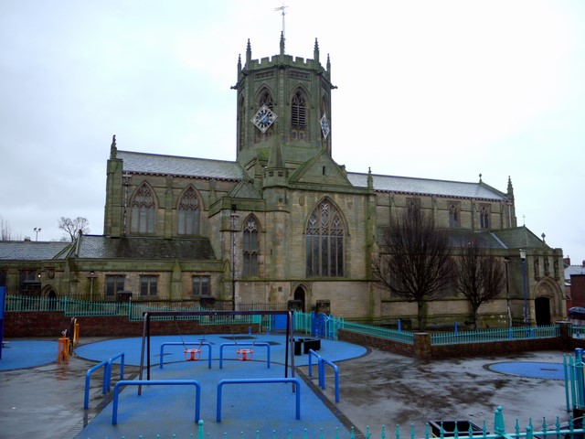
| Church of St Mary | 1025183 | II | 1822 | Pelaw & Heworth | Heworth |
| Dawes Tomb About 19 Metres North of Transept of Church of St Mary | 1185055 | II | Pelaw & Heworth | ||
| Garden Walls and Summerhouse of Former Nether Heworth Hall | 1025147 | II | Pelaw & Heworth | ||
| Group of 3 Grave Covers and 3 Grave Markers 4.5 Metres North of Church of St Mary | 1025184 | II | Pelaw & Heworth | ||
| Haddon Tomb 6.5 Metres North of Transept of Church of St Mary | 1355086 | II* | 1717 | Pelaw & Heworth | |
| Hepburn Tomb 32 Metres South and 29 Metres East of Transept of Church of St Mary | 1355087 | II | Pelaw & Heworth | ||
| Heworth Constitutional Club, Formerly Nether Heworth Hall | 1355084 | II* | C18th | Pelaw & Heworth | |
| Kell Tomb 3 Metres West of North Transept of Church of St Mary | 1025185 | II | Pelaw & Heworth | ||
| Monument 15 Metres West of Church of St Mary | 1185065 | II | Pelaw & Heworth | ||
| Tomb 20 Metres North of Transept of Church of St Mary | 1299851 | II | Pelaw & Heworth | ||
| No. 2, Whitewell Lane | 1025165 | II | Ryton & Crookhill & Stella | ||
| 4 Lamp Posts About 2 Metres South, 17 Metres East and 72 Metres East of Porch of Church of Holy Cros | 1355114 | II | Ryton & Crookhill & Stella | ||
| No. 4, Barmoor Lane | 1025146 | II | Ryton & Crookhill & Stella | ||
| No. 6, Village West | 1355116 | II | Ryton & Crookhill & Stella | ||
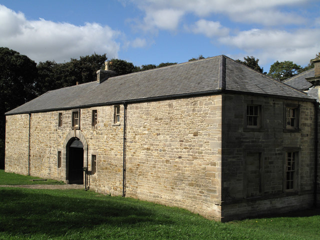
| Barn, Stables, Shelters, Implement Shed and Pig Sties to South of Town Farmhouse | 1025159 | II | Ryton & Crookhill & Stella | ||
| Blaydon Old Bridge | 1380569 | II | 1778 | Ryton & Crookhill & Stella | Bridge over Blaydon Burn |
| Chancer Tomb Above 24 Metres South of Church of Holy Cross | 1185223 | II | Ryton & Crookhill & Stella | ||
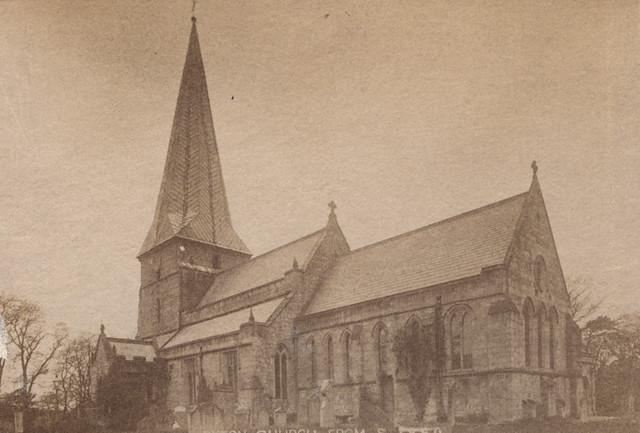
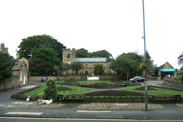
| Church of Holy Cross | 1025160 | I | C13th | Ryton & Crookhill & Stella | Ryton |
| Church of St Hilda | 1185248 | II | Ryton & Crookhill & Stella | ||
| Church of St Mary and St Thomas Aquinas and Prebytery Adjoining | 1355082 | II | 1832 | Ryton & Crookhill & Stella | Stella |
| Cross House | 1299742 | II | Ryton & Crookhill & Stella | ||
| Dean Hall House | 1299758 | II | Ryton & Crookhill & Stella | ||
| Fenwick Tomb About 24 Metres South and 6 Metres East of Church of Holy Cross | 1025161 | II | Ryton & Crookhill & Stella | ||
| Fountain in Wall of Barmoor Lane | 1025158 | II | Ryton & Crookhill & Stella | ||
| Fountain in Wall of Barmoor Lane | 1299764 | II | Ryton & Crookhill & Stella | ||
| Gate Piers to East of Ryton Rectory | 1025162 | II | Ryton & Crookhill & Stella | ||
| High Hedgefield House | 1025163 | II | Ryton & Crookhill & Stella | ||
| Number 4 and Wall Adjoining to North | 1025179 | II | Ryton & Crookhill & Stella | ||
| Pinfold | 1299765 | II | Ryton & Crookhill & Stella | ||
| Ryton War Memorial | 1439972 | II | 1921 | Ryton & Crookhill & Stella | Ryton. Station Bank. |
| Stack Yard Wall to South of Town Farm Building | 1185206 | II | Ryton & Crookhill & Stella | ||
| Stargate War Memorial | 1440563 | II | 1920 | Ryton & Crookhill & Stella | Stargate |
| Stella Hall Cottage | 1299906 | II | Ryton & Crookhill & Stella | ||
| Summerhouse | 1025180 | II | Ryton & Crookhill & Stella | ||
| The Grove (Church Army Home for the Elderly) | 1185209 | II | Ryton & Crookhill & Stella | ||
| The Nook | 1025164 | II | Ryton & Crookhill & Stella | ||
| The Rectory | 1185232 | II* | C18th | Ryton & Crookhill & Stella | |
| Town Farmhouse and Farm Buildings Attached | 1185203 | II | Ryton & Crookhill & Stella | ||
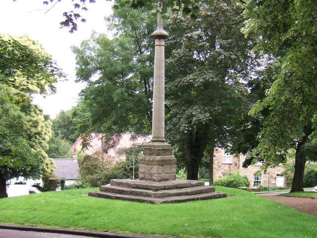
| Village Cross | 1355115 | II | 1795 | Ryton & Crookhill & Stella | Ryton Scheduled Monument (1018642) |
| White House | 1355112 | II | Ryton & Crookhill & Stella | ||
| Aviaries to North East of Saltwell Towers | 1248554 | II | c.1800? | Saltwell | |
| Belvedere Walls, Turrets and Staircases to West and South of Saltwell Towers | 1277873 | II | 1870s | Saltwell | |
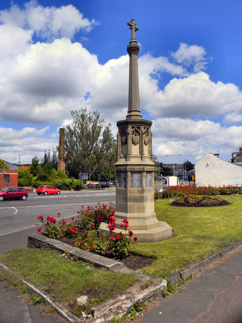
| Boer War Memorial | 1248761 | II | 1905 | Saltwell | |
| Charlton Memorial Drinking Fountain to North West of Saltwell Towers | 1248553 | II | Saltwell | ||
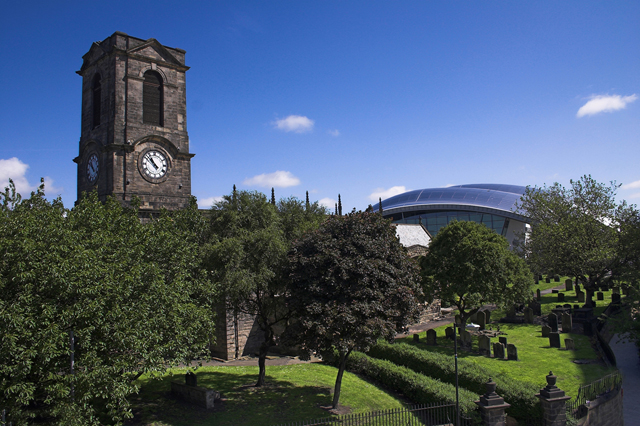
| Church of St Chad | 1277841 | II* | 1903 | Saltwell | Bensham |
| Entrance Gates and Piers to Saltwell Park | 1277843 | II | Saltwell | ||
| Heathfield House | 1248751 | II | Saltwell | ||
| North Shelter in Saltwell Park | 1248555 | II | Saltwell | ||
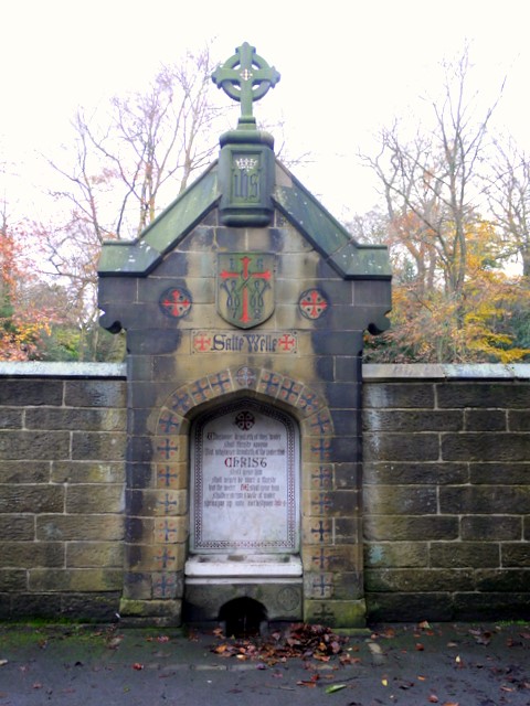
| Salte Well to South of Entrance Gates to Saltwell Park | 1249007 | II | 1872 | Saltwell | |
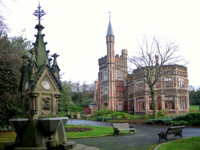
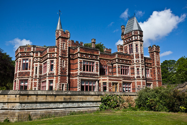
| Saltwell Towers | 1248550 | II | 1862 | Saltwell | Gothic mansion of William Wailes |
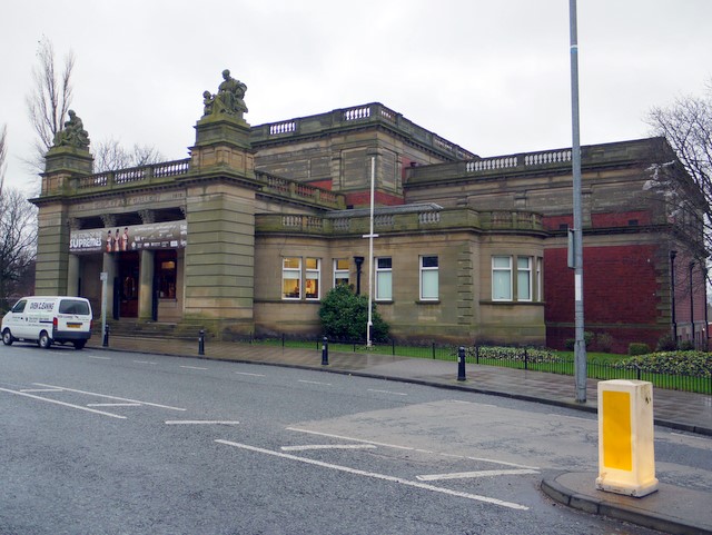
| Shipley Art Gallery | 1248566 | II | 1915 | Saltwell | |
| South Shelter in Saltwell Park | 1277742 | II | Saltwell | ||
| Stable Block to North East of Saltwell Towers | 1277773 | II | 1871 | Saltwell | |
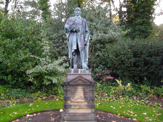
| Statue of Alderman John Lucas | 1248769 | II | 1903 | Saltwell | |
| Walls, Gate Piers and Arches to Main Entrance of Heathfield House and Stable Entrance to North | 1277871 | II | Saltwell | ||
| 'Derwent Walk Express' and supporting bridge abutment and approach spans | 1437836 | II | 1987 | Whickham North | Swalwell, Hexham Road |
| No. 67, Front Street | 1185451 | II | Whickham North | ||
| No. 69, Front Street | 1355105 | II | Whickham North | ||
| Bridge over River Derwent (Tyne and Wear Bridge Number 761) | 1355119 | II* | 1779 | Whickham North | Swalwell |
| Bust of John English at West Corner of Church Chare | 1355103 | II | Whickham North | ||
| Old Bridge End Cottage | 1379968 | II | 1779 | Whickham North | Swalwell. Former toll house. |
| Salisbury House | 1366087 | II | Whickham North | ||
| Swalwall War Memorial | 1366091 | II | 1918 | Whickham North | Swalwell |
| Whickham Cottage Hospital | 1025142 | II | Whickham North | ||
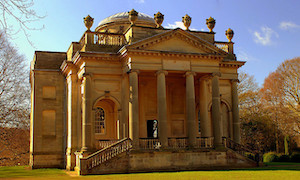
| Banqueting House About 500 Metres East and 300 Metres South of Gibside | 1355118 | I | 1751 | Whickham South & Sunniside | Gibside |
| Chapel House Circa 40 Metres to North West of Chapel | 1299718 | II | Whickham South & Sunniside | ||
| Cox Close House | 1185286 | II | Whickham South & Sunniside | ||
| Forge South East of Junction with A692 | 1355106 | II | Whickham South & Sunniside | ||
| Garden Wall to North of Chapel House and Garden House | 1025168 | II | Whickham South & Sunniside | ||
| Gibside Hall | 1299730 | II* | 1620 | Whickham South & Sunniside | Gibside Enlarged in C18th for George Bowes. Scheduled Monument (1017224) |
| Gibside (grounds) | 1000508 | I | 1730s | Whickham South & Sunniside | Gibside - National Trust. |
| House Behind Cox Close Cottage | 1355117 | II | Whickham South & Sunniside | ||
| Ice House About 90 Metres West and 170 Metres South of Gibside Hall | 1025167 | II | C18th | Whickham South & Sunniside | Gibside |
| Lodges and Gate Piers to South of Junction with Clockburn Lane | 1355102 | II | Whickham South & Sunniside | ||
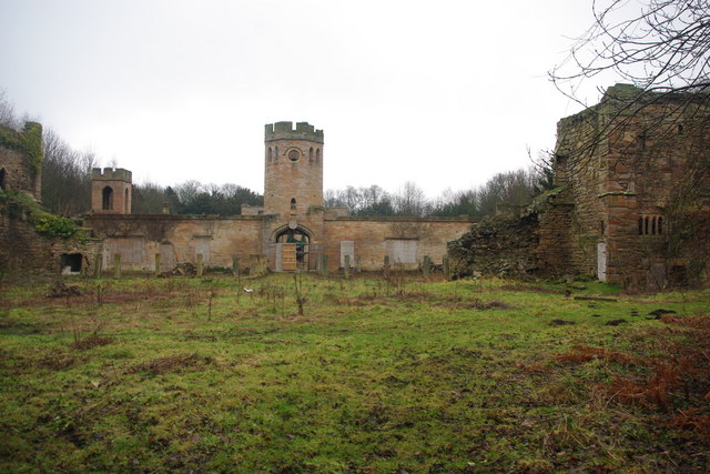
| Old Hollinside | 1025137 | I | C13th | Whickham South & Sunniside | Fortified manor house. Scheduled Monument (1018679) |
| Old Sunniside Farmhouse | 1025149 | II | Whickham South & Sunniside | ||
| Orangery About 300 Metres West and 260 Metres South of Gibside | 1299709 | II* | C18th | Whickham South & Sunniside | Gibside |
| Stables to South East of Gibside | 1185328 | II* | 1746 | Whickham South & Sunniside | Gibside |
| Sundial, Piers and Wall to West of Chapel | 1025169 | II | Whickham South & Sunniside | ||
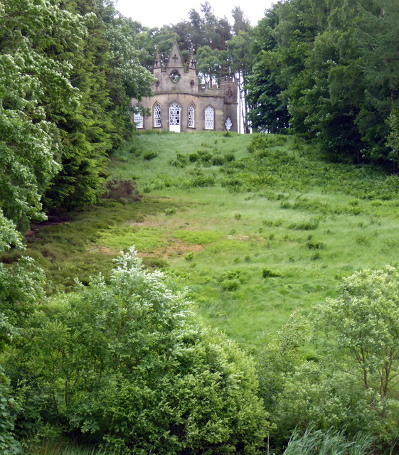
| The Chapel About 350 Metres West and 650 Metres South of Gibside Hall | 1185345 | I | 1769 | Whickham South & Sunniside | Gibside |
| Church of St Alban | 1299810 | II | 1842 | Windy Nook & Whitehills | Windy Nook |
| Gate Piers, Gates and Overthrow to East of Church of St Alban | 1355089 | II | Windy Nook & Whitehills | Windy Nook | |
| No. 24, Front Street | 1184792 | II | Winlaton & High Spen | ||
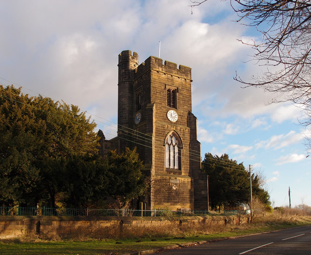
| Church of St Paul | 1025175 | II | 1829 | Winlaton & High Spen | Winlaton |
| Cowen Family Tomb and Wall Attached to North East of Church of St Paul | 1025176 | II | Winlaton & High Spen | ||
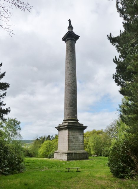
| Monument to British Liberty | 1025166 | I | 1757 | Winlaton & High Spen | Gibside |
| Pawston Birks Farmhouse | 1025174 | II | Winlaton & High Spen | ||
| Winlaton Forge | 1025172 | II | C18th | Winlaton & High Spen | Winlaton |
| Winlaton War Memorial | 1442836 | II | 1918 | Winlaton & High Spen | Winlaton |
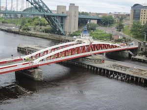
| Swing Bridge Over River Tyne | 1390930 | II* | 1876 | Bridges | Newcastle-Gateshead. Scheduled Monument (1003722) |
| Tyne Bridge (also known as New Tyne Bridge) | 1248569 | II* | 1928 | Bridges | Newcastle-Gateshead |
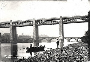
| High Level Bridge | 1248568 | I | 1849 | Bridges | Newcastle-Gateshead |
| King Edward VII Bridge | 1242100 | II | 1906 | Bridges | Newcastle-Gateshead |
| Nos. 3-8, Woodbine Place | 1248574 | II | Bridges | ||
| Nos. 36 and 38, Half Moon Lane | 1277621 | II | Bridges | ||
| Nos. 4-18, Woodbine Terrace | 1277610 | II | Bridges | ||
| Nos. 5-23, Regent Terrace | 1277677 | II | Bridges | ||
| Baptist Church and Sunday School | 1248557 | II | 1877 | Bridges | Gladstone Road. |
| Borough Engineering Department (Iii) | 1248571 | II | Bridges | ||
| Borough Engineering Services Department (I) | 1277844 | II | Bridges | ||
| Borough Engineering Services Department (II) | 1249017 | II | Bridges | ||
| Borough Housing Department | 1277840 | II | C19th | Bridges | Former Gateshead Dispensary, Nelson Street. |
| Chapel of St Edmund and Trinity Centre | 1277874 | I | C13th | Bridges | |
| Christ Church | 1248787 | II | Bridges | ||
| Christadelphian Hall | 1249087 | II | 1873 | Bridges | Eley Street. Now a Mosque |
| Church of St Joseph and Presbytery | 1248573 | II | Bridges | ||
| Church of St Mary | 1248544 | I | C14th | Bridges | Now St Mary's Heritage Centre |
| Clock Tower in Forecourt to West of Town Hall | 1277624 | II | Bridges | ||
| Coal Drops | 1248565 | II | Bridges | ||
| Council Offices (Department of Architectural Services) | 1277865 | II | Bridges | ||
| King Edward Railway Bridge | 1248576 | II | Bridges | ||
| King Edward Railway Bridge | 1242100 | II | Bridges | ||
| Lambton Lodge | 1248560 | II | Bridges | ||
| Mausoleum to East of Church of St Mary | 1248545 | II | Bridges | ||
| Monument to George Hawks | 1277866 | II | Bridges | ||
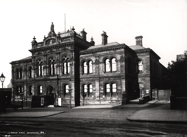
| Municipal Buildings | 1248570 | II | Bridges | ||
| Number 72 with Forecourt Wall | 1248540 | II | Bridges | ||
| Post Office | 1248572 | II | Bridges | ||
| Premises of Messrs Robinson and Spicey Limited (Part) | 1248579 | II | Bridges | ||
| Public Convenience at South End of Approach Span to New Tyne Bridge | 1277869 | II | Bridges | ||
| Railway Bridge of Former York, Newcastle and Berwick Railway | 1248561 | II | Bridges | ||
| The Central Public House | 1248558 | II | 1854 | Bridges | On Half Moon Lane |
| The Crown Public House | 1248542 | II | Bridges | ||
| The Former Boiler Shop of Greensfield Railway Works | 1248971 | II | Bridges | ||
| Town Hall, Ancillary Buildings and Former Police Station to Rear | 1277845 | II | 1870 | Bridges | |
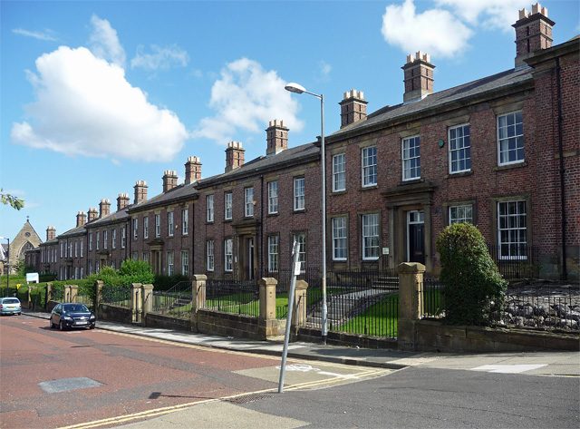
| Walker Terrace | 1277835 | II* | C19th | Bridges | |
| Walls, Gates and Railings Around St Mary's Churchyard | 1277794 | II | Bridges | ||
| No. 12, West Row | - | Local | Birtley | Birtley | |
| Barley Mow Inn, Vigo Lane | - | Local | Birtley | Birtley | |
| Blythe's Pillar - St Joseph's R.C. churchyard | - | Local | Birtley | Birtley | |
| Con Laoghair, 70 Harras Bank | - | Local | Birtley | Birtley | |
| Field House, Birtley Lane | - | Local | Birtley | Birtley | |
| High Lodge, 29 The Avenue | - | Local | Birtley | Birtley | |
| Lloyds TSB Bank, 54 Durham Road | - | Local | Birtley | Birtley | |
| Masonic Hall, Birtley Lane | - | Local | Birtley | Birtley | |
| Primitive Methodist Church and hall, Station Lane | - | Local | Birtley | Birtley | |
| Rockville, 27 The Avenue | - | Local | Birtley | Birtley | |
| Talbot Cottages, 1-6 Birtley Lane | - | Local | Birtley | Birtley | |
| The Railway Hotel, Durham Road | - | Local | Birtley | Birtley | |
| Nos. 1-9 (odd) Commercial Street | - | Local | Blaydon | Winlaton | |
| Axwell Park Estate | - | Local | Blaydon | Blaydon | |
| Black Bull public house, Bridge Street | - | Local | Blaydon | Blaydon | |
| Blaydon Cemetery, Shibdon Road | - | Local | Blaydon | Blaydon | |
| Blaydon House, Garden Street | - | Local | Blaydon | Blaydon | |
| Chapel, Blaydon Cemetery | - | Local | Blaydon | Blaydon | |
| Cowan water fountain, Shibdon Dene | - | Local | Blaydon | Blaydon | |
| Gateway to former Blaydon East School, Shibdon Cottage | - | Local | Blaydon | Blaydon, Shibdon Road | |
| Premises of Elddis Transport, north block of former Churchill Gears Factory | - | Local | Blaydon | Blaydon, Chainbridge Road | |
| Remains of Statue of Giuseppe Garibaldi (head), Blaydon Branch Library | - | Local | Blaydon | Blaydon, The Precinct | |
| Remains of Statue of Giuseppe Garibaldi (legs), St Josephs R.C. Primary School | - | Local | Blaydon | Blaydon, Croftdale Road | |
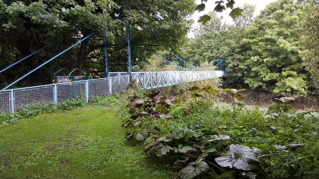
| Sands Suspension Bridge ('The Hikey Bridge') | - | Local | 1902 | Blaydon | Swalwell, Sands Lane |
| Shibdon Dene | - | Local | Blaydon | Blaydon | |
| Signal box | - | Local | Blaydon | Blaydon | |
| The Bisley Hotel, Shibdon Road | - | Local | Blaydon | Blaydon | |
| The Commercial public house | - | Local | Blaydon | Winlaton | |
| Tyne View House | - | Local | Blaydon | Winlaton | |
| Vacant dance Studio (former Library) | - | Local | Blaydon | Blaydon | |
| Path Head Water Mill | - | Local | C18th | Blaydon | Blaydon |
| Nos. 101-107 (odd) Bensham Road (part of Romulus Terrace) | - | Local | Bridges | ||
| Nos. 1-8, King James Street | - | Local | Bridges | ||
| Nos. 2-16, High Level Parade, Wellington Street | - | Local | Bridges | ||
| Nos. 224 to 230, High Street | - | Local | Bridges | ||
| 24-60 (even), Bewick Road | - | Local | Bridges | ||
| No. 241, High Street | - | Local | Bridges | ||
| No. 275, High Street | - | Local | Bridges | ||
| Nos. 297-299, High Street | - | Local | Bridges | ||
| Nos. 9 and 11, Wellington Street | - | Local | Bridges | ||
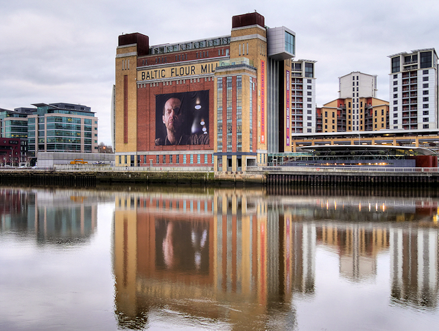
| Baltic Centre for Contemporary Art | - | Local | 1950 | Bridges | South Shore Road, former Flour Mill |
| Blue Bell public house, 347 and 349 High Street | - | Local | Bridges | ||
| Cemetery lodge, Gateshead East Cemetery | - | Local | Bridges | Sunderland Road | |
| Centre for Advanced Rabbinics (former Herdman Hall) | - | Local | Bridges | Prince Consort Road | |
| Co-op Store, 22-28 Jackson Street | - | Local | Bridges | ||
| Co-op Store, 30-34 Jackson Street | - | Local | Bridges | ||
| Curley's Bar and 270-274 (even), High Street | - | Local | Bridges | ||
| Drinking fountain, Gateshead East Cemetery | - | Local | Bridges | Sunderland Road | |
| Fairhaven Lodge – Gateshead East Cemetery | - | Local | Bridges | Cemetery Road | |
| Former C of E Chapel, Gateshead East Cemetery | - | Local | Bridges | Cemetery Road | |
| Former Kelvin Works | - | Local | Bridges | South Shore Road | |
| Former Nonconformist Chapel, Gateshead East Cemetery | - | Local | Bridges | Cemetery Road | |
| Gateshead East Cemetery | - | Local | Bridges | Old Durham Road / Sunderland Road | |
| Gateshead Sculpture Park | - | Local | Bridges | ||
| Kent House, Church Street | - | Local | Bridges | ||
| La Riviera Ristorante, Pipewellgate | - | Local | Bridges | ||
| Lloyds TSB Bank, 15 West Street | - | Local | Bridges | ||
| Railway Club, Hudson Street | - | Local | Bridges | ||
| Retaining walls of former Brandling Junction Railway Station (Jennings Yard) | - | Local | Bridges | Oakwellgate | |
| St. James and St. Bede Church Centre | - | Local | Bridges | Wordsworth Street | |
| The Borough Arms public house, 82 Bensham Road | - | Local | Bridges | ||
| The Grey Nag's Head, 219 High Street | - | Local | Bridges | ||
| The Honeysuckle public house, 92 Coatsworth Road | - | Local | Bridges | ||
| The Metropole public house, High Street | - | Local | Bridges | ||
| The Station Hotel, Hills Street | - | Local | Bridges | ||
| The William IV Inn, High Street | - | Local | Bridges | ||
| War memorial, Gateshead East Cemetery | - | Local | Bridges | Cemetery Road | |
| Windmill Hills Town Park | - | Local | Bridges | ||
| Woodbine Villa, Villa Place | - | Local | Bridges | ||
| Ye Olde Fleece, 289 and 291 High Street | - | Local | Bridges | ||
| Nos. 27 and 29 Derwent Street | - | Local | Chopwell & Rowlands Gill | Chopwell | |
| Beda Lodge, Hookergate Lane | - | Local | Chopwell & Rowlands Gill | High Spen | |
| Gate piers to St. Patrick’s Church | - | Local | Chopwell & Rowlands Gill | High Spen, Lintzford Lane | |
| High Rigg, Hall Road | - | Local | Chopwell & Rowlands Gill | Chopwell | |
| Old Lilley Brickworks, Lockhaugh Road | - | Local | Chopwell & Rowlands Gill | Rowlands Gill | |
| St. John the Evangelist Church | - | Local | 1909 | Chopwell & Rowlands Gill | Chopwell, Clayton Terrace Road |
| Station House, Station Lane | - | Local | Chopwell & Rowlands Gill | Rowlands Gill | |
| Ravensworth quadrangular castle | 1016975 | n/a | Medieval | Lamesley | Scheduled Monument |
1. Primary source: the National Heritage List for England - NHLE is the register of nationally protected historic buildings and sites in England, including listed buildings, scheduled monuments, protected wrecks, registered parks and gardens, and battlefields. The list is maintained by Historic England. Check NHLE for updates and new entries.
Secondary sources: British Listed Buildings and Sitelines.
2. Listed buildings and the local list - Gateshead Council.
Co-Curate Page
Newcastle Swing Bridge
- Overview Further Information Map Street View The Swing Bridge over the River Tyne was first used for road traffic on 15th June 1876 and opened for river traffic on 17th …
Co-Curate Page
High Level Bridge
- Overview About the High Level Bridge Map Street View The High Level Bridge is a 'double decker' road and railway bridge spanning the River Tyne between Newcastle and Gateshead. The …
Co-Curate Page
Monument to British Liberty
- Overview Map Street View The Statue of British Liberty, by Christopher Richardson was built for George Bowes, M.P. and coal owner. The monument is Grade I listed on the National …
Co-Curate Page
Gibside Chapel
- Overview Map Street View The mausoleum chapel at the south end of the 'Grand Walk' at Gibside was built following the death of George Bowes, owner of the estate, in 1760. …
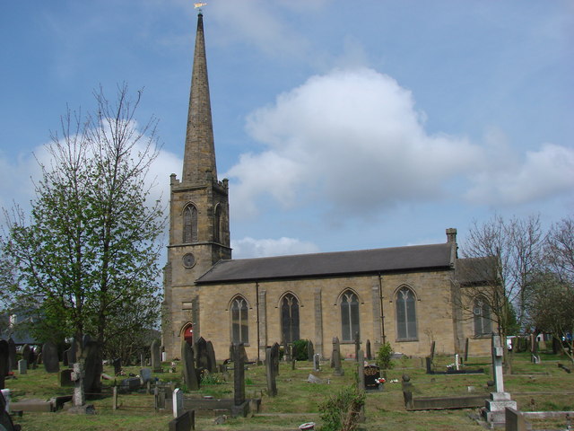
Co-Curate Page
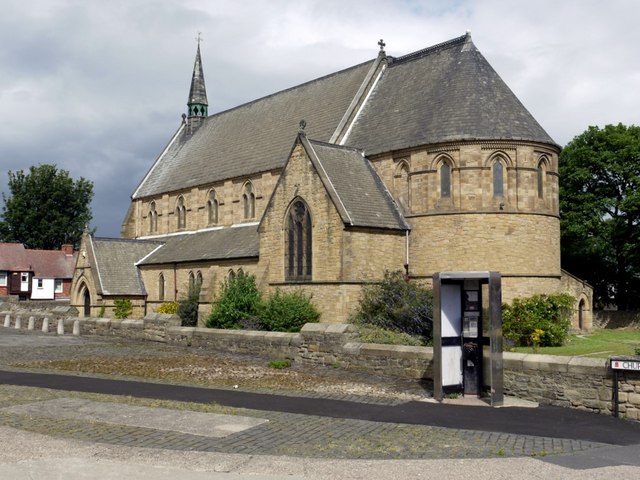
Church of the Holy Cross
- Overview Map Street View Holy Cross Church is located on The Green in Ryton, Gateshead. The parish church dates from the 13th century. It was restored 1877-1886. The church is …
Co-Curate Page
Church of St Mary the Virgin, Whickham
- Overview Map Street View St Mary the Virgin is the parish church in Whickham. The Norman church has a 12th century nave and 13th century aisles. The porch and tower …
Co-Curate Page
Ravensworth Castle
- Overview About the Castle Map A Grade II* listed building and Scheduled Monument. There are three phases to the castle; a medieval quadrangular castle, an 18th century country house, and …
Co-Curate Page
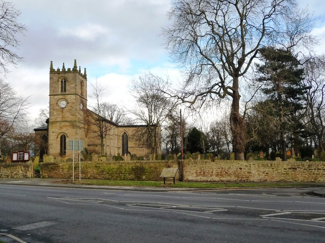
Church of St Andrew
- Overview Map Street View The church in Lamesley has medieval origins and can be trased back at least as far as the 13th century. The current church was built in 1759 repacing …
Co-Curate Page
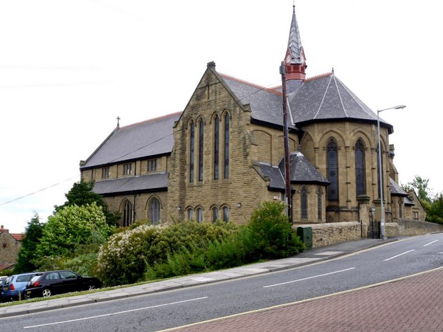
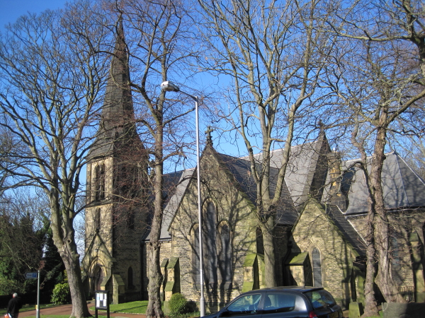
Church of St Chad, Bensham
- Overview Map Street View "St Chad's Church was consecrated in 1903. The church was designed by William Searle Hicks in the style of the Arts and Crafts movement, and built …
Co-Curate Page
War Memorial, Rowlands Gill
- The war memorial in Rowlands Gill is located at the junction of Station Road and Smailes Lane. The memorial was unveiled on the 18th of June, 1921, by Cllr. Brown. …

Co-Curate Page
Battle of Newburn Ford, 1640
- Overview Map of the Battlefield "King Charles I's attempt to impose a new prayer book on the Scots led to military conflict in the summer of 1640. To avoid assaulting …
Co-Curate Page
Dunston Staiths
- Overview About Dunston Staiths Timeline Map Street View "Dunston Staiths on the River Tyne is believed to be the largest timber structure in Europe, at its height, 5.5m tonnes of …
Co-Curate Page
War Memorial, Dunston Hill
- Overview Map Street View The war memorial in Dunston is located at the junction of Ellison Road and King George Avenue. In honour of the local men lost in the …
Co-Curate Page
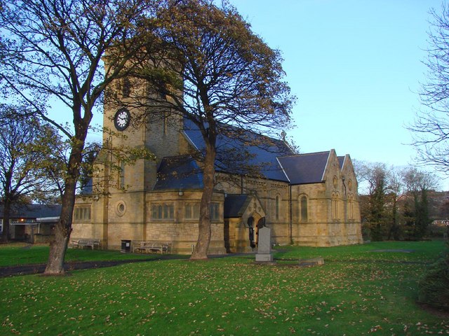
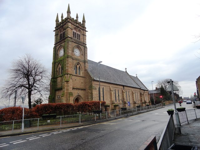
Church of St John the Evangelist
- Overview Map Street View St John's in the parish church in Birtley. The church was consecrated by the Bishop of Durham on 9th August 1849. Shortly afterwards on the 8th …
Co-Curate Page
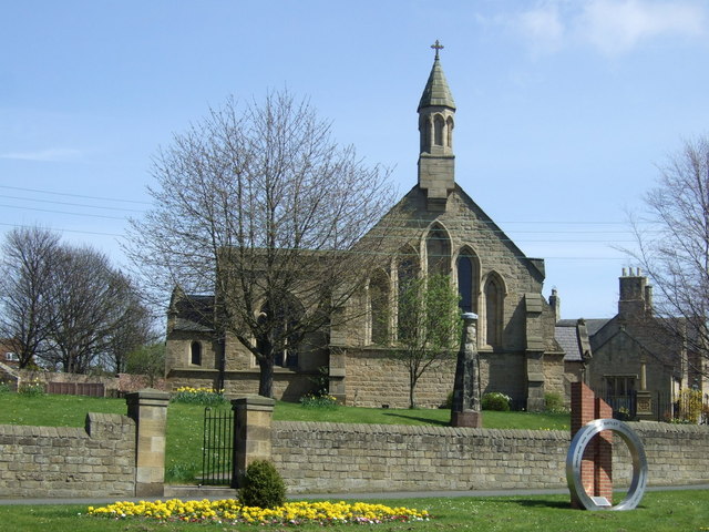
Church of St Joseph
- Overview Map Street View St Joseph's Church in Birtley was desigened by John Dobson and was opened by 1843 to replace the Birtley Roman Catholic Mission, which had moved to …
Co-Curate Page
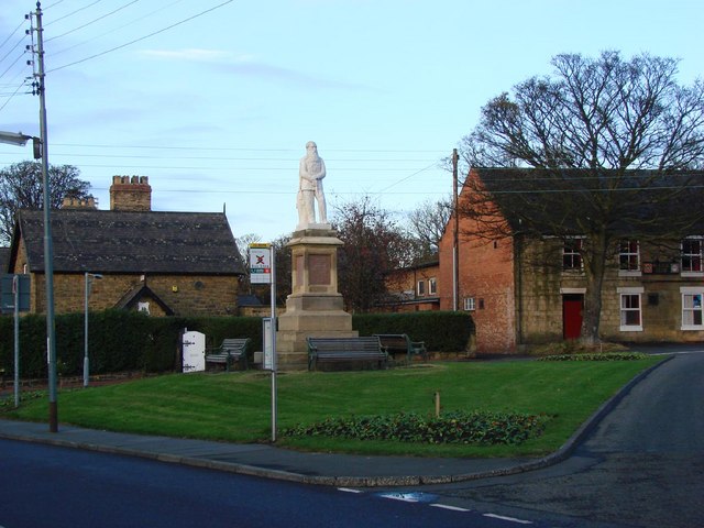
Statue of Edward Moseley Perkins
- Overview Map Street View Edward Mosely Perkins (1821-1871) came to Birtley as a partner in its Iron Company and two local pits in 1858, and lived in Birtley Hall. He …
Co-Curate Page
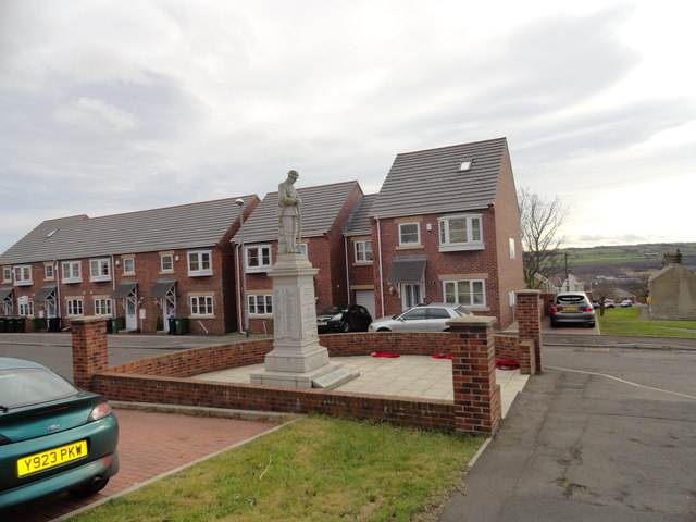
War Memorial, Blaydon
- Overview Map Street View The War Memorial is located outside the cemetry on Shibdon Road in Blaydon. The memorial was unveiled on the 7th of April 1923, dedicated to 201 …
Co-Curate Page
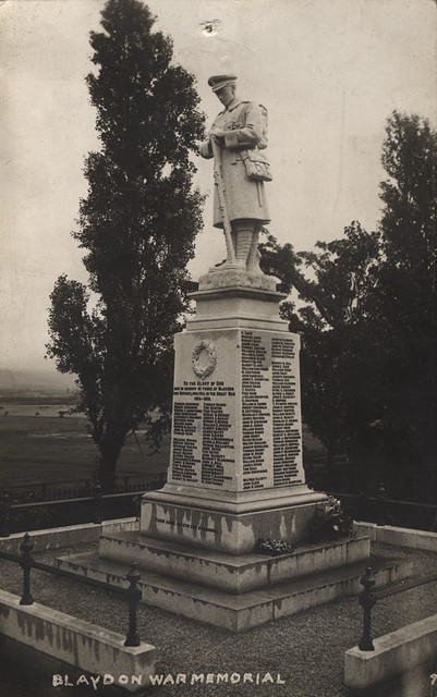
Chopwell War Memorial
- The war memorial in Chopwell commemorates the 205 local people who lost their lives in the First World War. It was reported that about 7,000 people attended the ceremony unveiling …
Co-Curate Page
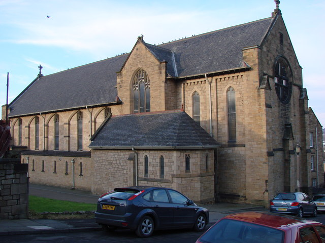
Christ Church
- Overview Map Street View Christ Church, on Carlisle Street in Felling, was built in 1866 by Austin and Johnson. The north aisle and vestry was added in 1903 by J. …
Co-Curate Page
Crow Hall
- A county house from the early 1700's, which gives its name to Crowhall Lane in Felling, where it is located. It is a private dwelling. Now a Grade II* Listed …
Co-Curate Page
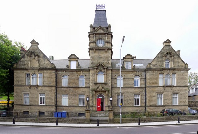
Former Council Offices, Sunderland Road
- Overview Map Street View Former Council Offices on Sunderland Road in Felling, built in 1902, now appartments ('The Appartment Company'). The building was designed by Henry Miller for, what was …
Co-Curate Page
St Patrick's RC Church
- Overview Map Street View St Patricks, on High Street in Felling, is a Roman Catholic parish church. The church was built 1893-1895 by C. Walker of Newcastle. It is Grade …
Co-Curate Page
St Mary's Church
- Overview Map Street View St Mary's is the Anglican parish church for Heworth, Pelaw, Bill Quay and Wardley, located to the east of Gateshead on Shields Road, near Heworth Metro.[1] The …
Co-Curate Page
Church of St Helen, Low Fell
- Overview Map Street View "The Parish of Saint Helen owes its existence to the large population explosion experienced by industrial centres of the nineteenth century. Until then Low Fell had …
Co-Curate Page
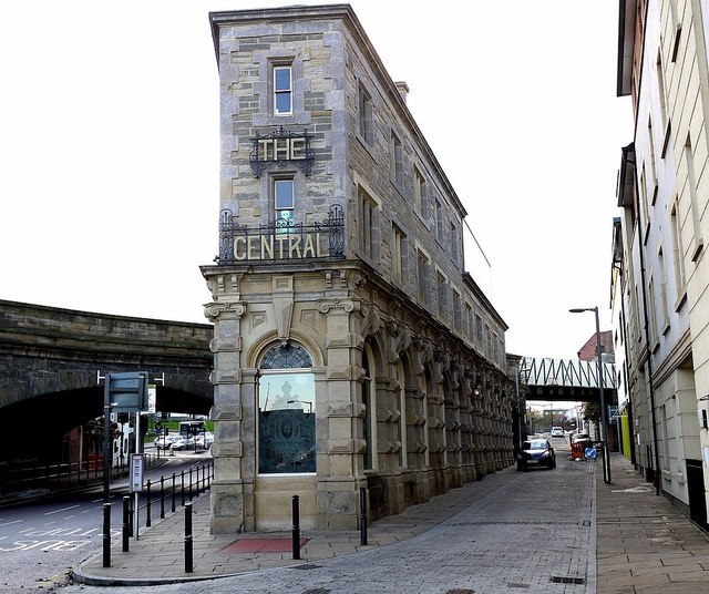
The Central
- Overview Map Street View The Central is a public house on Half Moon Lane and Hills Street in Gateshead. It was built in 1856, designed by M. Thompson for Alderman Potts, wine merchant, …
Co-Curate Page
Underhill, Kells Lane, Low Fell
- Overview About Underhill Map Street View Underhill is a large house at 99 Kells Lane in Low Fell, Gateshead - built in the 1860s. The inventor, Joseph Swan, lived at …
Co-Curate Page
Boer War Memorial
- There is a war memorial in Saltwell Park, Gateshead, which commemorates local servicemen who lost their lives in the Boer War. The memorial dates from 1905 and is Grade II …
Co-Curate Page
Charlton Memorial Fountain
- Inscribed: "GEORGE CHARLTON ESQ JP Mayor of Gateshead 1874 and 1875 in recognition of his labours in the cause of social reform"
Co-Curate Page
Shipley Art Gallery
- Overview About the Gallery Map Street View The Shipley Art Gallery, on Prince Consort Road, Gateshead, has around 800 paintings representing all the main schools of European art from the …
Co-Curate Page
Saltwell Towers
- Saltwell Towers was built in 1862 by William Wailes a renound stained glass manufacturer. The Victorian mansion was bulit in a Gothic Revivalist style and is now the Saltwell Park Visitors Centre …
Co-Curate Page
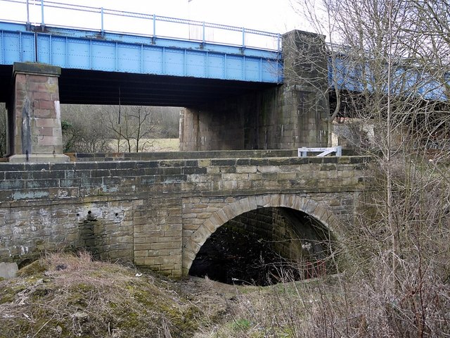
Old Derwent Bridge
- Overview Map Street View The stone bridge over the River Derwent at Swalwell was built in c.1779 for the Gateshead - Hexham Turnpike road.[1] It is known as the Clavering …

Co-Curate Page
Wardley Medieval Moated Site
- Scheduled Monument areas - based on Historic England data (Open Government Licence). There are earthwork remains at Wardley, Gateshead, of a medieval moated site and associated ridge and furrow cultivation. …
Co-Curate Page
Church of St Paul
- Overview Map Street View St Paul's Church in Winlaton was built 1827-1829 and designed by Ignatius Bonomi.[1] The church was consicrated in 1828. It was remodelled in the 1890s. The …

Co-Curate Page
Winlaton Forge
- Overview Map Street View Winlaton Forge is the last surviving link in the village with Crowley's Iron Works. Ambrose Crowley's works dominated the iron manufacturing trade in the North East …
Co-Curate Page
The Hikey Bridge
- The Sands Suspension Bridge, known locally as the 'Hikey Bidge', is a footbridge over the River Derwent at Swalwell, Gateshead. It was built in 1902 to link the allotments on …
Co-Curate Page
Baltic Centre for Contemporary Art
- Overview About the Baltic Map Street View The original Baltic Flour Mills were opened in 1950, built for the Rank Hovis company based on a 1930s design by Gelder and …
Co-Curate Page
Church of St. John the Evangelist, Chopwell
- Overview Map Street View The Church of St. John the Evangelist in Chopwell opened in 1909. It replaced an existing smaller church, as the parish population had expanded rapidy with …
Co-Curate Page
Church of St John, Gateshead Fell
- Overview About St John's Church Map Street View St John's Church, Gateshead Fell, is in Church Road, Sheriff Hill, Gateshead, Tyne and Wear, England. It is an active Anglican …
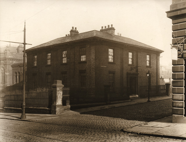
Co-Curate Page
Gateshead Dispensary, Nelson Street
- Overview Map Street View The Old Dispensary on the corner of Nelson Street and West Street in Gateshead was originally a villa built in the early 19th century. Prompted by …
Co-Curate Page
War Memorial, Clara Vale
- Overview Map Street View The War Memorial in Clara Vale is located on a prominent triangular plot at the junction of Stannerford Road and Edington Gardens. The memorial was unveiled on …

Co-Curate Page
Church of St. Alban, Windy Nook
- Overview Map Street View St Alban's Church is located off Windy Nook Road in the Windy Nook area of Gateshead. The parish church was built 1841-1842 by Thomas Liddell and …
Co-Curate Page
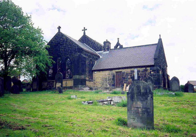
Stephens Hall, near Greenside
- Overview Map Stephens Hall Farm is located off Lead Road, to the east of Greenside and south of Ryton. Stephens Hall is a small fortified manor house dated 1635, with later …
Co-Curate Page
War Memorial, Whickham
- Overview Map Street View The War Memorial in Whickham is located off Front Steet by the corner of Church Green and the Harry Clasper (former Council Buildings). The memorial was …
Co-Curate Page
War Memorial, Greenside
- Overview Map Street View The War Memorial in Greenside, Gateshead, is located at the junction of Lead Road and Spen Lane. The memorial was unveiled on the 1st of October …

Co-Curate Page
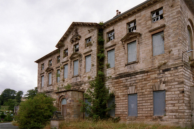
The Mansion House, Dunston Hill
- Overview Map Street View The Mansion House is a former country house (now apartments) in the Mansion Heights estate, in the Dunstan Hill area of Gateshead. Known as Dunston Hill …
Co-Curate Page
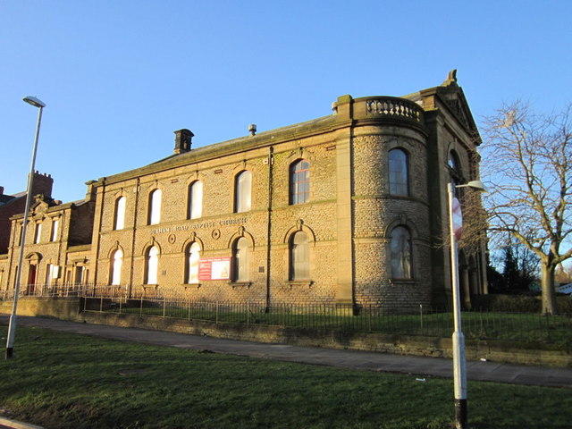
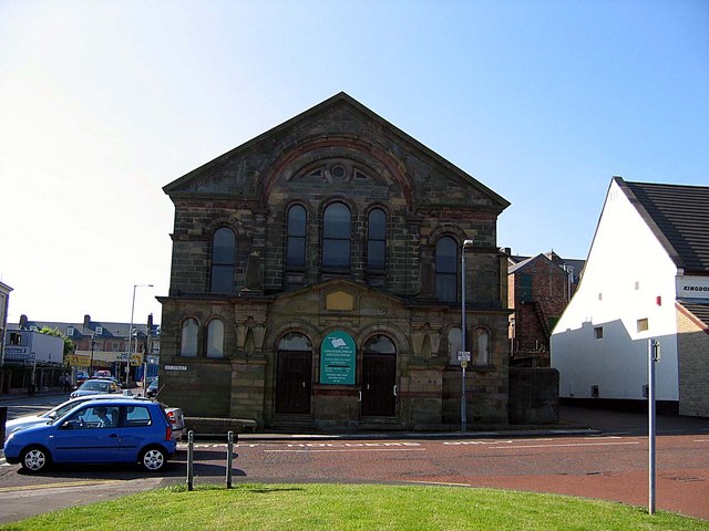
Gateshead Central Baptist Church
- Overview Map Street View Gateshead Central Baptist Church (formerly Durham Road Baptist Church) is located on the corner of High West Street and Gladstone Terrace in Gateshead. This Baptist Church …
Co-Curate Page
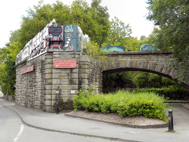
Derwent Walk Express
- Overview Map Street View The Derwent Walk Express is an art work by Andy Frost, which was installed in 1987 on Hexham Road in Swalwall, Gateshead. It is a two-thirds …
Co-Curate Page
Old Bridge over Blaydon Burn
- Overview Map Street View There is an old stone road bridge over Blaydon Burn (stream) which is directly north of the modern road bridge. This older single arched bridge dates …
Co-Curate Page
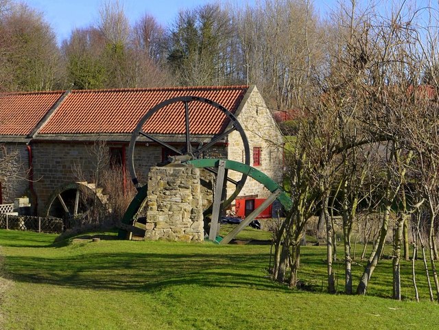
Path Head Water Mill, Blaydon
- Overview Map Street View The 18th Century Water Mill at Path Head, on Summerhill near Blaydon. The mill was derelict by 1974, but has been restored and renovated by the Vale …
Co-Curate Page
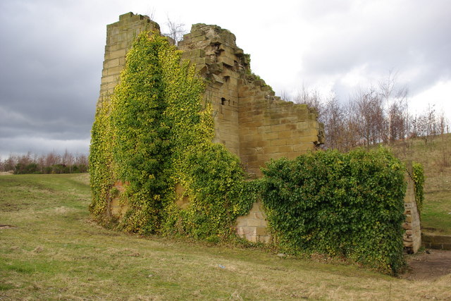
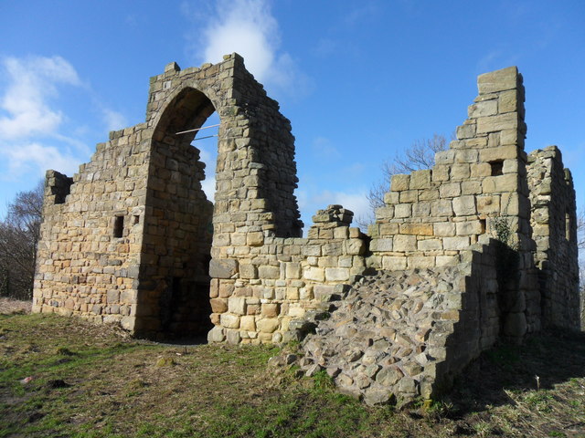
Old Hollinside
- Overview Map A 13th Century fortified manor house. Old Hollinside is a substantial ruin on the edge of the River Derwent valley, located just over a mile south-west of Whickham. …
Co-Curate Page
Masjid Islamia Naqshabandiya (Gateshead)
- Overview Map Street View Masjid Islamia Naqshabandiya (Gateshead) is a mosque at No. 1 Ely Street, on the junction with Prince Consort Road, in Gateshead. The building was originally a …
Co-Curate Page
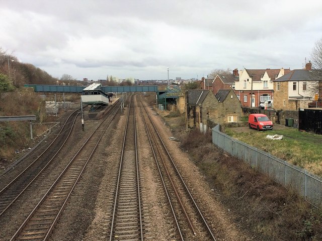
Old Felling Station
- Overview Map Street View The original Felling Station (aka Brandling Station) was built by the Brandling Junction Railway, as short distance east of where Felling Metro Station now stands. Work …
Co-Curate Page
Motte Castle, Ryton
- Map showing the Scheduled Monument area of the Motte Castle, north of Holycross Church, Ryton In the the churchyard, to the north of Holycross Church in Ryton, are the remains …
Co-Curate Page
Ditched enclosure S of North View, Coalburns
- Map showing North View Farm, with the Scheduled Monument area to the south. North View Farm is located on Bradley Fell Road, about 1½ miles SSW of Greenside and ¾mile …

Co-Curate Page
Newcastle Swing Bridge
- Overview Further Information Map Street View The Swing Bridge over the River Tyne was first used for road traffic on 15th June 1876 and opened for river traffic on 17th …
Co-Curate Page
High Level Bridge
- Overview About the High Level Bridge Map Street View The High Level Bridge is a 'double decker' road and railway bridge spanning the River Tyne between Newcastle and Gateshead. The …
Co-Curate Page
Monument to British Liberty
- Overview Map Street View The Statue of British Liberty, by Christopher Richardson was built for George Bowes, M.P. and coal owner. The monument is Grade I listed on the National …
Co-Curate Page
Gibside Chapel
- Overview Map Street View The mausoleum chapel at the south end of the 'Grand Walk' at Gibside was built following the death of George Bowes, owner of the estate, in 1760. …
Co-Curate Page
Church of the Holy Cross
- Overview Map Street View Holy Cross Church is located on The Green in Ryton, Gateshead. The parish church dates from the 13th century. It was restored 1877-1886. The church is …
Co-Curate Page
Church of St Mary the Virgin, Whickham
- Overview Map Street View St Mary the Virgin is the parish church in Whickham. The Norman church has a 12th century nave and 13th century aisles. The porch and tower …
Co-Curate Page
Ravensworth Castle
- Overview About the Castle Map A Grade II* listed building and Scheduled Monument. There are three phases to the castle; a medieval quadrangular castle, an 18th century country house, and …
Co-Curate Page
Church of St Andrew
- Overview Map Street View The church in Lamesley has medieval origins and can be trased back at least as far as the 13th century. The current church was built in 1759 repacing …
Co-Curate Page
Church of St Chad, Bensham
- Overview Map Street View "St Chad's Church was consecrated in 1903. The church was designed by William Searle Hicks in the style of the Arts and Crafts movement, and built …
Co-Curate Page
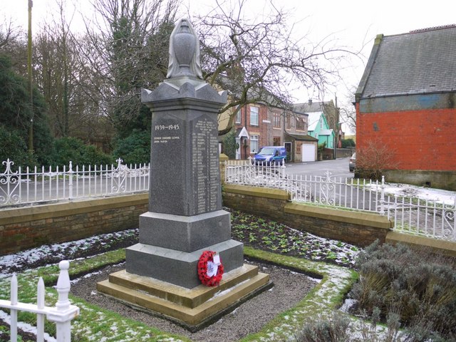
War Memorial, Rowlands Gill
- The war memorial in Rowlands Gill is located at the junction of Station Road and Smailes Lane. The memorial was unveiled on the 18th of June, 1921, by Cllr. Brown. …
Co-Curate Page
Battle of Newburn Ford, 1640
- Overview Map of the Battlefield "King Charles I's attempt to impose a new prayer book on the Scots led to military conflict in the summer of 1640. To avoid assaulting …
Co-Curate Page
Dunston Staiths
- Overview About Dunston Staiths Timeline Map Street View "Dunston Staiths on the River Tyne is believed to be the largest timber structure in Europe, at its height, 5.5m tonnes of …
Co-Curate Page
War Memorial, Dunston Hill
- Overview Map Street View The war memorial in Dunston is located at the junction of Ellison Road and King George Avenue. In honour of the local men lost in the …
Co-Curate Page
Church of St John the Evangelist
- Overview Map Street View St John's in the parish church in Birtley. The church was consecrated by the Bishop of Durham on 9th August 1849. Shortly afterwards on the 8th …
Co-Curate Page
Church of St Joseph
- Overview Map Street View St Joseph's Church in Birtley was desigened by John Dobson and was opened by 1843 to replace the Birtley Roman Catholic Mission, which had moved to …
Co-Curate Page
Statue of Edward Moseley Perkins
- Overview Map Street View Edward Mosely Perkins (1821-1871) came to Birtley as a partner in its Iron Company and two local pits in 1858, and lived in Birtley Hall. He …
Co-Curate Page
War Memorial, Blaydon
- Overview Map Street View The War Memorial is located outside the cemetry on Shibdon Road in Blaydon. The memorial was unveiled on the 7th of April 1923, dedicated to 201 …
Co-Curate Page
Chopwell War Memorial
- The war memorial in Chopwell commemorates the 205 local people who lost their lives in the First World War. It was reported that about 7,000 people attended the ceremony unveiling …
Co-Curate Page
Christ Church
- Overview Map Street View Christ Church, on Carlisle Street in Felling, was built in 1866 by Austin and Johnson. The north aisle and vestry was added in 1903 by J. …
Co-Curate Page
Crow Hall
- A county house from the early 1700's, which gives its name to Crowhall Lane in Felling, where it is located. It is a private dwelling. Now a Grade II* Listed …
Co-Curate Page
Former Council Offices, Sunderland Road
- Overview Map Street View Former Council Offices on Sunderland Road in Felling, built in 1902, now appartments ('The Appartment Company'). The building was designed by Henry Miller for, what was …
Co-Curate Page
St Patrick's RC Church
- Overview Map Street View St Patricks, on High Street in Felling, is a Roman Catholic parish church. The church was built 1893-1895 by C. Walker of Newcastle. It is Grade …
Co-Curate Page
St Mary's Church
- Overview Map Street View St Mary's is the Anglican parish church for Heworth, Pelaw, Bill Quay and Wardley, located to the east of Gateshead on Shields Road, near Heworth Metro.[1] The …
Co-Curate Page
Church of St Helen, Low Fell
- Overview Map Street View "The Parish of Saint Helen owes its existence to the large population explosion experienced by industrial centres of the nineteenth century. Until then Low Fell had …
Co-Curate Page
The Central
- Overview Map Street View The Central is a public house on Half Moon Lane and Hills Street in Gateshead. It was built in 1856, designed by M. Thompson for Alderman Potts, wine merchant, …
Co-Curate Page
Underhill, Kells Lane, Low Fell
- Overview About Underhill Map Street View Underhill is a large house at 99 Kells Lane in Low Fell, Gateshead - built in the 1860s. The inventor, Joseph Swan, lived at …
Co-Curate Page
Boer War Memorial
- There is a war memorial in Saltwell Park, Gateshead, which commemorates local servicemen who lost their lives in the Boer War. The memorial dates from 1905 and is Grade II …
Co-Curate Page
Charlton Memorial Fountain
- Inscribed: "GEORGE CHARLTON ESQ JP Mayor of Gateshead 1874 and 1875 in recognition of his labours in the cause of social reform"
Co-Curate Page
Shipley Art Gallery
- Overview About the Gallery Map Street View The Shipley Art Gallery, on Prince Consort Road, Gateshead, has around 800 paintings representing all the main schools of European art from the …
Co-Curate Page
Saltwell Towers
- Saltwell Towers was built in 1862 by William Wailes a renound stained glass manufacturer. The Victorian mansion was bulit in a Gothic Revivalist style and is now the Saltwell Park Visitors Centre …
Co-Curate Page
Old Derwent Bridge
- Overview Map Street View The stone bridge over the River Derwent at Swalwell was built in c.1779 for the Gateshead - Hexham Turnpike road.[1] It is known as the Clavering …
Co-Curate Page
Wardley Medieval Moated Site
- Scheduled Monument areas - based on Historic England data (Open Government Licence). There are earthwork remains at Wardley, Gateshead, of a medieval moated site and associated ridge and furrow cultivation. …
Co-Curate Page
Church of St Paul
- Overview Map Street View St Paul's Church in Winlaton was built 1827-1829 and designed by Ignatius Bonomi.[1] The church was consicrated in 1828. It was remodelled in the 1890s. The …
Co-Curate Page
Winlaton Forge
- Overview Map Street View Winlaton Forge is the last surviving link in the village with Crowley's Iron Works. Ambrose Crowley's works dominated the iron manufacturing trade in the North East …
Co-Curate Page
The Hikey Bridge
- The Sands Suspension Bridge, known locally as the 'Hikey Bidge', is a footbridge over the River Derwent at Swalwell, Gateshead. It was built in 1902 to link the allotments on …
Co-Curate Page
Baltic Centre for Contemporary Art
- Overview About the Baltic Map Street View The original Baltic Flour Mills were opened in 1950, built for the Rank Hovis company based on a 1930s design by Gelder and …
Co-Curate Page
Church of St. John the Evangelist, Chopwell
- Overview Map Street View The Church of St. John the Evangelist in Chopwell opened in 1909. It replaced an existing smaller church, as the parish population had expanded rapidy with …
Co-Curate Page
Church of St John, Gateshead Fell
- Overview About St John's Church Map Street View St John's Church, Gateshead Fell, is in Church Road, Sheriff Hill, Gateshead, Tyne and Wear, England. It is an active Anglican …
Co-Curate Page
Gateshead Dispensary, Nelson Street
- Overview Map Street View The Old Dispensary on the corner of Nelson Street and West Street in Gateshead was originally a villa built in the early 19th century. Prompted by …
Co-Curate Page
War Memorial, Clara Vale
- Overview Map Street View The War Memorial in Clara Vale is located on a prominent triangular plot at the junction of Stannerford Road and Edington Gardens. The memorial was unveiled on …
Co-Curate Page
Church of St. Alban, Windy Nook
- Overview Map Street View St Alban's Church is located off Windy Nook Road in the Windy Nook area of Gateshead. The parish church was built 1841-1842 by Thomas Liddell and …
Co-Curate Page
Stephens Hall, near Greenside
- Overview Map Stephens Hall Farm is located off Lead Road, to the east of Greenside and south of Ryton. Stephens Hall is a small fortified manor house dated 1635, with later …
Co-Curate Page
War Memorial, Whickham
- Overview Map Street View The War Memorial in Whickham is located off Front Steet by the corner of Church Green and the Harry Clasper (former Council Buildings). The memorial was …
Co-Curate Page
War Memorial, Greenside
- Overview Map Street View The War Memorial in Greenside, Gateshead, is located at the junction of Lead Road and Spen Lane. The memorial was unveiled on the 1st of October …
Co-Curate Page
The Mansion House, Dunston Hill
- Overview Map Street View The Mansion House is a former country house (now apartments) in the Mansion Heights estate, in the Dunstan Hill area of Gateshead. Known as Dunston Hill …
Co-Curate Page
Gateshead Central Baptist Church
- Overview Map Street View Gateshead Central Baptist Church (formerly Durham Road Baptist Church) is located on the corner of High West Street and Gladstone Terrace in Gateshead. This Baptist Church …
Co-Curate Page
Derwent Walk Express
- Overview Map Street View The Derwent Walk Express is an art work by Andy Frost, which was installed in 1987 on Hexham Road in Swalwall, Gateshead. It is a two-thirds …
Co-Curate Page
Old Bridge over Blaydon Burn
- Overview Map Street View There is an old stone road bridge over Blaydon Burn (stream) which is directly north of the modern road bridge. This older single arched bridge dates …
Co-Curate Page
Path Head Water Mill, Blaydon
- Overview Map Street View The 18th Century Water Mill at Path Head, on Summerhill near Blaydon. The mill was derelict by 1974, but has been restored and renovated by the Vale …
Co-Curate Page
Old Hollinside
- Overview Map A 13th Century fortified manor house. Old Hollinside is a substantial ruin on the edge of the River Derwent valley, located just over a mile south-west of Whickham. …
Co-Curate Page
Masjid Islamia Naqshabandiya (Gateshead)
- Overview Map Street View Masjid Islamia Naqshabandiya (Gateshead) is a mosque at No. 1 Ely Street, on the junction with Prince Consort Road, in Gateshead. The building was originally a …
Co-Curate Page
Old Felling Station
- Overview Map Street View The original Felling Station (aka Brandling Station) was built by the Brandling Junction Railway, as short distance east of where Felling Metro Station now stands. Work …
Co-Curate Page
Motte Castle, Ryton
- Map showing the Scheduled Monument area of the Motte Castle, north of Holycross Church, Ryton In the the churchyard, to the north of Holycross Church in Ryton, are the remains …
