English Heritage
English Heritage locations in Northern England:
| Site (click for details) | Overview | Location | |
|
|
Near Bishop Auckland | County Durham | |
|
|
Near Corbridge | Northumberland | |
|
|
Barnard Castle (town) | County Durham | |
|
|
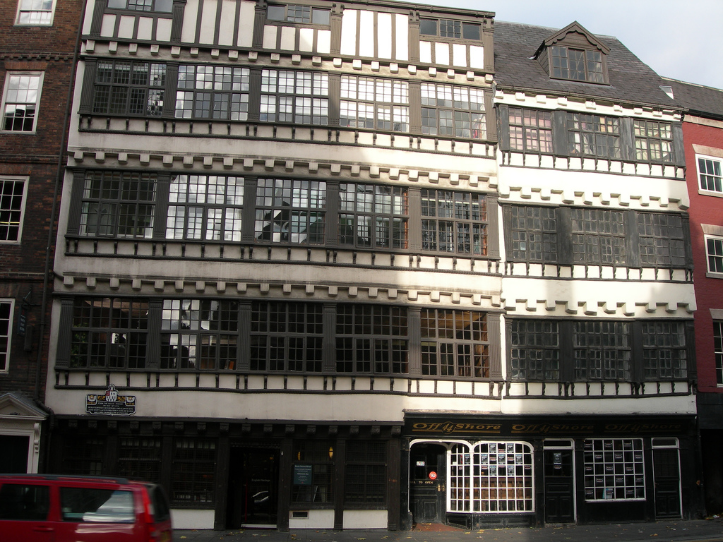
These two five-storey 16th and 17th century merchants' houses (later consolidated into a single building) are prime examples of Jacobean domestic architecture. The house is best known as the scene of the elopement of Bessie Surtees with John Scott, who later became Lord Chancellor of England. | Newcastle (Quayside) | Tyne & Wear |
|
|
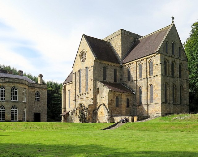
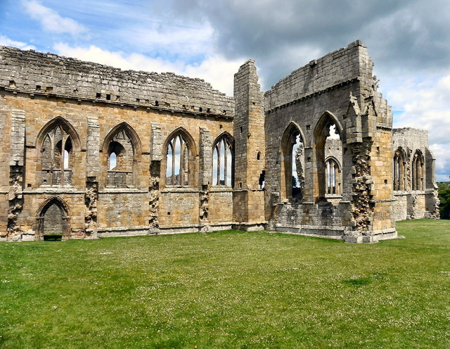
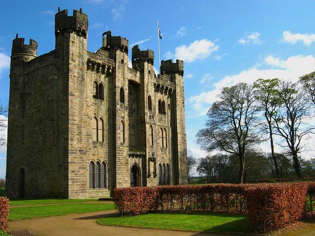
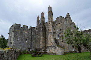
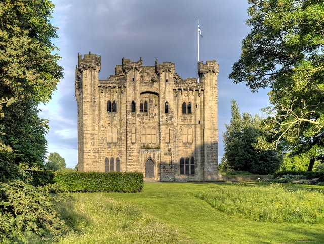
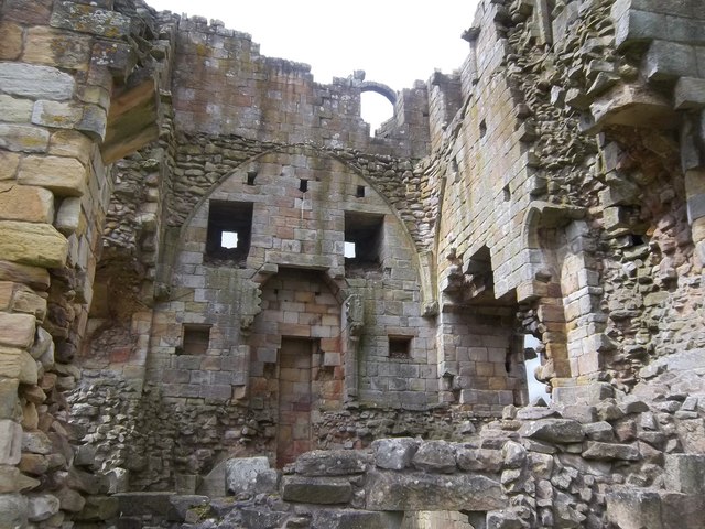
Belsay | Northumberland | |
|
|
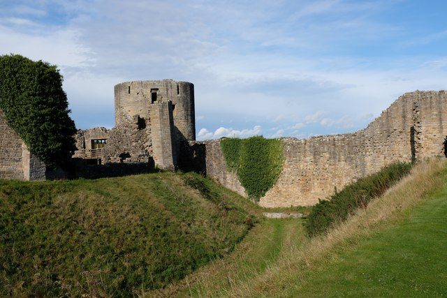
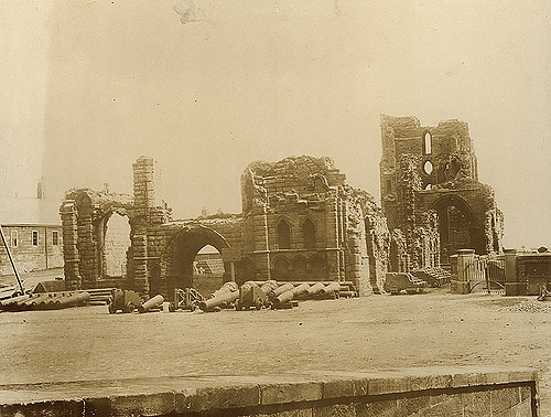
Berwick-upon-Tweed | Northumberland | |
|
Berwick Castle & Berwick Ramparts
|
Berwick-upon-Tweed | Northumberland | |
|
|
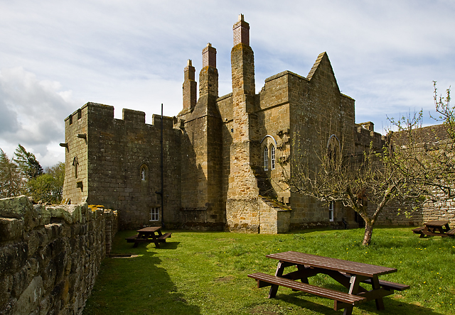
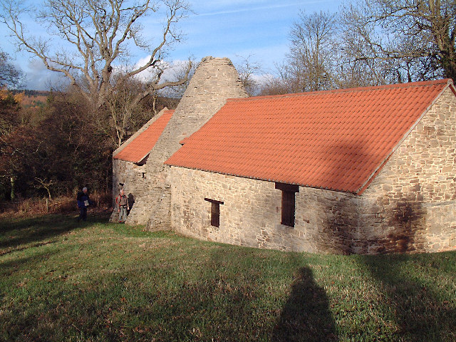
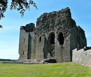
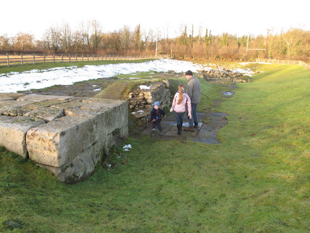
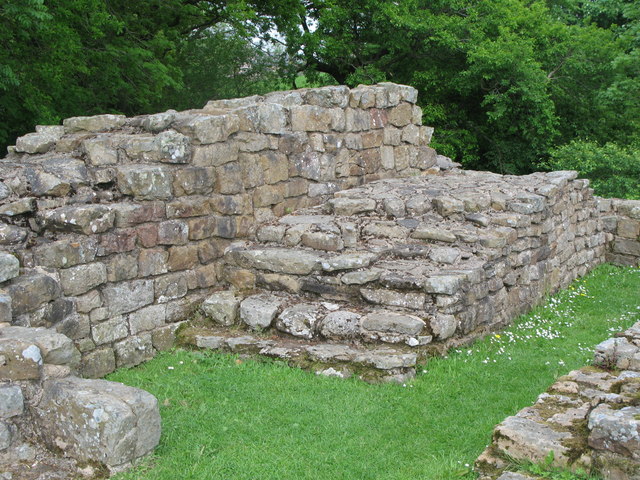
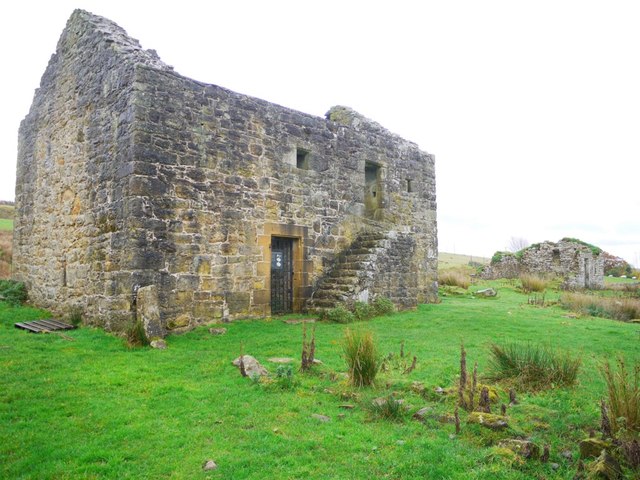
Black Middens Bastle House is at an isolated location on the north side of the Tarset Valley. It was built in the late 16th/early 17th century, one of a number of bastle houses (fortified farmhouses) in the area, built in times of frequent border raids and hostilities between England and Scotland. | Near Greenhaugh | Northumberland |
|
|
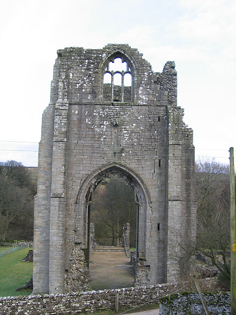
Near Longframlington | Northumberland | |
|
|
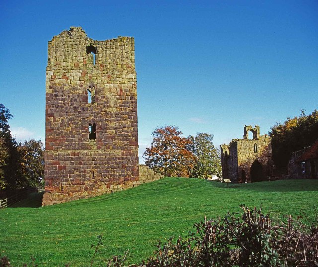
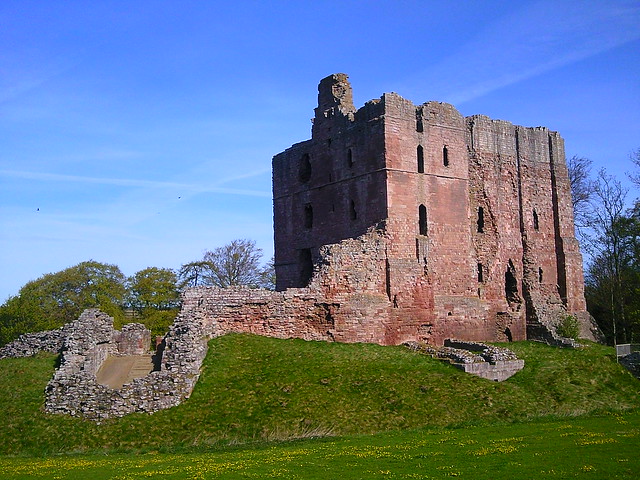
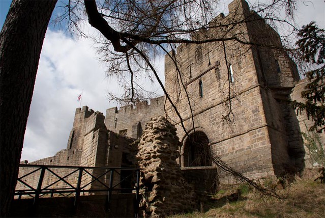
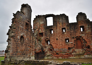
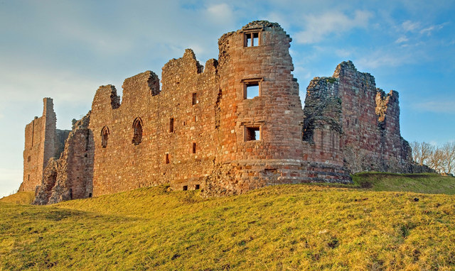
Bowes | County Durham | |
|
|
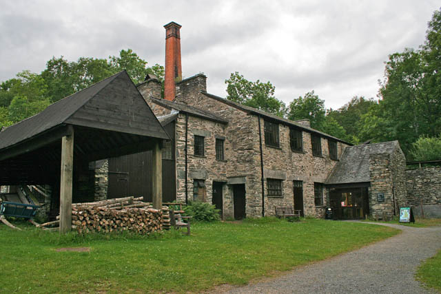
Built in the 1720s, Derwentcote is the earliest and most complete steel-making furnace in Britain. It was used for cementation, a process which converted wrought iron into steel. Derwentcote produced high-grade steel for springs and cutting tools. | Near Hamsterley | County Durham |
|
|
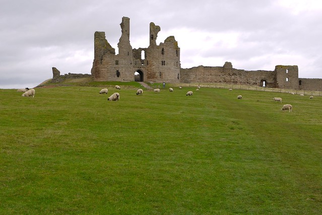
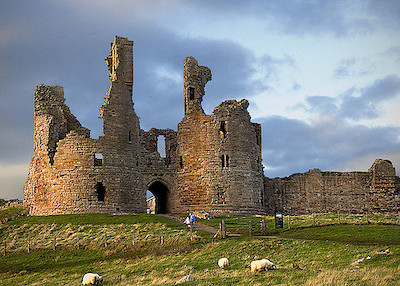
Dunstanburgh is a massive ruined castle, which is just over a miles walk along a beautiful coastal path from Craster. The castle was built in the 14th century by Thomas, Earl of Lancaster, the wealthiest nobleman in England and cousin to Edward II. The castle is owned by the National Trust and managed by English Heritage. | Near Craster | Northumberland |
|
|
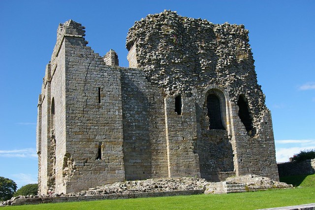
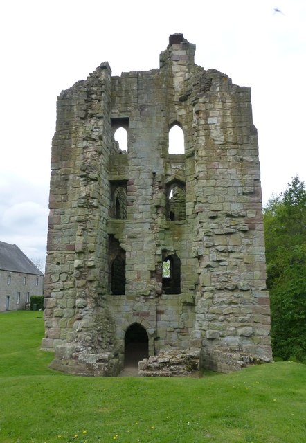
Edlingham | Northumberland | |
|
|
|||
|
|
Etal | Northumberland | |
|
|
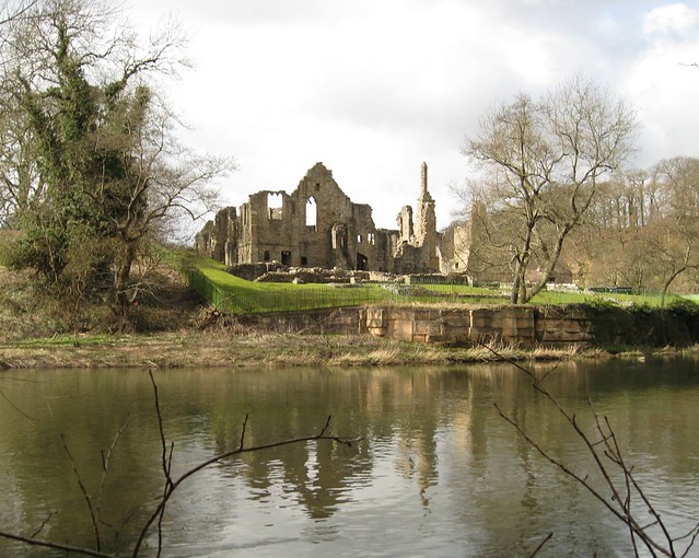
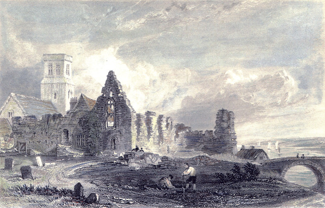
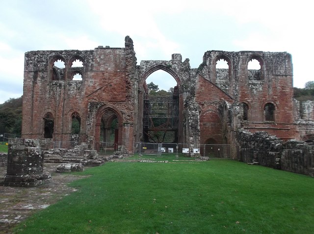
Finchale Priory was a Benedictine priory built in the 13th-century. The ruins of the Priory are located by the River Wear, four miles from Durham. | Near Durham | County Durham |
|
|
|||
|
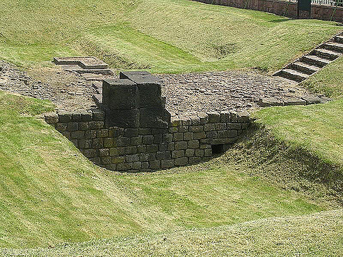
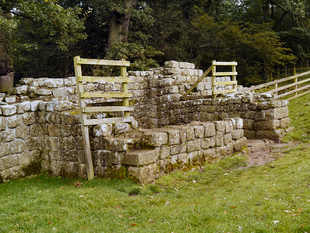
Hadrian's Wall: Benwell Roman Temple & Vallum Crossing
|
|||
|
Hadrian's Wall: Black Carts Turret
|
|||
|
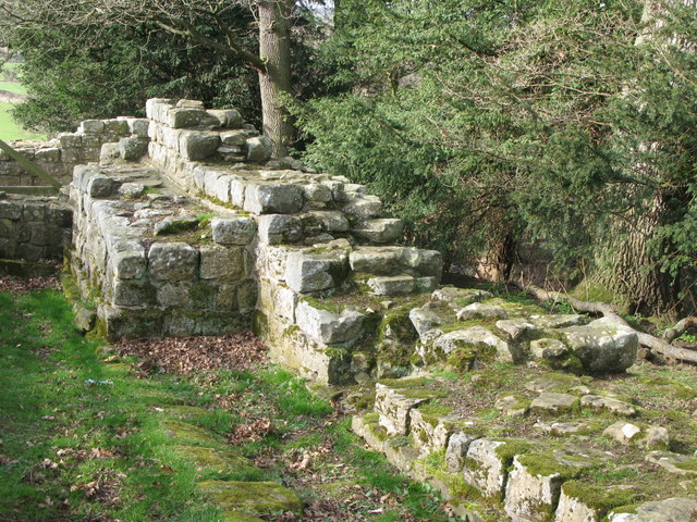
Hadrian's Wall: Brunton Turret
|
|||
|
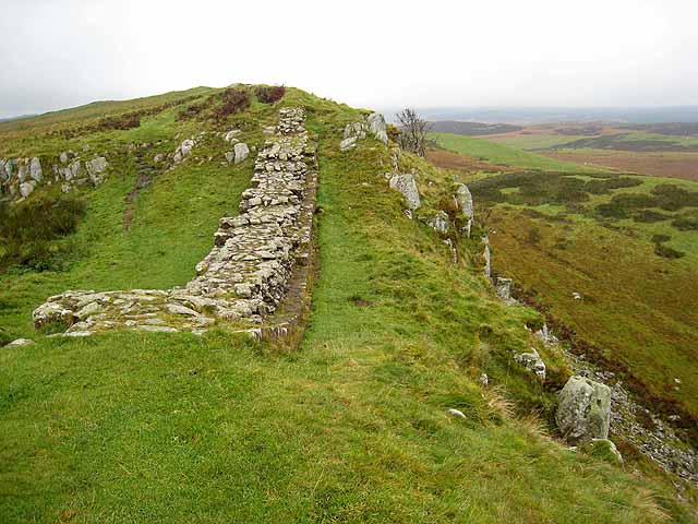
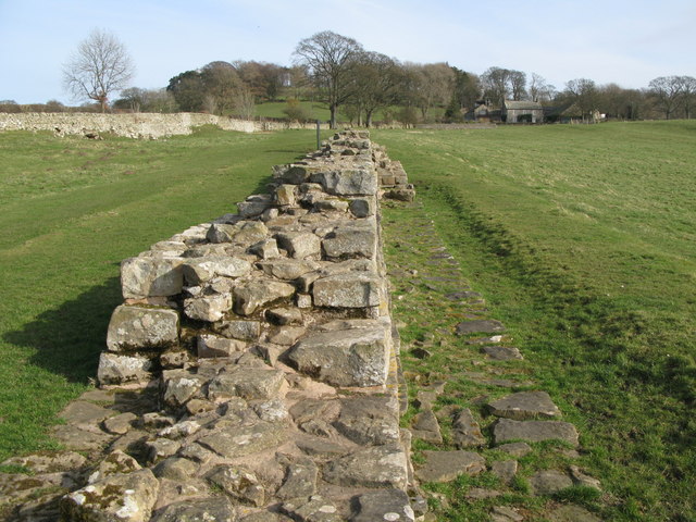
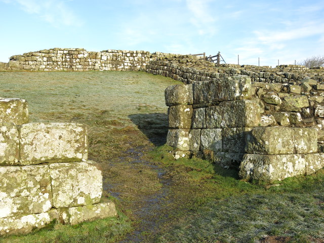
Hadrian's Wall: Cawfields Roman Wall
|
The stretch of Hadrian's Wall at Cawfields is one of the highest standing sections of the Wall. The section of wall includes turrets and the impressive Milecastle 42, thought to have been built by the Second Legion. | ||
|
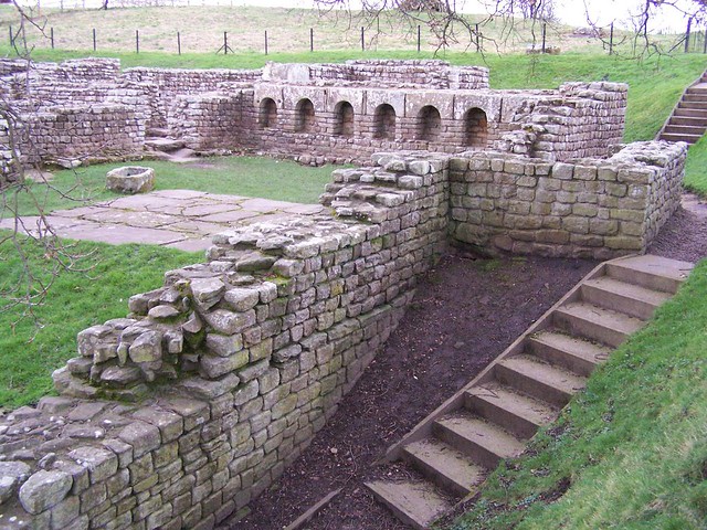
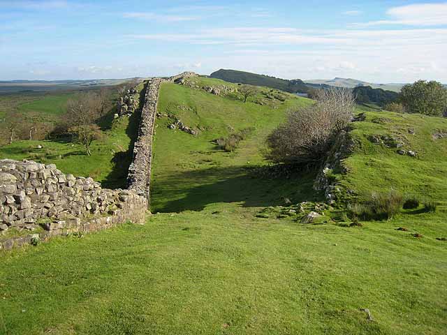
Hadrian's Wall: Chesters Roman Fort and Bridge
|
|||
|
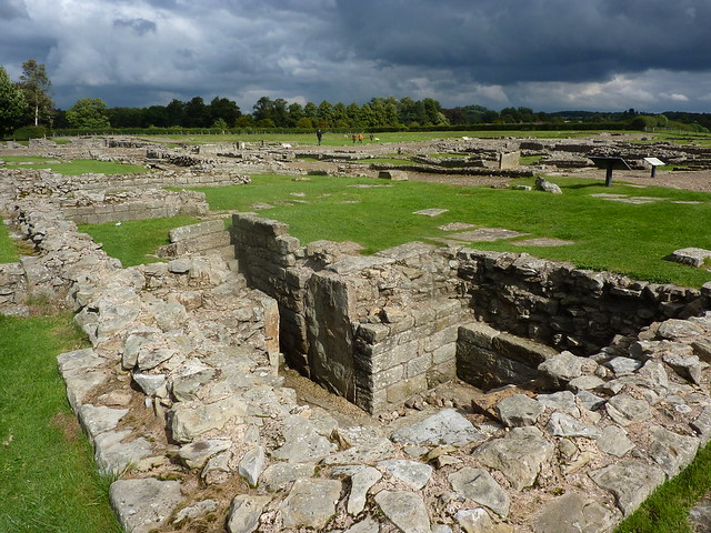
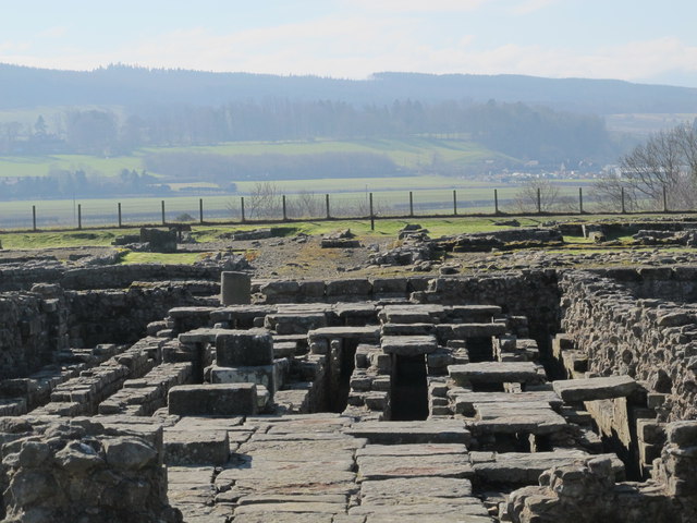
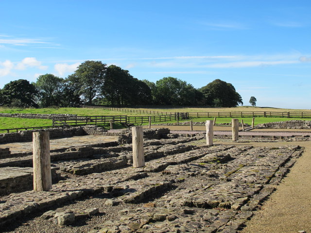
Hadrian's Wall: Corbridge Roman Town
|
Corbridge | Northumberland | |
|
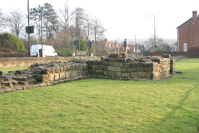
Hadrian's Wall: Denton Hall Turret
|
|||
|
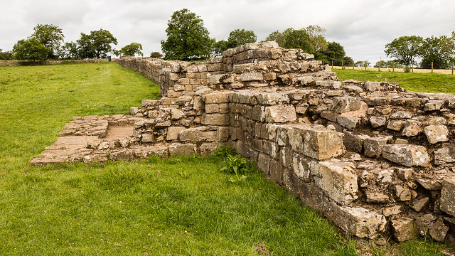
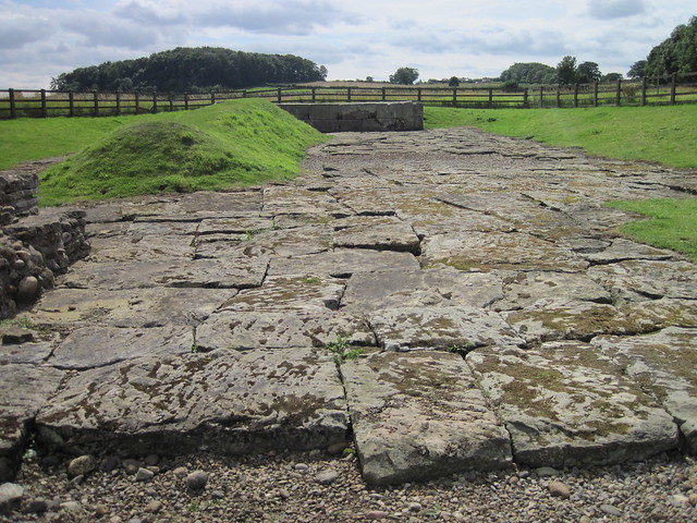
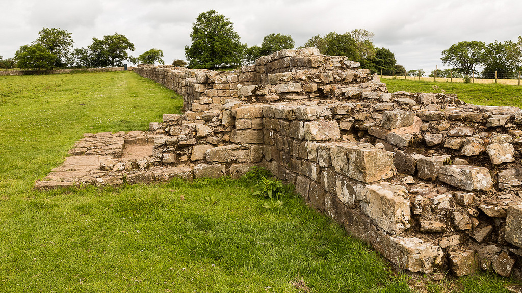
Hadrian's Wall: Heddon-on-the-Wall
|
Heddon-on-the-Wall | Northumberland | |
|
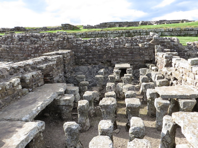
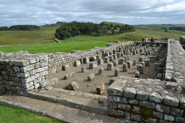
Hadrian's Wall: Housesteads Fort
|
Housesteads (Roman name: "Vercovicium") is one of the best preserved forts on Hadrian's Wall, built around 124 AD. The fort covers an area of approximately 5 acres, and had a garrison of around soldiers. The site is owned by the National Trust, and run by English Heritage. There is a museum on the site including Roman artefacts from the fort. | Near Bardon Mill | Northumberland |
|
Hadrian's Wall: Planetrees Roman Wall
|
|||
|
Hadrian's Wall: Sewingshields Wall
|
|||
|
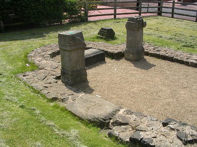
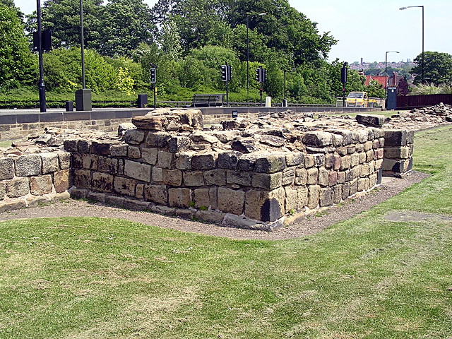
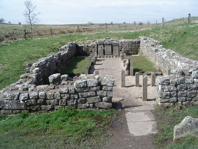
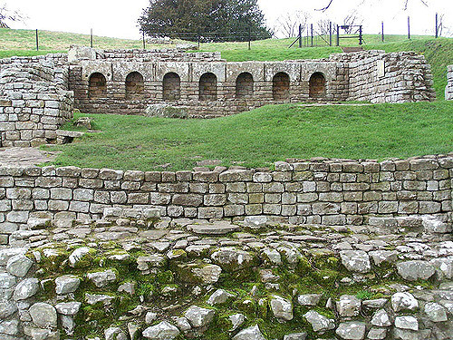
Hadrian's Wall: Temple of Mithras, Carrawburgh
|
|||
|
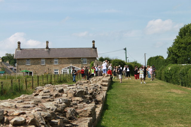
Hadrian's Wall: Walltown Crags
|
Near Greenhead | Northumberland | |
|
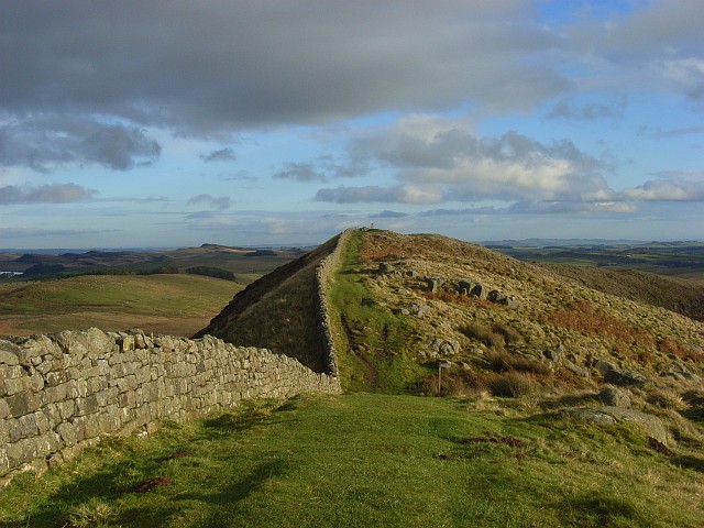
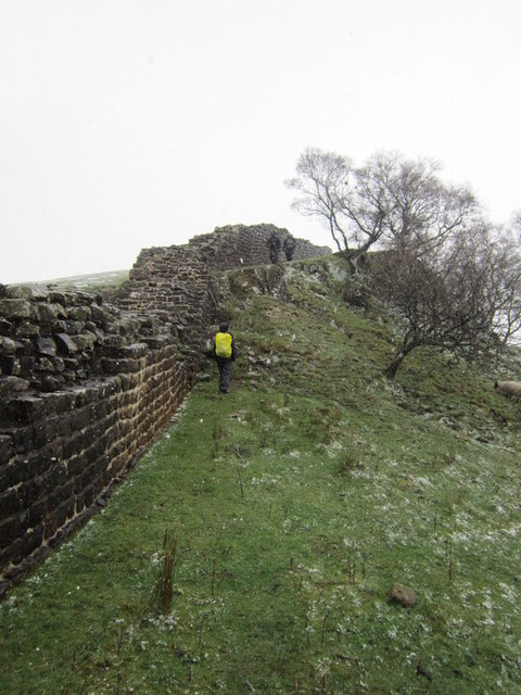
Hadrian's Wall: Winshields Wall
|
Near Once Brewed | Northumberland | |
|
|
|||
|
|
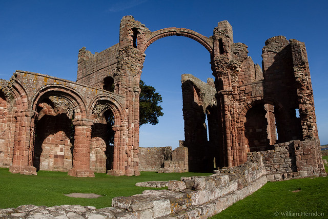
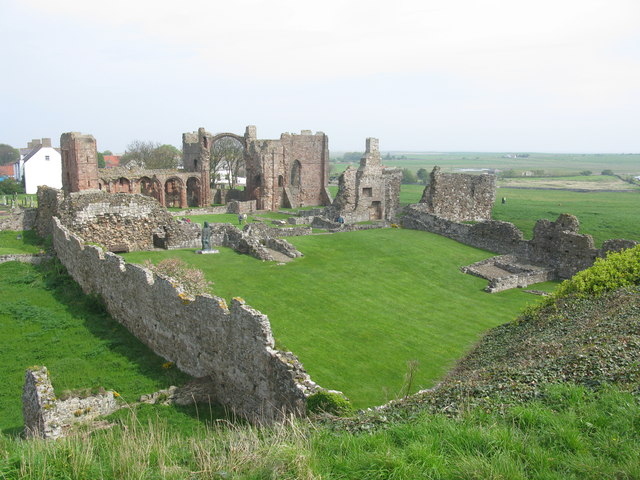
Holy Island | Northumberland | |
|
|
|||
|
|
|||
|
|
Prudhoe | Northumberland | |
|
|
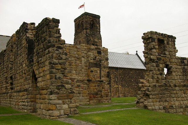
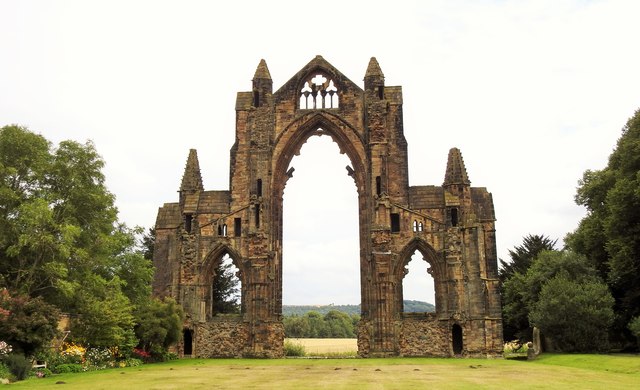
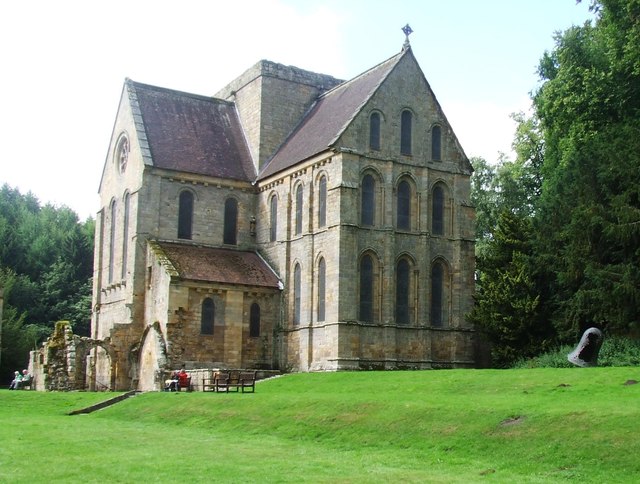
The twin monastery of Wearmouth–Jarrow was developed by Benedict Biscop, and became one of Europe’s most influential centres of learning and culture in the 7th and 8th centuries. The ruins of St Paul's monastery standing today are from the medieval monastery, but part of the older Anglo-Saxon monastery survives today as the chancel of St Paul's Church. | Jarrow | Tyne & Wear |
|
|
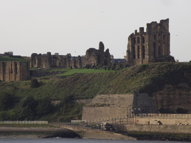
Tynemouth | Tyne & Wear | |
|
|
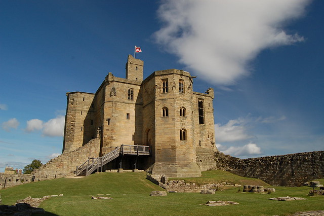
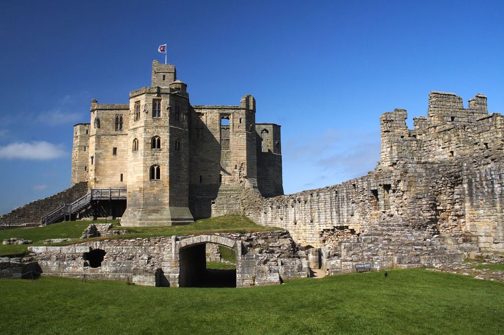
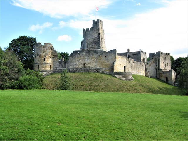
Warkworth | Northumberland | |
|
|
Near Warkworth | Northumberland | |


Co-Curate Page
Tynemouth Priory and Castle
- Overview History Aerial View Street View Tynemouth Castle is located on a rocky headland (known as Pen Bal Crag) at Tynemouth, overlooking Tynemouth Pier and the mouth of the River …
Co-Curate Page
Dunstanburgh Castle
- Overview About Dunstanburgh Castle Map Street View Dunstanburgh Castle is located on the Northumberland coast, one mile north of Craster and a mile and a half south-east of Embleton. The castle …
Co-Curate Page
Etal Castle
- Overview About Etal Castle Map Street View Etal Castle was built c.1341, by Robert Manners. The ruined medieval castle is located in the village of Etal, in Northumberland. Etal castle …
Co-Curate Page
Warkworth Castle
- Overview About Warkworth Castle Map Street View Warkworth Castle is a well preserved medieval castle which is cared for by English Heritage. The castle is located by a loop in …
Co-Curate Page
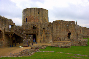
Bowes Castle
- Overview History Map The stone castle at Bowes was built between 1170 and 1174 on the site of the former Roman fort of Lavatrae. Bowes Castle was a medieval castle …
Co-Curate Page
Prudhoe Castle
- Overview About Prudhoe Castle Map Street View Prudhoe Castle is a ruined medieval English castle situated on the south bank of the River Tyne at Prudhoe, Northumberland, England. It …
Co-Curate Page
Aydon Castle
- Overview About Aydon Castle Map Street View Aydon Castle is a 13th century English manor house, located one mile from Corbridge. The house was heavily fortified on the outbreak of …
Co-Curate Page
St Paul's Monastery
- Overview History of Monkwearmouth–Jarrow The remains of St Paul's standing today are from the medieval monastery, but part of the Anglo-Saxon monastery survives today as the chancel of St Paul's …
Co-Curate Page
Bessie Surtees' House
- Overview About Bessie Surtees House Map Street View "These two five-storey 16th and 17th century merchants' houses are fine examples of Jacobean domestic architecture, with some splendid period interiors. The …
Co-Curate Page
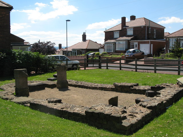
Hylton Castle
- Overview About Hylton Castle Map Street View Hylton Castle is a ruined stone castle located in the North Hylton area of Sunderland. A wooden fortification was constructed here by the …
Co-Curate Page
Benwell Temple of Antenociticus
- Overview About Antenociticus Map Street View "The fort at Benwell, which was occupied throughout most of the Roman period by the cavalry regiment ala I Asturum, is no longer visible. …
Co-Curate Page
Benwell Vallum Crossing / Condercum
- Overview About Condercum Map Street View "Nothing is now visible of the fort at Benwell (Condercum) in Newcastle, which was occupied throughout most of the Roman period by the Asturian …
Co-Curate Page
Denton Hall Roman Turret
- Turrets on Hadrian’s Wall were small watchtowers built into the wall, with two turrets per Roman mile, located between larger milecastles. They provided elevated viewpoints for small groups of 4 …

Co-Curate Page
Derwentcote Steel Furnace
- Overview Map "Built in the 1720s, Derwentcote is the earliest and most complete steel-making furnace in Britain. It produced high-grade steel for springs and cutting tools.....and was used for cementation, …

Co-Curate Page
Hadrian's Wall at Heddon-on-the-Wall
- A consolidated stretch of Wall, up to 2 metres (61⁄2 feet) thick in places. "Stretches of Hadrian’s Wall 220 metres long and of the Wall-ditch to its north are visible …
Co-Curate Page
Barnard Castle (castle)
- Overview About Barnard Castle Map Street View The medieval castle in the town of Barnard Castle, is cared for by English Heritage. The castle is a Scheduled Ancient Monument, and …
Co-Curate Page
Piercebridge Roman Bridge
- Overview About the Roman Bridge Map Street View The Roman bridge at Piercebridge crossed the River Tees, carrying Dere Street, the Roman road that linked York with Corbridge, near Hadrian’s …
Co-Curate Page
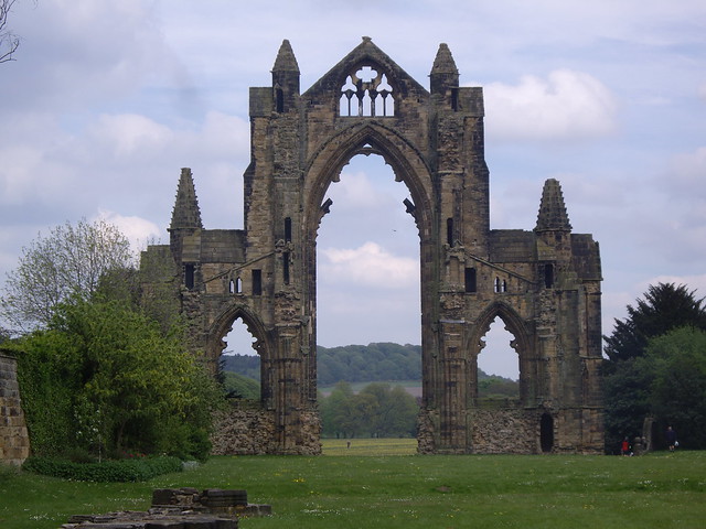
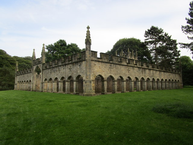
Brinkburn Priory
- Overview About Map Inside Brinkburn Priory was a medieval monastery built on a tight bend of the River Coquet, located 1.8 miles south west of Longframlington, in Northumberland. It was …
Co-Curate Page
Corbridge Roman Town and Fort
- Overview About Corbridge Roman Fort/Town Map Street View Corstopitum Coria was a fort and town 2.5 miles (4.0 km) south of Hadrian's Wall, in the Roman province of Britannia at a …
Co-Curate Page
Planetrees Roman Wall
- Overview About Planetrees Wall Map Street View Planetrees is an extant section of Hadrian's Wall named after the farm located around 250 metres (270 yd) to the west. The …
Co-Curate Page
Edlingham Castle
- Overview About Edlingham Castle Map Street View The ruins of Edlingham Castle are located to the north-east of the village of Edlingham, about 6 miles north-east of Rothbury. The 'castle' was …
Co-Curate Page
Turret 29a (Black Carts)
- Overview Map Street View Turrets on Hadrian’s Wall were small watchtowers built into the wall, with two turrets per Roman mile, located between larger milecastles. They provided elevated viewpoints for …

Co-Curate Page
Chesters Bridge Abutment
- Overview Map Close to Chesters Roman Fort are the remains of a bridge which carried Hadrian's Wall across the River North Tyne.
Co-Curate Page
Chesters Roman Fort
- Overview About Chesters (Cilurnum) Map Chesters Roman Fort and Museum, managed by English Heritage, is located near Walwick and Chollerford in Northumberland. The Roman cavalry fort (Cilurnum) was built in …

Co-Curate Page
Egglestone Abbey
- Overview About Egglestone Abbey Map Street View Egglestone Abbey is an abandoned Premonstratensian Abbey on the southern (Yorkshire) bank of the River Tees, 1 1⁄2 miles (2.4 km) south-east of …
Co-Curate Page
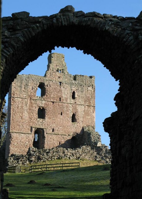
Norham Castle
- Overview About Norham Castle Map Street View Norham Castle is a castle in Northumberland, England, overlooking the River Tweed, on the border between England and Scotland. It is a …
Co-Curate Page
Lindisfarne Priory
- Overview About Lindisfarne Priory Map Street View "Lindisfarne was the site of the earliest Christian monastery in Anglo-Saxon Northumbria and one of the most important centres of early Christianity in …
Co-Curate Page
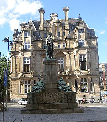
Grainger Town
- Overview About Grainger Town Grainger Town is the historic heart of Newcastle, which incorporates streets built in a neo-classical style by Richard Grainger between 1824 and 1841, including the Grainger …
Co-Curate Page
Warkworth Hermitage
- Overview Further Information Map "The Hermitage is reached by boat across the river Coquet. It was almost certainly established in about 1400 by the 1st Earl. Rather than a secluded …
Co-Curate Page
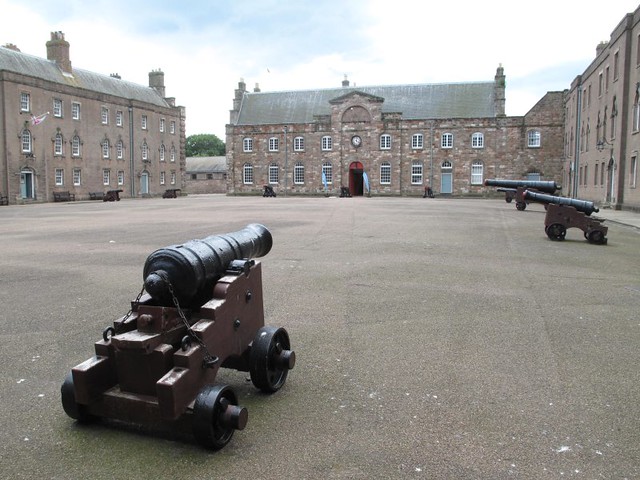
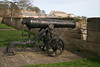
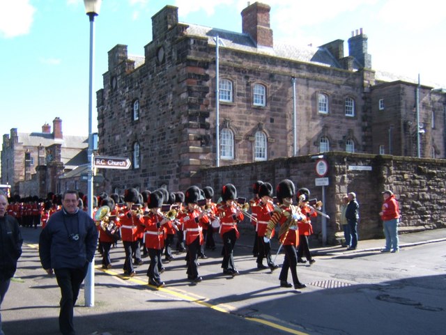
Berwick Barracks
- Overview About the Barracks Map Street View This is the earliest planned barrack complex in England, built because of the need for a permanent garrison on the Scottish border. Now …
Co-Curate Page
Poltross Burn Milecastle, Hadrian's Wall
- Overview About Milecastle 48 Map Street View Poltross Burn, located near Gilsland, is one of the best-preserved milecastles on Hadrian's Wall. It is larger than most other milecastles, housing two …
Co-Curate Page
Housesteads
- Overview About Howsteads Fort Map Street View Interactive Glossary Housesteads (Roman name: "Vercovicium") is one of the best preserved forts on Hadrian's Wall, built around 124 AD. The fort covers …
Co-Curate Page
Belsay Hall, Castle & Gardens
- Overview Map Street View The Belsay estate on the main route from Newcastle to Jedburgh was owned by the Middleton family from 1270, when it belonged to Sir John Middleton, …
Co-Curate Page
Black Middens Bastle House
- Overview About Black Middens Bastle Map Street View Black Middens Bastle House is at an isolated location on the north side of the Tarset Valley, about 2 miles north-west of …
Co-Curate Page
Brunton Turret, Hadrian's Wall
- Overview About Turret 26b Map Interactive Glossary Turret 26b, near Low Brunton, is in Wall Mile 26 of Hadrian's Wall. Turrets on Hadrian’s Wall were small watchtowers built into the …
Co-Curate Page
Hadrian's Wall at Cawfields
- Overview About Milecastle 42 Map Street View The stretch of Hadrian's Wall at Cawfields is one of the highest standing sections of the Wall. The section of wall includes turrets …

Co-Curate Page
Hadrian's Wall at Winshields
- The length of Wall at Winshields Craggs is the highest point on Hadrian's Wall.
Co-Curate Page
Heritage Sites
- This section includes profiles of some of the many heritage sites in the North East of England and Cumbria. Many more can also be found by locality via the Places …
Co-Curate Page
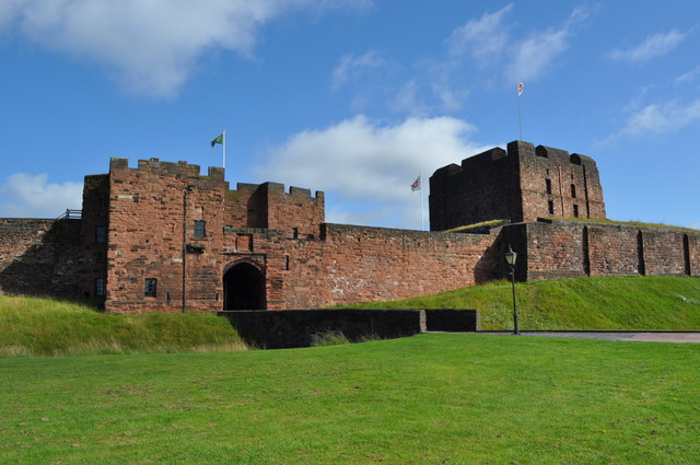
Carlisle Castle
- Overview About Carlisle Castle Map Street View Carlisle Castle is built on the site of a Roman fort (known as Luguvalium). Construction of a motte and bailey castle began in …
Co-Curate Page
Furness Abbey
- Overview About Furness Abbey Map Street View The substantial ruins of Furness Abbey are located in Barrow-in-Furness, and under the care of English Heritage. Furness Abbey was founded in 1123 …
Co-Curate Page
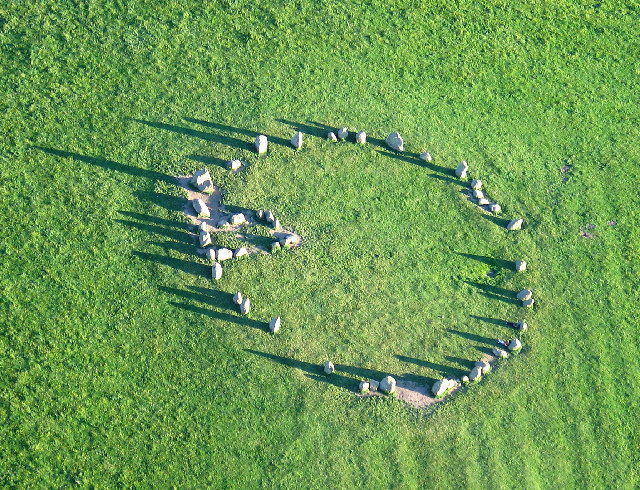
Castlerigg Stone Circle
- Overview About Castlerigg Stone Circle Map Street View Castlerigg Stone Circle, located just over a mile east of Keswick, is one of the earliest stone circles in the UK, thought …
Co-Curate Page
Penrith Castle
- Overview About Penrith Castle Map Street View Penrith Castle was built at the end of the 14th century by Ralph Neville (c.1364–1425) was granted the manor of Penrith in 1396. …
Co-Curate Page
Brough Castle
- Overview About Brough Castle Map Street View Not to be confused with Brough Castle in Brough, Caithness. Brough Castle is a ruined castle in the village of Brough, Cumbria, …
Co-Curate Page
Shap Abbey (ruins)
- Overview About Shap Abbey Map Street View Shap Abbey is located about 1½ miles west of the village of Shap in Cumbria. The Abbey was founded in c.1200 by local …
Co-Curate Page
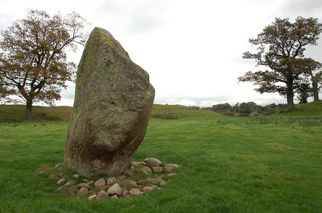
Mayburgh Henge
- Overview About Mayburgh Henge Map Street View Henges are ritual or ceremonial sites which date to the Late Neolithic period (2800-2000 BC). Mayburgh Henge is located close to the confluence …
Co-Curate Page
Birdoswald Roman Fort (Banna)
- Overview Map Street View Hadrian's Wall Glossary Birdoswald Roman Fort (known as Banna) is situated on the western part of Hadrian's Wall, about 1 mile west of Gilsland in Cumbria. …

Co-Curate Page
Tynemouth Priory and Castle
- Overview History Aerial View Street View Tynemouth Castle is located on a rocky headland (known as Pen Bal Crag) at Tynemouth, overlooking Tynemouth Pier and the mouth of the River …
Co-Curate Page
Dunstanburgh Castle
- Overview About Dunstanburgh Castle Map Street View Dunstanburgh Castle is located on the Northumberland coast, one mile north of Craster and a mile and a half south-east of Embleton. The castle …
Co-Curate Page
Etal Castle
- Overview About Etal Castle Map Street View Etal Castle was built c.1341, by Robert Manners. The ruined medieval castle is located in the village of Etal, in Northumberland. Etal castle …
Co-Curate Page
Warkworth Castle
- Overview About Warkworth Castle Map Street View Warkworth Castle is a well preserved medieval castle which is cared for by English Heritage. The castle is located by a loop in …
Co-Curate Page
Bowes Castle
- Overview History Map The stone castle at Bowes was built between 1170 and 1174 on the site of the former Roman fort of Lavatrae. Bowes Castle was a medieval castle …
Co-Curate Page
Prudhoe Castle
- Overview About Prudhoe Castle Map Street View Prudhoe Castle is a ruined medieval English castle situated on the south bank of the River Tyne at Prudhoe, Northumberland, England. It …
Co-Curate Page
Aydon Castle
- Overview About Aydon Castle Map Street View Aydon Castle is a 13th century English manor house, located one mile from Corbridge. The house was heavily fortified on the outbreak of …
Co-Curate Page
St Paul's Monastery
- Overview History of Monkwearmouth–Jarrow The remains of St Paul's standing today are from the medieval monastery, but part of the Anglo-Saxon monastery survives today as the chancel of St Paul's …
Co-Curate Page
Bessie Surtees' House
- Overview About Bessie Surtees House Map Street View "These two five-storey 16th and 17th century merchants' houses are fine examples of Jacobean domestic architecture, with some splendid period interiors. The …
Co-Curate Page
Hylton Castle
- Overview About Hylton Castle Map Street View Hylton Castle is a ruined stone castle located in the North Hylton area of Sunderland. A wooden fortification was constructed here by the …
Co-Curate Page
Benwell Temple of Antenociticus
- Overview About Antenociticus Map Street View "The fort at Benwell, which was occupied throughout most of the Roman period by the cavalry regiment ala I Asturum, is no longer visible. …
Co-Curate Page
Benwell Vallum Crossing / Condercum
- Overview About Condercum Map Street View "Nothing is now visible of the fort at Benwell (Condercum) in Newcastle, which was occupied throughout most of the Roman period by the Asturian …
Co-Curate Page
Denton Hall Roman Turret
- Turrets on Hadrian’s Wall were small watchtowers built into the wall, with two turrets per Roman mile, located between larger milecastles. They provided elevated viewpoints for small groups of 4 …
Co-Curate Page
Derwentcote Steel Furnace
- Overview Map "Built in the 1720s, Derwentcote is the earliest and most complete steel-making furnace in Britain. It produced high-grade steel for springs and cutting tools.....and was used for cementation, …
Co-Curate Page
Hadrian's Wall at Heddon-on-the-Wall
- A consolidated stretch of Wall, up to 2 metres (61⁄2 feet) thick in places. "Stretches of Hadrian’s Wall 220 metres long and of the Wall-ditch to its north are visible …
Co-Curate Page
Barnard Castle (castle)
- Overview About Barnard Castle Map Street View The medieval castle in the town of Barnard Castle, is cared for by English Heritage. The castle is a Scheduled Ancient Monument, and …
Co-Curate Page
Piercebridge Roman Bridge
- Overview About the Roman Bridge Map Street View The Roman bridge at Piercebridge crossed the River Tees, carrying Dere Street, the Roman road that linked York with Corbridge, near Hadrian’s …
Co-Curate Page
Brinkburn Priory
- Overview About Map Inside Brinkburn Priory was a medieval monastery built on a tight bend of the River Coquet, located 1.8 miles south west of Longframlington, in Northumberland. It was …
Co-Curate Page
Corbridge Roman Town and Fort
- Overview About Corbridge Roman Fort/Town Map Street View Corstopitum Coria was a fort and town 2.5 miles (4.0 km) south of Hadrian's Wall, in the Roman province of Britannia at a …
Co-Curate Page
Planetrees Roman Wall
- Overview About Planetrees Wall Map Street View Planetrees is an extant section of Hadrian's Wall named after the farm located around 250 metres (270 yd) to the west. The …
Co-Curate Page
Edlingham Castle
- Overview About Edlingham Castle Map Street View The ruins of Edlingham Castle are located to the north-east of the village of Edlingham, about 6 miles north-east of Rothbury. The 'castle' was …
Co-Curate Page
Turret 29a (Black Carts)
- Overview Map Street View Turrets on Hadrian’s Wall were small watchtowers built into the wall, with two turrets per Roman mile, located between larger milecastles. They provided elevated viewpoints for …
Co-Curate Page
Chesters Bridge Abutment
- Overview Map Close to Chesters Roman Fort are the remains of a bridge which carried Hadrian's Wall across the River North Tyne.
Co-Curate Page
Chesters Roman Fort
- Overview About Chesters (Cilurnum) Map Chesters Roman Fort and Museum, managed by English Heritage, is located near Walwick and Chollerford in Northumberland. The Roman cavalry fort (Cilurnum) was built in …
Co-Curate Page
Egglestone Abbey
- Overview About Egglestone Abbey Map Street View Egglestone Abbey is an abandoned Premonstratensian Abbey on the southern (Yorkshire) bank of the River Tees, 1 1⁄2 miles (2.4 km) south-east of …
Co-Curate Page
Norham Castle
- Overview About Norham Castle Map Street View Norham Castle is a castle in Northumberland, England, overlooking the River Tweed, on the border between England and Scotland. It is a …
Co-Curate Page
Lindisfarne Priory
- Overview About Lindisfarne Priory Map Street View "Lindisfarne was the site of the earliest Christian monastery in Anglo-Saxon Northumbria and one of the most important centres of early Christianity in …
Co-Curate Page
Grainger Town
- Overview About Grainger Town Grainger Town is the historic heart of Newcastle, which incorporates streets built in a neo-classical style by Richard Grainger between 1824 and 1841, including the Grainger …
Co-Curate Page
Warkworth Hermitage
- Overview Further Information Map "The Hermitage is reached by boat across the river Coquet. It was almost certainly established in about 1400 by the 1st Earl. Rather than a secluded …
Co-Curate Page
Berwick Barracks
- Overview About the Barracks Map Street View This is the earliest planned barrack complex in England, built because of the need for a permanent garrison on the Scottish border. Now …
Co-Curate Page
Poltross Burn Milecastle, Hadrian's Wall
- Overview About Milecastle 48 Map Street View Poltross Burn, located near Gilsland, is one of the best-preserved milecastles on Hadrian's Wall. It is larger than most other milecastles, housing two …
Co-Curate Page
Housesteads
- Overview About Howsteads Fort Map Street View Interactive Glossary Housesteads (Roman name: "Vercovicium") is one of the best preserved forts on Hadrian's Wall, built around 124 AD. The fort covers …
Co-Curate Page
Belsay Hall, Castle & Gardens
- Overview Map Street View The Belsay estate on the main route from Newcastle to Jedburgh was owned by the Middleton family from 1270, when it belonged to Sir John Middleton, …
Co-Curate Page
Black Middens Bastle House
- Overview About Black Middens Bastle Map Street View Black Middens Bastle House is at an isolated location on the north side of the Tarset Valley, about 2 miles north-west of …
Co-Curate Page
Brunton Turret, Hadrian's Wall
- Overview About Turret 26b Map Interactive Glossary Turret 26b, near Low Brunton, is in Wall Mile 26 of Hadrian's Wall. Turrets on Hadrian’s Wall were small watchtowers built into the …
Co-Curate Page
Hadrian's Wall at Cawfields
- Overview About Milecastle 42 Map Street View The stretch of Hadrian's Wall at Cawfields is one of the highest standing sections of the Wall. The section of wall includes turrets …
Co-Curate Page
Hadrian's Wall at Winshields
- The length of Wall at Winshields Craggs is the highest point on Hadrian's Wall.
Co-Curate Page
Heritage Sites
- This section includes profiles of some of the many heritage sites in the North East of England and Cumbria. Many more can also be found by locality via the Places …
Co-Curate Page
Carlisle Castle
- Overview About Carlisle Castle Map Street View Carlisle Castle is built on the site of a Roman fort (known as Luguvalium). Construction of a motte and bailey castle began in …
Co-Curate Page
Furness Abbey
- Overview About Furness Abbey Map Street View The substantial ruins of Furness Abbey are located in Barrow-in-Furness, and under the care of English Heritage. Furness Abbey was founded in 1123 …
Co-Curate Page
Castlerigg Stone Circle
- Overview About Castlerigg Stone Circle Map Street View Castlerigg Stone Circle, located just over a mile east of Keswick, is one of the earliest stone circles in the UK, thought …
Co-Curate Page
Penrith Castle
- Overview About Penrith Castle Map Street View Penrith Castle was built at the end of the 14th century by Ralph Neville (c.1364–1425) was granted the manor of Penrith in 1396. …
Co-Curate Page
Brough Castle
- Overview About Brough Castle Map Street View Not to be confused with Brough Castle in Brough, Caithness. Brough Castle is a ruined castle in the village of Brough, Cumbria, …
Co-Curate Page
Shap Abbey (ruins)
- Overview About Shap Abbey Map Street View Shap Abbey is located about 1½ miles west of the village of Shap in Cumbria. The Abbey was founded in c.1200 by local …
Co-Curate Page
Mayburgh Henge
- Overview About Mayburgh Henge Map Street View Henges are ritual or ceremonial sites which date to the Late Neolithic period (2800-2000 BC). Mayburgh Henge is located close to the confluence …


