Topics > Heritage Sites > Hadrian's Wall > Wall Mile 26 > Brunton Turret, Hadrian's Wall
Brunton Turret, Hadrian's Wall
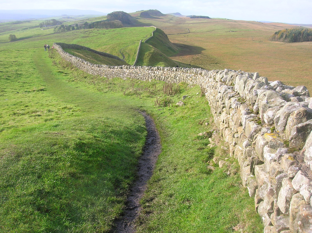
Turrets on Hadrian’s Wall were small watchtowers built into the wall, with two turrets per Roman mile, located between larger milecastles. They provided elevated viewpoints for small groups of 4 to 6 soldiers to spot threats and offer basic shelter for patrols. Turrets significantly enhanced continuous surveillance and control of the frontier by housing sentries between main garrisons. Their importance lay in forming an integrated part of the wall’s defensive system, enabling rapid communication and constant vigilance against incursions, turning the wall into a manned frontier rather than a simple barrier. Under a naming system introduced in 1930, turrets are numbered 1 to 80 from east (A) to west (B) and given numbers as pairs, taking the number of the nearest milecastle to their east.
Turret 26B
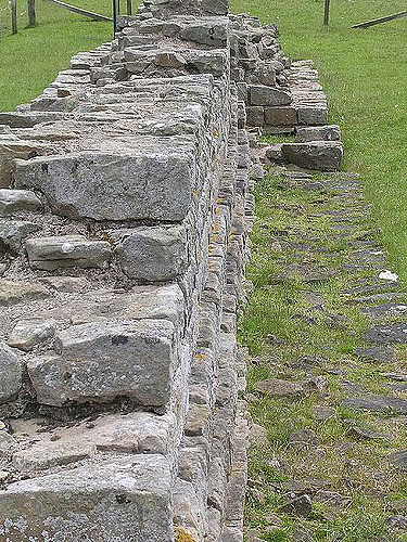
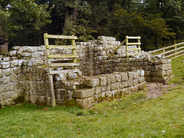
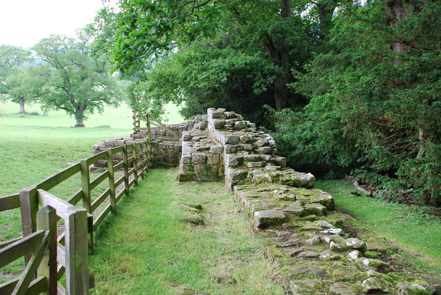
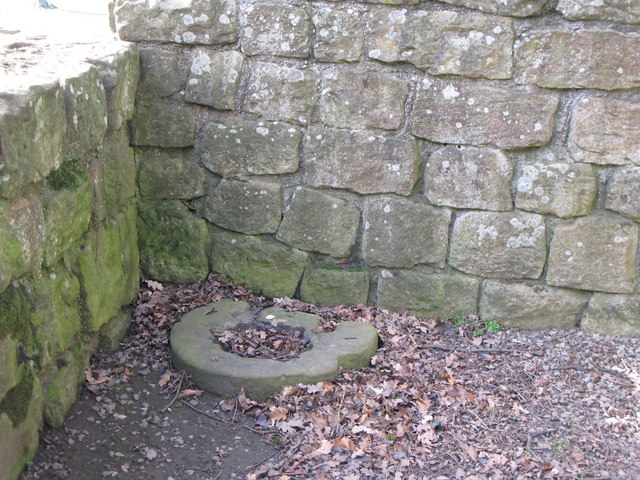
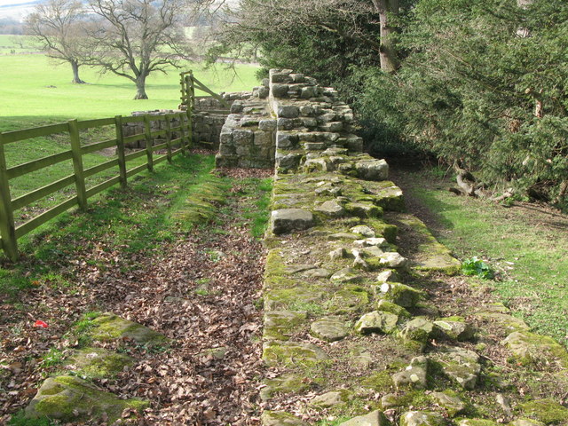
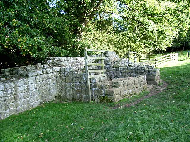
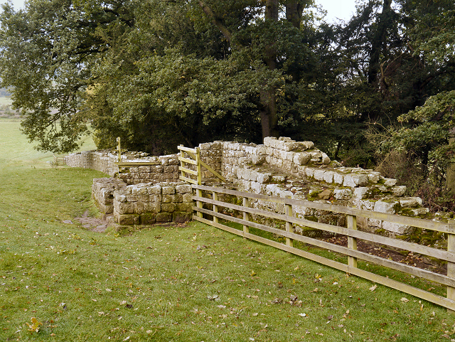
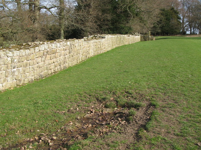
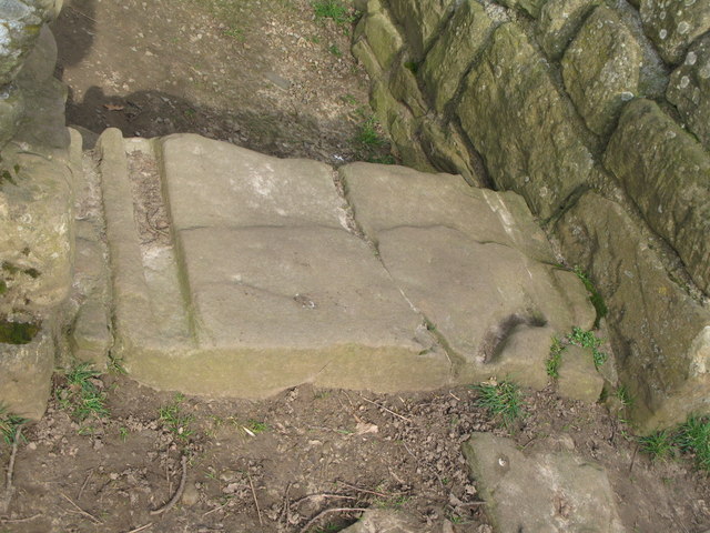
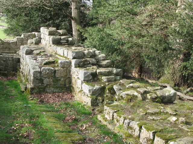
Turret 26B (Brunton) is located just to the west of Brunton House, between it and the A6079. It is preserved with upstanding remains up to 2.8 metres (9.2 ft) high, and forms part of a 69 metres (75 yd) extant section of Hadrian's Wall. Within the turret is a free-standing altar. The turret was first excavated by John Clayton during 1873 and later by T. Hepple in 1930. It has since been consolidated.
The turret measures 3.88 metres (12.7 ft) by 3.5 metres (11 ft) internally, and is recessed about 1.22 metres (4.0 ft) into the wall. It has a doorway nearly 1.22 metres (4.0 ft) wide. The side walls of the turret are 0.84 metres (2.8 ft) thick. Hadrian's Wall forms the north wall of the turret, which was standing eleven courses high in 1947. Its south wall is nearly 1.22 metres (4.0 ft) high. On the east side of the turret the broad wall wing is joined by a narrow section of wall, indicating that the turrets were built first and the Wall was then built up to them. Near to the turret a centurial stone was found in situ with the inscription COH IX > PAV.APRI ('The century of Paulus Aper of the ninth cohort').
Location on Ordnance Survey 1:25 000 map: 55.023025°N 2.124308°W
Public Access
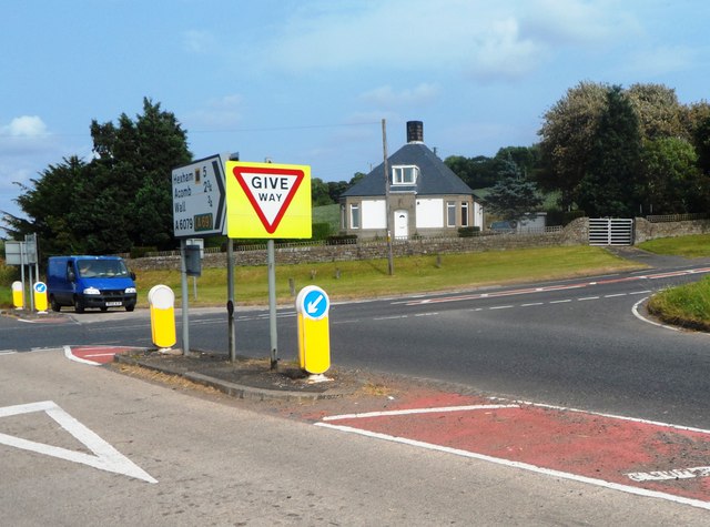
The sites of Milecastle 26 and Turret 26A are accessible via the Hadrian's Wall National Trail. Turret 26B is accessible from the east side of the A6079, just south of its junction with the B6318 Military Road.
Visit the page: Milecastle 26 for references and further details. You can contribute to this article on Wikipedia.
from Geograph (geograph)
Spring by Hadrian's Wall near Turret 26b (Brunton)
Pinned by Simon Cotterill

from http://www.english-heritage.o…
BRUNTON TURRET - HADRIAN'S WALL
- "Wall section and a surviving piece of turret two and a half metres high, built by men of the Twentieth Legion....." Directions etc.
Added by
Simon Cotterill

from https://historicengland.org.u…
Hadrian's Wall and vallum between St Oswald's Cottages, east of Brunton Gate and the North Tyne in wall miles 25, 26 and 27 - List Entry
- ".....The monument includes the stretch of Hadrian's Wall, vallum and associated features between St Oswald's Cottages, east of Brunton Gate in the east and the River North Tyne in the …
Added by
Simon Cotterill


from Geograph (geograph)
The north side of Hadrian's Wall near Turret 26b (Brunton)
Pinned by Simon Cotterill

from Geograph (geograph)
Spring by Hadrian's Wall near Turret 26b (Brunton)
Pinned by Simon Cotterill
from http://www.english-heritage.o…
BRUNTON TURRET - HADRIAN'S WALL
- "Wall section and a surviving piece of turret two and a half metres high, built by men of the Twentieth Legion....." Directions etc.
Added by
Simon Cotterill
from https://historicengland.org.u…
Hadrian's Wall and vallum between St Oswald's Cottages, east of Brunton Gate and the North Tyne in wall miles 25, 26 and 27 - List Entry
- ".....The monument includes the stretch of Hadrian's Wall, vallum and associated features between St Oswald's Cottages, east of Brunton Gate in the east and the River North Tyne in the …
Added by
Simon Cotterill
from Geograph (geograph)
The north side of Hadrian's Wall near Turret 26b (Brunton)
Pinned by Simon Cotterill