Topics > Heritage Sites > Hadrian's Wall > Cawfields Wall and Milecastle 42

Cawfields Wall and Milecastle 42


The stretch of Hadrian's Wall at Cawfields is one of the highest standing sections of the Wall. The section of wall includes turrets and the impressive Milecastle 42, thought to have been built by the Second Legion.[1] The section of Hadrian's Wall is managed by English Heritage. The Pennine Way runs alongside the wall at Cawfields.

Milecastle 42 (Cawfields) is a milecastle on Hadrian's Wall .

Description

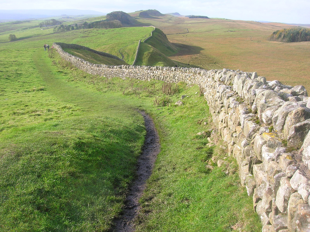
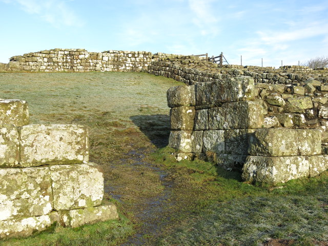
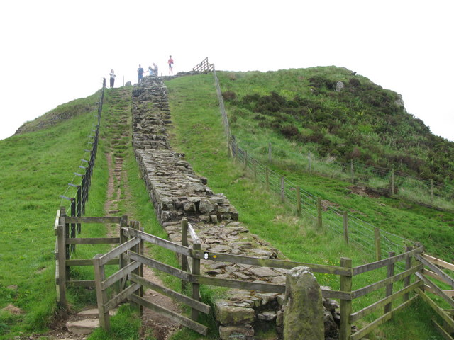
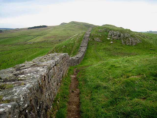
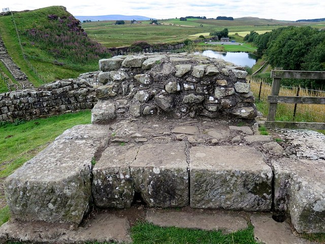
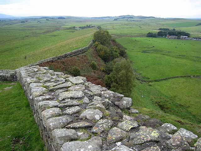
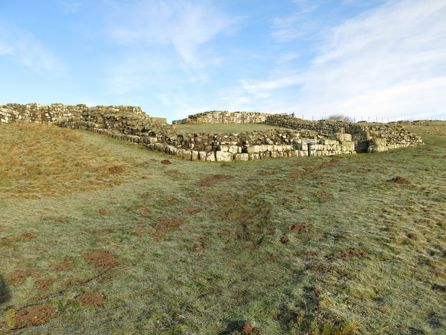
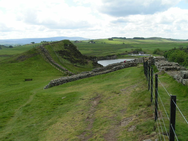
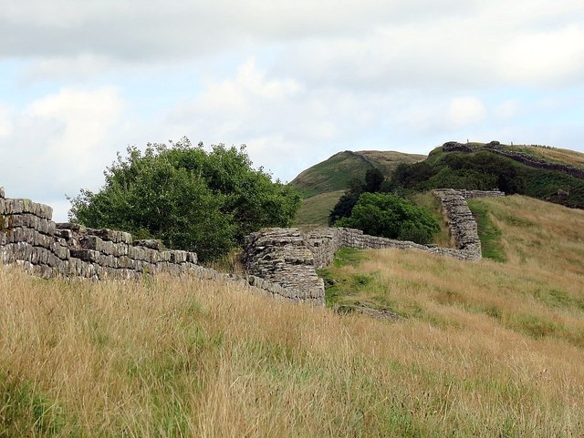
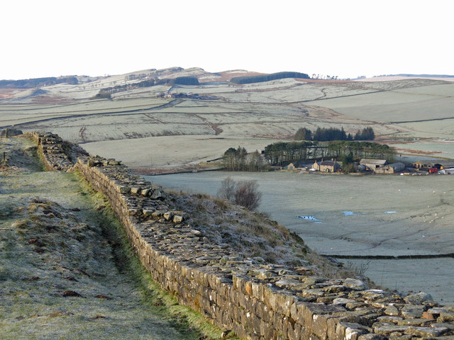
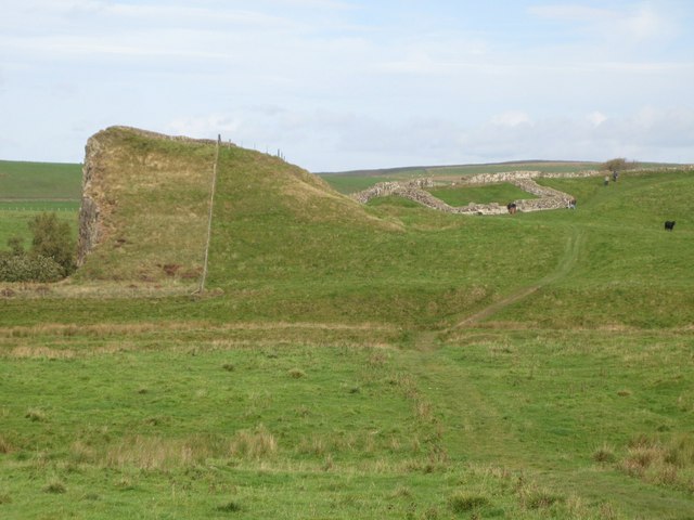
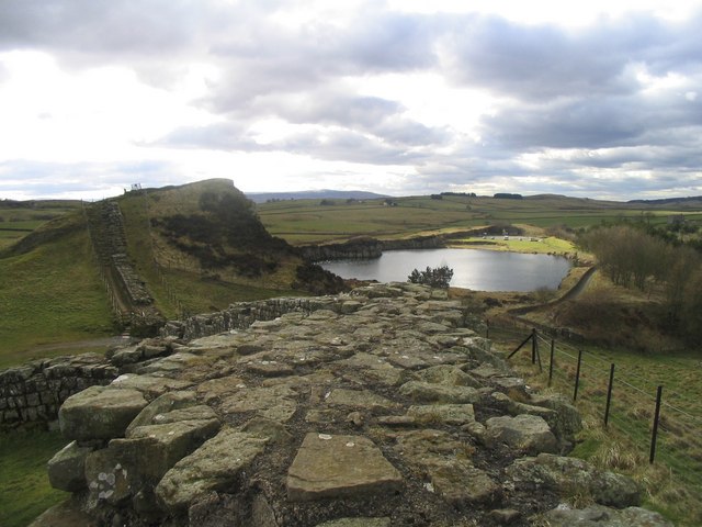
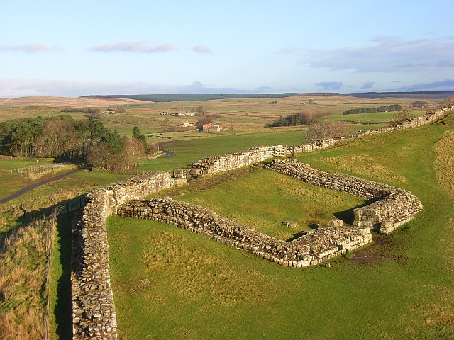
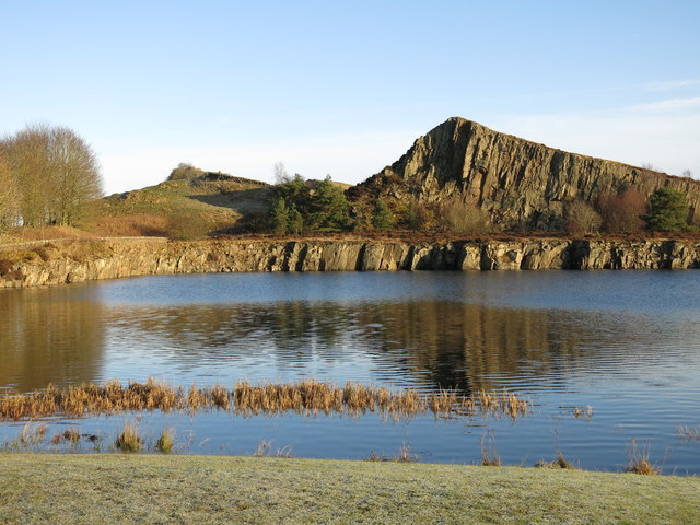
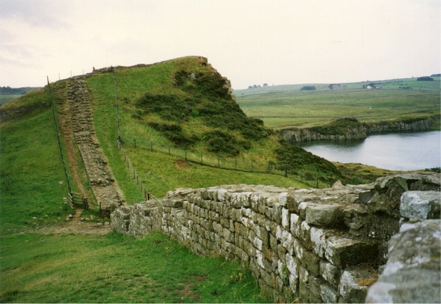
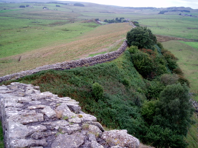
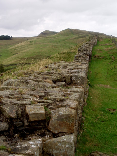
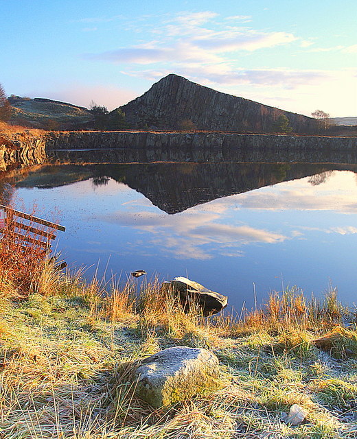
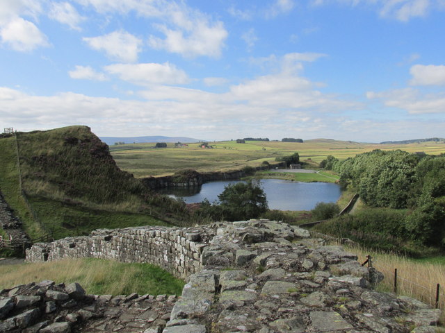
Milecastle 42 is situated on a steep south-facing slope, 10 metres south of Cawfield Crags, and looks over Hole Gap to the west. It is on a well-preserved section of Hadrian's Wall. It measures 17.8 metres east–west by 14.4 metres north–south internally, with walls 2.8 metres thick and 1.4 metres high.

Excavations

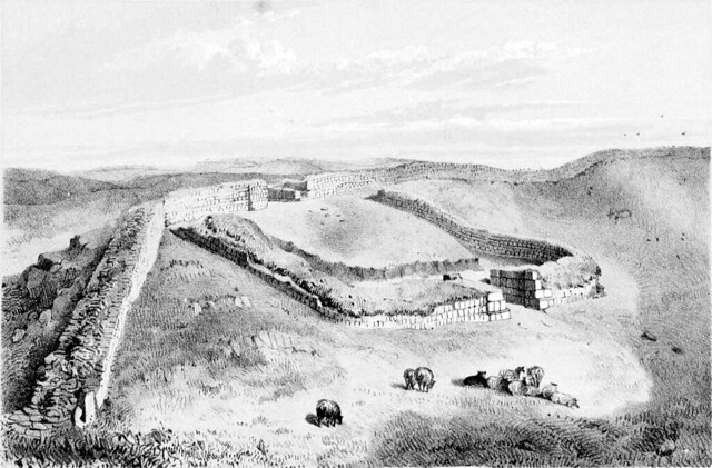
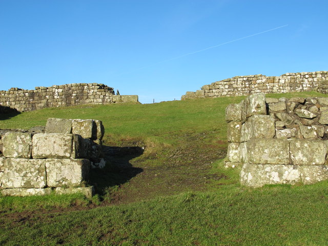
It was excavated in 1847–48 and again in 1936. The 1847–48 excavation uncovered part of a dedication slab indicating that the milecastle had been built by the Legio II Augusta. The 1936 excavations showed that the milecastle had a short axis, with a Type I gateway.

Associated turrets

Each milecastle on Hadrian's Wall had two associated turret structures. These turrets were positioned approximately one-third and two-thirds of a Roman mile to the west of the Milecastle, and would probably have been manned by part of the milecastle's garrison. The turrets associated with Milecastle 42 are known as Turret 42A and Turret 42B.

Turret 42A

Turret 42A (Burn Head) (grid reference NY713666) has not been located as its remains have been destroyed by quarrying.

Turret 42B

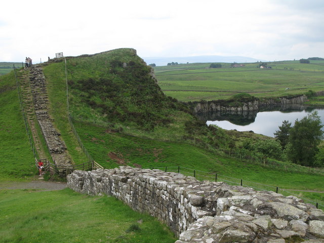
Turret 42B (Great Chesters) (grid reference NY70846682) was located by exploratory excavation in 1912. The site is visible as a turf-covered platform 0.5 metres high.

Public access

The milecastle and the site of Turrets 42B are both accessible via the Hadrian's Wall Path. Cawfields Picnic Area car park is on the line of the Hadrian's Wall Path, between the two sites. It is signposted from the B6318 (Military Road).

Text from Wikipedia, available under the Creative Commons Attribution-ShareAlike License (accessed: 10/04/2018).
Visit the page: Milecastle 42 for references and further details. You can contribute to this article on Wikipedia.

Hadrian's Wall English Heritage Milecastle 42, Hadrian's Wall
from Flickr (flickr)
Wall Mile 42

Pinned by Simon Cotterill
from Geograph (geograph)
Milecastle 42 (Cawfields) - south gate

Pinned by Simon Cotterill
from Geograph (geograph)
Hadrian's Wall at Cawfields

Pinned by Simon Cotterill
from Geograph (geograph)
Hadrian's Wall

Pinned by Simon Cotterill
from Geograph (geograph)
North gate of Milecastle 42 at Cawfields

Pinned by Simon Cotterill
from Geograph (geograph)
A well-preserved section of Hadrian's Wall

Pinned by Simon Cotterill
from Geograph (geograph)
Hadrian's Wall at Cawfields (2)

Pinned by Simon Cotterill
from Geograph (geograph)
Milecastle 42 (Cawfields)

Pinned by Simon Cotterill
from Geograph (geograph)
Milecastle 42 and Cawfield Crags, Hadrian's Wall

Pinned by Simon Cotterill
from Geograph (geograph)
Hadrian's Wall & Pennine Way at Cawfield Crags

Pinned by Simon Cotterill
from Geograph (geograph)
Hadrian’s Wall east of Thorny Doors (2)

Pinned by Simon Cotterill
from Geograph (geograph)
Milecastle 42 and the Vallum

Pinned by Simon Cotterill
from Geograph (geograph)
Looking down to the lake

Pinned by Simon Cotterill
from Geograph (geograph)
The southern gateway of Milecastle 42

Pinned by Simon Cotterill
from Geograph (geograph)
Milecastle 42, Hadrian's Wall

Pinned by Simon Cotterill
from Geograph (geograph)
Cawfields

Pinned by Simon Cotterill
from Geograph (geograph)
Section of Hadrian's Wall at Cawfields

Pinned by Simon Cotterill
from Geograph (geograph)
Hadrian's Wall at Cawfields

Pinned by Simon Cotterill
from Geograph (geograph)
Hadrian's Wall at Cawfields

Pinned by Simon Cotterill
from Geograph (geograph)
Cawfields quarry

Pinned by Simon Cotterill
from Geograph (geograph)
Cawfield quarry.

Pinned by Simon Cotterill
from http://www.english-heritage.o…
CAWFIELDS ROMAN WALL - HADRIAN'S WALL
- "At Cawfields is a dramatic stretch of Hadrian's Wall on a steep slope, one of the highest standing sections of the Wall. Within its length there are turrets and an …

Added by
Simon Cotterill

Comments

Add a comment or share a memory.

Login to add a comment. Sign-up if you don't already have an account.


ABOUT US

Co-Curate is a project which brings together online collections, museums, universities, schools and community groups to make and re-make stories and images from North East England and Cumbria. Co-Curate is a trans-disciplinary project that will open up 'official' museum and 'un-officia'l co-created community-based collections and archives through innovative collaborative approaches using social media and open archives/data.

LATEST SHARED RESOURCES