Topics > Northumberland > Civil Parishes in Northumberland > Rothbury Civil Parish > Rothbury Parish, 1848
Rothbury Parish, 1848
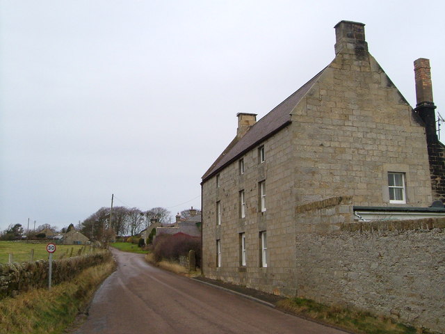
ROTHBURY (All Saints), a market-town and parish, and the head of a union, in the W. division of Coquetdale ward, N. division of Northumberland; containing 2,555 inhabitants, of whom 881 are in the town, 30 miles (N.W. by N.) from Newcastle, and 300 (N.N.W.) from London. The name of this place, anciently Roberie, Rathbury, and Routhbyrig, may be derived from the British Rhuthr, an attack; or from the Saxon Ruth, red, expressive of the colour of the river and its bed. The situation of the town, though low, is very beautiful, in a sequestered and romantic glen watered by the Coquet. This river abounds in trout, and is celebrated as a fishing stream; it is crossed on the south side of the town by an old stone bridge of four ribbed arches. Upon the west the vale opens gradually to the view, almost encircled by hills, and ridges of broken rocks, interspersed with trees; a few goats feed among the crags, and their milk and whey are in considerable request by the valetudinarians who resort hither during the summer season. The town, which is wide and airy, consists of three streets irregularly built, diverging from the market-place; the inhabitants are supplied with water from several springs. The market is on Friday, but has almost fallen into disuse: fairs for horses, cattle, and sheep, are held on Whit-Monday, October 2nd, and November 1st; and a statute-fair for hiring servants on the Friday in Easter-week. The powers of the county debt-court of Rothbury, established in 1847, extend over the registration-district of Rothbury.
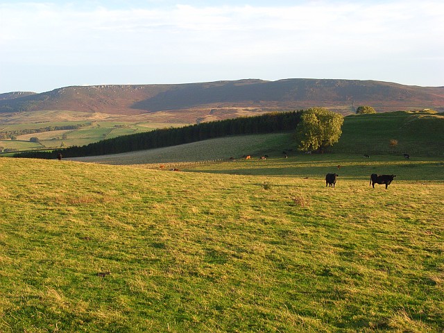
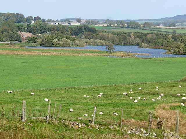
The parish consists of 33,770 acres, and comprises the townships of Bickerton, Caistron, Cartington, Debdon, Fallowlees, Flotterton, Hollinghill, Hepple, Hepple Demesne, Hesley-Hurst, Lee-Ward, Mount-Healey, Newtown, Paperhaugh, Raw, Rothbury, Snitter, Thropton, Great Tosson with Ryehill, Little Tosson, Trewhitt, Warton, Whitton, and Wreighill. The Duke of Northumberland is lord of the manor, and proprietor of a large portion of the parish. The haughs by the river side are good alluvial soil, but the rest of the land is generally covered with stones or heath. The parish contains an abundance of limestone, sandstone, and ironstone, and though there are no mines at present worked, yet, from the large accumulations of scoria, it is evident that the ironstone must have been extensively wrought at a very ancient period, and most probably by the Romans: in many parts, the water is so strongly impregnated with iron, as to be used medicinally. The ancient Forest of Rothbury, occupying a tract seven miles long and five broad, has been divided under the authority of an act of parliament passed in the year 1831.
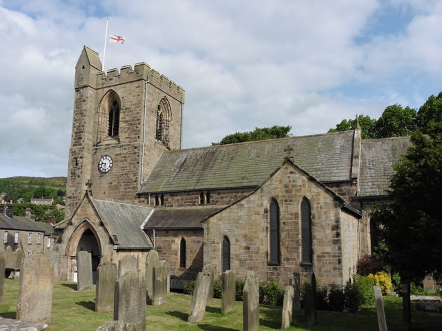
The living is a rectory, valued in the king's books at £58. 6. 8.; net income, £1,106; patron, the Bishop of Carlisle. The church is a ruinous cruciform structure in the early English style, with a square tower: against a pillar near the south door is the effigy in stone of a man in armour; and the font, which is very antique, bears a rudely-sculptured representation of the Redeemer sitting in Judgment. The Independents have a place of worship. Near the church is a free school, with a dwelling-house and garden for the master, to the erection of which the Rev. Mr. Thomlinson, rector, in 1720 gave £100, with £20 per annum as an endowment, to which have been added some other benefactions, producing £252. 18. per annum. The poor-law union of Rothbury comprises 71 parishes and townships, containing a population of 7,297. There are numerous British stations in the neighbourhood. About a mile to the west of Rothbury is a circular intrenchment, with a triple ditch and earthen rampart: at the distance of a quarter of a mile to the north-east of this, is another; on Tosson hills, two miles to the south-west, a third; and about the same distance to the south-east, on Whitton hills, a fourth. The last is still very perfect, and of great extent: the plan of one of the serpent temples of the Druids may be clearly traced; the stones, placed side by side, yet remain, and the visiter may pass into the inclosure by the original entrance. These stations were doubtless connected; they all stand upon abrupt and lofty elevations, commanding extensive views of the surrounding country and of each other. Dr. John Brown, vicar of St. Nicholas' in Newcastle, and author of some essays, poetical pieces, and dramatic writings, was a native of the parish. Bernard Romney, an ancient Norman bard and musician, lived and died here.
Extract from: A Topographical Dictionary of England comprising the several counties, cities, boroughs, corporate and market towns, parishes, and townships..... 7th Edition, by Samuel Lewis, London, 1848.

Co-Curate Page
Cartington Township, 1848
- CARTINGTON, a township, in the parish and union of Rothbury, W. division of Coquetdale ward, N. division of Northumberland, 3¼ miles (N.W. by N.) from Rothbury; containing, with Bankland, 66 …
Co-Curate Page
Trewhitt Township, 1848
- TREWHITT, a township, in the parish and union of Rothbury, W. division of Coquetdale ward, N. division of Northumberland; containing 130 inhabitants. High Trewhitt is 4¼ miles (N.W.) and Low …
Co-Curate Page
Snitter
- SNITTER, a township, in the parish and union of Rothbury, W. division of Coquetdale ward, N. division of Northumberland, 2¾ miles (N.W. by W.) from Rothbury; containing 163 inhabitants. It …
Co-Curate Page
Wreighill
- Overview Map Wreighill Farm is located by Wreighill Pike (hill), about 1 mile north of the village of Hepple and 5 miles west of Rothbury in Northumberland. There was once …
Co-Curate Page
Whitton, Northumberland, 1848
- WHITTON, a township, in the parish and union of Rothbury, W. division of Coquetdale ward, N. division of Northumberland, ½ a mile (S.) from Rothbury; containing 82 inhabitants. In 1381, …
Co-Curate Page
Little Tosson, Township, 1848
- TOSSON, LITTLE, a township, in the parish and union of Rothbury, W. division of Coquetdale ward, N. division of Northumberland, 2½ miles (W.S.W.) from Rothbury; containing 31 inhabitants. It stands …
Co-Curate Page
Great Tosson with Rye-Hill, Township, 1848
- TOSSON, GREAT, with Rye-Hill, a township, in the parish and union of Rothbury, W. division of Coquetdale ward, N. division of Northumberland, 2 miles (W.S.W.) from Rothbury; containing 178 inhabitants, …
Co-Curate Page
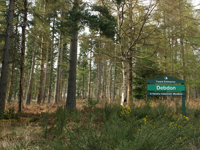
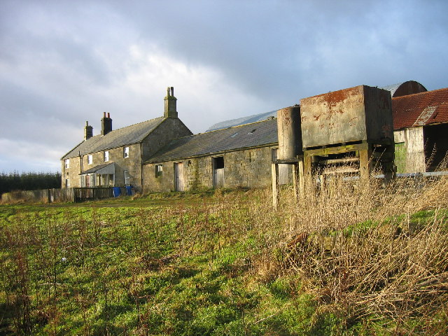
Debdon
- DEBDON, a township, in the parish and union of Rothbury, W. division of Coquetdale ward, N. division of Northumberland, 2¼ miles (N.) from Rothbury; containing 13 inhabitants. This place includes …
Co-Curate Page
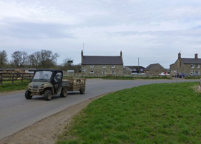
Caistron
- Overview Map Caistron is a farm / hamlet in Northumberland, located about 4 miles west of Rothbury and 1 mile north-east of the village of Hepple. It is situated on …
Co-Curate Page
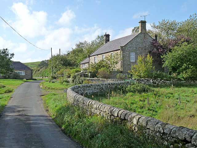
Bickerton
- Overview Map Street View Bickerton is a farm / hamlet in Northumberland, located about 4 miles west of the town of Rothbury and 1 mile east of the village of …
Co-Curate Page
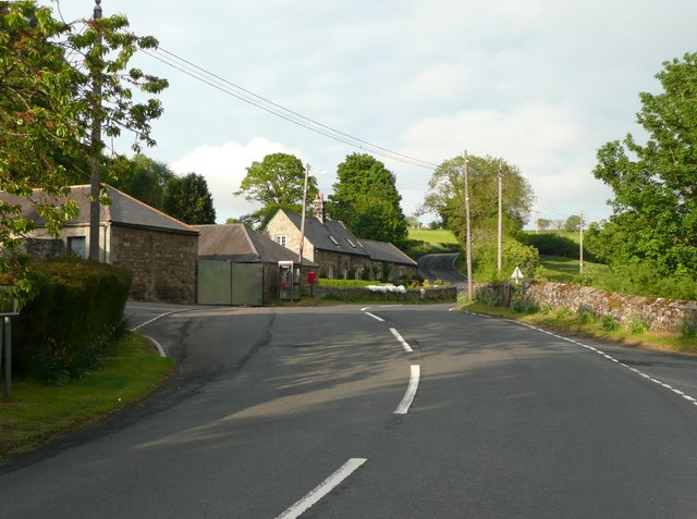
Thropton Township, 1848
- THROPTON, a township, in the parish and union of Rothbury, W. division of Coquetdale ward, N. division of Northumberland, 1½ mile (W. by N.) from Rothbury; containing 207 inhabitants. It …

Co-Curate Page
Warton Township, 1849
- WARTON, a township, in the parish and union of Rothbury, W. division of Coquetdale ward, N. division of Northumberland, 3¼ miles (W. by N.) from Rothbury; containing 74 inhabitants. It …
Co-Curate Page
Fallowlees
- Overview Map Fallowlees Farm is located on the edge of Harwood Forest, about 5 miles south-west of Rothbury in Northumberland. Remains of ridge and furrow cultivation suggest there was a …
Co-Curate Page
Flotterton
- FLOTTERTON, a township, in the parish and union of Rothbury, W. division of Coquetdale ward, N. division of Northumberland, 3¾ miles (W.) from Rothbury; containing 64 inhabitants. This place, which …
Co-Curate Page
Pauperhaugh
- Overview Map Street View Pauperhaugh is a hamlet by the River Coquet in Northumberland, located about 4 miles south-east of Rothbury. Historically, Pauperhaugh was a township in the ancient parish …
Co-Curate Page
Church of All Saints
- Overview Map Street View Inside All Saints is the parish church of Rothbury. The current church building dates from the 13th century, with restoration in 1850. However, it is a …
Co-Curate Page
Hepple Township, 1848
- HEPPLE, a township, in the parish and union of Rothbury, W. division of Coquetdale ward, N. division of Northumberland, 5½ miles (W. by S.) from the town of Rothbury; containing …
Co-Curate Page
Hepple Demesne, 1848
- HEPPLE-DEMESNE, a township, in the parish and union of Rothbury, W. division of Coquetdale ward, N. division of Northumberland; containing, with Whitefield House, 23 inhabitants. It was anciently held by …
Co-Curate Page
Healey Cote
- Overview Map Street View Healy Cote is a hamlet in Northumberland, located about 1 mile west of Longframlington and 3 miles south-east of Rothbury. Historically, Healy Cote was part of …
Co-Curate Page
Newtown, Northumberland (near Rothbury)
- NEWTOWN, a township, in the parish and union of Rothbury, W. division of Coquetdale ward, N. division of Northumberland, 1½ mile (W.S.W.) from Rothbury; containing 57 inhabitants. It is situated …
Co-Curate Page
Raw, Northumberland
- Overview Map (West Raw) Map (East Raw) Street View West Raw Farm is located by the River Coquet, about 2½ miles south-east of Rothbury in Northumberland. The hamlet of East Raw …

Co-Curate Page
Hollinghill, 1848
- HOLLINGHILL, a township, in the parish and union of Rothbury, W. division of Coquetdale ward, N. division of Northumberland, 4 miles (S. by W.) from Rothbury; containing 114 inhabitants. It …
Co-Curate Page
Hesleyhurst township, 1848
- HESLEY-HURST, a township, in the parish and union of Rothbury, W. division of Coquetdale ward, N. division of Northumberland, 4 miles (S.E. by S.) from Rothbury; containing 36 inhabitants. It …

Co-Curate Page
Cartington Township, 1848
- CARTINGTON, a township, in the parish and union of Rothbury, W. division of Coquetdale ward, N. division of Northumberland, 3¼ miles (N.W. by N.) from Rothbury; containing, with Bankland, 66 …
Co-Curate Page
Trewhitt Township, 1848
- TREWHITT, a township, in the parish and union of Rothbury, W. division of Coquetdale ward, N. division of Northumberland; containing 130 inhabitants. High Trewhitt is 4¼ miles (N.W.) and Low …
Co-Curate Page
Snitter
- SNITTER, a township, in the parish and union of Rothbury, W. division of Coquetdale ward, N. division of Northumberland, 2¾ miles (N.W. by W.) from Rothbury; containing 163 inhabitants. It …
Co-Curate Page
Wreighill
- Overview Map Wreighill Farm is located by Wreighill Pike (hill), about 1 mile north of the village of Hepple and 5 miles west of Rothbury in Northumberland. There was once …
Co-Curate Page
Whitton, Northumberland, 1848
- WHITTON, a township, in the parish and union of Rothbury, W. division of Coquetdale ward, N. division of Northumberland, ½ a mile (S.) from Rothbury; containing 82 inhabitants. In 1381, …
Co-Curate Page
Little Tosson, Township, 1848
- TOSSON, LITTLE, a township, in the parish and union of Rothbury, W. division of Coquetdale ward, N. division of Northumberland, 2½ miles (W.S.W.) from Rothbury; containing 31 inhabitants. It stands …
Co-Curate Page
Great Tosson with Rye-Hill, Township, 1848
- TOSSON, GREAT, with Rye-Hill, a township, in the parish and union of Rothbury, W. division of Coquetdale ward, N. division of Northumberland, 2 miles (W.S.W.) from Rothbury; containing 178 inhabitants, …
Co-Curate Page
Debdon
- DEBDON, a township, in the parish and union of Rothbury, W. division of Coquetdale ward, N. division of Northumberland, 2¼ miles (N.) from Rothbury; containing 13 inhabitants. This place includes …
Co-Curate Page
Caistron
- Overview Map Caistron is a farm / hamlet in Northumberland, located about 4 miles west of Rothbury and 1 mile north-east of the village of Hepple. It is situated on …
Co-Curate Page
Bickerton
- Overview Map Street View Bickerton is a farm / hamlet in Northumberland, located about 4 miles west of the town of Rothbury and 1 mile east of the village of …
Co-Curate Page
Thropton Township, 1848
- THROPTON, a township, in the parish and union of Rothbury, W. division of Coquetdale ward, N. division of Northumberland, 1½ mile (W. by N.) from Rothbury; containing 207 inhabitants. It …
Co-Curate Page
Warton Township, 1849
- WARTON, a township, in the parish and union of Rothbury, W. division of Coquetdale ward, N. division of Northumberland, 3¼ miles (W. by N.) from Rothbury; containing 74 inhabitants. It …
Co-Curate Page
Fallowlees
- Overview Map Fallowlees Farm is located on the edge of Harwood Forest, about 5 miles south-west of Rothbury in Northumberland. Remains of ridge and furrow cultivation suggest there was a …
Co-Curate Page
Flotterton
- FLOTTERTON, a township, in the parish and union of Rothbury, W. division of Coquetdale ward, N. division of Northumberland, 3¾ miles (W.) from Rothbury; containing 64 inhabitants. This place, which …
Co-Curate Page
Pauperhaugh
- Overview Map Street View Pauperhaugh is a hamlet by the River Coquet in Northumberland, located about 4 miles south-east of Rothbury. Historically, Pauperhaugh was a township in the ancient parish …
Co-Curate Page
Church of All Saints
- Overview Map Street View Inside All Saints is the parish church of Rothbury. The current church building dates from the 13th century, with restoration in 1850. However, it is a …
Co-Curate Page
Hepple Township, 1848
- HEPPLE, a township, in the parish and union of Rothbury, W. division of Coquetdale ward, N. division of Northumberland, 5½ miles (W. by S.) from the town of Rothbury; containing …
Co-Curate Page
Hepple Demesne, 1848
- HEPPLE-DEMESNE, a township, in the parish and union of Rothbury, W. division of Coquetdale ward, N. division of Northumberland; containing, with Whitefield House, 23 inhabitants. It was anciently held by …
Co-Curate Page
Healey Cote
- Overview Map Street View Healy Cote is a hamlet in Northumberland, located about 1 mile west of Longframlington and 3 miles south-east of Rothbury. Historically, Healy Cote was part of …
Co-Curate Page
Newtown, Northumberland (near Rothbury)
- NEWTOWN, a township, in the parish and union of Rothbury, W. division of Coquetdale ward, N. division of Northumberland, 1½ mile (W.S.W.) from Rothbury; containing 57 inhabitants. It is situated …
Co-Curate Page
Raw, Northumberland
- Overview Map (West Raw) Map (East Raw) Street View West Raw Farm is located by the River Coquet, about 2½ miles south-east of Rothbury in Northumberland. The hamlet of East Raw …
Co-Curate Page
Hollinghill, 1848
- HOLLINGHILL, a township, in the parish and union of Rothbury, W. division of Coquetdale ward, N. division of Northumberland, 4 miles (S. by W.) from Rothbury; containing 114 inhabitants. It …


