Topics > Civil Parishes in Cumbria > Kendal Town Council area > Kendal Parish, 1848
Kendal Parish, 1848
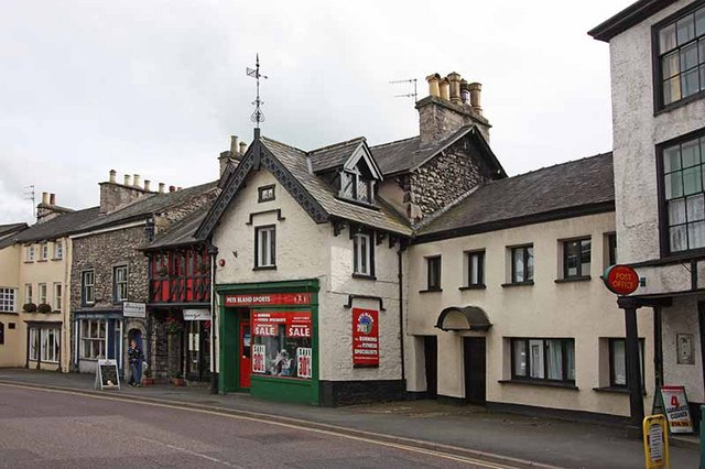
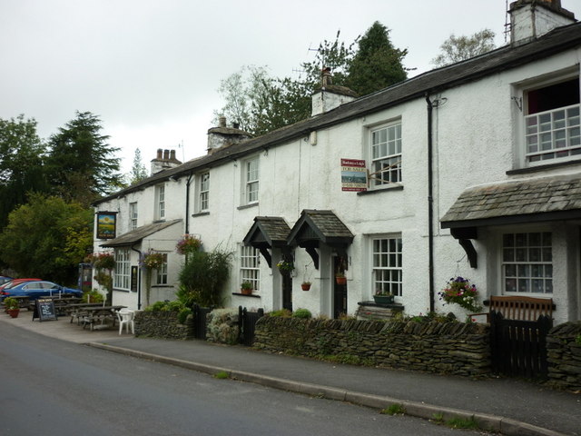
KENDAL (Holy Trinity), a newly-enfranchised borough, a market-town, and parish, and the head of a union, chiefly in Kendal ward, but partly in Lonsdale ward, county of Westmorland; the whole containing, exclusively of the chapelry of Winster, 18,027 inhabitants, of whom 10,225 are in the town, 23 miles (S.W. by S.) from Appleby, and 262 (N.W. by N.) from London, on the great north road. This place, which, from the various relics of antiquity discovered, was evidently a Roman station, is supposed by Dr. Gale to have been the Brovonacis of Antoninus; but the correctness of this opinion has been doubted by other antiquaries. The town is the largest in the county, and is very pleasantly situated in a valley, on the western bank of the Kent, over which river are three stone bridges, of three arches each. From one of the bridges a spacious street, named Stramongate, leads up a gentle acclivity to the centre of the town, where it meets another principal street, a mile in length, called Stricklandgate and Highgate, extending from north to south; from this a third main street leads down to the water side. These streets, which contain good houses of hewn limestone, roofed with blue slate, are intersected at right angles by several narrower ones, in which the houses are chiefly of rough stone, plastered, and in the ancient style. The town is lighted with gas, the footpaths are paved with pebbles, and the streets macadamized; the inhabitants are supplied with good water: for their better supply both of water and gas, an act was passed in 1846. On the west side the view is enriched by a long tier of gardens, terraces, and orchards. On the east bank of the river are the ruins of a castle, the baronial seat of the lords of Kendal, and the birthplace of Catherine Parr, the last queen of Henry VIII.; the remains consist of the outer walls, with two square towers and one round tower. Opposite the castle, and overlooking the town, is Castle-how Hill, an artificial circular mount, 30 feet in height, surrounded at its base by a deep fosse and a high rampart, strengthened by two bastions on the east; the summit, which is flat, is crossed by a ditch, and defended by a breastwork of earth. On this eminence an obelisk, commemorative of the Revolution of 1688, was erected by the inhabitants in 1788.
A mechanics' institute with a library was established in April, 1824; and there are also two newsrooms, a subscription library, a book club, and a natural history society, with a splendid museum, containing a collection of antiquities and natural curiosities. The assemblyrooms, erected by Mr. Webster, architect, and opened in 1827, have two fronts, one in Lowther-street, the other in Highgate, the latter is ornamented with a receding balcony, fronted with columns and pilasters of the Ionic order, supporting a pediment, and surmounted by a handsome cupola. The interior contains several public rooms, and on the principal floor is an elegant ballroom. The building was erected by shares of £100 each, and the total expenditure amounted to £6,000.
The manufacture of woollen-cloth was introduced in the reign of Edward III., by emigrants from the Low Countries; and it appears to have flourished, as, in the reigns of Richard II. and Henry IV., several provisions were made by parliament for the regulation of the "Kendal cloths." Previously to the establishment of the manufactories here, all the wool of the country was exported to the Netherlands, and there manufactured, affording such a source of gain as to induce the Duke of Burgundy to institute the order of the "Golden Fleece." The green druggets made at this and other places were the common clothing of the poor in London and elsewhere for several centuries, so that "Kendal Green" became proverbial. The chief articles of manufacture at present are, coarse woollen-cloth, linsey, knit worsted stockings, and Guernsey jackets for the navy. There are also considerable manufactories for common, Brussels, and Kidderminster carpets; an extensive establishment for the manufacture of Valentia, and fancy articles of very superior quality for waistcoats; large tanneries; a manufactory for fish-hooks and wool-cards; and mills for scouring, fulling, and friezing cloth, and for rasping dye-wood, together with corn and paper mills. Combs of all descriptions are made; and several persons are employed in working and polishing marble, which is remarkable for the beauty and variety of its colours, and is in part obtained from the adjacent mountainous district, some also being imported from Italy. The neighbourhood abounds with limestone, of which the houses in general are built, and which was first polished here in 1788; the stone presents a hard surface, variegated with petrified shells, and has a very beautiful appearance. At some mills below the town, gunpowder is manufactured. A canal, opened in 1819, extends from the river Kent to Lancaster, and thence to West Houghton, Wigan, &c., from which Kendal is supplied with coal. The Windermere branch of the Lancaster and Carlisle railway, 10¼ miles long, commences at Oxenholme station, about two miles from Kendal, and passes near the lowest part of the town; it was opened in the spring of 1847. The views on every side from Oxenholme are magnificent: Kendal Castle is on the left, Benson Knot to the right, Whinfell and Potter Fell to the north, and, north-westward, the mountains of the Lake district, Furness Fells, Hill Bell, and the Kentmere High-Street, the highest road in England, and one of the highest ever constructed by the legions of old Rome. The market, established by charter of Richard I., and confirmed by subsequent sovereigns, is held on Saturday, and is principally for corn, which is pitched in large quantities. Fairs are held at a place called Beast banks, on the 22nd of March, the 29th of April, and the 8th of November, and the following day, for horses, cattle, and sheep; and a statute-fair for hiring servants is held on the Saturday in Whitsun-week. The market-place, now used almost exclusively for corn, is near the centre of the town; very convenient shambles were opened in 1804, on its southern side: the fish-market is at the head of Finklestreet, and vegetables are sold in Stramongate.
This town received its first charter in the 18th of Elizabeth, and the borough was again incorporated in the 12th of Charles I. and 36th of Charles II.; under the last charter the corporation consisted of a mayor, recorder, 12 aldermen, and 20 capital burgesses, assisted by a town-clerk, two chamberlains, and other officers. By the act of the 5th and 6th of William IV., cap. 76, the government is now vested in a mayor, 6 aldermen, and 18 councillors; the borough is divided into three wards, the municipal and parliamentary boundaries being the same, and the number of magistrates is four. By the act of the 2nd of William IV., cap. 45, the town was made a representative borough, comprising 3678 acres: it returns one member to parliament, the right of election being vested in the £10 householders; and the mayor is returning officer. The adjourned sessions from Appleby, for the Kendal and Lonsdale wards, are held here three times a year, there being at present one general sessions at Appleby. The powers of the county debt-court of Kendal, established in 1847, extend over the greater part of the registration-district of Kendal. Petty-sessions are held twice a week. The town-hall is a handsome and spacious building, originally erected in 1591, and rebuilt on the same site in 1758. Near the poor-house, at the east end of the town, is the house of correction, built in 1786, and which has of late years undergone considerable alterations. Kendal is the head of a barony, which, prior to the Conquest, was included in the principality of Cumberland, and was in the possession of the Scottish crown; it comprises the whole of the Kendal and Lonsdale wards, and several other places within the county, and was given by the Conqueror to Ivo de Talbois, who thus became its first baron.
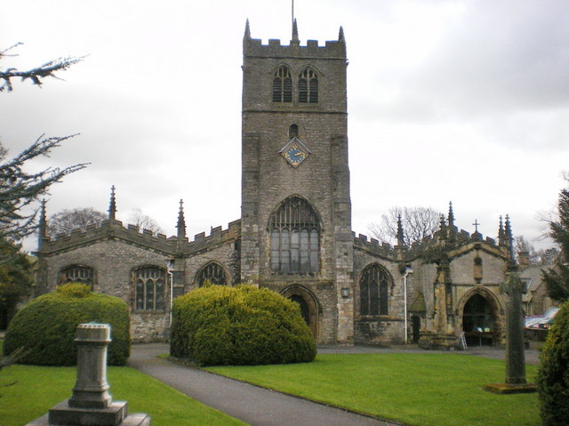
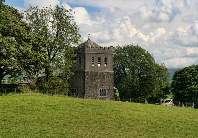
The parish comprises the chapelries of Burneside, Crook, Helsington, Hugil, Old Hutton with Holmescales, Kentmere, Natland, Long Sleddale, Nether and Over Stavely, Underbarrow with Bradley-Field, and Winster, also the townships of Dilliker, Docker, Grayrigg, New Hutton, Kirkland, Lambrigg, Patton, Scalthwaiterigg with Hay and Hutton-i'-th'-Hay, Selside with Whitwell, Skelsmergh, Strickland-Kettle, Strickland-Roger, and Whinfell; and part of the townships of Fawcett-Forest, Nether Graveship, and Undermilbeck, The living is a vicarage, valued in the king's books at £92. 5.; net income, £285; patrons and impropriators, the Master and Fellows of Trinity College, Cambridge. The church, which stands in the hamlet of Kirkland, is principally in the later English style, with a low tower: the roof is supported by four rows of pillars, which divide the interior into five aisles; there are many ancient monuments, and some screen-work. A district church, dedicated to St. Thomas, and consecrated in June, 1818, was built under the provisions of the act of parliament of the 1st and 2nd of George IV.; the patronage is vested in five Trustees, and the living is endowed with £1500, of which £500 were the legacy of a lady. The chapel dedicated to St. George, erected in 1754, in the centre of the town, has been converted into a schoolroom, and a very handsome church, in the later English style, erected in its stead, on the bank of the Kent, immediately opposite the Stramongate bridge, at a cost of about £4,000, towards which Her Majesty's Commissioners granted £1,000, and the Incorporated Society £400; it contains 1250 sittings, 870 of which are free. The living is a perpetual curacy; net income, £123; patron, the Vicar of Kendal. In the rural parts of the parish are fourteen other incumbencies, eleven of which are in the gift of the Vicar. There are places of worship for Baptists, the Society of Friends, Glassites, Independents, Inghamites, Primitive Methodists, Wesleyans, Scottish Seceders, Unitarians, and Roman Catholics. Near the parochial church is the site of an ancient house called Abbot-hall, which belonged to the abbey of St. Mary's, York: it was rebuilt by the late George Wilson, Esq.
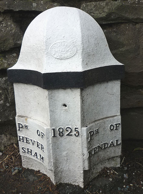
The Free Grammar school was founded and endowed by Adam Pennington, of Boston, in Lincolnshire, in 1525; the site was given in 1588, by Miles Phillipson, and the schoolroom was rebuilt in 1592: the endowment produces about £40 per annum. The school has three exhibitions of £5 each to Queen's College, Oxford; and another of £8 for four years to the same college, paid by the Chamber of Kendal; also 20s. and 40s. per annum for two exhibitions to Queen's College. There is, besides, an exhibition of £5 per annum for four years, to any college in Oxford, the candidate to be of the parishes of Kendal, Millom, or Heversham. Ephraim Chambers, the writer of the Cyclopædia; Dr. Edmund Law, Bishop of Carlisle; and Dr. Shaw, the celebrated traveller, were educated here. A school and hospital were endowed with estates by Thomas Sandes, an inhabitant, in 1670; the former for educating children, and the latter for the residence of eight widows: the annual income is £315. A school of industry, established in 1799, is supported partly from the interest of two bequests. A national school for boys was built by subscription in 1818, and endowed with £2000 in the five per cent. annuities, by Matthew Piper, Esq., of Whitehaven, a member of the Society of Friends, who, dying in 1821, at the advanced age of 93, was interred by his own request in the interior of the building. The poor-law union of Kendal comprises 57 parishes or places, and contains a population of 34,694.
The following persons were natives of the town: Dr. Thomas Shaw, the oriental traveller, son of an alderman of Kendal, born in 1692; Dr. Anthony Askew, a learned physician and classical scholar, born in 1722; John Wilson, a journeyman shoemaker, who distinguished himself as a botanist, and published a Synopsis of British Plants; William Hudson, the author of Flora Anglica, who was an apothecary in London, where he died in 1797; and John Gough, a member of the Society of Friends, who, though blind, attained considerable eminence by his researches in natural philosophy. Kendal has conferred the title of Earl on John, Duke of Bedford, brother of Henry V.; Prince George of Denmark; Prince Charles, third son of James II.; and other illustrious persons. The present Earl of Pembroke has the title of Baron Ross and Parr, of Kendal.
Extract from: A Topographical Dictionary of England comprising the several counties, cities, boroughs, corporate and market towns, parishes, and townships..... 7th Edition, by Samuel Lewis, London, 1848.
Co-Curate Page
Kendal
- Overview About Kendal Map Street View Kendal, anciently known as Kirkby in Kendal or Kirkby Kendal, is a market town and civil parish within the South Lakeland District of …
Co-Curate Page
Kirkland
- Kirkland is a major road in Kendal which continues northwards from Milthorpe Road and onwards to Highgate, forming pat of the A6 route. The area around here is referred to …

Co-Curate Page
Nether Staveley Township, 1848
- STAVELEY, NETHER, a township, in the parish, union, and ward of Kendal, county of Westmorland, 4¾ miles (N.W. by N.) from Kendal; containing 201 inhabitants. It comprises 2,540 acres of …
Co-Curate Page
Over Staveley Township, 1848
- STAVELEY, OVER, a township and chapelry, in the parish, union, and ward of Kendal, county of Westmorland, 5 miles (N.W. by N.) from the town of Kendal; the township containing …
Co-Curate Page
Whinfell Township (Kendal), 1848
- WHINFELL, a township, in the parish, union, and ward of Kendal, county of Westmorland, 6½ miles (N.E. by N.) from Kendal; with 187 inhabitants. Extract from: A Topographical Dictionary of …

Co-Curate Page
Winster
- Overview About Winster Map Street View Winster is a village in the South Lakeland district of Cumbria, located about 2½ miles south of Bowness-on-Windermere and 1½ miles east of Windermere …
Co-Curate Page
Underbarrow
- Overview Map Street View Underbarrow is a village in the South Lakeland district of Cumbria, located about 3 miles west of Kendal. Historically, Unerbarrow was a chapelry in the ancient …
Co-Curate Page
Longsleddale, 1848
- SLEDDALE, LONG, a chapelry, in the parish, union, and ward of Kendal, county of Westmorland, 8 miles (N. by W.) from Kendal; containing 160 inhabitants. It comprises 5,085 acres, nearly …
Co-Curate Page
Kentmere, 1848
- KENTMERE, a chapelry, in the parish, union, and ward of Kendal, county of Westmorland, 8 miles (N.N.W.) from Kendal; containing 198 inhabitants. This place derived its name from a mere …
Co-Curate Page
Crook
- Overview About Crook Map Street View Crook, South Lakeland CROOK, a chapelry, in the parish, union, and ward of Kendal, county of Westmorland, 4¾ miles (W.N.W.) from Kendal; containing 257 …
Co-Curate Page
Selside
- Overview Map Street View Selside is a distributed village and community in the South Lakeland district of Cumbria. Ameneties include St Thomas' Church, Selside CE Primary School, and Memorial Hall. Historically, Selside …
Co-Curate Page
Lambrigg Civil Parish
- Lambrigg is a rural civil parish in the South Lakeland district of Cumbria, with a population of 81 recorded in the 2011 Census. Historically, Lambrigg was a township in the …
Co-Curate Page
Helsington, 1848
- HELSINGTON, a chapelry, in the parish, union, and ward of Kendal, county of Westmorland, 3½ miles (S.W. by S.) from Kendal; containing 310 inhabitants. This place has been for many …
Co-Curate Page
Natland, 1848
- NATLAND, a chapelry, in the parish, union, and ward of Kendal, county of Westmorland, 2¼ miles (S.) from Kendal; containing 251 inhabitants. It comprises by measurement 1,117 acres, of which …
Co-Curate Page
Docker Township, 1848
- DOCKER, a township, in the parish and union of Kendal, Kendal ward, county of Westmorland, 4¼ miles (N.E. by E.) from Kendal; containing 82 inhabitants. At Docker Garths the Lancaster …
Co-Curate Page
Dillicar Township, 1848
- DILLIKER, a township, in the parish and union of Kendal, Lonsdale ward, county of Westmorland, 8½ miles (N.E. by E.) from Kendal; containing 85 inhabitants. It is bounded on the …
Co-Curate Page
Hugill, 1848
- HUGIL, a chapelry, in the parish, union, and ward of Kendal, county of Westmorland, 6¼ miles (N.W.) from Kendal; containing 382 inhabitants. Bobbinturning and the manufacture of woollen-cloth are carried …
Co-Curate Page
Patton Bridge
- Overview Map Street View Patton Bridge is a hamlet in the South Lakeland district of Cumbria, located about 3½ miles north-east of Kendal. There is a stone bridge over the …
Co-Curate Page
Grayrigg Chapelry, 1848
- GRAYRIGG, a chapelry, in the parish and union of Kendal, partly in Lonsdale ward, but chiefly in Kendal ward, county of Westmorland, 5½ miles (N.E. by E.) from Kendal; comprising …

Co-Curate Page
Strickland Ketel, 1848
- STRICKLAND-KETEL, a township, in the parish, union, and ward of Kendal, county of Westmorland, 2 miles (N. by W.) from Kendal; containing 466 inhabitants. This township, with Strickland-Roger, constitutes the …
Co-Curate Page
Strickland Roger, 1848
- STRICKLAND-ROGER, a township, in the parish, union, and ward of Kendal, county of Westmorland, 4 miles (N.) from Kendal; containing 412 inhabitants. It is bounded on the west by the …
Co-Curate Page
Old Hutton Chapelry, 1848
- HUTTON, OLD, a chapelry, in the parish, union, and ward of Kendal, county of Westmorland, 4 miles (S.E.) from Kendal; containing 488 inhabitants. This place and Holmescales form a joint …

Co-Curate Page
Scalthwaiterigg, with Hay and Hutton-i'-th'-Hay, 1848
- SCALTHWAITERIGG, with Hay and Hutton-i'th'-Hay, a township, in the parish, union, and ward of Kendal, county of Westmorland, 2 miles (N.E.) from Kendal; containing 408 inhabitants, of whom 222 are …
Co-Curate Page
Fawcett Forest Township, 1848
- FAWCET-FOREST, a township, partly in the parish of Orton, East ward, but chiefly in that of Kendal, union and ward of Kendal, county of Westmorland, 7 miles (N.N.E.) from Kendal; …
Co-Curate Page
Undermillbeck Township, 1848
- UNDERMILBECK, a township, in the parish of Windermere, union and ward of Kendal, county of Westmorland, 8 miles (W. by N.) from Kendal; containing, with the chapelry of Winster, 1,033 …

Co-Curate Page
Kendal
- Overview About Kendal Map Street View Kendal, anciently known as Kirkby in Kendal or Kirkby Kendal, is a market town and civil parish within the South Lakeland District of …
Co-Curate Page
Kirkland
- Kirkland is a major road in Kendal which continues northwards from Milthorpe Road and onwards to Highgate, forming pat of the A6 route. The area around here is referred to …
Co-Curate Page
Nether Staveley Township, 1848
- STAVELEY, NETHER, a township, in the parish, union, and ward of Kendal, county of Westmorland, 4¾ miles (N.W. by N.) from Kendal; containing 201 inhabitants. It comprises 2,540 acres of …
Co-Curate Page
Over Staveley Township, 1848
- STAVELEY, OVER, a township and chapelry, in the parish, union, and ward of Kendal, county of Westmorland, 5 miles (N.W. by N.) from the town of Kendal; the township containing …
Co-Curate Page
Whinfell Township (Kendal), 1848
- WHINFELL, a township, in the parish, union, and ward of Kendal, county of Westmorland, 6½ miles (N.E. by N.) from Kendal; with 187 inhabitants. Extract from: A Topographical Dictionary of …
Co-Curate Page
Winster
- Overview About Winster Map Street View Winster is a village in the South Lakeland district of Cumbria, located about 2½ miles south of Bowness-on-Windermere and 1½ miles east of Windermere …
Co-Curate Page
Underbarrow
- Overview Map Street View Underbarrow is a village in the South Lakeland district of Cumbria, located about 3 miles west of Kendal. Historically, Unerbarrow was a chapelry in the ancient …
Co-Curate Page
Longsleddale, 1848
- SLEDDALE, LONG, a chapelry, in the parish, union, and ward of Kendal, county of Westmorland, 8 miles (N. by W.) from Kendal; containing 160 inhabitants. It comprises 5,085 acres, nearly …
Co-Curate Page
Kentmere, 1848
- KENTMERE, a chapelry, in the parish, union, and ward of Kendal, county of Westmorland, 8 miles (N.N.W.) from Kendal; containing 198 inhabitants. This place derived its name from a mere …
Co-Curate Page
Crook
- Overview About Crook Map Street View Crook, South Lakeland CROOK, a chapelry, in the parish, union, and ward of Kendal, county of Westmorland, 4¾ miles (W.N.W.) from Kendal; containing 257 …
Co-Curate Page
Selside
- Overview Map Street View Selside is a distributed village and community in the South Lakeland district of Cumbria. Ameneties include St Thomas' Church, Selside CE Primary School, and Memorial Hall. Historically, Selside …
Co-Curate Page
Lambrigg Civil Parish
- Lambrigg is a rural civil parish in the South Lakeland district of Cumbria, with a population of 81 recorded in the 2011 Census. Historically, Lambrigg was a township in the …
Co-Curate Page
Helsington, 1848
- HELSINGTON, a chapelry, in the parish, union, and ward of Kendal, county of Westmorland, 3½ miles (S.W. by S.) from Kendal; containing 310 inhabitants. This place has been for many …
Co-Curate Page
Natland, 1848
- NATLAND, a chapelry, in the parish, union, and ward of Kendal, county of Westmorland, 2¼ miles (S.) from Kendal; containing 251 inhabitants. It comprises by measurement 1,117 acres, of which …
Co-Curate Page
Docker Township, 1848
- DOCKER, a township, in the parish and union of Kendal, Kendal ward, county of Westmorland, 4¼ miles (N.E. by E.) from Kendal; containing 82 inhabitants. At Docker Garths the Lancaster …
Co-Curate Page
Dillicar Township, 1848
- DILLIKER, a township, in the parish and union of Kendal, Lonsdale ward, county of Westmorland, 8½ miles (N.E. by E.) from Kendal; containing 85 inhabitants. It is bounded on the …
Co-Curate Page
Hugill, 1848
- HUGIL, a chapelry, in the parish, union, and ward of Kendal, county of Westmorland, 6¼ miles (N.W.) from Kendal; containing 382 inhabitants. Bobbinturning and the manufacture of woollen-cloth are carried …
Co-Curate Page
Patton Bridge
- Overview Map Street View Patton Bridge is a hamlet in the South Lakeland district of Cumbria, located about 3½ miles north-east of Kendal. There is a stone bridge over the …
Co-Curate Page
Grayrigg Chapelry, 1848
- GRAYRIGG, a chapelry, in the parish and union of Kendal, partly in Lonsdale ward, but chiefly in Kendal ward, county of Westmorland, 5½ miles (N.E. by E.) from Kendal; comprising …
Co-Curate Page
Strickland Ketel, 1848
- STRICKLAND-KETEL, a township, in the parish, union, and ward of Kendal, county of Westmorland, 2 miles (N. by W.) from Kendal; containing 466 inhabitants. This township, with Strickland-Roger, constitutes the …
Co-Curate Page
Strickland Roger, 1848
- STRICKLAND-ROGER, a township, in the parish, union, and ward of Kendal, county of Westmorland, 4 miles (N.) from Kendal; containing 412 inhabitants. It is bounded on the west by the …
Co-Curate Page
Old Hutton Chapelry, 1848
- HUTTON, OLD, a chapelry, in the parish, union, and ward of Kendal, county of Westmorland, 4 miles (S.E.) from Kendal; containing 488 inhabitants. This place and Holmescales form a joint …
Co-Curate Page
Scalthwaiterigg, with Hay and Hutton-i'-th'-Hay, 1848
- SCALTHWAITERIGG, with Hay and Hutton-i'th'-Hay, a township, in the parish, union, and ward of Kendal, county of Westmorland, 2 miles (N.E.) from Kendal; containing 408 inhabitants, of whom 222 are …
Co-Curate Page
Fawcett Forest Township, 1848
- FAWCET-FOREST, a township, partly in the parish of Orton, East ward, but chiefly in that of Kendal, union and ward of Kendal, county of Westmorland, 7 miles (N.N.E.) from Kendal; …