Topics > Civil Parishes in Cumbria > Kendal Town Council area
Kendal Town Council area
Parish boundaries may have changed - for the latest map see Kendal Town Council or Cumbria County Council.
About the Parish
| Main Settlements: | |
| Population: |
29,593 (2021 Census) 28,586 (2011 Census) 27,504 (2001 Census) |
| Area: | 14.9 km2 |
| Parish Council: | Kendal Town Council |
| Unitary Authority: | Westmorland and Furness Council |
| Ceremonial County: | Cumbria |
Historical |
|
|
Ancient Townships (in area of modern CP) |
Kendal (Market Town) - market charter granted in 1189 by King Richard I. Townships became civil parishes in their own right in 1866 (see below). |
| Ancient Parish: |
The ancient parish covered a much larger area compared to the modern civil parish. It included the chapelries of Burneside, Crook, Helsington, Hugil, Old Hutton with Holmescales, Kentmere, Natland, Long Sleddale, Nether and Over Stavely, Underbarrow with Bradley-Field, and Winster, also the townships of Dilliker, Docker, Grayrigg, New Hutton, Kirkland, Lambrigg, Patton, Scalthwaiterigg with Hay and Hutton-i'-th'-Hay, Selside with Whitwell, Skelsmergh, Strickland-Kettle, Strickland-Roger, and Whinfell; and part of the townships of Fawcett-Forest, Nether Graveship, and Undermilbeck. Ancient parishes refer to the parishes before the split between ecclesiastical (church) and civil parishes in the 19th century. They had a parish church and often were composed of multiple townships and chapelries. In many cases, townships and parishes were originally based on the territory of manors from the feudal system during medieval times. Civil parishes were created following the Poor Law Amendment Act 1866, in which Church of England parishes, extra-parochial areas, townships and chapelries, became "civil parishes" which could set their own poor rate (tax). Then the reforms of Local Government Act 1894 established elected civil parish councils (or parish meetings for parishes with less than 300 residents) and created urban and rural districts. Boundaries of parishes and civil parishes may have changed over time. |
| Ancient Districts: |
Kendal (ward) Lonsdale (ward) - some parts of the ancient parish. |
| Poor Law Union: |
Kendal Poor Law Union, formed in 1836. Kendal Poor Law Union had two main workhouses. The first was in Kendal, on Stricklandgate, housing up to 335 inmates. The second was the former Gilbert Union workhouse in Milnthorpe, on Kirkgate Lane, housing up to 300 inmates. Under the Poor Law Amendment Act of 1834 parishes were grouped into Unions, each of which had to build a workhouse if they did not already have one. It ended the old system of locally provided poor relief which had come under strain as numbers out of work grew, following increasing mechanisation of agriculture and the economic downturn after the Napoleonic Wars, along with changing social attitudes. The workhouse provided those unable to support themselves financially with accommodation and work. Inmates were generally segregated into men, women, boys and girls. The workhouse system was abolished by the Local Government Act 1929, but many workhouses lived on as ‘Public Assistance Institutions’ until the National Assistance Act 1948. |
| County: |
Westmorland, until 1974, then: Cumbria, which was created on the 1st of April 1974, following the Local Government Act 1972. The new county absorbed Cumberland and Westmorland, and added some parts of Lancashire and the West Riding of Yorkshire. Cumbria County Council was abolished in 2023 and replaced by 2 new Unitary authorities. Cumbria remains a ceremonial county; retaining ceremonial boundary and the roles and responsibilities of the Lord Lieutenant and High Sheriff of Cumbria - based on 'The Cumbria (Structural Changes) Order 2022'. |
|
District Council: |
Kendal Municipal Borough (1835 - 1974) South Lakeland District (1974 - 2023) Created by the Local Government Act 1972. The district was formed from parts of Westmorland (Kendal Borough, Windermere Urban District, most of Lakes Urban District, South Westmorland Rural District), parts of Lancashire (Grange Urban District, Ulverston Urban District and North Lonsdale Rural District) and Sedbergh Rural District from the West Riding of Yorkshire. South Lakeland and the 5 other district councils of Cumbria, along with the county council, were abolished as part of local government reorganisation in 2023; and replaced by two unitary authorities on 1st April 2023. |
|
Unitary Authority |
Westmorland and Furness Council was created on the 1st April 2023. The 'new' Westmorland & Furness unitary authority area includes the historic county of Westmorland, along with parts of historic Cumberland, including Penrith and it's surrounding area, and also parts of historic Yorkshire and Lancashire. |
|
Major boundary changes |
1908 - Kirkland Civil Parish and Nether Graveship were absorbed into Kendal CP. |
See also: ![]() Historic Buildings and Monuments in Kendal Civil Parish. Note: listed buildings are generally the responsibility of the county council / unitary authority, rather than the parish council.
Historic Buildings and Monuments in Kendal Civil Parish. Note: listed buildings are generally the responsibility of the county council / unitary authority, rather than the parish council.
from https://www.kendaltowncouncil…
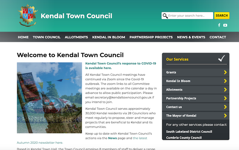
Kendal Town Council
- "...Kendal Town Council serves approximately 30,000 Kendal residents via 28 Councilors who meet regularly to propose, steer and manage projects that are beneficial to Kendal and its communities....Based in Kendal …
Added by
Simon Cotterill
Co-Curate Page
Kendal
- Overview About Kendal Map Street View Kendal, anciently known as Kirkby in Kendal or Kirkby Kendal, is a market town and civil parish within the South Lakeland District of …
Co-Curate Page
Oxenholme
- Overview Map Street View Oxenholme is a village in England just south of the town of Kendal, with which it has begun to merge. It is best known for …

from https://www.cumbriacountyhist…
Kendal (formerly Kirkby Kendal)
- "Borough, market and manufacturing town in Kendal ward, Westmorland. This entry covers medieval borough of Kendal and townships of Kirkland and Nether Graveship....Kendal was seat of barony of Kendal, covering …
Added by
Simon Cotterill


from https://www.kendaltowncouncil…
Kendal Town Council
- "...Kendal Town Council serves approximately 30,000 Kendal residents via 28 Councilors who meet regularly to propose, steer and manage projects that are beneficial to Kendal and its communities....Based in Kendal …
Added by
Simon Cotterill
Co-Curate Page
Kendal
- Overview About Kendal Map Street View Kendal, anciently known as Kirkby in Kendal or Kirkby Kendal, is a market town and civil parish within the South Lakeland District of …
Co-Curate Page
Oxenholme
- Overview Map Street View Oxenholme is a village in England just south of the town of Kendal, with which it has begun to merge. It is best known for …
from https://www.cumbriacountyhist…
Kendal (formerly Kirkby Kendal)
- "Borough, market and manufacturing town in Kendal ward, Westmorland. This entry covers medieval borough of Kendal and townships of Kirkland and Nether Graveship....Kendal was seat of barony of Kendal, covering …
Added by
Simon Cotterill


