Topics > Tyne and Wear > Sunderland > Historic Buildings and Monuments in Sunderland
Historic Buildings and Monuments in Sunderland
Listed buildings and scheduled monuments in Sunderland, from the National Heritage List for England[1]. Use the Search (below) if looking for a specific building / monument. Skip to photos / links.
| Structure | List No. | Grade | Built~ | Ward~ | Note |
|---|---|---|---|---|---|
| Roker Park | 1001325 | II | 1880 | St Peter's | Roker Listed Park and Garden. |
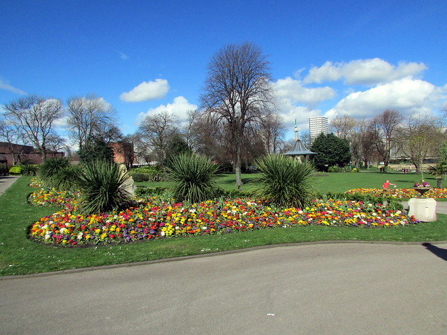
| Mowbray Park | 1001320 | II | 1857 | Listed Park and Garden | |
| Lambton Castle (Grounds) | 1001438 | II | C18th | Listed Park and Garden | |
| Hasting Hill cursus and causewayed enclosure, 600m south of Hasting Hill Farm | 1016977 | n/a | Scheduled Monument | ||
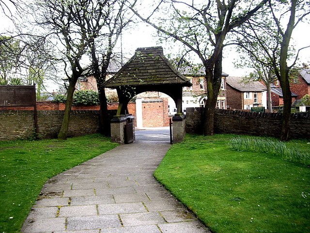
| Monkwearmouth Anglo-Saxon monastery and medieval priory | 1017222 | n/a | St Peter's | Scheduled Monument. Monkwearmouth Below ground remains in the grounds of St Peter's Church | |
| Round barrow on Hasting Hill, 230m west of Hasting Hill Farm | 1018639 | n/a | Neolithic | Scheduled Monument | |
| Seven Sisters round barrow, Copt Hill, Houghton-le-Spring | 1018680 | n/a | Neolithic | Scheduled Monument | |
| World War I early warning acoustic mirror on Namey Hill, 570m north of Carley Hill Cricket Ground | 1020325 | n/a | c.1915 | Scheduled Monument | |
| Defended settlement on Humbledon Hill | 1402212 | n/a | Bronze Age | Scheduled Monument | |
| Bowes Railway | 1003723 | n/a | 1826 | Scheduled Monument | |
| Bandstand Near North Boundary at NZ 3781 5567 | 1207781 | II | Barnes | ||
| Barnes Park South Entrance Walls Gates and Railings | 1207075 | II | Barnes | ||
| Children's Hospital and Attached Steps, Walls and Piers | 1207076 | II | Barnes | ||
| Church of St Gabriel | 1279870 | II | 1912 | Barnes | By CA Clayton Greene |
| East Building of Barnes School | 1208910 | II | c.1900 | Barnes | Now Barnes Infant Academy |
| Gates and Gate Piers at Entrance to Humbledon Pumping Station | 1218026 | II | Barnes | ||
| Hill House, | 1279925 | II | Barnes | ||
| Humbledon Pumping Station | 1279871 | II | Barnes | ||
| Lodge to Children's Hospital | 1279924 | II | Barnes | ||
| South East Lodge Bishopwearmouth Cemetery | 1207881 | II | Barnes | ||
| South Entrance Including Gates, Piers and Railings to Bishopwearmouth Cemetery | 1207930 | II | Barnes | ||
| Vaux Tomb 196 Metres West of South East Lodge at Bishopwearmouth Cemetery | 1207064 | II | Barnes | ||
| Walls, Piers and Railings to Children's Hospital | 1207077 | II | Barnes | ||
| West Building of Barnes School | 1207105 | II | c.1900 | Barnes | Now Barnes Junior School |
| Burdon Hall | 1184756 | II | Burdon | ||
| Tunstall Lodge | 1354975 | II | Burdon | ||
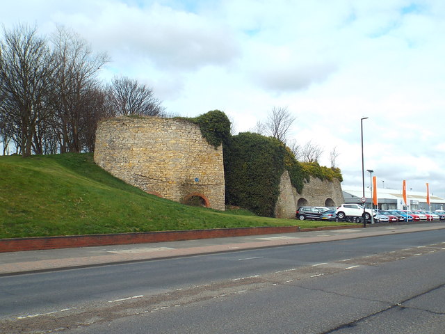
| Hylton Castle | 1207073 | I | C15th | Castle | North Hylton Scheduled Monument(1017223) |
| Hylton Chapel | 1293281 | I | C12th | Castle | North Hylton Scheduled Monument(1017223) |
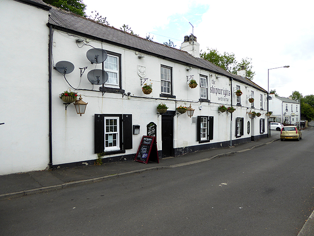
| The Shipwrights Public House | 1279927 | II | C18th | Castle | North Hylton Former coaching inn. |
| No. 16, Front Street | 1025410 | II | Copt Hill | ||
| No. 18, Front Street | 1025411 | II | Copt Hill | ||
| No. 2 Barns South of Russel House | 1184914 | II | Copt Hill | ||
| No. 20, Front Street | 1355002 | II | Copt Hill | ||
| Ashleigh | 1354966 | II | Copt Hill | ||
| Cellar Hill House | 1299884 | II | Copt Hill | ||
| Church of St Matthew | 1184890 | II | 1886 | Copt Hill | Newbottle |
| Church of St Michael | 1025405 | II | 1837 | Copt Hill | Houghton-le-Spring. RC church. |
| Dial House | 1025412 | II | Copt Hill | ||
| East Grange | 1355003 | II | Copt Hill | ||
| Engine House to East of Pumping Station | 1185037 | II | Copt Hill | ||
| Gate Piers and Gates North of Stonygate Pumping Station | 1354970 | II | Copt Hill | ||
| Heatherlee House and Warden House and Front Railings | 1184952 | II | Copt Hill | ||
| Houghton Hall | 1184920 | II* | C17th | Copt Hill | Houghton-le-Spring |
| Houghton Mines Rescue Station | 1268411 | II | Copt Hill | ||
| Laburnum House Area Railings and Dwarf Wall | 1184947 | II | Copt Hill | ||
| Manor House | 1025415 | II | Copt Hill | ||
| National Coal Board Central Garage | 1299853 | II | Copt Hill | ||
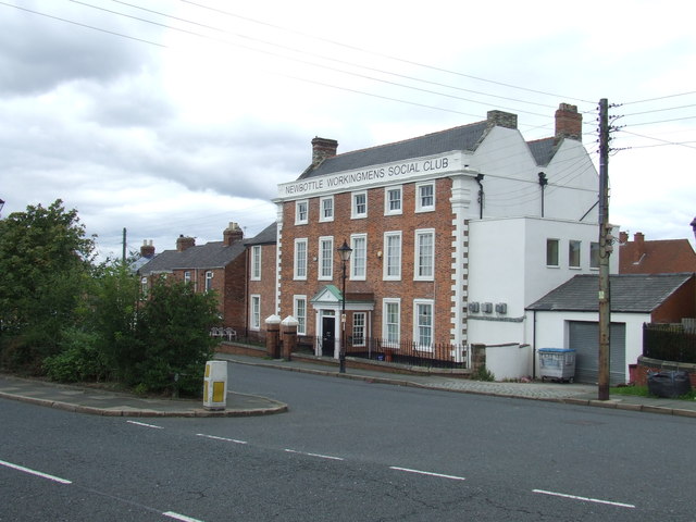
| Newbottle Working Men's Club | 1025409 | II | C18th | Copt Hill | Newbottle |
| North Farm and Adjacent Stable and Coachhouse, Railings and Gate | 1184881 | II | Copt Hill | ||
| Number 16, Area Railings and Dwarf Wall in Front | 1025416 | II | Copt Hill | ||
| Number 18, Area Railings and Dwarf Wall in Front | 1025417 | II | Copt Hill | ||
| Piers, Walls and Steps to North of Pumping Station | 1025421 | II | Copt Hill | ||
| Pillbox at NZ 35175 52073 | 1392382 | II | Copt Hill | ||
| Presbytery of Church of St Michael | 1025406 | II | Copt Hill | ||
| Pumping Station and Attached Outbuildings | 1185028 | II | Copt Hill | ||
| Russell House (East Farm) and Farm Building Adjacent | 1025413 | II | Copt Hill | ||
| Storey House | 1025414 | II | Copt Hill | ||
| Doxford House with conservatory | 1279879 | II* | C18th | Doxford | |
| Garden Wall to East of Silksworth Cottage | 1207147 | II | Doxford | ||
| Garden Walls and Piers to East of Doxford House | 1292003 | II | Doxford | ||
| Lamp Standard, Dwarf Piers and Chains in Front of Doxford House | 1207146 | II | Doxford | ||
| Silksworth Cottage | 1218380 | II | Doxford | ||
| Silkworth Hall | 1207129 | II | Doxford | ||
| Nos. 160, 162 and 164, Newcastle Road | 1025277 | II | Fulwell | ||
| Bents Farmhouse | 1207150 | II | Fulwell | ||
| Cottage and Former Stable to Fulwell Water Pumping Station | 1218030 | II | Fulwell | ||
| East Lodge and Gates to Mere Knolls Cemetery | 1207078 | II | Fulwell | ||
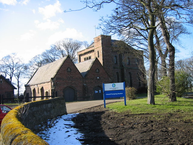
| Fulwell Water Pumping Station Engine House and Boiler House with Steps Attached | 1207128 | II | 1853 | Fulwell | Fulwell |
| Nos. 1-24, Park Place East | 1207114 | II | Hendon | ||
| Nos. 1-24, Park Place West | 1209501 | II | Hendon | ||
| No. 10, Church Street East | 1279470 | II* | Hendon | ||
| No. 11, Church Street East | 1207069 | II* | Hendon | ||
| No. 11, Mowbray Road | 1292879 | II | Hendon | ||
| Nos. 110, 111 and 112, High Street West | 1293118 | II | Hendon | ||
| No. 14, Foyle Street | 1207081 | II | Hendon | ||
| Nos. 15-25, Foyle Street | 1208293 | II | Hendon | ||
| Nos. 17-23, Saint Bede's Terrace | 1217868 | II | Hendon | ||
| Nos. 170, 171 and 173, High Street West | 1207092 | II | C18th | Hendon | Former Binns department store |
| No. 176, High Street West | 1208538 | II | Hendon | ||
| Nos. 2-15, The Oaks | 1391847 | II | Hendon | ||
| Nos. 21 and 22, Fawcett Street | 1208224 | II | Hendon | ||
| Nos. 211 and 212, High Street West | 1207093 | II | Hendon | ||
| No. 22, Athenaeum Street | 1279914 | II | Hendon | ||
| No. 3, Athenaeum Street | 1207056 | II | Hendon | ||
| Nos. 3-19, Ridley Terrace | 1207117 | II | Hendon | ||
| Nos. 43-48, West Sunniside | 1218409 | II | Hendon | ||
| Nos. 49 and 50, High Street East | 1207088 | II | Hendon | ||
| Nos. 5-12, Foyle Street | 1293239 | II | Hendon | ||
| No. 51, High Street East | 1208455 | II | Hendon | ||
| No. 64, Tatham Street | 1279872 | II | Hendon | ||
| Balustrade on Steps to Salisbury Street | 1292049 | II | Hendon | ||
| Bede Tower | 1279563 | II | 1851 | Hendon | Ashbrooke. By John and Benjamin Green |
| Bethesda Free Church | 1207137 | II | Hendon | ||
| Bonded Warehouse Premises of Thomas Maughan (Rose Line) at NZ 4017 5734 | 1207103 | II | Hendon | ||
| Borough Social Services Area Office | 1217980 | II | Hendon | ||
| Caretaker's Cottage to Church of Holy Trinity and Attached Wall | 1293305 | II | Hendon | ||
| Carlton House | 1207107 | II | 1850 | Hendon | Ashbrooke. By John and Benjamin Green |
| Central Buildings | 1291987 | II | Hendon | ||
| Church of Holy Trinity | 1208056 | I | 1719 | Hendon | |
| Church of St Aidan | 1292317 | II | Hendon | ||
| Church of St Ignatius | 1218133 | II | 1889 | Hendon | Suffolk Street |
| Church of St Mary and Attached Railings | 1207805 | II | Hendon | ||
| County Court with Attached Steps and Railings | 1207102 | II | Hendon | ||
| Custom House | 1279881 | II | Hendon | ||
| Dock Office at North End of Hudson Dock with Hydraulic Accumulator, Walls and Piers | 1279893 | II | Hendon | ||
| Drinking Fountain at North End of Central Avenue NZ 3986 5666 | 1208918 | II | Hendon | ||
| Footbridge over Cutting Between Mowbray Park and Mowbray Extension Park | 1207106 | II | Hendon | ||
| Forecourt Wall and Gate Piers to Church of Holy Trinity | 1207070 | II | Hendon | ||
| Forecourt Wall, Piers and Railings to North of Trafalgar Square Almshouses | 1208160 | II | Hendon | ||
| Forecourt Walls Gate and Railings to Caretaker's Cottage Church of Holy Trinity | 1279920 | II | Hendon | ||
| Former Presbyterian Chapel | 1292024 | II | Hendon | ||
| Former Salvation Army Citadel | 1279897 | II | Hendon | ||
| Former South Lodge to Mowbray Park | 1207143 | II | Hendon | ||
| Gas Holder at NZ 4080 5544 to East of East End of Corporation Road | 1207072 | II | Hendon | ||
| Gates and Railings in Front of Number 19 | 1207145 | II | Hendon | ||
| Gates, Piers and Railings to Former Sunderland Orphange | 1208905 | II | Hendon | ||
| Gray House | 1279889 | II | Hendon | ||
| Hutchinson's Buildings | 1208477 | II | Hendon | ||
| Lampholder in Centre of Trafalgar Square | 1208169 | II | Hendon | ||
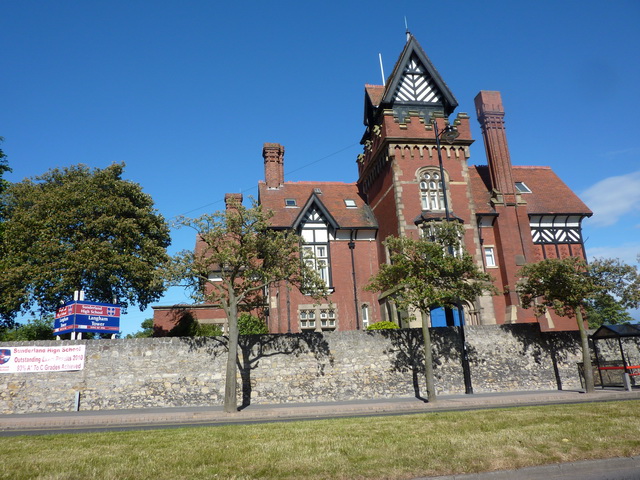
| Langham Tower (Sunderland High School) | 1207123 | II | 1891 | Hendon | Ashbrooke |
| Machinery Pit to West of Swing Bridge at East Side of Dock | 1207096 | II | Hendon | ||
| Mackie's Corner | 1207090 | II | Hendon | ||
| Maritime Buildings and Attached Balustrade | 1217999 | II | Hendon | ||
| Medieval Arch in Wall to West of Public Gardens | 1218428 | II | Hendon | ||
| Medieval Arch Under Cliff Near South East Corner of Park | 1292898 | II | Hendon | ||
| Museum and Library | 1207798 | II | Hendon | ||
| No. 20, Villiers Street | 1218336 | II | Hendon | ||
| North Lodge of Sunderland Cemetery | 1207124 | II | Hendon | ||
| Nos. 29 and 30, Villiers Street | 1292027 | II | Hendon | ||
| Number 13 and Attached Railings | 1208287 | II | Hendon | ||
| Number 19 and Attached Wall, Railings and Area Cover | 1355049 | II | Hendon | ||
| Numbers 1-16 with Attached Handrails | 1207126 | II | Hendon | ||
| Numbers 11-17 with Steps and Railings Attached | 1293041 | II | Hendon | ||
| Numbers 17-23 and Attached Steps and Railings | 1207108 | II | Hendon | ||
| Numbers 17-29 with Steps and Handrails Attached | 1279888 | II | Hendon | ||
| Numbers 20-23 with Steps and Railings Attached | 1208682 | II | Hendon | ||
| Numbers 25-28 with Steps and Railings Attached | 1279896 | II | Hendon | ||
| Numbers 28-39 (Consecutive) with Steps and Railings Attached | 1218396 | II | Hendon | ||
| Numbers 31, 32 and 33 and Attached Steps, Walls, Railings and Area Cover | 1208999 | II | Hendon | ||
| Numbers 32-42 with Steps and Railings Attached | 1208314 | II | Hendon | ||
| Numbers 45, 46 and 47 with Attached Steps and Railings | 1207101 | II | Hendon | ||
| Numbers 45-58 with Steps and Railings Attached | 1207082 | II | Hendon | ||
| Numbers 48-58 with Steps and Railings Attached | 1293017 | II | Hendon | ||
| Park Road Methodist Church with School, Walls and Gates Attached | 1207115 | II | Hendon | ||
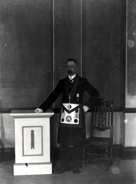
| Phoenix Lodge (Freemason's Hall) | 1279903 | I | 1785 | Hendon | Queen Street East |
| Piers at North End | 1292623 | II | Hendon | ||
| Post Office and Railings | 1207149 | II | Hendon | ||
| Register Buildings | 1207091 | II | Hendon | ||
| South Lodge of Sunderland Cemetery | 1207125 | II | Hendon | ||
| Statue of General Havelock in South West of Park, Building Hill Nz 3984 5639 | 1208966 | II | Hendon | ||
| Statue of John Candlish Mp at South End of Central Avenue NZ 3986 5658 | 1279899 | II | Hendon | ||
| Sunderland and South Shields Water Company Offices, with Steps, Walls and Railings | 1293010 | II | Hendon | ||
| Sunderland East Community Centre, Former Sunderland Orphanage | 1207104 | II | Hendon | ||
| Sunderland Exchange | 1207089 | II | 1814 | Hendon | High Street East |
| Sunderland Synagogue | 1387275 | II | Hendon | ||
| Sunniside Chambers | 1207148 | II | Hendon | ||
| Swing Bridge at East Side with Ashlar Walls | 1279892 | II | Hendon | ||
| Swing Bridge, Lock and Walls of North End of Dock | 1207097 | II | Hendon | ||
| Tavistock House | 1279873 | II | Hendon | ||
| Terrace Wall and Statues South of Museum and Library at North End of Park | 1292891 | II | Hendon | ||
| The Bridge Hotel | 1208524 | II | Hendon | ||
| The Manor House | 1291959 | II | Hendon | ||
| The Midland Bank | 1279926 | II | Hendon | ||
| Trafalgar Square Merchant Seamen's Almshouses | 1207071 | II | 1840 | Hendon | |
| Two Lamp Standards in Front of Main Entrance to Museum and Library | 1207059 | II | Hendon | ||
| Wall and Pier at Lock at North End of Tide Basin | 1207112 | II | Hendon | ||
| Wall to North of Church of Holy Trinity Churchyard | 1208124 | II | Hendon | ||
| Wall, Piers and Railings to East Boundary of Mowbray Park | 1218323 | II | Hendon | ||
| Walls, Piers and Gates to Gray House | 1208355 | II | Hendon | ||
| Warehouse on Wylam Wharf, Premises of Rose Line Limited at NZ 4025 5736 | 1208788 | II | Hendon | ||
| Wave Basin Battery Adjacent to Old South Pier | 1207135 | II | Hendon | ||
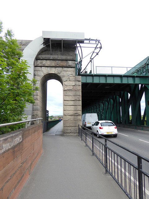
| Wearmouth Bridge | 1279911 | II | 1929 | Hendon | |
| Area Offices of Sunderland District Council | 1354977 | II | Hetton | ||
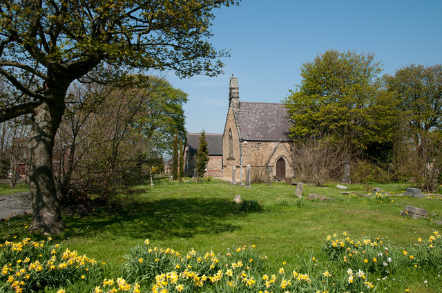
| Church of St Cuthbert | 1184778 | II | 1867 | Hetton | East Rainton |
| High Farm House | 1184776 | II | Hetton | ||
| Laburnum House | 1354976 | II | Hetton | ||
| Monument 13.8 Metres South of Church of St Michael | 1184771 | II | Hetton | ||
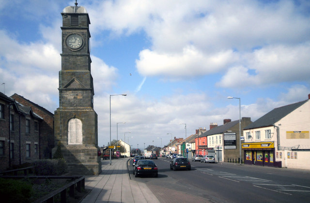
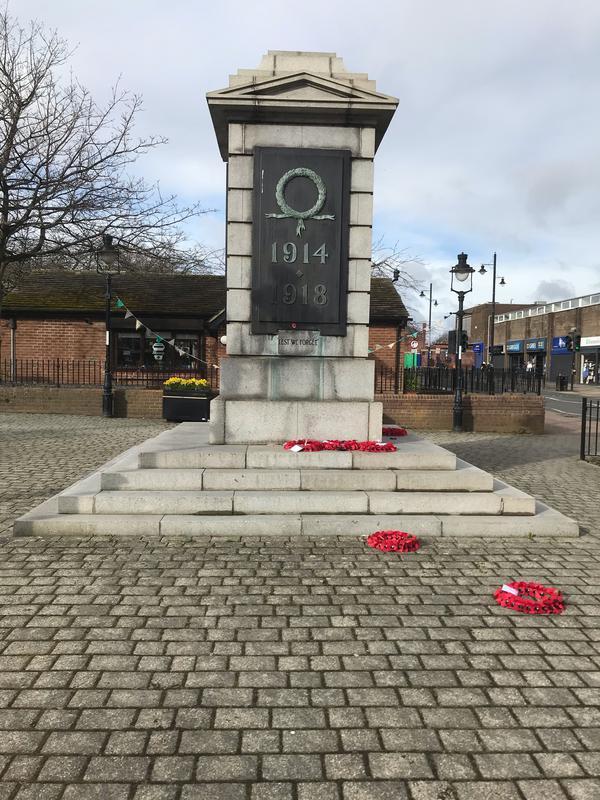
| Monument 30 Metres West of Junction with Elemore Lane | 1025439 | II | 1921 | Hetton | Easington Lane. War Memorial |
| Pithead Baths (Premises of Elemore Auto Parts Limited) and Wall and Railings in Front | 1184774 | II | Hetton | ||
| Primative Methodist Church | 1025441 | II | Hetton | ||
| Smithy | 1025440 | II | Hetton | ||
| St Nicholas House | 1299967 | II | Hetton | ||
| Tomb of Nicholas Wood, 32 Metres to South of Church of St Nicholas | 1025438 | II | Hetton | ||
| Arch to West of Church of St Michael and All Angels, Formerly Part of Rectory Lodges | 1025442 | II | Houghton | ||
| Church of St Michael and All Angels | 1184780 | I | C12th | Houghton | Houghton-le-Spring |
| Davenport and Lilburne Almshouses | 1184826 | II | Houghton | ||
| Gilpin House | 1354979 | II | Houghton | ||
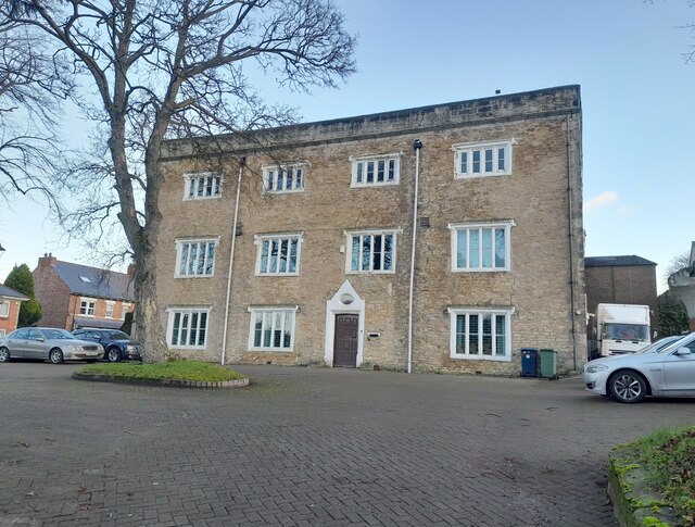
| Houghton Le Spring Area Offices of Sunderland District Council | 1184817 | II* | C17th | Houghton | Houghton-le-Spring. Now The Old Rectory |
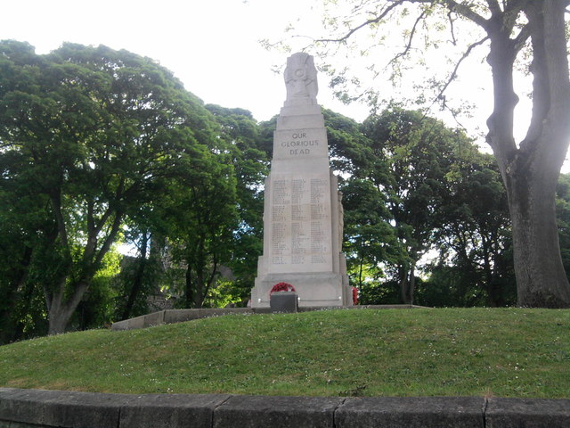
| Houghton-le-Spring War Memorial | 1438103 | II | 1925 | Houghton | Houghton-le-Spring |
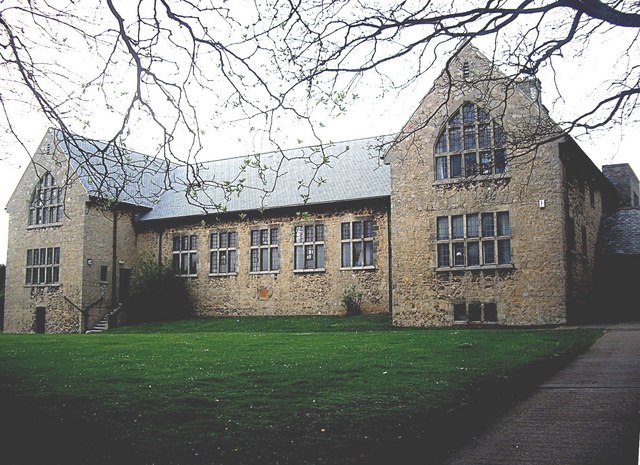
| Kepier Grammar School | 1025443 | II* | C16th | Houghton | Houghton-le-Spring. Now Kepier Hall |
| Lilburn House | 1184830 | II | Houghton | ||
| The Old Mill Public House | 1025404 | II | Houghton | ||
| The Rectory | 1355001 | II | Houghton | ||
| The Villa (Office of the Clerk to the Justices) | 1025445 | II | Houghton | ||
| Nos. 1-29, Thornhill Terrace | 1292039 | II | Millfield | ||
| Nos. 1-7, High Street West | 1293137 | II | Millfield | ||
| Barclays Bank | 1208231 | II | Millfield | ||
| Church of St Joseph | 1207116 | II | Millfield | ||
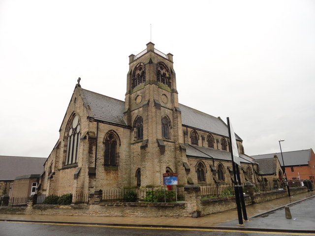
| Church of St Mark | 1207099 | II | Millfield | ||
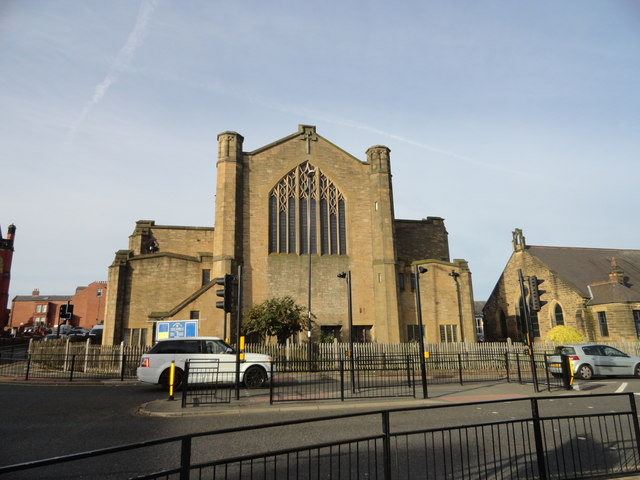
| Church of St Michael (Sunderland Minster) | 1207993 | II* | Pre-Conquest | Millfield | |
| Drinking Fountain to West of Saltgrass Public House | 1292011 | II | Millfield | ||
| Fitzgerald's Public House | 1208372 | II | Millfield | ||
| Former Gas Board Offices with Walls and Piers Attached | 1207094 | II | Millfield | ||
| Former Simpson Street Secondary School | 1279880 | II | Millfield | ||
| Galen Building with steps, walls and railings attached | 1207084 | II | Millfield | ||
| Greens Public House | 1208778 | II | Millfield | ||
| Livingstone's Public House | 1218062 | II | Millfield | ||
| Lloyd's Bank and Attached Walls and Gates | 1207080 | II | Millfield | ||
| Lodge to North West of Westburn House (St Anthony's Secondary School) | 1218294 | II | Millfield | ||
| Magistrates' Court | 1208328 | II | Millfield | ||
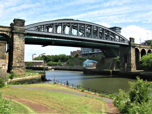
| Monkwearmouth Railway Bridge over River Wear with Viaduct to North | 1207051 | II | 1879 | Millfield | Monkwearmouth |
| Mountain Daisy Public House | 1279894 | II* | 1901 | Millfield | Millfield |
| Mowbray Almshouses Forecourt Walls and Piers | 1207067 | II | Millfield | ||
| National Westminster Bank | 1207079 | II | Millfield | ||
| Numbers 1-7, Crowtree Terrace and Attached Steps and Railings Including 35-38 Crowtree Road | 1207074 | II | Millfield | ||
| Piers and Walls to North of Westburn House (St Anthony's Secondary School) | 1279877 | II | Millfield | ||
| Retaining Wall and Railings Around Corner of Raised Area Opposite Number 12 | 1208389 | II | Millfield | ||
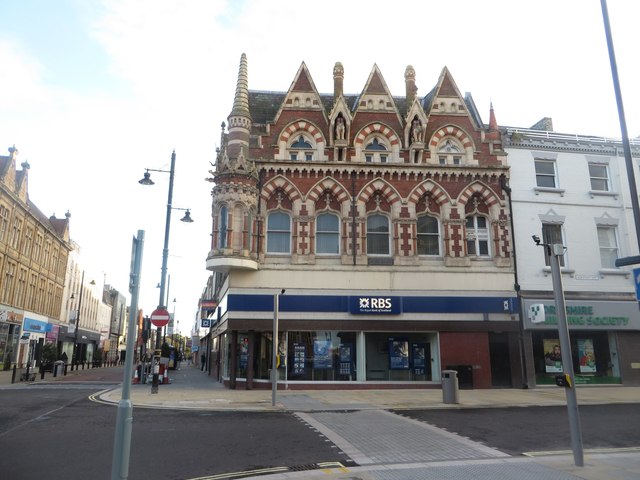
| Royal Bank of Scotland (Elephant Tea Rooms) | 1208244 | II | 1877 | Millfield | High Street West |
| St Mary's Building of the University of Sunderland | 1208574 | II | Millfield | ||
| The Croft, Formerly Tonstall School | 1279876 | II | Millfield | ||
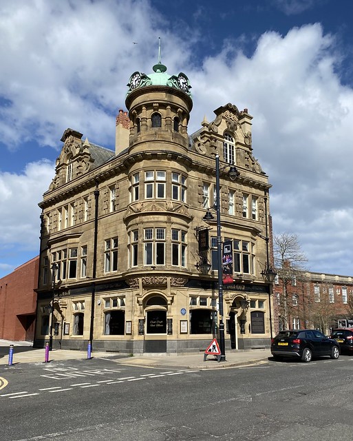
| The Dun Cow Public House | 1208545 | II | 1901 | Millfield | High Street West |
| The Empire Theatre | 1279891 | II* | 1907 | Millfield | High Street West |
| The King's Arms Public House | 1279890 | II | Millfield | ||
| The Londonderry Public House | 1293067 | II | Millfield | ||
| Wall behind St Mary's Building at the University of Sunderland | 1207095 | II | Millfield | ||
| Websters Public House | 1209626 | II | Millfield | ||
| Websters Ropery | 1207121 | II | Millfield | ||
| Westburn House (St Anthony's Secondary School) | 1207142 | II | Millfield | ||
| Bolam Tomb 200 Metres West of South East Lodge at Bishopwearmouth Cemetery | 1279919 | II | Pallion | ||
| Central Chapel Bishopwearmouth Cemetery | 1207062 | II | Pallion | ||
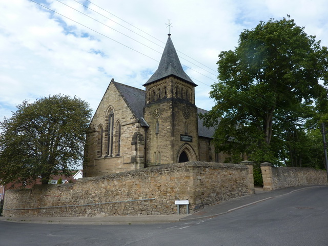
| Church of St Luke | 1292949 | II | 1874 | Pallion | |
| North Chapel Bishopwearmouth Cemetery | 1279542 | II | Pallion | ||
| North Entrance Including Gates, Piers and Railings to Bishopwearmouth Cemetery | 1207098 | II | Pallion | ||
| South Chapel Bishopwearmouth Cemetery | 1207063 | II | Pallion | ||
| Sunderland Corporation West Branch Library | 1208734 | II | Pallion | ||
| Taylor Tomb 210 Metres West of South East Lodge at Bishopwearmouth Cemetery | 1207897 | II | Pallion | ||
| Victoria Hall Disaster Memorial 180 Metres North of South East Lodge at Bishopwearmouth Cemetery | 1207911 | II | Pallion | ||
| Webster Tomb 210 Metres West of South East Lodge Bishopwearmouth Cemetery | 1207065 | II | Pallion | ||
| Nos. 9 and 10, Ryhope Village | 1279875 | II | Ryhope | Ryhope | |
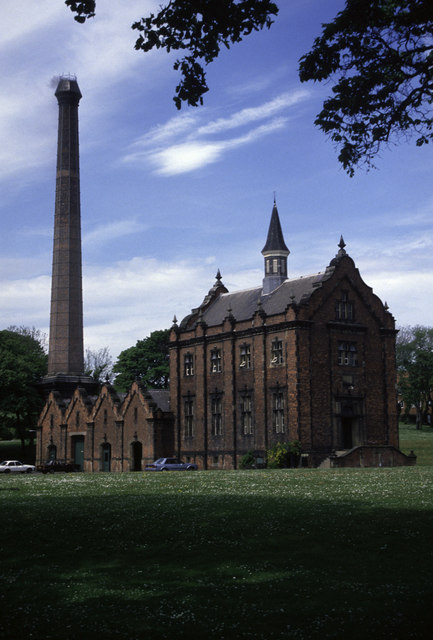
| Chimney to West of Boiler House at Ryhope Pumping Station | 1207133 | II* | 1869 | Ryhope | Ryhope |
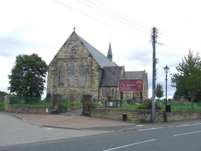
| Church of St Paul | 1217835 | II | 1873 | Ryhope | Ryhope |
| Cooling Ponds to North and South and Reservoir to East of Ryhope Pumping Station | 1292116 | II | Ryhope | Ryhope | |
| Coqueda Hall | 1292083 | II | Ryhope | ||
| Engine House and Boiler House at Ryhope Pumping Station | 1218116 | II* | 1868 | Ryhope | Ryhope Now Ryhope Engines Museum Scheduled Monument(1005916) |
| Entrance Gates, Piers and Front Railings to Sunderland Cemetery | 1217820 | II | Ryhope | ||
| Former Workers Cottages and Stables/Coach House of Ryhope Pumping Station | 1390597 | II | Ryhope | Ryhope | |
| Fountain 5 Metres South East of Sunderland Cemetery North Chapel | 1217797 | II | Ryhope | ||
| North Chapel of Sunderland Cemetery | 1279868 | II | Ryhope | ||
| Pigeon Cree at Storefield Belonging to Mr M Surtees | 1119716 | II | Ryhope | ||
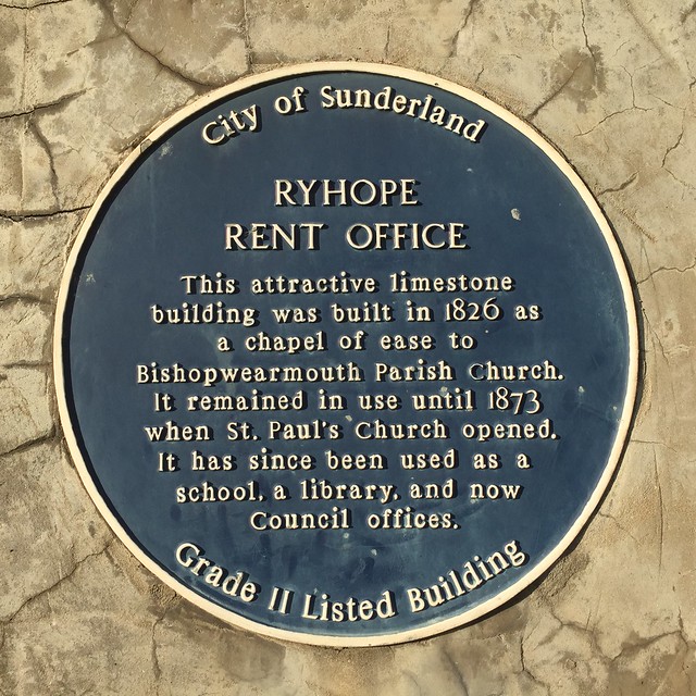
| Rent Office, Former Chapel | 1207141 | II | 1826 | Ryhope | Ryhope |
| Ryhope | 1279921 | II | Ryhope | ||
| Ryhope Grange Farmhouse Including Barn Adjacent to West | 1292290 | II | Ryhope | ||
| South Chapel of Sunderland Cemetery | 1217808 | II | Ryhope | ||
| Superintendent's House South West of Ryhope Pumping Station | 1218132 | II | Ryhope | ||
| The Chestnuts | 1208175 | II | Ryhope | ||
| The Railway Inn | 1207118 | II | C18th | Ryhope | Ryhope |
| Wall, Gates and Railings Around Former Graveyard and Chapel, Now Rent Office | 1218238 | II | Ryhope | Ryhope | |
| Walls, Piers, Gates and Railings South of Ryhope Pumping Station | 1207134 | II | Ryhope | Ryhope | |
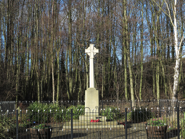
| War Memorial at West End | 1207138 | II | 1924 | Ryhope | Ryhope |
| Accommodation Arch in Railway Embankment North of Low Lambton Farm | 1354980 | II | Shiney Row | ||
| Alice Well, North of Number 5 | 1025444 | II | Shiney Row | ||
| Church of All Saints | 1299896 | II | Shiney Row | ||
| Church of St Aidan | 1025420 | II | Shiney Row | ||
| Earl of Durham's Monument (Penshaw Monument) | 1354965 | I | 1844 | Shiney Row | Penshaw |
| Joicey Aged Miners' Homes, Front Wall and Railings | 1184991 | II | Shiney Row | ||
| Monument 25 Metres South of Church of All Saints | 1354967 | II | Shiney Row | ||
| National Coal Board Workshops Coal Face Machinery and Electrical Overhaul Shops | 1025419 | II | Shiney Row | ||
| National Coal Board Workshops Office Block | 1184970 | II | Shiney Row | ||
| National Coal Board Workshops Underground Battery Locomotive Shop | 1025418 | II | Shiney Row | ||
| National Coal Board Workshops Welding Bay and Fabrication Block | 1184985 | II | Shiney Row | ||
| National Coal Board Workshops Winding and Cable Repair Shops | 1184980 | II | Shiney Row | ||
| National Coal Board Workshops: Machine Shop and Surface Locomotive Shop | 1354968 | II | Shiney Row | ||
| Penshaw House | 1354969 | II | Shiney Row | ||
| Penshaw Parish, Shiney Row War Memorial | 1439795 | II | 1922 | Shiney Row | Shiney Row |
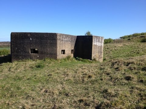
| Pillbox at NZ 34875 52938 | 1392381 | II | 1940 | Shiney Row | Herrington Hill |
| Stone at Junction with Woodhouse Lane | 1184833 | II | Shiney Row | ||
| Roman Catholic Church of St Leonard with attached presbytery and stone walls | 1431019 | II | Silksworth | ||
| Silksworth and Tunstall War Memorial | 1463870 | II | Silksworth | ||
| Tunstall Hope Lodge | 1207144 | II | Silksworth | ||
| No. 6, Back North Bridge Street | 1207057 | II | Southwick | ||
| Nos. 65-95, James Armitage Street | 1279895 | II | Southwick | ||
| Nos. 76-92, James Armitage Street | 1207100 | II | Southwick | ||
| Acoustic Mirror at NZ 389 596 | 1355057 | II | Southwick | ||
| Boiler House Walls and Piers to South East of Church of Holy Trinity | 1207951 | II | Southwick | ||
| Church of Holy Trinity | 1207066 | II | 1842 | Southwick | Southwick |
| Church of St Columba | 1208179 | II | Southwick | ||
| Coal Staithe at Wearmouth Collery | 1218456 | II | Southwick | ||
| Eight Lime Kilns at Fulwell Quarry NZ 3918 5955 | 1207110 | II | C18th | Southwick | |
| Former North Eastern Railway Stables | 1031895 | II | Southwick | ||
| Fulwell Mill | 1207109 | II* | 1808 | Southwick | Fulwell Windmill |
| Gates, Piers and Railings to South of Monkwearmouth College Swan Street Centre | 1207136 | II | Southwick | ||
| Lime Kilns on North Bank of River Wear at NZ 3895 5826 | 1292063 | II | Southwick | ||
| Monkwearmouth College Swan Street Centre (West Building) | 1218138 | II | Southwick | ||
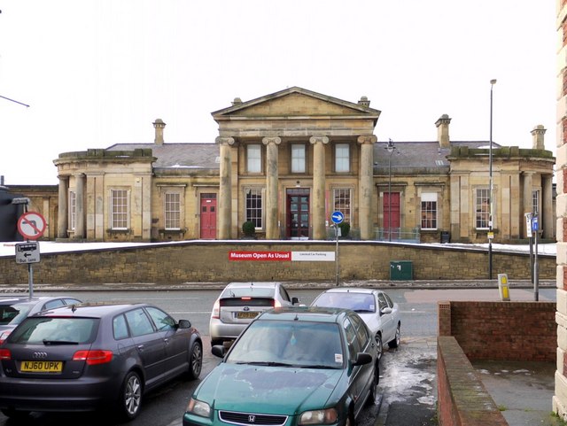
| Monkwearmouth Museum of Land Transport with Walls, Footbridge, Waiting Room | 1209029 | II* | 1848 | Southwick | Now Monkwearmouth Station Museum |
| Queen Alexandra Bridge | 1207052 | II | 1909 | Southwick | Southwick - Deptford |
| The Tramcar Inn | 1279874 | II | Southwick | ||
| Thompson Memorial in Centre of Green, with Posts to North and South | 1207139 | II | Southwick | ||
| Walls, Gates and Railings to North South and East of Chutch of Holy Trinity | 1207966 | II | Southwick | ||
| War Memorial at East End | 1207140 | II | 1928 | Southwick | Southwick Green |
| Church of St Mary | 1390829 | II | 1880 | St Anne's | South Hylton |
| Hylton House and Attached Garden Wall | 1207086 | II | St Anne's | ||
| Retaining Walls Fronting Number 41 (The Terrace) and Number 42 Hylton House | 1293161 | II | St Anne's | ||
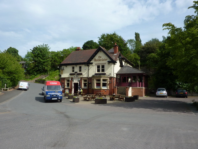
| The Golden Lion Public House | II | c.1910 | St Anne's | South Hylton. Fire damaged 2019. | |
| The Terrace and Attached Garden Wall | 1208425 | II | St Anne's | ||
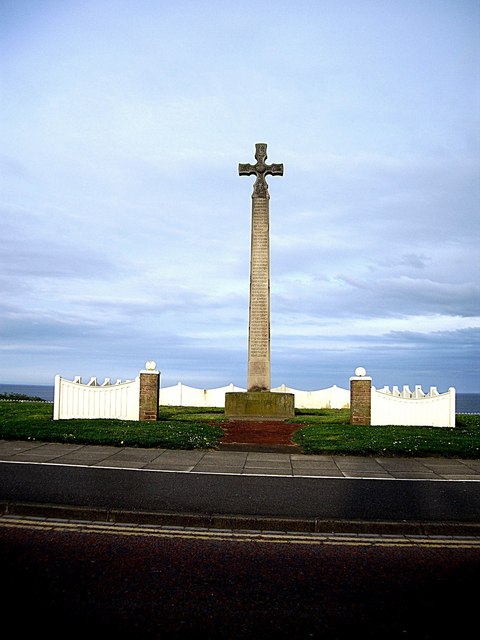
| War Memorial opposite Railway Terrace | 1208443 | II | St Anne's | ||
| Greystones | 1218038 | II | St Chad's | ||
| Ivy House | 1207130 | II | St Chad's | ||
| Middle Herrington Farmhouse and Outbuildings Attached to West | 1279922 | II | St Chad's | ||
| Nos. 1-15 Grange Crescent (Terrace) with Steps and Handrails | 1218083 | II | St Michael's | ||
| Nos. 1-9 the Esplanade (Terrace) with Steps and Handrails | 1207131 | II | St Michael's | ||
| Nos. 14-16, Stockton Road | 1209034 | II | St Michael's | ||
| Nos. 2 and 3, Mary Street | 1279898 | II | St Michael's | ||
| Nos. 3 and 4, Albion Place | 1207053 | II | St Michael's | ||
| No. 5, Albion Place | 1279912 | II | St Michael's | ||
| Ashburne House, part of Backhouse Building of the University of Sunderland | 1209651 | II | St Michael's | ||
| Burdon House | 1207060 | II | St Michael's | ||
| Christ Church Including Attached Vestry and Verger's House | 1209657 | II | St Michael's | ||
| Church House to Church of St John | 1279913 | II | St Michael's | ||
| Church of St George with Trininty and St James with Hall, Walls and Gates | 1279916 | II* | 1890 | St Michael's | Ashbrooke Stockton road URC. |
| Church of St John and Attached Hall | 1207054 | II | St Michael's | ||
| Churchyard Walls and Gates North and East of Church of St John | 1207055 | II | St Michael's | ||
| Douro Terrace Including Douro House (No. 7) with Steps and Railings | 1279553 | II | St Michael's | ||
| Forecourt and Side Railings to St George's House | 1279902 | II | St Michael's | ||
| Lamp Standard North East of War Memorial | 1279567 | II | St Michael's | ||
| Lamp Standard North West of War Memorial | 1207061 | II | St Michael's | ||
| Lamp Standard South East of War Memorial | 1207845 | II | St Michael's | ||
| Lamp Standard South West of War Memorial | 1279918 | II | St Michael's | ||
| Monument to Jack Crawford at NGR 3979 5652 | 1279900 | II | St Michael's | ||
| Numbers 1-6 (Consecutive) Including Coach House to Number 6 | 1279878 | II | St Michael's | ||
| Parish Church of St Nicholas (CofE) | 1405866 | II | St Michael's | ||
| St George's House with Attached Steps, Railings and Yard Walls | 1292629 | II | St Michael's | ||
| Terrace Walls and Piers to Ashburne House | 1207122 | II | St Michael's | ||
| Walls, Railings and Gates to Christ Church | 1279907 | II | St Michael's | ||
| War Memorial South of Christ Church | 1292312 | II | St Michael's | ||
| War Memorial with Railings and Gates | 1279917 | II | St Michael's | ||
| Wearside Masonic Temple with Attached Walls and Gates | 1279533 | II | St Michael's | ||
| West Hendon House | 1279869 | II | St Michael's | ||
| West Lodge, Tunstall School (Senior Section) with Attached Garden Wall | 1292021 | II | St Michael's | ||
| West Park United Reformed Church | 1207132 | II | St Michael's | ||
| Andover | 1207120 | II | St Peter's | ||
| Bandstand at North End (Roker Park) | 1207119 | II | 1910 | St Peter's | Roker |
| Barclay Lodge | 1207058 | II | St Peter's | ||
| Church of All Saints | 1207083 | II | St Peter's | ||
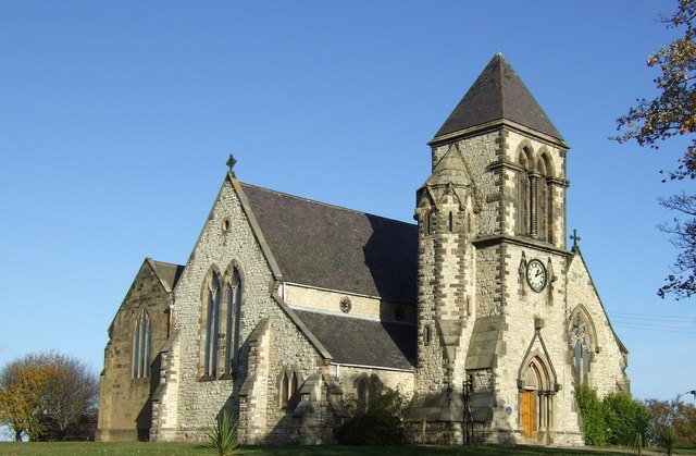
| Church of St Andrew | 1207113 | I | 1907 | St Peter's | Roker |
| Church of St Peter | 1217958 | I | C7th | St Peter's | Monkwearmouth |
| Drinking Fountain Near North End of Roker Park Terrace | 1279905 | II | St Peter's | ||
| Hebron Church with Attached Gates | 1207111 | II | St Peter's | ||
| Lych Gate and Walls South, East and North of Church of St Andrew | 1279901 | II | c.1908 | St Peter's | Roker |
| Monkwearmouth Branch Library and Attached Railings | 1207068 | II | St Peter's | ||
| Old South Pier Lighthouse in Roker Cliff Park NZ 4073 5974 | 1218440 | II* | 1856 | St Peter's | Roker |
| Parish Hall West of Church of St Andrew | 1209496 | II | 1928 | St Peter's | Roker Priestman Church Hall |
| Remaining Walls of North Dock | 1207085 | II | St Peter's | ||
| Retaining Wall to East of Former Graveyard of St Peter | 1207127 | II | St Peter's | ||
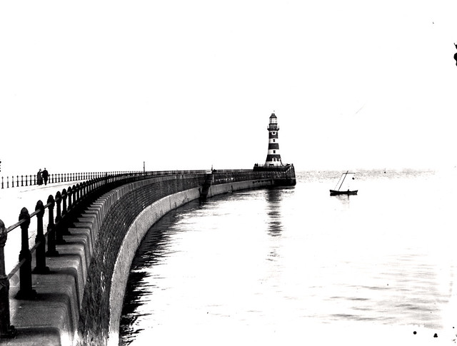
| Roker Pier and Lighthouse with Railings, Lamp Standards and Part of Promenade | 1279906 | II | 1903 | St Peter's | Roker Built 1885 - 1903 |
| The Bede Memorial | 1279882 | II | 1904 | St Peter's | Roker |
| Vicarage to Church of All Saints | 1293223 | II | St Peter's | ||
| Wall Attached to North West | 1279915 | II | St Peter's | ||
| Walls and Four Mooring Posts to North Dock Basin | 1293182 | II | St Peter's | ||
| Wheatsheaf Hotel Public House | 1279904 | II | St Peter's | ||
| Church of Holy Trinity | 1185061 | II | 1832 | Washington Central | by John and Benjamin Green |
| Church of Our Blessed Lady Immaculate and Presbytery Adjoining | 1299818 | II | Washington Central | ||
| Gates and Gate Piers to West of Washington Old Hall | 1025423 | II | Washington Central | Washington | |
| Lodge to West of Washington Old Hall | 1185067 | I | C17th | Washington Central | Washington |
| Monument 5 Metres to North of Church of Our Blessed Lady Immaculate | 1025385 | II | Washington Central | ||
| The Old Hall Smithy | 1354972 | II | Washington Central | ||
| War memorial c40m to the west of the Church of Our Blessed Lady Immaculate, Washington | 1441589 | II | Washington Central | ||
| Washington and Barmston War Memorial | 1441367 | II | 1920 | Washington Central | |
| Washington Hall School | 1185075 | II | Washington Central | ||
| Washington Old Hall | 1354971 | I | C17th | Washington Central | Washington Home of George Washington' |
| Fatfield House and Garden Wall Adjoining | 1025437 | II | C19th | Washington East | Fatfield |
| Fatfield War Memorial | 1436957 | II | 1922 | Washington East | |
| Ha Ha Wall South of Fatfield House | 1184760 | II | Washington East | ||
| Low Barmston Farmhouse | 1299800 | II | Washington East | ||
| Victoria Railway Bridge | 1354978 | II* | 1838 | Washington East | Fatfield |
| Hylton Grove Bridge | 1185305 | II | Washington North | ||
| Usworth Hall | 1025384 | II | C18th | Washington North | Usworth |
| Blue House Villa | 1025424 | II | Washington West | ||
| Church of Holy Trinity | 1025382 | II | Washington West | ||
| F Pit Winding House | 1025422 | II | Washington West | Of former Washington Colliery. Scheduled Monument(1018224) | |
| Farm Building and Yard Wall Adjoining to North of Peareth Hall Farmhouse | 1185128 | II | Washington West | ||
| Monument 6 Metres South West of Church of Holy Trinity | 1025383 | II | Washington West | ||
| Peareth Hall Farmhouse | 1354991 | II | Washington West | ||
| Red Hill House | 1185130 | II | Washington West |
Primary source: the National Heritage List for England - NHLE is the register of nationally protected historic buildings and sites in England, including listed buildings, scheduled monuments, protected wrecks, registered parks and gardens, and battlefields. The list is maintained by Historic England. Check NHLE for updates and new entries. Secondary sources: British Listed Buildings and Sitelines.
Co-Curate Page
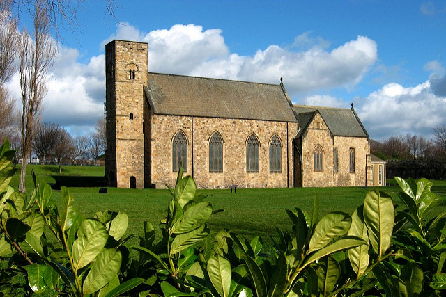
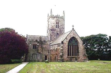
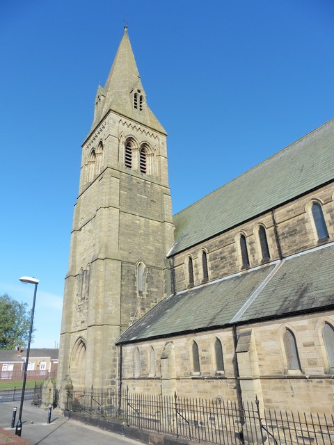
St Peter's Church, Monkwearmouth
- Overview About St Peter's Church Map Street View St Peter's Church, Monkwearmouth is the parish church of Monkwearmouth in Sunderland, Tyne and Wear, England. It is one of three …
Co-Curate Page
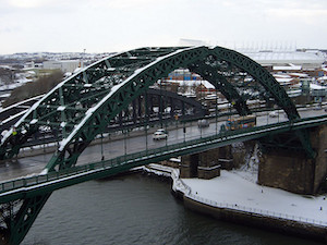
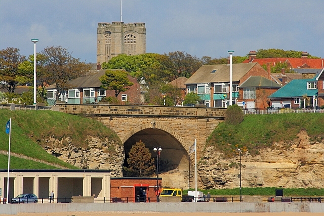
Wearmouth Bridge
- Overview History Timeline Map Street View The Wearmouth Bridge crosses the River Wear in Sunderland. The current bridge was built 1927 to 1929 and replaced an earlier cast-iron bridge in the same …
Co-Curate Page
Washington Old Hall
- Overview About Washington Old Hall Map Street View Inside Washington Old Hall is a manor house located in the Washington area of Tyne and Wear, England, United Kingdom. It …
Co-Curate Page
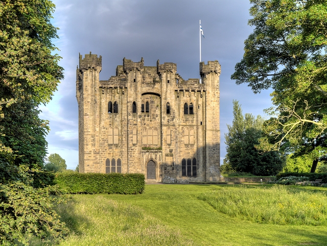
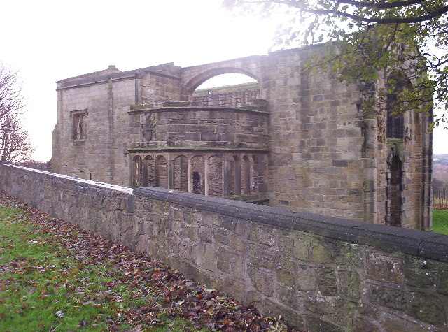
Hylton Castle
- Overview About Hylton Castle Map Street View Hylton Castle is a ruined stone castle located in the North Hylton area of Sunderland. A wooden fortification was constructed here by the …
Co-Curate Page
Church of St Michael and All Angels
- Overview Map Street View Inside St Michael and All Angels is the parish church in Houghton-le-Spring. The church dates from the late 12th centuty. It has a C13th chancel; C14th …
Co-Curate Page
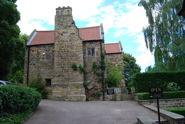
St Catherines Chapel, Hylton
- Overview Map Street View The chapel, located near Hyton Castle, dates back to at least the 12th Century and is a Scheduled Ancient Monument and a Grade 1 listed building.
Co-Curate Page
Church of St Andrew
- Overview About the Church Map The Parish church was built 1906-1907 by Edward Priorand with architect A Randall Wells. The main benefactor for building the church was Sunderland shipping magnate John …
Co-Curate Page
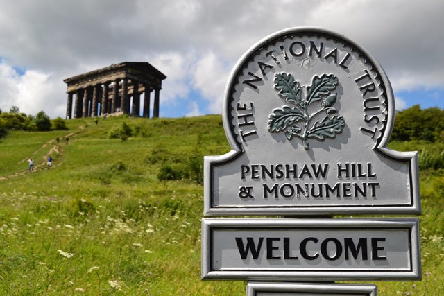
Penshaw Monument
- Overview History and Further Details Map Street View The Earl of Durham's Monument, better known as the Penshaw Monument, was built in 1844 on Penshaw Hill. The folly is a …
Co-Curate Page
Phoenix Lodge
- Overview About Phoenix Lodge Map Street View Freemasons' Hall located on Queen Street East, Sunderland. The hall was built in 1785, designed by John Bonner, to replace an earlier lodge …
Co-Curate Page
Church of Holy Trinity
- Overview About Holy Trinity Church Map Street View Holy Trinity opened in 1719 as the church for the newly created Parish of Sunderland. The church played a major part in …
Co-Curate Page
Nos. 170 -175, High Street West
- Overview Map Street View This row of 18th century buildings on High Street West in Sunderland, is being restored by the Tyne & Wear Buildings Preservation Trust. Number 173 was …
Co-Curate Page
Sunderland Minster
- Overview About Sunderland Minster Map Street View The Minster Church of St Michael and All Angels and St Benedict Biscop (commonly referred to as 'Sunderland Minster') is located on Church …
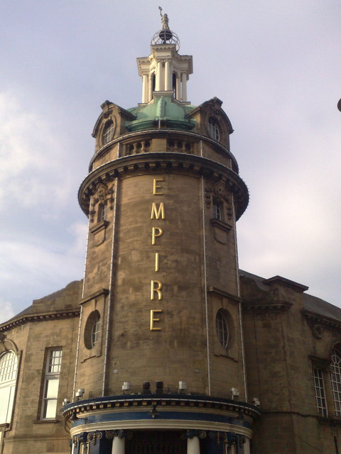
Co-Curate Page
Sunderland Empire Theatre
- Overview About Sunderland Empire Map The Empire is a 1,860 seat theatre located on High Street West in Sunderland SR1 3EX. The Empire was opened on 1st July 1907 by variety …
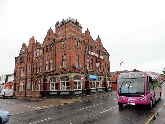
Co-Curate Page
Mountain Daisy Public House
- Overview Map Street View The Mountain Daisy is a pub located on Hylton Road in the Millfield area of Sunderland. In addition to its 'Modified Queen Anne style.' exterior, the …
Co-Curate Page
Stockton Road United Reformed Church
- Overview About Stocton Road URC Map Street View Formerly known as the Church of St George with Trinity and St James, on Stockton Road in Sunderland. It originally opened as …
Co-Curate Page
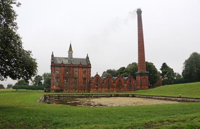
Ryhope Engines Museum
- Overview About Ryhope Engines Museum Map Street View Ryhope Pumping Station was built in 1868 for the Sunderland & South Shields Water Company, to supply water to the Sunderland area. The …
Co-Curate Page
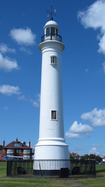
Lighthouse, Roker Cliff Park
- The lighthouse was originally built in 1856 on Sunderland's South Pier. In 1983 it was dismantled to allow for harbour improvements, and then re-erected in Roker Cliff Park, between Roker …
Co-Curate Page
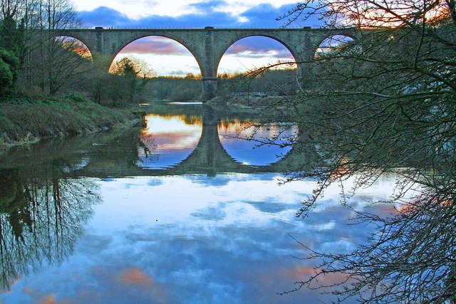
Victoria Viaduct
- Overview About the Victoria Viaduct Map Victoria Bridge is a 810 ft long rail viaduct over the River Wear near Fatfield, Washington. It was built for the Durham Junction Railway and opened …
Co-Curate Page
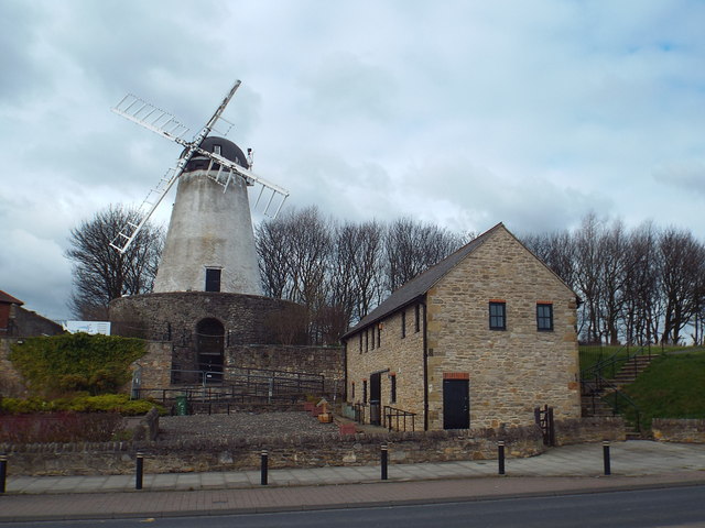
Fulwell Windmill
- Overview Map Street View "Fulwell Windmill started to appear on the Sunderland skyline in 1806 and became the familiar landmark we know today when opened in 1808. Built for Joseph …
Co-Curate Page
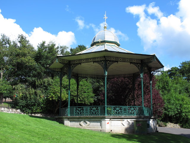
Bandstand, Roker Park
- "The bandstand is one of the park's most popular features. Its characteristic shape was influenced by Chinese style garden buildings, popular in Europe in the mid 18th century. The present …
Co-Curate Page
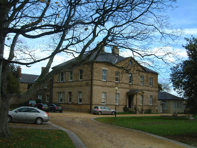
Charlton House, Sunderland
- Overview Map Street View Charlton House, No. 2 Mowbray Road, Sunderland (formerly known as Nicholson House) was built in 1850 by John and Benjamin Green. The mansion was built for …
Co-Curate Page
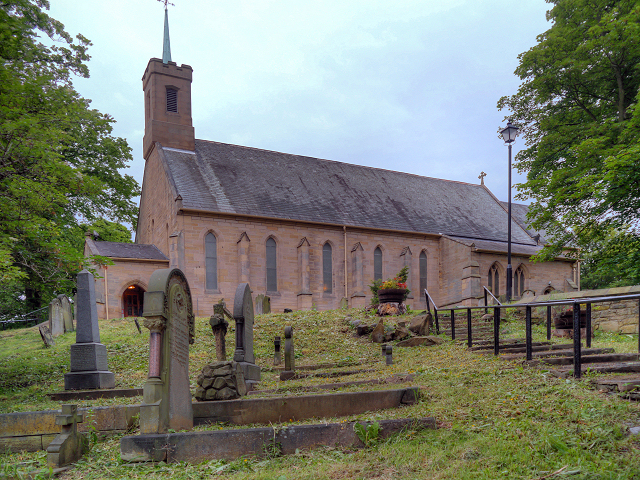
Church of St. Cuthbert
- Overview Map Street View The Church of St. Cuthbert on Quary House Lane in East Rainton was built 1866-1867 and designed by C.H. Fowler. The south chancel window in the …
Co-Curate Page
Church of St Paul
- Overview Map Street View St Paul's in the parish church of Ryhope. The church was built 1868 -1873 to cater for the growing population of Ryhope, and replaced a smaller church …
Co-Curate Page
Lime Kilns
- Overview Map Street View There are a distinctive bank of 8 lime kilns off Newcastle Road in Fulwell, Sunderland. The kilns were built for Sir Hedworth Williamson in the 18th …
Co-Curate Page
Fatfield House
- Overview Map Street View A 19th century house on Vigo Lane in Harraton - which had been in Fatfield before the boundaries changed with the creation of Washingon new town. …
Co-Curate Page
War Memorial, Harraton / Fatfield
- Overview Map Street View The memorial commemorates 103 local servicemen who died in the First World War and later the names of 12 people who died in the Second World …
Co-Curate Page
Fulwell Pumping Station
- Overview Map Fulwell Pumping Station was built in 1853, designed by Thomas Hawksley. The water pumping station is located to the north of Fulwell, near Cut Throat Dean, which marks …
Co-Curate Page
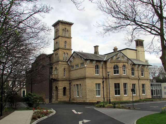
Langham Tower
- Overview Map Street View Langham Tower is a large Victorian mansion, located on the corner of Ryhope Road and Mombray Road in the Ashbrooke suburb of Sunderland. The mansion was built 1889-1891 …
Co-Curate Page
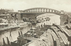
Monkwearmouth Railway Bridge
- Overview About Monkwearmouth Railway Bridge Map Street View Monkwearmouth Railway Bridge (officially Monkwearmouth Bridge, also called Wearmouth Railway Bridge or Sunderland Railway Bridge) is a railway bridge built in …
Co-Curate Page
War Memorial, Easington Lane
- Overview Map Street View The clock tower war memorial in Easington Lane was unveiled by Lord Joicey on the 27th August 1921, in honour of the men of Easington Lane …
Co-Curate Page
Mowbray Park
- Summary Map "Mowbray Park first opened in 1857, following a public health enquiry into the cholera epidemic of the 1840s. The enquiry recommended that a park should be built so …
Co-Curate Page
Pillbox, Herrington Hill
- Built with reinforced concrete this pillbox was constructed in 1940-41. It was one of a pair built as part of an inland "stop-line" designed to slow down anticipated invasion during …
Co-Curate Page
Queen Alexandra Bridge
- Overview About the Bridge Map Street View The Queen Alexandra Bridge over the River Wear links the Southwick and Deptford areas of Sunderland. The bridge was built 1907-1909, originally as a double-decker …
Co-Curate Page
Rent Office
- Overview Map Street View This building on The Village, in Ryhope, was originally built in 1826 as a chapel of ease to Church of St Michael in Bishopwearmouth (now Sunderland …
Co-Curate Page
Roker Park
- Overview About Roker Park Map Roker Park, in the Roker area of Sunderland, was opened on 23rd June 1880. The land for the park was donated by Sir Hedworth Williamson, …
Co-Curate Page
Roker Pier and Lighthouse
- The foundation stone for the New North Pier (Roker Pier) at Sunderland was laid on 14 September 1885. With growing use of the port at Sunderland the piers were built …
Co-Curate Page
Elephant Tea Rooms
- Overview About The Elephant Tea Rooms Map Street View Former Elephant Tea Rooms, on the corner of Fawset Street and High Street West, Sunderland. The building was constructed from 1872 …

Co-Curate Page
Sunderland Exchange
- Overview Map Sunderland, 197 High Street East. Originally built as the Sunderland Exchange in 1812-1814, designed by John and William Stokoe of Newcastle; builder George Cameron of Esk. Later the building …
Co-Curate Page
Bede Memorial Cross
- Overview Map Street View The Bede Memorial Cross is located at the seafront in Cliff Park, Roker. It was built in 1904 by G.W. Millburn and C.C. Hodges, and dedicated …
Co-Curate Page
Golden Lion, South Hylton
- The Golden Lion was a public house in South Hylton, dating from c.1910. The entrance reused an early 18th century stone surround, said to have come from the north wing …
Co-Curate Page
Railway Inn
- Overview Map Street View There are several public houses in Ryhope - the Railway Inn, on Robson Place, is notable as a Grade II listed building. It was built in …
Co-Curate Page
The Shipwrights, North Hylton
- Overview Map Street View The Shipwrights is a pub and resturant located on Ferryboat Lane in North Hylton, by the River Wear. The building dates from the 18th century; and …
Co-Curate Page
Trafalgar Square
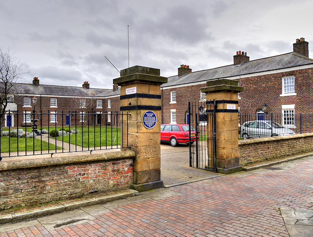
- Overview Map Street View Former merchant seamen's almshouses in Hendon, Sunderland - 14 almshouses, built in 1840 by William Drysdale for the Trustees of the Muster Roll to house aged …
Co-Curate Page
Usworth Hall
- Overview Map Street View Usworth Hall was built in the late 18th century for Bernard Shaw.[1] In the mid 20th century it was owned by the National Coal Board. Then …
Co-Curate Page
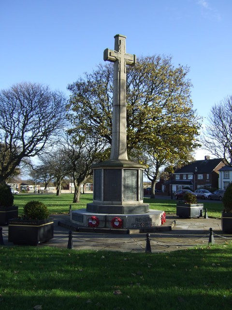
Ryhope War Memorial
- Overview Map Street View War memorial, located at the west end of the village green in Ryton. The memorial was unveiled in October 1924, by Colonel T.G. Taylor of Kelso, …
Co-Curate Page
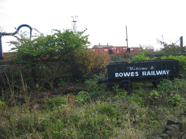
Bowes Railway
- Overview About Bowes Railway Map Street View Bowes Railway was originally built by George Stephenson in 1826 to transport coal from pits in north west Durham to boats on the …
Co-Curate Page
Sunderland
- Overview About the City of Sunderland Timeline Map Street View The City of Sunderland is located in Tyne and Wear, in the North East England. The former Metropolitan Borough of …
Co-Curate Page
War Memorial, Southwick
- Overview Map Street View The cenotaph in Southwick is located by Sunderland Road, at the east end of Southwick Green. The memorial was unveiled by Lord Londonderry on the 4th …
Co-Curate Page
Washington and Barmston War Memorial
- Overview Map Street View The Washington and Barmston War Memorial is located on the Village Green in Washington, Tyne & Wear. The pond on the Village Green was filled and …
Co-Curate Page
Church of St Gabriel, Barnes
- Overview Map Street View St Gabriel's Church is located on the corner of Chester Road and St Gabriel's Avenue, in the Barnes area of Sunderland. The Parish Church was built …

Co-Curate Page
Barnes Infant Academy
- Overview Map Street View Barnes Infant Academy is located on Mount Road in Barnes, Sunderland. The school has about 340 pupils aged 3 to 7. Previously, this was known as …
Co-Curate Page
Barnes Junior School
- Overview Map Street View Barnes Junior School is located on Mount Road in Barnes, Sunderland. It is a Community school, with about 340 pupils aged 7 to 11. For many years …
Co-Curate Page
The Dun Cow, Sunderland
- Overview Map Street View The Dun Cow public house is located on High Street West in Sunderland. It was built in 1901 by Benjamin F. Simpson, for Robert Deuchar Ltd.[1] The Dun …
Co-Curate Page
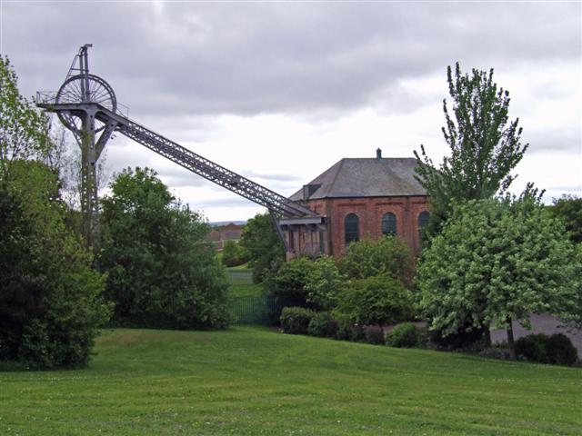
Monkwearmouth Station Museum
- "The new railway station in North Bridge Street, Monkwearmouth was opened on 19 June 1848. It was the new Sunderland terminus for the Brandling Junction Railway, opened in 1839, that …
Co-Curate Page
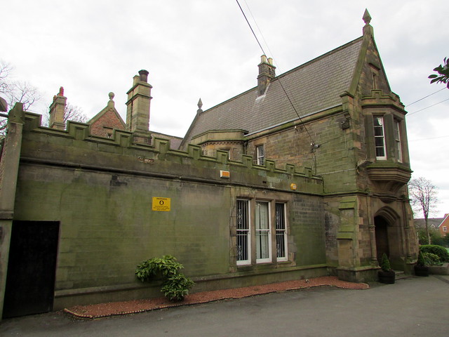
The Old Rectory, Houghton-le-Spring
- Overview Map Street View The Old Rectory is a community hub, located in Houghton Park, off the Broadway in Houghton-le-Spring. This former rectory to St Michael's Church dates from the early …
Co-Curate Page
Kepier Hall, Houghton-le-Spring
- Overview Map Street View Kepier Hall is a community building off Church Street in Houghton-le-Spring. It was originally Kepier Grammar School, which was founded in 1574 by Bernard Gilpin, the …
Co-Curate Page
Houghton Hall
- Overview Map Street View Houghton Hall is located near the head of Hall Lane, by the junction with Nesham Place, in Houghton-le-Spring. The building dates from the early 17th century. …
Co-Curate Page
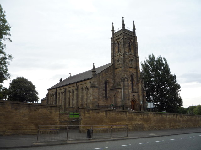
St Michael's RC Church
- Overview Map Street View St Michael's Roman Catholic Church is located on Durham Road in Houghton-le-Spring. The church, by Ignatius Bonomi, was built in 1837. The church is a Grade …
Co-Curate Page
Church of St Ignatius, Hendon
- Overview Map Street View St Ignatius' Church is located on Suffork Street in the Hendon area of Sunderland. The foundation stone for this Roman Catholic Parish church was laid on …
Co-Curate Page
Chimney, Ryhope Pumping Station
- The chimney at the west of Ryhope Pumping Station (now museum) was built 1866-1869, by Hawksley, for the Sunderland and South Shields Water Co. The octagonal brick chimney is almost …

Co-Curate Page
Doxford House
- Overview Map Street View Doxford House is located on Warden Law Lane in Siksworth, Sunderland. The large house was built 1775–1780 by William Johnson. It was extended in c.1900 and …

Co-Curate Page
St Peter's Church, Monkwearmouth
- Overview About St Peter's Church Map Street View St Peter's Church, Monkwearmouth is the parish church of Monkwearmouth in Sunderland, Tyne and Wear, England. It is one of three …
Co-Curate Page
Wearmouth Bridge
- Overview History Timeline Map Street View The Wearmouth Bridge crosses the River Wear in Sunderland. The current bridge was built 1927 to 1929 and replaced an earlier cast-iron bridge in the same …
Co-Curate Page
Washington Old Hall
- Overview About Washington Old Hall Map Street View Inside Washington Old Hall is a manor house located in the Washington area of Tyne and Wear, England, United Kingdom. It …
Co-Curate Page
Hylton Castle
- Overview About Hylton Castle Map Street View Hylton Castle is a ruined stone castle located in the North Hylton area of Sunderland. A wooden fortification was constructed here by the …
Co-Curate Page
Church of St Michael and All Angels
- Overview Map Street View Inside St Michael and All Angels is the parish church in Houghton-le-Spring. The church dates from the late 12th centuty. It has a C13th chancel; C14th …
Co-Curate Page
St Catherines Chapel, Hylton
- Overview Map Street View The chapel, located near Hyton Castle, dates back to at least the 12th Century and is a Scheduled Ancient Monument and a Grade 1 listed building.
Co-Curate Page
Church of St Andrew
- Overview About the Church Map The Parish church was built 1906-1907 by Edward Priorand with architect A Randall Wells. The main benefactor for building the church was Sunderland shipping magnate John …
Co-Curate Page
Penshaw Monument
- Overview History and Further Details Map Street View The Earl of Durham's Monument, better known as the Penshaw Monument, was built in 1844 on Penshaw Hill. The folly is a …
Co-Curate Page
Phoenix Lodge
- Overview About Phoenix Lodge Map Street View Freemasons' Hall located on Queen Street East, Sunderland. The hall was built in 1785, designed by John Bonner, to replace an earlier lodge …
Co-Curate Page
Church of Holy Trinity
- Overview About Holy Trinity Church Map Street View Holy Trinity opened in 1719 as the church for the newly created Parish of Sunderland. The church played a major part in …
Co-Curate Page
Nos. 170 -175, High Street West
- Overview Map Street View This row of 18th century buildings on High Street West in Sunderland, is being restored by the Tyne & Wear Buildings Preservation Trust. Number 173 was …
Co-Curate Page
Sunderland Minster
- Overview About Sunderland Minster Map Street View The Minster Church of St Michael and All Angels and St Benedict Biscop (commonly referred to as 'Sunderland Minster') is located on Church …
Co-Curate Page
Sunderland Empire Theatre
- Overview About Sunderland Empire Map The Empire is a 1,860 seat theatre located on High Street West in Sunderland SR1 3EX. The Empire was opened on 1st July 1907 by variety …
Co-Curate Page
Mountain Daisy Public House
- Overview Map Street View The Mountain Daisy is a pub located on Hylton Road in the Millfield area of Sunderland. In addition to its 'Modified Queen Anne style.' exterior, the …
Co-Curate Page
Stockton Road United Reformed Church
- Overview About Stocton Road URC Map Street View Formerly known as the Church of St George with Trinity and St James, on Stockton Road in Sunderland. It originally opened as …
Co-Curate Page
Ryhope Engines Museum
- Overview About Ryhope Engines Museum Map Street View Ryhope Pumping Station was built in 1868 for the Sunderland & South Shields Water Company, to supply water to the Sunderland area. The …
Co-Curate Page
Lighthouse, Roker Cliff Park
- The lighthouse was originally built in 1856 on Sunderland's South Pier. In 1983 it was dismantled to allow for harbour improvements, and then re-erected in Roker Cliff Park, between Roker …
Co-Curate Page
Victoria Viaduct
- Overview About the Victoria Viaduct Map Victoria Bridge is a 810 ft long rail viaduct over the River Wear near Fatfield, Washington. It was built for the Durham Junction Railway and opened …
Co-Curate Page
Fulwell Windmill
- Overview Map Street View "Fulwell Windmill started to appear on the Sunderland skyline in 1806 and became the familiar landmark we know today when opened in 1808. Built for Joseph …
Co-Curate Page
Bandstand, Roker Park
- "The bandstand is one of the park's most popular features. Its characteristic shape was influenced by Chinese style garden buildings, popular in Europe in the mid 18th century. The present …
Co-Curate Page
Charlton House, Sunderland
- Overview Map Street View Charlton House, No. 2 Mowbray Road, Sunderland (formerly known as Nicholson House) was built in 1850 by John and Benjamin Green. The mansion was built for …
Co-Curate Page
Church of St. Cuthbert
- Overview Map Street View The Church of St. Cuthbert on Quary House Lane in East Rainton was built 1866-1867 and designed by C.H. Fowler. The south chancel window in the …
Co-Curate Page
Church of St Paul
- Overview Map Street View St Paul's in the parish church of Ryhope. The church was built 1868 -1873 to cater for the growing population of Ryhope, and replaced a smaller church …
Co-Curate Page
Lime Kilns
- Overview Map Street View There are a distinctive bank of 8 lime kilns off Newcastle Road in Fulwell, Sunderland. The kilns were built for Sir Hedworth Williamson in the 18th …
Co-Curate Page
Fatfield House
- Overview Map Street View A 19th century house on Vigo Lane in Harraton - which had been in Fatfield before the boundaries changed with the creation of Washingon new town. …
Co-Curate Page
War Memorial, Harraton / Fatfield
- Overview Map Street View The memorial commemorates 103 local servicemen who died in the First World War and later the names of 12 people who died in the Second World …
Co-Curate Page
Fulwell Pumping Station
- Overview Map Fulwell Pumping Station was built in 1853, designed by Thomas Hawksley. The water pumping station is located to the north of Fulwell, near Cut Throat Dean, which marks …
Co-Curate Page
Langham Tower
- Overview Map Street View Langham Tower is a large Victorian mansion, located on the corner of Ryhope Road and Mombray Road in the Ashbrooke suburb of Sunderland. The mansion was built 1889-1891 …
Co-Curate Page
Monkwearmouth Railway Bridge
- Overview About Monkwearmouth Railway Bridge Map Street View Monkwearmouth Railway Bridge (officially Monkwearmouth Bridge, also called Wearmouth Railway Bridge or Sunderland Railway Bridge) is a railway bridge built in …
Co-Curate Page
War Memorial, Easington Lane
- Overview Map Street View The clock tower war memorial in Easington Lane was unveiled by Lord Joicey on the 27th August 1921, in honour of the men of Easington Lane …
Co-Curate Page
Mowbray Park
- Summary Map "Mowbray Park first opened in 1857, following a public health enquiry into the cholera epidemic of the 1840s. The enquiry recommended that a park should be built so …
Co-Curate Page
Pillbox, Herrington Hill
- Built with reinforced concrete this pillbox was constructed in 1940-41. It was one of a pair built as part of an inland "stop-line" designed to slow down anticipated invasion during …
Co-Curate Page
Queen Alexandra Bridge
- Overview About the Bridge Map Street View The Queen Alexandra Bridge over the River Wear links the Southwick and Deptford areas of Sunderland. The bridge was built 1907-1909, originally as a double-decker …
Co-Curate Page
Rent Office
- Overview Map Street View This building on The Village, in Ryhope, was originally built in 1826 as a chapel of ease to Church of St Michael in Bishopwearmouth (now Sunderland …
Co-Curate Page
Roker Park
- Overview About Roker Park Map Roker Park, in the Roker area of Sunderland, was opened on 23rd June 1880. The land for the park was donated by Sir Hedworth Williamson, …
Co-Curate Page
Roker Pier and Lighthouse
- The foundation stone for the New North Pier (Roker Pier) at Sunderland was laid on 14 September 1885. With growing use of the port at Sunderland the piers were built …
Co-Curate Page
Elephant Tea Rooms
- Overview About The Elephant Tea Rooms Map Street View Former Elephant Tea Rooms, on the corner of Fawset Street and High Street West, Sunderland. The building was constructed from 1872 …
Co-Curate Page
Sunderland Exchange
- Overview Map Sunderland, 197 High Street East. Originally built as the Sunderland Exchange in 1812-1814, designed by John and William Stokoe of Newcastle; builder George Cameron of Esk. Later the building …
Co-Curate Page
Bede Memorial Cross
- Overview Map Street View The Bede Memorial Cross is located at the seafront in Cliff Park, Roker. It was built in 1904 by G.W. Millburn and C.C. Hodges, and dedicated …
Co-Curate Page
Golden Lion, South Hylton
- The Golden Lion was a public house in South Hylton, dating from c.1910. The entrance reused an early 18th century stone surround, said to have come from the north wing …
Co-Curate Page
Railway Inn
- Overview Map Street View There are several public houses in Ryhope - the Railway Inn, on Robson Place, is notable as a Grade II listed building. It was built in …
Co-Curate Page
The Shipwrights, North Hylton
- Overview Map Street View The Shipwrights is a pub and resturant located on Ferryboat Lane in North Hylton, by the River Wear. The building dates from the 18th century; and …
Co-Curate Page
Trafalgar Square
- Overview Map Street View Former merchant seamen's almshouses in Hendon, Sunderland - 14 almshouses, built in 1840 by William Drysdale for the Trustees of the Muster Roll to house aged …
Co-Curate Page
Usworth Hall
- Overview Map Street View Usworth Hall was built in the late 18th century for Bernard Shaw.[1] In the mid 20th century it was owned by the National Coal Board. Then …
Co-Curate Page
Ryhope War Memorial
- Overview Map Street View War memorial, located at the west end of the village green in Ryton. The memorial was unveiled in October 1924, by Colonel T.G. Taylor of Kelso, …
Co-Curate Page
Bowes Railway
- Overview About Bowes Railway Map Street View Bowes Railway was originally built by George Stephenson in 1826 to transport coal from pits in north west Durham to boats on the …
Co-Curate Page
Sunderland
- Overview About the City of Sunderland Timeline Map Street View The City of Sunderland is located in Tyne and Wear, in the North East England. The former Metropolitan Borough of …
Co-Curate Page
War Memorial, Southwick
- Overview Map Street View The cenotaph in Southwick is located by Sunderland Road, at the east end of Southwick Green. The memorial was unveiled by Lord Londonderry on the 4th …
Co-Curate Page
Washington and Barmston War Memorial
- Overview Map Street View The Washington and Barmston War Memorial is located on the Village Green in Washington, Tyne & Wear. The pond on the Village Green was filled and …
Co-Curate Page
Church of St Gabriel, Barnes
- Overview Map Street View St Gabriel's Church is located on the corner of Chester Road and St Gabriel's Avenue, in the Barnes area of Sunderland. The Parish Church was built …
Co-Curate Page
Barnes Infant Academy
- Overview Map Street View Barnes Infant Academy is located on Mount Road in Barnes, Sunderland. The school has about 340 pupils aged 3 to 7. Previously, this was known as …
Co-Curate Page
Barnes Junior School
- Overview Map Street View Barnes Junior School is located on Mount Road in Barnes, Sunderland. It is a Community school, with about 340 pupils aged 7 to 11. For many years …
Co-Curate Page
The Dun Cow, Sunderland
- Overview Map Street View The Dun Cow public house is located on High Street West in Sunderland. It was built in 1901 by Benjamin F. Simpson, for Robert Deuchar Ltd.[1] The Dun …
Co-Curate Page
Monkwearmouth Station Museum
- "The new railway station in North Bridge Street, Monkwearmouth was opened on 19 June 1848. It was the new Sunderland terminus for the Brandling Junction Railway, opened in 1839, that …
Co-Curate Page
The Old Rectory, Houghton-le-Spring
- Overview Map Street View The Old Rectory is a community hub, located in Houghton Park, off the Broadway in Houghton-le-Spring. This former rectory to St Michael's Church dates from the early …
Co-Curate Page
Kepier Hall, Houghton-le-Spring
- Overview Map Street View Kepier Hall is a community building off Church Street in Houghton-le-Spring. It was originally Kepier Grammar School, which was founded in 1574 by Bernard Gilpin, the …
Co-Curate Page
Houghton Hall
- Overview Map Street View Houghton Hall is located near the head of Hall Lane, by the junction with Nesham Place, in Houghton-le-Spring. The building dates from the early 17th century. …
Co-Curate Page
St Michael's RC Church
- Overview Map Street View St Michael's Roman Catholic Church is located on Durham Road in Houghton-le-Spring. The church, by Ignatius Bonomi, was built in 1837. The church is a Grade …
Co-Curate Page
Church of St Ignatius, Hendon
- Overview Map Street View St Ignatius' Church is located on Suffork Street in the Hendon area of Sunderland. The foundation stone for this Roman Catholic Parish church was laid on …
Co-Curate Page
Chimney, Ryhope Pumping Station
- The chimney at the west of Ryhope Pumping Station (now museum) was built 1866-1869, by Hawksley, for the Sunderland and South Shields Water Co. The octagonal brick chimney is almost …


