Topics > Heritage Sites > Scheduled Monument > Scheduled Monuments in Northumberland
Scheduled Monuments in Northumberland
Some of the Scheduled Monuments on this Website which are located in Northumberland. Not an exhaustive list!

Co-Curate Page
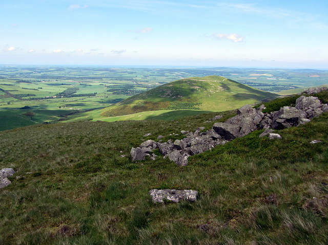
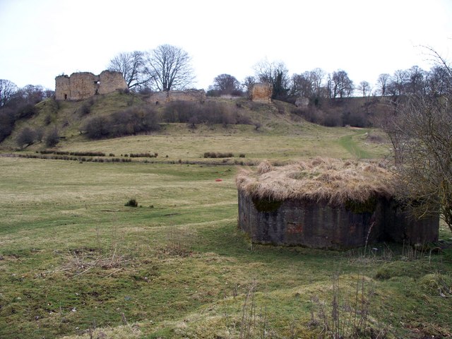
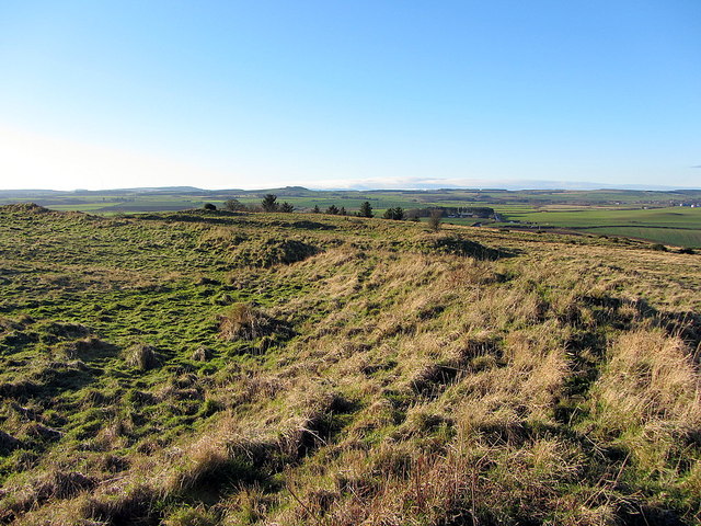
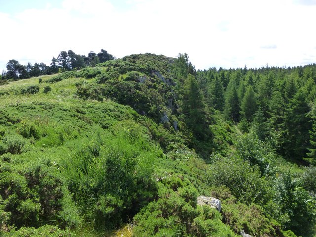
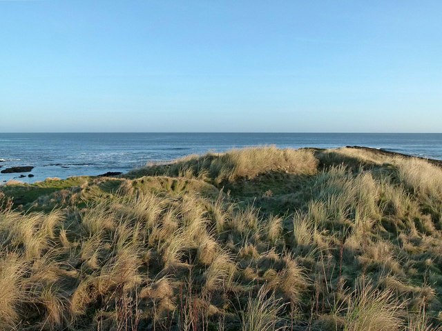
Bewick Hill Camp
- Scheduled Monument area - based on Historic England data (Open Government Licence). Bewick Hill Camp is a hillfort, located to the east of Old Bewick in Northumberland. It is presumed …
Co-Curate Page
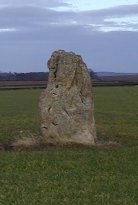
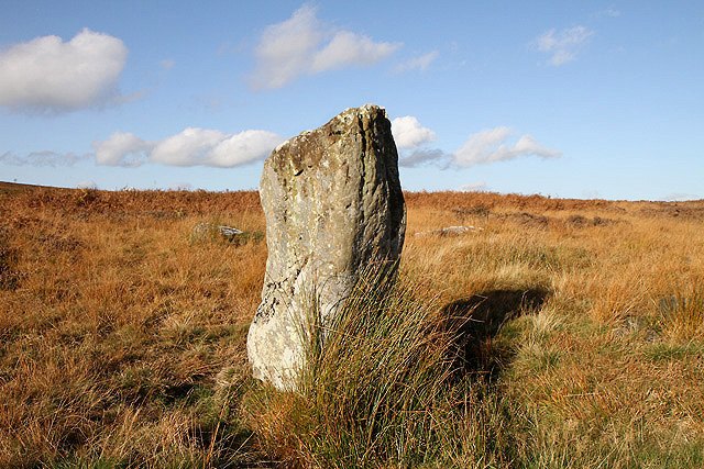
The King's Stone NW of Crookham Westfield
- The King's Stone, to the north-west of Crookham Westfield in Northumberland, is a standing stone of either late Neolithic or early Bronze Age date. It is formed from cherty magnesium …
Co-Curate Page
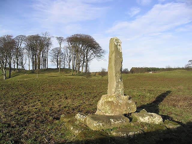
The Hurl Stone
- Overview Map Tthe Hurl Stone is a Medieval standing cross located near Newtown and Lilburn Tower in Northumberland. The stone is a Scheduled Monument.
Co-Curate Page
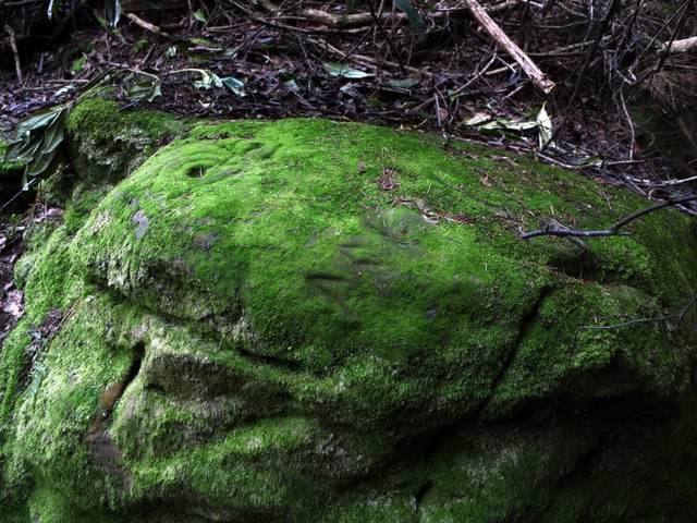
Prehistoric Rock Art in Lemmington Wood
- Deep in Lemmington Woods is a rock with 'cup and rings' carvings, thought to date from the early Bronze Age. The rock is very unusual as it also has later Anglo-Saxon …
Co-Curate Page
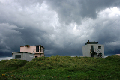
Blyth Battery
- Overview Map Street View Blyth Battery is a Military and Local Heritage museum which is free to visit. The artillery battery was originally built in 1916 to defend the port …
Co-Curate Page
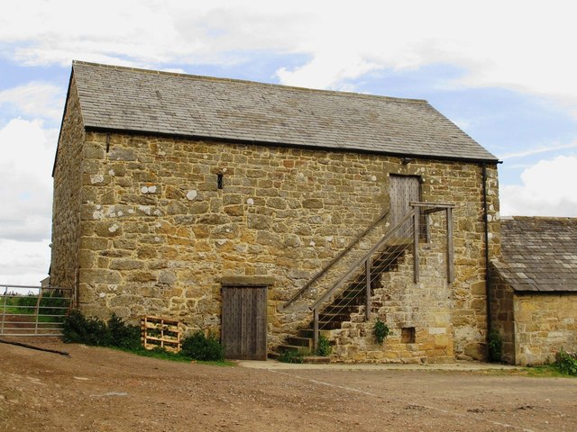
Slate Hill Settlement Earthworks, Bolam
- Overview Map Remains of a defended Iron Age settlement around the top of Slate Hill, just north of Bolam Lake in Northumberland. The ruins are a Sheduled Monument.
Co-Curate Page
Wooler Tower (remains)
- Overview Map Street View There was a fortified stone tower, built in the early 16th century, on Tower Hill in Wooler. Only 3 large blocks of masonary survive, one near …
Co-Curate Page
Kettles Hillfort, near Wooler
- The Kettles is the earwork remains of an Iron Age and Roman hill fort and settlement near Earle and Wooler in Northumberland.[1] The fort occupies a natural ridge protected on …
Co-Curate Page
Hillfort, Yeavering Bell
- Overview Map Aerial view of Yeavering Bell hillfort on Google Maps. The walls (originally 2+m high, now collapsed with a spread of 8-9m) are clearly visible. The remains of a …
Co-Curate Page
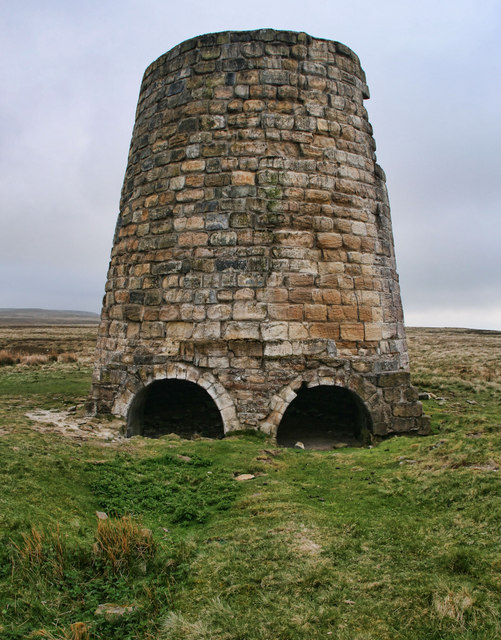
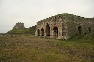
Lime Kilns
- Overview Map Street View The lime kilns at Castle Point on Lindisfarne are amongst the largest and best preserved lime kilns in Northumberland. They have a complex layout compared to …
Co-Curate Page
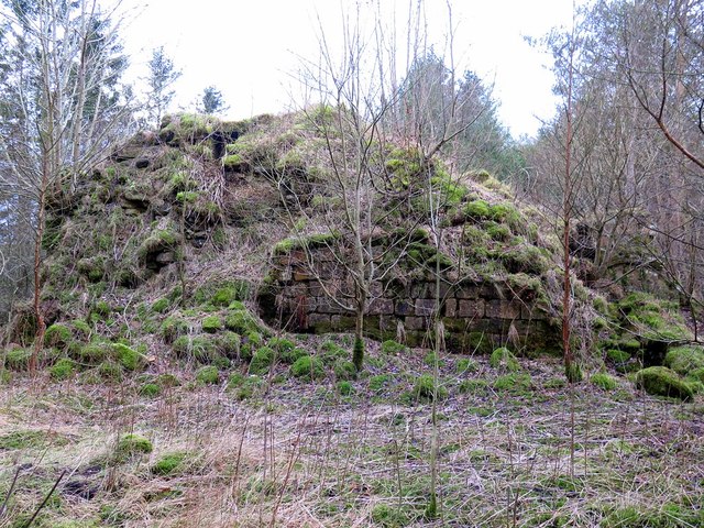
Engine House, Ridsdale Iron Works
- Overview Map Street View The remains of Ridsdale Iron Works are to the north of Ridsdale in Northumberland. Established in 1836, the works consisted of 3 furnaces, an engine house, coke …
Co-Curate Page
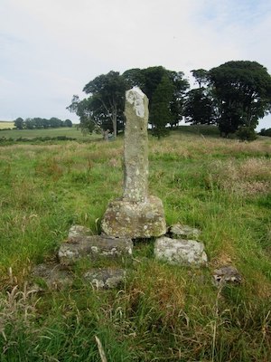
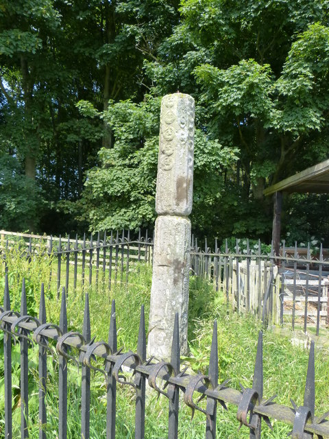
Percy's Cross (between Powburn & Wooperton)
- Overview Map This is a 15th century wayside cross, located close to the A697 road between Powburn and Wooperton in Northumberland. The cross commemorates Sir Ralph Percy who was killed near …
Co-Curate Page
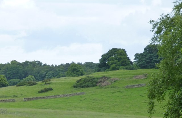
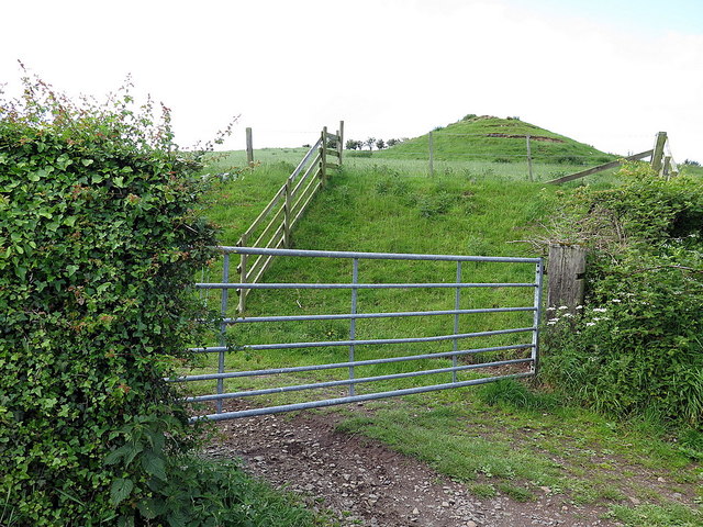
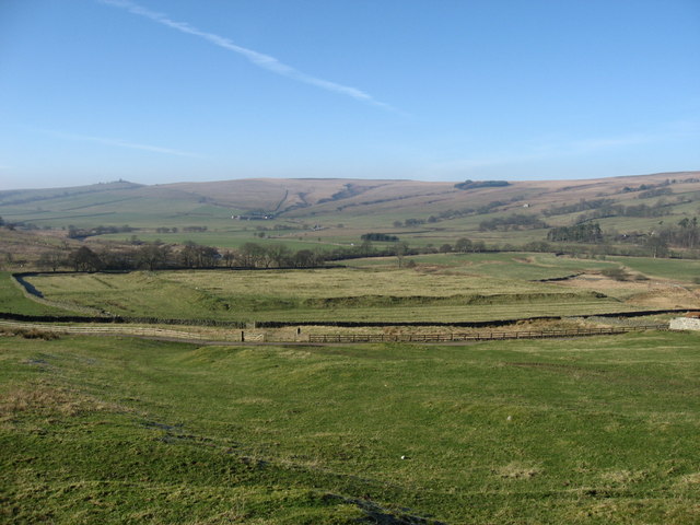
Castle Hill camp, near Alnham
- Overview Map Castle Hill is located about ¼ mile north-east of Old Hazeltonrig and 1½ miles west of the hamlet of Alnham in Northumberland. At the summit of the hill …

Co-Curate Page
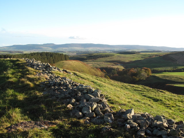
Bivallate Defended Settlement WNW of Craghead
- Scheduled Monument area - based on Historic England data (Open Government Licence). The site of this bivallate (two line of ramparts) hillfort, located to the south-east of Wagtail Farm, about …
Co-Curate Page
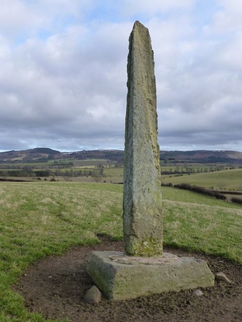
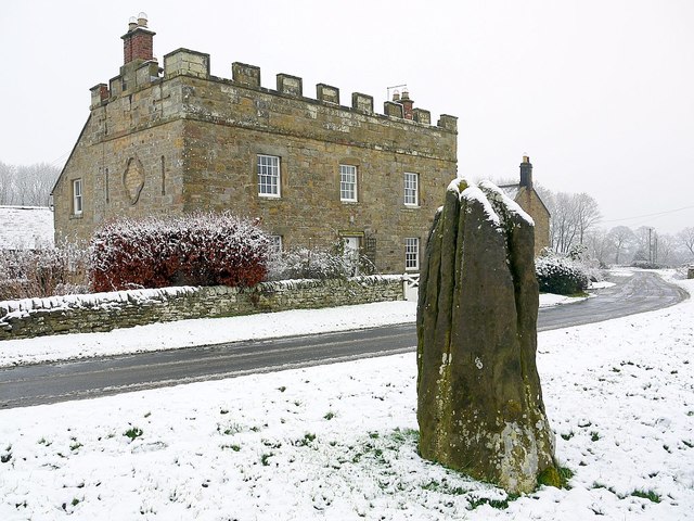
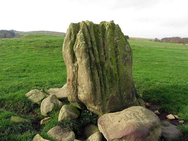
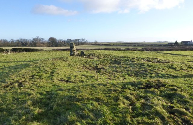
Stob Stone
- Overview Map Street View Stob Stone is a Bronze Age standing stone, located by the roadside at Standing Stone Farm, about half a mile south of Matfen in Northumberland. The …
Co-Curate Page
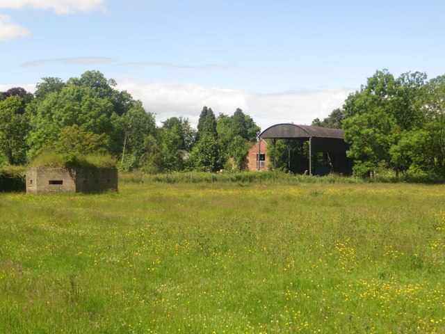
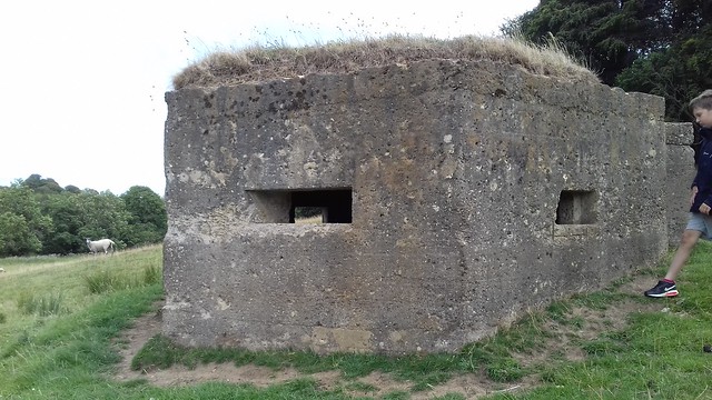
Pillbox, near Mitford Castle
- This Second World War pillbox is located near Mitford Castle, 718m south-west of Mitford Bridge. It was built by the Northern Command as part of the River Wansbeck Stop Line …
Co-Curate Page
Site of Iron Age Settlement, Houghton
- Overview Aerial View To the south-west of Houghton in Northumberland, by Broomy Hill, are the remains of an Iron Age defended settlement. The remains are not easily visible as most of the defensive …
Co-Curate Page
Pillbox near Spittal Hill Farm
- This Second World War pillbox is located near Spittal Hill Farm, 320m north-west of Mitford Bridge. It was built by the Northern Command as part of the River Wansbeck Stop …
Co-Curate Page
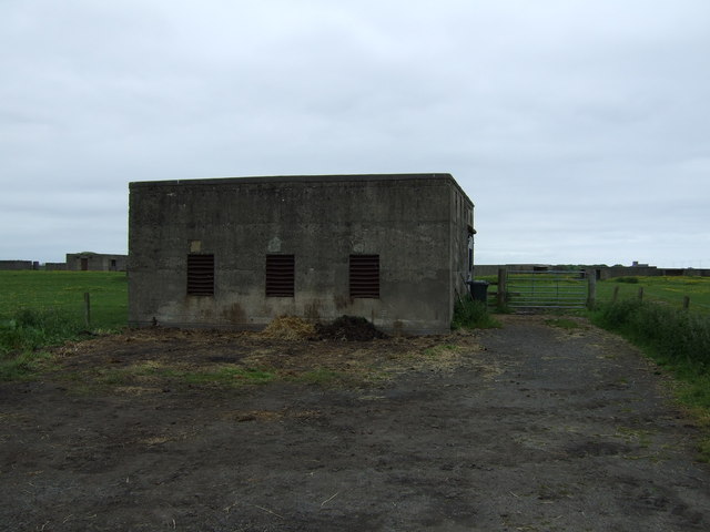
Gloucester Lodge Heavy Anti-Aircraft Battery
- Gloucester Lodge Battery, just south of Blyth, was a Second World War heavy anti-aircraft gun battery and radar site. It is one of only a handful of complete or near …

Co-Curate Page
Gunnerton Crag camps
- Scheduled Monument area - based on Historic England data (Open Government Licence). Gunnerton Crags, located to the east of the village of Gunnerton in Northumberland, are the site of a …
Co-Curate Page
Humbleton Chapel (ruins)
- Overview Map Street View A knoll, known as 'Chapel Hill', is located to the south of Humbleton. This is the reamins of Humbleton Chapel and it's associated burial ground. The earliest …
Co-Curate Page
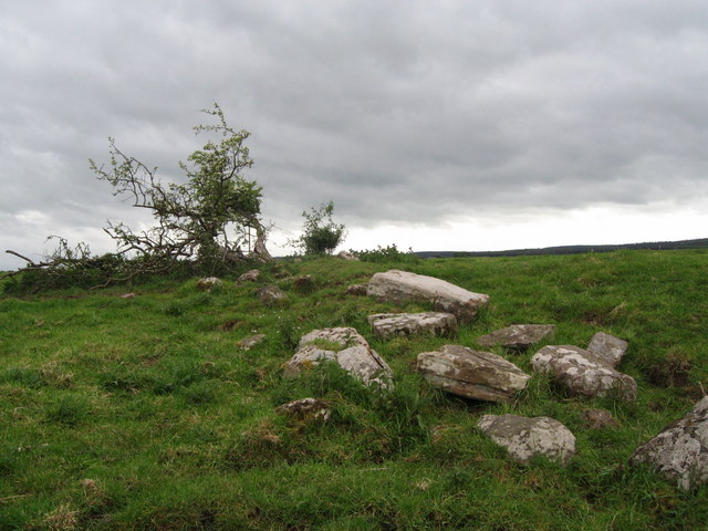
The Poind & His Man
- "The monument includes a standing stone and an adjacent round cairn of Late Neolithic/Early Bronze Age date situated in a prominent position on the top of a small knoll.....The cairn …

Co-Curate Page
Ringses multivallate hillfort, Doddington Moor
- Scheduled Monument area - based on Historic England data (Open Government Licence). The Ringses is the site of a multivallate hillfort, located on Doddington Moor, about 1 mile ENE of …
Co-Curate Page
Beldon lead mine and ore works
- Overview Map The remains of Beldon lead mine and ore works are situated on two levels in the valley of Beldon Burn at Beldon Shield. The visible remains of the …
Co-Curate Page
Kyloe Hills promontory fort
- "The monument includes the remains of an Iron Age promontory fort abutting a steep cliff to the south. The promontory fort is visible as a semi-circular enclosure measuring about 109m …

Co-Curate Page
Dod Law Hillforts
- Scheduled Monument area - based on Historic England data (Open Government Licence). Dod Law is a prominent ridge, which rises to the highest point of Doddington Moor (trig point at …

Co-Curate Page
Greaves Ash camp
- Scheduled Monument area - based on Historic England data (Open Government Licence). Greaves Ash camp is the site of a large Iron Age and Romano-British settlement, situated onhigh ground by …

Co-Curate Page
The Ringses camp, burial mounds and cairns, Beanley Moor
- Scheduled Monument areas - based on Historic England data (Open Government Licence). The Ringses is located on Beanley Moor in Northumberland, about east of Beanley and 1km south-west of Eglingham. …
Co-Curate Page
East Matfen medieval village
- Map showing the Scheduled Monument area of East Matfen medieval village, with Matfen to the west. The site of East Matfen medieval village is located about a mile ESE of …
Co-Curate Page
Halton Medieval Settlement
- Scheduled Monument areas - based on Historic England data (Open Government Licence). In Medieval times, there was a larger settlement at Halton (classed as a shrunken Medieval village). In the …
Co-Curate Page
Welton Medieval Settlement
- Scheduled Monument areas - based on Historic England data (Open Government Licence). Welton in Northumberland, situated to the south of Whittle Burn, is the site of a deserted medieval village. …
Co-Curate Page
Welton Tower House
- Overview Map Street View The remains of a 15th century tower house are located within the farm complex at Welton. The tower house was originally on the street line at …
Co-Curate Page
Scotsgate
- Overview Map Street View Scotsgate is part of the defensive Town Walls in Berwick-upon-Tweed. It dates from Elizabethan times, altered in 1815 and again in 1858.[1] Scotsgate, between the streets …
Co-Curate Page
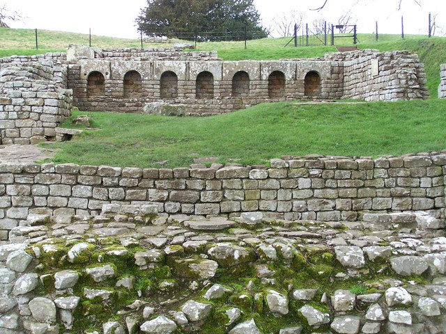
Chesters Roman Fort
- Overview About Chesters (Cilurnum) Map Chesters Roman Fort and Museum, managed by English Heritage, is located near Walwick and Chollerford in Northumberland. The Roman cavalry fort (Cilurnum) was built in …
Co-Curate Page
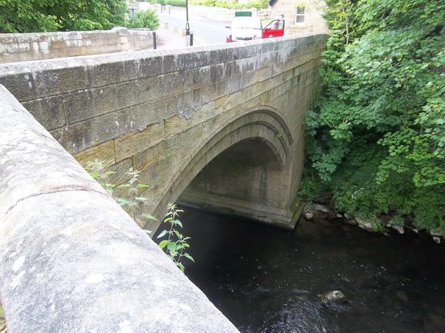
Old Bridge
- Overview Map Street View The old stone bridge over the River Aln at Lesbury dates from the 15th century, though substantially altered in the 19th century. The bridge is Grade …
Co-Curate Page
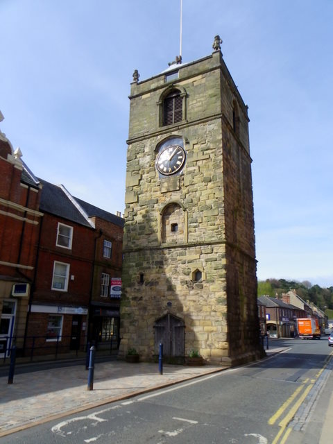
Clock Tower
- Overview About the Clock Tower Map Street View The Clock Tower on Old Gate in Morpeth was built in the early 17th century, using stone from an earlier Medieval building. …
Co-Curate Page
Medieval Preceptory, Low Chibburn
- In Low Chibburn, near Widdrington, are the remains of a preceptory (monestary) of the Knights Hospitallers. The buildings stood beside the Dunbar Burn, a small stream, used to feed a …
Co-Curate Page
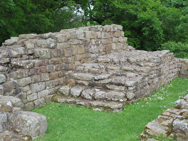
Habitancum Roman Fort
- Overview About Habitancum Habitancum was an ancient Roman fort (castra) located at Risingham, Northumberland, England. The fort was one of the defensive structures built along Dere Street, a Roman road …
Co-Curate Page
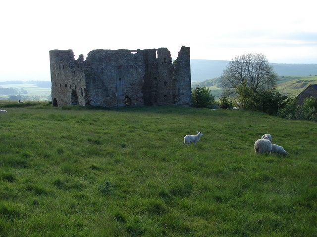
Simonburn Castle
- Ruins of a 13th century tower house near Simonburn in Northumberland.
Co-Curate Page
Deserted Medieval Village and Chapel, Tughall
- The village of Tughall was recorded as being part of the barony of Alnwick in 1242. The ruins of its 12th century chapel and its graveyard are located at the …
Co-Curate Page
Duddo Stone Circle
- Overview About Duddo Stone Circle Map Street View Northumberland's answer to Stonehenge! The stone circle is located just under a mile north of Duddo, close to the border with Scotland. …
Co-Curate Page
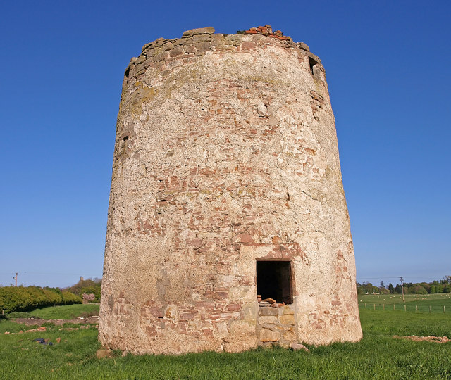
Haggerston Dovecote
- Overview Map Street View This round stone dovecote is located a quarter mile west of Haggerston Castle in Northumberland. It is thought to have been originally been built as a …

Co-Curate Page
Grindon School Roman Camp
- Overview Map There was a Roman temporary camp at Grindon, just south of Hadrian's Wall. There are few visible remains today because of farming over the years. It survives as …
Co-Curate Page
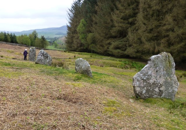
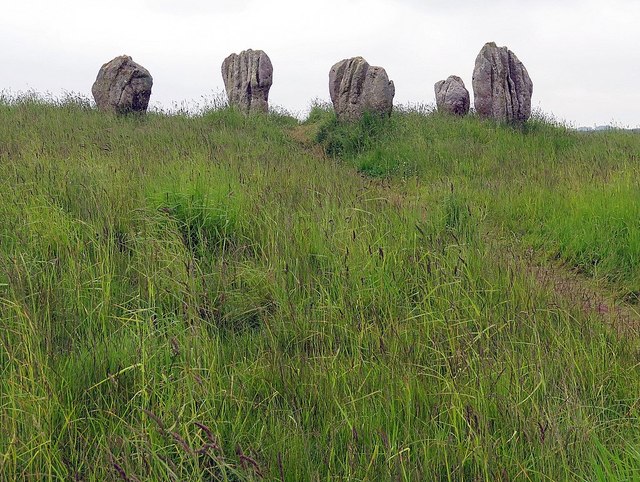
Standing Stones, Doddington Moor
- Map showing Doddington (village) and the Standing Stones (to the south-east). Zoom in to see the Scheduled Monument area. This group of standing stones are located on the high moorland, …
Co-Curate Page
Poltross Burn Milecastle, Hadrian's Wall
- Overview About Milecastle 48 Map Street View Poltross Burn, located near Gilsland, is one of the best-preserved milecastles on Hadrian's Wall. It is larger than most other milecastles, housing two …
Co-Curate Page
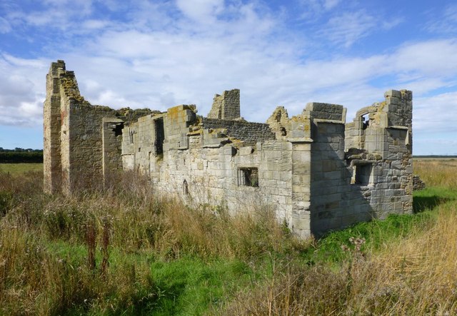
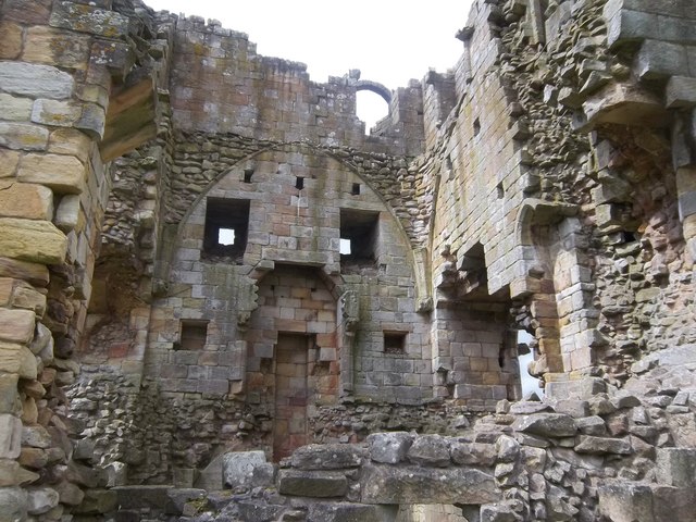
Edlingham Castle
- Overview About Edlingham Castle Map Street View The ruins of Edlingham Castle are located to the north-east of the village of Edlingham, about 6 miles north-east of Rothbury. The 'castle' was …
Co-Curate Page
Fenham Monastic Grange (ruins)
- Overview Map Aerial View % There are ruins of a monastic grange at Fenham in Northumberland - a farm complex owned by the Benedictine priory of Lindisfarne, on nearby Holy …
Co-Curate Page
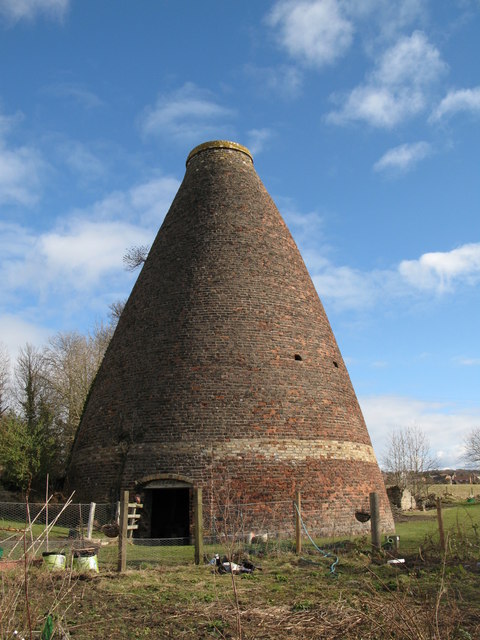
Bottle kilns
- Overview Map Street View Walker's Pottery on Milkwell Lane in Corbridge operated from the early 19th century until 1910. The pottery produced pipes, tiles and low-grade pottery for agricultural use, …
Co-Curate Page
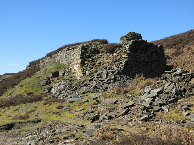
Mohope Lead Mines
- The Mohope Head Lead Mine and associated ore works were operating between the 1820s and the 1850s. The remains of the lead mine which are still visible today include an …
Co-Curate Page
Pawston Hill - Iron Age Hillfort
- The remains of an Iron Age hillfort are located on Pawston Hill, located to the south-west of the hamlet of Pawston and just to the north-west of Pawston Lake in …
Co-Curate Page
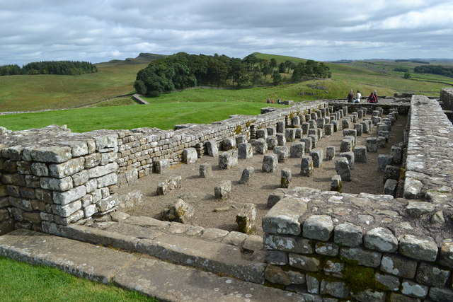
Housesteads
- Overview About Howsteads Fort Map Street View Interactive Glossary Housesteads (Roman name: "Vercovicium") is one of the best preserved forts on Hadrian's Wall, built around 124 AD. The fort covers …
Co-Curate Page
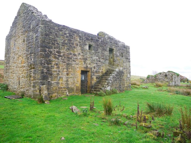
Black Middens Bastle House
- Overview About Black Middens Bastle Map Street View Black Middens Bastle House is at an isolated location on the north side of the Tarset Valley, about 2 miles north-west of …
Co-Curate Page
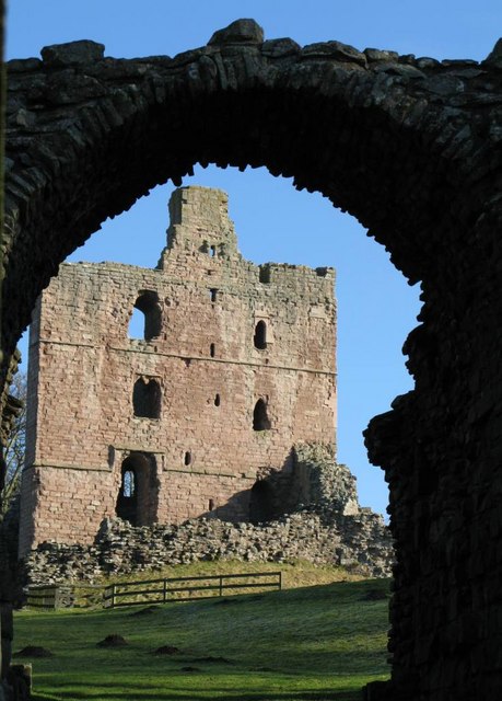
Norham Castle
- Overview About Norham Castle Map Street View Norham Castle is a castle in Northumberland, England, overlooking the River Tweed, on the border between England and Scotland. It is a …
Co-Curate Page
Newminster Abbey (ruins)
- The ruins of Newminster Abbey are located on the west side of Morpeth, near the south banks of the River Wansbeck. This Cistercian abbey was founded in 1137; most of …
Co-Curate Page
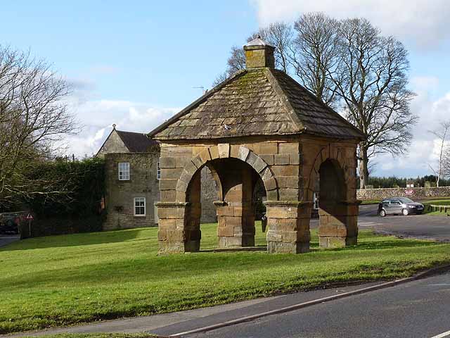
Market Cross
- Overview Map Street View The Market Cross (aka "Butter Cross") is located on the western side of the village green in Stamfordham. It is a small square, single-storey building, with …
Co-Curate Page
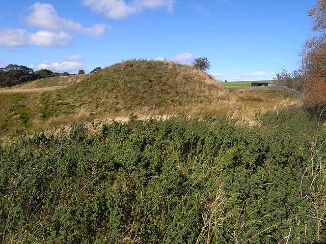
Mote Hills (Elsdon Castle)
- Overview About Elsdon Castle Map Street View Mote Hills at the village of Elsdon are the earthwork remains of a medieval motte and bailey castle. The castle was built on …
Co-Curate Page
Robin of Risingham
- "Robin of Risingham" is a Roman rock carving located between Ridsdale and West Woodburn, and about ½ mile south-east of Habitancum Roman Fort. The carving of a figure holding a …
Co-Curate Page
St Leonard's Hospital (ruins), Denwick
- Overview Map Street View The remains of the medieval St Leonard's Hospital are beside the B6341 road, about ¾ mile north of Alnwick and a mile west of the village of …
Co-Curate Page
Learchild Roman fort (Alavna)
- The shallow earthwork remains of a large Roman fort (thought to be 'Alavna') near High Learchild were discovered by arial photography in 1945, and confirmed by subsequent archaeological digs. The fort …
Co-Curate Page
Bolton Leper Hospital
- Overview Map A leper hopital was established in Bolton, Northumberland, in the 13th century. The site covers a large area to the north of the modern village. There are few …
Co-Curate Page
The Norse Camp, Alnmouth
- The Norse Camp is a Scheduled Monument at the north of Alnmouth. It is also known traditionally as Night Folds; the county Conservation team list it as Mount Pleasant Enclosure, …
Co-Curate Page
Bewick Hill cup and ring marked rocks
- Located to the east of Bewick Hill Camp (hillfort). Scheduled Monument (legally protected). "A series of seven cup and ring marked stones or possible cup marked stones were recorded during …
Co-Curate Page
Standing Stones Camp, Horton Moor
- Map showing Doddington (village) and the site of Standing Stones Camp (to the south-east). Zoom in to see the Scheduled Monument area. Standing Stones Camp is located on the edge …
Co-Curate Page
Defended settlement, SW of Nesbit, Northumberland
- Scheduled Monument area - based on Historic England data (Open Government Licence). The buried remains of an Iron Age multivallate defended settlement are located to the south-west of Nesbit, near …
Co-Curate Page
Defended settlement, SW of Sandy House
- Scheduled Monument area - based on Historic England data (Open Government Licence). The site of an Iron Age defended settlement is located south-owest of Sandy House, about 1km north-east of …
Co-Curate Page
Ewart Park Henge
- Map showing Ewart Newton and the site of Ewart Park Henge to the east. This site, preserved as an oval cropmark, has the remains of a late Neolithic henge. It …
Co-Curate Page
Settlement on SE slope of Ewe Hill
- Map showing Ingram and the Scheduled Monument area on Ewe Hill, to the north-west. Ewe Hill is located along the valley of the River Breamish, about 1km west of Ingram …
Co-Curate Page
Rosebrough Moor round cairns
- Map showing Rosebrough to the east and the two cairns on Rosebrough to the west. Scheduled Monument (#1002911): Rosebrough Moor round cairns Click the headings below to expand (selected extracts …
Co-Curate Page
Bellister Castle - uninhabited parts
- Scheduled Monument areas - based on Historic England data (Open Government Licence). Scheduled Monument (#1002910): Bellister Castle (uninhabited parts) Click the headings below to expand (selected extracts from the Historic …
Co-Curate Page
Camphill Iron Age Settlement
- On Camp Hill, to the north-west of Berwick-upon-Tweed, are the remains of an Iron Age defended settlement. The site, which is heavily farmed, is a Scheduled Monument (legally protected). Nearby, …
Co-Curate Page
Halidon Hill Iron Age Settlement
- Scheduled Monument areas - based on Historic England data (Open Government Licence). To the north-west of Berwick-upon-Tweed is Halidon Hill; by its summit, on it's south-facing slope is the site …
Co-Curate Page
Edlingham Deserted Medieval Village
- Scheduled Monument areas - based on Historic England data (Open Government Licence). To the south of St John's Church in Edlingham is the probable site of the deserted medieval village …
Co-Curate Page
Camp NW of Chesterhill
- Scheduled Monument area - based on Historic England data (Open Government Licence). Scheduled Monument (#1003764): Camp 500yds (460m) NW of Chesterhill Click the headings below to expand (selected extracts from …
Co-Curate Page
Defended settlement SW of Broomhouse
- Map showing Broomhouse and the Scheduled Monument area to the south-west. To the south-west of Broomhouse in Tillside are the buried remains of an Iron Age defended settlement. It is …
Co-Curate Page
Defended settlement on White Hill, SE of Kimmerston
- Map showing Kimmerson with the Scheduled Monument area to the south east. The cropmarked remains of a multivallate defended settlement are located 590m south-east of Kimmerston in Northumberland. Situated on …
Co-Curate Page
Enclosed settlement, SE of Cornhill Castle
- Map showing the enclosed settlement Scheduled Monument area, with Cornhill-on-Tweed to the south and Cornhill Castle to the north-west. About 700m north of Cornhill-on-Tweed is the site on an enclosed …

Co-Curate Page
Bewick Hill Camp
- Scheduled Monument area - based on Historic England data (Open Government Licence). Bewick Hill Camp is a hillfort, located to the east of Old Bewick in Northumberland. It is presumed …
Co-Curate Page
The King's Stone NW of Crookham Westfield
- The King's Stone, to the north-west of Crookham Westfield in Northumberland, is a standing stone of either late Neolithic or early Bronze Age date. It is formed from cherty magnesium …
Co-Curate Page
The Hurl Stone
- Overview Map Tthe Hurl Stone is a Medieval standing cross located near Newtown and Lilburn Tower in Northumberland. The stone is a Scheduled Monument.
Co-Curate Page
Prehistoric Rock Art in Lemmington Wood
- Deep in Lemmington Woods is a rock with 'cup and rings' carvings, thought to date from the early Bronze Age. The rock is very unusual as it also has later Anglo-Saxon …
Co-Curate Page
Blyth Battery
- Overview Map Street View Blyth Battery is a Military and Local Heritage museum which is free to visit. The artillery battery was originally built in 1916 to defend the port …
Co-Curate Page
Slate Hill Settlement Earthworks, Bolam
- Overview Map Remains of a defended Iron Age settlement around the top of Slate Hill, just north of Bolam Lake in Northumberland. The ruins are a Sheduled Monument.
Co-Curate Page
Wooler Tower (remains)
- Overview Map Street View There was a fortified stone tower, built in the early 16th century, on Tower Hill in Wooler. Only 3 large blocks of masonary survive, one near …
Co-Curate Page
Kettles Hillfort, near Wooler
- The Kettles is the earwork remains of an Iron Age and Roman hill fort and settlement near Earle and Wooler in Northumberland.[1] The fort occupies a natural ridge protected on …
Co-Curate Page
Hillfort, Yeavering Bell
- Overview Map Aerial view of Yeavering Bell hillfort on Google Maps. The walls (originally 2+m high, now collapsed with a spread of 8-9m) are clearly visible. The remains of a …
Co-Curate Page
Lime Kilns
- Overview Map Street View The lime kilns at Castle Point on Lindisfarne are amongst the largest and best preserved lime kilns in Northumberland. They have a complex layout compared to …
Co-Curate Page
Engine House, Ridsdale Iron Works
- Overview Map Street View The remains of Ridsdale Iron Works are to the north of Ridsdale in Northumberland. Established in 1836, the works consisted of 3 furnaces, an engine house, coke …
Co-Curate Page
Percy's Cross (between Powburn & Wooperton)
- Overview Map This is a 15th century wayside cross, located close to the A697 road between Powburn and Wooperton in Northumberland. The cross commemorates Sir Ralph Percy who was killed near …
Co-Curate Page
Castle Hill camp, near Alnham
- Overview Map Castle Hill is located about ¼ mile north-east of Old Hazeltonrig and 1½ miles west of the hamlet of Alnham in Northumberland. At the summit of the hill …
Co-Curate Page
Bivallate Defended Settlement WNW of Craghead
- Scheduled Monument area - based on Historic England data (Open Government Licence). The site of this bivallate (two line of ramparts) hillfort, located to the south-east of Wagtail Farm, about …
Co-Curate Page
Stob Stone
- Overview Map Street View Stob Stone is a Bronze Age standing stone, located by the roadside at Standing Stone Farm, about half a mile south of Matfen in Northumberland. The …
Co-Curate Page
Pillbox, near Mitford Castle
- This Second World War pillbox is located near Mitford Castle, 718m south-west of Mitford Bridge. It was built by the Northern Command as part of the River Wansbeck Stop Line …
Co-Curate Page
Site of Iron Age Settlement, Houghton
- Overview Aerial View To the south-west of Houghton in Northumberland, by Broomy Hill, are the remains of an Iron Age defended settlement. The remains are not easily visible as most of the defensive …
Co-Curate Page
Pillbox near Spittal Hill Farm
- This Second World War pillbox is located near Spittal Hill Farm, 320m north-west of Mitford Bridge. It was built by the Northern Command as part of the River Wansbeck Stop …
Co-Curate Page
Gloucester Lodge Heavy Anti-Aircraft Battery
- Gloucester Lodge Battery, just south of Blyth, was a Second World War heavy anti-aircraft gun battery and radar site. It is one of only a handful of complete or near …
Co-Curate Page
Gunnerton Crag camps
- Scheduled Monument area - based on Historic England data (Open Government Licence). Gunnerton Crags, located to the east of the village of Gunnerton in Northumberland, are the site of a …
Co-Curate Page
Humbleton Chapel (ruins)
- Overview Map Street View A knoll, known as 'Chapel Hill', is located to the south of Humbleton. This is the reamins of Humbleton Chapel and it's associated burial ground. The earliest …
Co-Curate Page
The Poind & His Man
- "The monument includes a standing stone and an adjacent round cairn of Late Neolithic/Early Bronze Age date situated in a prominent position on the top of a small knoll.....The cairn …
Co-Curate Page
Ringses multivallate hillfort, Doddington Moor
- Scheduled Monument area - based on Historic England data (Open Government Licence). The Ringses is the site of a multivallate hillfort, located on Doddington Moor, about 1 mile ENE of …
Co-Curate Page
Beldon lead mine and ore works
- Overview Map The remains of Beldon lead mine and ore works are situated on two levels in the valley of Beldon Burn at Beldon Shield. The visible remains of the …
Co-Curate Page
Kyloe Hills promontory fort
- "The monument includes the remains of an Iron Age promontory fort abutting a steep cliff to the south. The promontory fort is visible as a semi-circular enclosure measuring about 109m …
Co-Curate Page
Dod Law Hillforts
- Scheduled Monument area - based on Historic England data (Open Government Licence). Dod Law is a prominent ridge, which rises to the highest point of Doddington Moor (trig point at …
Co-Curate Page
Greaves Ash camp
- Scheduled Monument area - based on Historic England data (Open Government Licence). Greaves Ash camp is the site of a large Iron Age and Romano-British settlement, situated onhigh ground by …
Co-Curate Page
The Ringses camp, burial mounds and cairns, Beanley Moor
- Scheduled Monument areas - based on Historic England data (Open Government Licence). The Ringses is located on Beanley Moor in Northumberland, about east of Beanley and 1km south-west of Eglingham. …
Co-Curate Page
East Matfen medieval village
- Map showing the Scheduled Monument area of East Matfen medieval village, with Matfen to the west. The site of East Matfen medieval village is located about a mile ESE of …
Co-Curate Page
Halton Medieval Settlement
- Scheduled Monument areas - based on Historic England data (Open Government Licence). In Medieval times, there was a larger settlement at Halton (classed as a shrunken Medieval village). In the …
Co-Curate Page
Welton Medieval Settlement
- Scheduled Monument areas - based on Historic England data (Open Government Licence). Welton in Northumberland, situated to the south of Whittle Burn, is the site of a deserted medieval village. …
Co-Curate Page
Welton Tower House
- Overview Map Street View The remains of a 15th century tower house are located within the farm complex at Welton. The tower house was originally on the street line at …
Co-Curate Page
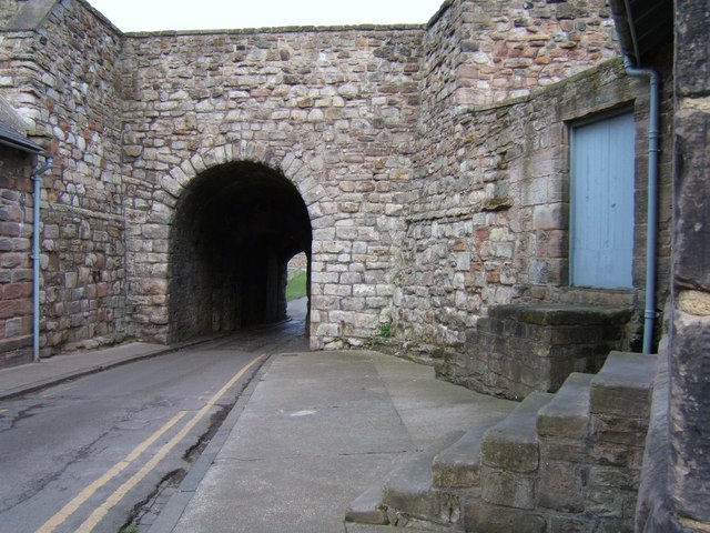
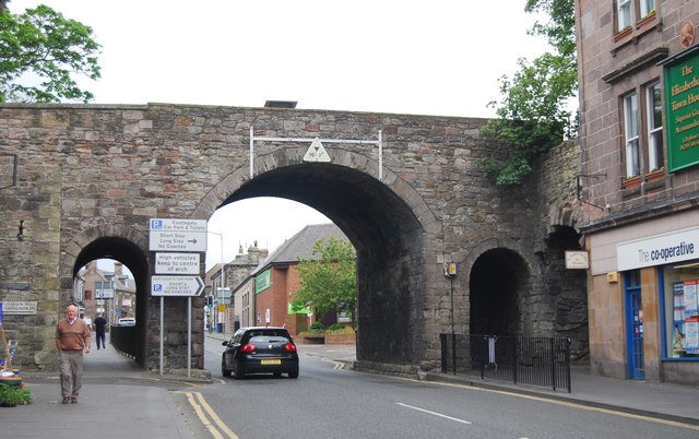
Scotsgate
- Overview Map Street View Scotsgate is part of the defensive Town Walls in Berwick-upon-Tweed. It dates from Elizabethan times, altered in 1815 and again in 1858.[1] Scotsgate, between the streets …
Co-Curate Page
Chesters Roman Fort
- Overview About Chesters (Cilurnum) Map Chesters Roman Fort and Museum, managed by English Heritage, is located near Walwick and Chollerford in Northumberland. The Roman cavalry fort (Cilurnum) was built in …
Co-Curate Page
Old Bridge
- Overview Map Street View The old stone bridge over the River Aln at Lesbury dates from the 15th century, though substantially altered in the 19th century. The bridge is Grade …
Co-Curate Page
Clock Tower
- Overview About the Clock Tower Map Street View The Clock Tower on Old Gate in Morpeth was built in the early 17th century, using stone from an earlier Medieval building. …
Co-Curate Page
Medieval Preceptory, Low Chibburn
- In Low Chibburn, near Widdrington, are the remains of a preceptory (monestary) of the Knights Hospitallers. The buildings stood beside the Dunbar Burn, a small stream, used to feed a …
Co-Curate Page
Habitancum Roman Fort
- Overview About Habitancum Habitancum was an ancient Roman fort (castra) located at Risingham, Northumberland, England. The fort was one of the defensive structures built along Dere Street, a Roman road …
Co-Curate Page
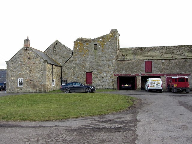
Simonburn Castle
- Ruins of a 13th century tower house near Simonburn in Northumberland.
Co-Curate Page
Deserted Medieval Village and Chapel, Tughall
- The village of Tughall was recorded as being part of the barony of Alnwick in 1242. The ruins of its 12th century chapel and its graveyard are located at the …
Co-Curate Page
Duddo Stone Circle
- Overview About Duddo Stone Circle Map Street View Northumberland's answer to Stonehenge! The stone circle is located just under a mile north of Duddo, close to the border with Scotland. …
Co-Curate Page
Haggerston Dovecote
- Overview Map Street View This round stone dovecote is located a quarter mile west of Haggerston Castle in Northumberland. It is thought to have been originally been built as a …
Co-Curate Page
Grindon School Roman Camp
- Overview Map There was a Roman temporary camp at Grindon, just south of Hadrian's Wall. There are few visible remains today because of farming over the years. It survives as …
Co-Curate Page
Standing Stones, Doddington Moor
- Map showing Doddington (village) and the Standing Stones (to the south-east). Zoom in to see the Scheduled Monument area. This group of standing stones are located on the high moorland, …
Co-Curate Page
Poltross Burn Milecastle, Hadrian's Wall
- Overview About Milecastle 48 Map Street View Poltross Burn, located near Gilsland, is one of the best-preserved milecastles on Hadrian's Wall. It is larger than most other milecastles, housing two …
Co-Curate Page
Edlingham Castle
- Overview About Edlingham Castle Map Street View The ruins of Edlingham Castle are located to the north-east of the village of Edlingham, about 6 miles north-east of Rothbury. The 'castle' was …
Co-Curate Page
Fenham Monastic Grange (ruins)
- Overview Map Aerial View % There are ruins of a monastic grange at Fenham in Northumberland - a farm complex owned by the Benedictine priory of Lindisfarne, on nearby Holy …
Co-Curate Page
Bottle kilns
- Overview Map Street View Walker's Pottery on Milkwell Lane in Corbridge operated from the early 19th century until 1910. The pottery produced pipes, tiles and low-grade pottery for agricultural use, …
Co-Curate Page
Mohope Lead Mines
- The Mohope Head Lead Mine and associated ore works were operating between the 1820s and the 1850s. The remains of the lead mine which are still visible today include an …
Co-Curate Page
Pawston Hill - Iron Age Hillfort
- The remains of an Iron Age hillfort are located on Pawston Hill, located to the south-west of the hamlet of Pawston and just to the north-west of Pawston Lake in …
Co-Curate Page
Housesteads
- Overview About Howsteads Fort Map Street View Interactive Glossary Housesteads (Roman name: "Vercovicium") is one of the best preserved forts on Hadrian's Wall, built around 124 AD. The fort covers …
Co-Curate Page
Black Middens Bastle House
- Overview About Black Middens Bastle Map Street View Black Middens Bastle House is at an isolated location on the north side of the Tarset Valley, about 2 miles north-west of …
Co-Curate Page
Norham Castle
- Overview About Norham Castle Map Street View Norham Castle is a castle in Northumberland, England, overlooking the River Tweed, on the border between England and Scotland. It is a …
Co-Curate Page
Newminster Abbey (ruins)
- The ruins of Newminster Abbey are located on the west side of Morpeth, near the south banks of the River Wansbeck. This Cistercian abbey was founded in 1137; most of …
Co-Curate Page
Market Cross
- Overview Map Street View The Market Cross (aka "Butter Cross") is located on the western side of the village green in Stamfordham. It is a small square, single-storey building, with …
Co-Curate Page
Mote Hills (Elsdon Castle)
- Overview About Elsdon Castle Map Street View Mote Hills at the village of Elsdon are the earthwork remains of a medieval motte and bailey castle. The castle was built on …
Co-Curate Page
Robin of Risingham
- "Robin of Risingham" is a Roman rock carving located between Ridsdale and West Woodburn, and about ½ mile south-east of Habitancum Roman Fort. The carving of a figure holding a …
Co-Curate Page
St Leonard's Hospital (ruins), Denwick
- Overview Map Street View The remains of the medieval St Leonard's Hospital are beside the B6341 road, about ¾ mile north of Alnwick and a mile west of the village of …
Co-Curate Page
Learchild Roman fort (Alavna)
- The shallow earthwork remains of a large Roman fort (thought to be 'Alavna') near High Learchild were discovered by arial photography in 1945, and confirmed by subsequent archaeological digs. The fort …
Co-Curate Page
Bolton Leper Hospital
- Overview Map A leper hopital was established in Bolton, Northumberland, in the 13th century. The site covers a large area to the north of the modern village. There are few …
Co-Curate Page
The Norse Camp, Alnmouth
- The Norse Camp is a Scheduled Monument at the north of Alnmouth. It is also known traditionally as Night Folds; the county Conservation team list it as Mount Pleasant Enclosure, …
Co-Curate Page
Bewick Hill cup and ring marked rocks
- Located to the east of Bewick Hill Camp (hillfort). Scheduled Monument (legally protected). "A series of seven cup and ring marked stones or possible cup marked stones were recorded during …
Co-Curate Page
Standing Stones Camp, Horton Moor
- Map showing Doddington (village) and the site of Standing Stones Camp (to the south-east). Zoom in to see the Scheduled Monument area. Standing Stones Camp is located on the edge …
Co-Curate Page
Defended settlement, SW of Nesbit, Northumberland
- Scheduled Monument area - based on Historic England data (Open Government Licence). The buried remains of an Iron Age multivallate defended settlement are located to the south-west of Nesbit, near …
Co-Curate Page
Defended settlement, SW of Sandy House
- Scheduled Monument area - based on Historic England data (Open Government Licence). The site of an Iron Age defended settlement is located south-owest of Sandy House, about 1km north-east of …
Co-Curate Page
Ewart Park Henge
- Map showing Ewart Newton and the site of Ewart Park Henge to the east. This site, preserved as an oval cropmark, has the remains of a late Neolithic henge. It …
Co-Curate Page
Settlement on SE slope of Ewe Hill
- Map showing Ingram and the Scheduled Monument area on Ewe Hill, to the north-west. Ewe Hill is located along the valley of the River Breamish, about 1km west of Ingram …
Co-Curate Page
Rosebrough Moor round cairns
- Map showing Rosebrough to the east and the two cairns on Rosebrough to the west. Scheduled Monument (#1002911): Rosebrough Moor round cairns Click the headings below to expand (selected extracts …
Co-Curate Page
Bellister Castle - uninhabited parts
- Scheduled Monument areas - based on Historic England data (Open Government Licence). Scheduled Monument (#1002910): Bellister Castle (uninhabited parts) Click the headings below to expand (selected extracts from the Historic …
Co-Curate Page
Camphill Iron Age Settlement
- On Camp Hill, to the north-west of Berwick-upon-Tweed, are the remains of an Iron Age defended settlement. The site, which is heavily farmed, is a Scheduled Monument (legally protected). Nearby, …
Co-Curate Page
Halidon Hill Iron Age Settlement
- Scheduled Monument areas - based on Historic England data (Open Government Licence). To the north-west of Berwick-upon-Tweed is Halidon Hill; by its summit, on it's south-facing slope is the site …
Co-Curate Page
Edlingham Deserted Medieval Village
- Scheduled Monument areas - based on Historic England data (Open Government Licence). To the south of St John's Church in Edlingham is the probable site of the deserted medieval village …
Co-Curate Page
Camp NW of Chesterhill
- Scheduled Monument area - based on Historic England data (Open Government Licence). Scheduled Monument (#1003764): Camp 500yds (460m) NW of Chesterhill Click the headings below to expand (selected extracts from …
Co-Curate Page
Defended settlement SW of Broomhouse
- Map showing Broomhouse and the Scheduled Monument area to the south-west. To the south-west of Broomhouse in Tillside are the buried remains of an Iron Age defended settlement. It is …
Co-Curate Page
Defended settlement on White Hill, SE of Kimmerston
- Map showing Kimmerson with the Scheduled Monument area to the south east. The cropmarked remains of a multivallate defended settlement are located 590m south-east of Kimmerston in Northumberland. Situated on …


