Topics > Tyne and Wear > South Tyneside > Historic Buildings and Monuments in South Tyneside
Historic Buildings and Monuments in South Tyneside
This page includes historic buildings, monuments, parks and sites in South Tyneside, compiled from two sources: a) Listed buildings and scheduled monuments, from the National Heritage List for England[1]. b) the List of Buildings, Parks and Gardens of Special Local Architectural or Historic Interest ('Local List') from South Tyneside Council.[2] Use the Search in the data table (below) if looking for a specific building / monument, or to filter on a particular area e.g. type: Hebburn.
| Structure | List No. | Grade | Built~ | Ward~ | Note |
|---|---|---|---|---|---|
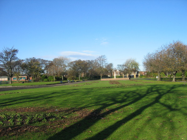
| Carr-Ellison Park | - | Local | Hebburn South | Hebburn | |
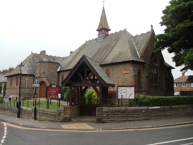
| Whitburn Methodist Church | - | Local | 1881 | Whitburn & Marsden | Whitburn |
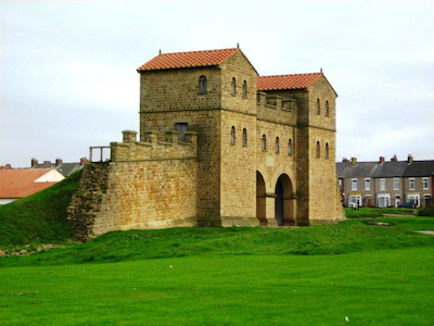
| Arbeia Roman Fort | 1005910 | n/a | Roman | Scheduled Monument | |
| Lizard Lane Heavy Anti-Aircraft Battery | 1419998 | n/a | C20th | Whitburn & Marsden | Marsden. Scheduled Monument |
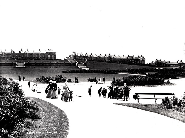
| North and South Marine Parks and Bents Park | 1001466 | II | 1869 | Listed | |
| Village of Jarrow | 1005897 | n/a | Scheduled Monument | ||
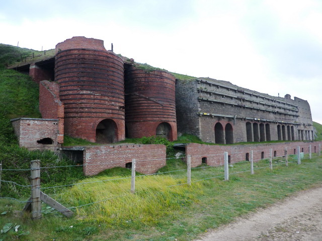
| Marsden lime kilns | 1005911 | n/a | 1870s | Whitburn & Marsden | Marsden. Scheduled Monument |
| No. 1, Beach Road | 1231575 | II | Beacon & Bents | ||
| Nos. 105 and 107, King Street | 1232153 | II | Beacon and Bents | ||
| No. 11, Beach Road | 1277484 | II | Beacon & Bents | ||
| No. 16, Barrington Street | 1231574 | II | Beacon & Bents | ||
| No. 17, Beach Road | 1231722 | II | Beacon & Bents | ||
| Nos. 21 and 21a, Beach Road | 1231577 | II | Beacon & Bents | ||
| No. 23, Beach Road | 1231739 | II | Beacon & Bents | ||
| No. 23, Mill Dam | 1277489 | II | Beacon & Bents | ||
| Nos. 29, 31 and 33, Beach Road | 1277485 | II | Beacon & Bents | ||
| Nos. 3 and 3a, Beach Road | 1231674 | II | Beacon & Bents | ||
| Nos. 37-57, Beach Road | 1231847 | II | Beacon & Bents | ||
| No. 5, Beach Road | 1231576 | II | Beacon & Bents | ||
| Nos. 67 and 69, King Street | 1232151 | II | Beacon & Bents | ||
| Nos. 68, 69 and 70, Greens Place | 1231586 | II | Beacon & Bents | ||
| No. 81, Greens Place | 1232134 | II | Beacon & Bents | ||
| Nos. 83, 84 and 85, Greens Place | 1231587 | II | Beacon & Bents | ||
| Alum House Ham (Tyne Dock Engineering Company Limited) | 1232320 | II | Beacon & Bents | ||
| Barclays Bank | 1232198 | II | Beacon & Bents | ||
| Boundary Wall to Numbers 1 to 22 (Consecutive) Fronting Road | 1231875 | II | Beacon & Bents | ||
| Boundary Wall to Numbers 23 to 39 (Consecutive) | 1231580 | II | Beacon & Bents | ||
| Canopy over Lifeboat | 1277136 | II | Beacon & Bents | ||
| Church of St Hilda | 1232156 | II | C18th | Beacon & Bents | |
| Church of St Stephen | 1232159 | II | Beacon & Bents | ||
| East Beacon | 1232155 | II | Beacon & Bents | ||
| Entrance Building of the Former Theatre of Varieties | 1277214 | II | Beacon & Bents | ||
| Forecourt Railings and Statue of Britannia in Front of Britannia Public House | 1277273 | II | Beacon & Bents | ||
| Four Gate Piers Immediately to West of Church of St Hilda | 1232227 | II | Beacon & Bents | ||
| Jubilee Memorial | 1232319 | II | 1890 | Beacon & Bents | South Shields, Ocean Road |
| Lifeboat | 1232425 | II | 1833 | Beacon & Bents | Old lifeboat, now memorial. |
| Lloyds Bank | 1232152 | II | Beacon & Bents | ||
| Mariners' Cottages | 1231578 | II | Beacon & Bents | ||
| Mariners' Cottages | 1231579 | II | Beacon & Bents | ||
| Marks and Spencer | 1232150 | II | Beacon & Bents | ||
| Mill Dam | 1231582 | II | Beacon & Bents | ||
| Municipal Buildings | 1232325 | II | 1910 | Beacon & Bents | |
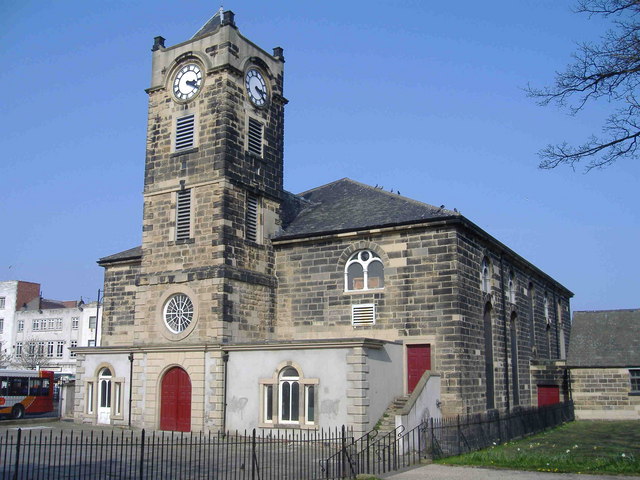
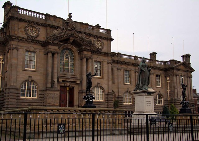
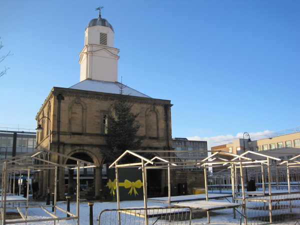
| Old Town Hall | 1232158 | I | 1768 | Beacon & Bents | Market Palce, South Shields |
| Railings and Piers to the Municipal Buildings Fronting Onto Broughton Road | 1232327 | II | Beacon & Bents | ||
| River Tyne, River Police Offices | 1232160 | II | Beacon & Bents | ||
| Roman Catholic Church of St Bede and attached Presbytery including attached walls and detached wall | 1431017 | II | Beacon & Bents | ||
| South Pier, South Shields | 1436854 | II | Beacon & Bents | ||
| South Shields Museum and Art Gallery | 1232317 | II | Beacon & Bents | ||
| South Shields Volunteer Life Brigage Watch House | 1277138 | II | Beacon & Bents | ||
| St Hilda's Colliery Head Stocks | 1277144 | II | Beacon & Bents | ||
| Stag's Head Public House | 1393666 | II | Beacon & Bents | ||
| Statue of Queen Victoria | 1232222 | II | Beacon & Bents | ||
| Sundial to South West of Church of St Hilda | 1232157 | II | Beacon & Bents | ||
| The Britannia Public House | 1277488 | II | Beacon & Bents | ||
| The Former Marine School (Ocean Road Annexe) | 1232318 | II | Beacon & Bents | ||
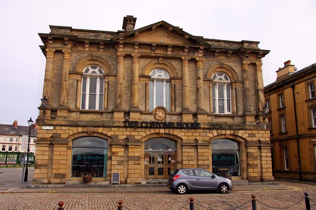
| The Former Mercantile Marine Offices (Customs House) | 1232273 | II | 1864 | Beacon & Bents | |
| The Scotia Public House | 1232248 | II | Beacon & Bents | ||
| The South Groyne | 1232321 | II | Beacon & Bents | ||
| Trustee Savings Bank | 1277483 | II | Beacon & Bents | ||
| Victoria Hall | 1232945 | II | Beacon & Bents | ||
| Wall and Railings of the Museum and Art Gallery Fronting Road | 1277135 | II | Beacon & Bents | ||
| War memorial outside St Hilda's Church | 1440513 | II | Beacon & Bents | ||
| West Beacon | 1232154 | II | Beacon & Bents | ||
| Bede Monastery Museum (Jarrow Hall) | 1185882 | II | 1785 | Bede | Jarrow |
| Church of St Paul | 1355091 | I | Bede | Jarrow | |
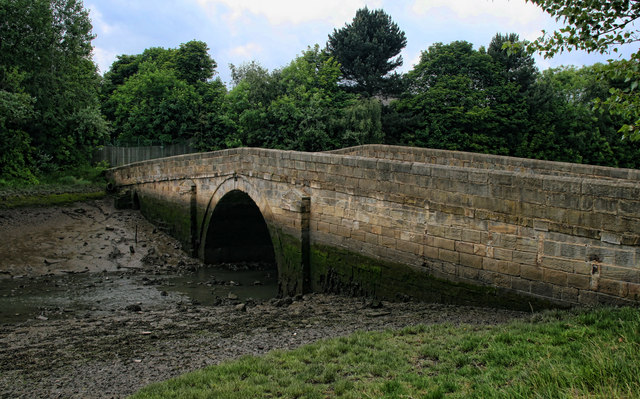
| Jarrow Bridge (Tyne and Wear County Council Bridge No 433) | 1355092 | II | 1781 | Bede | Jarrow |
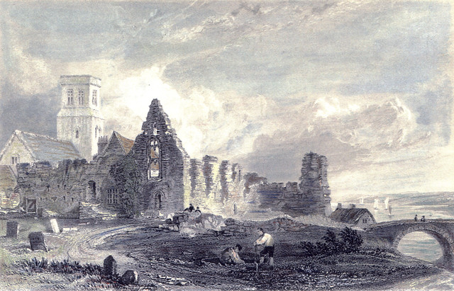
| Monastery of St Paul | 1025198 | I | C7th | Bede | Jarrow. Scheduled Monument (1002978) |
| Barn and Gin-Gang to South of Downhill Farmhouse | 1355078 | II | Bolden Colliery | ||
| Boldon Mill | 1025227 | II | Bolden Colliery | ||
| Church of Saint Nicholas | 1025225 | II | Bolden Colliery | ||
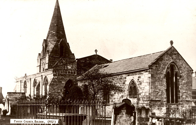
| Church of Saint Nicholas | 1355070 | I | C13th | Bolden Colliery | West Bolden |
| Doorway to South of Rectory Green | 1185725 | II | Bolden Colliery | ||
| Downhill Farmhouse | 1025248 | II | Bolden Colliery | ||
| Downhill House | 1355079 | II | Bolden Colliery | ||
| Limekiln to South East of Downhill Farmhouse | 1025249 | II | Bolden Colliery | ||
| Mansion House | 1185551 | II | Bolden Colliery | ||
| Pair of Lodge Cottages at Entrance to Downhill House | 1185283 | II | Bolden Colliery | ||
| Tomb 22 Metres South of the South Porch of the Church of Saint Nicholas | 1185751 | II | Bolden Colliery | ||
| Vicarage of Saint Nicholas | 1299605 | II | Bolden Colliery | ||
| Walls and Gate Piers to West of Church of St Nicholas | 1025231 | II | Bolden Colliery | ||
| Walls, Gates and Gate Piers to South of West Boldon Hall | 1299610 | II | Bolden Colliery | ||
| West Boldon Hall | 1025226 | II* | Bolden Colliery | ||
| Combined Engine and Boiler Houses, Adjacent Coal Store, Engineman's House and Cottage at Cleadon Pum | 1232322 | II | Cleadon Park | Cleadon | |
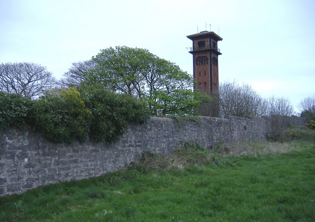
| Detached chimney at Cleadon Pumping Station (Cleadon Water Tower) | 1416041 | II* | 1862 | Cleadon Park | Cleadon |
| No. 1, Front Street | 1025250 | II | Cleadon & East Boldon | ||
| No. 100, Front Street | 1025219 | II | Cleadon & East Boldon | ||
| No. 11, Front Street | 1185314 | II | Cleadon & East Boldon | ||
| No. 3, Front Street | 1355080 | II | Cleadon & East Boldon | ||
| No. 36, Front Street | 1025215 | II | Cleadon & East Boldon | ||
| No. 5, Front Street | 1299739 | II | Cleadon & East Boldon | ||
| No. 64, Front Street | 1025217 | II | Cleadon & East Boldon | ||
| No. 7, Front Street | 1025251 | II | Cleadon & East Boldon | ||
| No. 94, Front Street | 1025218 | II | Cleadon & East Boldon | ||
| Boldon House and Wall to South of Nos 70 and 64 | 1355101 | II | Cleadon & East Boldon | ||
| Boldon Lodge | 1025214 | II | Cleadon & East Boldon | ||
| Boldon War Memorial | 1435093 | II | Cleadon & East Boldon | ||
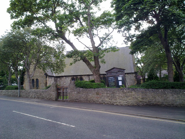
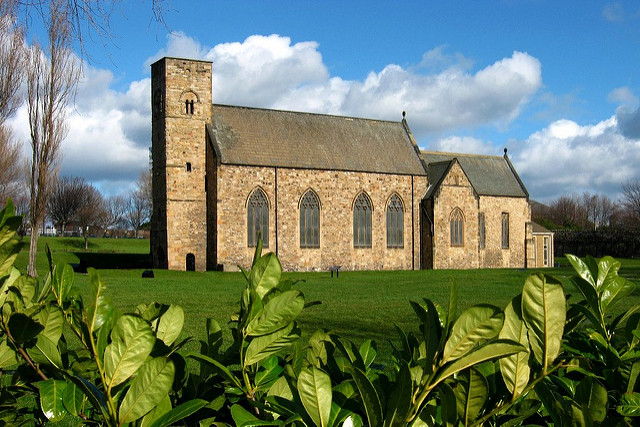
| Church of All Saints | 1025247 | II | 1869 | Cleadon & East Boldon | |
| Cleadon House | 1025212 | II* | Cleadon & East Boldon | ||
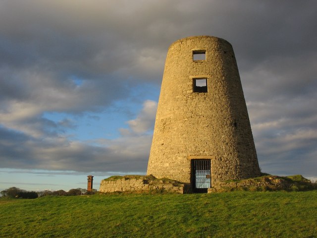
| Cleadon Mill and Surrounding Wall (Cleadon Windmill) | 1025192 | II | 1820s | Cleadon & East Boldon | Cleadon |
| Cleadon Tower | 1025211 | II | C18th | Cleadon & East Boldon | Cleadon. House, with tower. |
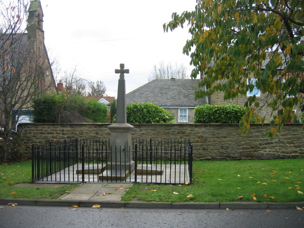
| Cleadon War Memorial | 1436752 | II | 1920 | Cleadon & East Boldon | Cleadon |
| Gas Lamp Opposite Entrance to Number 4 | 1262061 | II | Cleadon & East Boldon | ||
| Gas Lamp Opposite Entrance to Number 8 Cherry Tree | 1252872 | II | Cleadon & East Boldon | ||
| Gas Lamp to Rear of Number 6 | 1262062 | II | Cleadon & East Boldon | ||
| Gates and Gate Piers at North East Corner of Junction with Sunderland Road | 1025210 | II | Cleadon & East Boldon | ||
| Grotto in Cleadon Recreation Park | 1355067 | II | Cleadon & East Boldon | ||
| South Lodge | 1185760 | II | Cleadon & East Boldon | ||
| Undercliff | 1355077 | II | Cleadon & East Boldon | ||
| Wall Attached to Cleadon House; Gate Piers and Wall North of Cleadon House | 1025213 | II | Cleadon & East Boldon | ||
| Walls and Gate Piers at South East of Garden of No 70 (Boldon House) | 1025216 | II | Cleadon & East Boldon | ||
| Barn Ranges at Laverick Hall | 1185623 | II | Fellgate & Hedworth | ||
| Boldon Fellgate Farmhouse | 1025229 | II | C18th | Fellgate & Hedworth | Newcastle Road |
| Laverick Hall and Linked Outbuildings | 1025228 | II | Fellgate & Hedworth | ||
| Scots House | 1185728 | II* | Fellgate & Hedworth | ||
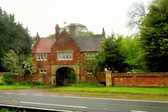
| Scots House Gatehouse, Walls, Gates and Gate Piers | 1355069 | II | c.1890 | Fellgate & Hedworth | Newcastle Road |
| Stables at Scots House | 1025230 | II | Fellgate & Hedworth | ||
| Boundary Wall Immediately to South of Church of St Peter, Fronting Sunderland Road and Turning Along | 1232560 | II | Harton | ||
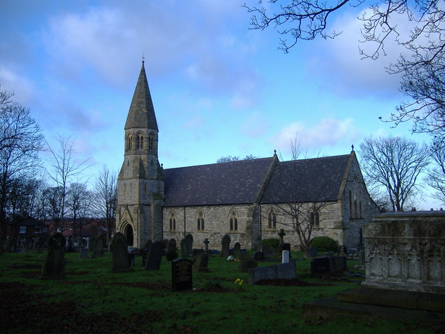
| Church of St Peter | 1232324 | II | 1867 | Harton | Harton |
| Church of St Aloysius | 1025193 | II | Hebburn North | ||
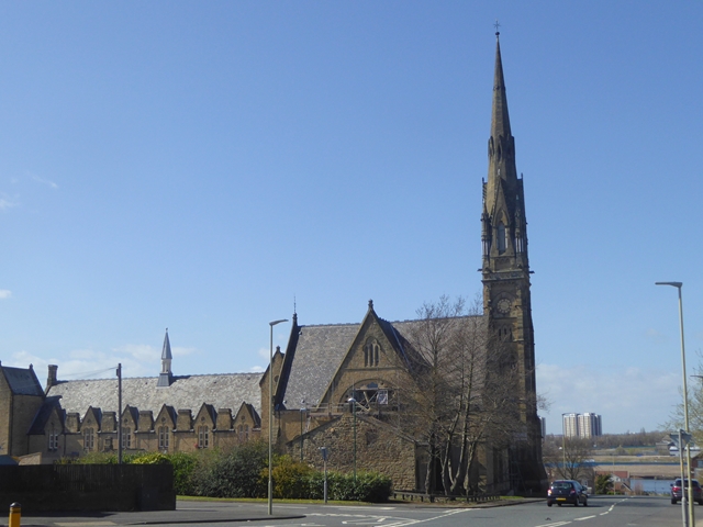
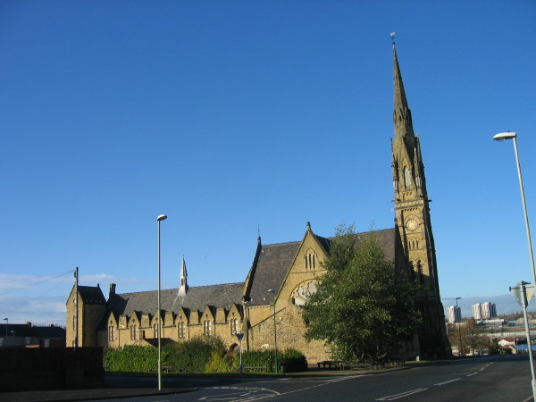
| St Andrews Centre (Wat Phra Dhammakaya) | 1025195 | II | 1872 | Hebburn North | Hebburn. Former church, Buddhist meditation centre |
| St Andrews Centre (former church hall) | 1299492 | II | 1872 | Hebburn North | Hebburn. Former church hall, Buddhist meditation centre |
| The Albert Public House | 1185776 | II | Hebburn North | ||
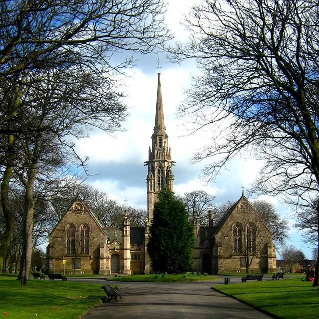
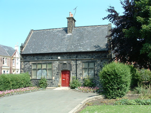
| Arch, Walls, Piers, Gates and Railings at Entrance to Hebburn Cemetery | 1025196 | II | Hebburn South | ||
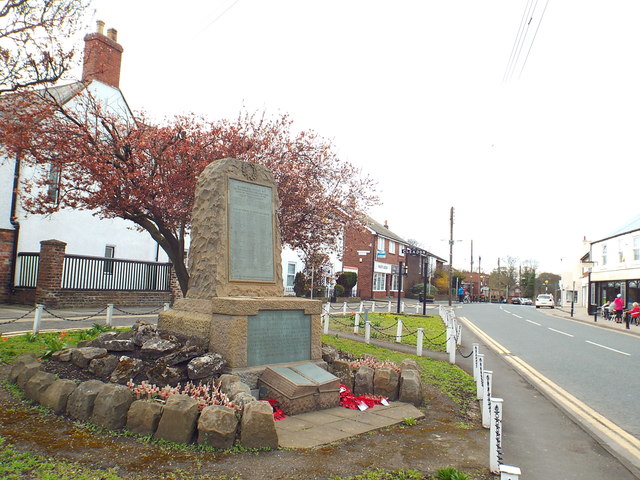
| Carr-Ellison Park First World War Memorial | 1438373 | II | 1920 | Hebburn South | Hebburn |
| Church of St John | 1185819 | II | Hebburn South | ||
| Entrance Lodge to Hebburn Cemetery | 1185857 | II | Hebburn South | ||
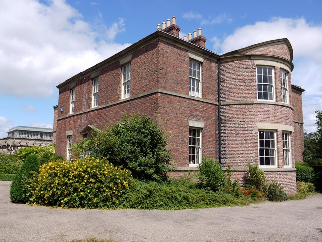
| Hebburn Hall | 1025194 | II | C18th | Hebburn South | Hebburn. 1819 alterations by John Dobson |
| Mortuary Gateway and Chapels in Hebburn Cemetery | 1185874 | II | Hebburn South | ||
| Trow Rock Floating Platform | 1232338 | II | Horsley Hill | ||
| Bede Cottage and Bede House and Attached Outbuilding | 1186029 | II* | C17th | Monkton | Monkton |
| Bedes Well North of the Grange | 1025201 | II | C18th? | Monkton | Monkton |
| Clubhouse in Jarrow Park | 1186032 | II | 1876 | Monkton | Jarrow |
| Monkton Farmhouse | 1355094 | II* | Monkton | ||
| Monkton Hall | 1299419 | II | Monkton | ||
| Monkton War Memorial | 1391715 | II | 1921 | Monkton | Monkton |
| Piers, Walls, Gates and Railings at Entrance to Jarrow Park | 1025202 | II | 1876 | Monkton | Jarrow |
| St Bedes Parochial Church Centre | 1268474 | II | Monkton | ||
| The Grange | 1355093 | II | Monkton | ||
| The Grange Farmhouse | 1299385 | II | Monkton | ||
| Walls Gateways and Gates South of the Grange | 1025200 | II | Monkton | ||
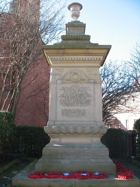
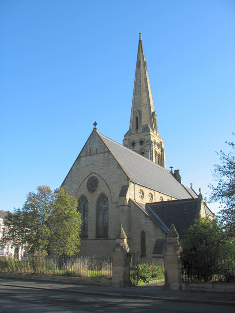
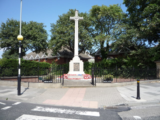
| Cenotaph North East of Christ Church Rectory | 1299481 | II | 1921 | Primrose | Jarrow |
| Christ Church | 1025199 | II | 1868 | Primrose | Jarrow |
| Church of St Bede | 1025197 | II | 1862 | Primrose | Jarrow, Chapel Road |
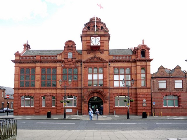
| Jarrow Town Hall | 1299416 | II | 1920 | Primrose | Jarrow |
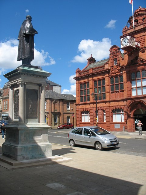
| Statue to Sir Charles Mark Palmer | 1355095 | II | 1903 | Primrose | Jarrow |
| Tyne Pedestrian and Cyclist Tunnel | 1380275 | II | 1951 | Primrose | Jarrow to Howdon |
| Church of St Simon | 1277137 | II | Simonside & Rekendyke | ||
| St Mary's War Memorial | 1440515 | II | Simonside & Rekendyke | ||
| Bandstand in West Park | 1277061 | II | West Park | ||
| Brinkburn Farmhouse | 1277482 | II | West Park | ||
| Nos. 1-7, Wood Terrace | 1232337 | II | Westoe | ||
| Nos. 34 and 38, Horsley Hill Road | 1277246 | II | Westoe | ||
| No. 5, Westoe Village | 1232328 | II | Westoe | ||
| No. 6, Westoe Village | 1232329 | II | Westoe | ||
| No. 7, Westoe Village | 1232330 | II | Westoe | ||
| Nos. 9 and 10, Westoe Village | 1232331 | II | Westoe | ||
| Briary | 1277140 | II | Westoe | ||
| Building in North East Corner of Garden to the White House, Westoe Village to West of No 34 Horsley | 1232149 | II | Westoe | ||
| Chapel House | 1232334 | II | Westoe | ||
| Chapels to Harton Cemetery | 1231987 | II | 1891 | Westoe | Harton |
| Church of St Michael | 1232581 | II | Westoe | ||
| Entrance Gates to Harton Cemetery | 1277329 | II | Westoe | ||
| Former Talbot Memorial House | 1277139 | II | Westoe | ||
| Garden Wall to South East of Southgarth West | 1246445 | II | Westoe | ||
| Ivy House | 1232336 | II | Westoe | ||
| Lodge to Harton Cemetery | 1277487 | II | Westoe | ||
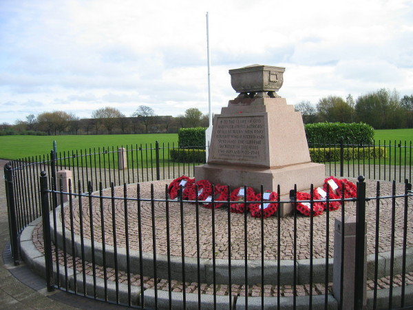
| South Shields War Memorial | 1434280 | II | 1926 | Westoe | Westoe |
| Southgarth (Former Medical Mission Sisters Convent) | 1277143 | II | Westoe | ||
| The Chase | 1277141 | II | Westoe | ||
| The White House | 1232333 | II | Westoe | ||
| Westoe Hall | 1232335 | II | Westoe | ||
| Westoe Terrace | 1277490 | II | Westoe | ||
| Westoe Village | 1277142 | II | Westoe | ||
| Westoe Villas | 1232834 | II | Westoe | ||
| No. 37, Front Street | 1185414 | II | Whitburn & Marsden | ||
| No. 44, Front Street | 1025223 | II | Whitburn & Marsden | ||
| Nos. 46, 46a, Front Street | 1355065 | II | Whitburn & Marsden | ||
| No. 54, Front Street | 1355066 | II | Whitburn & Marsden | ||
| East-West Wall 35 Metres South of Red Cottage and Linking Wall to House | 1025246 | II | Whitburn & Marsden | ||
| Gate Piers West of Whitburn Moors Farm | 1355071 | II | Whitburn & Marsden | ||
| Gates,gate Piers,steps and Garden Ornaments to South West of No 18 | 1355064 | II | Whitburn & Marsden | ||
| Hill Crest | 1185504 | II | Whitburn & Marsden | ||
| Hill House | 1025222 | II | Whitburn & Marsden | ||
| Ice House North of No 45 (No 1 the Limes) | 1025220 | II | Whitburn & Marsden | ||
| No 49 (The Lodge) and Wall and Railings to the South of No 49 | 1185469 | II | Whitburn & Marsden | ||
| No 52 (Olde House) and Coach House Adjoining to East | 1299633 | II | Whitburn & Marsden | ||
| Parish Church | 1025244 | II | Whitburn & Marsden | ||
| Seed House to South West of No18 | 1185529 | II | Whitburn & Marsden | ||
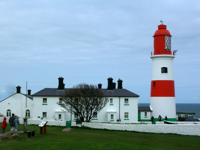
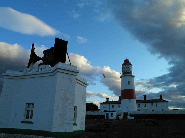
| Souter Point Lighthouse and Attached Buildings | 1185593 | II* | 1871 | Whitburn & Marsden | Lizard point, between Marsden & Whitburn |
| Souter Point Lighthouse Foghorn to East of Lighthouse and Steps and Walls to East of Lighthouse | 1355068 | II | 1871 | Whitburn & Marsden | Lizard point, between Marsden & Whitburn |
| Steps, Walls and Piers to South of No55 (Hill House) | 1299620 | II | Whitburn & Marsden | ||
| The Close | 1025245 | II | Whitburn & Marsden | ||
| The Limes | 1355062 | II | Whitburn & Marsden | ||
| The Rectory | 1025221 | II | Whitburn & Marsden | ||
| The Red Cottage | 1355076 | II | Whitburn & Marsden | ||
| Wall to North of No 47 Front Street (Whitburn House) | 1355063 | II | Whitburn & Marsden | ||
| Wall to West of No 48 (Whitehouse Farm) | 1025224 | II | Whitburn & Marsden | ||
| Walls Extending from Mill Lane Around the Lighthouse and Linked Buildings | 1185616 | II | Whitburn & Marsden | ||
| Whitburn House | 1185444 | II | Whitburn & Marsden | Whitburn | |
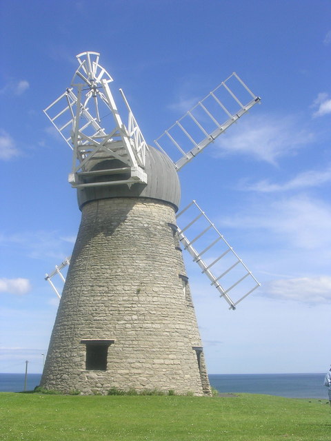
| Whitburn Mill (Whitburn Windmill) | 1355075 | II | C18th | Whitburn & Marsden | Whitburn |
| Whitburn War Memorial | 1442999 | II | 1921 | Whitburn & Marsden | Whitburn |
| Whitehouse Farm | 1185549 | II | Whitburn & Marsden | ||
| The Quadrant, Mill Dam | - | Local | South Shields | ||
| Mill Dam Jetty, Mill Dam | - | Local | South Shields | ||
| Middle Docks, Mill Dam | - | Local | South Shields | ||
| Chimney, former Cookson Glassworks, Harton Staithes | - | Local | South Shields | ||
| Merchant Navy Memorial, Mill Dam | - | Local | South Shields | ||
| Staithes House (includes wall), Mill Dam | - | Local | South Shields | ||
| The Waterfront PH, 9-11 (odds) Mill Dam | - | Local | South Shields | ||
| Dalton Lane Workshops, 2-6 Dalton Lane, Mill Dam | - | Local | South Shields | ||
| The Mission to Seafarers, Holborn House, 53 Mill Dam | - | Local | South Shields | ||
| Unity Hall, 71 Mill Dam | - | Local | South Shields | ||
| Painted Mural, Commercial Road | - | Local | South Shields | ||
| Ferry Landing | - | Local | South Shields | ||
| Harton Low Staithes | - | Local | South Shields | ||
| Nos. 29-33 (odds) King Street | - | Local | South Shields | ||
| Former Woolworth Building, King Street | - | Local | South Shields | ||
| Former Bridge Buffet, 30 King Street | - | Local | South Shields | ||
| National Westminster Bank, 40 King Street | - | Local | South Shields | ||
| Edinburgh Buildings, 20-24 (evens) King Street incorporating 1-4 Station Approach | - | Local | South Shields | ||
| Criterion PH, 2 Ocean Road | - | Local | South Shields | ||
| 4-8 (evens) Fowler Street | - | Local | South Shields | ||
| Mechanics Arms PH, East Street | - | Local | South Shields | ||
| Lambton Arms PH, East Street | - | Local | South Shields | ||
| Victorian Pillar Box, Market Place / King Street | - | Local | South Shields | ||
| No. 10, Mile End Road | - | Local | South Shields | ||
| Minchella's Cafe, 9-11 (odds) Ocean Road | - | Local | South Shields | ||
| Burton Menswear, 64 King Street | - | Local | South Shields | ||
| Man with the Donkey Statue, Ocean Road | - | Local | South Shields | ||
| Lion Statue, Ocean Road | - | Local | South Shields | ||
| Ship and Royal PH, 1 Ocean Road | - | Local | South Shields | ||
| Riddicks, 22 Fowler Street | - | Local | South Shields | ||
| HSBC Bank, 21 Fowler Street | - | Local | South Shields | ||
| The Dolly Peel, River Drive | - | Local | South Shields | ||
| Nos. 1-18 Greens Place, Mile End Road | - | Local | South Shields | ||
| Former Rennoldson‟s Shipyard Building, Wapping Street | - | Local | South Shields | ||
| North East Maritime Trust wooden workshops, Wapping Street | - | Local | South Shields | ||
| Fleet and Spirit of South Shields Artworks, Market Dock/Long Row | - | Local | South Shields | ||
| Bridge, River Drive | - | Local | South Shields | ||
| Pier Watchman's Office, South Pier | - | Local | South Shields | ||
| South Pier | - | Local | South Shields | ||
| WWI Slipway, adjacent to South Groyne | - | Local | South Shields | ||
| Conversation Piece Artwork, Harbour Drive | - | Local | South Shields | ||
| Pilots' Watch House, Lawe Road, Lawe Top | - | Local | South Shields | ||
| Westovian Theatre (Pier Pavilion Theatre), Pier Parade / Sea Road | - | Local | South Shields | ||
| Gandhi's Temple, bandstand and lavatories, Sea Road | - | Local | South Shields | ||
| Gypsies Green, South Foreshore | - | Local | South Shields | ||
| Victorian Pillar Box, Beach Road / St. Hilda Street, opposite South Shields Town Hall | - | Local | South Shields | ||
| Former South Shields Hebrew Congregation, 25 Beach Road | - | Local | South Shields | ||
| St. Paul and St John United Reform Church, Beach Road | - | Local | South Shields | ||
| St. Bede's RC Church and Vicarage, 10 Westoe Road | - | Local | South Shields | ||
| Railings, Westoe Road and Horsley Hill Road | - | Local | South Shields | ||
| Former Ingham Infirmary, Westoe Road | - | Local | South Shields | ||
| War Memorial, Horsley Hill Road, Westoe Village | - | Local | South Shields | ||
| Wyvestow Lodge, Sunderland Road, Westoe Village | - | Local | South Shields | ||
| Former South Tyneside College Planetarium, St George‟s Avenue | - | Local | South Shields | ||
| Robert Redhead Park, Sunderland Road | - | Local | South Shields | ||
| Crosses of Sacrifice, Harton Cemetery | - | Local | South Shields | ||
| Cyprus PH, 48 Chichester Road | - | Local | South Shields | ||
| Commercial Hotel, 115 West Holborn | - | Local | South Shields | ||
| Gas Holder, Oyston Street | - | Local | South Shields | ||
| Bethesda Free Church, Victoria Road | - | Local | South Shields | ||
| Al-Azhar Mosque, Laygate | - | Local | South Shields | ||
| Level Crossing, over West Holborn | - | Local | South Shields | ||
| Tyne Dock Gut AKA Readhead's Landing, next to McNulty's on Corstophine Town | - | Local | South Shields | ||
| Tyne Dock War Memorial, Readhead's Shipyard, Tyne Dock | - | Local | South Shields | ||
| Marsden Inn, Redwell Lane / Marsden Lane | - | Local | South Shields | ||
| Pill Box, Trow Point, Coast Road | - | Local | South Shields | ||
| RC Church of Holy Rosary, Horsley Hill Square | - | Local | South Shields | ||
| RC Church of St. Oswald, Gainsborough Avenue, Whiteleas | - | Local | South Shields | ||
| Tipping Point and Target Rock, Lizard Point | - | Local | South Shields | ||
| Pill Box, Marsden | - | Local | South Shields | ||
| The Grotto and associated Lift Shaft, Marsden Bay | - | Local | Marsden. Originally excavated in 1782 | ||
| White Horse, cliff face by Marsden Craggs / Quarry Lane | - | Local | South Shields | ||
| Heavy Anti-Aircraft Site, Lizard Farm, Lizard Lane | - | Local | See Scheduled Monument | ||
| War Memorial, South Eldon Street | - | Local | South Shields | ||
| Former Tyne Dock LNER station entrance and railway bridges, Hudson Street / Boldon Lane | - | Local | South Shields | ||
| Colliery Hotel PH, Boldon Lane / Stanley Street | - | Local | South Shields | ||
| All Saints Church, Boldon Lane, West Harton | - | Local | South Shields | ||
| Vigilant PH, 165 Sunderland Road | - | Local | South Shields | ||
| Brockley Whins Railway Bridge, off Masefield Drive | - | Local | South Shields | ||
| Masonic Hall, 2–6 (evens) Grange Road | - | Local | Jarrow | ||
| Balgownie House, 43 Bede Burn Road | - | Local | Jarrow | ||
| Park Methodist Church, Bede Burn Road | - | Local | Jarrow | ||
| St. Paul's Rectory, Borough Road | - | Local | Jarrow | ||
| Nos. 60-68 (evens) Ellison Street | - | Local | Jarrow | ||
| Jarrow Old Civic Hall, Ellison Street | - | Local | Jarrow | ||
| Palmer War Memorial, next to Palmer's Hospital | - | Local | Jarrow | ||
| Vikings, Grange Road | - | Local | Jarrow | ||
| Tyne Tunnel Ventilation Shaft, Chaytor Street | - | Local | Jarrow | ||
| Northumbria Probation Service, St. John's Terrace | - | Local | Jarrow | ||
| Police Station, Clervaux Terrace | - | Local | Jarrow | ||
| Victorian Pillar Box, Clervaux Terrace | - | Local | Jarrow | ||
| Burton Buildings, 47-55 (odds) Ormonde Street | - | Local | Jarrow | ||
| Ben Lomond PH, Grange Road West | - | Local | Jarrow | ||
| Northern Rock (original Water Co. office), Grange Road / Wylam Street | - | Local | Jarrow | ||
| Christ Church Rectory, Clayton Street | - | Local | Jarrow | ||
| Cross of Sacrifice, Jarrow Cemetery | - | Local | Jarrow | ||
| St. Bede‟s RC Primary School, Harold Street | - | Local | Jarrow | ||
| Railway Bridge, Monkton Terrace | - | Local | Jarrow | ||
| Longmore Memorial, Springwell Park, Springwell Road | - | Local | Jarrow | ||
| East Farm and Barns | - | Local | Monkton Village | ||
| Whites Cottages | - | Local | Monkton Village | ||
| Field Depressions, Monkton Fell | - | Local | Monkton | ||
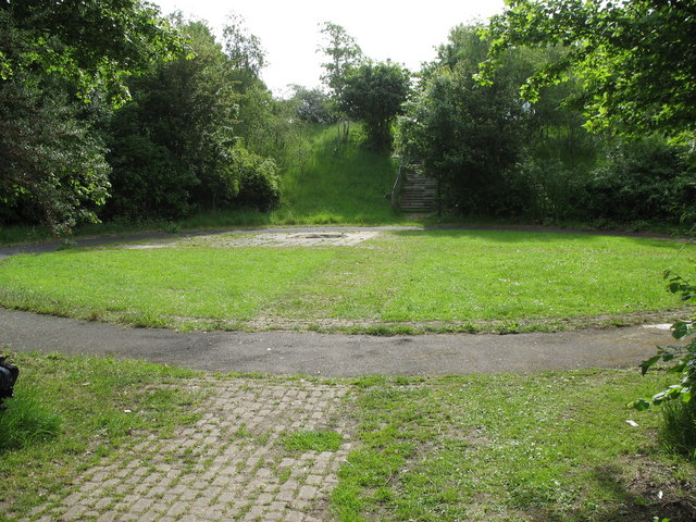
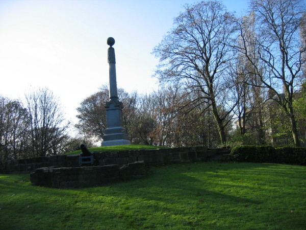
| Boer War Memorial, Carr Ellison Park | - | Local | 1905 | Hebburn | |
| Cross of Sacrifice, Hebburn Cemetery, Victoria Road West | - | Local | Hebburn | ||
| Hedley Sunday School, Argyle Street | - | Local | Hebburn | ||
| St. Cuthbert's Church, Argyle Street | - | Local | Hebburn | ||
| Victoria House, 7-9 (odds) Prince Consort Road | - | Local | Hebburn | ||
| The Eco Centre and Wind Turbine, Windmill Way | - | Local | Hebburn | ||
| Hebburn / Jarrow Staithes, Wagonway Industrial Estate | - | Local | Hebburn | ||
| St. Oswald's Church, St. Oswald's Road | - | Local | Hebburn | ||
| Crown Hotel PH, 68 Hedworth Lane | - | Local | Boldon Colliery | ||
| Drinking Fountain, Hubert Lane / Cotswold Lane | - | Local | Boldon Colliery | ||
| Boldon Palace Cinema, North Road | - | Local | Boldon Colliery | ||
| Quadrus Centre, Woodstock Way | - | Local | Boldon Colliery | ||
| Nos. 2-12 (evens) Lorne Terrace, Lorne House (No.14), Front Street | - | Local | East Boldon | ||
| Nos. 30-34 (evens) Front Street | - | Local | East Boldon | ||
| Mansion House Farm, 62 Front Street | - | Local | East Boldon | ||
| Nos. 86-92 (evens) and 96 Front Street | - | Local | East Boldon | ||
| Shadwell Towers, Western Terrace | - | Local | East Boldon | ||
| Grey Horse Public House, Front Street | - | Local | East Boldon | ||
| Black Bull Public House, 98 Front Street | - | Local | East Boldon | ||
| Boundary Wall, West of 57a Front Street | - | Local | East Boldon | ||
| Boldon Golf Club, Dipe Lane | - | Local | East Boldon | ||
| Field Depressions, Mundles Farm, Mundles Lane | - | Local | East Boldon | ||
| Mixed Board School, Front Street | - | Local | East Boldon | ||
| Boldon United Reform Church, Front Street | - | Local | East Boldon | ||
| No. 23 North Road | - | Local | East Boldon | ||
| War Memorial, Front Street | - | Local | East Boldon | ||
| No. 49 Front Street | - | Local | East Boldon | ||
| Anti-Aircraft Supply Depot (former MOD bunkers and medical stores) | - | Local | East Boldon | ||
| Field Depressions, Boldon Flats | - | Local | East Boldon | ||
| St. George's Church, Front Street | - | Local | East Boldon | ||
| Grange Terrace | - | Local | East Boldon | ||
| No. 21 North Road | - | Local | East Boldon | ||
| No. 1 Gordon Drive | - | Local | East Boldon | ||
| West Boldon Cemetery Buildings (includes gateway), Dipe Lane | - | Local | West Boldon | ||
| Wall and Railings, Mansion House, Harton View | - | Local | West Boldon | ||
| Sandfield, Downhill View, Downhill Lane | - | Local | West Boldon | ||
| Boundary Wall to Rectory Green, Rectory Green | - | Local | West Boldon | ||
| Mount Pleasant Farm, Newcastle Road | - | Local | West Boldon | ||
| Victorian Post Box, Dipe Lane | - | Local | West Boldon | ||
| Hall Green Farm, Dipe Lane | - | Local | West Boldon | ||
| Heavy Anti-Aircraft Battery, Red Barns Farm | - | Local | Fellgate | ||
| West Fellgate Farm (includes West Fellgate Cottage) | - | Local | C19th | Fellgate | |
| East Farm and Boundary Walls, 1 Cleadon Lane / Sunniside Lane | - | Local | Cleadon | ||
| Boundary Walls, 2 North Drive | - | Local | Cleadon | ||
| West Hall Farm (includes gateposts and farm buildings) Cleadon Lane | - | Local | Cleadon | ||
| Peacock Lodge, Cleadon Lane | - | Local | Cleadon | ||
| Cleadon Village Pond | - | Local | Cleadon | ||
| Cleadon Recreation Area | - | Local | Cleadon | ||
| Guidepost, opposite Foxton Court | - | Local | Cleadon | ||
| Ridge and Furrow, East Farm | - | Local | Cleadon | ||
| Covered Reservoir, Cleadon Pumping Station | - | Local | Cleadon | ||
| Pill Box, Cleadon Hills | - | Local | Cleadon | ||
| Ridge and Furrow, Cleadon Hills Farm | - | Local | Cleadon | ||
| Cleadon Infants School, Sunderland Road | - | Local | Cleadon | ||
| Church Hall, Sunderland Road | - | Local | Cleadon | ||
| The Vicarage, Sunderland Road | - | Local | Cleadon | ||
| Greenlands, 2 Boldon Lane | - | Local | Cleadon | ||
| Cardrona House, 19 Underhill Road | - | Local | Cleadon | ||
| Ardmore, 45 Whitburn Road | - | Local | Cleadon | ||
| Whitburn Methodist Church, North Guards | - | Local | Whitburn | ||
| Whitburn Parish Hall, Sandy Chare and Boundary Walls | - | Local | Whitburn | ||
| Whitburn Hall Lodge, 18 Front Street | - | Local | Whitburn | ||
| No. 20 Front Street | - | Local | Whitburn | ||
| Boundary Walls and Gateways, former Whitburn Hall, Front Street / Church Lane | - | Local | Whitburn | ||
| Coach House to former Whitburn Hall, Front Street | - | Local | Whitburn | ||
| Boundary Wall, The Close, Church Lane | - | Local | Whitburn | ||
| Boundary Wall, The Lawns, East Street | - | Local | Whitburn | ||
| West Well, The Green | - | Local | Whitburn | ||
| Boundary Wall, Orchard Gardens, Front Street | - | Local | Whitburn | ||
| Front Boundary Wall, Gates and Piers, 39 Front Street | - | Local | Whitburn | ||
| Front Wall, Railings, Lych Gate and Rear Boundary Walls, Parish Church, Church Lane | - | Local | Whitburn | ||
| Nos. 5-17 (odds) Front Street | - | Local | Whitburn | ||
| Nos. 19-31 (odds) Front Street and 35 Front Street | - | Local | Whitburn | ||
| Village Pond, Cleadon Lane / North Guards | - | Local | Whitburn | ||
| Nos. 1, 3, 5 North Guards | - | Local | Whitburn | ||
| Nos. 36-40 (evens) Front Street | - | Local | Whitburn | ||
| Drinking Fountain, Front Street | - | Local | Whitburn | ||
| Gate, Piers and Boundary Wall, North Guards / Sandy Chare | - | Local | Whitburn | ||
| Grey Horse PH, North Guards | - | Local | Whitburn | ||
| Glebe Farm Barns, Glebe Farm, Moor Lane | - | Local | Whitburn | ||
| Fern, Hope and Ivy Cottages, North Guards | - | Local | Whitburn | ||
| The Village Pound (Pinfold), Moor Lane | - | Local | Whitburn | ||
| Churchyard, Church Lane | - | Local | Whitburn | ||
| Recreation Ground, Cleadon Lane | - | Local | Whitburn | ||
| Whitburn Rifle Ranges | - | Local | Whitburn | ||
| Pillbox, East Street | - | Local | Whitburn | ||
| Bombing Decoy Site Control Shelter, Wellands Farm, Wellands Lane | - | Local | Whitburn | ||
| Village Green | - | Local | Whitburn |
1. Primary source: the National Heritage List for England - NHLE is the register of nationally protected historic buildings and sites in England, including listed buildings, scheduled monuments, protected wrecks, registered parks and gardens, and battlefields. The list is maintained by Historic England. Check NHLE for updates and new entries.
Secondary sources: British Listed Buildings and Sitelines.
2. South Tyneside's Local List - South Tyneside Council (see also the South Tyneside Local Development Framework). Check South Tyneside Council for updates and new entries. Additional details from Sitelines.
Co-Curate Page
Arbeia - Roman Fort
- Overview About Arbeia Map Street View The fort stood on the Lawe Top in South Shields, overlooking the River Tyne. It was built around 120 AD, guarded the main sea …
Co-Curate Page
St Paul's Monastery
- Overview History of Monkwearmouth–Jarrow The remains of St Paul's standing today are from the medieval monastery, but part of the Anglo-Saxon monastery survives today as the chancel of St Paul's …

Co-Curate Page
Hebburn Hall
- Overview About Hebburn Hall Map Hebburn Hall (aslo known as Ellison Hall) is a 17th century manor house in Hebburn, largely rebuilt in 1790-1792.[1] It was built on the site …
Co-Curate Page
Whitburn Windmill
- Overview Map Street View Whitburn windmill was built in the 18th century and is Grade II listed on the National Heritage List for England. The windmill was restored by South Tyneside …
Co-Curate Page
Bede Cottage
- Overview Map Street View Bede Cottage and Bede House are adjoining houses located on Monkton Lane in Monkton. They date from the early or mid 17th century and are Grade …
Co-Curate Page
Tyne Pedestrian and Cyclist Tunnels
- Overview About the Tunnels The Tyne Pedestrian and Cyclist Tunnels were opened to the people of Tyneside on 24th July 1951. These two purpose-built tunnels were designed to connect Howdon …
Co-Curate Page
Cenotaph
- Overview Map Street View The Cenotaph in Jarrow is located outside Palmer Community Hospital, just off Station Street. The memorial was commissioned by the Palmer Shipbuilding and Iron Co. (1,543 …
Co-Curate Page
Jarrow Town Hall
- Overview Map Street View Jarrow Town Hall and municipal buildings on Grange Road in Jarrow, were built in 1902. The red brick, baroque-style building was designed by Fred Rennoldson of …
Co-Curate Page
Charles Palmer Statue
- The statue was designed by Albert Arthur Toft and unveiled in 1903 by Lady Palmer. The statue pays tribute to Sir Charles Mark Palmer, the first Mayor of Jarrow, and …
Co-Curate Page
Chapels to Harton Cemetery
- The twin chapels to Harton Cemetery were built from 1888-1891. Designed by architect Henry Grieves, the chapels are now Grade II listed.
Co-Curate Page
Whitburn Methodist Church
- Overview Map Street View Whitburn Methodist Church is located on North Guards in Whitburn. It was built in 1881 to replace an earlier Wesleyan Chapel of 1812.[1] A tapered octagonal tower …
Co-Curate Page
Wat Phra Dhammakaya
- Overview Map Street View Former Church of St Andrew in Hebburn, now a Buddhist meditation centre. The church was originally built in 1872 paid for by Andrew Leslie, whose shipbuilding firm …
Co-Curate Page
St Andrew's Church Hall
- Formerly St Andrew's Church Hall, Hebburn, built c.1872. Later became St. Andrew's Centre, a community centre and school. It is located next to the former Church of St Andrew; now …
Co-Curate Page
Souter Lighthouse
- Overview About Souter Lighthouse Map Street View Souter Lighthouse is located on Lizard point on the South Tyneside coast, between Marsden and Whitburn. It was built in 1871 by Sir …
Co-Curate Page
Lime Kilns, Marsden
- Overview Map Street View Marsden Lime Kilns are located off the Coast Road near Marsden Quarry in South Shields. The massive battery of 15 lime kilns were built in the …
Co-Curate Page
All Saints Church, Cleadon
- "Originally the village of Cleadon formed part of the parish of Whitburn (it’s larger neighbour to the east at the coast). In the mid nineteenth century Cleadon had started to …
Co-Curate Page
Marine Park
- Overview Map Street View Aerial View North Marine Park, South Marine Park, and Bents Park are 3 adjacent parks in South Shields. They were developed in the late 19th and …
Co-Curate Page
Church of St Peter, Harton
- Overview Map Street View St Peter's is the parish church of Harton, in Sunderland. The church was built 1866-1867, designed in an Early English style by C Hodgson Fowler.[1] Harton …
Co-Curate Page
Customs House
- Overview About the Customs House Map Street View The Customs House in Mill Dam, South Shields, was built from 1863 to 1864, by T.H. Clemence, architect and borough engineer. The …
Co-Curate Page
Cleadon Water Tower
- Overview Detail Map Street View Cleadon Water Tower is a prominent landmark based on the Cleadon Hills. The chimney was for a Victorian steam-powered pumping station, built 1860 to 1862 …
Co-Curate Page
Cleadon Windmill
- Overview Detail The ruined windmill is located on the highest part of Cleadon Hills, built the 1820s. The mill was severely damaged in a storm during the 1870s. Interestingly it …
Co-Curate Page
Jarrow Hall
- Jarrow Hall was built in 1785 for Simon Temple, a local mining and ship building industrialist. The Hall is now a museum, and part of Jarrow Hall - Anglo Saxon …
Co-Curate Page
Old Town Hall
- Overview Map Street View The Old Town Hall in South Shields was built in 1768 by the Dean and Chapter of Durham as the centrepiece of the new Market Place (c.1767) …
Co-Curate Page
South Shields War Memorial
- Overview Map Street View South Shields War Memorial is located by the junction of Horsley Hill Road and Westoe Road in Westoe, South Shields. It was commissioned by South Shields War …
Co-Curate Page
Boer War Memorial, Carr Ellison Park
- A memorial to seven local men men who were killed in the Boer War of 1899-1902 was built on a mound adjacent to the Dell in Carr Ellison Park, Hebburn. …

Co-Curate Page
Church of St Paul
- Overview Map Street View Inside St Paul's Church is located on Church Bank in Jarrow. The Parish Church, formerly two separate churches, was part of the monastery of St Paul, …
Co-Curate Page
St Peter's Church, Monkwearmouth
- Overview About St Peter's Church Map Street View St Peter's Church, Monkwearmouth is the parish church of Monkwearmouth in Sunderland, Tyne and Wear, England. It is one of three …
Co-Curate Page
Foghorn, Souter Lighthouse
- Overview About the Foghorn Map Street View There is an engine house with a foghorn at Souter Lighthouse. It was originally built in 1871 by Sir James Douglas for Trinity …
Co-Curate Page
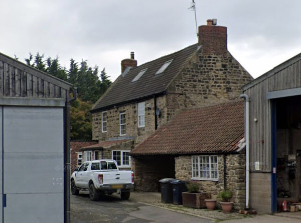
West Fellgate Farm
- Overview Map Street View West Fellgate Farm is located off Leam Lane, Fellgate, in South Tyneside. The farm building dates from the 19th century. The farmhouse and West Fellgate Cottage …
Co-Curate Page
Scot's House Gatehouse, Newcastle Road
- Overview Map Street View Scot's House Gatehouse is located off Newcastle Road (A184), near West Boldon. The lodge was built in c.1890 for H.L. Pattinson, chemical manufacturer. Scots House Gatehouse, …

Co-Curate Page
Boldon Fellgate Farm
- Overview Map Street View Boldon Fellgate Farm is located by Newcastle Road (A184), near West Boldon. The farmhouse dates from the late 18th or early 19th century. The farmhouse is …
Co-Curate Page
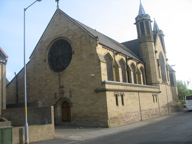
St Bede's RC Church, Jarrow
- Overview Map Street View St Bede's Church, located on Chapel Road in Jarrow, is a Roman Catholic parish church. It was built 1860-1862, with additions in 1883, built by J. …
Co-Curate Page
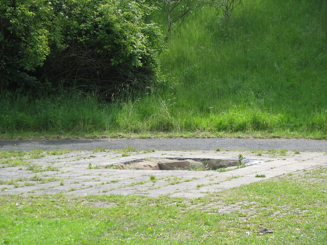
Bede's Well
- This former well is located north of The Grange in Monkton. Local tradition associates the well with the Venerable Bede. The well was described in Brand's History of Newcastle (1789). …
Co-Curate Page
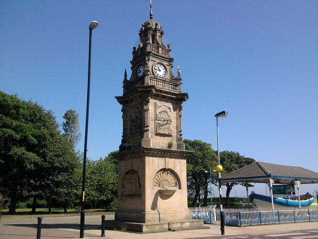
Jubilee Memorial, South Shields
- West face carries a medallion portrait of William Wouldhave, the east face one of Henry Greathead. Wouldhave and Greathead are the disputed inventors of the modern first self-righting lifeboat. The …
Co-Curate Page
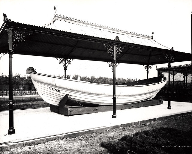
Lifeboat, Ocean Road, South Shields
- The "Tyne" lifeboat was built in South Shields by J. Oliver in 1833, and was one of the earliest, purpose-built lifeboats. The Tyne served for over six decades, and her …

Co-Curate Page
Arbeia - Roman Fort
- Overview About Arbeia Map Street View The fort stood on the Lawe Top in South Shields, overlooking the River Tyne. It was built around 120 AD, guarded the main sea …
Co-Curate Page
St Paul's Monastery
- Overview History of Monkwearmouth–Jarrow The remains of St Paul's standing today are from the medieval monastery, but part of the Anglo-Saxon monastery survives today as the chancel of St Paul's …
Co-Curate Page
Hebburn Hall
- Overview About Hebburn Hall Map Hebburn Hall (aslo known as Ellison Hall) is a 17th century manor house in Hebburn, largely rebuilt in 1790-1792.[1] It was built on the site …
Co-Curate Page
Whitburn Windmill
- Overview Map Street View Whitburn windmill was built in the 18th century and is Grade II listed on the National Heritage List for England. The windmill was restored by South Tyneside …
Co-Curate Page
Bede Cottage
- Overview Map Street View Bede Cottage and Bede House are adjoining houses located on Monkton Lane in Monkton. They date from the early or mid 17th century and are Grade …
Co-Curate Page
Tyne Pedestrian and Cyclist Tunnels
- Overview About the Tunnels The Tyne Pedestrian and Cyclist Tunnels were opened to the people of Tyneside on 24th July 1951. These two purpose-built tunnels were designed to connect Howdon …
Co-Curate Page
Cenotaph
- Overview Map Street View The Cenotaph in Jarrow is located outside Palmer Community Hospital, just off Station Street. The memorial was commissioned by the Palmer Shipbuilding and Iron Co. (1,543 …
Co-Curate Page
Jarrow Town Hall
- Overview Map Street View Jarrow Town Hall and municipal buildings on Grange Road in Jarrow, were built in 1902. The red brick, baroque-style building was designed by Fred Rennoldson of …
Co-Curate Page
Charles Palmer Statue
- The statue was designed by Albert Arthur Toft and unveiled in 1903 by Lady Palmer. The statue pays tribute to Sir Charles Mark Palmer, the first Mayor of Jarrow, and …
Co-Curate Page
Chapels to Harton Cemetery
- The twin chapels to Harton Cemetery were built from 1888-1891. Designed by architect Henry Grieves, the chapels are now Grade II listed.
Co-Curate Page
Whitburn Methodist Church
- Overview Map Street View Whitburn Methodist Church is located on North Guards in Whitburn. It was built in 1881 to replace an earlier Wesleyan Chapel of 1812.[1] A tapered octagonal tower …
Co-Curate Page
Wat Phra Dhammakaya
- Overview Map Street View Former Church of St Andrew in Hebburn, now a Buddhist meditation centre. The church was originally built in 1872 paid for by Andrew Leslie, whose shipbuilding firm …
Co-Curate Page
St Andrew's Church Hall
- Formerly St Andrew's Church Hall, Hebburn, built c.1872. Later became St. Andrew's Centre, a community centre and school. It is located next to the former Church of St Andrew; now …
Co-Curate Page
Souter Lighthouse
- Overview About Souter Lighthouse Map Street View Souter Lighthouse is located on Lizard point on the South Tyneside coast, between Marsden and Whitburn. It was built in 1871 by Sir …
Co-Curate Page
Lime Kilns, Marsden
- Overview Map Street View Marsden Lime Kilns are located off the Coast Road near Marsden Quarry in South Shields. The massive battery of 15 lime kilns were built in the …
Co-Curate Page
All Saints Church, Cleadon
- "Originally the village of Cleadon formed part of the parish of Whitburn (it’s larger neighbour to the east at the coast). In the mid nineteenth century Cleadon had started to …
Co-Curate Page
Marine Park
- Overview Map Street View Aerial View North Marine Park, South Marine Park, and Bents Park are 3 adjacent parks in South Shields. They were developed in the late 19th and …
Co-Curate Page
Church of St Peter, Harton
- Overview Map Street View St Peter's is the parish church of Harton, in Sunderland. The church was built 1866-1867, designed in an Early English style by C Hodgson Fowler.[1] Harton …
Co-Curate Page
Customs House
- Overview About the Customs House Map Street View The Customs House in Mill Dam, South Shields, was built from 1863 to 1864, by T.H. Clemence, architect and borough engineer. The …
Co-Curate Page
Cleadon Water Tower
- Overview Detail Map Street View Cleadon Water Tower is a prominent landmark based on the Cleadon Hills. The chimney was for a Victorian steam-powered pumping station, built 1860 to 1862 …
Co-Curate Page
Cleadon Windmill
- Overview Detail The ruined windmill is located on the highest part of Cleadon Hills, built the 1820s. The mill was severely damaged in a storm during the 1870s. Interestingly it …
Co-Curate Page
Jarrow Hall
- Jarrow Hall was built in 1785 for Simon Temple, a local mining and ship building industrialist. The Hall is now a museum, and part of Jarrow Hall - Anglo Saxon …
Co-Curate Page
Old Town Hall
- Overview Map Street View The Old Town Hall in South Shields was built in 1768 by the Dean and Chapter of Durham as the centrepiece of the new Market Place (c.1767) …
Co-Curate Page
South Shields War Memorial
- Overview Map Street View South Shields War Memorial is located by the junction of Horsley Hill Road and Westoe Road in Westoe, South Shields. It was commissioned by South Shields War …
Co-Curate Page
Boer War Memorial, Carr Ellison Park
- A memorial to seven local men men who were killed in the Boer War of 1899-1902 was built on a mound adjacent to the Dell in Carr Ellison Park, Hebburn. …
Co-Curate Page
Church of St Paul
- Overview Map Street View Inside St Paul's Church is located on Church Bank in Jarrow. The Parish Church, formerly two separate churches, was part of the monastery of St Paul, …
Co-Curate Page
St Peter's Church, Monkwearmouth
- Overview About St Peter's Church Map Street View St Peter's Church, Monkwearmouth is the parish church of Monkwearmouth in Sunderland, Tyne and Wear, England. It is one of three …
Co-Curate Page
Foghorn, Souter Lighthouse
- Overview About the Foghorn Map Street View There is an engine house with a foghorn at Souter Lighthouse. It was originally built in 1871 by Sir James Douglas for Trinity …
Co-Curate Page
West Fellgate Farm
- Overview Map Street View West Fellgate Farm is located off Leam Lane, Fellgate, in South Tyneside. The farm building dates from the 19th century. The farmhouse and West Fellgate Cottage …
Co-Curate Page
Scot's House Gatehouse, Newcastle Road
- Overview Map Street View Scot's House Gatehouse is located off Newcastle Road (A184), near West Boldon. The lodge was built in c.1890 for H.L. Pattinson, chemical manufacturer. Scots House Gatehouse, …
Co-Curate Page
Boldon Fellgate Farm
- Overview Map Street View Boldon Fellgate Farm is located by Newcastle Road (A184), near West Boldon. The farmhouse dates from the late 18th or early 19th century. The farmhouse is …
Co-Curate Page
St Bede's RC Church, Jarrow
- Overview Map Street View St Bede's Church, located on Chapel Road in Jarrow, is a Roman Catholic parish church. It was built 1860-1862, with additions in 1883, built by J. …
Co-Curate Page
Bede's Well
- This former well is located north of The Grange in Monkton. Local tradition associates the well with the Venerable Bede. The well was described in Brand's History of Newcastle (1789). …
Co-Curate Page
Jubilee Memorial, South Shields
- West face carries a medallion portrait of William Wouldhave, the east face one of Henry Greathead. Wouldhave and Greathead are the disputed inventors of the modern first self-righting lifeboat. The …

")


