Topics > Historical Periods > Roman Period (43 to 409 AD) > Dere Street
Dere Street
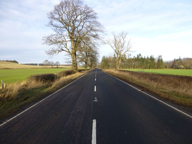
Dere Street or Deere Street is a modern designation of a Roman road which ran north from Eboracum (York), crossing Stanegate at Corbridge (Hadrian's Wall was crossed at the Portgate, just to the north) and continuing beyond into what is now Scotland, later at least as far as the Antonine Wall. Portions of its route are still followed by modern roads, including the A1 (south of the River Tees) and the A68 north of Corbridge.
Name
The Roman name for the route is lost. Its English name corresponds with the post-Roman Anglo-Saxon kingdom of Deira, through which the first part of its route lies. That kingdom possibly took its name from the Yorkshire River Derwent. The term "street" derives from its Old English sense (from via strata), which referred to any paved road and had no particular association with urban thoroughfares.
Portions of the road in Scotland were later known as St Cuthbert's Way and as the Royal Way (Via Regia).
"Watling Street"
The Roman equivalent of Watling Street, the Antonine Itinerary's 2nd British route, shared Dere Street's trunk road between Eboracum and Cataractonium (Catterick) before branching off to the northwest to communicate with Luguvalium (Carlisle). Owing to this, some stretches or the entirety of Dere Street is sometimes referenced as "Watling Street". It should not, however, be confused with the traditional route between Canterbury and Wroxeter in the south nor with the Carlisle route to its west.
Roman route
As far as Hadrian's Wall Dere Street roughly corresponds to the Antonine Itinerary's 1st British route, which however began further south than York and ended at the Wall:
As the text implies, the road served to allow the legion garrisoned in York quick access to the eastern borderlands and, later, the eastern posts on Hadrian's Wall. The Itinerary's 2nd and 5th British routes—which split off to reach the western territories—share the stations between Eboracum and Cataractonium. The forts along the roads were manned by infantry cohorts and cavalry alae of the Roman army's auxiliaries.
Margary notes that the last entry is probably in error and should be emended to 10 Roman miles.
Modern route
The modern route omits the now-lost road south of York but continues farther north along Roman roads either omitted by the compiler of the Antonine Itineraries or constructed after his time.
The route begins at York and crosses the River Ure near Aldborough close to Boroughbridge. It crosses the Swale near Catterick. (The ruins of Cataractonium lie just north of Catterick at Scotch Corner.) The A66 road preserves the route of the Roman-era Watling Street, branching off here to cross Stainmore to Penrith and Carlisle at the western end of Hadrian's Wall.
Dere Street crossed the River Tees over a stone arch bridge near the present-day Piercebridge Roman Fort ruins. Such bridges were rare in Roman Britain except for here in the far north. The original bridge was replaced by one on a different alignment. There is evidence of other minor realignments of Dere Street over the Roman period. In 1994, construction of a garage at Cliffe exposed a section of the Roman road and discovered pottery and tile from the period. Selkirk suggested that the ruins on the south side of the Tees at Cliffe are the remains of a jetty; the archaeological television programme Time Team investigated this in 2009.
The next river crossing occurred over the Wear near present-day Bishop Auckland. At this point, the fort Vinovia guarded a branch road that turned off to the right heading for Durham, Chester-le-Street, and Newcastle. There, the Pons Aelius crossed the River Tyne.
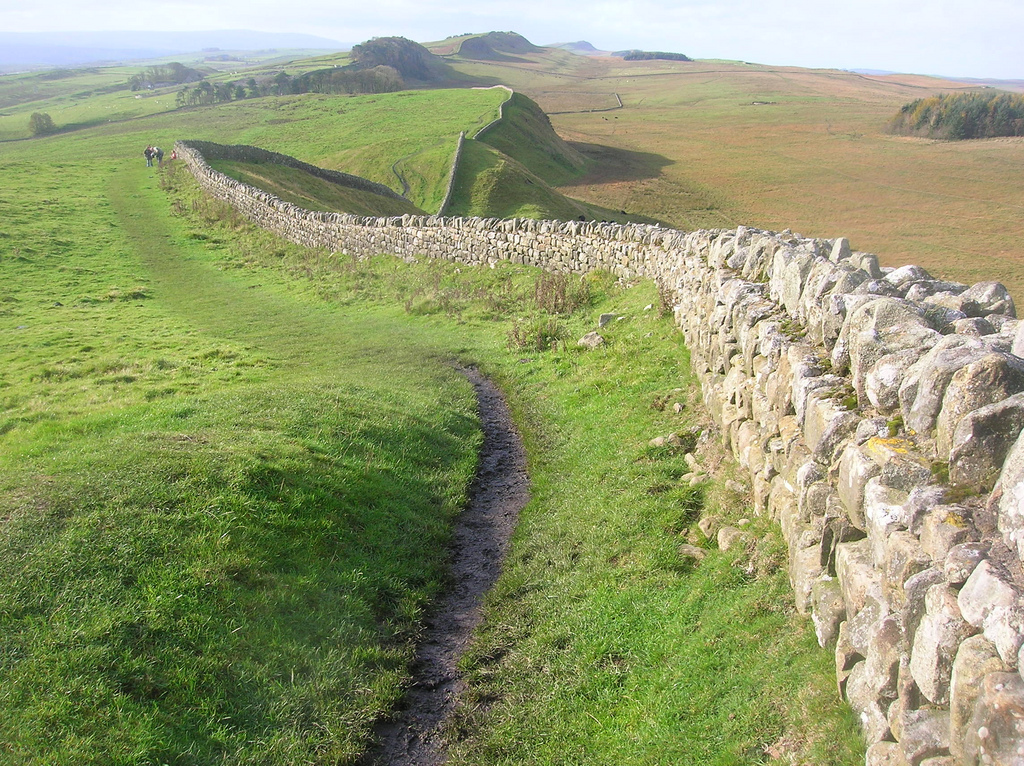
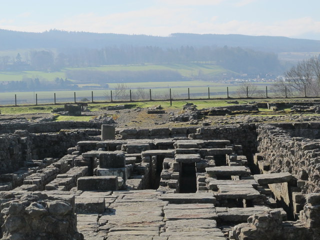
Dere Street, meanwhile, travels onward past Lanchester and Ebchester, the sites of the former forts of Longovicium and Vindomora. At Coria (modern Corbridge), it met the Stanegate road which runs parallel to Hadrian's Wall. Stanegate and Dere Street were originally the same width (roughly ) but the depth of metalling on Stanegate— against Dere Street's —argues for a greater frequency of resurfacing and for greater or heavier traffic. Crossing at Corbridge, the route passed though Portgate on the Wall and passed into lands only tenuously claimed by Rome.
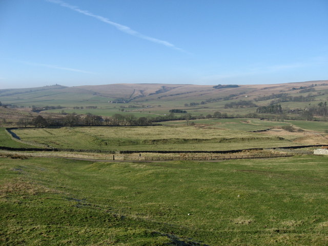
The route passes north into Redesdale and thence into the Cheviot Hills, where there are the remains of marching forts at Fourlaws, West Woodburn (Habitancum), Rochester (Bremenium), and at Chew Green. Brementium was the last stop listed for Antonine Itinerary, but the Roman road's remains now lead further, past the present Anglo-Scottish border at Carter Fell near the present A68 road. Nearby, there are the remains of a camp at Pennymuir. Further on, well-preserved sections of the road form part of St Cuthbert's Way to Trimontium near Melrose. There, the route crosses the Tweed and follows the Leader Water to the foot of the Lammermuirs, where there is evidence of Roman forts near Oxton. Another well-preserved section rises through the Lammermuirs over Soutra Hill and on to Edinburgh, where Din Eidyn was a stronghold for the British Votadini tribe. Nearby, the Romans held garrisons at Cramond and Inveresk at the eastern end of the Antonine Wall.
History
During the High Middle Ages, the section of the route between Jedburgh and Edinburgh was known as the Royal Way (Via Regia). It connected the larger part of Scotland with the important ecclesiastic sites of the Scottish Borders. King Malcolm IV established his Church and Hospital of the Holy Trinity halfway along this section to provide succour for the many pilgrims using it.
After the destruction of the Border Abbeys during the "Rough Wooing" of Mary, Queen of Scots, by the Earl of Hertford's forces and during the Reformation of the Scottish Church, the route fell into disuse and disrepair. It was used mainly for driving livestock and occasional travellers daring enough to venture into the lawless border region.
Dere Street continued in use between Durham and York in medieval times. Being limited by daylight, "about thirty miles in a day in winter on horseback and between thirty-six and forty in summer was what a man could do." Tough, vigorous men could walk from Darlington to York, and it was said that the quality of a horse could make the difference between a possible thirty and fifty miles per day. A wish to hear mass or the organisation of a train by the rich could shorten the travelling day to twenty miles. Roads were described as so muddy and difficult between November and February that to finish the journey by daylight one could barely stop to eat; however a "royal highway" or alta via regia strata was passable in winter between York and Durham, and this could have been Dere Street. Heavy packhorse loads were taken on the route, for example of wool. Clerics, traders and the nobility were more likely to travel than others, and some people rarely travelled at all. Travelling in style involved the use of carts for luggage, but carts bogged down in winter mud, so traders with packhorses travelled more easily in winter than the rich.
Visit the page: Dere Street for references and further details. You can contribute to this article on Wikipedia.
from https://commons.wikimedia.org…
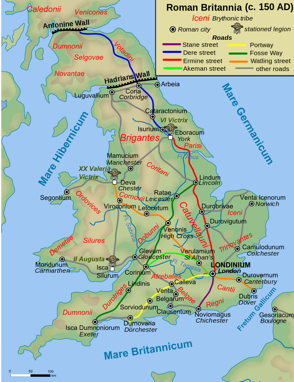
Roman Roads in Britain around 150 AD/CE.
- Public domain image from Andrei nacu, c/o Wikimedia Commons
Added by
Simon Cotterill
Co-Curate Page
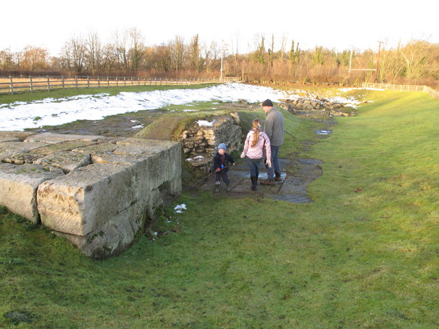
Piercebridge Roman Bridge
- Overview About the Roman Bridge Map Street View The Roman bridge at Piercebridge crossed the River Tees, carrying Dere Street, the Roman road that linked York with Corbridge, near Hadrian’s …
Co-Curate Page
Morbium - Roman Fort at Piercebridge
- Note: Scheduled Monument area - map data from Hstoric England c/o Open Data UK, under the Open Government Licence, imported into Google MyMaps, March 2026. "Piercebridge is located on the …
Co-Curate Page
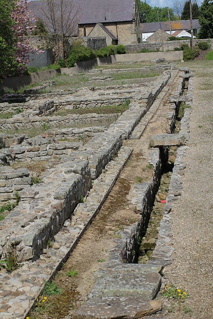
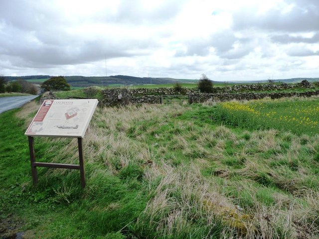
Longovicium, Lanchester Roman Fort
- Overview About Longovicium Map Street View Longovicium was a Roman fort established in the mid 2nd century AD, which lay on Dere Street, the Roman road connecting York with the …
Co-Curate Page
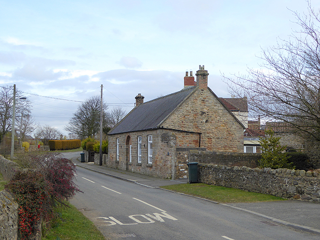
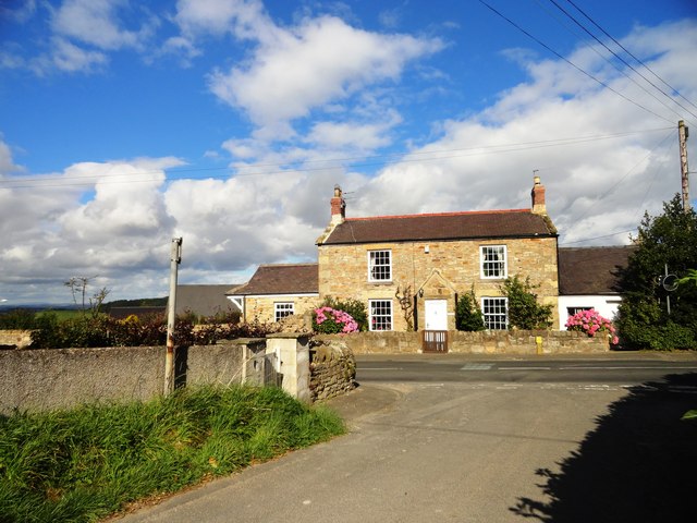
Bolam
- Overview Notable Buildings Map Street View Bolam is a village in County Durham located 6 miles north west of Darlington and 3 miles south of Bishop Auckland. The parish Church …
Co-Curate Page
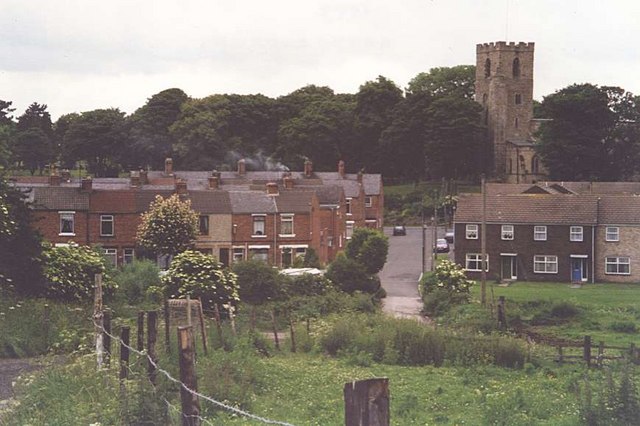
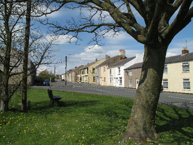
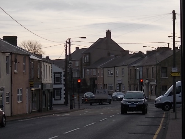
Bishop Auckland
- Overview About Bishop Auckland Map Street View Bishop Auckland is a market town in County Durham in north located between Darlington and Durham at the confluence of the River Wear …
Co-Curate Page
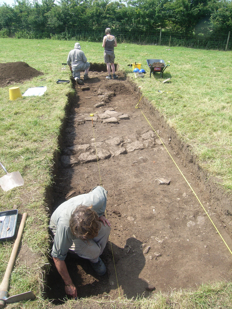
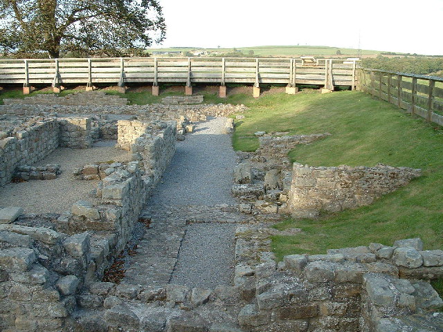
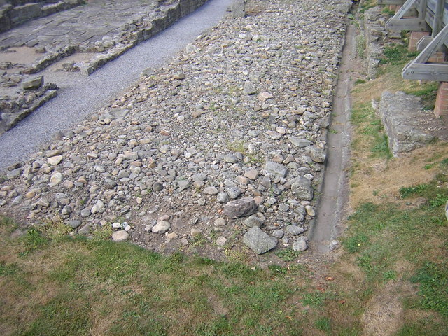
Vinovia, Binchester Roman Fort
- Overview About Vinovia Map Street View Vinovia was a Roman Fort established c.80 AD, located about a mile north of Bishop Auckland in County Durham. It was situated on Dere …
Co-Curate Page
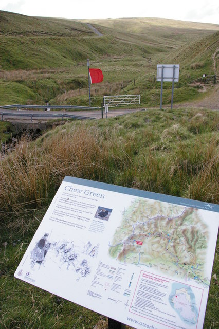
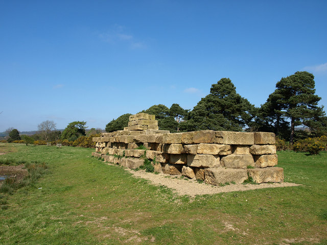
Chew Green, Roman Fort
- Overview About Chew Green Map & Aerial View Chew Green is the site of a large Roman encampment located about 9 miles west of Alwinton in Northumberland, and very close …
Co-Curate Page
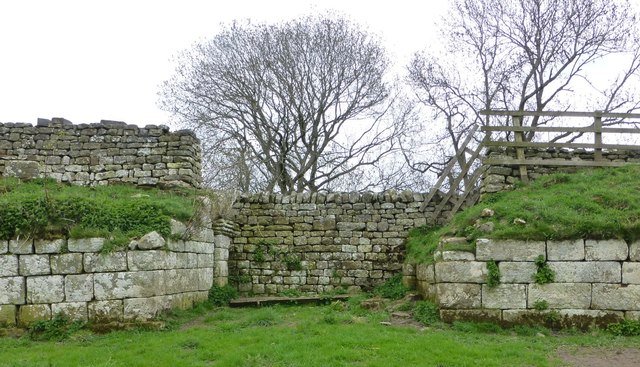
Habitancum Roman Fort
- Overview About Habitancum Habitancum was an ancient Roman fort (castra) located at Risingham, Northumberland, England. The fort was one of the defensive structures built along Dere Street, a Roman road …
Co-Curate Page
Quebec
- Overview About Quebec Map Street View Quebec is a small former mining village in County Durham, located under a mile north of Esh Winning and about 5 miles west of Durham …
Co-Curate Page
Hunwick
- Overview About Hunwick Map Street View Hunwick is a semi-rural village in County Durham, England. There are actually two villages that are often referred to collectively as Hunwick, Hunwick …
Co-Curate Page
Roman Bridge at Corbridge
- The Romans built a bridge at Corbridge to carry Dere Street (the Roman road from York to Scotland) over the River Tyne. Remains of the southern end of the bridge are …

Co-Curate Page
Chollerton Civil Parish
- Overview Map Chollerton Civil Parish iin Northumberland is located about 5 miles north of Hexham. It includes the villages of Barrasford, Colwell, and Gunnerton, and the smaller settlements of Barrasford Park, Chollerton, Great Swinburne, plus …
Co-Curate Page
Bremenium Roman Fort
- Overview About Bremenium Map Street View Bremenium was an ancient Roman fort (castra) located at Rochester, Northumberland, England. The fort was one of the defensive structures built along Dere …

Co-Curate Page
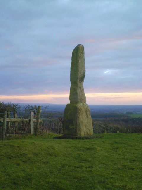
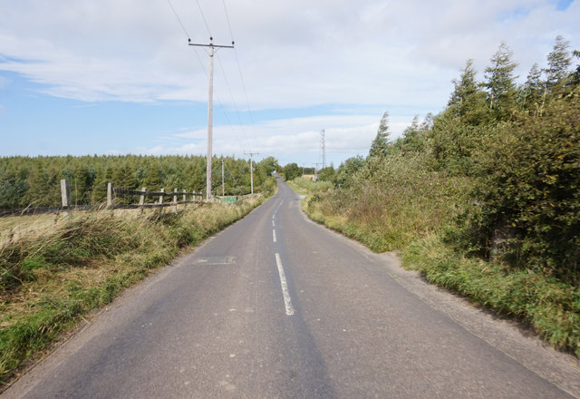
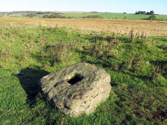
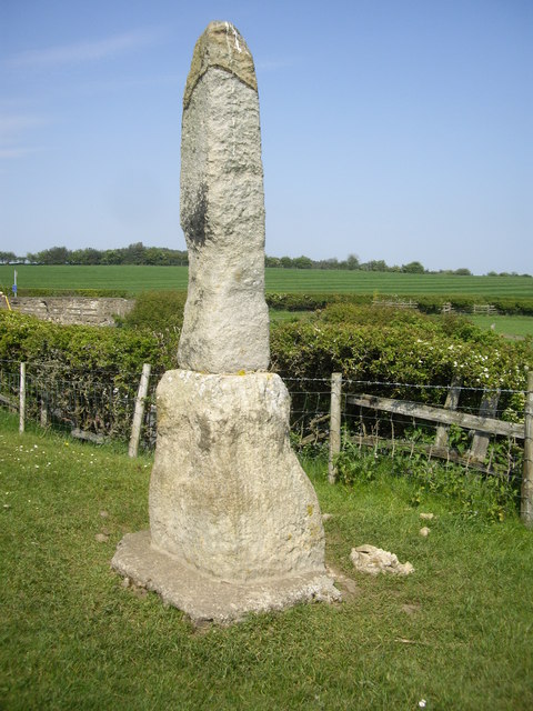
Outer Golden Pot
- Overview Map The Outer Golden Pot is the socket stone of a medieval wayside cross, situated in an elevated position on the western edge of Dere Street, the Roman road between …

Co-Curate Page
Middle Golden Pot
- Overview Map The Middle Golden Pot is the socket stone of a medieval wayside cross, situated in an elevated position on the western edge of Dere Street, the Roman road …
Co-Curate Page
Medieval wayside cross, Brownrigg
- Overview Map The socket stone of a Medieval wayside cross is located 200m north-west of Brownrigg (in Rochester with Byreness Civil Parish), by the route of Dere Street (Roman Road). …

Co-Curate Page
Ebchester Roman Fort (Vindomora)
- Map of the Vindomora Scheduled Monument area. The site of Vindomora Roman Fort is located in the heart of Ebchester in County Durham. There are no obvious visible remains, however, …

from https://commons.wikimedia.org…
Roman Roads in Britain around 150 AD/CE.
- Public domain image from Andrei nacu, c/o Wikimedia Commons
Added by
Simon Cotterill
Co-Curate Page
Piercebridge Roman Bridge
- Overview About the Roman Bridge Map Street View The Roman bridge at Piercebridge crossed the River Tees, carrying Dere Street, the Roman road that linked York with Corbridge, near Hadrian’s …
Co-Curate Page
Morbium - Roman Fort at Piercebridge
- Note: Scheduled Monument area - map data from Hstoric England c/o Open Data UK, under the Open Government Licence, imported into Google MyMaps, March 2026. "Piercebridge is located on the …
Co-Curate Page
Longovicium, Lanchester Roman Fort
- Overview About Longovicium Map Street View Longovicium was a Roman fort established in the mid 2nd century AD, which lay on Dere Street, the Roman road connecting York with the …
Co-Curate Page
Bolam
- Overview Notable Buildings Map Street View Bolam is a village in County Durham located 6 miles north west of Darlington and 3 miles south of Bishop Auckland. The parish Church …
Co-Curate Page
Bishop Auckland
- Overview About Bishop Auckland Map Street View Bishop Auckland is a market town in County Durham in north located between Darlington and Durham at the confluence of the River Wear …
Co-Curate Page
Vinovia, Binchester Roman Fort
- Overview About Vinovia Map Street View Vinovia was a Roman Fort established c.80 AD, located about a mile north of Bishop Auckland in County Durham. It was situated on Dere …
Co-Curate Page
Chew Green, Roman Fort
- Overview About Chew Green Map & Aerial View Chew Green is the site of a large Roman encampment located about 9 miles west of Alwinton in Northumberland, and very close …
Co-Curate Page
Habitancum Roman Fort
- Overview About Habitancum Habitancum was an ancient Roman fort (castra) located at Risingham, Northumberland, England. The fort was one of the defensive structures built along Dere Street, a Roman road …
Co-Curate Page
Quebec
- Overview About Quebec Map Street View Quebec is a small former mining village in County Durham, located under a mile north of Esh Winning and about 5 miles west of Durham …
Co-Curate Page
Hunwick
- Overview About Hunwick Map Street View Hunwick is a semi-rural village in County Durham, England. There are actually two villages that are often referred to collectively as Hunwick, Hunwick …
Co-Curate Page
Roman Bridge at Corbridge
- The Romans built a bridge at Corbridge to carry Dere Street (the Roman road from York to Scotland) over the River Tyne. Remains of the southern end of the bridge are …
Co-Curate Page
Chollerton Civil Parish
- Overview Map Chollerton Civil Parish iin Northumberland is located about 5 miles north of Hexham. It includes the villages of Barrasford, Colwell, and Gunnerton, and the smaller settlements of Barrasford Park, Chollerton, Great Swinburne, plus …
Co-Curate Page
Bremenium Roman Fort
- Overview About Bremenium Map Street View Bremenium was an ancient Roman fort (castra) located at Rochester, Northumberland, England. The fort was one of the defensive structures built along Dere …
Co-Curate Page
Outer Golden Pot
- Overview Map The Outer Golden Pot is the socket stone of a medieval wayside cross, situated in an elevated position on the western edge of Dere Street, the Roman road between …
Co-Curate Page
Middle Golden Pot
- Overview Map The Middle Golden Pot is the socket stone of a medieval wayside cross, situated in an elevated position on the western edge of Dere Street, the Roman road …
Co-Curate Page
Medieval wayside cross, Brownrigg
- Overview Map The socket stone of a Medieval wayside cross is located 200m north-west of Brownrigg (in Rochester with Byreness Civil Parish), by the route of Dere Street (Roman Road). …


