Topics > Northumberland > Civil Parishes in Northumberland > Stamfordham Civil Parish
Stamfordham Civil Parish
Parish boundaries may have changed - for the latest map see the Parish Council or Northumberland County Council.
About the Parish
| Settlements: | The parish includes the village of Stamfordham and the hamlets of Dalton, Eachwick, Harlow Hill, Hawkwell, Heugh, Nesbitt Hill Head, Ouston, and also Albmemarle Camp. |
| Population: |
1,173 (2021 Census) 1,185 (2011 Census) 1,047 (2001 Census) |
| Area: | 33 km2 |
| Parish Council: | Stamfordham Parish Council |
| Unitary Authority: | Northumberland County Council |
Historical |
|
|
Ancient Townships (in modern CP area) |
Townships became civil parishes in their own right in 1866 (see below). In 1955, the nine civil parishes of these former townships were merged to form the current Stamfordham Civil Parish. |
| Ancient Parish: |
The ancient parish os Stamfordham covered a much larger geographical area, compared to the modern Civil Parish Stamfordham. It also included the townships of Fenwick, Ingoe, Kearsley, Matfen (East), Marfen (West), Ryal - now in Matfen Civil Parish. Also, the townships of Bitchfield, Black Heddon and Wallridge - now in Belsay Civil Parish Eachwick township was in the ancient parish of Heddon-on-the-Wall. Dalton township was in the ancient parish of Newburn. Ancient parishes refer to the parishes before the split between ecclesiastical (church) and civil parishes in the 19th century. They had a parish church and often were composed of multiple townships and chapelries. In many cases, townships and parishes were originally based on the territory of manors from the feudal system during medieval times. Civil parishes were created following the Poor Law Amendment Act 1866, in which Church of England parishes, extra-parochial areas, townships and chapelries, became "civil parishes" which could set their own poor rate (tax). Then the reforms of Local Government Act 1894 established elected civil parish councils (or parish meetings for parishes with less than 300 residents) and created urban and rural districts. Boundaries of parishes and civil parishes may have changed over time. |
| Ancient District: |
Tynedale |
| Poor Law Union: |
Castle Poor Law Union, formed in 1836. Castle Union Workhouse was initially based in an existing workhouse in Heddon on the Wall. A new workhouse was built in Ponteland in 1848, accommodating 120 inmates. The workhouse buildings were extended in the 1850s and in 1910. Under the Poor Law Amendment Act of 1834 parishes were grouped into Unions, each of which had to build a workhouse if they did not already have one. It ended the old system of locally provided poor relief which had come under strain as numbers out of work grew, following increasing mechanisation of agriculture and the economic downturn after the Napoleonic Wars, along with changing social attitudes. The workhouse provided those unable to support themselves financially with accommodation and work. Inmates were generally segregated into men, women, boys and girls. The workhouse system was abolished by the Local Government Act 1929, but many workhouses lived on as ‘Public Assistance Institutions’ until the National Assistance Act 1948. |
|
District Council: |
Castle Ward Rural District, formed in 1894. The district was abolished in 1974, following the Local Government Act 1972. Castle Morpeth, formed in 1974, by the merger of the Borough of Morpeth, Morpeth Rural District, and part of Castle Ward Rural District. The district council was abolished when Northumberland became a unitary authority on the 1st of April 2009. |
|
Major Boundary Changes |
1955 - Stamfordham CP was enlarged by the abolition of Cheesburn Grange Civil Parish 1955 - Stamfordham CP was enlarged by the abolition of Dalton Civil Parish 1955 - Stamfordham CP was enlarged by the abolition of Eachwick Civil Parish 1955 - Stamfordham CP was enlarged by the abolition of Harlow Hill Civil Parish 1955 - Stamfordham CP was enlarged by the abolition of Harkwell Civil Parish 1955 - Stamfordham CP was enlarged by the abolition of Heugh Civil Parish 1955 - Stamfordham CP was enlarged by the abolition of Nesbit Civil Parish 1955 - Stamfordham CP was enlarged by the abolition of Ouston Civil Parish |
|
County / Unitary Authority |
The ancient county of Northumberland was enlarged following the Counties (Detached Parts) Act 1844; Bedlingtonshire, Norhamshire, Islandshire, the Farne Islands and Monks' House all became part of Northumberland. Up to then they had been enclaves of County Durham. Northumberland County Council formed 1889. Major boundary changes came into effect on the 1st April 1974. This followed the Local Government Act 1972, which formed the non-metropolitan county of Northumberland. This excluded the City of Newcastle upon Tyne and North Tyneside, which up to then had been part of Northumberland, but now became part of the newly formed Tyne & Wear. Northumberland County Council became a unitary authority on the 1st of April 2009. |
See also: ![]() Historic Buildings and Monuments in Stamfordham Civil Parish. Note: listed buildings are generally the responsibility of the county council / unitary authority, rather than the parish council.
Historic Buildings and Monuments in Stamfordham Civil Parish. Note: listed buildings are generally the responsibility of the county council / unitary authority, rather than the parish council.
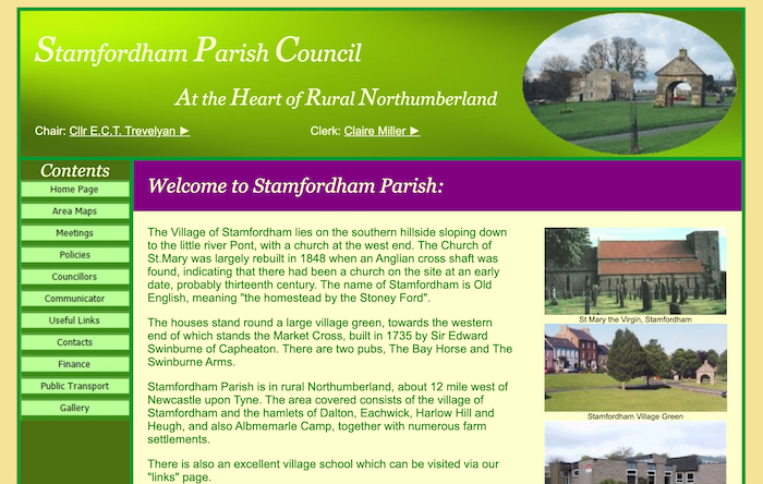
from https://www.stamfordhamparish…
Stamfordham Parish Council
- "...Stamfordham Parish is in rural Northumberland, about 12 mile west of Newcastle upon Tyne. The area covered consists of the village of Stamfordham and the hamlets of Dalton, Eachwick, Harlow …
Added by
Simon Cotterill
Co-Curate Page
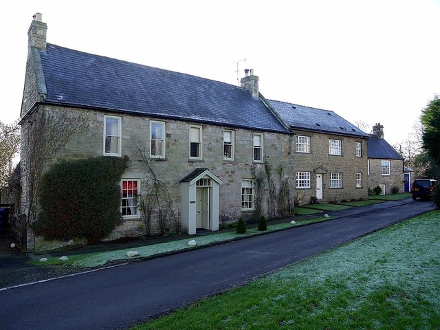
Stamfordham
- Overview About Stamfordham Map Street View Stamfordham is a village and civil parish in Northumberland, about 11 miles west of Newcastle upon Tyne, 5 miles west of Ponteland and …
Co-Curate Page
Eachwick
- Overview Map Street View Eachwick is a hamlet in Northumberland, located about 3 miles east of Ponteland and 9 miles north-west of Newcastle. In medieval times, there was substantial village …
Co-Curate Page
Dalton, Ponteland
- Overview Map Street View Dalton is a village in Northumberland, located about 3 miles west of Ponteland and 9 miles north-west of the centre of Newcastle. Historically, Dalton was a …
Co-Curate Page
Harlow Hill
- Overview About Harlow Hill Map Street View Harlow Hill is a hamlet in Northumberland, located about 2 miles south of Stamfordham and 10 miles north-west of Newcastle upon Tyne. Harlow …
Co-Curate Page
Hawkwell
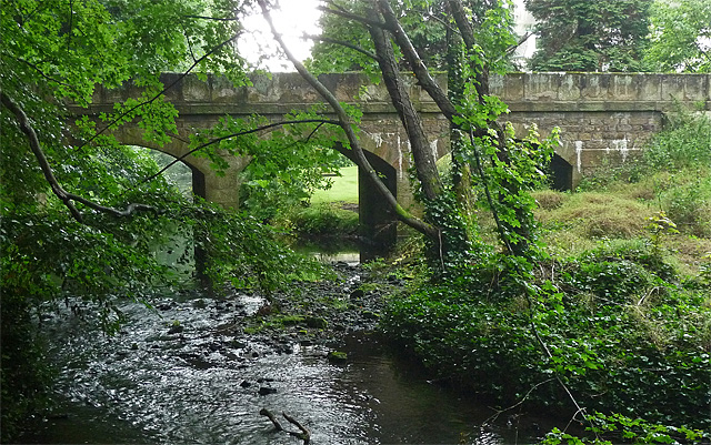
- Overview Map Street View Hawkwell is a hamlet on the south side of the River Pont, over the river from the village of Stamfordham in Northumberland, and located about 11 …
Co-Curate Page
Nesbitt Hill Head
- Overview Map Nesbitt Hill Head is a hamlet/farm in Northumberland, located about 1½ miles south of the village of Stamfordham. It is located at the south-west of Ouston Airfield, close …
Co-Curate Page
Ouston
- Overview Map Street View Ouston is a hamlet / farm located about half a mile south of Stamfordham in Northumberland. An airfield, RAF Ouston, was built here during the Second …
Co-Curate Page
Heugh, Northumberland
- Overview Map Street View HEUGH, a township, in the parish of Stamfordham, union of Castle ward, N. E. division of Tindale ward, S. division of Northumberland, 12½ miles (N.W. by …


from https://keystothepast.info/se…
Local History - Stamfordham
- "Stamfordham parish lies in south Northumberland. It has a range of archaeological landscapes, from Hadrian's Wall to post-medieval country houses and parkland.
A cup marked stone from a barrow on …
Added by
Simon Cotterill

from https://www.stamfordhamparish…
Stamfordham Parish Council
- "...Stamfordham Parish is in rural Northumberland, about 12 mile west of Newcastle upon Tyne. The area covered consists of the village of Stamfordham and the hamlets of Dalton, Eachwick, Harlow …
Added by
Simon Cotterill
Co-Curate Page
Stamfordham
- Overview About Stamfordham Map Street View Stamfordham is a village and civil parish in Northumberland, about 11 miles west of Newcastle upon Tyne, 5 miles west of Ponteland and …
Co-Curate Page
Eachwick
- Overview Map Street View Eachwick is a hamlet in Northumberland, located about 3 miles east of Ponteland and 9 miles north-west of Newcastle. In medieval times, there was substantial village …
Co-Curate Page
Dalton, Ponteland
- Overview Map Street View Dalton is a village in Northumberland, located about 3 miles west of Ponteland and 9 miles north-west of the centre of Newcastle. Historically, Dalton was a …
Co-Curate Page
Harlow Hill
- Overview About Harlow Hill Map Street View Harlow Hill is a hamlet in Northumberland, located about 2 miles south of Stamfordham and 10 miles north-west of Newcastle upon Tyne. Harlow …
Co-Curate Page
Hawkwell
- Overview Map Street View Hawkwell is a hamlet on the south side of the River Pont, over the river from the village of Stamfordham in Northumberland, and located about 11 …
Co-Curate Page
Nesbitt Hill Head
- Overview Map Nesbitt Hill Head is a hamlet/farm in Northumberland, located about 1½ miles south of the village of Stamfordham. It is located at the south-west of Ouston Airfield, close …
Co-Curate Page
Ouston
- Overview Map Street View Ouston is a hamlet / farm located about half a mile south of Stamfordham in Northumberland. An airfield, RAF Ouston, was built here during the Second …
Co-Curate Page
Heugh, Northumberland
- Overview Map Street View HEUGH, a township, in the parish of Stamfordham, union of Castle ward, N. E. division of Tindale ward, S. division of Northumberland, 12½ miles (N.W. by …
from https://keystothepast.info/se…
Local History - Stamfordham
- "Stamfordham parish lies in south Northumberland. It has a range of archaeological landscapes, from Hadrian's Wall to post-medieval country houses and parkland.
A cup marked stone from a barrow on …
Added by
Simon Cotterill