Topics > Historical Periods > Roman Period (43 to 409 AD)
Roman Period (43 to 409 AD)
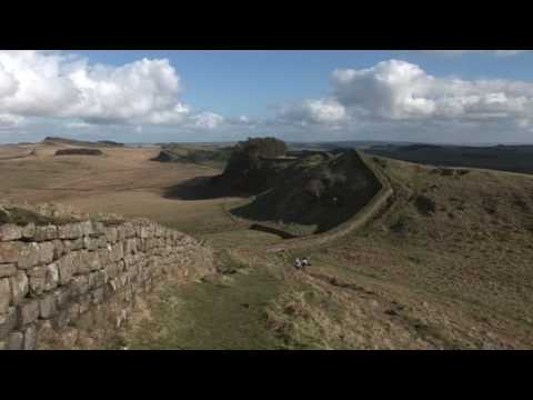
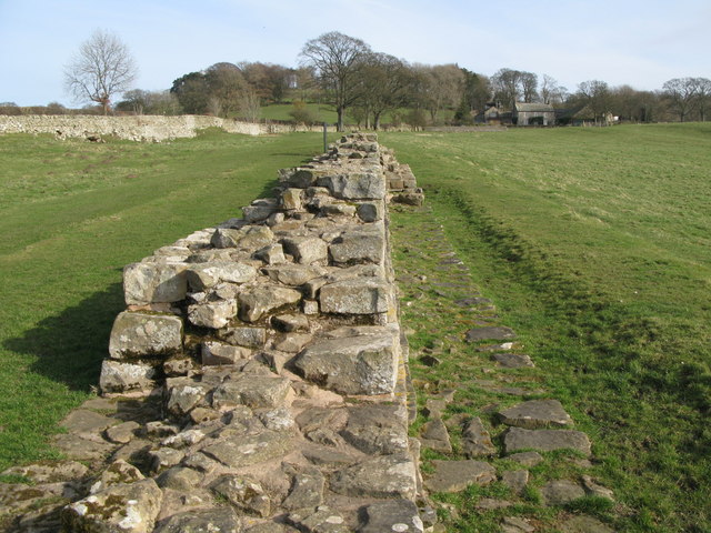
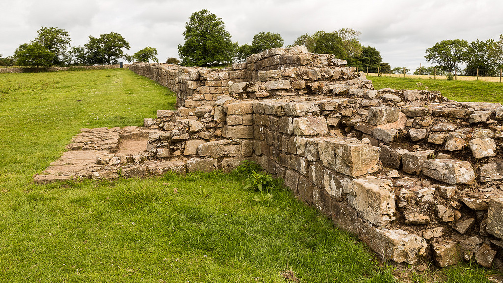
The Romans invaded Great Britain in 43 AD, though there had been earlier Roman expeditions into Britain, led by Julius Caesar in 55 and 54 BC. The Romans occupied most of the island of Great Britain, except northern Scotland, until their withdrawal in 410 AD. Todays Northern England was at the frontier of the Roman Empire. In AD 122 construction of Hadrian’s Wall began, when completed it ran 73 miles coast to coast across Northern England. Much of Hadrian's Wall survives today and is designated as a World Heritage Site. There was a network of forts along Hadrian's Wall, and also forts north of the wall and supply forts to the south. Dere Street was a major Roman road running from Eboracum (York) up to Hadrian's Wall and on into Scotland. There are a wealth of Roman remains and places to visit in the North of England.
Key Roman sites in the North of England
|
Forts along Hadrian's Wall
Wall, Milecastles, Turrets etc. see: through to |
Dere Street (Roman road from York to Scotland) Stanegate (Roman road from Carlisle to Corbridge) Devil's Causeway (Roman road, off Dere Street to near Berwick) A few of the many Roman forts & structures in the North England:
|
For lots more Roman sites in the North East & Cumbria, see: Index of Roman Sites on this Website.
Co-Curate Page
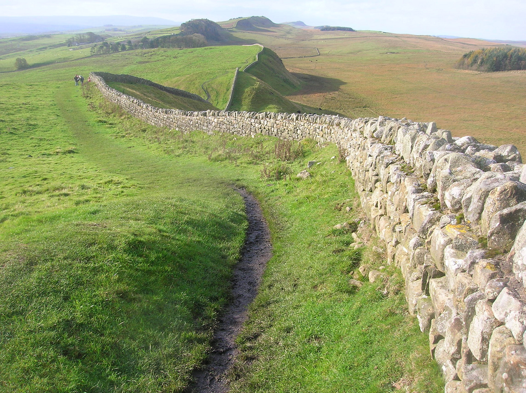
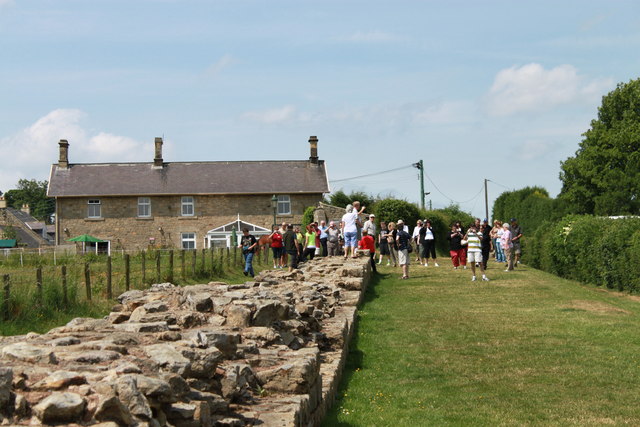
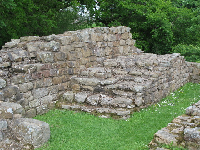
Hadrian's Wall
- Overview About Hadrian's Wall Map Hadrian's Wall Glossary Hadrian's Wall stretches over 73 miles (117 km) coast to coast across Northern England. Construction began in AD 122 during the rule …
from https://www.futurelearn.com/c…
Hadrian's Wall: Life on the Roman Frontier (course)
- An online course by Newcastle University on Futurelearn. "This six week course offers a comprehensive introduction to Hadrian’s Wall and its people and raises fascinating issues concerning colonisation, cultural transformation, …
Added by
Simon Cotterill
Co-Curate Page
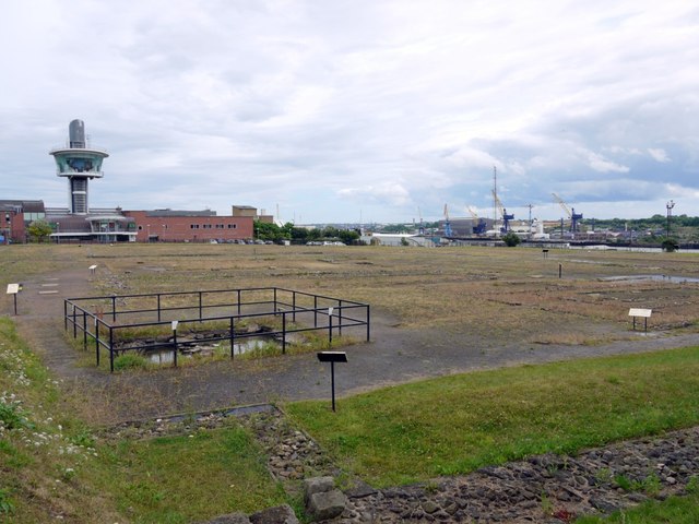
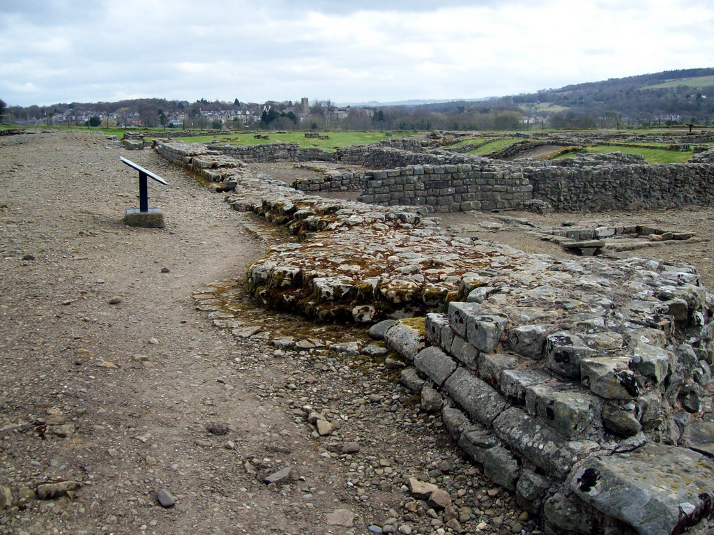
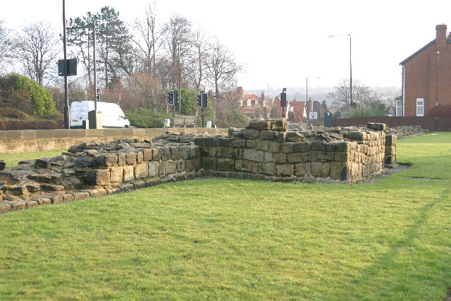
Segedunum
- Overview About Segedunum Map Segedunum was a Roman fort built at the eastern end of Hadrian's Wall near the banks of the River Tyne. It is located in modern-day Wallsend, …
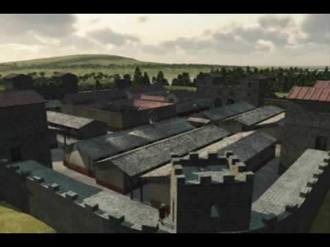
from Youtube (youtube)
Hadrian's Wall - NewCastle Roman Fort 3D Reconstruction
Pinned by Simon Cotterill
Co-Curate Page
Arbeia - Roman Fort
- Overview About Arbeia Map Street View The fort stood on the Lawe Top in South Shields, overlooking the River Tyne. It was built around 120 AD, guarded the main sea …

from North East Museums (youtube)
Portable Roman shrine at Segedunum Roman Fort
Pinned by Simon Cotterill

from North East Museums (youtube)
A new Roman find at Arbeia Roman Fort & Museum
Pinned by Simon Cotterill

from North East Museums (youtube)
Segedunum Roman Fort with Kingston Park Primary School.
Pinned by Simon Cotterill

from Newcastle libraries (flickr)
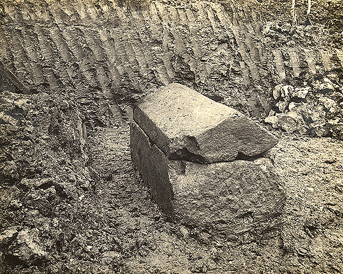
003358:Roman Coffin Newcastle-Upon-Tyne 1903
Pinned by Simon Cotterill
Co-Curate Page
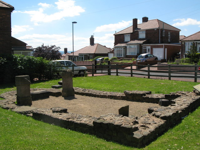
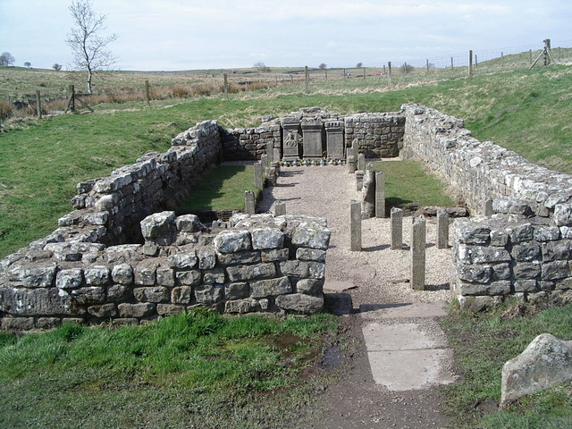
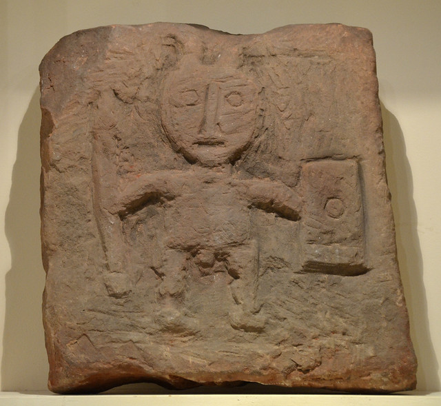
Benwell Temple of Antenociticus
- Overview About Antenociticus Map Street View "The fort at Benwell, which was occupied throughout most of the Roman period by the cavalry regiment ala I Asturum, is no longer visible. …
Co-Curate Page
Benwell Vallum Crossing / Condercum
- Overview About Condercum Map Street View "Nothing is now visible of the fort at Benwell (Condercum) in Newcastle, which was occupied throughout most of the Roman period by the Asturian …
Co-Curate Page
Denton Hall Roman Turret
- Turrets on Hadrian’s Wall were small watchtowers built into the wall, with two turrets per Roman mile, located between larger milecastles. They provided elevated viewpoints for small groups of 4 …
Co-Curate Page
Hadrian's Wall at Heddon-on-the-Wall
- A consolidated stretch of Wall, up to 2 metres (61⁄2 feet) thick in places. "Stretches of Hadrian’s Wall 220 metres long and of the Wall-ditch to its north are visible …
Co-Curate Page
Piercebridge Roman Bridge
- Overview About the Roman Bridge Map Street View The Roman bridge at Piercebridge crossed the River Tees, carrying Dere Street, the Roman road that linked York with Corbridge, near Hadrian’s …
Co-Curate Page
Morbium - Roman Fort at Piercebridge
- Note: Scheduled Monument area - map data from Hstoric England c/o Open Data UK, under the Open Government Licence, imported into Google MyMaps, March 2026. "Piercebridge is located on the …
Co-Curate Page
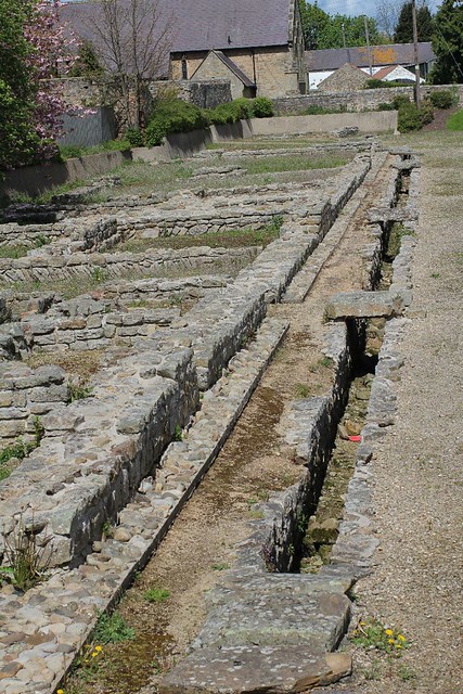
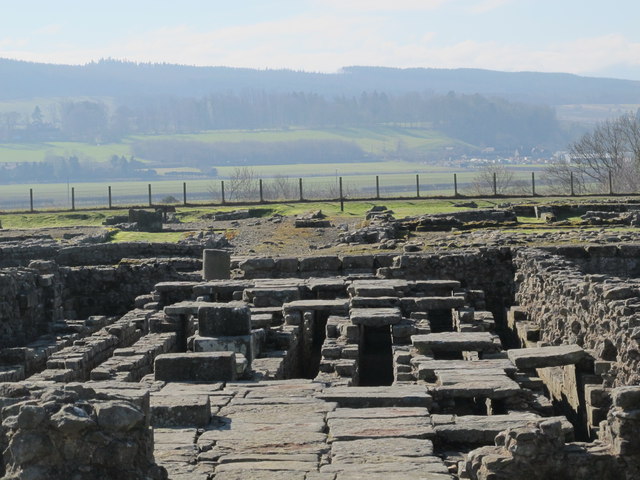
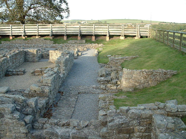
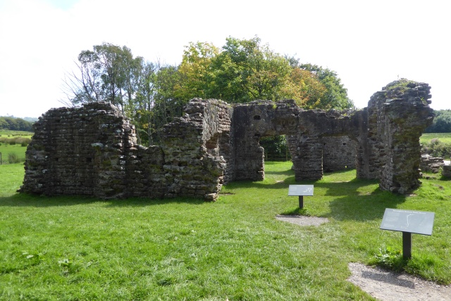
Corbridge Roman Town and Fort
- Overview About Corbridge Roman Fort/Town Map Street View Corstopitum Coria was a fort and town 2.5 miles (4.0 km) south of Hadrian's Wall, in the Roman province of Britannia at a …
Co-Curate Page
Planetrees Roman Wall
- Overview About Planetrees Wall Map Street View Planetrees is an extant section of Hadrian's Wall named after the farm located around 250 metres (270 yd) to the west. The …
Co-Curate Page
Turret 29a (Black Carts)
- Overview Map Street View Turrets on Hadrian’s Wall were small watchtowers built into the wall, with two turrets per Roman mile, located between larger milecastles. They provided elevated viewpoints for …

Co-Curate Page
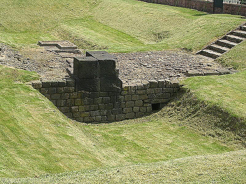
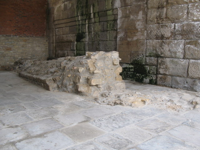
Chesters Bridge Abutment
- Overview Map Close to Chesters Roman Fort are the remains of a bridge which carried Hadrian's Wall across the River North Tyne.
Co-Curate Page
Chesters Roman Fort
- Overview About Chesters (Cilurnum) Map Chesters Roman Fort and Museum, managed by English Heritage, is located near Walwick and Chollerford in Northumberland. The Roman cavalry fort (Cilurnum) was built in …
Co-Curate Page
Pons Aelius
- Overview About Pons Aelius Remains The Romans built Pons Aelius, a bridge to cross the River Tyne, around 122AD. A fort was built there, eventually becoming known under the same …
from Newcastle libraries (flickr)
003357:Roman Coffin Newcastle-Upon-Tyne 1903
Pinned by Simon Cotterill
Co-Curate Page
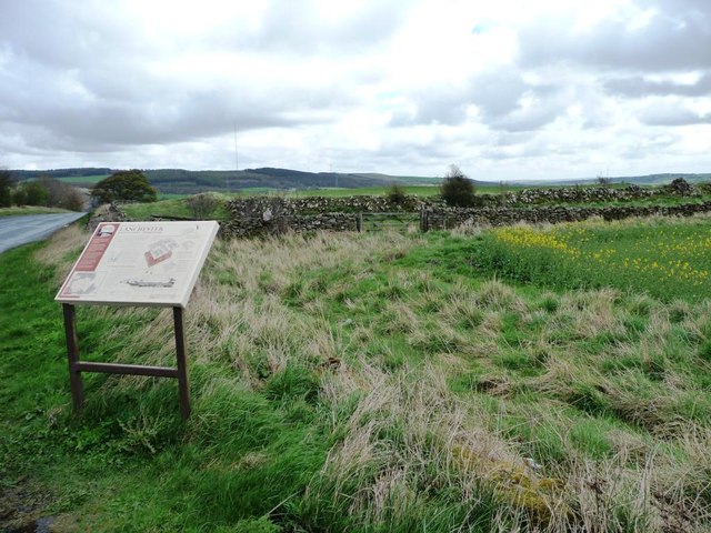
Longovicium, Lanchester Roman Fort
- Overview About Longovicium Map Street View Longovicium was a Roman fort established in the mid 2nd century AD, which lay on Dere Street, the Roman road connecting York with the …
Co-Curate Page
Vinovia, Binchester Roman Fort
- Overview About Vinovia Map Street View Vinovia was a Roman Fort established c.80 AD, located about a mile north of Bishop Auckland in County Durham. It was situated on Dere …
Co-Curate Page
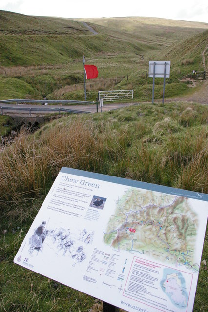
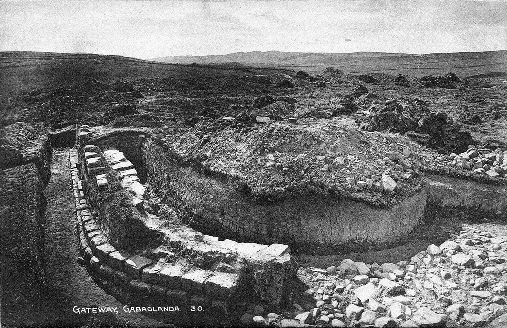
Chew Green, Roman Fort
- Overview About Chew Green Map & Aerial View Chew Green is the site of a large Roman encampment located about 9 miles west of Alwinton in Northumberland, and very close …

from Newcastle libraries (flickr)
003355:Roman Mask Newcastle-Upon-Tyne 1906
Pinned by Simon Cotterill
Co-Curate Page
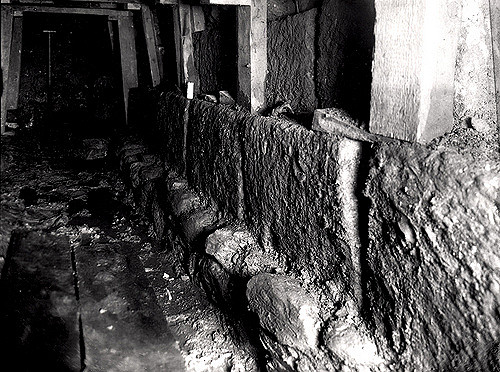
Habitancum Roman Fort
- Overview About Habitancum Habitancum was an ancient Roman fort (castra) located at Risingham, Northumberland, England. The fort was one of the defensive structures built along Dere Street, a Roman road …
Co-Curate Page
Haltwhistle Burn Roman Fortlets
- Overview Map and Aerial View From about AD 105 there was a small fort guarding Stanegate, the Roman military road from Corbridge (Corio) to Carlisle (Luguvalium), where it crossed the …

Co-Curate Page
Grindon School Roman Camp
- Map showing Grindon School temporary camp, to the south-east of Milecastle 35 on Hadrian's Wall, and north-west of Grindon Farm. There was a Roman temporary camp at Grindon, just south …
Co-Curate Page
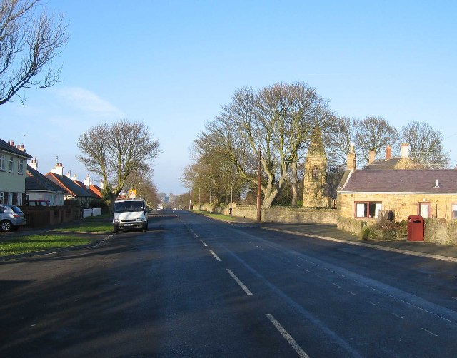
Scremerston
- Overview About Scremerston Map Street View Scremerston is a village in Northumberland, close to the coast and located about 3 miles south of Berwick-upon-Tweed. Initially an agricultural settlement, Scremerston grew …
Co-Curate Page
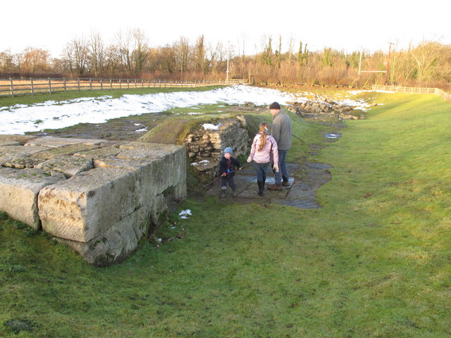
Poltross Burn Milecastle, Hadrian's Wall
- Overview About Milecastle 48 Map Street View Poltross Burn, located near Gilsland, is one of the best-preserved milecastles on Hadrian's Wall. It is larger than most other milecastles, housing two …
Co-Curate Page
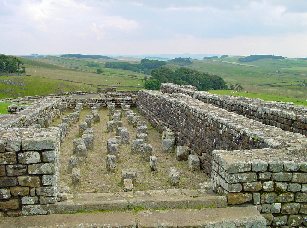
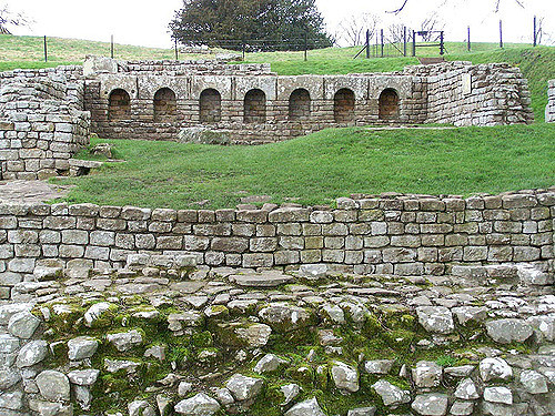
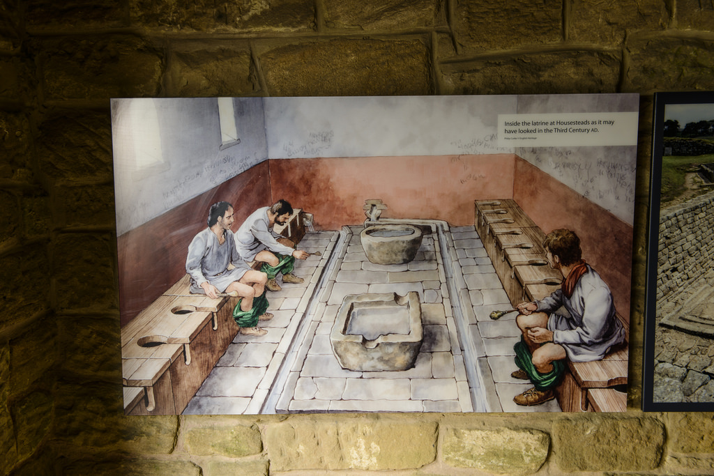
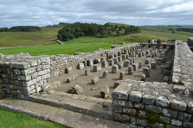
Housesteads
- Overview About Howsteads Fort Map Street View Interactive Glossary Housesteads (Roman name: "Vercovicium") is one of the best preserved forts on Hadrian's Wall, built around 124 AD. The fort covers …
Co-Curate Page
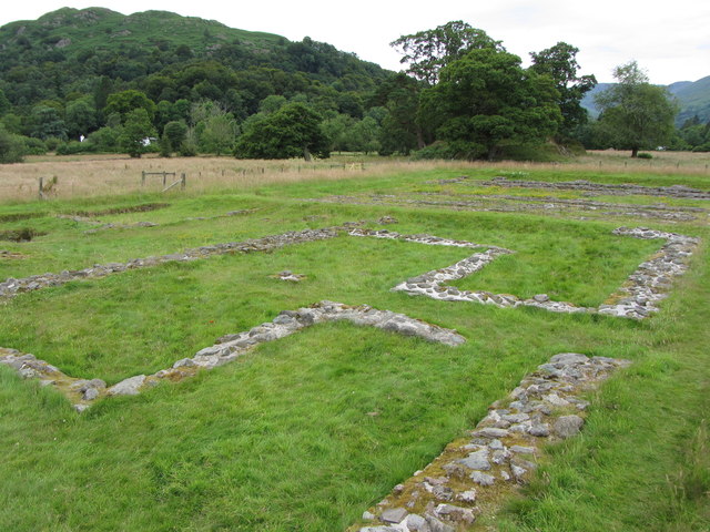
Ambleside Roman Fort (Galava)
- Overview About Ambleside Roman Fort Map Street View The remains of Ambleside Roman Fort (Galava) are located in a field by the shores of Lake Windermere in Ambleside. The stone …
Co-Curate Page
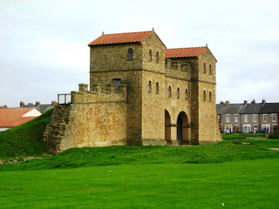
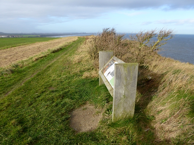
Huntcliff Roman Signal Station
- Overview Map Street View "The site of a Roman signal station at Huntcliff, thought to be of late fourth century date. A Roman signal station at Huntcliff was discovered circa …
Co-Curate Page
Milefortlet 9 (Skinburness)
- Overview About Milefortlet 9 Map Just north-west of Skinburness, by the crest of Grune Point, are the buried remains of a Roman milefortlet and the buried remains of an earlier Roman camp. …
Co-Curate Page
Learchild Roman fort (Alavna)
- The shallow earthwork remains of a large Roman fort (thought to be 'Alavna') near High Learchild were discovered by arial photography in 1945, and confirmed by subsequent archaeological digs. The fort …
Co-Curate Page
Bremenium Roman Fort
- Overview About Bremenium Map Street View Bremenium was an ancient Roman fort (castra) located at Rochester, Northumberland, England. The fort was one of the defensive structures built along Dere …
Co-Curate Page
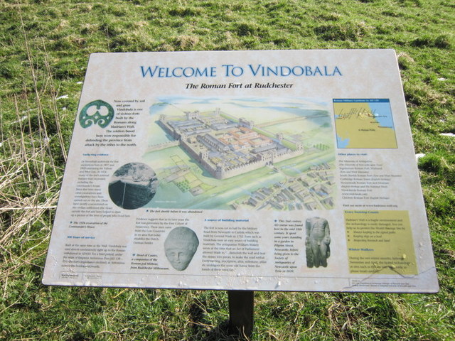
Vindobala
- Overview About Vindobala Map Street View Vindobala (Brytonnic Celtic : windo- fair, white, bala place, situation?, cf. Old Irish bal, bail place, situation, condition, (good) luck) was a Roman …
Co-Curate Page
Alauna Roman Fort (Maryport)
- Overview About Alauna Aerial View / Map Street View Alauna was a fort in the Roman province of Britannia, located on the coastal sandstone ridge to north of the modern …
Co-Curate Page
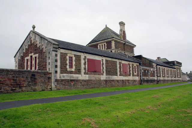
Senhouse Roman Museum
- Overview Map Street View Senhouse Roman Museum is located at The Battery on Sea Brows in Maryport. The museum occupies part of the site of Alauna - the Roman fort …
Co-Curate Page
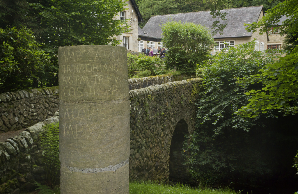
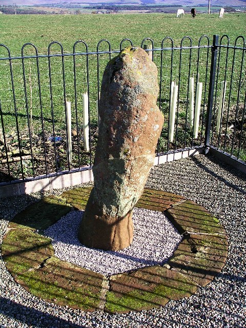
Roman milestone near Spitals Farm
- There is Roman milestone near Spitals Farm, on the side of the old A66 road between the villages of Kirkby Thore and Temple Sowerby in Cumbria. The milestone, carved from red …
Co-Curate Page
Burrow Walls Roman Fort
- Overview Map Burrow Walls is located between Workington and Seaton in Cumbria. This Scheduled Monument includes the buried remains of a Roman fort and also visible sections of a wall made …

Co-Curate Page
Boothby Roman Fort
- There was a Roman fortlet (no visible remains today) at a strategic position overlooking the River Irthing, located to the north-west of Boothby in Cumbria. It was built in the …

from Youtube (youtube)
What Was Life Like? | Episode 2: Romans - Meet a Roman Legionary
Pinned by Simon Cotterill


Co-Curate Page
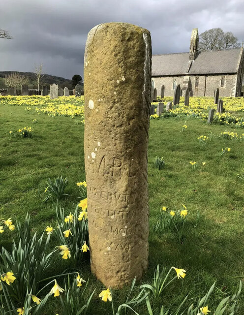
Old Roman Milestone, Middleton Parish
- The remains of a Roman milestone in Middleton are situated close to the former route of the Roman road from Ribchester to Low Borrow Bridge. The milestone is cylindrical with …

Co-Curate Page
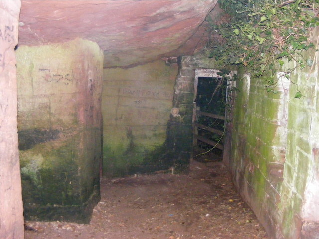
St Constantine's Cells (Wetheral Caves) and rock-cut Roman Graffiti
- Overview Map St Constantine's Cells (aka Wetheral Caves, Wetheral Safeguard, or Constantine's Hermitage) are three chambers cut into the cliff face about 40ft above the River Eden, south of Wetheral. …
Co-Curate Page
Concangis Roman Fort
- Concangis (modern-day Chester-le-Street) was an auxiliary fort established by the Romans in the late 70s AD. It was situated on a high bluff, guarding the River Wear and Cong Burn …
Co-Curate Page
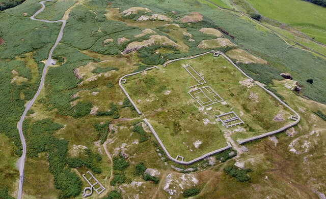
Hardknott Roman Fort
- Overview Map Street View Aerial View The well-preserved remains of Hardknott Roman Fort (Mediobogdum) are located about 5 miles east of the village of Eskdale Green in Cumbria. It was …

Co-Curate Page
Turma! Hadrian's Cavalry Charge
- Turma! Hadrian's Cavalry Charge was a Roman cavalry re-enactment event 1st-2nd July 2017 held at Bitts Park, Carlisle. It is thought to be first time in over 1,500 years, that a …

from Flickr (flickr)
Head of the god of Antenociticus, Great North Museum, Newcastle
Pinned by Simon Cotterill

from Flickr (flickr)
Altars dedicated to Neptune and Oceanus by the Sixth Legion Victrix Pia Fidelis, Great North Museum, Newcastle
Pinned by Simon Cotterill

from Flickr (flickr)
Milecastle 38 inscription proving that Hadrian commissioned the wall that now bears his name (RIB 1638), Great North Museum, Newcastle
Pinned by Simon Cotterill


from Flickr (flickr)
Altar in sandstone dedicated to Mithras, from Carrawburgh, CIMRM 847, Great North Museum, Newcastle
Pinned by Simon Cotterill

from Flickr (flickr)
Stone relief with Mithras emerging from the cosmic egg, from Housesteads, CIMRM 860, Great North Museum, Newcastle
Pinned by Simon Cotterill


from Flickr (flickr)
Hadrianic construction inscription recording work by the Classis Britannica, in found 1937 in a granary portico at Benwell fort, RIB 1340, Great North Museum, Newcastle
Pinned by Simon Cotterill

Co-Curate Page
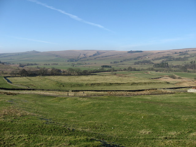
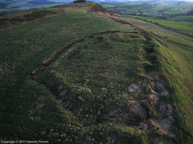
Hillfort and Roman signal station, Barcombe Hill
- Overview Map Scheduled Monument area - based on Historic England data (Open Government Licence). The remains of an Iron Age defended settlement and Roman signal station are located on Barcombe …

Co-Curate Page
Knockcross Roman temporary camp
- Overview Map The site of the Roman temporary camp known as Knockcross is located at Grey Havens (house), about ½mile east of Bowness‑on‑Solway and 190m north of Hadrian’s Wall. Although …
Co-Curate Page
Roman fort and watch tower, south of Burgh by Sands
- Overview Map The site of a Roman fort and watch tower are located just over ½mile south of Burgh by Sands (and the course of Hadrian's Wall, which ran through …
Co-Curate Page
Ravenglass Roman Fort
- % The site of the Roman fort Glannoventa is located to the south of Ravenglass. The burried remains of the fort survive as visible earthworks. The fort served as an …
Co-Curate Page
Roman Bath House, Ravenglass
- Overview Map Street View The remains of the bath house of Ravenglass Roman Fort, established around AD 130, are among the tallest Roman structures surviving in northern Britain. The bath …

Co-Curate Page
Roman Tile Kilns, near Birks Coppice
- % The site of two Roman tile kilns is located by Birks Coppice in Eskdale, just over 2 miles north-east of Muncaster. The remains of the kilns were first found …
Co-Curate Page
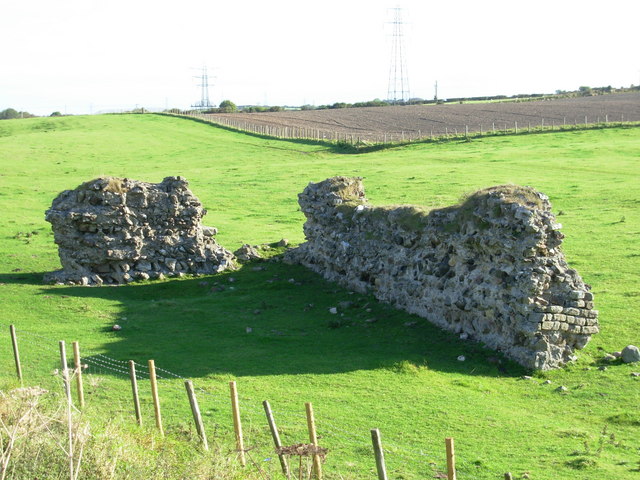
Ebchester Roman Fort (Vindomora)
- Map of the Vindomora Scheduled Monument area. The site of Vindomora Roman Fort is located in the heart of Ebchester in County Durham. There are no obvious visible remains, however, …

Co-Curate Page
Lavatrae Roman Fort
- % Map showing the Scheduled Monument area for Lavatrae Roman Fort Lavatrae was a Roman auxiliary fort situated by the River Greta, located in modern-day Bowes in County Durham. It …

Co-Curate Page
Whitley Castle Roman Fort (Epiacum)
- Overview Street View Map of Whitley Castle Roman fort (Epiacum) - Scheduled Monument Area The remains of Epiacum Roman Fort are located about 1½ miles north-west of Alston. The fort …
Co-Curate Page
Low Borrowbridge Roman Fort
- The remains of a Roman fort and its civilian settlement (vicus) are located at Low Borrowbridge, about 2 miles south of Tebay in Cumbria. The site is situated by the …
Co-Curate Page
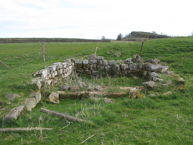
Kirkhaugh Roman Bridge Abutments
- Scheduled Monument (#1006577): Kirkhaugh Bridge abutments 1/2 mile (800m) NE of Whitley Castle Click the headings below to expand (selected extracts from the Historic England scheduling) Significance Roman bridges are …
Co-Curate Page
Springhill Camp
- Scheduled Monument areas - based on Historic England data (Open Government Licence). This site is located close to Spring Hill, to the south of Tweedmouth in Northumberland. It is scheduled …
Co-Curate Page
Roman aqueduct to Great Chesters from Caw Burn
- Scheduled Monument areas - based on Historic England data (Open Government Licence). The Romans constructed an extensive aqueduct to carry water from Caw Burn westwards to supply Great Chesters fort …
Co-Curate Page
Washingwells Roman fort, Whickham
- Scheduled Monument area - based on Historic England data (Open Government Licence). The site of Washingwells Roman fort is located to the east of Whickham, near Watergate Forest Park. The …
Co-Curate Page
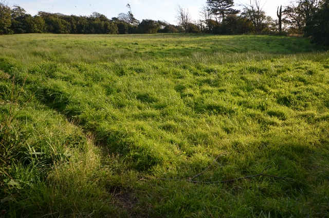
Enclosure near Damhead Wood, Whickham
- Scheduled Monument area - based on Historic England data (Open Government Licence). The remains of a rectilinear, double-ditched, enclosure are situated near Damhead Wood, to the east of the River …
Co-Curate Page
Walwick Fell Roman temporary camp
- Map showing the Scheduled Monument area to the south of Black Carts Turret. The site of Walwick Fell Roman temporary camp is located about 1.5 km north-west of the village …
Co-Curate Page
Brown Dikes Roman temporary camp
- Map showing Brown Dikes temporary camp to the south-west of Carraw Farm, and south of Hadrian's Wall (running in parallel to, and just north of, the B6318). The Brown Dikes …
Co-Curate Page
Chesters Pike Roman temporary camp
- Chesters Pike temporary camp is located to the north-east of Chesters Roman Fort (Aecia), and about 5 km north-east of Greenhead in Northumberland. The camp probably pre-dated Hadrian's Wall. The …
Co-Curate Page
Section of Stanegate Roman road, NE of Greenhead
- Map showing the Scheduled Monument area for the section of Stanegate, with a Roman cemetery at it's west end. A surviving section of the Stanegate Roman road, located north-east of …
Co-Curate Page
Coesike East Roman temporary camp
- Map showing the Scheduled Monument area to the north of Grindon Farm and east of Milecastle 35 on Hadrian's Wall. Scheduled Monument (#1010937): Coesike East Roman temporary camp Click the …
Co-Curate Page
Coesike West Roman temporary camps
- Map showing the Scheduled Monument area of Coesike West Roman temporary camps to the north-west of Grindon Farm. Scheduled Monument (#1010938): Coesike West Roman temporary camps 1 and 2 Click …
Co-Curate Page
Haltwhistle Burn 1 temporary camp, fortlet, and section of Stanegate
- Scheduled Monument (#1010945): Haltwhistle Burn 1 Roman temporary camp, fortlet and section of the Stanegate Click the headings below to expand (selected extracts from the Historic England scheduling) Significance The …
Co-Curate Page
Haltwhistle Burn Roman temporary camps 2 and 3 and area of cord rig cultivation
- Scheduled Monument (#1010946): Haltwhistle Burn Roman temporary camps 2 and 3 and area of cord rig cultivation Click the headings below to expand (selected extracts from the Historic England scheduling) …
Co-Curate Page
Brown Moor Roman temporary camp
- Scheduled Monument (#1010981): Brown Moor Roman temporary camp Click the headings below to expand (selected extracts from the Historic England scheduling) Significance Over 40 temporary camps of many different sizes, …
Co-Curate Page
Fell End Roman temporary camp and section of Stanegate
- Scheduled Monument (#1010953): Fell End Roman temporary camp and section of the Stanegate Roman road Click the headings below to expand (selected extracts from the Historic England scheduling) Significance The …
Co-Curate Page
Carvoran Roman fort
- Map showing Carvoran Roman fort (shaded area) within the wider Scheduled Monument area. The remains of Carvoran fort, known to the Romans as Magna, are located on Hadrian's Wall (Wall …
Co-Curate Page
Seatsides 2 Roman temporary camp
- Map showing the Scheduled Monument area for Seatsides 2 Roman temporary camp. Scheduled Monument (#1010941): Seatsides 2 Roman temporary camp Click the headings below to expand (selected extracts from the …
Co-Curate Page
Bean Burn 2 Roman temporary camp
- Map showing the Scheduled Monument area of Bean Burn 2 Roman temporary camp. Scheduled Monument (#1010943): Bean Burn 2 Roman temporary camp Click the headings below to expand (selected extracts …
Co-Curate Page
Bean Burn 1 Roman temporary camp
- Map showing the Scheduled Monument area of Bean Burn 1 Roman temporary camp. Scheduled Monument (#1010942): Bean Burn 1 Roman temporary camp Click the headings below to expand (selected extracts …
Co-Curate Page
Sunny Rigg 1 Roman temporary camp
- Map showing the Scheduled Monument area of Sunny Rigg 1 Roman temporary camp Scheduled Monument (#1010950): Sunny Rigg 1 Roman temporary camp Click the headings below to expand (selected extracts …
Co-Curate Page
Sunny Rigg 2 Roman temporary camp
- Map showing the Scheduled Monument area of Sunny Rigg 2 Roman temporary camp Scheduled Monument (#1010951): Sunny Rigg 2 Roman temporary camp Click the headings below to expand (selected extracts …
Co-Curate Page
Sunny Rigg 3 Roman temporary camp
- Map showing the Scheduled Monument area of Sunny Rigg 3 Roman temporary camp Scheduled Monument (#1010952): Sunny Rigg 3 Roman temporary camp Click the headings below to expand (selected extracts …
Co-Curate Page
Chapel Rigg Roman temporary camp
- Map showing the Scheduled Monument area of Chapel Rigg Roman temporary camp Scheduled Monument (#1010954): Chapel Rigg Roman temporary camp Click the headings below to expand (selected extracts from the …
Co-Curate Page
Crooks Roman temporary camp
- Map showing the Scheduled Monument area of Crooks Roman temporary camp Scheduled Monument (#1010955): Crooks Roman temporary camp Click the headings below to expand (selected extracts from the Historic England …

Co-Curate Page
Hadrian's Wall
- Overview About Hadrian's Wall Map Hadrian's Wall Glossary Hadrian's Wall stretches over 73 miles (117 km) coast to coast across Northern England. Construction began in AD 122 during the rule …
from https://www.futurelearn.com/c…
Hadrian's Wall: Life on the Roman Frontier (course)
- An online course by Newcastle University on Futurelearn. "This six week course offers a comprehensive introduction to Hadrian’s Wall and its people and raises fascinating issues concerning colonisation, cultural transformation, …
Added by
Simon Cotterill
Co-Curate Page
Segedunum
- Overview About Segedunum Map Segedunum was a Roman fort built at the eastern end of Hadrian's Wall near the banks of the River Tyne. It is located in modern-day Wallsend, …
from Youtube (youtube)
Hadrian's Wall - NewCastle Roman Fort 3D Reconstruction
Pinned by Simon Cotterill
Co-Curate Page
Arbeia - Roman Fort
- Overview About Arbeia Map Street View The fort stood on the Lawe Top in South Shields, overlooking the River Tyne. It was built around 120 AD, guarded the main sea …
from North East Museums (youtube)
Portable Roman shrine at Segedunum Roman Fort
Pinned by Simon Cotterill
from North East Museums (youtube)
A new Roman find at Arbeia Roman Fort & Museum
Pinned by Simon Cotterill
from North East Museums (youtube)
Segedunum Roman Fort with Kingston Park Primary School.
Pinned by Simon Cotterill
from Newcastle libraries (flickr)
003358:Roman Coffin Newcastle-Upon-Tyne 1903
Pinned by Simon Cotterill
Co-Curate Page
Benwell Temple of Antenociticus
- Overview About Antenociticus Map Street View "The fort at Benwell, which was occupied throughout most of the Roman period by the cavalry regiment ala I Asturum, is no longer visible. …
Co-Curate Page
Benwell Vallum Crossing / Condercum
- Overview About Condercum Map Street View "Nothing is now visible of the fort at Benwell (Condercum) in Newcastle, which was occupied throughout most of the Roman period by the Asturian …
Co-Curate Page
Denton Hall Roman Turret
- Turrets on Hadrian’s Wall were small watchtowers built into the wall, with two turrets per Roman mile, located between larger milecastles. They provided elevated viewpoints for small groups of 4 …
Co-Curate Page
Hadrian's Wall at Heddon-on-the-Wall
- A consolidated stretch of Wall, up to 2 metres (61⁄2 feet) thick in places. "Stretches of Hadrian’s Wall 220 metres long and of the Wall-ditch to its north are visible …
Co-Curate Page
Piercebridge Roman Bridge
- Overview About the Roman Bridge Map Street View The Roman bridge at Piercebridge crossed the River Tees, carrying Dere Street, the Roman road that linked York with Corbridge, near Hadrian’s …
Co-Curate Page
Morbium - Roman Fort at Piercebridge
- Note: Scheduled Monument area - map data from Hstoric England c/o Open Data UK, under the Open Government Licence, imported into Google MyMaps, March 2026. "Piercebridge is located on the …
Co-Curate Page
Corbridge Roman Town and Fort
- Overview About Corbridge Roman Fort/Town Map Street View Corstopitum Coria was a fort and town 2.5 miles (4.0 km) south of Hadrian's Wall, in the Roman province of Britannia at a …
Co-Curate Page
Planetrees Roman Wall
- Overview About Planetrees Wall Map Street View Planetrees is an extant section of Hadrian's Wall named after the farm located around 250 metres (270 yd) to the west. The …
Co-Curate Page
Turret 29a (Black Carts)
- Overview Map Street View Turrets on Hadrian’s Wall were small watchtowers built into the wall, with two turrets per Roman mile, located between larger milecastles. They provided elevated viewpoints for …
Co-Curate Page
Chesters Bridge Abutment
- Overview Map Close to Chesters Roman Fort are the remains of a bridge which carried Hadrian's Wall across the River North Tyne.
Co-Curate Page
Chesters Roman Fort
- Overview About Chesters (Cilurnum) Map Chesters Roman Fort and Museum, managed by English Heritage, is located near Walwick and Chollerford in Northumberland. The Roman cavalry fort (Cilurnum) was built in …
Co-Curate Page
Pons Aelius
- Overview About Pons Aelius Remains The Romans built Pons Aelius, a bridge to cross the River Tyne, around 122AD. A fort was built there, eventually becoming known under the same …
from Newcastle libraries (flickr)
003357:Roman Coffin Newcastle-Upon-Tyne 1903
Pinned by Simon Cotterill
Co-Curate Page
Longovicium, Lanchester Roman Fort
- Overview About Longovicium Map Street View Longovicium was a Roman fort established in the mid 2nd century AD, which lay on Dere Street, the Roman road connecting York with the …
Co-Curate Page
Vinovia, Binchester Roman Fort
- Overview About Vinovia Map Street View Vinovia was a Roman Fort established c.80 AD, located about a mile north of Bishop Auckland in County Durham. It was situated on Dere …
Co-Curate Page
Chew Green, Roman Fort
- Overview About Chew Green Map & Aerial View Chew Green is the site of a large Roman encampment located about 9 miles west of Alwinton in Northumberland, and very close …
from Newcastle libraries (flickr)
003355:Roman Mask Newcastle-Upon-Tyne 1906
Pinned by Simon Cotterill
Co-Curate Page
Habitancum Roman Fort
- Overview About Habitancum Habitancum was an ancient Roman fort (castra) located at Risingham, Northumberland, England. The fort was one of the defensive structures built along Dere Street, a Roman road …
Co-Curate Page
Haltwhistle Burn Roman Fortlets
- Overview Map and Aerial View From about AD 105 there was a small fort guarding Stanegate, the Roman military road from Corbridge (Corio) to Carlisle (Luguvalium), where it crossed the …
Co-Curate Page
Grindon School Roman Camp
- Map showing Grindon School temporary camp, to the south-east of Milecastle 35 on Hadrian's Wall, and north-west of Grindon Farm. There was a Roman temporary camp at Grindon, just south …
Co-Curate Page
Scremerston
- Overview About Scremerston Map Street View Scremerston is a village in Northumberland, close to the coast and located about 3 miles south of Berwick-upon-Tweed. Initially an agricultural settlement, Scremerston grew …
Co-Curate Page
Poltross Burn Milecastle, Hadrian's Wall
- Overview About Milecastle 48 Map Street View Poltross Burn, located near Gilsland, is one of the best-preserved milecastles on Hadrian's Wall. It is larger than most other milecastles, housing two …
Co-Curate Page
Housesteads
- Overview About Howsteads Fort Map Street View Interactive Glossary Housesteads (Roman name: "Vercovicium") is one of the best preserved forts on Hadrian's Wall, built around 124 AD. The fort covers …
Co-Curate Page
Ambleside Roman Fort (Galava)
- Overview About Ambleside Roman Fort Map Street View The remains of Ambleside Roman Fort (Galava) are located in a field by the shores of Lake Windermere in Ambleside. The stone …
Co-Curate Page
Huntcliff Roman Signal Station
- Overview Map Street View "The site of a Roman signal station at Huntcliff, thought to be of late fourth century date. A Roman signal station at Huntcliff was discovered circa …
Co-Curate Page
Milefortlet 9 (Skinburness)
- Overview About Milefortlet 9 Map Just north-west of Skinburness, by the crest of Grune Point, are the buried remains of a Roman milefortlet and the buried remains of an earlier Roman camp. …
Co-Curate Page
Learchild Roman fort (Alavna)
- The shallow earthwork remains of a large Roman fort (thought to be 'Alavna') near High Learchild were discovered by arial photography in 1945, and confirmed by subsequent archaeological digs. The fort …
Co-Curate Page
Bremenium Roman Fort
- Overview About Bremenium Map Street View Bremenium was an ancient Roman fort (castra) located at Rochester, Northumberland, England. The fort was one of the defensive structures built along Dere …
Co-Curate Page
Vindobala
- Overview About Vindobala Map Street View Vindobala (Brytonnic Celtic : windo- fair, white, bala place, situation?, cf. Old Irish bal, bail place, situation, condition, (good) luck) was a Roman …
Co-Curate Page
Alauna Roman Fort (Maryport)
- Overview About Alauna Aerial View / Map Street View Alauna was a fort in the Roman province of Britannia, located on the coastal sandstone ridge to north of the modern …
Co-Curate Page
Senhouse Roman Museum
- Overview Map Street View Senhouse Roman Museum is located at The Battery on Sea Brows in Maryport. The museum occupies part of the site of Alauna - the Roman fort …
Co-Curate Page
Roman milestone near Spitals Farm
- There is Roman milestone near Spitals Farm, on the side of the old A66 road between the villages of Kirkby Thore and Temple Sowerby in Cumbria. The milestone, carved from red …
Co-Curate Page
Burrow Walls Roman Fort
- Overview Map Burrow Walls is located between Workington and Seaton in Cumbria. This Scheduled Monument includes the buried remains of a Roman fort and also visible sections of a wall made …
Co-Curate Page
Boothby Roman Fort
- There was a Roman fortlet (no visible remains today) at a strategic position overlooking the River Irthing, located to the north-west of Boothby in Cumbria. It was built in the …
from Youtube (youtube)
What Was Life Like? | Episode 2: Romans - Meet a Roman Legionary
Pinned by Simon Cotterill
Co-Curate Page
Old Roman Milestone, Middleton Parish
- The remains of a Roman milestone in Middleton are situated close to the former route of the Roman road from Ribchester to Low Borrow Bridge. The milestone is cylindrical with …
Co-Curate Page
St Constantine's Cells (Wetheral Caves) and rock-cut Roman Graffiti
- Overview Map St Constantine's Cells (aka Wetheral Caves, Wetheral Safeguard, or Constantine's Hermitage) are three chambers cut into the cliff face about 40ft above the River Eden, south of Wetheral. …
Co-Curate Page
Concangis Roman Fort
- Concangis (modern-day Chester-le-Street) was an auxiliary fort established by the Romans in the late 70s AD. It was situated on a high bluff, guarding the River Wear and Cong Burn …
Co-Curate Page
Hardknott Roman Fort
- Overview Map Street View Aerial View The well-preserved remains of Hardknott Roman Fort (Mediobogdum) are located about 5 miles east of the village of Eskdale Green in Cumbria. It was …
Co-Curate Page
Turma! Hadrian's Cavalry Charge
- Turma! Hadrian's Cavalry Charge was a Roman cavalry re-enactment event 1st-2nd July 2017 held at Bitts Park, Carlisle. It is thought to be first time in over 1,500 years, that a …
from Flickr (flickr)
Head of the god of Antenociticus, Great North Museum, Newcastle
Pinned by Simon Cotterill
from Flickr (flickr)
Altars dedicated to Neptune and Oceanus by the Sixth Legion Victrix Pia Fidelis, Great North Museum, Newcastle
Pinned by Simon Cotterill
from Flickr (flickr)
Milecastle 38 inscription proving that Hadrian commissioned the wall that now bears his name (RIB 1638), Great North Museum, Newcastle
Pinned by Simon Cotterill
from Flickr (flickr)
Altar in sandstone dedicated to Mithras, from Carrawburgh, CIMRM 847, Great North Museum, Newcastle
Pinned by Simon Cotterill
from Flickr (flickr)
Stone relief with Mithras emerging from the cosmic egg, from Housesteads, CIMRM 860, Great North Museum, Newcastle
Pinned by Simon Cotterill
from Flickr (flickr)
Hadrianic construction inscription recording work by the Classis Britannica, in found 1937 in a granary portico at Benwell fort, RIB 1340, Great North Museum, Newcastle
Pinned by Simon Cotterill
Co-Curate Page
Hillfort and Roman signal station, Barcombe Hill
- Overview Map Scheduled Monument area - based on Historic England data (Open Government Licence). The remains of an Iron Age defended settlement and Roman signal station are located on Barcombe …
Co-Curate Page
Knockcross Roman temporary camp
- Overview Map The site of the Roman temporary camp known as Knockcross is located at Grey Havens (house), about ½mile east of Bowness‑on‑Solway and 190m north of Hadrian’s Wall. Although …
Co-Curate Page
Roman fort and watch tower, south of Burgh by Sands
- Overview Map The site of a Roman fort and watch tower are located just over ½mile south of Burgh by Sands (and the course of Hadrian's Wall, which ran through …
Co-Curate Page
Ravenglass Roman Fort
- % The site of the Roman fort Glannoventa is located to the south of Ravenglass. The burried remains of the fort survive as visible earthworks. The fort served as an …
Co-Curate Page
Roman Bath House, Ravenglass
- Overview Map Street View The remains of the bath house of Ravenglass Roman Fort, established around AD 130, are among the tallest Roman structures surviving in northern Britain. The bath …
Co-Curate Page
Roman Tile Kilns, near Birks Coppice
- % The site of two Roman tile kilns is located by Birks Coppice in Eskdale, just over 2 miles north-east of Muncaster. The remains of the kilns were first found …
Co-Curate Page
Ebchester Roman Fort (Vindomora)
- Map of the Vindomora Scheduled Monument area. The site of Vindomora Roman Fort is located in the heart of Ebchester in County Durham. There are no obvious visible remains, however, …
Co-Curate Page
Lavatrae Roman Fort
- % Map showing the Scheduled Monument area for Lavatrae Roman Fort Lavatrae was a Roman auxiliary fort situated by the River Greta, located in modern-day Bowes in County Durham. It …
Co-Curate Page
Whitley Castle Roman Fort (Epiacum)
- Overview Street View Map of Whitley Castle Roman fort (Epiacum) - Scheduled Monument Area The remains of Epiacum Roman Fort are located about 1½ miles north-west of Alston. The fort …
Co-Curate Page
Low Borrowbridge Roman Fort
- The remains of a Roman fort and its civilian settlement (vicus) are located at Low Borrowbridge, about 2 miles south of Tebay in Cumbria. The site is situated by the …
Co-Curate Page
Kirkhaugh Roman Bridge Abutments
- Scheduled Monument (#1006577): Kirkhaugh Bridge abutments 1/2 mile (800m) NE of Whitley Castle Click the headings below to expand (selected extracts from the Historic England scheduling) Significance Roman bridges are …
Co-Curate Page
Springhill Camp
- Scheduled Monument areas - based on Historic England data (Open Government Licence). This site is located close to Spring Hill, to the south of Tweedmouth in Northumberland. It is scheduled …
Co-Curate Page
Roman aqueduct to Great Chesters from Caw Burn
- Scheduled Monument areas - based on Historic England data (Open Government Licence). The Romans constructed an extensive aqueduct to carry water from Caw Burn westwards to supply Great Chesters fort …
Co-Curate Page
Washingwells Roman fort, Whickham
- Scheduled Monument area - based on Historic England data (Open Government Licence). The site of Washingwells Roman fort is located to the east of Whickham, near Watergate Forest Park. The …
Co-Curate Page
Enclosure near Damhead Wood, Whickham
- Scheduled Monument area - based on Historic England data (Open Government Licence). The remains of a rectilinear, double-ditched, enclosure are situated near Damhead Wood, to the east of the River …
Co-Curate Page
Walwick Fell Roman temporary camp
- Map showing the Scheduled Monument area to the south of Black Carts Turret. The site of Walwick Fell Roman temporary camp is located about 1.5 km north-west of the village …
Co-Curate Page
Brown Dikes Roman temporary camp
- Map showing Brown Dikes temporary camp to the south-west of Carraw Farm, and south of Hadrian's Wall (running in parallel to, and just north of, the B6318). The Brown Dikes …
Co-Curate Page
Chesters Pike Roman temporary camp
- Chesters Pike temporary camp is located to the north-east of Chesters Roman Fort (Aecia), and about 5 km north-east of Greenhead in Northumberland. The camp probably pre-dated Hadrian's Wall. The …
Co-Curate Page
Section of Stanegate Roman road, NE of Greenhead
- Map showing the Scheduled Monument area for the section of Stanegate, with a Roman cemetery at it's west end. A surviving section of the Stanegate Roman road, located north-east of …
Co-Curate Page
Coesike East Roman temporary camp
- Map showing the Scheduled Monument area to the north of Grindon Farm and east of Milecastle 35 on Hadrian's Wall. Scheduled Monument (#1010937): Coesike East Roman temporary camp Click the …
Co-Curate Page
Coesike West Roman temporary camps
- Map showing the Scheduled Monument area of Coesike West Roman temporary camps to the north-west of Grindon Farm. Scheduled Monument (#1010938): Coesike West Roman temporary camps 1 and 2 Click …
Co-Curate Page
Haltwhistle Burn 1 temporary camp, fortlet, and section of Stanegate
- Scheduled Monument (#1010945): Haltwhistle Burn 1 Roman temporary camp, fortlet and section of the Stanegate Click the headings below to expand (selected extracts from the Historic England scheduling) Significance The …
Co-Curate Page
Haltwhistle Burn Roman temporary camps 2 and 3 and area of cord rig cultivation
- Scheduled Monument (#1010946): Haltwhistle Burn Roman temporary camps 2 and 3 and area of cord rig cultivation Click the headings below to expand (selected extracts from the Historic England scheduling) …
Co-Curate Page
Brown Moor Roman temporary camp
- Scheduled Monument (#1010981): Brown Moor Roman temporary camp Click the headings below to expand (selected extracts from the Historic England scheduling) Significance Over 40 temporary camps of many different sizes, …
Co-Curate Page
Fell End Roman temporary camp and section of Stanegate
- Scheduled Monument (#1010953): Fell End Roman temporary camp and section of the Stanegate Roman road Click the headings below to expand (selected extracts from the Historic England scheduling) Significance The …
Co-Curate Page
Carvoran Roman fort
- Map showing Carvoran Roman fort (shaded area) within the wider Scheduled Monument area. The remains of Carvoran fort, known to the Romans as Magna, are located on Hadrian's Wall (Wall …
Co-Curate Page
Seatsides 2 Roman temporary camp
- Map showing the Scheduled Monument area for Seatsides 2 Roman temporary camp. Scheduled Monument (#1010941): Seatsides 2 Roman temporary camp Click the headings below to expand (selected extracts from the …
Co-Curate Page
Bean Burn 2 Roman temporary camp
- Map showing the Scheduled Monument area of Bean Burn 2 Roman temporary camp. Scheduled Monument (#1010943): Bean Burn 2 Roman temporary camp Click the headings below to expand (selected extracts …
Co-Curate Page
Bean Burn 1 Roman temporary camp
- Map showing the Scheduled Monument area of Bean Burn 1 Roman temporary camp. Scheduled Monument (#1010942): Bean Burn 1 Roman temporary camp Click the headings below to expand (selected extracts …
Co-Curate Page
Sunny Rigg 1 Roman temporary camp
- Map showing the Scheduled Monument area of Sunny Rigg 1 Roman temporary camp Scheduled Monument (#1010950): Sunny Rigg 1 Roman temporary camp Click the headings below to expand (selected extracts …
Co-Curate Page
Sunny Rigg 2 Roman temporary camp
- Map showing the Scheduled Monument area of Sunny Rigg 2 Roman temporary camp Scheduled Monument (#1010951): Sunny Rigg 2 Roman temporary camp Click the headings below to expand (selected extracts …
Co-Curate Page
Sunny Rigg 3 Roman temporary camp
- Map showing the Scheduled Monument area of Sunny Rigg 3 Roman temporary camp Scheduled Monument (#1010952): Sunny Rigg 3 Roman temporary camp Click the headings below to expand (selected extracts …
Co-Curate Page
Chapel Rigg Roman temporary camp
- Map showing the Scheduled Monument area of Chapel Rigg Roman temporary camp Scheduled Monument (#1010954): Chapel Rigg Roman temporary camp Click the headings below to expand (selected extracts from the …


