Topics > Transport and Travel > Road > Stanegate
Stanegate
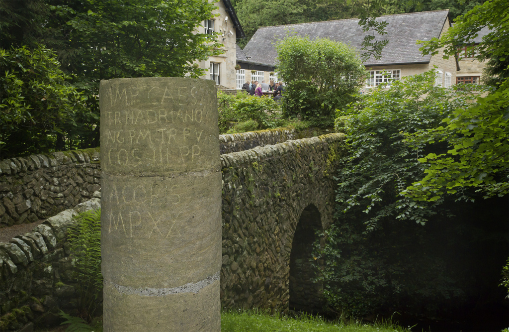
The Stanegate ("stone road") was an important Roman road, built before Hadrian's Wall, which linked forts at Carlisle (Luguvalium) and Corbridge (Corstopitum). It became the northern frontier of Roman empire in Britain until Hadrian's Wall was built just north of it. A modern tarmac road taking the name Stanegate runs close in parallel to parts of the Roman road.
from https://commons.wikimedia.org…
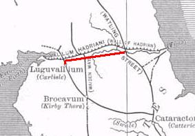
Route of the Stanegate
- Diagram by Neddyseagoon, c/o Wikimedia: CC BY-SA 3.0
Added by
Simon Cotterill

Co-Curate Page
Roman Period (43 to 409 AD)
- The Romans invaded Great Britain in 43 AD, though there had been earlier Roman expeditions into Britain, led by Julius Caesar in 55 and 54 BC. The Romans occupied most …

Co-Curate Page
Bardon Mill
- Overview About Bardon Mill Map Street View Bardon Mill is a village in Northumberland, located about 16 miles west of Hexham and 9 miles east of Haltwhistle. It is situated …
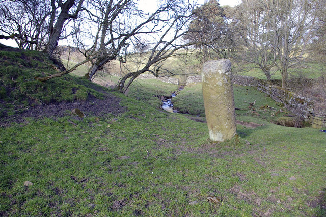
from Geograph (geograph)
Pasture, Bradley Burn and Roman milestone, near Vindolanda
Pinned by Simon Cotterill
Co-Curate Page
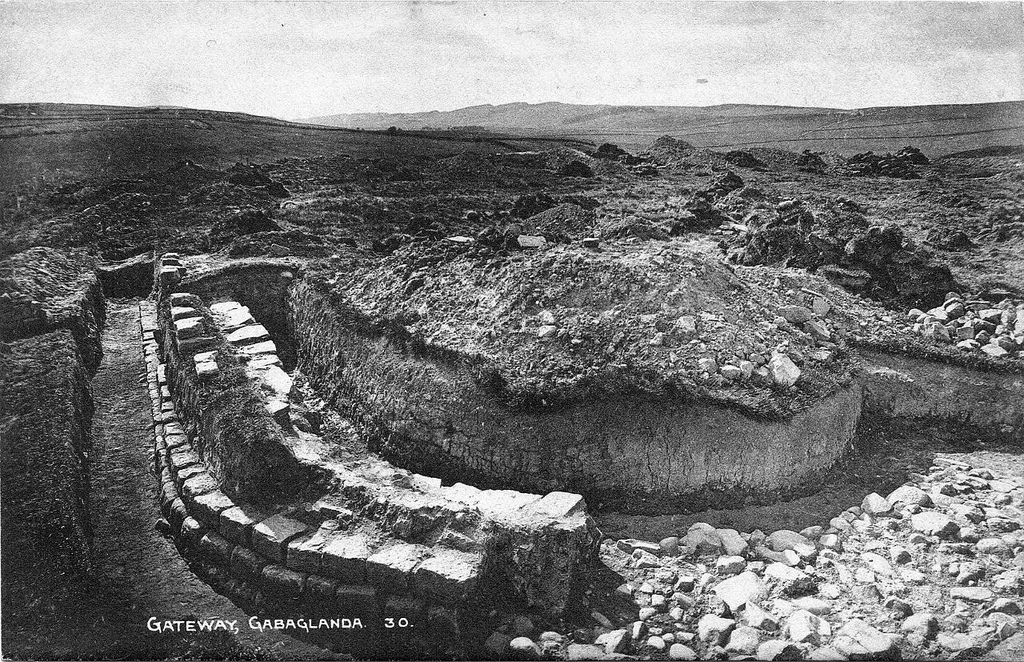
Haltwhistle Burn Roman Fortlets
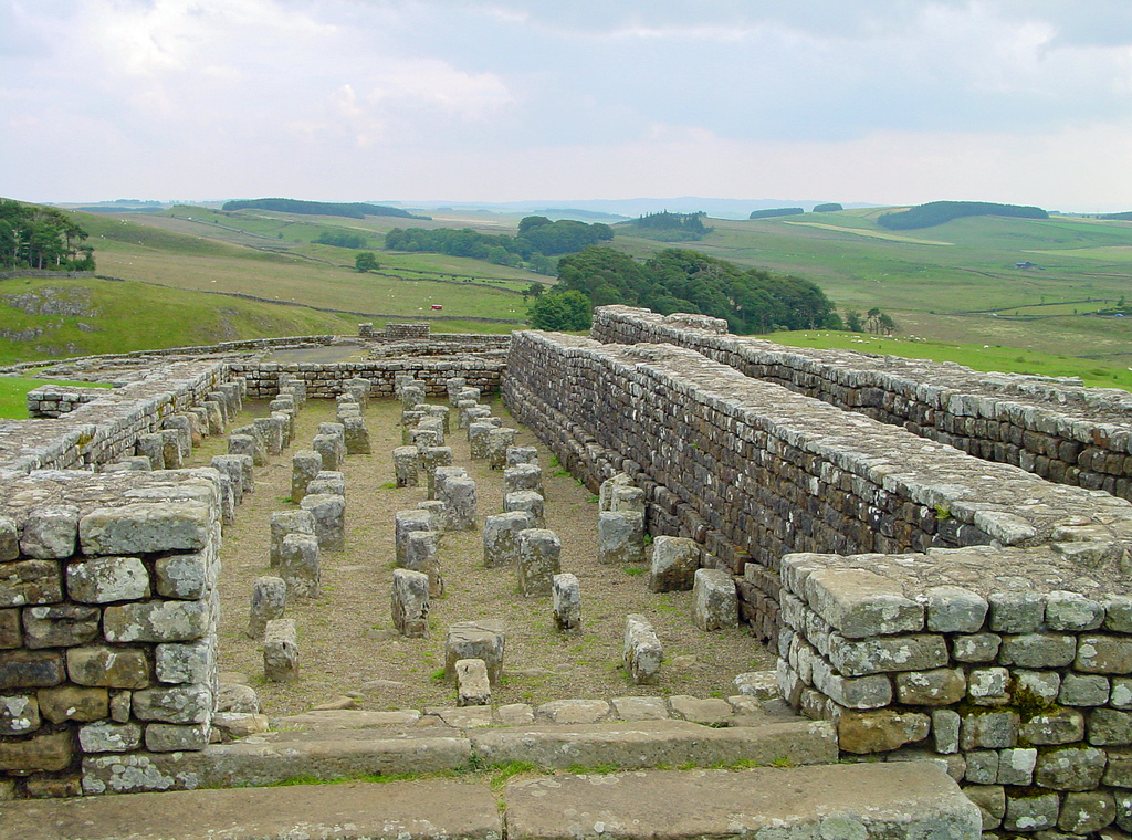
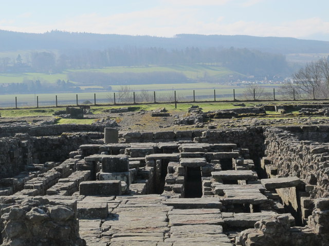
- Overview Map and Aerial View From about AD 105 there was a small fort guarding Stanegate, the Roman military road from Corbridge (Corio) to Carlisle (Luguvalium), where it crossed the …

Co-Curate Page
Boothby Roman Fort
- There was a Roman fortlet (no visible remains today) at a strategic position overlooking the River Irthing, located to the north-west of Boothby in Cumbria. It was built in the …
Co-Curate Page
Fourstones
- Overview About Fourstones Map Street View Fourstones is a village in Northumberland, located on the north bank of the River South Tyne about 4 miles north-west of the town of …
Co-Curate Page
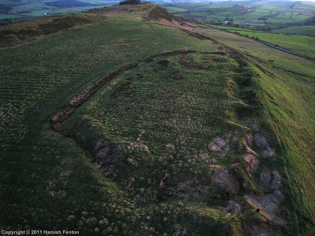
Hillfort and Roman signal station, Barcombe Hill
- Overview Map Scheduled Monument area - based on Historic England data (Open Government Licence). The remains of an Iron Age defended settlement and Roman signal station are located on Barcombe …

Co-Curate Page
Seldom Seen, Haydon Bridge
- Overview Map Seldom Seen is a farm in Northumberland, located off Stanegate, about 2½ miles NNW of Haydon Bridge. The farm is situated by Honeycrook Burn. To the north-west of …

Co-Curate Page
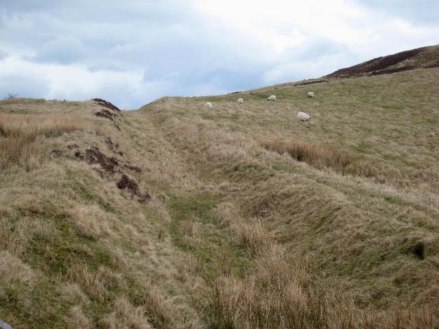
Section of Stanegate Roman road, NE of Greenhead
- Map showing the Scheduled Monument area for the section of Stanegate, with a Roman cemetery at it's west end. A surviving section of the Stanegate Roman road, located north-east of …
Co-Curate Page
Haltwhistle Burn 1 temporary camp, fortlet, and section of Stanegate
- Scheduled Monument (#1010945): Haltwhistle Burn 1 Roman temporary camp, fortlet and section of the Stanegate Click the headings below to expand (selected extracts from the Historic England scheduling) Significance The …

Co-Curate Page
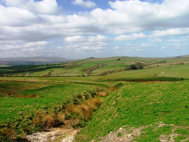
Fell End Roman temporary camp and section of Stanegate
- Scheduled Monument (#1010953): Fell End Roman temporary camp and section of the Stanegate Roman road Click the headings below to expand (selected extracts from the Historic England scheduling) Significance The …
Co-Curate Page
Seatsides 1 Roman temporary camp and section of Stanegate
- Map showing the Scheduled Monument area for the Seatsides 1 temporary camp and section of the Stanegate Roman road. Scheduled Monument (#1010940): Seatsides 1 Roman temporary camp and section of …

from https://commons.wikimedia.org…
Route of the Stanegate
- Diagram by Neddyseagoon, c/o Wikimedia: CC BY-SA 3.0
Added by
Simon Cotterill
Co-Curate Page
Roman Period (43 to 409 AD)
- The Romans invaded Great Britain in 43 AD, though there had been earlier Roman expeditions into Britain, led by Julius Caesar in 55 and 54 BC. The Romans occupied most …
Co-Curate Page
Bardon Mill
- Overview About Bardon Mill Map Street View Bardon Mill is a village in Northumberland, located about 16 miles west of Hexham and 9 miles east of Haltwhistle. It is situated …
from Geograph (geograph)
Pasture, Bradley Burn and Roman milestone, near Vindolanda
Pinned by Simon Cotterill
Co-Curate Page
Haltwhistle Burn Roman Fortlets
- Overview Map and Aerial View From about AD 105 there was a small fort guarding Stanegate, the Roman military road from Corbridge (Corio) to Carlisle (Luguvalium), where it crossed the …
Co-Curate Page
Boothby Roman Fort
- There was a Roman fortlet (no visible remains today) at a strategic position overlooking the River Irthing, located to the north-west of Boothby in Cumbria. It was built in the …
Co-Curate Page
Fourstones
- Overview About Fourstones Map Street View Fourstones is a village in Northumberland, located on the north bank of the River South Tyne about 4 miles north-west of the town of …
Co-Curate Page
Hillfort and Roman signal station, Barcombe Hill
- Overview Map Scheduled Monument area - based on Historic England data (Open Government Licence). The remains of an Iron Age defended settlement and Roman signal station are located on Barcombe …
Co-Curate Page
Seldom Seen, Haydon Bridge
- Overview Map Seldom Seen is a farm in Northumberland, located off Stanegate, about 2½ miles NNW of Haydon Bridge. The farm is situated by Honeycrook Burn. To the north-west of …
Co-Curate Page
Section of Stanegate Roman road, NE of Greenhead
- Map showing the Scheduled Monument area for the section of Stanegate, with a Roman cemetery at it's west end. A surviving section of the Stanegate Roman road, located north-east of …
Co-Curate Page
Haltwhistle Burn 1 temporary camp, fortlet, and section of Stanegate
- Scheduled Monument (#1010945): Haltwhistle Burn 1 Roman temporary camp, fortlet and section of the Stanegate Click the headings below to expand (selected extracts from the Historic England scheduling) Significance The …
Co-Curate Page
Fell End Roman temporary camp and section of Stanegate
- Scheduled Monument (#1010953): Fell End Roman temporary camp and section of the Stanegate Roman road Click the headings below to expand (selected extracts from the Historic England scheduling) Significance The …
Co-Curate Page
Seatsides 1 Roman temporary camp and section of Stanegate
- Map showing the Scheduled Monument area for the Seatsides 1 temporary camp and section of the Stanegate Roman road. Scheduled Monument (#1010940): Seatsides 1 Roman temporary camp and section of …
Haltwhistle Burn Roman Fortlets
Hillfort and Roman signal station, Barcombe Hill
Seatsides 1 Roman temporary camp and section of Stanegate
Section of Stanegate Roman road, NE of Greenhead
Haltwhistle Burn 1 temporary camp, fortlet, and section of Stanegate

Turret 45a (Walltown), Hadrian's Wall

Pike Hill Signal Tower, Hadrian's Wall


