Topics > Civil Parishes in Cumbria > Alston Moor Civil Parish > Historic Buildings and Monuments in Alston Moor Civil Parish
Historic Buildings and Monuments in Alston Moor Civil Parish
Listed buildings and scheduled monuments in Alston Moor Civil Parish, Cumbria, from the National Heritage List for England[1]. In the absence of a published 'local list', some other public buildings of interest may also be included. Use the Search (below) if looking for a specific building / monument.
| Structure | List No. | Grade | Built~ | Notes |
|---|---|---|---|---|
| Third House from West End of Road | 1144973 | II | C18th | Nenthead |
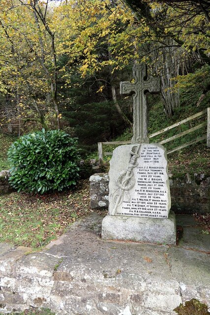
| Alston War Memorial | 1463516 | II | 1922 | |
| Bird House to East of Clarghyll Hall | 1326962 | II | ||
| Blackstock's Baker's Shop | 1106287 | II | ||
| Blue Bell Hotel (closed) | 1144991 | II | C18th | Alston - former inn |
| Boundary Stone C1600 Yards South West of Nenthead in Field on South Side of Road | 1335853 | II | ||
| Boundary Stone C2000 Yards South East of Nenthead in Field on North Side of Road | 1326961 | II | ||
| Boundary Stone to East of Bundershill | 1326261 | II | ||
| Bridge House | 1144964 | II | ||
| Burial Ground Walls and Wooden Gate to Congregational Chapel | 1107191 | II | ||
| Church Gates | 1145002 | II | ||
| Church of St Augustine | 1106230 | II | 1886 | Alston |
| Claim Stone in Corner of Field C1000 Yards North East of Blagillhead Farmhouse | 1145020 | II | ||
| Clarghyll Hall | 1087069 | II* | C16th | Clarghyll House, incorporating 2 bastles. |
| Congregational Chapel | 1144972 | II | 1756 | Redwing, Garrigill. |
| Corner House Adjoining House to South of Blue Bell Hotel | 1144990 | II | ||
| Cross View Cottage | 1325978 | II | ||
| Dene Terrace | 1107220 | II | ||
| Drystone Forecourt Walls and Piers to Front of Clarghyll Hall | 1144982 | II | ||
| Forecourt Walls to Front of Bridge House, Four Pines and the Shieling | 1144965 | II | ||
| Forecourt Walls, Gate and End Piers to Ivy House Farmhouse | 1144967 | II | ||
| Forecourt Walls, Gate Piers, and Central Gate to Front of Ivy House | 1326975 | II | ||
| Former Powder Magazine 150 Metres South West of Chapel Houses | 1144925 | II | ||
| Four Pines | 1144963 | II | ||
| Garage and Garden Walls to Loaning Foot House | 1144968 | II | ||
| Gilderdale Bridge | 1104899 | II | 1836 | Road bridge. Partly in this parish. |
| Gilderdale Viaduct | 1144983 | II | 1852 | Rail bridge. Partly in this parish |
| Gossipgate Bridge to South West of Gossipgate House | 1332956 | II | C18th | Near Alston |
| H Kearton and Sons Store | 1326976 | II | ||
| H Kearton's Shops Adjoining West End of Cross View Cottage | 1144969 | II | ||
| Harbut Lodge | 1252966 | II | ||
| High Mill | 1419977 | II* | 1767 | Alston. Corn mill complex, by John Smeaton |
| Hillcrest Hotel | 1144989 | II | ||
| House Adjoining North End of Monument View | 1086939 | II | ||
| House Adjoining South End of Blue Bell Hotel | 1326943 | II | ||
| House Adjoining South End of Monument View | 1087011 | II | ||
| Ivy House | 1107214 | II | ||
| Ivy House Farmhouse and Adjoining Byre | 1144966 | II | C18th | Garrigill. On the site of an earlier building. |
| Killhope Cross | 1326948 | II | Medieval | East of Nenthead |
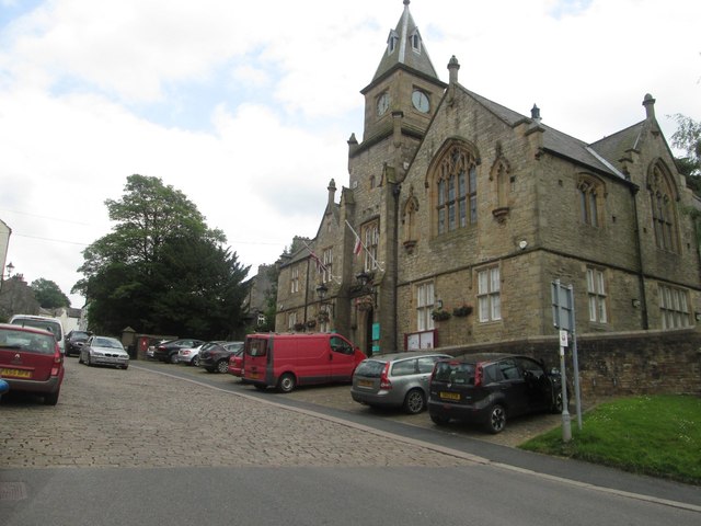
| Library, Town Hall, Trustee Saving Bank (Town Hall) | 1106388 | II | 1857 | Alston, Front Street |
| Loaning Foot House | 1326972 | II | ||
| Lowbyer Manor Farmhouse | 1144994 | II | ||
| Lowbyer Manor Hotel | 1326945 | II | C18th | Alston, Hexham Road |
| Lyndhurst | 1087003 | II | ||
| Market Cross | 1325968 | II* | 1764 | Alston. Re-erected 1883, 1970 & 1981. |
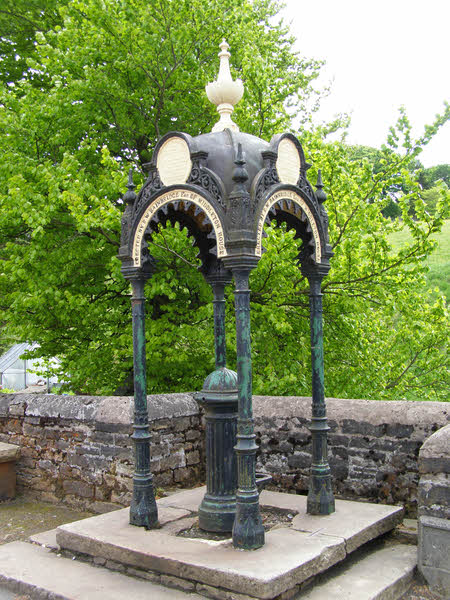
| Memorial Pump and Canopy | 1144997 | II | 1877 | Nenthead |
| Milestone Half Way Between Darngill and Crookburn Bridges | 1105661 | II | ||
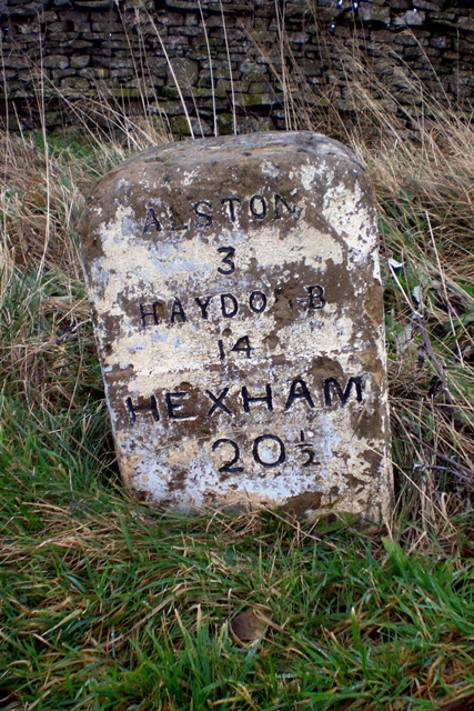
| Milestone Set into Rounded Corner of Wall to West of Town Hall | 1326952 | II | C19th | Alston |
| Milestone to East of Ashgillside | 1326265 | II | C19th | Ashgill, by B6277 |
| Milestone to East of Bayles | 1144987 | II | ||
| Milestone to East of Bunkershill | 1326949 | II | ||
| Milestone to East of over Lee House | 1145000 | II | ||
| Milestone to North East of Hartside Cottages | 1144986 | II | ||
| Milestone to North East of High Annat Walls | 1144998 | II | ||
| Milestone to North East of Hilltop | 1104870 | II | ||
| Milestone to North of Hudgillrigg | 1104911 | II | ||
| Milestone to North of Whitehouse | 1104894 | II | ||
| Milestone to North of Woodbrae | 1326947 | II | ||
| Milestone to South of Ladygill Bridge | 1326950 | II | ||
| Milestone to South West of Hartside House | 1144985 | II | ||
| Milestone to South West of Newshield | 1326946 | II | ||
| Milestone to South West of Skelgillrigg | 1144996 | II | ||
| Milestone to West of Clargillhead | 1144995 | II | C19th | Near Clarghyll |
| Milestone to West of Rise Head | 1144999 | II | ||
| Monument View | 1326944 | II | ||
| Nenthead Methodist Church | 1408095 | II | 1873 | Nenthead. Former chapel, now 'The Hive' |
| Nenthall War Memorial | 1467848 | II | 1920 | Nenthall |
| Number 4, Adjoining North End of Lyndhurst | 1144992 | II | ||
| Orchard House | 1144993 | II | ||
| Property Adjoining East End of Blackstock's Baker's Shop | 1326974 | II | ||
| Property Adjoining East End of Cross View Cottage | 1326973 | II | ||
| Property Adjoining to South of Midland Bank | 1144970 | II | ||
| Property Adjoining West End of Angel Inn | 1106259 | II | ||
| Property Occupied by the Sunderland Building Society | 1145004 | II | ||
| Property on Corner at West End of Street | 1145001 | II | ||
| Quaker Meeting House | 1144960 | II | 1732 | Alston. Front Street. |
| Randalholme Hall and Adjoining Byre | 1144984 | II | ||
| Reading Room, Adjoining West End of Ivy House | 1144971 | II | 1855 | Nenthead. Community Shop. |
| South Tyne House and Part of the Former Alston Brewery | 1144988 | II | 1770s | Alston |
| Station House | 1325522 | II | 1852 | Alston |
| Sun House, Adjoining North End of Orchard House | 1104921 | II | ||
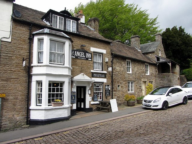
| The Angel Inn | 1326951 | II | 1611 | Alston, Front Street |
| The Beeches | 1332960 | II | ||
| The Cottage | 1106380 | II | ||
| The Gatehouse | 1326653 | II | C19th | A686. Former tollhouse. |
| The Shielding | 1144962 | II | ||
| Vicarage and Ajoining Stables | 1106250 | II | ||
| Walls and Gates to St Augustine's Churchyard Entrance | 1145003 | II | ||
| Walls to Burial Ground in Front of Quaker Meeting House | 1144961 | II | ||
| Hudgill lead mine bingsteads, 200m north east of Hudgill Farm | 1017449 | n/a | Scheduled Monument | |
| Fletcheras Rake lead workings | 1017447 | n/a | Scheduled Monument | |
| Whitesike and Bentyfield lead mines and ore works | 1015832 | n/a | Scheduled Monument | |
| Lead mines, ore works and smeltmill at Nenthead | 1015858 | n/a | Scheduled Monument | |
| Lead rake workings on Flinty Fell, 800m north west of Flinty Quarry | 1017448 | n/a | Scheduled Monument | |
| Moated site, 340m north east of Moorwell Bridge | 1007134 | n/a | Scheduled Monument | |
| Parkin's Stones round cairn on the summit of Benty Hill | 1007244 | n/a | Scheduled Monument | |
| Rotherhopefell lead and fluorspar mines and ore works | 1015827 | n/a | Scheduled Monument | |
| Upper Slatesike lead mine and ore works, 750m north east of Black Dub | 1015837 | n/a | Scheduled Monument | |
| Perry's Dam | 1015859 | n/a | Scheduled Monument | |
| Walton Monument | not listed | n/a | 1864 | Alston |
| Railway Bridge west of Coatlith Hill | not listed | n/a | C19th | Over River South Tyne |
| Ashgill Bridge | not listed | n/a | 1916 | Over Ashgill Force |
| Church of St John | not listed | n/a | C18th | Garrigill |
| Tynebottom Mine (remains) | not listed | n/a | 1771 | Garrigill |
| Church of St John the Evangelist | not listed | n/a | 1845 | Nenthead |
| Alston Conservation Area | - | n/a | Conservation Area | |
| Garrigill Conservation Area | - | n/a | Conservation Area |
Primary source: the National Heritage List for England - NHLE is the register of nationally protected historic buildings and sites in England, including listed buildings, scheduled monuments, protected wrecks, registered parks and gardens, and battlefields. The list is maintained by Historic England. Check NHLE for updates and new entries. Secondary sources: British Listed Buildings.
Co-Curate Page
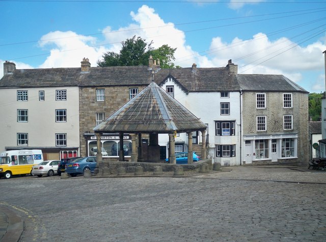
Market Cross
- Overview Map Street View The Market Cross is located in the Market Place in Alston. It was first erected in 1764. The Market Cross was rebuilt in 1883, but taken …
Co-Curate Page
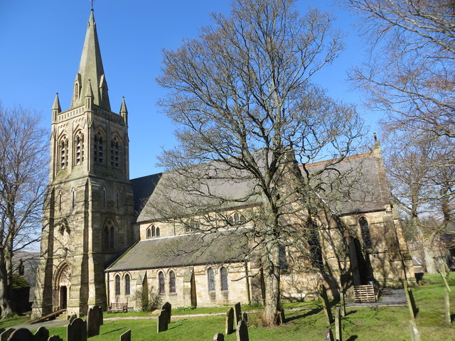
Church of St Augustine
- Overview Map Street View Inside The Church of St Augustine of Canterbury is located off Front Street in Alston. The Parish Church was built in 1870 by J.W. Walton, replacing …
Co-Curate Page
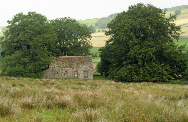
Redwing Chapel, near Garrigill
- Overview Map Street View There is an old Congregational chapel, located in an isolated position about half a mile north-west of Garrigill in Cumbria. The chapel was built in 1756 and …
Co-Curate Page
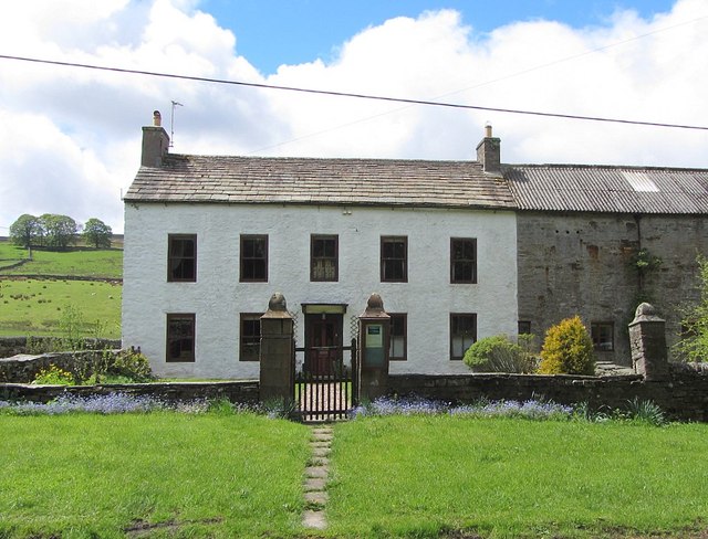
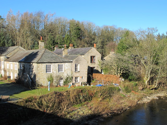
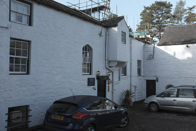
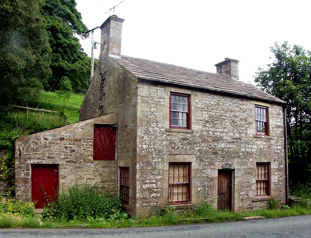
Ivy House Farm
- Overview Map Street View Ivy House Farmhouse and adjacent brye (barn) in Garrigill were built in the 18th century on the site of an earlier building of 1694.[1] The farmhouse …
Co-Curate Page
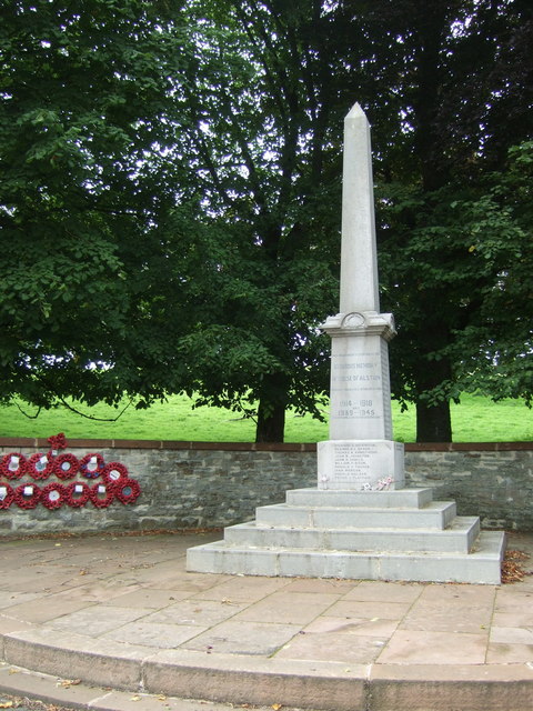
War Memorial, Alston
- Overview Map Street View The war memorial in Alston is located on Raise Bank at the junction of the A686 and A689 roads. The 2.5m tall obelisk was unveiled on …
Co-Curate Page
Old Brewery, Alston
- Overview Map Street View The former late 18th century brewery is located by the River South Tyne in Alston. The former brewery complex included the brewmaster's house (now 'South Tyne …
Co-Curate Page
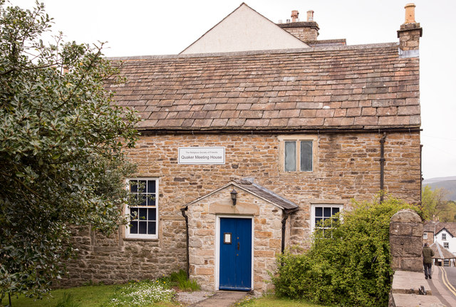
Friends Meeting House, Alston
- Overview Map Street View The Friends Meeting House on Front Street in Alston was built in 1732, with contributions from the Religious Society of Friends (Quakers), and it was extended …
Co-Curate Page
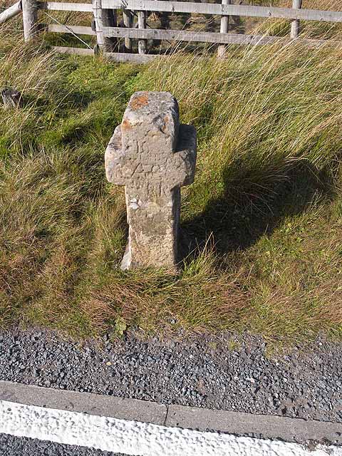
Killhope Cross, near Nenthead
- Overview Map Street View Killhope Cross is a small roadside cross, thought to be of medieval origins, located by the A689 on the county border between Cumbria and County Durham, …
Co-Curate Page
Alston Town Hall
- Overview Map Street View Alston Town Hall is located on the corner of Front Street and Station Road in Alston. The Gothic-style building was built in 1857, designed by A.B. …
Co-Curate Page
Rotherhope Fell Mine
- Overview Map (area 1) Map (area 2) "...The monument, which is divided into two areas, is situated on the north east side of Rotherhope Fell above Black Burn. It includes …
Co-Curate Page
Clarghyll Hall
- Overview Map Clarghyll Hall is a country house located about 2 miles north east of Alston in Cumbria, close to the county border with Northumberland. The house incorporates a 16th …
Co-Curate Page
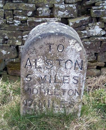
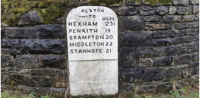
Milestone, Clargillhead
- Overview Map Street View There is an old milestone by the A686 road, to west of Clargillhead. It was made in the early 19th century for the Alston Turnpike Trust. …
Co-Curate Page
High Mill, Alston
- Overview Map Street View - Front Street View - Rear High Mill, off Front Street in Alston, was originally built as a water-powered corn mill in 1767, by the eminent …
Co-Curate Page
War Memorial, Nenthall
- Overview Map Street View The war memorial at Nenthall is located by the roadside on the A689, by it's junction with the minor road to West Cocklake. The carved stone …
Co-Curate Page
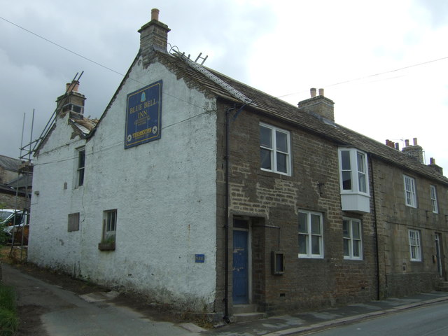
The Angel Inn, Alston
- Overview Map Street View The Angel Inn on Front Street in Alston dates from 1611, with later additions and modifications. The Inn is a Grade II listed building on the …
Co-Curate Page
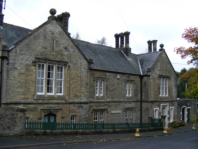
Lowbyer Manor Country House, Alston
- Overview Map Street View Lowbyer Manor Country House is located on the A686 (Hexham Road) in Alston. The building dates from the 18th century, originally a house with barn range …
Co-Curate Page
Old Milestone nr Ashgill Bridge
- Overview Map Street View There is an old milestone on the B6277 road to the north west of Ashgill Bridge. The milestone, made by the Alston Turnpike Trust, dates from …
Co-Curate Page
Gilderdale Bridge
- Overview Map Street View Gilderdale Bridge carries the A689 road over Gilderdale Burn, about 1 mile south-east of Kirkhaugh and 1½ miles north-west of Alston. The stone bridge was built in 1836 …
Co-Curate Page
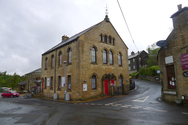
The Hive (former chapel), Nenthead
- Overview Map Street View Wesleyan Methodist Chapel, 1873 to the designs of George Race, incorporating the western block of an earlier 1826 chapel at its west end. The building is …
Co-Curate Page
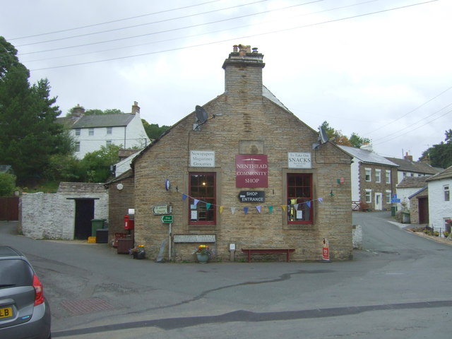
Community Shop and Post Office
- Overview Map Street View The Community Shop and Post Office in Nenthead was originally a reading room built by the London Lead Company in 1855 and enlarged in 1859. …
Co-Curate Page
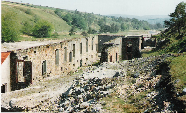
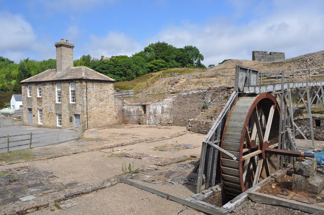
Nenthead Mines
- Overview Map Street View "Nenthead Mines is a historic place at Nenthead, near Alston, in Cumbria, UK. This remote valley is covered by remains from the lead and zinc mining …
Co-Curate Page
Station House, Alston
- Station with station-master's house, built in 1852 as the terminus to the Alston Branch of the Newcastle and Carlisle Railway. This is a Grade II listed building on the National …

Co-Curate Page
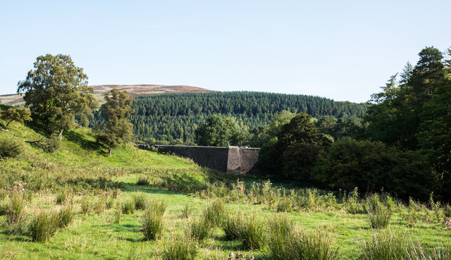
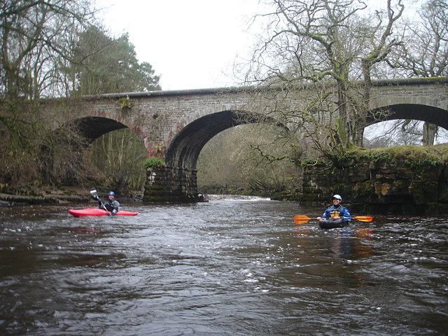
Gossipgate Bridge, Alston
- Overview Map Gossipgate Bridge is a road bridge over the River Nent, located about ½ mile east of Alston. The stone bridge dates from the 18th century and has a …
Co-Curate Page
Old Milestone near Alston Town Hall
- Overview Map Street View There is an old milestone set into the rounded corner of the stone wall, by Front Street (A686) , to the west of the Town Hall, …
Co-Curate Page
Old Tollhouse, A686
- Overview Map Street View The Gate House is a former tollhouse on the A686 near Coatlith Hill, about ½ mile north of Alston. The building was erected for the Alston …
Co-Curate Page
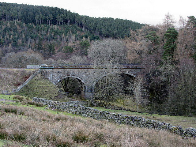
Railway Bridge over the South Tyne, nr Coatlith Hill
- Overview Map There is a stone railway bridge over the River South Tyne, west of Coatlith Hill, about ½ mile north of Alston. It carries the South Tynedale Railway.
Co-Curate Page
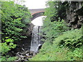
Ashgill Bridge over Ashgill Force
- Overview Map Street View Ashgill Bridge carries the B6277 road over Ash Gill, by Ashgill Force Waterfall, about 1 mile south-east of Garrigill. A plaque on the bridge notes that …
Co-Curate Page
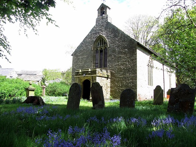
St Johns' Church
- Overview Map Street View Inside St John's Church in Garrigill dates from the 18th century, with extensive alterations made to the church in 1890.[1]
Co-Curate Page
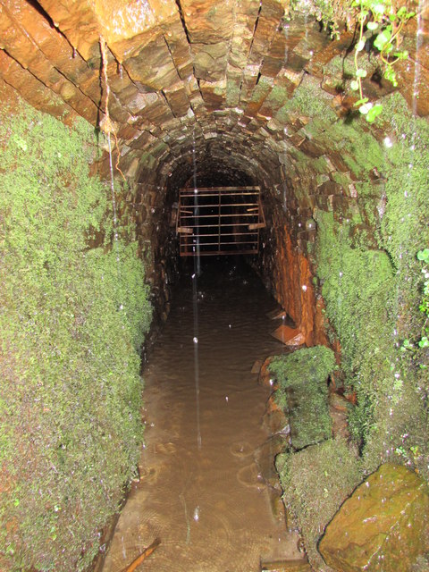
Tynebottom Mine, near Garrigill
- Tynebottom is a former lead mine at Redwig by the River South Tyne, about half a mile north-west of Garrigill in Cumbria - seen from the route of the Pennine Way. Tynebottom …
Co-Curate Page
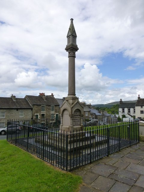
Walton Monument, Alston
- Overview Map Street View The Walton Monument in Alston is a 5 metre high granite column, built in honour of mining engineer and proprietor, Jacob Walton (1809 -1863), who played …

Co-Curate Page
Market Cross
- Overview Map Street View The Market Cross is located in the Market Place in Alston. It was first erected in 1764. The Market Cross was rebuilt in 1883, but taken …
Co-Curate Page
Church of St Augustine
- Overview Map Street View Inside The Church of St Augustine of Canterbury is located off Front Street in Alston. The Parish Church was built in 1870 by J.W. Walton, replacing …
Co-Curate Page
Redwing Chapel, near Garrigill
- Overview Map Street View There is an old Congregational chapel, located in an isolated position about half a mile north-west of Garrigill in Cumbria. The chapel was built in 1756 and …
Co-Curate Page
Ivy House Farm
- Overview Map Street View Ivy House Farmhouse and adjacent brye (barn) in Garrigill were built in the 18th century on the site of an earlier building of 1694.[1] The farmhouse …
Co-Curate Page
War Memorial, Alston
- Overview Map Street View The war memorial in Alston is located on Raise Bank at the junction of the A686 and A689 roads. The 2.5m tall obelisk was unveiled on …
Co-Curate Page
Old Brewery, Alston
- Overview Map Street View The former late 18th century brewery is located by the River South Tyne in Alston. The former brewery complex included the brewmaster's house (now 'South Tyne …
Co-Curate Page
Friends Meeting House, Alston
- Overview Map Street View The Friends Meeting House on Front Street in Alston was built in 1732, with contributions from the Religious Society of Friends (Quakers), and it was extended …
Co-Curate Page
Killhope Cross, near Nenthead
- Overview Map Street View Killhope Cross is a small roadside cross, thought to be of medieval origins, located by the A689 on the county border between Cumbria and County Durham, …
Co-Curate Page
Alston Town Hall
- Overview Map Street View Alston Town Hall is located on the corner of Front Street and Station Road in Alston. The Gothic-style building was built in 1857, designed by A.B. …
Co-Curate Page
Rotherhope Fell Mine
- Overview Map (area 1) Map (area 2) "...The monument, which is divided into two areas, is situated on the north east side of Rotherhope Fell above Black Burn. It includes …
Co-Curate Page
Clarghyll Hall
- Overview Map Clarghyll Hall is a country house located about 2 miles north east of Alston in Cumbria, close to the county border with Northumberland. The house incorporates a 16th …
Co-Curate Page
Milestone, Clargillhead
- Overview Map Street View There is an old milestone by the A686 road, to west of Clargillhead. It was made in the early 19th century for the Alston Turnpike Trust. …
Co-Curate Page
High Mill, Alston
- Overview Map Street View - Front Street View - Rear High Mill, off Front Street in Alston, was originally built as a water-powered corn mill in 1767, by the eminent …
Co-Curate Page
War Memorial, Nenthall
- Overview Map Street View The war memorial at Nenthall is located by the roadside on the A689, by it's junction with the minor road to West Cocklake. The carved stone …
Co-Curate Page
The Angel Inn, Alston
- Overview Map Street View The Angel Inn on Front Street in Alston dates from 1611, with later additions and modifications. The Inn is a Grade II listed building on the …
Co-Curate Page
Lowbyer Manor Country House, Alston
- Overview Map Street View Lowbyer Manor Country House is located on the A686 (Hexham Road) in Alston. The building dates from the 18th century, originally a house with barn range …
Co-Curate Page
Old Milestone nr Ashgill Bridge
- Overview Map Street View There is an old milestone on the B6277 road to the north west of Ashgill Bridge. The milestone, made by the Alston Turnpike Trust, dates from …
Co-Curate Page
Gilderdale Bridge
- Overview Map Street View Gilderdale Bridge carries the A689 road over Gilderdale Burn, about 1 mile south-east of Kirkhaugh and 1½ miles north-west of Alston. The stone bridge was built in 1836 …
Co-Curate Page
The Hive (former chapel), Nenthead
- Overview Map Street View Wesleyan Methodist Chapel, 1873 to the designs of George Race, incorporating the western block of an earlier 1826 chapel at its west end. The building is …
Co-Curate Page
Community Shop and Post Office
- Overview Map Street View The Community Shop and Post Office in Nenthead was originally a reading room built by the London Lead Company in 1855 and enlarged in 1859. …
Co-Curate Page
Nenthead Mines
- Overview Map Street View "Nenthead Mines is a historic place at Nenthead, near Alston, in Cumbria, UK. This remote valley is covered by remains from the lead and zinc mining …
Co-Curate Page
Station House, Alston
- Station with station-master's house, built in 1852 as the terminus to the Alston Branch of the Newcastle and Carlisle Railway. This is a Grade II listed building on the National …
Co-Curate Page
Gossipgate Bridge, Alston
- Overview Map Gossipgate Bridge is a road bridge over the River Nent, located about ½ mile east of Alston. The stone bridge dates from the 18th century and has a …
Co-Curate Page
Old Milestone near Alston Town Hall
- Overview Map Street View There is an old milestone set into the rounded corner of the stone wall, by Front Street (A686) , to the west of the Town Hall, …
Co-Curate Page
Old Tollhouse, A686
- Overview Map Street View The Gate House is a former tollhouse on the A686 near Coatlith Hill, about ½ mile north of Alston. The building was erected for the Alston …
Co-Curate Page
Railway Bridge over the South Tyne, nr Coatlith Hill
- Overview Map There is a stone railway bridge over the River South Tyne, west of Coatlith Hill, about ½ mile north of Alston. It carries the South Tynedale Railway.
Co-Curate Page
Ashgill Bridge over Ashgill Force
- Overview Map Street View Ashgill Bridge carries the B6277 road over Ash Gill, by Ashgill Force Waterfall, about 1 mile south-east of Garrigill. A plaque on the bridge notes that …
Co-Curate Page
St Johns' Church
- Overview Map Street View Inside St John's Church in Garrigill dates from the 18th century, with extensive alterations made to the church in 1890.[1]
Co-Curate Page
Tynebottom Mine, near Garrigill
- Tynebottom is a former lead mine at Redwig by the River South Tyne, about half a mile north-west of Garrigill in Cumbria - seen from the route of the Pennine Way. Tynebottom …


