Topics > Civil Parishes in Cumbria > Alston Moor Civil Parish
Alston Moor Civil Parish
Parish boundaries may have changed - for the latest map see the Parish Council or Westmorland & Furness Council.
About the Parish
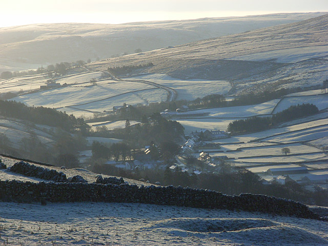
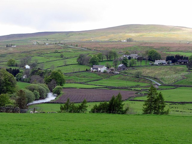
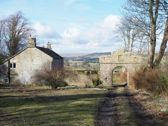
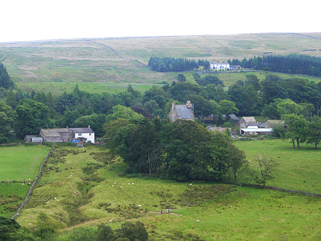
Alston Moor Civil Parish is within the part of the North Pennines Area of Outstanding Natural Beauty.
| Main Settlements: |
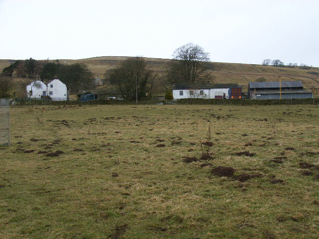
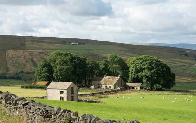
The market town of Alston and the villages of Garrigill and Nenthead, as well as several hamlets including: Ashgill, Blagill, Bayles, Clarghyll, Cocklake, Galligill, Leadgate, Nenthall, Nentsberry and Raise. |
| Population: |
2,028 (2021 Census) 2,088 (2011 Census) 2,156 (2001 Census) |
| Area: | 149.6 km2 |
| Parish Council: | Alston Moor Parish Council |
| Unitary Authority: | Westmorland & Furness Council |
| Ceremonial County: | Cumbria |
Historical |
|
| Ancient Townships: |
Alston (market town) Garrigill (chapelry) |
| Ancient Parish: |
Alternaive names: Altson Moor, Alston with Garrigill. Ancient parishes refer to the parishes before the split between ecclesiastical (church) and civil parishes in the 19th century. They had a parish church and often were composed of multiple townships and chapelries. In many cases, townships and parishes were originally based on the territory of manors from the feudal system during medieval times. Civil parishes were created following the Poor Law Amendment Act 1866, in which Church of England parishes, extra-parochial areas, townships and chapelries, became "civil parishes" which could set their own poor rate (tax). Then the reforms of Local Government Act 1894 established elected civil parish councils (or parish meetings for parishes with less than 300 residents) and created urban and rural districts. Boundaries of parishes and civil parishes may have changed over time. |
| Ancient District: |
Leath (ward) |
| Poor Law Union: |
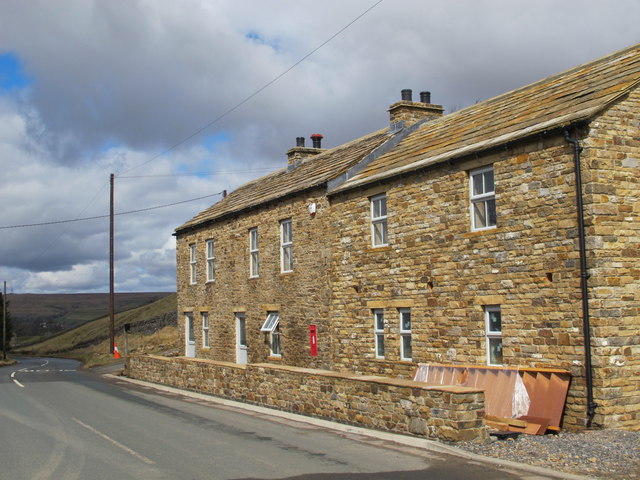
Alston with Garrigill Poor Law Union, formed in 1837. Alston with Garrigill Union Workhouse extended the existing parish workhouse in Alston, which had been established in the late 18th century. Under the Poor Law Amendment Act of 1834 parishes were grouped into Unions, each of which had to build a workhouse if they did not already have one. It ended the old system of locally provided poor relief which had come under strain as numbers out of work grew, following increasing mechanisation of agriculture and the economic downturn after the Napoleonic Wars, along with changing social attitudes. The workhouse provided those unable to support themselves financially with accommodation and work. Inmates were generally segregated into men, women, boys and girls. Alston with Garrigill Union Workhouse closed in 1917 and remaining inmates were transferred to the workhouse at Brampton. The buildings remain, now converted into a row of houses.[1] at NY71954599 The workhouse system was abolished by the Local Government Act 1929, but many workhouses lived on as ‘Public Assistance Institutions’ until the National Assistance Act 1948. |
| County: |
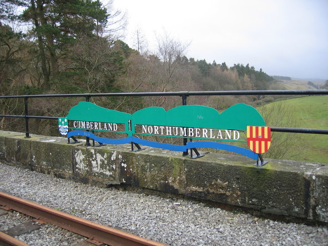
Northumberland - Alston Moor was once part of the Liberty of Tynedale in the Kingdom and later, Earldom of Northumberland. By the 12th century, it had been effectively transferred to Cumberland by the Normans, after lead mines were established in the area by Carlisle merchants.[1] Cumberland, until 1974, then: Cumbria, which was created on the 1st of April 1974, following the Local Government Act 1972. The new county absorbed Cumberland and Westmorland, and added some parts of Lancashire and the West Riding of Yorkshire. Cumbria County Council was abolished in 2023 and replaced by 2 new Unitary authorities. Cumbria remains a ceremonial county; retaining ceremonial boundary and the roles and responsibilities of the Lord Lieutenant and High Sheriff of Cumbria - based on 'The Cumbria (Structural Changes) Order 2022'. |
|
District Council: |
Alston with Garrigill Rural District (1894 - 1974) Eden District (1974 - 2023) Created by the Local Government Act 1972. Eden District was formed from an amalgamation of Penrith Urban District, Alston with Garrigill Rural District and Penrith Rural District (Cumberland), and Appleby Municipal Borough, part of Lakes Urban District and North Westmorland Rural District (Westmorland). Eden and the 5 other district councils of Cumbria, along with the county council, were abolished as part of local government reorganisation in 2023; and replaced by two unitary authorities on 1st April 2023. |
|
Civil Parish: |
The civil parish had been known as "Alston with Garrigill", until the 18th June 1974, when it was renamed "Alston Moor". The parish is divided into the wards of Alston (including Leadgate), Garrgill and Nenthead. |
|
Unitary Authority: |
Westmorland & Furness Council was created on the 1st April 2023. The 'new' Cumberland unitary authority area includes most of the historic county, with the exception of Penrith and it's surrounding area, which is part the 'new' Westmorland and Furness unitary authority. |
See also: ![]() Historic Buildings and Monuments in Alston Moor Civil Parish. Note: listed buildings are generally the responsibility of the county council / unitary authority, rather than the parish council.
Historic Buildings and Monuments in Alston Moor Civil Parish. Note: listed buildings are generally the responsibility of the county council / unitary authority, rather than the parish council.
from https://alstonmoor.org/
Alston Moor Parish Council
- "Welcome to Alston Moor which is home to a vibrant, self-sufficient community living in the high North Pennines, in an Area of Outstanding Natural Beauty....Alston Moor Parish Council represents approximately …
Added by
Simon Cotterill
Co-Curate Page
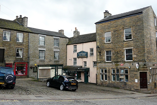
Alston
- Overview About Alston Map Street View Alston is a small town in Cumbria, England, within the civil parish of Alston Moor on the River South Tyne. It shares the …
Co-Curate Page
Garrigill
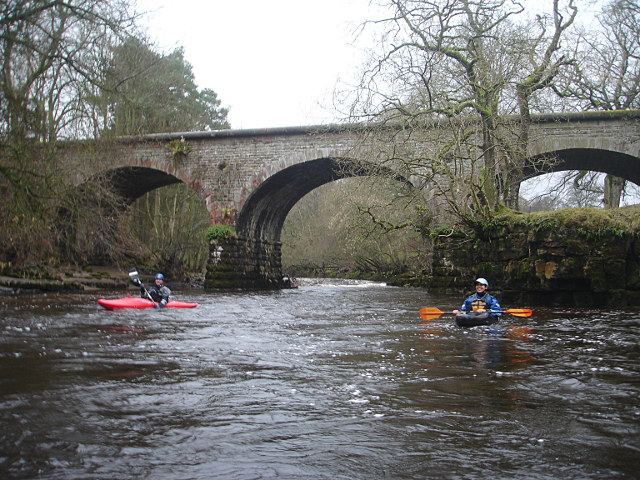
- Overview About Garrigill Map Street View Garrigill is a village in Cumbria, located in the North Pennines, about 3 miles south of Alston. Garrigill is situated by the River South …
Co-Curate Page
Nenthead
- Overview About Nenthead Map Street View Nenthead is a village in the Eden district of Cumbria, located about 4 miles south-east of Alston. Nenthead is situated by the River Nent and the smaller …
Co-Curate Page
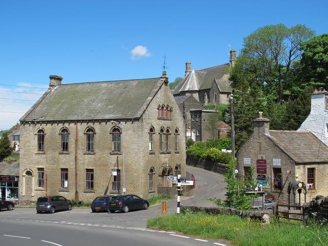
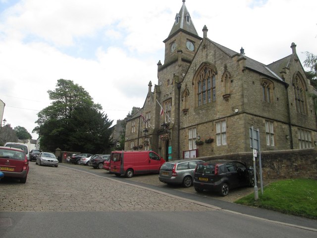
Alston Town Hall
- Overview Map Street View Alston Town Hall is located on the corner of Front Street and Station Road in Alston. The Gothic-style building was built in 1857, designed by A.B. …
from https://alstonmoorhistoricals…
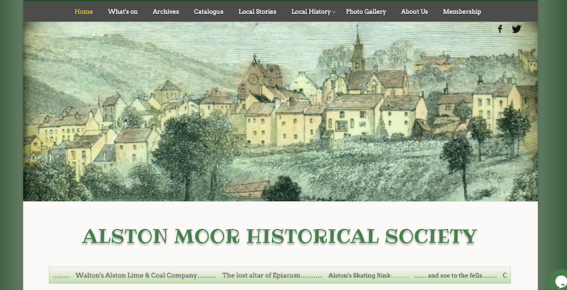
Alston Moor Historical Society
- "....Alston Moor Historical Society was founded in 1973 and it is a member of the Cumbria Federation of Local History Societies.
The history of our unique community, from its earliest …
Added by
Simon Cotterill
Co-Curate Page
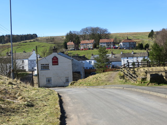
Leadgate
- Overview About Leadgate Map Street View Leadgate is a hamlet in the Eden sistrict of Cumbria, located about 2 miles south of Alston and 3 miles north-west of Garrigill. Leadgate …
Co-Curate Page
Bayles
- Overview Map Street View Bayles is a hamlet in the Eden district of Cumbria, located about 1 miles south west of Alston. It forms part of Alston Moor Civil Parish.
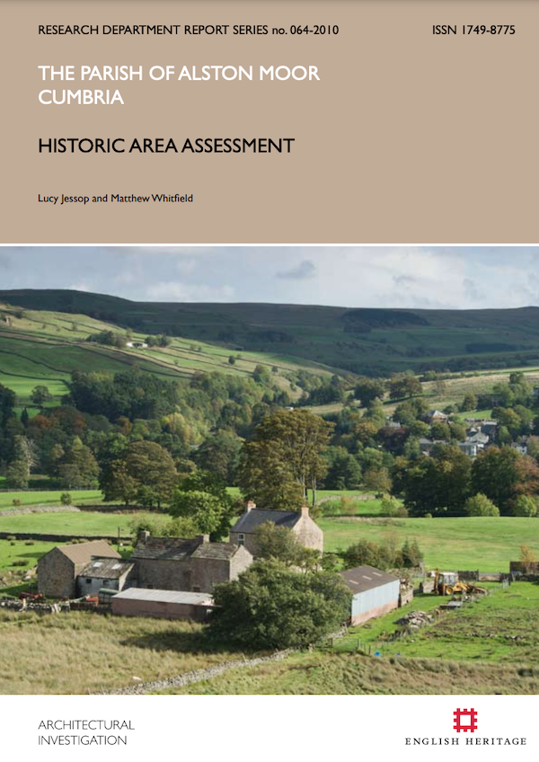
from https://historicengland.org.u…
The Parish of Alston Moor, Cumbria: Historic Area Assessment
- Lucy Jessop, Matthew Whitfield. Historic England, 2011. ISSN 1749-8775.
Added by
Simon Cotterill
Co-Curate Page
Clarghyll
- Overview Map Street View Clarghyll (historically aka Clargill) is a hamlet in the Eden district of Cumbria, located to the north of Alston and very close to the county border …

from https://www.cumbriacountyhist…
Alston Moor
- "Ancient parish in Leath ward, Cumberland. Includes market town of Alston, chapelry of Garrigill and mining village of Nenthead....manor of Alston held by de Veteripont (Vipont) family from mid-12th century …
Added by
Simon Cotterill
Co-Curate Page
Nentsberry
- Overview Map Street View Nentsberry is a distributed hamlet in the Eden district of Cumbria, located about 3 miles south east of Alston. It is on the A689 road, between …
Co-Curate Page
Nenthall
- Overview Map Street View Nenthall is a hamlet in the Eden district of Cumbria, located on the A689 road, about 2½ miles east of Alston and 2 miles north west of Nenthead. Nenthall Bridge …
from https://alstonmoorhistoricals…
Story No 43: Why is Alston Moor in Cumbria?
- "...Have you ever wondered why Alston Moor is in Cumbria?
If not, then wonder now. Geographically, the district is separated from Cumbria by the scarp of Cross Fell. Melmerby, the …
Added by
Simon Cotterill

Co-Curate Page
Raise Hamlet
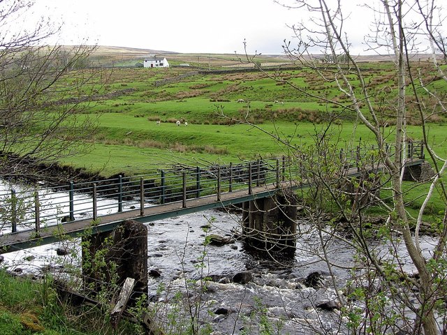
- Overview Map Street View Raise is located on the west side of the River South Tyne next to Alston, which is on the east side of the river. It is …
from https://www.workhouses.org.uk…
Workhouse - Alston with Garrigill, Cumberland
Added by
Simon Cotterill
Co-Curate Page
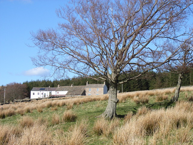
Ashgill, Cumbria
- Overview Map Street View Ashgill is an area located about 1 mile south east of the village of Garrigill in the Eden District of Cumbria. There are isolated farms/houses in …
Co-Curate Page
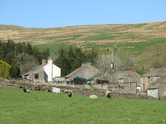
Blagill
- Overview Map Street View Blagill is a hamlet in the Eden district of Cumbria, located about 1½ miles north east of Alston and 3½ miles north west of Nenthead. It is …
Co-Curate Page
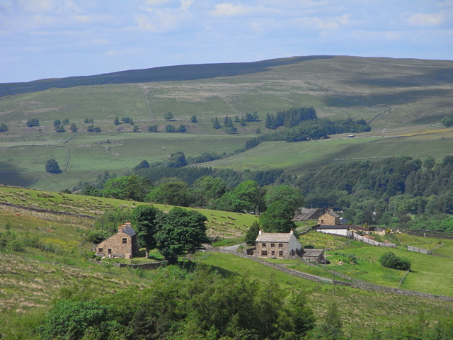
Galligill, Alston
- Overview Map Street View To the north west of Nenthead are Low Galligill and High Galligill, situated by Galligill Burn, a stream, which flows into the River Nent. There are …
Co-Curate Page
Cocklake, Alston
- Overview Map Street View West Cocklake and East Cocklake are located near Nenthall, about 2 miles east of Alston and 2½ miles north-west of Nenthead in Cumbria. They are situated …
Co-Curate Page
Gilderdale
- Non-'official' Map of Gilderdale, modified from Gilderdale Burn Catchment Area (water body). Map also shows part of the Pennine Way / Issac's Tea Trail, which cuts across Gilderdale. Gilderdale is …
Co-Curate Page
Overwater, Nenthead
- Overview Map Street View Overwater is a hamlet located to the west of the River Nent, immediately opposite Nenthead.

from https://alstonmoor.org/
Alston Moor Parish Council
- "Welcome to Alston Moor which is home to a vibrant, self-sufficient community living in the high North Pennines, in an Area of Outstanding Natural Beauty....Alston Moor Parish Council represents approximately …
Added by
Simon Cotterill
Co-Curate Page
Alston
- Overview About Alston Map Street View Alston is a small town in Cumbria, England, within the civil parish of Alston Moor on the River South Tyne. It shares the …
Co-Curate Page
Garrigill
- Overview About Garrigill Map Street View Garrigill is a village in Cumbria, located in the North Pennines, about 3 miles south of Alston. Garrigill is situated by the River South …
Co-Curate Page
Nenthead
- Overview About Nenthead Map Street View Nenthead is a village in the Eden district of Cumbria, located about 4 miles south-east of Alston. Nenthead is situated by the River Nent and the smaller …
Co-Curate Page
Alston Town Hall
- Overview Map Street View Alston Town Hall is located on the corner of Front Street and Station Road in Alston. The Gothic-style building was built in 1857, designed by A.B. …
from https://alstonmoorhistoricals…
Alston Moor Historical Society
- "....Alston Moor Historical Society was founded in 1973 and it is a member of the Cumbria Federation of Local History Societies.
The history of our unique community, from its earliest …
Added by
Simon Cotterill
Co-Curate Page
Leadgate
- Overview About Leadgate Map Street View Leadgate is a hamlet in the Eden sistrict of Cumbria, located about 2 miles south of Alston and 3 miles north-west of Garrigill. Leadgate …
Co-Curate Page
Bayles
- Overview Map Street View Bayles is a hamlet in the Eden district of Cumbria, located about 1 miles south west of Alston. It forms part of Alston Moor Civil Parish.
from https://historicengland.org.u…
The Parish of Alston Moor, Cumbria: Historic Area Assessment
- Lucy Jessop, Matthew Whitfield. Historic England, 2011. ISSN 1749-8775.
Added by
Simon Cotterill
Co-Curate Page
Clarghyll
- Overview Map Street View Clarghyll (historically aka Clargill) is a hamlet in the Eden district of Cumbria, located to the north of Alston and very close to the county border …
from https://www.cumbriacountyhist…
Alston Moor
- "Ancient parish in Leath ward, Cumberland. Includes market town of Alston, chapelry of Garrigill and mining village of Nenthead....manor of Alston held by de Veteripont (Vipont) family from mid-12th century …
Added by
Simon Cotterill
Co-Curate Page
Nentsberry
- Overview Map Street View Nentsberry is a distributed hamlet in the Eden district of Cumbria, located about 3 miles south east of Alston. It is on the A689 road, between …
Co-Curate Page
Nenthall
- Overview Map Street View Nenthall is a hamlet in the Eden district of Cumbria, located on the A689 road, about 2½ miles east of Alston and 2 miles north west of Nenthead. Nenthall Bridge …
from https://alstonmoorhistoricals…
Story No 43: Why is Alston Moor in Cumbria?
- "...Have you ever wondered why Alston Moor is in Cumbria?
If not, then wonder now. Geographically, the district is separated from Cumbria by the scarp of Cross Fell. Melmerby, the …
Added by
Simon Cotterill
Co-Curate Page
Raise Hamlet
- Overview Map Street View Raise is located on the west side of the River South Tyne next to Alston, which is on the east side of the river. It is …
from https://www.workhouses.org.uk…
Workhouse - Alston with Garrigill, Cumberland
Added by
Simon Cotterill
Co-Curate Page
Ashgill, Cumbria
- Overview Map Street View Ashgill is an area located about 1 mile south east of the village of Garrigill in the Eden District of Cumbria. There are isolated farms/houses in …
Co-Curate Page
Blagill
- Overview Map Street View Blagill is a hamlet in the Eden district of Cumbria, located about 1½ miles north east of Alston and 3½ miles north west of Nenthead. It is …
Co-Curate Page
Galligill, Alston
- Overview Map Street View To the north west of Nenthead are Low Galligill and High Galligill, situated by Galligill Burn, a stream, which flows into the River Nent. There are …
Co-Curate Page
Cocklake, Alston
- Overview Map Street View West Cocklake and East Cocklake are located near Nenthall, about 2 miles east of Alston and 2½ miles north-west of Nenthead in Cumbria. They are situated …
Co-Curate Page
Gilderdale
- Non-'official' Map of Gilderdale, modified from Gilderdale Burn Catchment Area (water body). Map also shows part of the Pennine Way / Issac's Tea Trail, which cuts across Gilderdale. Gilderdale is …