Topics > Northumberland > Civil Parishes in Northumberland > Allendale Civil Parish > Historic Buildings and Monuments in Allendale Civil Parish
Historic Buildings and Monuments in Allendale Civil Parish
Listed buildings and scheduled monuments in Allendale Civil Parish, Northumberland, from the National Heritage List for England[1]. In the absence of a published 'local list', some other public buildings of interest may also be included. Use the Search (below) if looking for a specific building / monument. Skip to photos below this table.
| Structure | List No. | Grade | Built~ | Notes |
|---|---|---|---|---|
| No. 8, Shield Street | 1154893 | II | C18th | Allendale Town |
| Nos. 1-5, Sipton Terrace | 1154949 | II | C19th | Sipton |
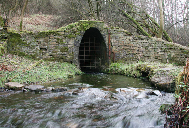
| Adit Entrance of Swinhope Horse Level on South Bank of Swinhope Burn | 1042934 | II | C19th | Lead mine adit portal |
| Allen Lodge | 1154179 | II | C19th | Allenheads |
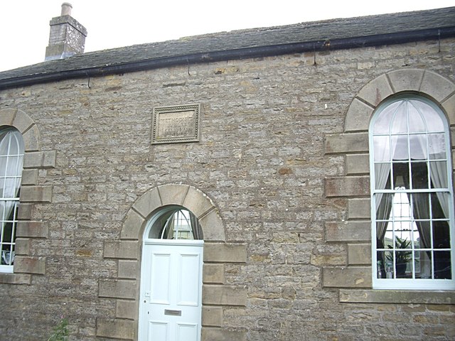
| Allendale Library | 1042978 | II | C19th | Allendale Town. Former Primitive Methodist Chapel |
| Allendale Town Bridge, over River East Allen | 1370615 | II | C19th | Allendale Town |
| Allenheads Church | 1042964 | II | 1825 | Allenheads |
| Allenheads Estate Offices | 1303988 | II | C19th | Allenheads |
| Allenheads Farmhouse and Adjacent Farmbuildings | 1370610 | II | C19th | Allenheads |
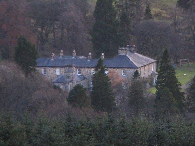
| Allenheads Hall | 1154155 | II | 1847 | Allenheads |
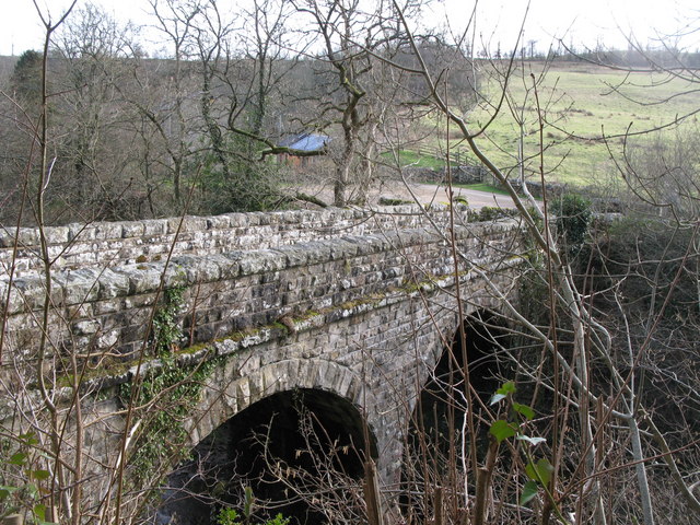
| Allenmill Bridge over River East Allen | 1042970 | II | C19th | NW of Allendale Town |
| Arnison Terrace | 1042942 | II | C18th | Allendale Town, Market Place |
| Asheybank Farmhouse | 1370585 | II | C16th | |
| Barn 10 Metres North-West of Beacon Rigg Farmhouse | 1042959 | II | C19th | |
| Beacon Rigg Farmhouse | 1370606 | II | C19th | |
| Beaumont House, Allenheads | 1370611 | II | C19th | Allenheads |
| Beaumont Mine | 1042967 | II | C19th | Allenheads |
| Beaumont Mine, Fawside Level Portal in Wall on East Side of Site | 1370612 | II | C19th | Allenheads |
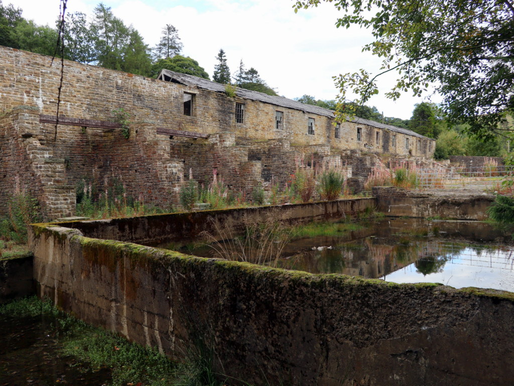
| Beaumont Mine, Tunnel Entrances and Channel to North of Sawmill | 1303925 | II | C19th | Allenheads |
| Beaumont Mine. Former Sawmill and Remains of Bouse Team Immediately to West | 1154253 | II | C19th | Allenheads |
| Belvina and Adjacent House to East | 1370596 | II | C18th | Allendale Town, Market Place. |
| Bishopside Farmhouse | 1303756 | II | C18th | Colliery Lane |
| Blackett Level, 100 Metres North-West of Parish Church | 1154086 | II | 1854 | Allendale Town. Adit portal. |
| Breckon Hill | 1370607 | II | C19th | Cottage. B6295 |
| Brides Hill Holiday Home | 1154344 | II | 1851 | Allenmill. Former School. |
| Bridge 100 Metres South of Burnfoot Farmhouse | 1370600 | II | C18th | |
| Bridge End Cottages | 1154413 | II | C19th | Allendale Town |
| Bridge End House | 1042971 | II | C19th | Allendale Town |
| Bridge over River East Allen 20 Metres North-East of St Peter's Church | 1370604 | II | C19th | Spartylea. |
| Bridge over Sipton Burn on the Long Drag | 1155693 | II | 1878 | NE of Spartylea |
| Burnfoot Farmhouse and Attached Barn to South West | 1154819 | II | 1678 | |
| Burnlaw Farmhouse | 1042992 | II | C16th | |
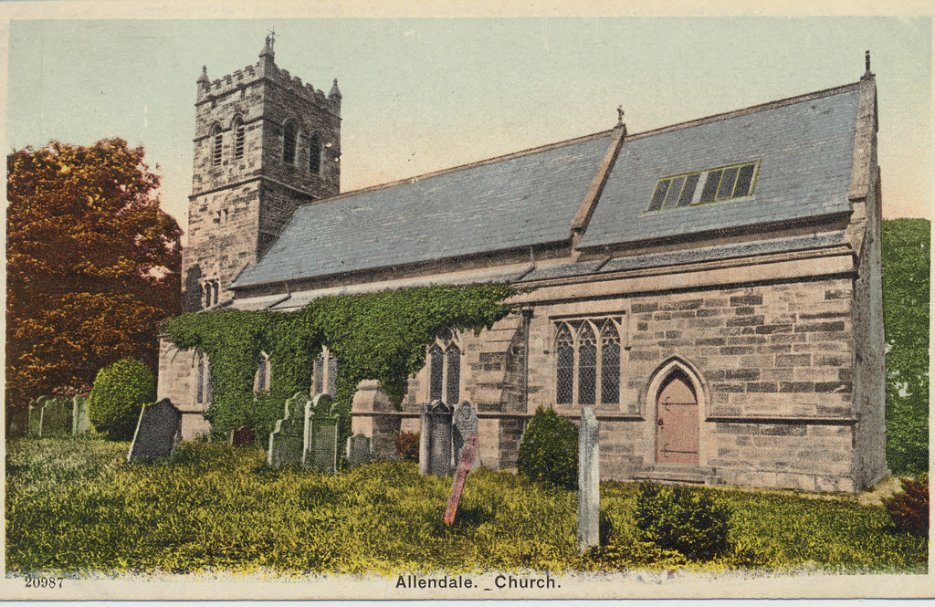
| Church of St Cuthbert | 1042941 | II | 1874 | Allendale Town. On site of Medieval church. |
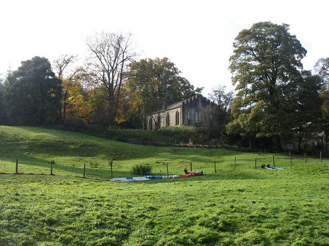
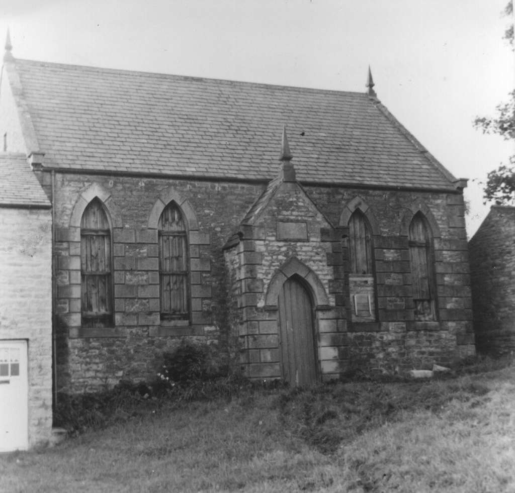
| Church of St Peter, Spartylea | 1154970 | II | 1825 | Spartylea. Former church. |
| Corn Mill Farmhouse and Adjacent Farmbuildings | 1154979 | II | C19th | Spartylea |
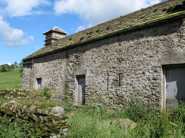
| Curtain House and Adjacent Barn to West | 1154511 | II | C16th | Catton. Bastle. |
| Disused Furnace 40 Metres South East of Furnace Cottage | 1042956 | II | C19th | B6295 |
| Drinking Fountain in Front of No.4 and the Cottage | 1042946 | II | C18th | Allendale Town. Shield Street |
| Drinking fountain opposite Allendale Library | 1042963 | II | 1902 | Allendale Town |
| Dudley Place, and Privy Row Adjacent | 1303880 | II | C18th | Allenheads. Terrace of houses. |
| Ellershope, the Eastern House with Byre Adjoining | 1370635 | II | C19th | |
| Elliott's Shop | 1370597 | II | C19th | Allendale Town. Market Place. Now Emma's Coffee & Sweets |
| Farm Buildings 20 Metres North of Westside Farmhouse | 1042958 | II | c.1610 | Former bastle. |
| Farmbuildings Attached to North-East Corner of Wooley Farmhouse | 1042955 | II | C16th | |
| Farmbuildings to Northwest of High Frosthall Farmhouse | 1042993 | II | C19th | |
| Farmhouse and Adjacent Outbuildings at the Northern Farm, Old Town | 1154572 | II | C16th | Colliery Lane. Former bastle. |
| Fawside Green | 1042968 | II | 1790 | Allenheads. Terrace of houses. |
| Former Chapel on West Side of Green | 1042975 | II | 1870 | Catton |
| Former County Primary School | 1370609 | II | 1879 | Allendale Town |
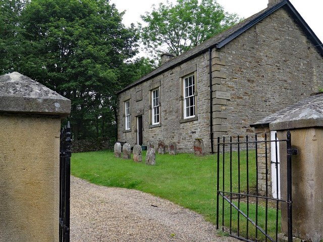
| Friends Meeting House | 1042972 | II | 1868 | Allendale Town. Quaker meeting house. |
| Garden Wall, Gate and Railings to South of Park Farmhouse | 1042957 | II | c.1840 | Park |
| Garden Walls to East and Railings to South of Beaumont House | 1042966 | II | C19th | Allenheads |
| Gate Piers and Screen Wall Adjacent to Allenmill Bridge | 1303840 | II | C19th | Allenmill |
| Gatepiers and Gate Close to North West Corner of St Peter's Church | 1042950 | II | C19th | Spartylea |
| Golden Lion Hotel | 1303668 | II | c.1839 | Allendale Town |
| Hallgarth | 1154886 | II | 1829 | Allendale Town, The Peth. |
| Hammershield Farmhouse and Attached Farm Buildings | 1303622 | II | C19th | |
| Hare and Hounds Inn | 1370601 | II | C18th | Allendale Town, The Peth. Now a house. |
| High Swinhope Shield Farmhouse | 1042952 | II | C17th | Swinhope |
| Hindley Wrae Farmhouse | 1042994 | II | 1660s | |
| Hollin Close Farmhouse | 1042995 | II | 1794 | |
| Hollingreen Farmhouse | 1042996 | II | C19th | |
| Holme Dene | 1042940 | II | C19th | Allendale Town, Market Place. House. |
| Hopehead Farmhouse and Adjacent Buildings | 1155000 | II | C16th | Hope Head. Bastle. |
| Hotspur Hotel | 1303651 | II | 1806 | Allendale Town. Now Hotspur House, B&B |
| House Adjoining Hare and Hounds Inn to East | 1303598 | II | C18th | Allendale Town, The Peth |
| House Adjoining North End of Allendale Library | 1370634 | II | C19th | Allendale Town, Dawson Terrace |
| Hunter Headstone 7 Metres South-West of the South-West Corner of St Peter's Church Porch | 1042949 | II | 1775 | Spartylea |
| Hydrant in Front of Number 3 Arnison Terrace | 1370599 | II | C19th | Allendale Town, Market Place |
| Iceton House | 1370613 | II | C18th | Allenheads |
| Isaac's Well | 1154790 | II | 1849 | Allendale Town, Market Place |
| K6 Outside Westhoe House | 1253844 | II | 1935 | Allendale Town, Market Place. |
| Keenley and Broadside War Memorial | 1438957 | II | 1921 | Keenley, Common Bank |
| Kings Head Hotel | 1370598 | II | C18th | Allendale Town, Market Place. Now The Kings Head. |
| Level Mouth Cottage | 1042969 | II | C19th | Allenheads |
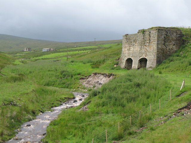
| Limekilns 100 Metres West of Wainford Bridge | 1042944 | II | C19th | Allenheads |
| Low Broadwood Hall with Attached Outbuildings and Wall to Right Rear | 1303808 | II | 1716 | Allendale Town, Bridge End |
| Low Huntwell Farmhouse | 1042960 | II | C19th | B6295 |
| Mill Cottage | 1042936 | II | C19th | Ropehaugh |
| Moor Houses Farmhouse and Attached Range to West | 1042976 | II | C16th | Chats Lane. Bastle. |
| New Houses | 1154329 | II | 1788 | Allenheads |
| Nine Dargue, 150 Metres South-East of Nettle Hill Farmhouse | 1043000 | II | C16th | Bastle |
| Old Limekiln in North Bank of Black Cleugh, Beside Track to Intake Head | 1042953 | II | C19th | Swinhope |
| Outbuilding 10 Metres South of Corn Mill Farmhouse | 1042951 | II | C18th | Spartylea |
| Outbuilding 30 Metres North of Hayrake Farmhouse, with Adjacent Ruin to North | 1154907 | II | C16th | Bastle |
| Outbuilding to the East of the Old Post Office | 1154987 | II | C18th | Spartylea |
| Outbuildings 25 Metres North of Hollybush Farmhouse | 1042997 | II | C16th | Bastle |
| Outbuildings Around Stable Yard, Allenheads Hall | 1042965 | II | C19th | Allenheads |
| Paddock Cottage | 1370605 | II | C17th | Near Cross House. |
| Park Farmhouse and Attached Barn on East | 1153959 | II | c.1840 | Park |
| Path House | 1042945 | II | 1813 | Allendale Town, The Peth |
| Peasmeadows Cottage and Ruin to South | 1370608 | II | C19th | Peasemeadows. With C16th basstle ruin. |
| Peasmeadows House | 1042962 | II | C19th | Peasemeadows |
| Peth Head House | 1154875 | II | C18th | Allendale Town |
| Post Office | 1370614 | II | C19th | Allenheads. Former Post Office. |
| Powder House in Field 150 Metres South of Sipton Terrace | 1042948 | II | C19th | Sipton |
| Railed Enclosure Beside Road, Opposite North-East Corner of Estate Offices | 1154297 | II | C19th | Allenheads. Horse Track Entrance to Mine |
| Range of Buildings Adjacent to West Side of Low Sinderhope Shield Farmhouse | 1370603 | II | C16th | Sinderhope |
| Range of Buildings to North West of Monk Farmhouse | 1042998 | II | C16th | Monk Farm Bastle? & Dovecote |
| Range of Farmbuildings North-East of Bungalow at the Southern Farm, Old Town | 1042977 | II | C16th | Old Town. Colliery Lane. Bastle. |
| Selah House, Section Adjacent to West End of Hotspur Hotel | 1042943 | II | C19th | Allendale Town, Market Place. |
| Sinderhope Bridge, over Sinderhope Burn | 1042913 | II | C19th | Sinderhope |
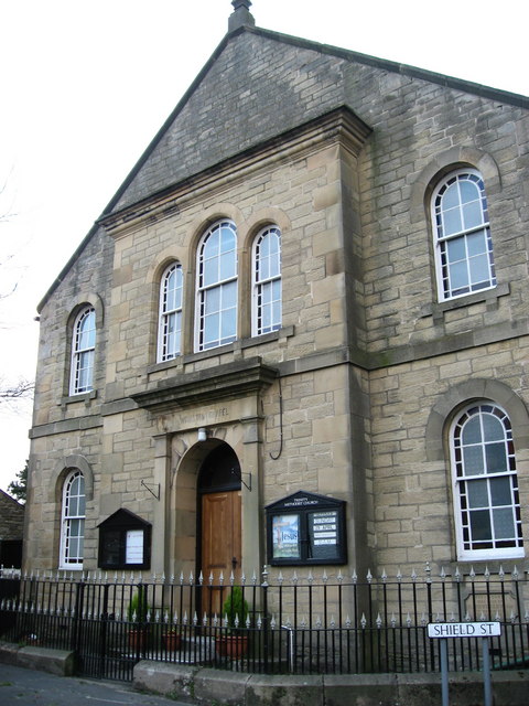
| Sinderhope Methodist Chapel | 1042947 | II | 1860 | Sinderhope |
| Sipton Bridge over Sipton Sike | 1042961 | II | C19th | Sipton |
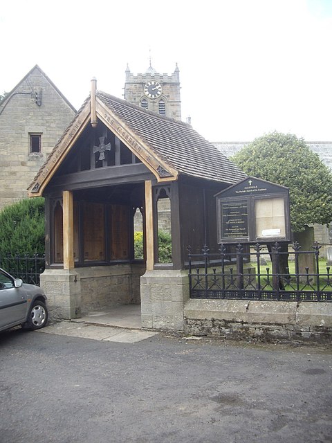
| St Cuthbert's Lychgate War Memorial | 1393517 | II | 1920 | Allendale Town |
| Swin Hope Methodist Chapel | 1155021 | II | 1845 | Swinhope |
| Tea Rooms | 1154721 | II | C19th | Allendale Town, Market Place |
| The Cave | 1154420 | II | 1838 | Allendale Town. House, Bridge End |
| The Hagg Farmhouse | 1370586 | II | 1691 | |
| The Old School, Keenley Crossroads | 1042937 | II | 1875 | Keenley. Now residential. |
| Tithe Barn 50 Metres South West of Monk Farmhouse | 1042999 | II | C17th | Monk Farm |
| Trinity Methodist Church | 1370602 | II | 1875 | Allendale Town |
| Trustee Savings Bank | 1042938 | II | 1873 | Allendale Town. Former bank. |
| Wall and Railings to West and South of Former County Primary School | 1154048 | II | C19th | Allendale Town |
| Wall, Railings and Gate to South of Allendale Library | 1042935 | II | 1878 | Allendale Town, Dawson Place |
| Wall, Railings and Gate to South of Trustee Savings Bank | 1042939 | II | 1873 | Allendale Town, Market Place |
| War Memorial | 1391491 | II | 1920 | Allenheads |
| Waterwheel Pit at Holmslinn Shaft, on South Bank of River East Allen | 1154939 | II | C19th | |
| Wayside Cottage | 1042974 | II | C18th | Allendale Town, Bridge End |
| Wellhead 20 Metres South East of South Corner of the Riding School | 1042973 | II | 1766 | Allendale Town, Bridge End |
| Wooley Burnfoot Cottage | 1154498 | II | 1868 | Allendale Town, Bridge End. Now Meeting House Cottage. |
| Wooley Cottage and Ruined Cottage Adjacent | 1042954 | II | C18th | Wooley. With ruined C16th Bastle. |
| Wooley Farmhouse | 1155030 | II | C16th | Wooley |
| Blackett Level portal | 1006414 | n/a | C19th | Scheduled Monument. Allendale |
| Holmslinn lead mine, 200m south east of Holmes | 1015848 | n/a | C19th | Scheduled Monument. |
| Allen smelt mill, flue system and chimneys | 1016817 | n/a | C18th | Scheduled Monument. Allenheads |
| Allenheads lead ore works | 1016348 | n/a | C18th | Scheduled Monument. Allenheads |
| Allendale Village Hall | Not listed | n/a | 1905 | Allendale Town. Former Temerance Hall. |
| High Forest Community Centre | Not listed | n/a | 1881 | Sinderhope. Former school. |
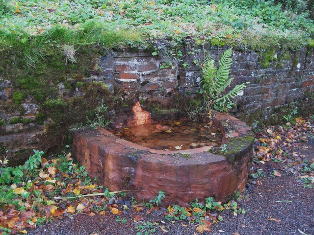
| The Iron Well | Not listed | n/a | C19th? | Allenheads |
| Former Bethel Chapel | Not listed | n/a | 1848 | Ropehaugh |
| Keenley Methodist Chapel | Not listed | n/a | 1874 | Keenley |
| Packhorse Bridge over Sipton Burn | Not listed | n/a | ? | Sipton |
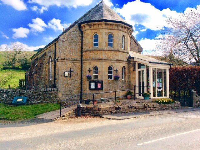
| Catton Methodist Church | Not Listed | n/a | 1882 | Catton |
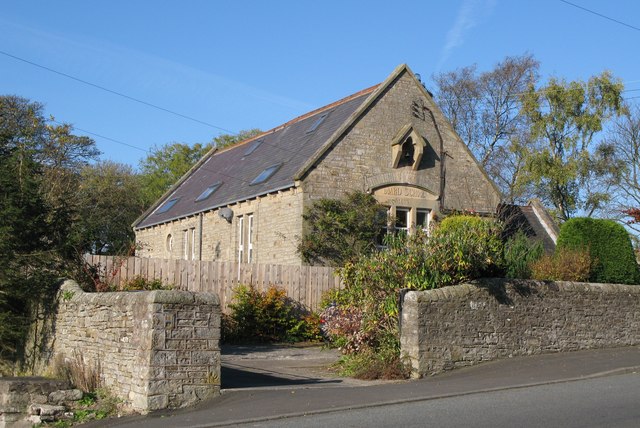
| Former Board School | Not Listed | n/a | 1880 | Catton |
| Oakpool Bridge | Not listed | n/a | C19th | Oakpool |
| Oakpool | Not listed | n/a | ? | Former farmhouse, incorporating bastle |
| Allendale Conservation Area | - | n/a | Conservation Area |
Primary source: the National Heritage List for England - NHLE is the register of nationally protected historic buildings and sites in England, including listed buildings, scheduled monuments, protected wrecks, registered parks and gardens, and battlefields. The list is maintained by Historic England. Check NHLE for updates and new entries. Secondary sources: British Listed Buildings and Keys to the Past.
Co-Curate Page
Allenheads Hall
- Overview Map Allenshead Hall is a country house, built in 1847 by E.B. Lamb for Thomas Sopwith, engineer and mine agent to the Beaumont family. Some sources indicate it was …
Co-Curate Page
Friends' Meeting House
- Overview Map Street View The Friends' Meeting House in Wooley Burnfoot, Allendale is oldest Quaker Meeting House in Northumberland still in regular use. A Meeting House was first built here in 1688, replaced …
Co-Curate Page
Thorngreen Lime Kilns
- Overview Map Street View The Thorngreen Lime Kilns are located on the side of Slag Hill above Middlehope Burn, just north west of Allenheads in Northumberland. The lime kilns were …
Co-Curate Page
Methodist Chapel, Sinderhope
- Overview Map Street View Now converted for a private residence, the Primitive Methodist Jubilee Chapel in Sinderhope was built in 1860. It is Grade II listed on the National Heritage …
Co-Curate Page
Church of St. Cuthbert
- Overview Map The parish church in Allendale is part of the Benefice of the Allen Valleys. The present church was built in 1874 by Austin and Johnson, except for lower …
Co-Curate Page
War Memorial
- Overview Map The gothic style Lych gate at St. Cuthbert’s Church was built as a memorial dedicated to the people of Allendale who lost their lives in the First World War. …
Co-Curate Page
Old School, Keenley
- Overview Map Street View The school at Keenley Crossroads was built in 1875. It is now a private residence. The old school in Keenley is Grade II listed on the …
Co-Curate Page
Church of St Peter in The Forest, Spartylea
- St Peter's Church in Spartylea, now converted into a private residence, was built in 1825. It replaced an earlier church of 1701. The church was known as St Peter's in The …
Co-Curate Page
Allendale Library
- Overview Map Street View Allendale Library is located on Dawson Place in Allendale Town. The library building is a former Primitive Methodist Chapel, with a date stone of 1878. Adjoining …
Co-Curate Page
Corn Mill Bridge, Spartylea
- The stone bridge over the River East Allen is located near the old corn mill and St Peter's Church in Spartylea. The bridge dates from the early 19th century and …
Co-Curate Page
Former Allendale First School
- Allendale First School closed in August 2013 when Allendale and the wider area switched from a three-tier to a two-tier education system. The children transfered to Allendale Primary School. The …
Co-Curate Page
Golden Lion, Allendale
- Overview Map Street View The Golden Lion is an inn and resturant located on the north side of the Market Place in Allendale Town. "The '1839 Restaurant' is named after …
Co-Curate Page
Former Trustee Savings Bank
- Overview Map Street View This former Savings Bank is located at the south-east corner of the Market Place in Allendale. It is dated 1873 and built in a 17th century …
Co-Curate Page
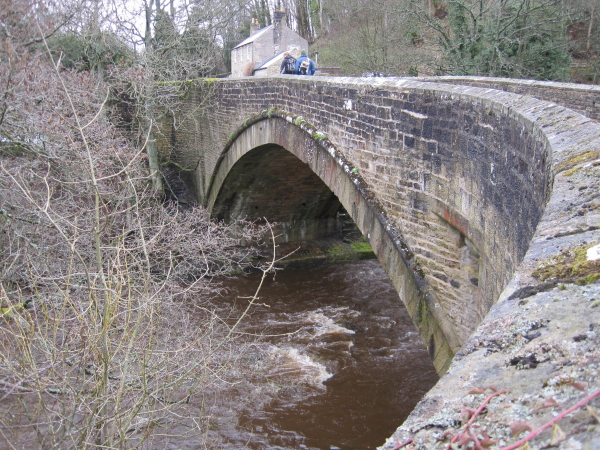
Allendale Town Bridge
- Overview Map Street View Allendale Town Bridge, located at the east of Allendale Town, carries the B6925 road over the River East Allen. The stone segmental arch bridge dates from the …
Co-Curate Page
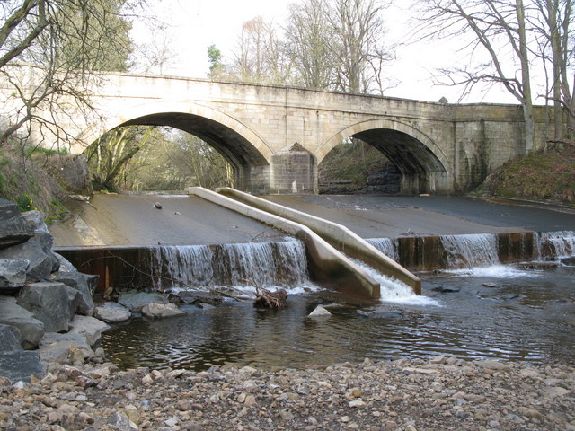
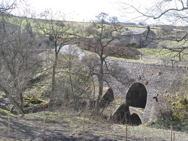
Allenmill Bridge
- Overview Map Street View Allenmill Bridge, located just over half mile north-west of Allendale Town, carries the B6295 road over the River East Allen. The stone bridge, with 2 segmental …
Co-Curate Page
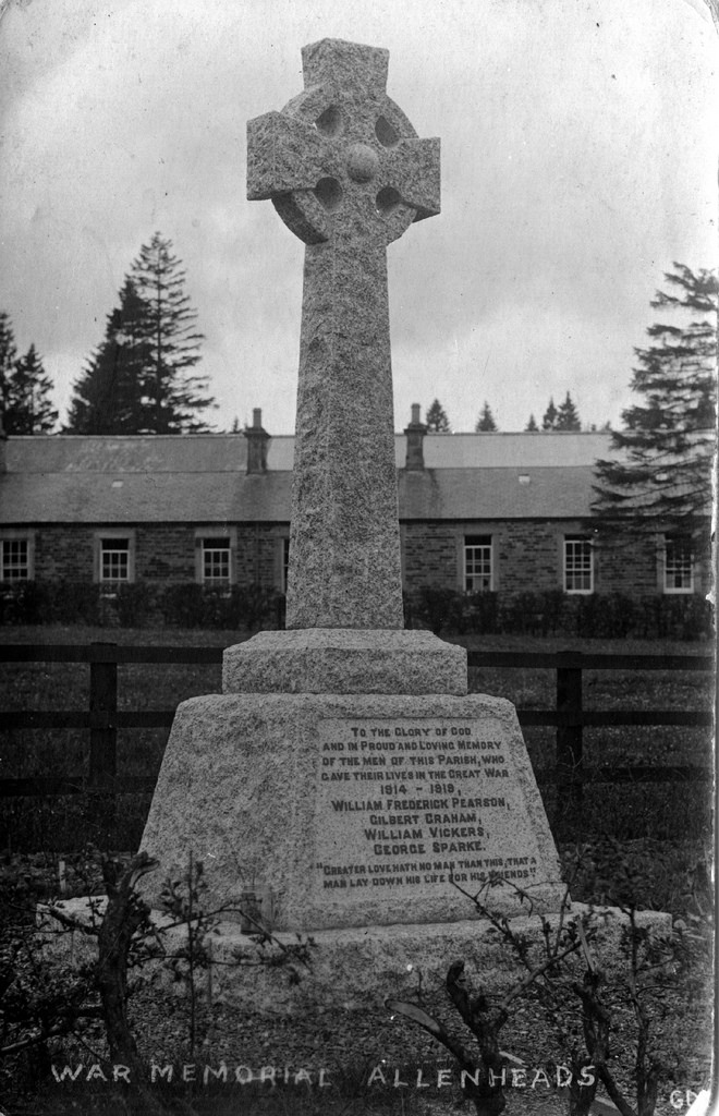
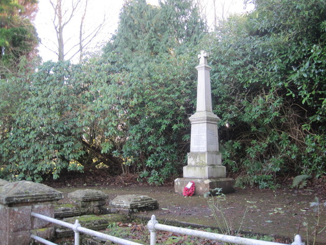
War Memorial
- Overview Map Street The war memorial in Allenheads was sculpted by R.B Aves of Hexham, made from Cornish granite. The memorial was unveiled by Viscount Allendale in October 1920, dedicated …
Co-Curate Page
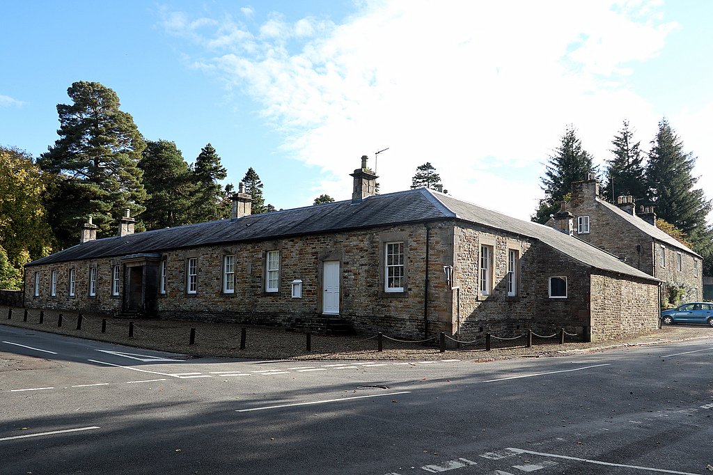
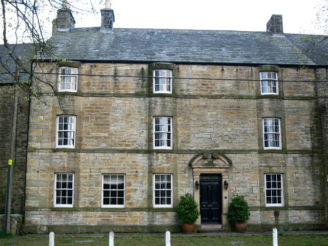
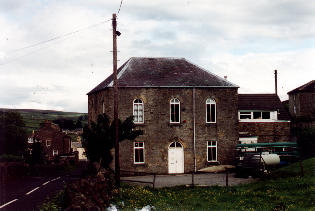
Allenheads Estate Offices
- Overview Map Street View Allenheads Estate Offices and former Village Hall were built in the mid 19th century. The building is Grade II listed on the National Heritage List for …
Co-Curate Page
Keenley and Broadside War Memorial
- Overview Map Street View Keenley and Broadside War Memorial is located by Common Bank (road), near Burn Tongues Farm. The memorial was unveiled on the 28th May 1921 by Colonel …
Co-Curate Page
Hotspur House, Allendale
- Overview Map Street View Hotspur House is located on the south side of the Market Place in Allendale Town and provides bed and breakfast accommodation. The former inn is dated …

Co-Curate Page
Kings Head, Allendale
- The Kings Head is a public house located on the north side of the Market Place in Allendale Town. The former inn dates from the early 18th century. It was …
Co-Curate Page
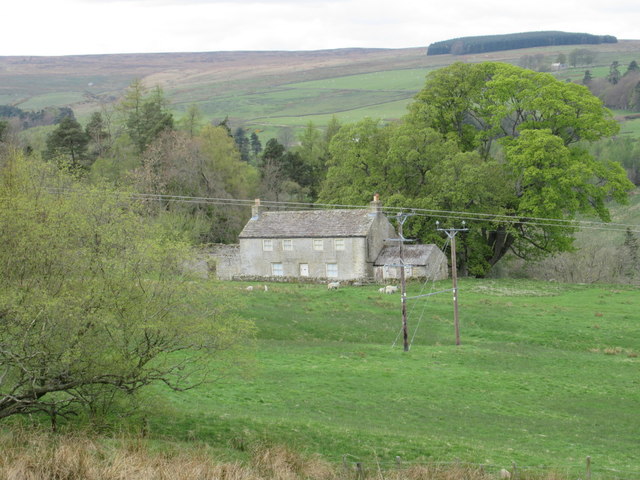
Asheybank Farm, Allendale
- Overview Map Asheybank farmhouse is in a remote location, near the River West Allen, and about ¾miles south-east of Whitfield and 3 miles north-west of Allendale Town. The house dates …
Co-Curate Page
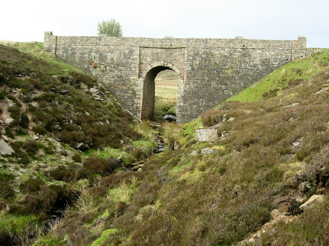
Bridge over Sipton Burn on the Long Drag
- Overview Map This bridge, dated 1878 and inscribed with the initials W.B.B., carries the Long Drag (road) over Sipton Burn. It is located about a mile north-east of Spartylea. The …
Co-Curate Page
Sipton Bridge, over Sipton Sike
- Overview Map Street View Sipton Bridge carries the B6295 road over Sipton Sike. The bridge at Sipton dates from the early 19th century and is located about half mile north …
Co-Curate Page
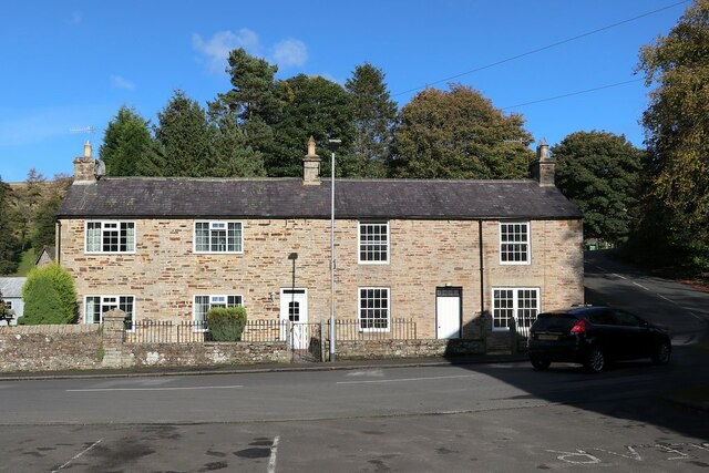
Sipton Terrace
- Overview Map Street View Sipton Terrace is a terrace of 5 houses at Sipton. The terrace dates from the early 19th century and were built for workers of Sipton Mine. …
Co-Curate Page
Old Powder House of Sipton Mine
- Overview Map Street View This Powder House is one of the few buildings remaining from the former Sipton Mine. It is located in a field, about 140 metres south of …
Co-Curate Page
Swinhope Methodist Chapel
- Overview Map Street View Swinhope Primitive Methodist Chapel was built in 1845 and remodelled in 1884. It is now converted into a dwelling. The former chapel is a Grade II …
Co-Curate Page
Sinderhope Bridge, over Sinderhope Burn
- Overview Map Street View Sinderhope Bridge at Sinderhope in Northumberland, carries the B6295 road over Sinderhope Burn, a short distance downstream of its confluence with Hollocks Burn. Built in the …
Co-Curate Page
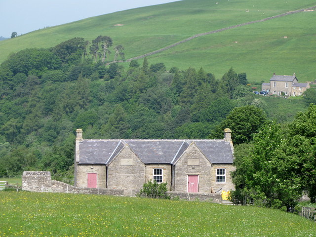
High Forest Community Centre
- Overview Map Street View High Forest Community Centre is located in Sinderhope, Northumberland. Originally a Board school, built in 1881, the building now serves as a community centre for the …
Co-Curate Page
Old Post Office, Allenheads
- The former W. Pearson’s shop and Post Office in Allenheads is now a private residence. The house and shop were built in the 19th century. The old post office is …
Co-Curate Page
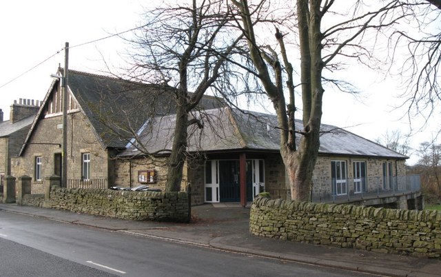
Allendale Village Hall
- Overview Map Street View Allendale Village Hall and Recreation Ground are located on Leadgate (B6303) in Allendale Town. The building was originally constructed as a Temperance Hall in 1905. The …
Co-Curate Page
Keenley Methodist Chapel
- Overview Map Street View Keenley Methodist chapel was built in 1874, replacing an earlier chapel of 1750 that was the second purpose-built Methodist chapel in North East England. Still in …
Co-Curate Page
Former Bethel Chapel, Ropehaugh
- Overview Map Street View Bethel Chapel in Ropehaugh, Allenheads, was a Primitive Methodist Chapel built in 1848. The building was converted into an outdoor centre in the 1970s. Allenheads Lodge …

Co-Curate Page
Tithe Barn, Monk Farm, Allendale
- Overview Map This former tithe barn is located a short distance south-west of Monk farmhouse in Allendale. The barn is thought to date from the 17th century, and was reconstructed …
Co-Curate Page
Monk Farm
- Overview Map The Monk Farm stands on the east side of the valley of the River West Allen in Northumberland, at the head of a steep slope. It is about …
Co-Curate Page
Old Wesleyan Chapel, Catton
- Overview Map Street View This former Wesleyan chapel, on the west side of the village green in Catton dates from 1870. The chapel closed in 1939 and was sold to …
Co-Curate Page
Catton Methodist Church
- Overview Map Street View Catton Methodist Church is located on the main road (B6295) through Catton on the left-hand side of a small crossroads at the bottom of the hill. …
Co-Curate Page
Former Board School, Catton
- Overview Map Street View Catton Board School was built in 1879, for the Allendale and West Allen School Board, and funded by the Beaumont family who were local land owners.[1] …

Co-Curate Page
Old Town (South), Allendale
- Nearby is Old Town (North Farm). aka Wester Old Town?

Co-Curate Page
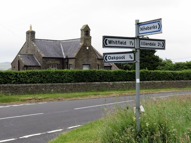
Oakpool, Allendale
- Overview Map Street View Oakpool (aka Oak Pool) is located on Appletree Bank (road), by the west bank of River East Allen, about 2 miles north-west of Allendale Town. Whellan's …
Co-Curate Page
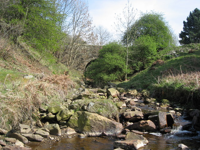
Oakpool Bridge over the River East Allen
- Overview Map Street View There is a stone bridge with two arches over the River East Allen at Oakpool. The single track bridge caries Appletree Bank (road) over the river, …
Co-Curate Page
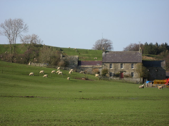
Park Farm, Allendale
- Overview Map Street View Park Farm is located about 1½ miles south of Allendale Town. It is situated by the west banks of the River East Allen, close to where …
Co-Curate Page
Allenheads lead ore works
- Scheduled Monument areas - based on Historic England data (Open Government Licence). Scheduled Monument (#1016348): Allenheads lead ore works Click the headings below to expand (selected extracts from the Historic …
Co-Curate Page
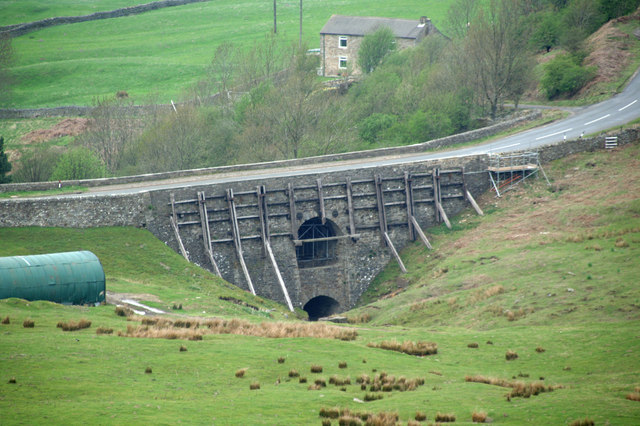
Blackett Level
- Map showing the location of the Blackett Level Portal in Allendale Town. The Blackett Level is a historic 4½ mile-long subterranean lead mine drainage tunnel and exploration adit in the …

Co-Curate Page
Allenheads Hall
- Overview Map Allenshead Hall is a country house, built in 1847 by E.B. Lamb for Thomas Sopwith, engineer and mine agent to the Beaumont family. Some sources indicate it was …
Co-Curate Page
Friends' Meeting House
- Overview Map Street View The Friends' Meeting House in Wooley Burnfoot, Allendale is oldest Quaker Meeting House in Northumberland still in regular use. A Meeting House was first built here in 1688, replaced …
Co-Curate Page
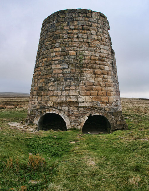
Thorngreen Lime Kilns
- Overview Map Street View The Thorngreen Lime Kilns are located on the side of Slag Hill above Middlehope Burn, just north west of Allenheads in Northumberland. The lime kilns were …
Co-Curate Page
Methodist Chapel, Sinderhope
- Overview Map Street View Now converted for a private residence, the Primitive Methodist Jubilee Chapel in Sinderhope was built in 1860. It is Grade II listed on the National Heritage …
Co-Curate Page
Church of St. Cuthbert
- Overview Map The parish church in Allendale is part of the Benefice of the Allen Valleys. The present church was built in 1874 by Austin and Johnson, except for lower …
Co-Curate Page
War Memorial
- Overview Map The gothic style Lych gate at St. Cuthbert’s Church was built as a memorial dedicated to the people of Allendale who lost their lives in the First World War. …
Co-Curate Page
Old School, Keenley
- Overview Map Street View The school at Keenley Crossroads was built in 1875. It is now a private residence. The old school in Keenley is Grade II listed on the …
Co-Curate Page
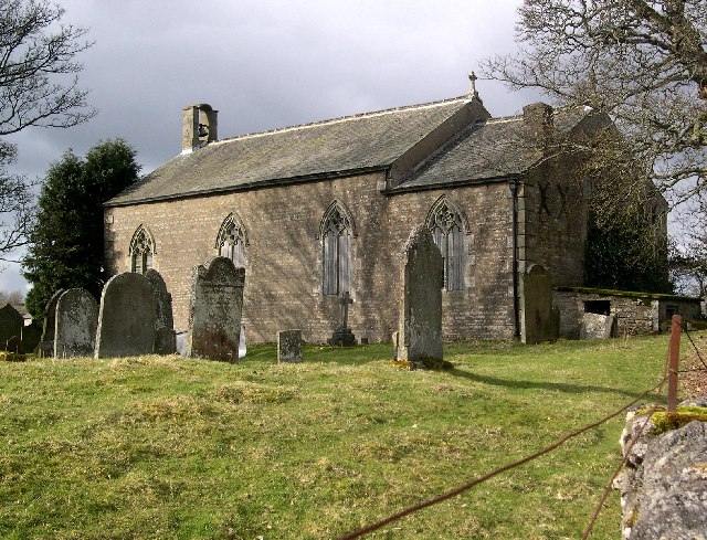
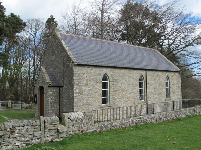
Church of St Peter in The Forest, Spartylea
- St Peter's Church in Spartylea, now converted into a private residence, was built in 1825. It replaced an earlier church of 1701. The church was known as St Peter's in The …
Co-Curate Page
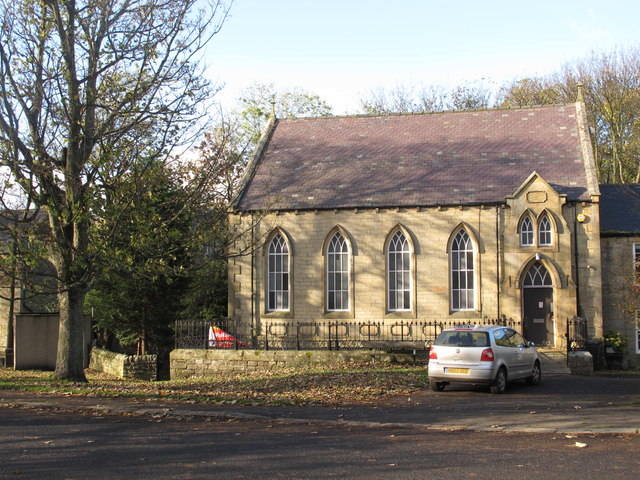
Allendale Library
- Overview Map Street View Allendale Library is located on Dawson Place in Allendale Town. The library building is a former Primitive Methodist Chapel, with a date stone of 1878. Adjoining …
Co-Curate Page
Corn Mill Bridge, Spartylea
- The stone bridge over the River East Allen is located near the old corn mill and St Peter's Church in Spartylea. The bridge dates from the early 19th century and …
Co-Curate Page
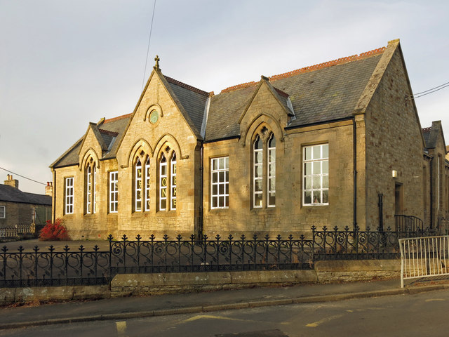
Former Allendale First School
- Allendale First School closed in August 2013 when Allendale and the wider area switched from a three-tier to a two-tier education system. The children transfered to Allendale Primary School. The …
Co-Curate Page
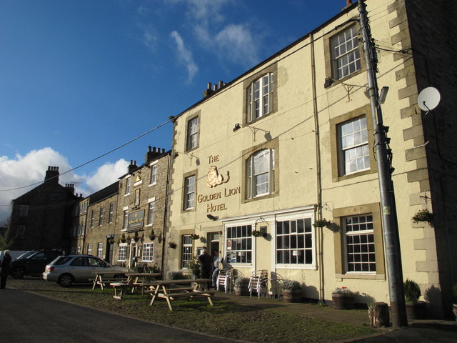
Golden Lion, Allendale
- Overview Map Street View The Golden Lion is an inn and resturant located on the north side of the Market Place in Allendale Town. "The '1839 Restaurant' is named after …
Co-Curate Page
Former Trustee Savings Bank
- Overview Map Street View This former Savings Bank is located at the south-east corner of the Market Place in Allendale. It is dated 1873 and built in a 17th century …
Co-Curate Page
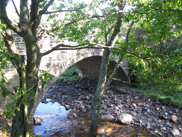
Allendale Town Bridge
- Overview Map Street View Allendale Town Bridge, located at the east of Allendale Town, carries the B6925 road over the River East Allen. The stone segmental arch bridge dates from the …
Co-Curate Page
Allenmill Bridge
- Overview Map Street View Allenmill Bridge, located just over half mile north-west of Allendale Town, carries the B6295 road over the River East Allen. The stone bridge, with 2 segmental …
Co-Curate Page
War Memorial
- Overview Map Street The war memorial in Allenheads was sculpted by R.B Aves of Hexham, made from Cornish granite. The memorial was unveiled by Viscount Allendale in October 1920, dedicated …
Co-Curate Page
Allenheads Estate Offices
- Overview Map Street View Allenheads Estate Offices and former Village Hall were built in the mid 19th century. The building is Grade II listed on the National Heritage List for …
Co-Curate Page
Keenley and Broadside War Memorial
- Overview Map Street View Keenley and Broadside War Memorial is located by Common Bank (road), near Burn Tongues Farm. The memorial was unveiled on the 28th May 1921 by Colonel …
Co-Curate Page
Hotspur House, Allendale
- Overview Map Street View Hotspur House is located on the south side of the Market Place in Allendale Town and provides bed and breakfast accommodation. The former inn is dated …
Co-Curate Page
Kings Head, Allendale
- The Kings Head is a public house located on the north side of the Market Place in Allendale Town. The former inn dates from the early 18th century. It was …
Co-Curate Page
Asheybank Farm, Allendale
- Overview Map Asheybank farmhouse is in a remote location, near the River West Allen, and about ¾miles south-east of Whitfield and 3 miles north-west of Allendale Town. The house dates …
Co-Curate Page
Bridge over Sipton Burn on the Long Drag
- Overview Map This bridge, dated 1878 and inscribed with the initials W.B.B., carries the Long Drag (road) over Sipton Burn. It is located about a mile north-east of Spartylea. The …
Co-Curate Page
Sipton Bridge, over Sipton Sike
- Overview Map Street View Sipton Bridge carries the B6295 road over Sipton Sike. The bridge at Sipton dates from the early 19th century and is located about half mile north …
Co-Curate Page
Sipton Terrace
- Overview Map Street View Sipton Terrace is a terrace of 5 houses at Sipton. The terrace dates from the early 19th century and were built for workers of Sipton Mine. …
Co-Curate Page
Old Powder House of Sipton Mine
- Overview Map Street View This Powder House is one of the few buildings remaining from the former Sipton Mine. It is located in a field, about 140 metres south of …
Co-Curate Page
Swinhope Methodist Chapel
- Overview Map Street View Swinhope Primitive Methodist Chapel was built in 1845 and remodelled in 1884. It is now converted into a dwelling. The former chapel is a Grade II …
Co-Curate Page
Sinderhope Bridge, over Sinderhope Burn
- Overview Map Street View Sinderhope Bridge at Sinderhope in Northumberland, carries the B6295 road over Sinderhope Burn, a short distance downstream of its confluence with Hollocks Burn. Built in the …
Co-Curate Page
High Forest Community Centre
- Overview Map Street View High Forest Community Centre is located in Sinderhope, Northumberland. Originally a Board school, built in 1881, the building now serves as a community centre for the …
Co-Curate Page
Old Post Office, Allenheads
- The former W. Pearson’s shop and Post Office in Allenheads is now a private residence. The house and shop were built in the 19th century. The old post office is …
Co-Curate Page
Allendale Village Hall
- Overview Map Street View Allendale Village Hall and Recreation Ground are located on Leadgate (B6303) in Allendale Town. The building was originally constructed as a Temperance Hall in 1905. The …
Co-Curate Page
Keenley Methodist Chapel
- Overview Map Street View Keenley Methodist chapel was built in 1874, replacing an earlier chapel of 1750 that was the second purpose-built Methodist chapel in North East England. Still in …
Co-Curate Page
Former Bethel Chapel, Ropehaugh
- Overview Map Street View Bethel Chapel in Ropehaugh, Allenheads, was a Primitive Methodist Chapel built in 1848. The building was converted into an outdoor centre in the 1970s. Allenheads Lodge …
Co-Curate Page
Tithe Barn, Monk Farm, Allendale
- Overview Map This former tithe barn is located a short distance south-west of Monk farmhouse in Allendale. The barn is thought to date from the 17th century, and was reconstructed …
Co-Curate Page
Monk Farm
- Overview Map The Monk Farm stands on the east side of the valley of the River West Allen in Northumberland, at the head of a steep slope. It is about …
Co-Curate Page
Old Wesleyan Chapel, Catton
- Overview Map Street View This former Wesleyan chapel, on the west side of the village green in Catton dates from 1870. The chapel closed in 1939 and was sold to …
Co-Curate Page
Catton Methodist Church
- Overview Map Street View Catton Methodist Church is located on the main road (B6295) through Catton on the left-hand side of a small crossroads at the bottom of the hill. …
Co-Curate Page
Former Board School, Catton
- Overview Map Street View Catton Board School was built in 1879, for the Allendale and West Allen School Board, and funded by the Beaumont family who were local land owners.[1] …
Co-Curate Page
Old Town (South), Allendale
- Nearby is Old Town (North Farm). aka Wester Old Town?
Co-Curate Page
Oakpool, Allendale
- Overview Map Street View Oakpool (aka Oak Pool) is located on Appletree Bank (road), by the west bank of River East Allen, about 2 miles north-west of Allendale Town. Whellan's …
Co-Curate Page
Oakpool Bridge over the River East Allen
- Overview Map Street View There is a stone bridge with two arches over the River East Allen at Oakpool. The single track bridge caries Appletree Bank (road) over the river, …
Co-Curate Page
Park Farm, Allendale
- Overview Map Street View Park Farm is located about 1½ miles south of Allendale Town. It is situated by the west banks of the River East Allen, close to where …
Co-Curate Page
Allenheads lead ore works
- Scheduled Monument areas - based on Historic England data (Open Government Licence). Scheduled Monument (#1016348): Allenheads lead ore works Click the headings below to expand (selected extracts from the Historic …


