Topics > Northumberland > Keenley
Keenley
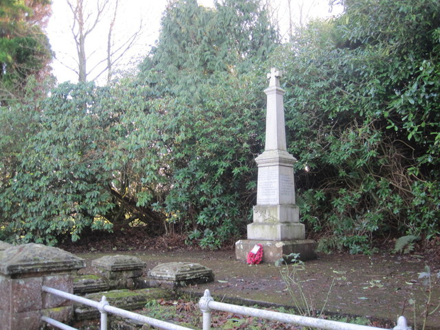
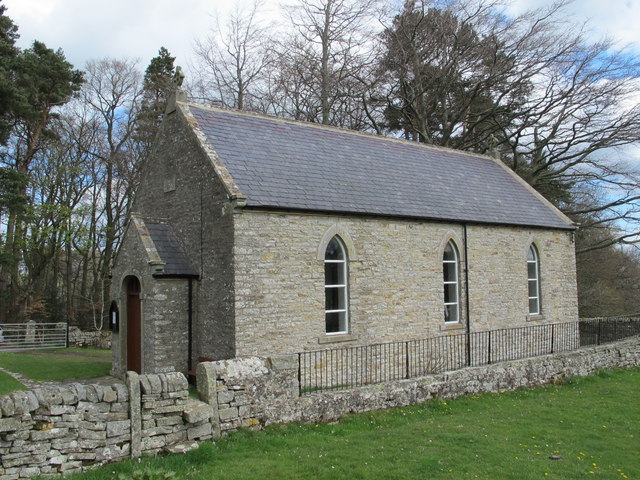
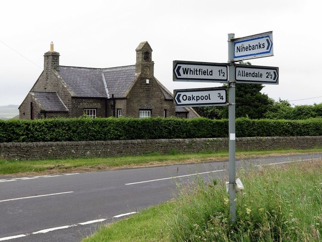
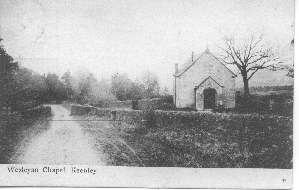
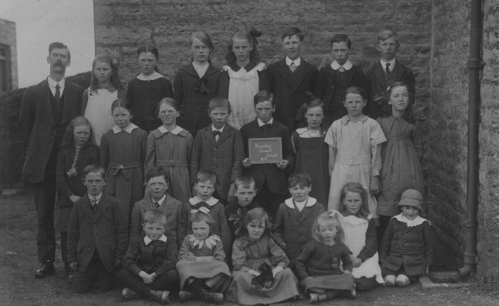
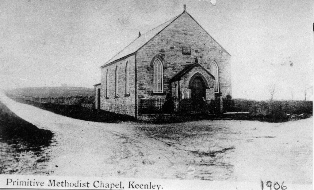
Keenley is a distributed community, located about 2 miles west of Allendale town in Northumberland. There is no village as such, but a number of farms and dwellings are located on either side of Common Bank. One of these is Burn Tongues farm. Keenley Methodist Chapel is located here. The Old School of 1875 is located at Keenley Crossroads. Keenley is part of Allendale Civil Parish.
KEENLY, a grieveship, in the parish of Allendale, union of Hexham, S. division of Tindale ward and of Northumberland; with 275 inhabitants.
Extract from: A Topographical Dictionary of England comprising the several counties, cities, boroughs, corporate and market towns, parishes, and townships..... 7th Edition, by Samuel Lewis, London, 1848.
Whellan's 1855 directory of Northumberland lists the following under the grieveship of Keenley: Burn Tongues, Burnlaw, Chapel House, Cleugh Bank, East Burnlaw, Frost Hall, Harlowburn, Hawksteel, Hay Leazes, Hindley Hill, Hindley Wrea, Holly Bush, Huntergap, Huntnook, Keenley Thorn, Keenley Well, Keenleywell House, Lane Head, Low Bank, Monk, Oak Pool, Plaintree House, West Side, and Wide Hill
from Allen Valleys Local History (flickr)
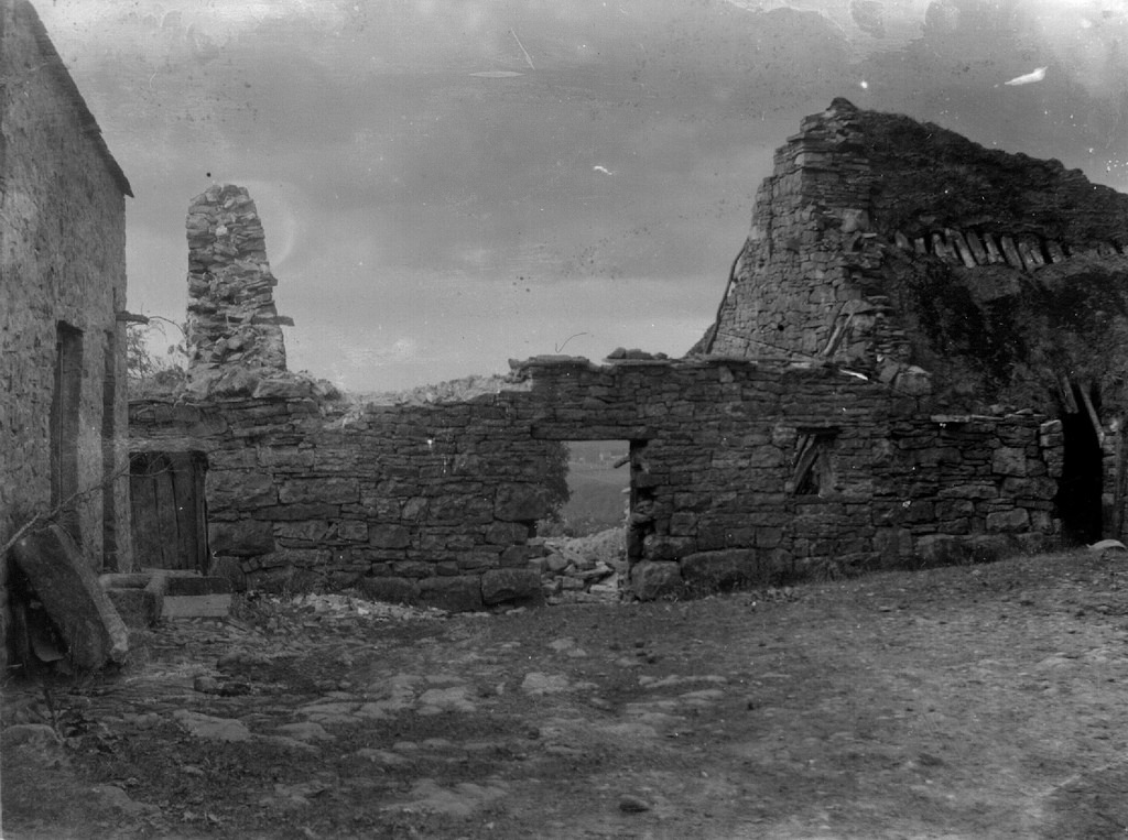
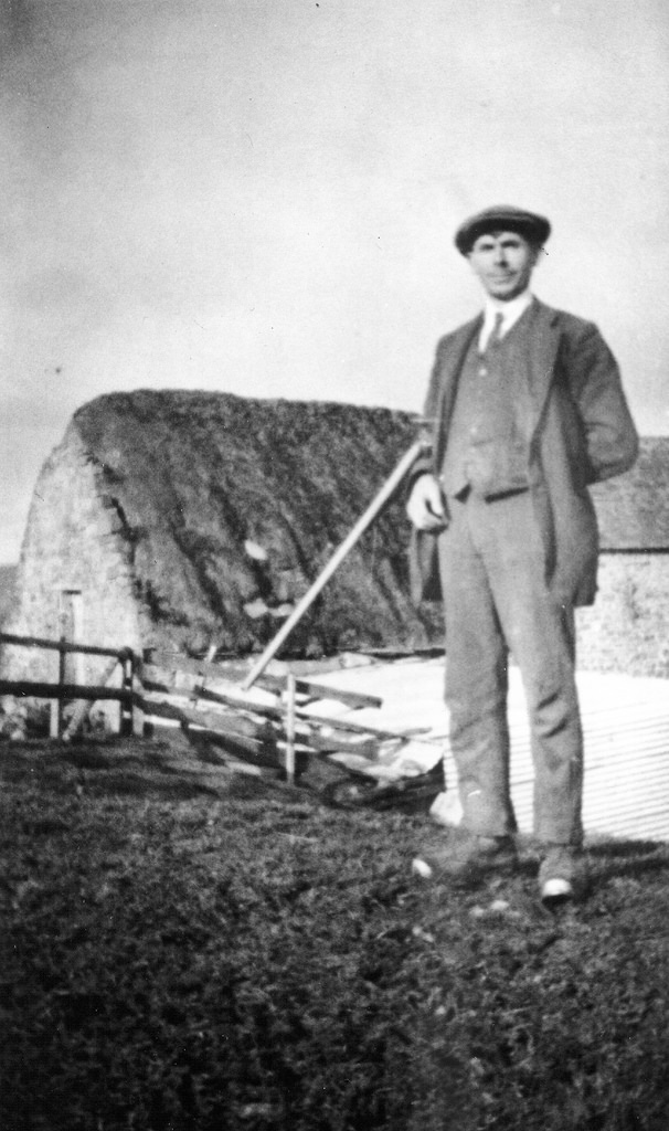
Keenley February 1981 [0002-014]
Pinned by Simon Cotterill

from https://keystothepast.info/se…
Keenley medieval settlement (Allendale)
- "Keenley was a member of the regality of Hexham and was described as a hamlet in a survey of 1536. By 1546 no village existed there and only two tenements …
Added by
Simon Cotterill
Co-Curate Page
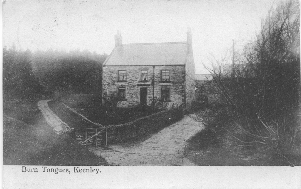
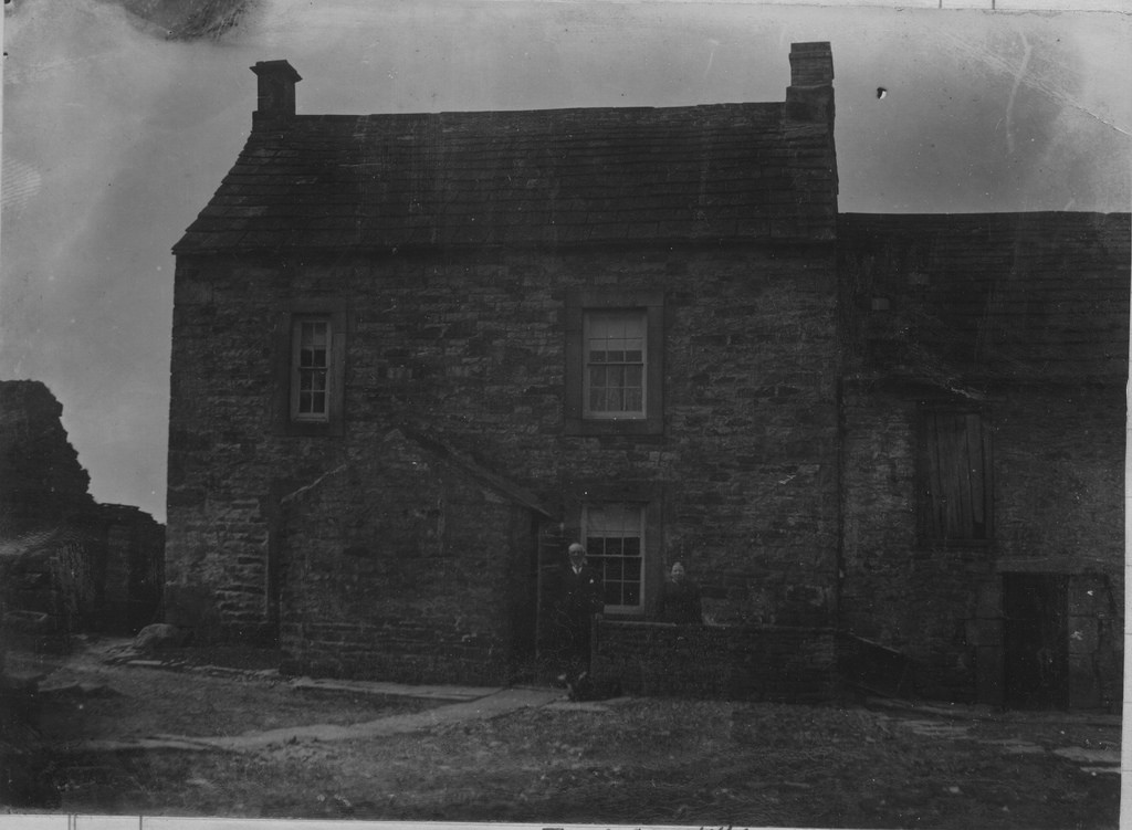
Burn Tongues, Northumberland
- Overview Map Street View Burn Tongues is a farm in Keenley, Northumberland. It is located off Common Bank (road), about 2 miles west of Allendale Town. The farm is situated …
Co-Curate Page
Monk Farm
- Overview Map The Monk Farm stands on the east side of the valley of the River West Allen in Northumberland, at the head of a steep slope. It is about …

Co-Curate Page
Oakpool, Allendale
- Overview Map Street View Oakpool (aka Oak Pool) is located on Appletree Bank (road), by the west bank of River East Allen, about 2 miles north-west of Allendale Town. Whellan's …

Co-Curate Page
Hindleyhill, Allendale
- Overview Map Hindleyhill (aka Hindley Hill) is a farm in Northumberland, located about 2½ miles north-west of Allendale Town. It is situated by the River East Allen, near where Hindley …

Co-Curate Page
Keenley Thorn
- Overview Map Street View Keenley Thorn is a farm in West Allen, located about 2 miles north-east of Ninebanks. Whellan's 1855 directory of Northumberland lists Robert Blair as farmer at …

Co-Curate Page
Quarry House, Allendale
- Overview Map Street View Quarry House is located on Keenley Fell, near Keenley Thorn in Allendale. Four disused quarries are shown on OS Maps around the house. There is an …

Co-Curate Page
Lanehead, Allendale
- Overview Map Street View Lanehead (aka Lane Head) is located about 2¾ miles north-west of Allendale Town and 1 mile east of Bearsbridge. Originally, there was a bastle here, built …

from Allen Valleys Local History (flickr)
Keenley February 1981 [0002-014]
Pinned by Simon Cotterill
from https://keystothepast.info/se…
Keenley medieval settlement (Allendale)
- "Keenley was a member of the regality of Hexham and was described as a hamlet in a survey of 1536. By 1546 no village existed there and only two tenements …
Added by
Simon Cotterill
Co-Curate Page
Burn Tongues, Northumberland
- Overview Map Street View Burn Tongues is a farm in Keenley, Northumberland. It is located off Common Bank (road), about 2 miles west of Allendale Town. The farm is situated …
Co-Curate Page
Monk Farm
- Overview Map The Monk Farm stands on the east side of the valley of the River West Allen in Northumberland, at the head of a steep slope. It is about …
Co-Curate Page
Oakpool, Allendale
- Overview Map Street View Oakpool (aka Oak Pool) is located on Appletree Bank (road), by the west bank of River East Allen, about 2 miles north-west of Allendale Town. Whellan's …
Co-Curate Page
Hindleyhill, Allendale
- Overview Map Hindleyhill (aka Hindley Hill) is a farm in Northumberland, located about 2½ miles north-west of Allendale Town. It is situated by the River East Allen, near where Hindley …
Co-Curate Page
Keenley Thorn
- Overview Map Street View Keenley Thorn is a farm in West Allen, located about 2 miles north-east of Ninebanks. Whellan's 1855 directory of Northumberland lists Robert Blair as farmer at …
Co-Curate Page
Quarry House, Allendale
- Overview Map Street View Quarry House is located on Keenley Fell, near Keenley Thorn in Allendale. Four disused quarries are shown on OS Maps around the house. There is an …