Topics > Northumberland > Civil Parishes in Northumberland > Allendale Civil Parish
Allendale Civil Parish
Parish boundaries may have changed - for the latest map see the Parish Council or Northumberland County Council.
About the Parish
| Settlements: |
Allendale (town), Allenheads, Catton, Keenley, Park, Ropehaugh, Sinderhope, Sipton, Spartylea, Studdon, Swinhope, Thornley Gate |
| Population: |
1,984 (2021 Census) 2,021 (2011 Census) 2,120 (2001 Census) |
| Area: | 109 km2 |
| Parish Council: | Allendale Parish Council |
| Unitary Authority: | Northumberland County Council |
Historical |
|
| Ancient Parish: |
Allendale Parish (St Cuthbert) The ancient parish covered a wider area compared to the modern civil parish. Allendale was originally divided into four grieveships (divisions). From the 15th and 16th centuries these were further divided, for example Allenheads was originally in the grieveship of East Allen, but was eventually in the area known as High Forest. By the 19th century there were 9 grieveships:
The parish of Allendale St Peter was created in 1819, as a former chapelry at Allenheads, but this didn't endure as a separate parish for long. Ancient parishes refer to the parishes before the split between ecclesiastical (church) and civil parishes in the 19th century. They had a parish church and often were composed of multiple townships and chapelries. In many cases, townships and parishes were originally based on the territory of manors from the feudal system during medieval times. Civil parishes were created following the Poor Law Amendment Act 1866, in which Church of England parishes, extra-parochial areas, townships and chapelries, became "civil parishes" which could set their own poor rate (tax). However, the 9 grieveships of Allerdale did not become separate civil parishes following the the Poor Law Amendment Act 1866. The reforms of Local Government Act 1894 established elected civil parish councils (or parish meetings for parishes with less than 300 residents) and created urban and rural districts. Boundaries of parishes and civil parishes may have changed over time. |
| Ancient District: |
Tynedale (ward) |
| Poor Law Union: |
Hexham Poor Law Union, formed in 1836. Hexham Union Workhouse was located on Dean Street in Hexham, opening in 1839. This replaced smaller existing workhouses in Corbridge, Hexham and Horsley. Under the Poor Law Amendment Act of 1834 parishes were grouped into Unions, each of which had to build a workhouse if they did not already have one. It ended the old system of locally provided poor relief which had come under strain as numbers out of work grew, following increasing mechanisation of agriculture and the economic downturn after the Napoleonic Wars, along with changing social attitudes. The workhouse provided those unable to support themselves financially with accommodation and work. Inmates were generally segregated into men, women, boys and girls. The workhouse system was abolished by the Local Government Act 1929, but many workhouses lived on as ‘Public Assistance Institutions’ until the National Assistance Act 1948. |
|
Major Boundary Change: |
Allendale Civil Parish was reduced in size in 1897, by the creation of: West Allen Civil Parish created 1st April 1897. West Allen CP includes the settlements of Carrshield, Coalcleugh, & Ninebanks |
|
District Council: |
Hexham Rural District (1894 - 1974). The district was abolished in 1974, following the Local Government Act 1972. Tynedale District (1974 - 2009). Tynedale covered the area of 5 former districts (Hexham Urban District, Prudhoe Urban District, Bellingham Rural District, Haltwhistle Rural District, and Hexham Rural District). The borough council was abolished when Northumberland County Council became a unitary authority on the 1st of April 2009. |
|
County - pre 1572 |
Allendale was once part of 'The Regality of Hexhamshire' - an area probably relating to the land given by Queen Ethelreda to St. Wilfred in 674 to found the Priory of Hexham. Hexamshire included the ancient parishes of Hexham, Allendale and St John Lee. Up to the 12th century, Hexhamshire was part of the County Palantine of Durham, controlled by the powerful Prince Bishops of Durham. In the 12th century Hexhamshire was given full county status by Henry I, in an attempt to reduce the territory and power of the Prince Bishops of Durham. However, Hexhamshire was put under the control of the Archbishop of York, so in some respects could be considered to have been an 'enclave' of Yorkshire. |
|
County / Unitary Authority |
Allendale became part of Northumberland in 1572 when Parliament passed a bill annexing Hexham and Hexamshire to the County of Northumberland. The ancient county of Northumberland was enlarged following the Counties (Detached Parts) Act 1844; Bedlingtonshire, Norhamshire, Islandshire, the Farne Islands and Monks' House all became part of Northumberland. Up to then they had been enclaves of County Durham. Northumberland County Council formed 1889. Major boundary changes came into effect on the 1st April 1974. This followed the Local Government Act 1972, which formed the non-metropolitan county of Northumberland. This excluded the City of Newcastle upon Tyne and North Tyneside, which up to then had been part of Northumberland, but now became part of the newly formed Tyne & Wear. Northumberland County Council became a unitary authority on the 1st of April 2009. |
See also: ![]() Historic Buildings and Monuments in Allendale Civil Parish. Note: listed buildings are generally the responsibility of the county council / unitary authority, rather than the parish council.
Historic Buildings and Monuments in Allendale Civil Parish. Note: listed buildings are generally the responsibility of the county council / unitary authority, rather than the parish council.
from https://northumberlandparishe…
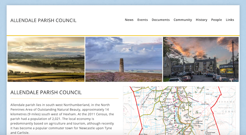
Allendale Parish Council
- "Allendale parish lies in south west Northumberland, in the North Pennines Area of Outstanding Natural Beauty, approximately 14 kilometres (9 miles) south west of Hexham. At the 2011 Census, the …
Added by
Simon Cotterill
Co-Curate Page
Allendale Town
- Overview About Allendale Allendale in 1833 Map Street View What was written about Allendale in 1833: ALLENDALE a parochial chapelry in Northumberland with a population of 5540 inhabitants in …
Co-Curate Page
Allenheads
- Overview About Allenheads Map Street View Allenheads is a village in Northumberland by the River East Allen and located about 7 miles south of Allendale Town and 3 miles north …
Co-Curate Page
Catton
- Overview Map Street View Catton is a village by the River East Allen in Northumberland. Catton is located about a mile north of Allendale Town. Historically, the wider area around …
Co-Curate Page
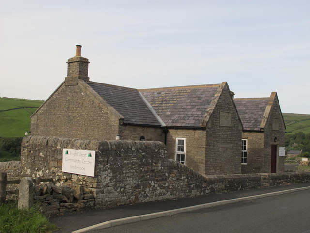
Sinderhope
- Overview About Sinderhope Map Street View Sinderhope is a village by the River East Allen, located 2 miles south of Allendale Town in Northumberland. The population is spread over a …
Co-Curate Page
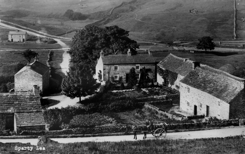
Spartylea
- Overview Map Street View Spartylea (or Sparty Lea) is a village in the valley of the River East Allen, in Northumberland. The village is on the B6925 road, about 4½ …
Co-Curate Page
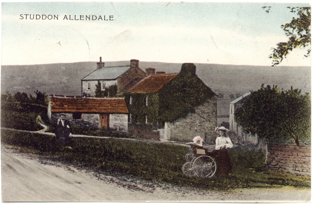
Studdon
- Overview Map Street View Studdon is a hamlet in the valley of the River East Allen, located just over a mile south of Allendale Town. Allendale Golf Club and the …
Co-Curate Page
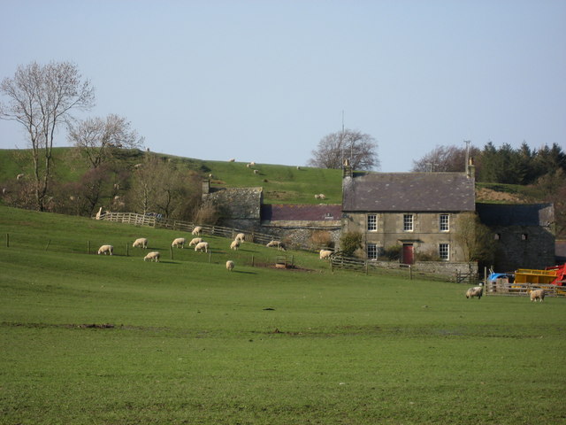
Keenley
- Overview Map Street View Keenley is a distributed community, located about 2 miles west of Allendale town in Northumberland. There is no village as such, but a number of farms …
Co-Curate Page
Park (grieveship), Allendale
- PARK, a grieveship, in the parish of Allendale, union of Hexham, S. division of Tindale ward and of Northumberland; containing 275 inhabitants. Extract from: A Topographical Dictionary of England comprising …
Co-Curate Page
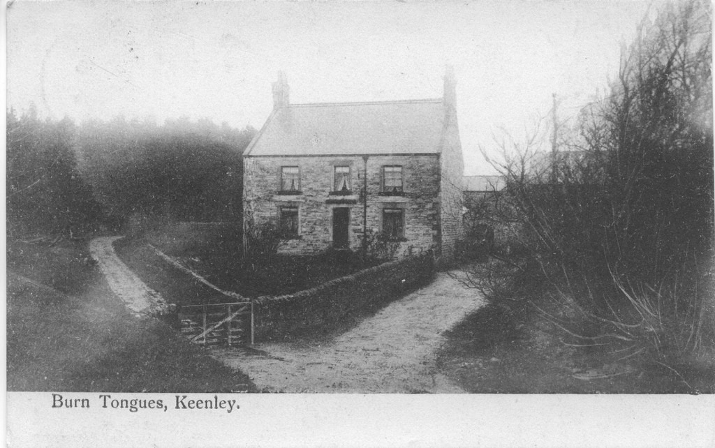
Burn Tongues, Northumberland
- Overview Map Street View Burn Tongues is a farm in Keenley, Northumberland. It is located off Common Bank (road), about 2 miles west of Allendale Town. The farm is situated …
Co-Curate Page
Thornley Gate, Northumberland
- Overview Map Street View Thornley Gate is a hamlet in Northumberland, located about half mile north-west of Allendale Town. There is a five-way crossroads at the centre of the settlement. …
Co-Curate Page
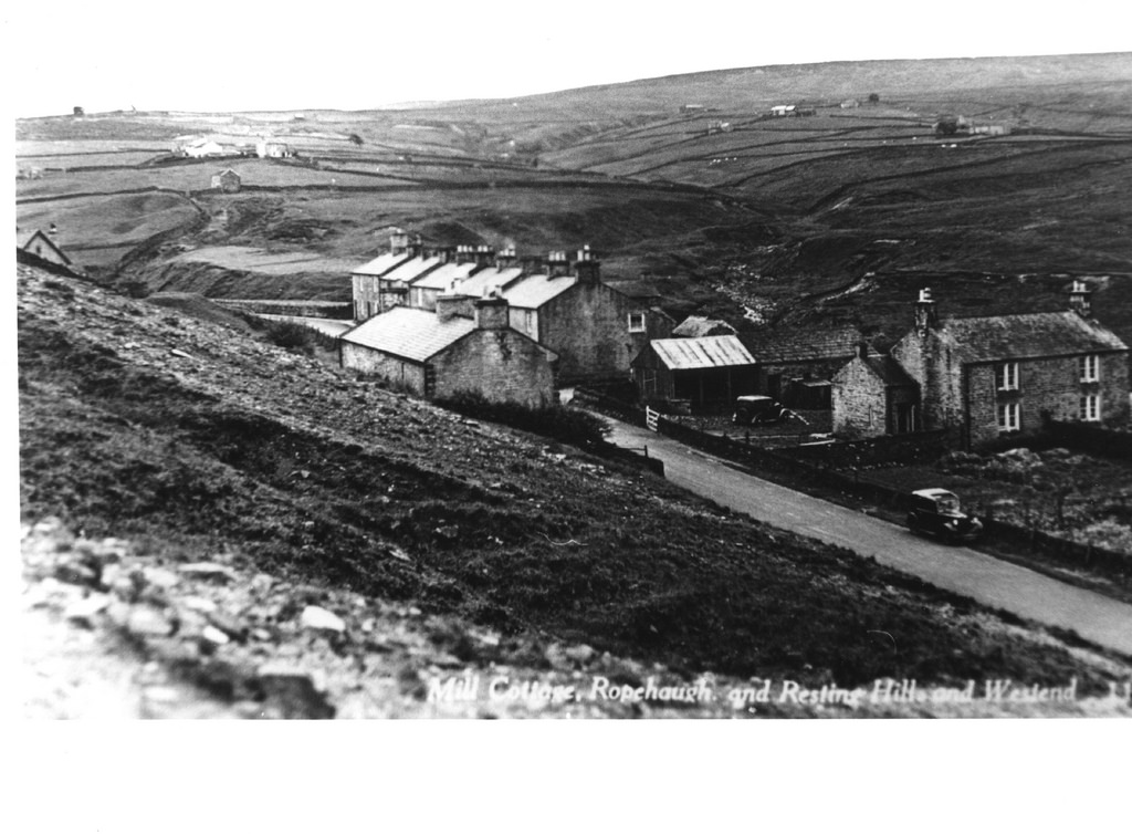
Ropehaugh (Dirt Pot)
- Overview Map Street View Ropehaugh (Dirt Pot) is a hamlet in Northumberland, located about half mile north-west of Allenheads and within the North Pennines AONB. It is a linear settlement, …
Co-Curate Page
Sipton
- Overview Map Street View Sipton is located just under 4 miles south of Allerdale Town and half mile north of Spartylea in Northumberland. It is situated by Sipton Burn, near …

Co-Curate Page
Peasmeadows
- Overview Map Street View Peasmeadows is a hamlet situated by the River East Allen. It is located off the B6295 road, about 1 mile north-west of Allenheads and 5½ miles …

Co-Curate Page
Old Town (South), Allendale
- Nearby is Old Town (North Farm). aka Wester Old Town?

Co-Curate Page
Oakpool, Allendale
- Overview Map Street View Oakpool (aka Oak Pool) is located on Appletree Bank (road), by the west bank of River East Allen, about 2 miles north-west of Allendale Town. Whellan's …

Co-Curate Page
Hindleyhill, Allendale
- Overview Map Hindleyhill (aka Hindley Hill) is a farm in Northumberland, located about 2½ miles north-west of Allendale Town. It is situated by the River East Allen, near where Hindley …

Co-Curate Page
Lanehead, Allendale
- Overview Map Street View Lanehead (aka Lane Head) is located about 2¾ miles north-west of Allendale Town and 1 mile east of Bearsbridge. Originally, there was a bastle here, built …

from https://northumberlandparishe…
Allendale Parish Council
- "Allendale parish lies in south west Northumberland, in the North Pennines Area of Outstanding Natural Beauty, approximately 14 kilometres (9 miles) south west of Hexham. At the 2011 Census, the …
Added by
Simon Cotterill
Co-Curate Page
Allendale Town
- Overview About Allendale Allendale in 1833 Map Street View What was written about Allendale in 1833: ALLENDALE a parochial chapelry in Northumberland with a population of 5540 inhabitants in …
Co-Curate Page
Allenheads
- Overview About Allenheads Map Street View Allenheads is a village in Northumberland by the River East Allen and located about 7 miles south of Allendale Town and 3 miles north …
Co-Curate Page
Catton
- Overview Map Street View Catton is a village by the River East Allen in Northumberland. Catton is located about a mile north of Allendale Town. Historically, the wider area around …
Co-Curate Page
Sinderhope
- Overview About Sinderhope Map Street View Sinderhope is a village by the River East Allen, located 2 miles south of Allendale Town in Northumberland. The population is spread over a …
Co-Curate Page
Spartylea
- Overview Map Street View Spartylea (or Sparty Lea) is a village in the valley of the River East Allen, in Northumberland. The village is on the B6925 road, about 4½ …
Co-Curate Page
Studdon
- Overview Map Street View Studdon is a hamlet in the valley of the River East Allen, located just over a mile south of Allendale Town. Allendale Golf Club and the …
Co-Curate Page
Keenley
- Overview Map Street View Keenley is a distributed community, located about 2 miles west of Allendale town in Northumberland. There is no village as such, but a number of farms …
Co-Curate Page
Park (grieveship), Allendale
- PARK, a grieveship, in the parish of Allendale, union of Hexham, S. division of Tindale ward and of Northumberland; containing 275 inhabitants. Extract from: A Topographical Dictionary of England comprising …
Co-Curate Page
Burn Tongues, Northumberland
- Overview Map Street View Burn Tongues is a farm in Keenley, Northumberland. It is located off Common Bank (road), about 2 miles west of Allendale Town. The farm is situated …
Co-Curate Page
Thornley Gate, Northumberland
- Overview Map Street View Thornley Gate is a hamlet in Northumberland, located about half mile north-west of Allendale Town. There is a five-way crossroads at the centre of the settlement. …
Co-Curate Page
Ropehaugh (Dirt Pot)
- Overview Map Street View Ropehaugh (Dirt Pot) is a hamlet in Northumberland, located about half mile north-west of Allenheads and within the North Pennines AONB. It is a linear settlement, …
Co-Curate Page
Sipton
- Overview Map Street View Sipton is located just under 4 miles south of Allerdale Town and half mile north of Spartylea in Northumberland. It is situated by Sipton Burn, near …
Co-Curate Page
Peasmeadows
- Overview Map Street View Peasmeadows is a hamlet situated by the River East Allen. It is located off the B6295 road, about 1 mile north-west of Allenheads and 5½ miles …
Co-Curate Page
Old Town (South), Allendale
- Nearby is Old Town (North Farm). aka Wester Old Town?
Co-Curate Page
Oakpool, Allendale
- Overview Map Street View Oakpool (aka Oak Pool) is located on Appletree Bank (road), by the west bank of River East Allen, about 2 miles north-west of Allendale Town. Whellan's …
Co-Curate Page
Hindleyhill, Allendale
- Overview Map Hindleyhill (aka Hindley Hill) is a farm in Northumberland, located about 2½ miles north-west of Allendale Town. It is situated by the River East Allen, near where Hindley …
Co-Curate Page
Lanehead, Allendale
- Overview Map Street View Lanehead (aka Lane Head) is located about 2¾ miles north-west of Allendale Town and 1 mile east of Bearsbridge. Originally, there was a bastle here, built …

Northumberland
Civil Parishes in Northumberland

Allendale Parish, 1848

Allendale Parish, 1855
Asheybank Farm, Allendale
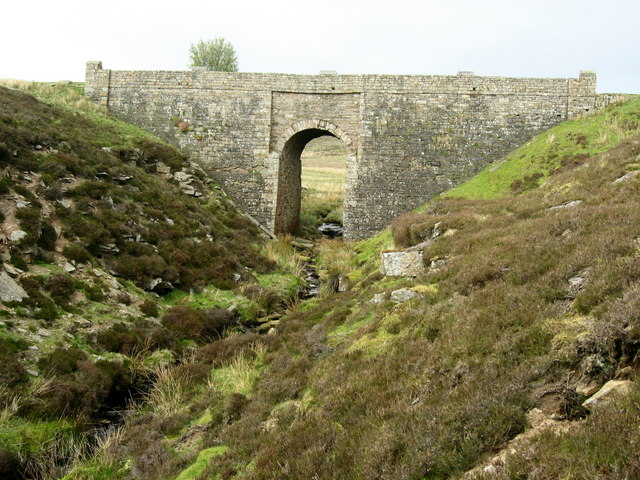
Bridge over Sipton Burn on the Long Drag
Broadside, Allendale, 1848

Crowberry Hall
High Forest and Low Forest (Allendale), 1848
Historic Buildings and Monuments in Allendale Civil Parish
Lanehead, Allendale
Monk Farm, Allendale
Park Farm, Allendale

Quarry House, Allendale


