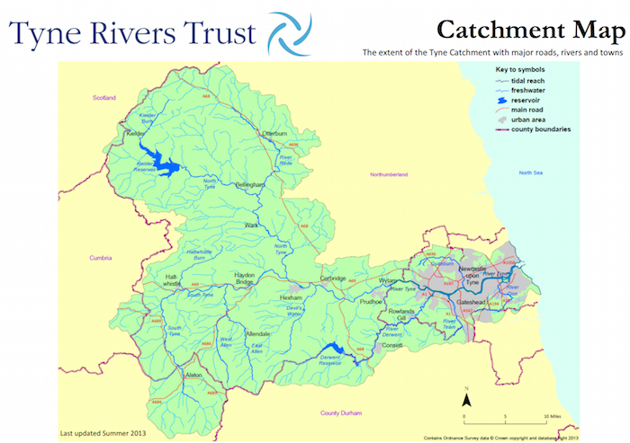
Topics > Geography > Rivers > River South Tyne
River South Tyne
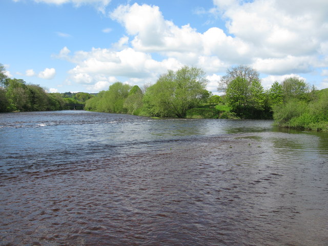
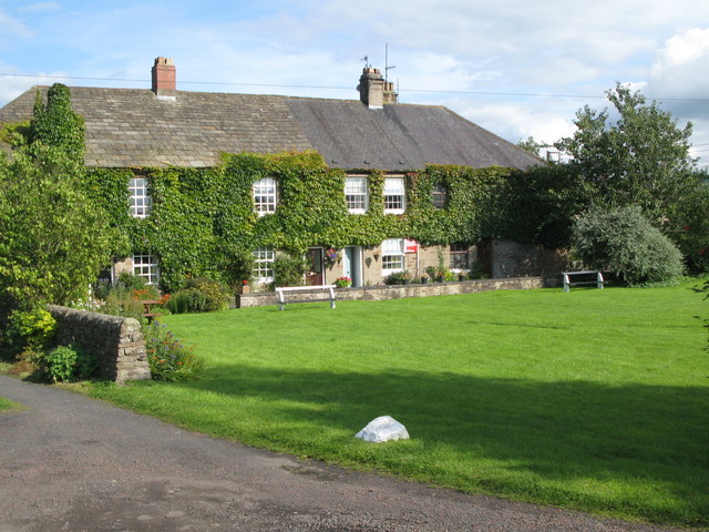
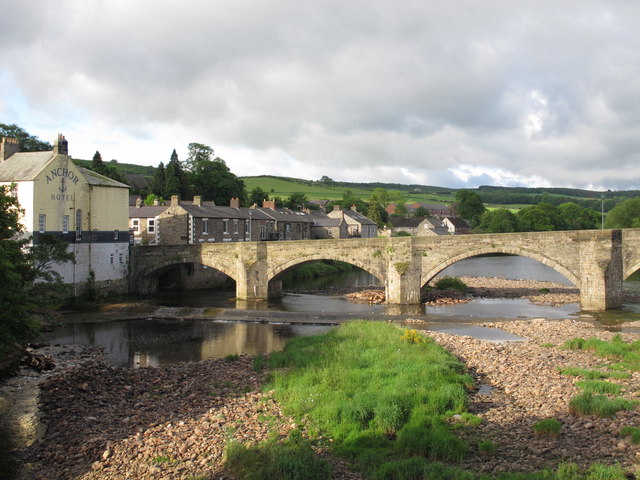
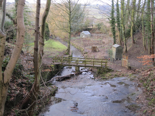
The River South Tyne rises high in the North Pennines at Tynehead Fell in Cumbria and flows in a roughly north-easterly direction to Warden Rock, near Hexham, where it joins the River North Tyne to form the River Tyne. The valley of the South Tyne is sometimes called the 'Tyne Gap'. Settlements along the River South Tyne include Garrigill, Alston, Slaggyford, Knarsdale, Lambley, Haltwhistle, Melkridge, Redburn, Bardon Mill, Haydon Bridge, Newbrough and Fourstones.
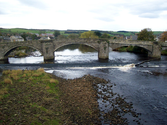
| Order | Bridge | Built | Notes | NHLE Listed? |
|---|---|---|---|---|
| 38 | Warden Railway Bridge | ? | ||
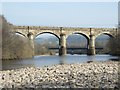
| 37 | West Boat Bridge | 1903 | ||
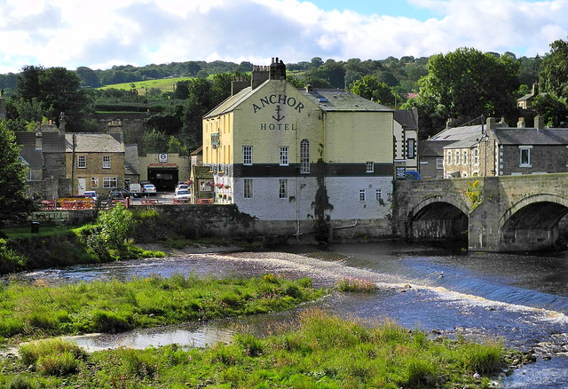
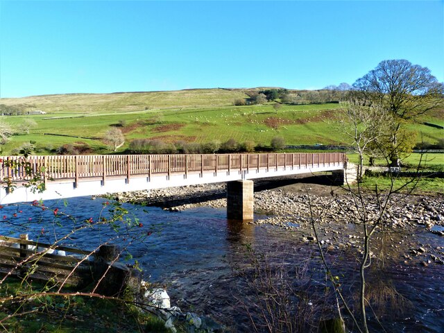
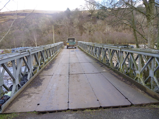
| 36 | Haydon Bridge | 1970 | ||
| 35 | Old Haydon Bridge | 1776 | ||
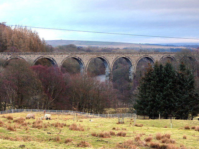
| 34 | South Tyne Viaduct | 2009 | ||
| 33 | Tedcastle Railway Bridge | ? | ||
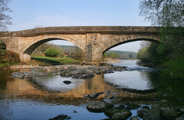
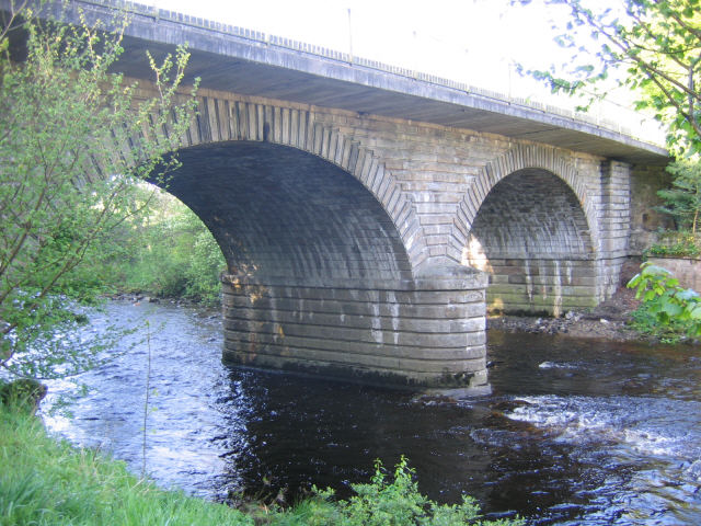
| 32 | Ridley Bridge | 1792 | Grade II* | |
| 31 | Ridley Railway Bridge | ? | ||
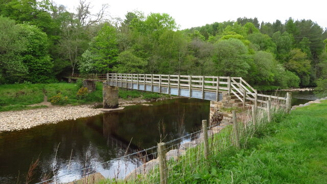
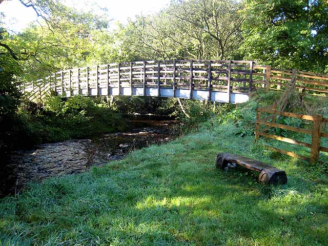
| 30 | Bardon Mill Footbridge | 1883 | ||
| 29 | Haltwhistle A69 Bridge (east) | 1997 | ||
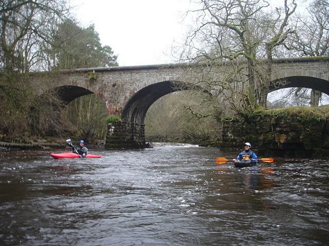
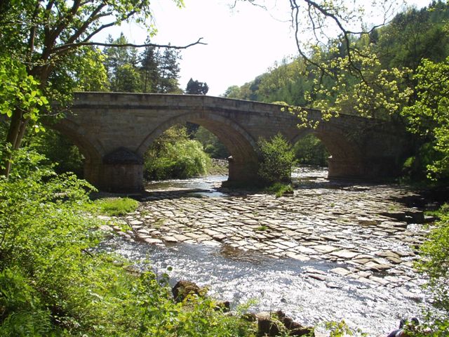
| 28 | Alston Arches Viaduct (Haltwhistle) | 1852 | Haltwhistle to Alston branch line (closed 1976). | Grade II* |
| 27 | Haltwhistle Tyne Bridge | 1875 | ||
| 26 | Bellister Bridge | 1967 | Haltwhistle | - |
| 25 | Haltwhistle A69 Bridge (west) | 1997 | ||
| 24 | Featherstone Bridge | 1775 | Grade II* | |
| 23 | Featherstone Footbridge | 1990 | Largely rebuilt following collapse in 2014. | - |
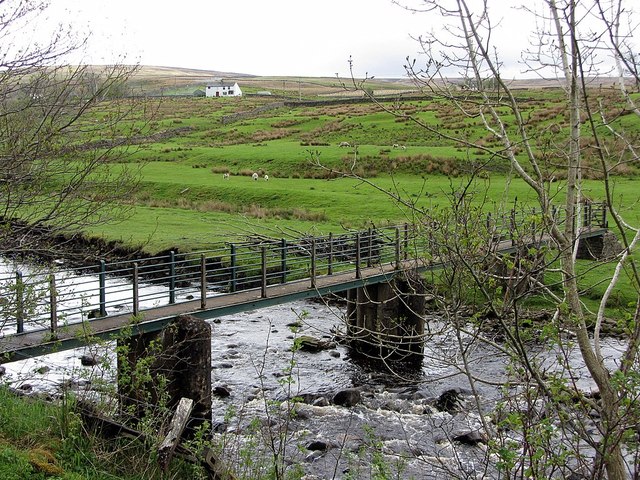
| 22 | Diamond Oak Bridge | 1975 | ||
| 21 | Lambley Footbridge | 1954 | ||
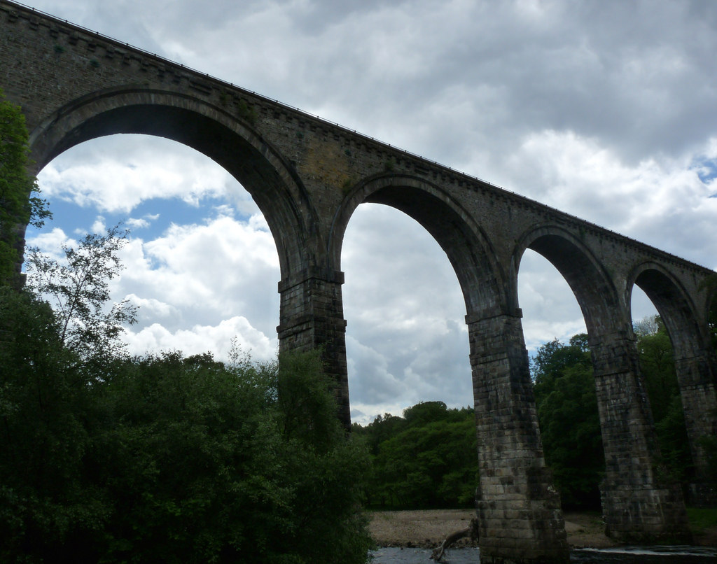
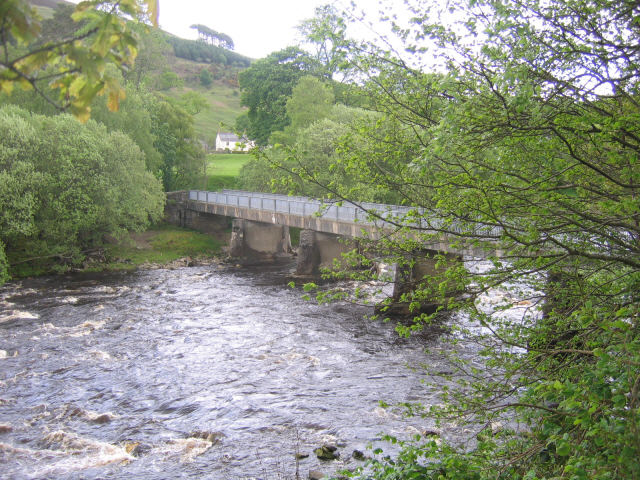
| 20 | Lambley Railway Viaduct | 1852 | Haltwhistle to Alston branch line (closed 1976). | Grade II* |
| 19 | Whitwam Footbridge | ? | ||
| 18 | Eals Bridge | 1733 | Grade II | |
| 17 | Parson Shields Bridge | c.1972 | ||
| 16 | Williamston Bridge | ? | Road bridge, aka Thompson's Well Bridge. | - |
| 15 | Kirkhaugh Footbridge | 2020 | Replaced bridge of 1954. On Isaac's Tea Trail. | - |
| 14 | Alston Railway Viaduct | 1852 | Now carries the South Tynedale Railway. | |
| 13 | Alston Road Bridge | C19th? | Carries the A685 and also on the Pennine Way | - |
| 12 | Bleagate Footbridge | ? | ||
| 11 | Footbridge near Dryburn Farm | ? | On the Pennine Way | - |
| 10 | Footbridge near High Redwig | ? | - | |
| 09 | Garrigill Bridge | ? | ||
| 08 | Windshaw Bridge | ? | ||
| 07 | Ashgillside Footbridge | ? | ||
| 06 | Lee Houses Footbridge | ? | ||
| 05 | West Ashgill Footbridge | ? | ||
| 04 | Hole House Bridge | ? | ||
| 03 | Tynehead Bridge | ? | ||
| 02 | Sheep Shelter Bridge | ? | - | |
| 01 | First bridge | ? | Slab across the infant river! | - |
from http://tyneriverstrust.org/
Tyne Rivers Trust
- "Tyne Rivers Trust has a unique role as guardian of the River Tyne Catchment, overseeing the continuing conservation and regeneration of the river from the impacts of its industrial past. …
Added by
Simon Cotterill
Co-Curate Page
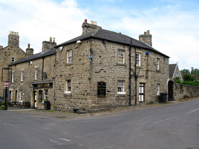
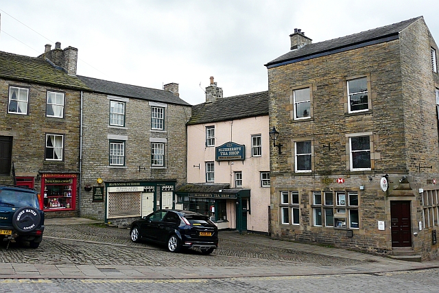
Haltwhistle
- Overview About Haltwhistle Map Street View Haltwhistle is a small town and civil parish in Northumberland, England, 10 miles east of Brampton, near Hadrian's Wall. It had a population …
Co-Curate Page
Haydon Bridge
- Overview About Haydon Bridge Map Street View OS Map Extract showing Haydon Bridge, suveyed 1860, CC-BY NLS Haydon Bridge is a village in Northumberland, England, with a population of about …

Co-Curate Page
Bardon Mill
- Overview About Bardon Mill Map Street View Bardon Mill is a village in Northumberland, located about 16 miles west of Hexham and 9 miles east of Haltwhistle. It is situated …
Co-Curate Page
Lambley
- Overview About Lambley Map Street View Lambley, formerly known as Harper Town, is a village in Northumberland, England about 4 miles southwest of Haltwhistle.The village lies adjacent to the …
Co-Curate Page
Fourstones
- Overview About Fourstones Map Street View Fourstones is a village in Northumberland, located on the north bank of the River South Tyne about 4 miles north-west of the town of …
Co-Curate Page
Newbrough
- Overview About Newbrough Map Street View Newbrough is a village in Northumberland which lies by the north bank of the River South Tyne, abot 4½ miles north-west of Hexham. Newbrough …
from Geograph (geograph)
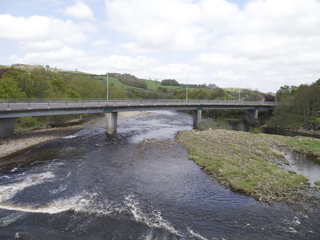
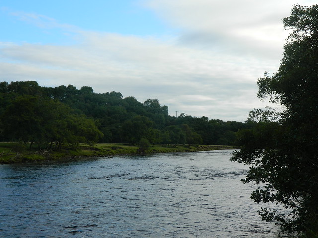
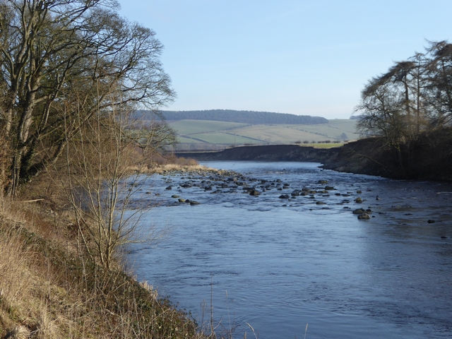
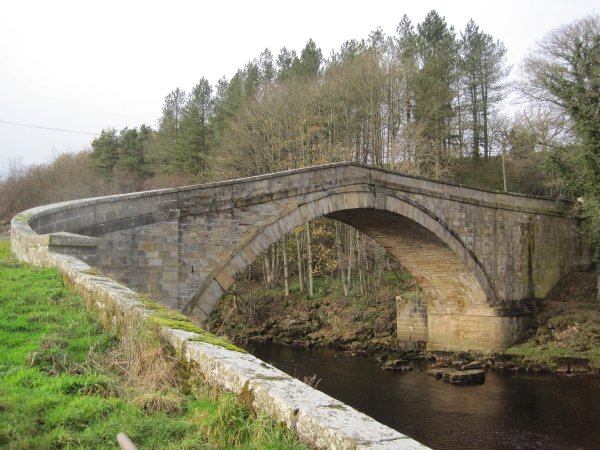
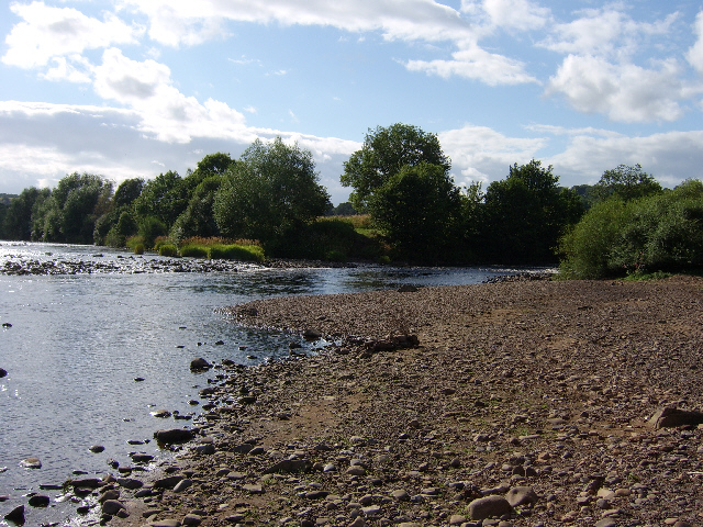
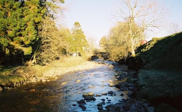
Confluence of the River South Tyne and the River North Tyne
Pinned by Simon Cotterill
Co-Curate Page
Lambley Viaduct
- Overview About Lambley Viaduct Map Lambley viaduct was built by George Barclay Bruce for the Newcastle and Carlisle Railway in 1852 to carry the Haltwhistle to Alston branch line over the …
Co-Curate Page
Knarsdale
- Overview About Knarsdale Map Street View Knarsdale is a village in Northumberland, located within the North Pennines Area of Natural Beauty, and near the River South Tyne. Knarsdale includes St …
Co-Curate Page
Henshaw
- Overview Map Street View Henshaw is a village in Northumberland, located near Bardon Mill and lies off the A69 road, 10 miles west of Hexham. Henshaw is situated close to …
Co-Curate Page
Redburn
- Overview Map Street View Redburn is a village in Northumberland, adjacent to Henshaw and Tow House. Redburn is located near Bardon Mill and lies off the A69 road, 9 miles west of Hexham. The village is …

Co-Curate Page
Tow House Bastle
- There is a 16th century bastle (fortified tower house) in Tow House, near Henshaw, built at a time of hostilities with Scotland and frequent border raids. The building has altered …
Co-Curate Page
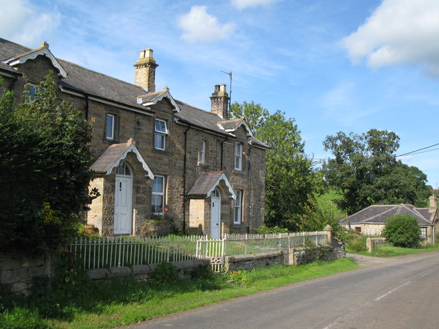
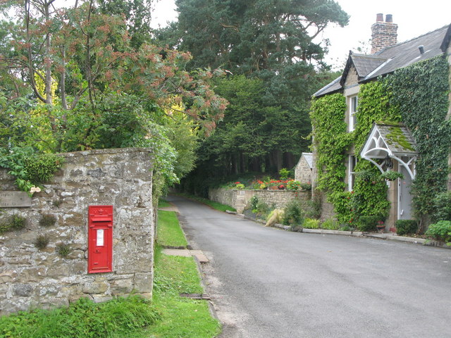
Melkridge Village
- Overview About Melkridge Map Street View Melkridge is a village in Northumberland, located about 2 miles east of Haltwhistle. It is located by the north banks of the River South …
Co-Curate Page
Alston Arches Viaduct
- Overview Map Street View Alston Arches Viaduct is a disused railway viaduct over the River South Tyne at Haltwhistle. It was built in 1852 by Sir George Barclay Bruce for …
Co-Curate Page
Alston
- Overview About Alston Map Street View Alston is a small town in Cumbria, England, within the civil parish of Alston Moor on the River South Tyne. It shares the …

Co-Curate Page
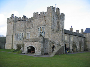
Featherstone Castle
- Overview About Featherstone Castle Map Street View The castle is located by the River South Tyne, 3 miles from Haltwhistle. The castle's origins can be traced back to the early …
Co-Curate Page
Featherstone Bridge
- Overview Map Street View Featherstone Bridge ia a single-track road bridge over River South Tyne, located about half a mile east of Featherstone Castle and 2 miles north-west of Haltwhistle. …
Co-Curate Page
Garrigill
- Overview About Garrigill Map Street View Garrigill is a village in Cumbria, located in the North Pennines, about 3 miles south of Alston. Garrigill is situated by the River South …
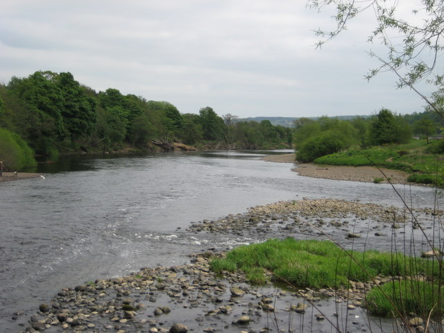
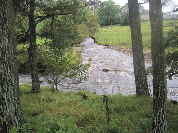
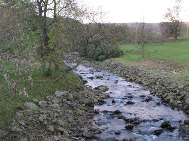
from Geograph (geograph)
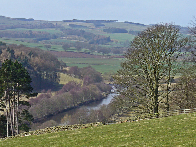
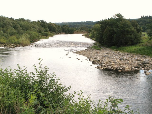
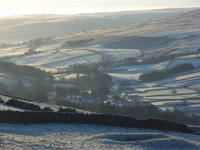
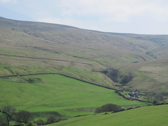
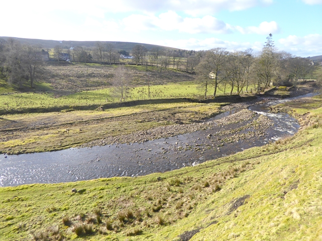
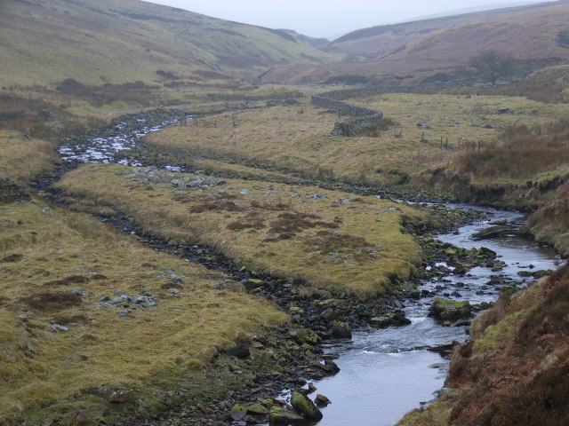
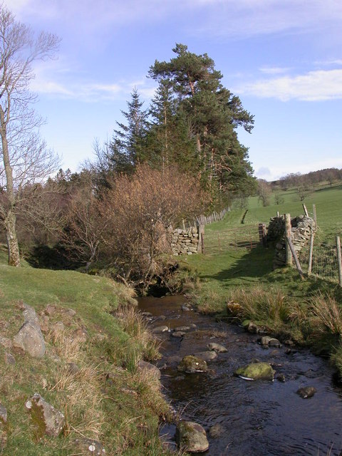
The valley of the River South Tyne around Tynehead
Pinned by Simon Cotterill

Co-Curate Page
River Nent
- The River Nent in Cumbria is a tributary of the River South Tyne. The river is about 11½ km long and has a catchment area of 29.3 km2.[1] The river …
Co-Curate Page
Allerwash, Northumberland
- Overview Map Street View Allerwash, Allerwash Hall, and Allerwash Buildings.
Co-Curate Page
Railway Bridge over the South Tyne, nr Coatlith Hill
- Overview Map There is a stone railway bridge over the River South Tyne, west of Coatlith Hill, about ½ mile north of Alston. It carries the South Tynedale Railway.
Co-Curate Page
Kirkhaugh Footbridge
- This footbridge over the River South Tyne is located at Kirkhaugh in Northumberland and is on Isaac's Tea Trail. The present bridge, opened on the 16th October 2020, replaced a …
Co-Curate Page
Kirkhaugh
- Overview Map Kirkhaugh is a distributed village and former civil parish in Northumberland, situated by the River South Tyne and located about 2½ miles north-west of Alston. The place name …
Co-Curate Page
Eals Bridge over the River South Tyne
- Overview Map Street View Eals Bridge carries the road over the River South Tyne south of Eals in Northumberland. The stone bridge dates from 1733 has two segmental arches. It …
Co-Curate Page
Williamston Bridge over the South Tyne
- Williamston Bridge (aka Thompson's Well Bridge) is a road bridge over the River South Tyne. It carries the minor road to Williamston and beyond, joining the A689 south of Slaggyford. …
Co-Curate Page
Parson Shields Bridge, Knarsdale
- Overview Map Parson Shields Bridge is a single track steel girder bridge across the River South Tyne. It carries a minor farm road leading off the A689 about ¼mile north …
Co-Curate Page
Footbridge over the South Tyne
- Overview Map There is a footbridge carrying the Pennine Way over the River South Tyne near Dryburn Farm, about 1½ miles north-west of Garrigill.

Co-Curate Page
Footbridge over the South Tyne
- Overview Map Street View There is a footbridge over the River South Tyne near High Redwing, a short distance north-west of Garrigill.
Co-Curate Page
Alston Bridge over the South Tyne
- Overview Map Street View This bridge over the River South Tyne is located on the south-western outskirts of Alston. It carries the A685 road and is also on the Pennine …
Co-Curate Page
Featherstone Footbridge
- Overview Map Street View Featherstone Footbridge (aka Castle Bridge) over the River South Tyne is in the parklands of Featherstone Castle, about 3 miles south-west of Haltwhistle. The wooden-decked girder …

Co-Curate Page
Bellister Bridge
- Overview Map Street View Bellister Bridge crosses the River South Tyne connecting the south-west of Haltwhistle with Plenmeller Road and the grounds of Bellister Castle. It was originally built as …
Co-Curate Page
East Unthank
- Overview Map East Unthank is a farm, situated near the south banks of the River South Tyne. It is located on Unthank Road, about ½ mile east of Unthank Hall …
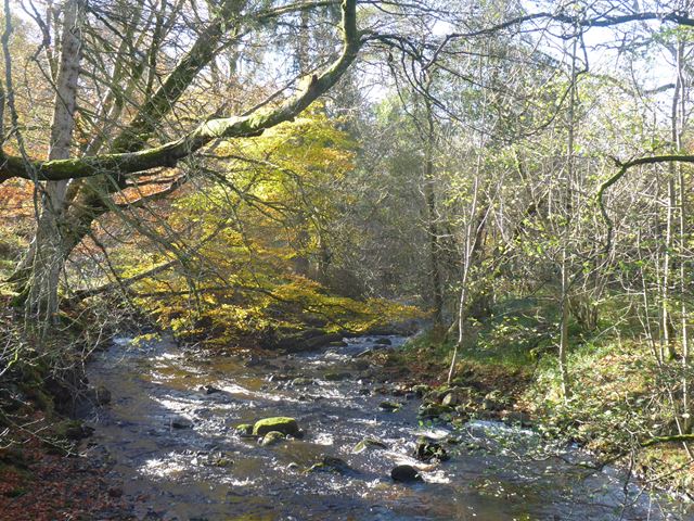
from https://commons.wikimedia.org…
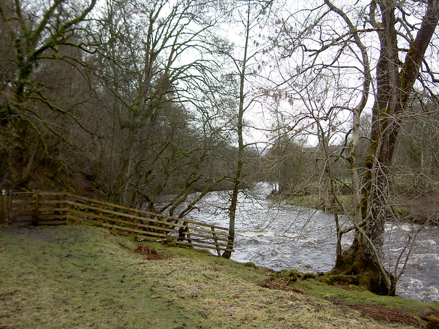
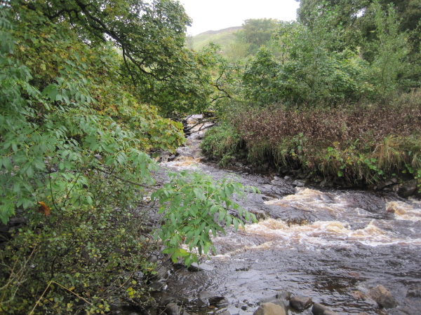
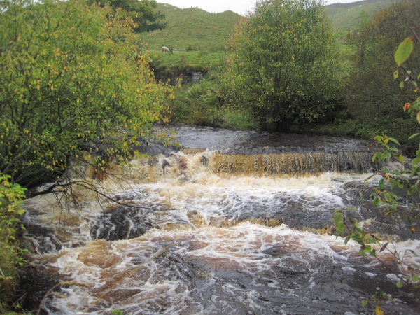
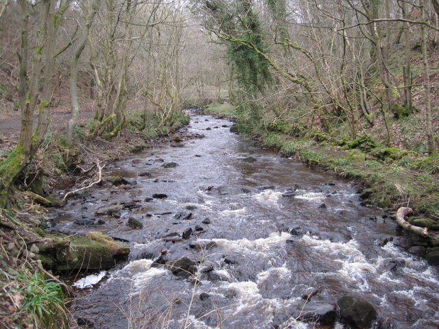
Confluence of Cross Gill and River South Tyne
- Photo by Les Hull , 12 October 2011.
Source: Geograph Britain and Ireland Edit this at Structured Image c/o Wikimedia Commons, available under a Creative Commons Attribution-Share Alike 2.0 Generic …
Added by
Simon Cotterill
Co-Curate Page
Kirkhaugh Roman Bridge Abutments
- Scheduled Monument (#1006577): Kirkhaugh Bridge abutments 1/2 mile (800m) NE of Whitley Castle Click the headings below to expand (selected extracts from the Historic England scheduling) Significance Roman bridges are …

from http://tyneriverstrust.org/
Tyne Rivers Trust
- "Tyne Rivers Trust has a unique role as guardian of the River Tyne Catchment, overseeing the continuing conservation and regeneration of the river from the impacts of its industrial past. …
Added by
Simon Cotterill
Co-Curate Page
Haltwhistle
- Overview About Haltwhistle Map Street View Haltwhistle is a small town and civil parish in Northumberland, England, 10 miles east of Brampton, near Hadrian's Wall. It had a population …
Co-Curate Page
Haydon Bridge
- Overview About Haydon Bridge Map Street View OS Map Extract showing Haydon Bridge, suveyed 1860, CC-BY NLS Haydon Bridge is a village in Northumberland, England, with a population of about …
Co-Curate Page
Bardon Mill
- Overview About Bardon Mill Map Street View Bardon Mill is a village in Northumberland, located about 16 miles west of Hexham and 9 miles east of Haltwhistle. It is situated …
Co-Curate Page
Lambley
- Overview About Lambley Map Street View Lambley, formerly known as Harper Town, is a village in Northumberland, England about 4 miles southwest of Haltwhistle.The village lies adjacent to the …
Co-Curate Page
Fourstones
- Overview About Fourstones Map Street View Fourstones is a village in Northumberland, located on the north bank of the River South Tyne about 4 miles north-west of the town of …
Co-Curate Page
Newbrough
- Overview About Newbrough Map Street View Newbrough is a village in Northumberland which lies by the north bank of the River South Tyne, abot 4½ miles north-west of Hexham. Newbrough …
from Geograph (geograph)
Confluence of the River South Tyne and the River North Tyne
Pinned by Simon Cotterill
Co-Curate Page
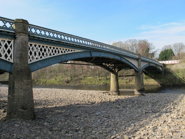
Lambley Viaduct
- Overview About Lambley Viaduct Map Lambley viaduct was built by George Barclay Bruce for the Newcastle and Carlisle Railway in 1852 to carry the Haltwhistle to Alston branch line over the …
Co-Curate Page
Knarsdale
- Overview About Knarsdale Map Street View Knarsdale is a village in Northumberland, located within the North Pennines Area of Natural Beauty, and near the River South Tyne. Knarsdale includes St …
Co-Curate Page
Henshaw
- Overview Map Street View Henshaw is a village in Northumberland, located near Bardon Mill and lies off the A69 road, 10 miles west of Hexham. Henshaw is situated close to …
Co-Curate Page
Redburn
- Overview Map Street View Redburn is a village in Northumberland, adjacent to Henshaw and Tow House. Redburn is located near Bardon Mill and lies off the A69 road, 9 miles west of Hexham. The village is …
Co-Curate Page
Tow House Bastle
- There is a 16th century bastle (fortified tower house) in Tow House, near Henshaw, built at a time of hostilities with Scotland and frequent border raids. The building has altered …
Co-Curate Page
Melkridge Village
- Overview About Melkridge Map Street View Melkridge is a village in Northumberland, located about 2 miles east of Haltwhistle. It is located by the north banks of the River South …
Co-Curate Page
Alston Arches Viaduct
- Overview Map Street View Alston Arches Viaduct is a disused railway viaduct over the River South Tyne at Haltwhistle. It was built in 1852 by Sir George Barclay Bruce for …
Co-Curate Page
Alston
- Overview About Alston Map Street View Alston is a small town in Cumbria, England, within the civil parish of Alston Moor on the River South Tyne. It shares the …
Co-Curate Page
Featherstone Castle
- Overview About Featherstone Castle Map Street View The castle is located by the River South Tyne, 3 miles from Haltwhistle. The castle's origins can be traced back to the early …
Co-Curate Page
Featherstone Bridge
- Overview Map Street View Featherstone Bridge ia a single-track road bridge over River South Tyne, located about half a mile east of Featherstone Castle and 2 miles north-west of Haltwhistle. …
Co-Curate Page
Garrigill
- Overview About Garrigill Map Street View Garrigill is a village in Cumbria, located in the North Pennines, about 3 miles south of Alston. Garrigill is situated by the River South …
from Geograph (geograph)
The valley of the River South Tyne around Tynehead
Pinned by Simon Cotterill
Co-Curate Page
River Nent
- The River Nent in Cumbria is a tributary of the River South Tyne. The river is about 11½ km long and has a catchment area of 29.3 km2.[1] The river …
Co-Curate Page
Allerwash, Northumberland
- Overview Map Street View Allerwash, Allerwash Hall, and Allerwash Buildings.
Co-Curate Page
Railway Bridge over the South Tyne, nr Coatlith Hill
- Overview Map There is a stone railway bridge over the River South Tyne, west of Coatlith Hill, about ½ mile north of Alston. It carries the South Tynedale Railway.
Co-Curate Page
Kirkhaugh Footbridge
- This footbridge over the River South Tyne is located at Kirkhaugh in Northumberland and is on Isaac's Tea Trail. The present bridge, opened on the 16th October 2020, replaced a …
Co-Curate Page
Kirkhaugh
- Overview Map Kirkhaugh is a distributed village and former civil parish in Northumberland, situated by the River South Tyne and located about 2½ miles north-west of Alston. The place name …
Co-Curate Page
Eals Bridge over the River South Tyne
- Overview Map Street View Eals Bridge carries the road over the River South Tyne south of Eals in Northumberland. The stone bridge dates from 1733 has two segmental arches. It …
Co-Curate Page
Williamston Bridge over the South Tyne
- Williamston Bridge (aka Thompson's Well Bridge) is a road bridge over the River South Tyne. It carries the minor road to Williamston and beyond, joining the A689 south of Slaggyford. …
Co-Curate Page
Parson Shields Bridge, Knarsdale
- Overview Map Parson Shields Bridge is a single track steel girder bridge across the River South Tyne. It carries a minor farm road leading off the A689 about ¼mile north …
Co-Curate Page
Footbridge over the South Tyne
- Overview Map There is a footbridge carrying the Pennine Way over the River South Tyne near Dryburn Farm, about 1½ miles north-west of Garrigill.
Co-Curate Page
Footbridge over the South Tyne
- Overview Map Street View There is a footbridge over the River South Tyne near High Redwing, a short distance north-west of Garrigill.
Co-Curate Page
Alston Bridge over the South Tyne
- Overview Map Street View This bridge over the River South Tyne is located on the south-western outskirts of Alston. It carries the A685 road and is also on the Pennine …
Co-Curate Page
Featherstone Footbridge
- Overview Map Street View Featherstone Footbridge (aka Castle Bridge) over the River South Tyne is in the parklands of Featherstone Castle, about 3 miles south-west of Haltwhistle. The wooden-decked girder …
Co-Curate Page
Bellister Bridge
- Overview Map Street View Bellister Bridge crosses the River South Tyne connecting the south-west of Haltwhistle with Plenmeller Road and the grounds of Bellister Castle. It was originally built as …
Co-Curate Page
East Unthank
- Overview Map East Unthank is a farm, situated near the south banks of the River South Tyne. It is located on Unthank Road, about ½ mile east of Unthank Hall …
from https://commons.wikimedia.org…
Confluence of Cross Gill and River South Tyne
- Photo by Les Hull , 12 October 2011.
Source: Geograph Britain and Ireland Edit this at Structured Image c/o Wikimedia Commons, available under a Creative Commons Attribution-Share Alike 2.0 Generic …
Added by
Simon Cotterill
Co-Curate Page
Kirkhaugh Roman Bridge Abutments
- Scheduled Monument (#1006577): Kirkhaugh Bridge abutments 1/2 mile (800m) NE of Whitley Castle Click the headings below to expand (selected extracts from the Historic England scheduling) Significance Roman bridges are …
Geography

Rivers
Ash Gill
Barhaugh Burn
Black Burn (tributary of the River South Tyne)
Chainley Burn
Cross Gill (trib. of South Tyne)
Crossley Burn
Darden Burn
Garrigill Burn
Gilderdale Burn
Haltwhistle Burn
Hartley Burn (trib. River South Tyne)

Honeycrook Burn (trib. River South Tyne)
Howden Burn
Knar Burn
Langley Burn
Newbrough Burn (trib. South Tyne)
Park Burn (trib. River South Tyne)
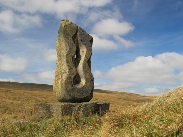
Source of the South Tyne (Sculpture)
Thinhope Burn
Tipalt Burn
Willimoteswick Burn
Whitchester (near Haltwhistle), Northumberland
Williamston Bridge over the South Tyne
Parson Shields Bridge, Knarsdale
Footbridge over the South Tyne
Footbridge over the South Tyne
Alston Bridge over the South Tyne
Kirkhaugh Roman Bridge Abutments
Melkridge Village, Northumberland
Railway Bridge over the South Tyne, nr Coatlith Hill
