Topics > Carlisle > State Management of Public Houses (1916 - 1971)
State Management of Public Houses (1916 - 1971)
| Name (in Archive) | Location | Notes |
|---|---|---|
| Central Hotel | Victoria Viaduct | Later Central Plaza Hotel. Demolished 2020. |
| The Horse and Farrier Inn | Wigton Road | Grade II listed Building |
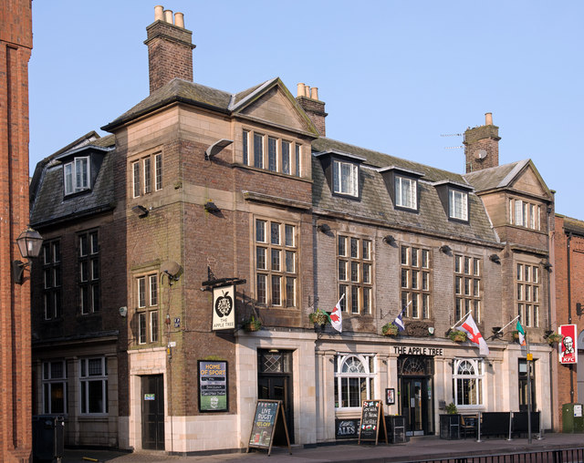
| The Apple Tree Inn | Lowther Street | Built 1925. Grade II listed building. |
| Citadel Tavern | Formerly Three Crowns and The Wellington | |
| Irishgate Tavern | Formerly The Black Bull and The Saracens Head | |
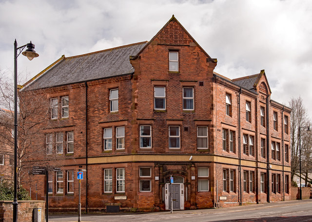
| The Bowling Green Hotel | Lowther Street | Now a Probation & Bail Hostel |
| The Pheasant Inn | Church Street, Caldewgate | The pub closed 2000. Grade II listed building. |
| The Prince of Wales Hotel | Denton Street | |
| Deakins Vault | Botchergate | |
| The Caledonian Inn | Botchergate | |
| The Albion Hotel | Botchergate | |
| The Goliah Hotel | Crown Street | |
| The Currock Hotel | Boundary Road | Built 1899. Now called 'The Rock' |
| The Fox and Hounds | Rickergate | |
| The Joiners Arms Hotel | Church Street, Caldewgate | |
| The Blue Bell Hotel | Scotch Street | |
| The Crescent Inn | Warwick Road | |
| The Cumberland Wrestlers | Currock Street | |
| The Earl Grey | Botchergate | Built 1935, to replace earlier establishement of same name |
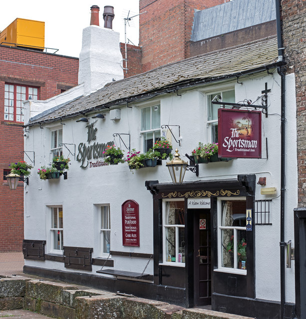
| The Sportsman Inn | Heads Lane | Now just called 'The Sportsman' |
| The Crown Inn | Stanwix | |
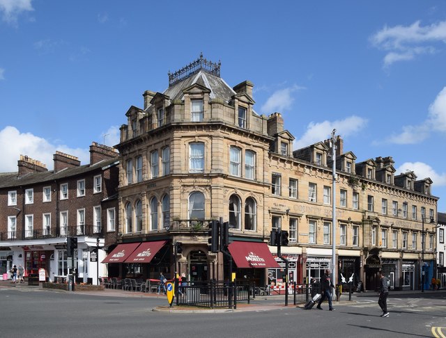
| The Red Lion Hotel | Botchergate | Built 1895. Now the County Hotel. Grade II listed Building |
| The Magpie Inn | Victoria Road | Built 1933. Grade II listed building |
| The Cumberland Inn | Botchergate | Built 1930. Grade II listed building |
| The Redfern Inn | Etterby | Built for the State Management Scheme, opened 1940. |
| Harraby Grange (Harraby Inn) | Durranhill Road | |
| Coach and Horses Inn | Kingstown Road | |
| Inglewood Forest Inn | Pennine Way | Shortened its name to the Inglewood prior to closure in 2007. It was demolished in 2010 |
| Beehive Inn | Warwick Road | |
| Caledonian Hotel | Botchergate | |
| Royal Scott | Langrigg Road, Morton | |
| Prince of Wales | Denton Street | |
| Kings Head | Fisher Street | |
| Border Terrier | Newlaithes Avenue, Morton | |
| The Brewery | Caldewgate | |
| Railway Hotel | London Road | Later, The Railway Inn. Closed 2005. Grade II listed building |
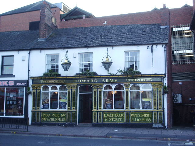
| Howard Arms | Lowther Street | Grade II listed building. |
| The Golden Lion | Botchergate | Now Gallaghers Bar. Grade II listed building |
| The Green Dragon | Newtown Road | 1806. Closed 1998, now a residence |
| The Samson | London Road | 1891. Now a fast food outlet |
| St Nicholas Arms | London Road | |
| Jovial Sailor | Caldcotes | |
| The Boardroom | Castle Street | Grade II listed building. |
| The Arroyo Arms | Edgehill Road | Built 1958 |
| The Turf | Newark Road | Grade II listed building |
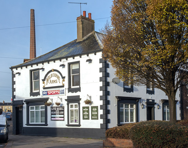
| The Milbourne Arms | Milbourne Street | Built 1853. Grade II listed building. |
| The Crown & Thistle | Church Street, Stanwix |
Based on: https://discovery.nationalarchives.gov.uk/browse/r/h/79bb3c3a-ec8a-4429-a628-2315f03a4bd2
The State Management Scheme was the nationalisation of the brewing, distribution and sale of liquor in three districts of the United Kingdom from 1916 until 1973.
The main focus of the scheme, now commonly known as the Carlisle Experiment, was Carlisle and the surrounding district close to the armament factories at Gretna, founded in 1916 to supply explosives and shells to the British Army in the First World War. However, there were three schemes in total: Carlisle and Gretna, Cromarty Firth, and Enfield. In 1921 Carlisle and Gretna was split into two separate areas. Carlisle was the larger part and supplied some beer to Gretna. In 1922 the Enfield scheme ended and its public houses were sold back to private enterprise.
The scheme was privatised by Edward Heath's Conservative Government in 1971 and its assets were sold at auction in six lots, mostly to established brewing interests.
Ethos
A central pillar of the scheme was the ethos of disinterested management: public house managers had no incentive to sell liquor, which supported the aim of reducing drunkenness and its effects on the arms industry. From 1916 to 1919 the scheme had a "no treating" policy, forbidding the buying of rounds of drinks.
Architecture
The scheme also involved the refurbishment of public houses, and the demolition and replacement of substandard premises. Most of the new premises were designed by the scheme's chief architect, Harry Redfern in his New Model Inn style, which influenced the design of public houses in the rest of the UK.
Visit the page: State Management Scheme for references and further details. You can contribute to this article on Wikipedia.
Co-Curate Page
Howard Arms, Carlisle
- Overview Map Street View The Howard Arms is a public house on the west side of Lowther Street in Carlisle. Originally, it was one of 2 adjoining houses built in …
from https://thestatemanagementsto…
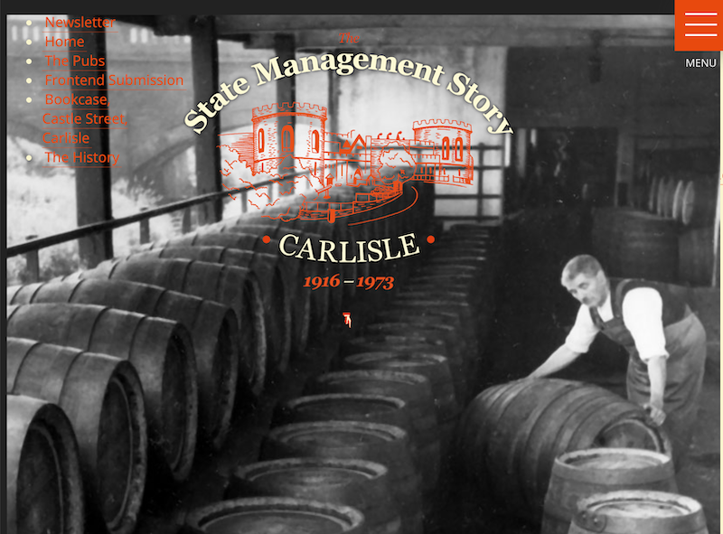
State Management Story - Carlisle - 1916-1971
- Website commissioned by Carlisle City Centre Business Group with funding from the Heritage Lottery Fund.
"In 1916, as an attempt to curb the enthusiasm of Carlisle’s drinking classes, many pubs …
Added by
Simon Cotterill
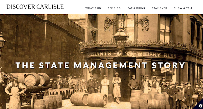
from https://www.discovercarlisle.…
The State Management Story
- "The State Management Scheme was introduced into Carlisle and the surrounding area in 1916 as an attempt by the Government to control the drinking habits of the people in the …
Added by
Simon Cotterill
Co-Curate Page
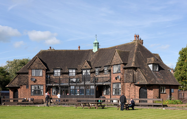
The Redfern, Etterby
- Overview Map Street View The Redfern is a public house located on Kingmoor Road, in the Etterby area of Carlisle. It was opened on the 1st of October 1940 and …
Co-Curate Page
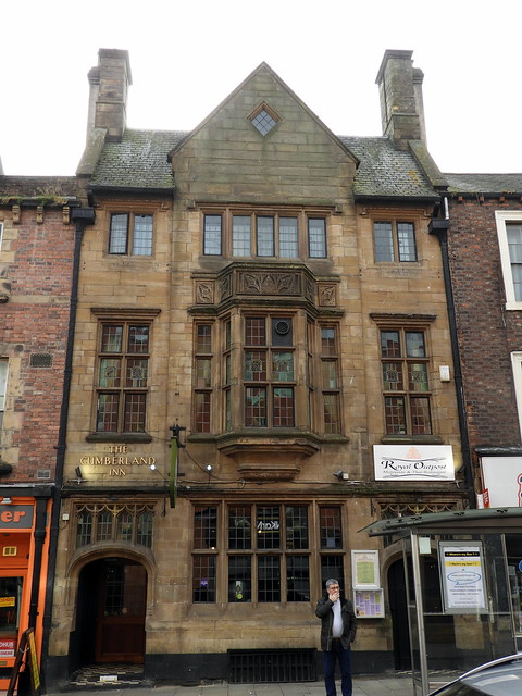
Cumberland Inn, Carlisle
- Overview Map Street View The Cumberland Inn, no. 22 Botchergate in Carlsile is public house built under the Carlisle and District State Management Scheme. Designed by Harry Redfern in a 'Tudor …
Co-Curate Page
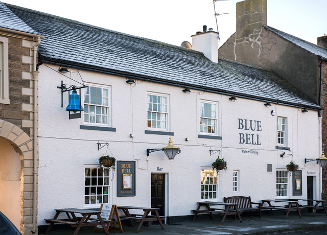
The Blue Bell, Dalston
- Overview Map Street View The Blue Bell is a public house on the east side of The Square in Dalston. It dates from the early 18th century and is a …
Co-Curate Page
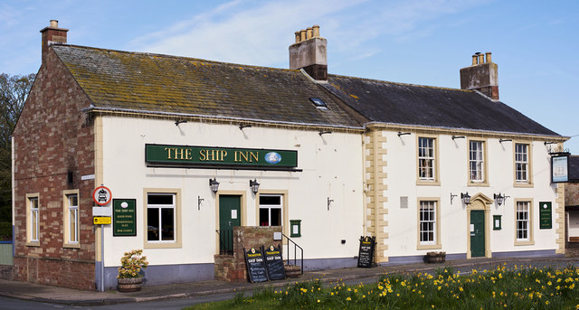
The Ship Inn, Thursby
- Overview Map Street View The Ship Inn is located by The Green in Thursby. The inn probably dates from the late 18th century and has former stable buildings; it was …
Co-Curate Page
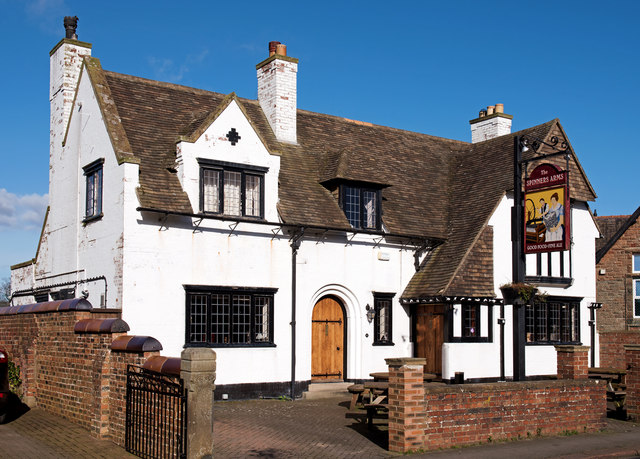
The Spinners Arms, Cummersdale
- Overview Map Street View The Spinners Arms is a public house in Cummersdale. It was built from 1929-1930 by Harry Redfern for the Carlisle District State Management Scheme. The pub …
Co-Curate Page
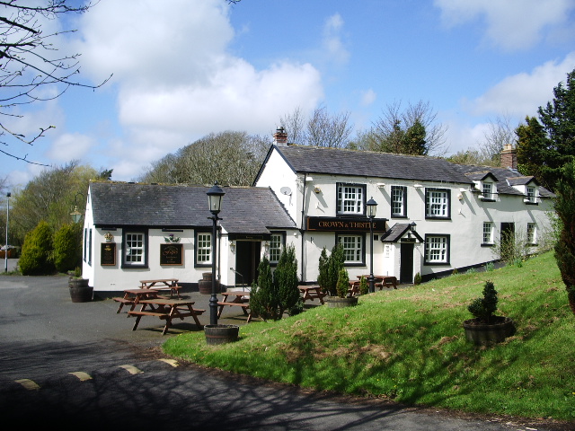
The Crown and Thistle, Rockcliffe
- Overview Map Street View The Crown and Thistle is a public house and resturant in Rockcliffe, Cumbria. The building dates from the 19th century, with a 20th century extention.[1] The …
Co-Curate Page
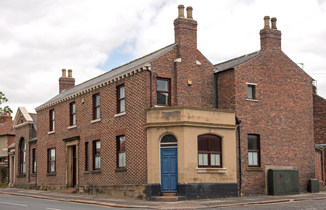
Former Green Dragon pub, Newtown Road, Carlisle
- The former Green Dragon public house on Newtown Road, Carlisle, dates from 1806. In 1860, it was extended out to Newtown Road.[1] The Green Dragon was acquired by the State …
Co-Curate Page
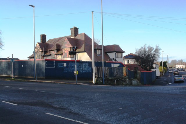
The Horse and Farrier, Wigton Road, Carlisle
- Overview Map Street View The Horse and Farrier is a public house at the junction of Wigton Road and Orton Road in Carlisle. The pub is dated 1928, built for …
Co-Curate Page
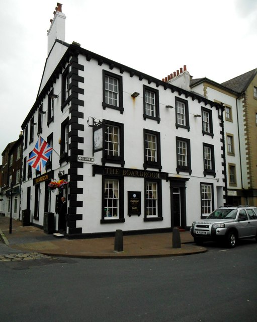
The Boardroom, Carlisle
- Overview Map Street View The Boardroom is a public house, located on the corner of Castle Street and Paternoster Row in Carlisle. The building dates from at least the late …
Co-Curate Page
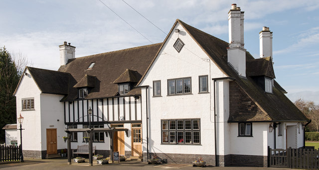
Magpie Inn, Carlisle
- Overview Map Street View The Magpie Inn is located by the junction of Victoria Road and Banks Lane in Botcherby, Carlisle. The public house was built in 1933 to designs …

Co-Curate Page
The Rock (former Currock Inn), Carlisle
- Overview Map Street View The Rock is a public house, previously known as 'The Currock', located at the junction of Robinson Avenue and Boundary Road in Currock, Carlisle. It was …
Co-Curate Page
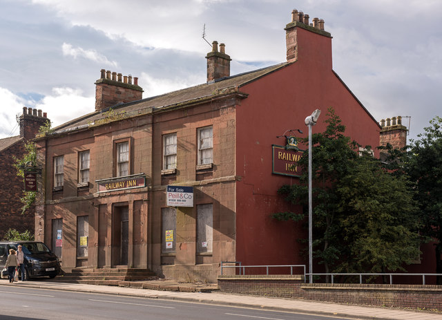
Railway Inn, London Road, Carlisle
- Overview Map Street View The former Railway Inn is located at No. 104, London Road in Carlisle. It was originally built in 1837 as the Station Hotel to serve passengers …

from Geograph (geograph)
St Nicholas Arms, London Road, Carlisle - September 2016
Pinned by Simon Cotterill

from Geograph (geograph)
The Samson, London Road, Carlisle - March 2017 (1)
Pinned by Simon Cotterill
Co-Curate Page
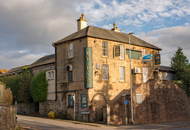
Harraby Inn, London Road, Carlisle
- Overview Map Street View Harraby Pub and Kitchen is located on London Road, by the junction with Harraby Grove, in the Harraby area of Carlisle. It opened as a public …

from Geograph (geograph)
Jovial Sailor, Caldcotes, Carlisle - November 2016 (1)
Pinned by Simon Cotterill
from Geograph (geograph)
Former "Bowling Green Hotel", Lowther Street - March 2018
Pinned by Simon Cotterill
Co-Curate Page
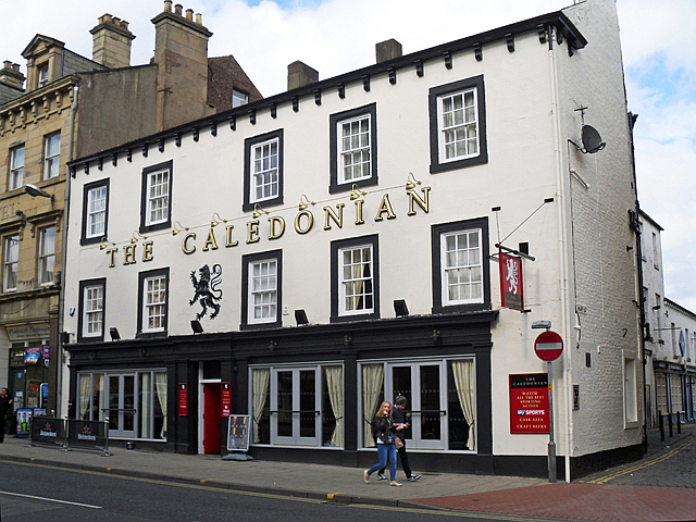
The Caledonian, Botchergate, Carlisle
- Overview Map Street View The Caledonian is a public house on Botchergate, at the junction with Mary Street, in Carlisle. The first reference to this pub is found in 1852 …
Co-Curate Page
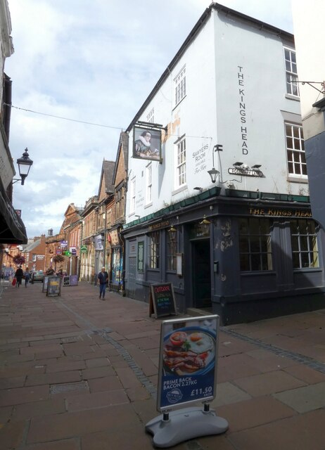
The Kings Head, Carlisle
- Overview Map Street View The Kings Head on Fisher Street is reputed to be the oldest public house in Carlisle. The present building dates from the 17th Century (with later …
Co-Curate Page
The Sportsman Inn, Carlisle
- Overview Map Street View The Sportsman is a public house located on Heads Lane, by the junction with Blackfriars Street in Carlise. The inn originates from the early 18th century. …
Co-Curate Page
Milbourne Arms, Denton Holme
- Overview Map Street View The Milbourne Arms is a public house located at the south end of Milbourne Street by Junction Street, in Denton Holme, Carlisle. It was built 1852-1853.[1] …
Co-Curate Page
County Hotel, Botchergate
- Overview Map Street View The County Hotel is located on the corner of Botchergate and The Crescent in Carlisle. It was originally built 1894-1896 and named The Red Lion Hotel. The …
Co-Curate Page
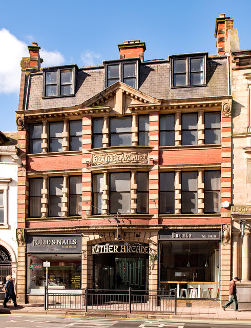
Nos. 15 & 17 Lowther Street, Carlisle
- Overview Map Street View Nos. 15 & 17 Lowther Street in Carlisle includes the East entrance to Lowther Arcade. The building has 2 shops with offices above. Dated 1904, this …
Co-Curate Page
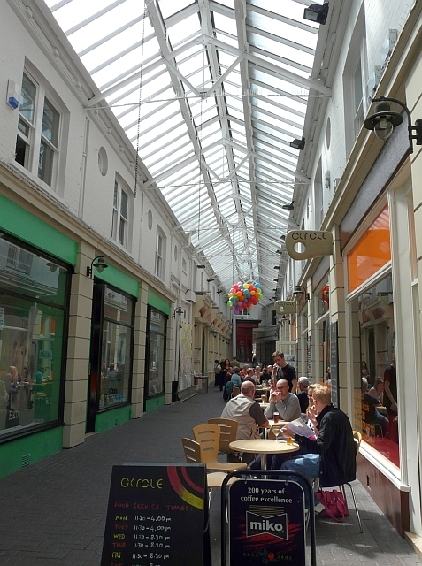
Lowther Arcade, Carlisle
- Overview Map Street View Inside Lowther Arcade runs between Lowther Street and English Street in Carlisle, and dates from 1904. The East entrance to arcade (Nos 15 & 17 Lowther …
Co-Curate Page
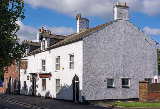
Crown & Thistle, Stanwix
- Overview Map Street View The Crown & Thistle is a public house on Church Street in Stanwix, Carlisle. The pub, located north of St Michael's Church, dates from the late …

Co-Curate Page
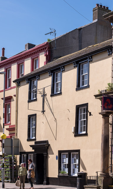
Nos. 161-163 Botchergate
- Overview Map Street View Nos. 161-163, Botchergate, hosts the Carlisle Taekwon-do Centre. The Art-Deco style building originally opened on the 9th July 1935 as the Earl Grey public house. Designed …
Co-Curate Page
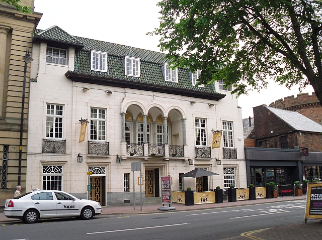
Wigton Youth Station (former White Swan)
- Overview Map Street View Wigton Youth Station is located at No. 16, High Street in Wigton. The building dates from the late 18th century and was formerly the White Swan …
Co-Curate Page
The Andalusian, Carlisle
- Overview Map Street View The Andalusian is a bar and resurant on Warwick Road, by the junction with The Cresent, in Carlisle. Originally it was "The Crescent Inn", built in …

Co-Curate Page
St Nicholas Arms, London Road, Carlisle
- Overview Map Street View St Nicholas Arms is a public house located on London Road, by the junction with Grey Street, in Carlisle. Originally a large house, (shown on the …
Co-Curate Page
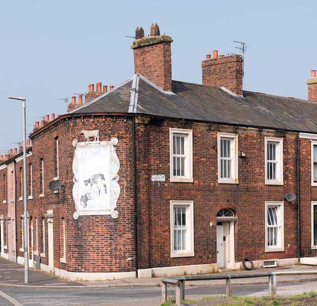
Former White Ox, St Nicholas Street, Carlisle
- Overview Map Street View The former White Ox public hose is located on St Nicholas Street, at the junction with Woodroufe Terrace, in Carlisle. It was built in c.1852, and …

Co-Curate Page
Gallaghers Bar (former Golden Lion), Carlisle
- Overview Map Street View Gallaghers Bar is located at the junction of St Nicholas Street and Botchergate in Carlisle. It is thought to have originally been 3 houses, built in …

Co-Curate Page
Greyhounds Inn, Burgh by Sands
- Overview Map Street View The Greyhounds Inn is a public house in Burgh by Sands. It was originally a house built in the late 18th century. The pub was taken …
Co-Curate Page
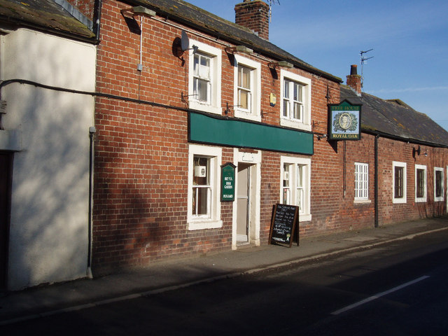
The Royal Oak, Moorhouse
- Overview Map Street View The Royal Oak is a public house in Moorhouse, situated on the B5307 road. The pub was taken over by the State Management Scheme in c.1916 …
Co-Curate Page
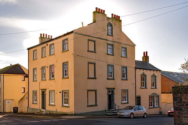
Former Senhouse Arms, Maryport
- Overview Map Street View The former Senhouse Arms, now private residences, is located on the corner of Crosby Street and Eaglesfield Street in Maryport. The building dates from the early …


Co-Curate Page
Howard Arms, Carlisle
- Overview Map Street View The Howard Arms is a public house on the west side of Lowther Street in Carlisle. Originally, it was one of 2 adjoining houses built in …

from https://thestatemanagementsto…
State Management Story - Carlisle - 1916-1971
- Website commissioned by Carlisle City Centre Business Group with funding from the Heritage Lottery Fund.
"In 1916, as an attempt to curb the enthusiasm of Carlisle’s drinking classes, many pubs …
Added by
Simon Cotterill

from https://www.discovercarlisle.…
The State Management Story
- "The State Management Scheme was introduced into Carlisle and the surrounding area in 1916 as an attempt by the Government to control the drinking habits of the people in the …
Added by
Simon Cotterill

Co-Curate Page
The Redfern, Etterby
- Overview Map Street View The Redfern is a public house located on Kingmoor Road, in the Etterby area of Carlisle. It was opened on the 1st of October 1940 and …

Co-Curate Page
Cumberland Inn, Carlisle
- Overview Map Street View The Cumberland Inn, no. 22 Botchergate in Carlsile is public house built under the Carlisle and District State Management Scheme. Designed by Harry Redfern in a 'Tudor …

Co-Curate Page
The Blue Bell, Dalston
- Overview Map Street View The Blue Bell is a public house on the east side of The Square in Dalston. It dates from the early 18th century and is a …

Co-Curate Page
The Ship Inn, Thursby
- Overview Map Street View The Ship Inn is located by The Green in Thursby. The inn probably dates from the late 18th century and has former stable buildings; it was …

Co-Curate Page
The Spinners Arms, Cummersdale
- Overview Map Street View The Spinners Arms is a public house in Cummersdale. It was built from 1929-1930 by Harry Redfern for the Carlisle District State Management Scheme. The pub …

Co-Curate Page
The Crown and Thistle, Rockcliffe
- Overview Map Street View The Crown and Thistle is a public house and resturant in Rockcliffe, Cumbria. The building dates from the 19th century, with a 20th century extention.[1] The …

Co-Curate Page
Former Green Dragon pub, Newtown Road, Carlisle
- The former Green Dragon public house on Newtown Road, Carlisle, dates from 1806. In 1860, it was extended out to Newtown Road.[1] The Green Dragon was acquired by the State …

Co-Curate Page
The Horse and Farrier, Wigton Road, Carlisle
- Overview Map Street View The Horse and Farrier is a public house at the junction of Wigton Road and Orton Road in Carlisle. The pub is dated 1928, built for …

Co-Curate Page
The Boardroom, Carlisle
- Overview Map Street View The Boardroom is a public house, located on the corner of Castle Street and Paternoster Row in Carlisle. The building dates from at least the late …

Co-Curate Page
Magpie Inn, Carlisle
- Overview Map Street View The Magpie Inn is located by the junction of Victoria Road and Banks Lane in Botcherby, Carlisle. The public house was built in 1933 to designs …

Co-Curate Page
The Rock (former Currock Inn), Carlisle
- Overview Map Street View The Rock is a public house, previously known as 'The Currock', located at the junction of Robinson Avenue and Boundary Road in Currock, Carlisle. It was …

Co-Curate Page
Railway Inn, London Road, Carlisle
- Overview Map Street View The former Railway Inn is located at No. 104, London Road in Carlisle. It was originally built in 1837 as the Station Hotel to serve passengers …

from Geograph (geograph)
St Nicholas Arms, London Road, Carlisle - September 2016
Pinned by Simon Cotterill

from Geograph (geograph)
The Samson, London Road, Carlisle - March 2017 (1)
Pinned by Simon Cotterill

Co-Curate Page
Harraby Inn, London Road, Carlisle
- Overview Map Street View Harraby Pub and Kitchen is located on London Road, by the junction with Harraby Grove, in the Harraby area of Carlisle. It opened as a public …

from Geograph (geograph)
Jovial Sailor, Caldcotes, Carlisle - November 2016 (1)
Pinned by Simon Cotterill

from Geograph (geograph)
Former "Bowling Green Hotel", Lowther Street - March 2018
Pinned by Simon Cotterill

Co-Curate Page
The Caledonian, Botchergate, Carlisle
- Overview Map Street View The Caledonian is a public house on Botchergate, at the junction with Mary Street, in Carlisle. The first reference to this pub is found in 1852 …

Co-Curate Page
The Kings Head, Carlisle
- Overview Map Street View The Kings Head on Fisher Street is reputed to be the oldest public house in Carlisle. The present building dates from the 17th Century (with later …

Co-Curate Page
The Sportsman Inn, Carlisle
- Overview Map Street View The Sportsman is a public house located on Heads Lane, by the junction with Blackfriars Street in Carlise. The inn originates from the early 18th century. …

Co-Curate Page
Milbourne Arms, Denton Holme
- Overview Map Street View The Milbourne Arms is a public house located at the south end of Milbourne Street by Junction Street, in Denton Holme, Carlisle. It was built 1852-1853.[1] …

Co-Curate Page
County Hotel, Botchergate
- Overview Map Street View The County Hotel is located on the corner of Botchergate and The Crescent in Carlisle. It was originally built 1894-1896 and named The Red Lion Hotel. The …

Co-Curate Page
Nos. 15 & 17 Lowther Street, Carlisle
- Overview Map Street View Nos. 15 & 17 Lowther Street in Carlisle includes the East entrance to Lowther Arcade. The building has 2 shops with offices above. Dated 1904, this …

Co-Curate Page
Lowther Arcade, Carlisle
- Overview Map Street View Inside Lowther Arcade runs between Lowther Street and English Street in Carlisle, and dates from 1904. The East entrance to arcade (Nos 15 & 17 Lowther …

Co-Curate Page
Crown & Thistle, Stanwix
- Overview Map Street View The Crown & Thistle is a public house on Church Street in Stanwix, Carlisle. The pub, located north of St Michael's Church, dates from the late …

Co-Curate Page
Nos. 161-163 Botchergate
- Overview Map Street View Nos. 161-163, Botchergate, hosts the Carlisle Taekwon-do Centre. The Art-Deco style building originally opened on the 9th July 1935 as the Earl Grey public house. Designed …

Co-Curate Page
Wigton Youth Station (former White Swan)
- Overview Map Street View Wigton Youth Station is located at No. 16, High Street in Wigton. The building dates from the late 18th century and was formerly the White Swan …

Co-Curate Page
The Andalusian, Carlisle
- Overview Map Street View The Andalusian is a bar and resurant on Warwick Road, by the junction with The Cresent, in Carlisle. Originally it was "The Crescent Inn", built in …

Co-Curate Page
St Nicholas Arms, London Road, Carlisle
- Overview Map Street View St Nicholas Arms is a public house located on London Road, by the junction with Grey Street, in Carlisle. Originally a large house, (shown on the …

Co-Curate Page
Former White Ox, St Nicholas Street, Carlisle
- Overview Map Street View The former White Ox public hose is located on St Nicholas Street, at the junction with Woodroufe Terrace, in Carlisle. It was built in c.1852, and …

Co-Curate Page
Gallaghers Bar (former Golden Lion), Carlisle
- Overview Map Street View Gallaghers Bar is located at the junction of St Nicholas Street and Botchergate in Carlisle. It is thought to have originally been 3 houses, built in …

Co-Curate Page
Greyhounds Inn, Burgh by Sands
- Overview Map Street View The Greyhounds Inn is a public house in Burgh by Sands. It was originally a house built in the late 18th century. The pub was taken …

Co-Curate Page
The Royal Oak, Moorhouse
- Overview Map Street View The Royal Oak is a public house in Moorhouse, situated on the B5307 road. The pub was taken over by the State Management Scheme in c.1916 …

