Topics > Heritage Sites > Scheduled Monument > Scheduled Monuments in County Durham
Scheduled Monuments in County Durham
Some of the Scheduled Monuments on this Website which are located in the County Durham (Unitary Authority area). Not an exhaustive list!
Scheduled Monuments are sites of national significance which have been given the top-level of legal protection under the Ancient Monuments and Archaeological Areas Act 1979. They range from archaeological sites (prehistoric, Roman, Medieval etc) to ruins or surviving structures (including some 19th/20th century industrial and military sites).
Co-Curate Page
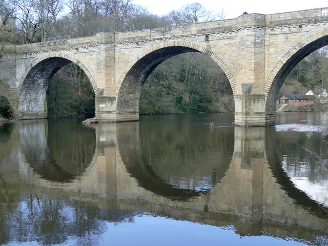
Prebends Bridge
- Overview About Prebends Bridge Map Street View Prebends Bridge over the River Wear at Durham was built for the Dean and Chapter of Durham to provide access to Durham Cathedral …
Co-Curate Page
Sherburnhouse Bridge
- Overview Map Street View The old Sherburnhouse Bridge, located to the north-west of the hamlet of Sherburn House in County Durham, dates from 1335, with the upper part of the …
Co-Curate Page
Coke Ovens at Inkerman Farm
- "The beehive coke ovens are some of the last remaining examples of this type of oven left in County Durham. At one time there were over 100,000 in the County. …
Co-Curate Page
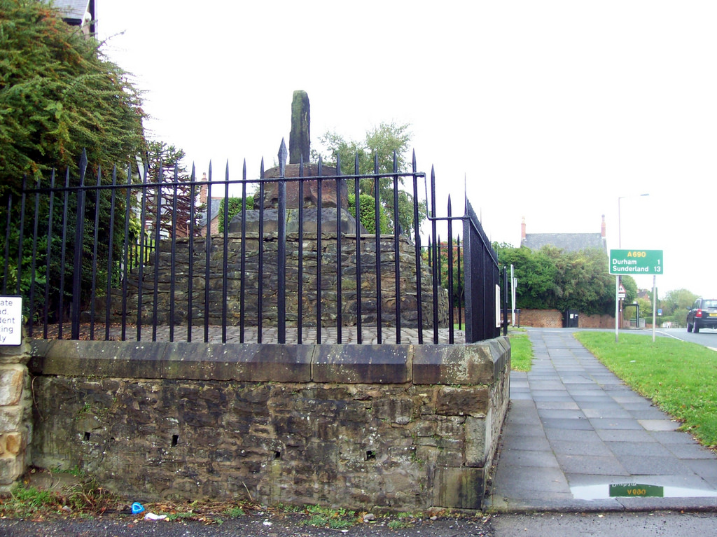
Neville's Cross (monument)
- Overview Map Street View The remains of the medieval Neville's Cross are located on the north side of Crossgate Peth, opposite St John's Church in the Nevil's Cross area of …
Co-Curate Page
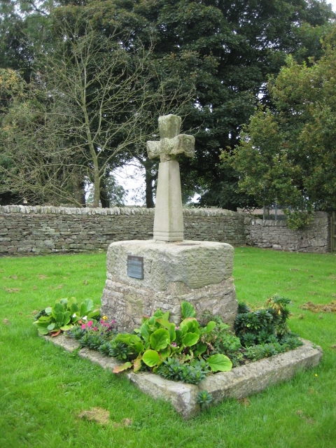
Village Cross, Esh
- Overview Map Street View Esh Cross is located in its original position on a raised area at the southern end of the village green in Esh. It is an important …
Co-Curate Page
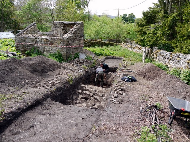
Coxhoe Medieval Settlement
- Overview Map The buried remains of the Medieval village of Coxhoe are located to the south-west of East House Farm, roughly half way between the modern villages of Coxhoe and …

Co-Curate Page
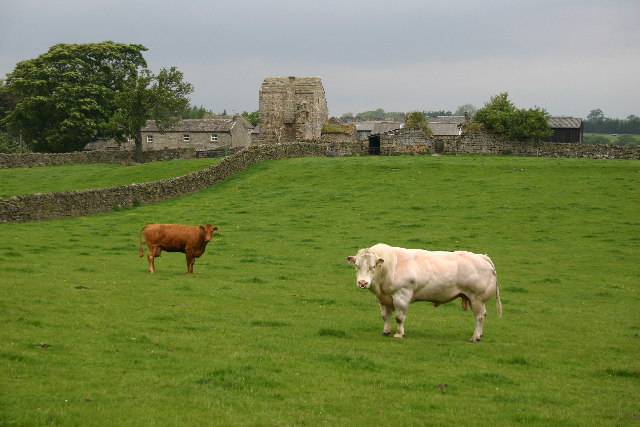
The Castles (camp)
- Overview Map 'The Castles' (camp) a large stone-built enclosure, located near West Shipley Farm, Hamsterley, in County Durham. It is believed to be the remains of a fortified site of …
Co-Curate Page
Scargill Castle
- Overview Map Scargill was originally built in the late 12th century by Warren de Scargill whilst he was overseeing building work at the nearby Bowes Castle. King Edward II is …
Co-Curate Page
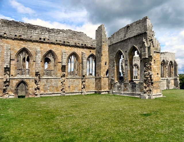
Egglestone Abbey
- Overview About Egglestone Abbey Map Street View Egglestone Abbey is an abandoned Premonstratensian Abbey on the southern (Yorkshire) bank of the River Tees, 1 1⁄2 miles (2.4 km) south-east of …
Co-Curate Page
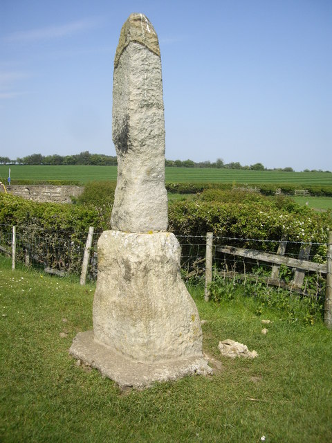
Legs Cross
- Overview Map Street View Near Bolam, County Durham. "The base and fragment of a cross shaft dating from the 9th century. A rough cut rectangular sandstone base, badly worn, but …
Co-Curate Page
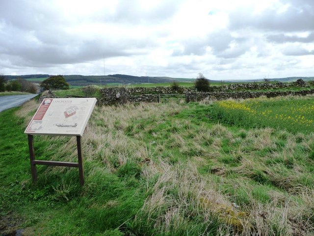
Longovicium, Lanchester Roman Fort
- Overview About Longovicium Map Street View Longovicium was a Roman fort established in the mid 2nd century AD, which lay on Dere Street, the Roman road connecting York with the …
Co-Curate Page
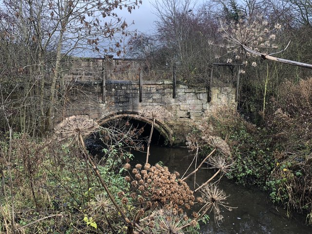
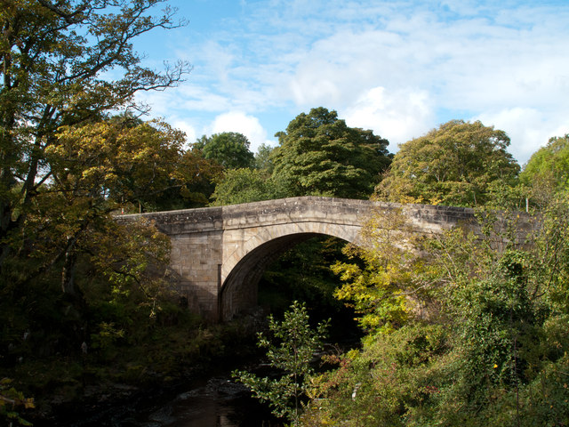
Bridge over the Wear
- Overview Map Street View This stone bridge over the River Wear just west of Stanhope dates from medieval times. The bridge now carries the B6278 road. It is Grade II* …
Co-Curate Page
Framwellgate Bridge
- Overview About Framwellgate Bridge Map Street View Framwellgate Bridge is a medieval stone bridge over the River Wear in Durham. The bridge was built in the 15th century and replaced …
Co-Curate Page
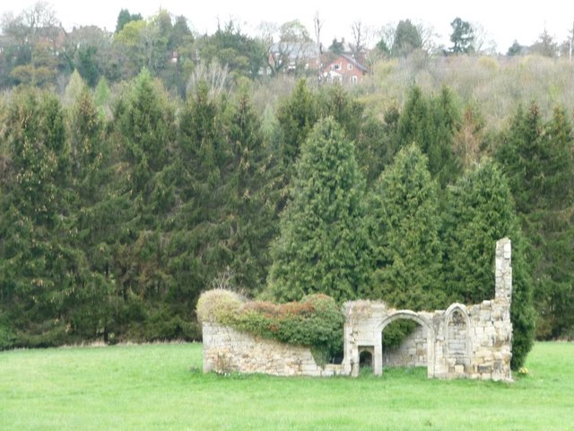
Friarside Chapel, nr Burnopfield
- Overview Map High Friarside Hospice was a Medieval leper hospital, located just south of the River Derwent, north of Burnopfield and south of Rowlands Gill, in County Durham. The hospital was founded …
Co-Curate Page
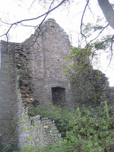
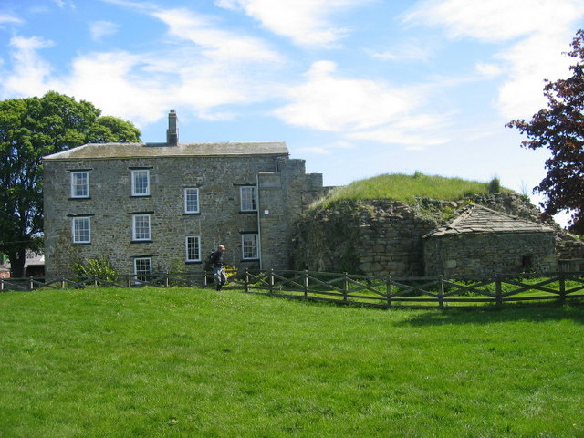
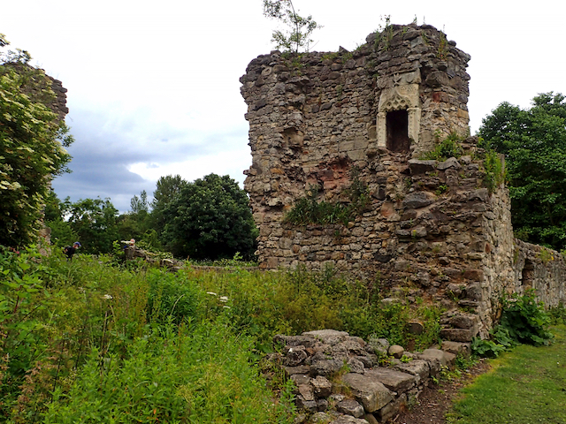
Dalden Tower
- Overview Map Street View Dalden Tower, is located in Seaham in the Dean which runs to Dalton-le-Dale. The pele-tower is the most prominent part of the remains of what was …
Co-Curate Page
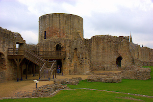
Barnard Castle (castle)
- Overview About Barnard Castle Map Street View The medieval castle in the town of Barnard Castle, is cared for by English Heritage. The castle is a Scheduled Ancient Monument, and …
Co-Curate Page
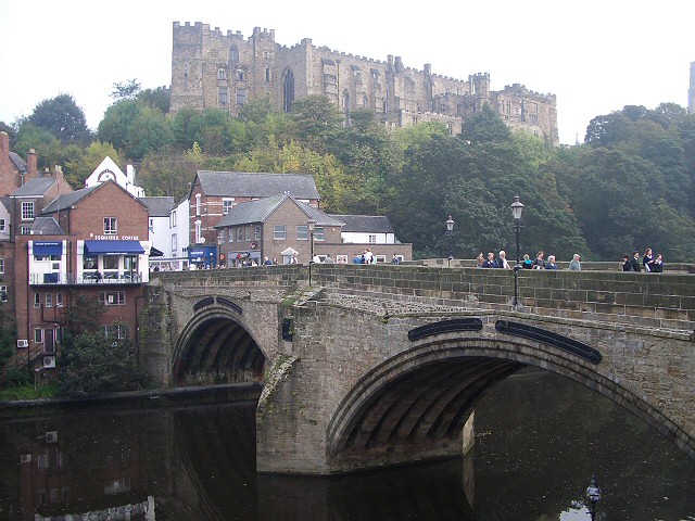
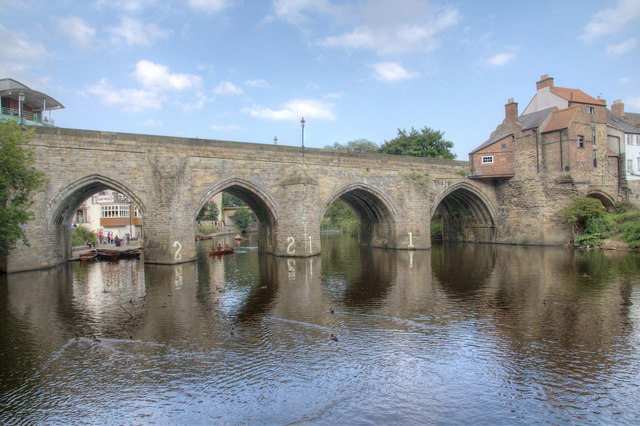
Elvet Bridge
- Overview Further Information Map Street View Elvet Bridge is a stone bridge which crosses the River Wear connecting the peninsula in central Durham and the Elvet area of the city. …
Co-Curate Page
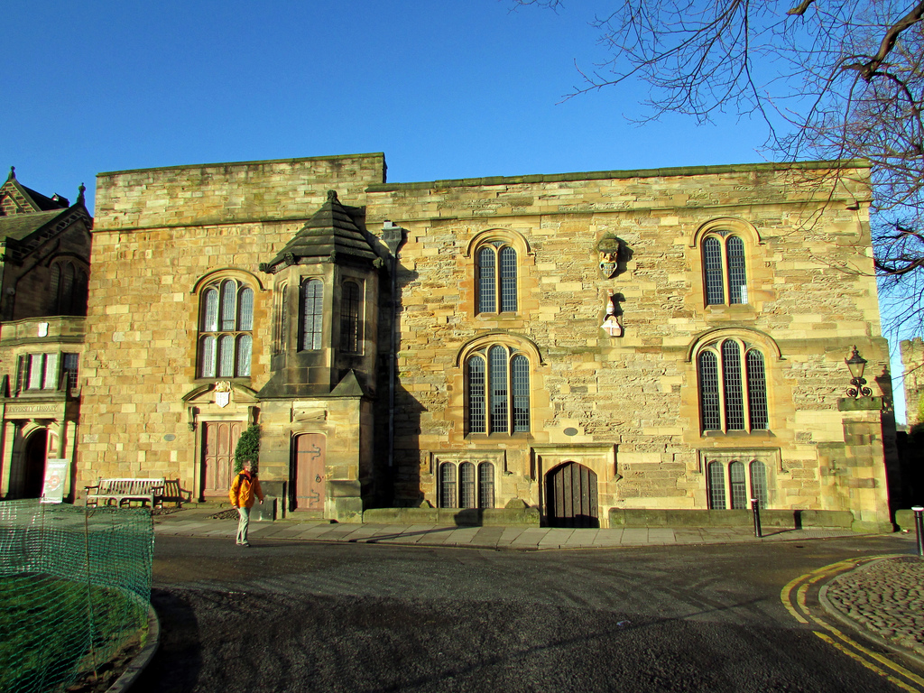
Middleham Castle
- Middleham Castle was the main house of the Bishops of Durham from the Norman Conquest (1066) to the end of the 14th century. It was a fortified manor house, located …

Co-Curate Page
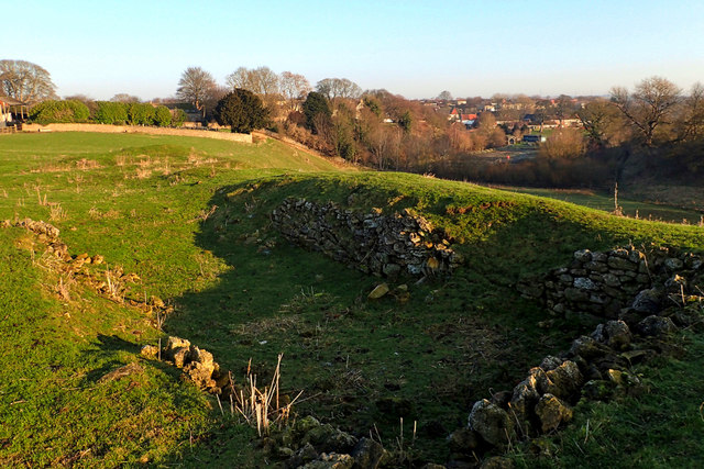
Ebchester Roman Fort (Vindomora)
- Map of the Vindomora Scheduled Monument area. The site of Vindomora Roman Fort is located in the heart of Ebchester in County Durham. There are no obvious visible remains, however, …

Co-Curate Page
Archdeacon Newton Medieval Settlement
- Note: Scheduled Monument area - map data from Historic England c/o Open Data UK, under the Open Government Licence, imported into Google MyMaps, March 2026. Archdeacon Newton is the site …

Co-Curate Page
Prebends Bridge
- Overview About Prebends Bridge Map Street View Prebends Bridge over the River Wear at Durham was built for the Dean and Chapter of Durham to provide access to Durham Cathedral …
Co-Curate Page
Sherburnhouse Bridge
- Overview Map Street View The old Sherburnhouse Bridge, located to the north-west of the hamlet of Sherburn House in County Durham, dates from 1335, with the upper part of the …
Co-Curate Page
Coke Ovens at Inkerman Farm
- "The beehive coke ovens are some of the last remaining examples of this type of oven left in County Durham. At one time there were over 100,000 in the County. …
Co-Curate Page
Neville's Cross (monument)
- Overview Map Street View The remains of the medieval Neville's Cross are located on the north side of Crossgate Peth, opposite St John's Church in the Nevil's Cross area of …
Co-Curate Page
Village Cross, Esh
- Overview Map Street View Esh Cross is located in its original position on a raised area at the southern end of the village green in Esh. It is an important …
Co-Curate Page
Coxhoe Medieval Settlement
- Overview Map The buried remains of the Medieval village of Coxhoe are located to the south-west of East House Farm, roughly half way between the modern villages of Coxhoe and …
Co-Curate Page
The Castles (camp)
- Overview Map 'The Castles' (camp) a large stone-built enclosure, located near West Shipley Farm, Hamsterley, in County Durham. It is believed to be the remains of a fortified site of …
Co-Curate Page
Scargill Castle
- Overview Map Scargill was originally built in the late 12th century by Warren de Scargill whilst he was overseeing building work at the nearby Bowes Castle. King Edward II is …
Co-Curate Page
Egglestone Abbey
- Overview About Egglestone Abbey Map Street View Egglestone Abbey is an abandoned Premonstratensian Abbey on the southern (Yorkshire) bank of the River Tees, 1 1⁄2 miles (2.4 km) south-east of …
Co-Curate Page
Legs Cross
- Overview Map Street View Near Bolam, County Durham. "The base and fragment of a cross shaft dating from the 9th century. A rough cut rectangular sandstone base, badly worn, but …
Co-Curate Page
Longovicium, Lanchester Roman Fort
- Overview About Longovicium Map Street View Longovicium was a Roman fort established in the mid 2nd century AD, which lay on Dere Street, the Roman road connecting York with the …
Co-Curate Page
Bridge over the Wear
- Overview Map Street View This stone bridge over the River Wear just west of Stanhope dates from medieval times. The bridge now carries the B6278 road. It is Grade II* …
Co-Curate Page
Framwellgate Bridge
- Overview About Framwellgate Bridge Map Street View Framwellgate Bridge is a medieval stone bridge over the River Wear in Durham. The bridge was built in the 15th century and replaced …
Co-Curate Page
Friarside Chapel, nr Burnopfield
- Overview Map High Friarside Hospice was a Medieval leper hospital, located just south of the River Derwent, north of Burnopfield and south of Rowlands Gill, in County Durham. The hospital was founded …
Co-Curate Page
Dalden Tower
- Overview Map Street View Dalden Tower, is located in Seaham in the Dean which runs to Dalton-le-Dale. The pele-tower is the most prominent part of the remains of what was …
Co-Curate Page
Barnard Castle (castle)
- Overview About Barnard Castle Map Street View The medieval castle in the town of Barnard Castle, is cared for by English Heritage. The castle is a Scheduled Ancient Monument, and …
Co-Curate Page
Elvet Bridge
- Overview Further Information Map Street View Elvet Bridge is a stone bridge which crosses the River Wear connecting the peninsula in central Durham and the Elvet area of the city. …
Co-Curate Page
Middleham Castle
- Middleham Castle was the main house of the Bishops of Durham from the Norman Conquest (1066) to the end of the 14th century. It was a fortified manor house, located …
Co-Curate Page
Ebchester Roman Fort (Vindomora)
- Map of the Vindomora Scheduled Monument area. The site of Vindomora Roman Fort is located in the heart of Ebchester in County Durham. There are no obvious visible remains, however, …


