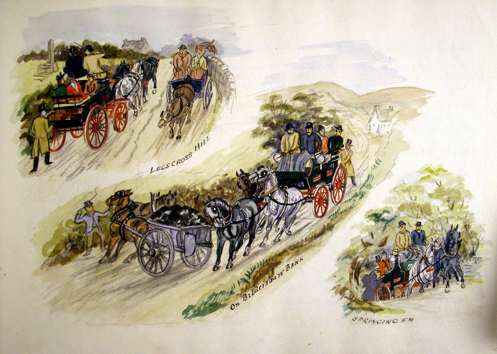
Topics > Landmarks, Parks and Buildings > Legs Cross
Legs Cross
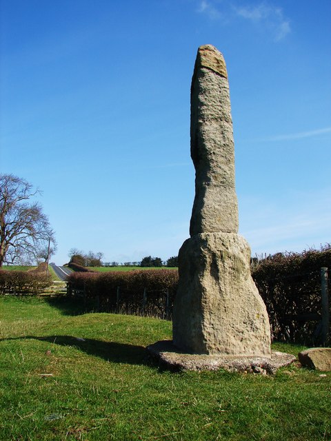
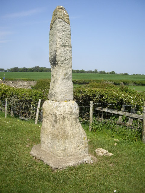
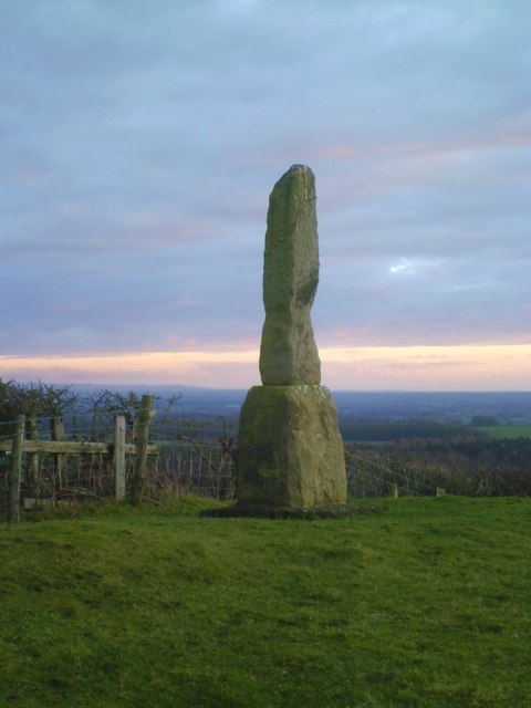
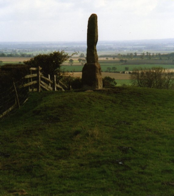
Near Bolam, County Durham. "The base and fragment of a cross shaft dating from the 9th century. A rough cut rectangular sandstone base, badly worn, but is said to have featured interlacing ornament. This is probably a Legs Cross which marked the subdivision of a major Anglo-Saxon estate centered on Gainford Village." (Keys to the Past) A foundation stone for a Roman milestone used to lie next to the monument, but is no longer evident.[1] Legs Cross is a Scheduled Ancient Monument.

from http://upload.wikimedia.org/w…
Ancient monument at Legs Cross near Bolam Co Durham
- Photograph by Vivienne Smith and published under a Creative Commons CC BY-SA 2.0 licence.
Added by
Simon Cotterill
from http://s0.geograph.org.uk/geo…
Legs Cross, near Bolam
- Photograph by A. Chilton and licensed for reuse under a Creative Commons Licence.
Added by
Simon Cotterill

from https://historicengland.org.u…
LEGS CROSS - List Entry
- "Base and fragment of cross shaft. Probably C9. Sandstone. Rough, rectangular base about one metre high. Badly worn, tapering cross shaft, about 1.5 metres high, is said to have featured …
Added by
Simon Cotterill

from http://www.keystothepast.info…
Legs Cross, Dere Street, Bolam (Bolam)
- "This is a listed building. The base and fragment of a cross shaft dating from the 9th century. A rough cut rectangular sandstone base, badly worn, but is said to …
Added by
Simon Cotterill
Co-Curate Page
Dere Street
- Overview About Dere Street Dere Street was the Roman road which ran north from Eboracum (York) to Hadrian's Wall and beyond to the Antonine Wall in Scotland. The road connected …

from http://upload.wikimedia.org/w…
Ancient monument at Legs Cross near Bolam Co Durham
- Photograph by Vivienne Smith and published under a Creative Commons CC BY-SA 2.0 licence.
Added by
Simon Cotterill
from http://s0.geograph.org.uk/geo…
Legs Cross, near Bolam
- Photograph by A. Chilton and licensed for reuse under a Creative Commons Licence.
Added by
Simon Cotterill
from https://historicengland.org.u…
LEGS CROSS - List Entry
- "Base and fragment of cross shaft. Probably C9. Sandstone. Rough, rectangular base about one metre high. Badly worn, tapering cross shaft, about 1.5 metres high, is said to have featured …
Added by
Simon Cotterill
from http://www.keystothepast.info…
Legs Cross, Dere Street, Bolam (Bolam)
- "This is a listed building. The base and fragment of a cross shaft dating from the 9th century. A rough cut rectangular sandstone base, badly worn, but is said to …
Added by
Simon Cotterill
Co-Curate Page
Dere Street
- Overview About Dere Street Dere Street was the Roman road which ran north from Eboracum (York) to Hadrian's Wall and beyond to the Antonine Wall in Scotland. The road connected …


List number: 1323020
List grade: 2*
County: County Durham
Keys to the Past HER: D37472
Grid ref: NZ2072122496
List grade: 2*
County: County Durham
Keys to the Past HER: D37472
Grid ref: NZ2072122496


