Topics > Northumberland > Civil Parishes in Northumberland > Longhorsley Civil Parish > Longhorsley Parish, 1848
Longhorsley Parish, 1848
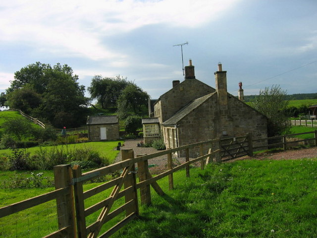
HORSLEY, LONG (St. Helen), a parish, in the union of Rothbury, W. division of Morpeth ward, N. division of Northumberland, 6¾ miles (N.W. by N.) from Morpeth; containing, with the townships of Bigge's Quarter, Freeholders' Quarter, Longshaws, Riddell's Quarter, Stanton, Todburn, Wingates, and Witton Shields, 922 inhabitants. The manor was at an early period the property of the Merlays; after them the Greystocks held it; and the Horsleys possessed lands here from an early period, till their heiress married into the family of Widdrington. The parish, which is about seven miles long and five broad, is bounded on the north by the river Coquet; the great sandstone stratum, called the millstone-grit, passes through it. A large portion of the soil is a clay loam, which in the neighbourhood of Horsley and of Linden is very fertile; the other parts vary much in quality, but chiefly consist of a stiff clayey soil, growing wheat and oats. Coal and limestone exist in the parish, and thriving woods decorate considerable portions of the banks of the Font and Coquet; the plantations at Linden are also luxuriant. The Roman road called Cobb's Causeway runs through. The village is of tolerable extent, and partly in each of the three quarters named Bigge's or Linden, Riddell's, and Freeholders', which see. The living is a vicarage, valued in the king's books at £17. 13. 4., and in the patronage of the Crown; net income, £336; impropriator, C. W. Bigge, Esq.: there are about 50 acres of glebe. The church was rebuilt in 1783, and is a neat edifice of stone, nearly half a mile from the village; the present communion table and rails were made out of an oak-tree that was found buried in a neighbouring moss a few years since. A strong ancient tower, the property of the Widdrington family, from whom it descended to the Riddells of Helton, near the western extremity of the village, has been converted into a residence for a Roman Catholic priest, and a chapel built close to it. In the parish are several chalybeate springs.
Extract from: A Topographical Dictionary of England comprising the several counties, cities, boroughs, corporate and market towns, parishes, and townships..... 7th Edition, by Samuel Lewis, London, 1848.

Co-Curate Page
Freeholders Quarter, Longhorsley, 1848
- FREEHOLDERS' QUARTER, a township, in the parish of Long Horsley, union of Morpeth, W. division of Morpeth ward, N. division of Northumberland; containing 109 inhabitants. Among the ancient proprietors of …
Co-Curate Page
Todburn Township (Longhorsley Parish), 1848
- TODBURN, a township, in the parish of Long Horsley, union of Rothbury, W. division of Morpeth ward, N. division of Northumberland, 8 miles (N.W. by N.) from Morpeth; containing 22 …
Co-Curate Page
Bigge's Quarter, Longhorsley, 1848
- BIGGE'S QUARTER, a township, in the parish of Long Horsley, union of Morpeth, W. division of Morpeth ward, N. division of Northumberland, 8 miles (N.N.W.) from Morpeth; containing 252 inhabitants. …
Co-Curate Page
Wingates Township, 1848
- WINGATES, a township, in the parish of Long Horsley, union of Rothbury, W. division of the ward of Morpeth, N. division of Northumberland, 6 miles (S.E. by S.) from Rothbury; …
Co-Curate Page
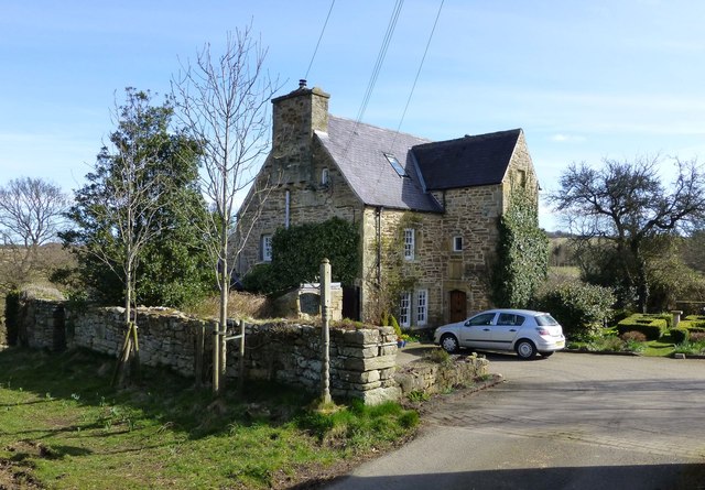
Witton Shields
- Overview Map Witton Shields is a farm and hamlet in Northumberland. It is located just over half a mile west of the larer hamlet of Stanton and is today part …
Co-Curate Page
Stanton
- Overview About Stanton Map Street View STANTON, a township, in the parish of Long Horsley, union, and W. division of the ward, of Morpeth, N. division of Northumberland, 6 miles …
Co-Curate Page
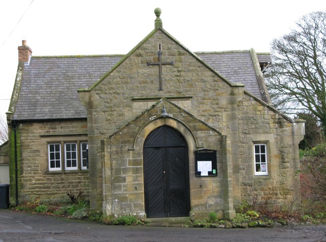
Church of St. Helen
- Overview Map Street View The current building of St Helen's Church on West Road in Longhorsley was the former village school, which was built in 1848. The school was converted …
from https://www.familysearch.org/…
Longhorsley, Northumberland Genealogy
- "...Longhorsley St Helen is an Ancient Parish and includes: Bigge's Quarter, Carlisle's Quarter, Chirn, Freeholders' Quarter, Garrotlee, Longhorsley Moor, Longshaws, Moresley Moor, Riddell's Quarter, Stanton, Todburn, Wholm, Wingates, Wingates Moor, …
Added by
Simon Cotterill
Co-Curate Page
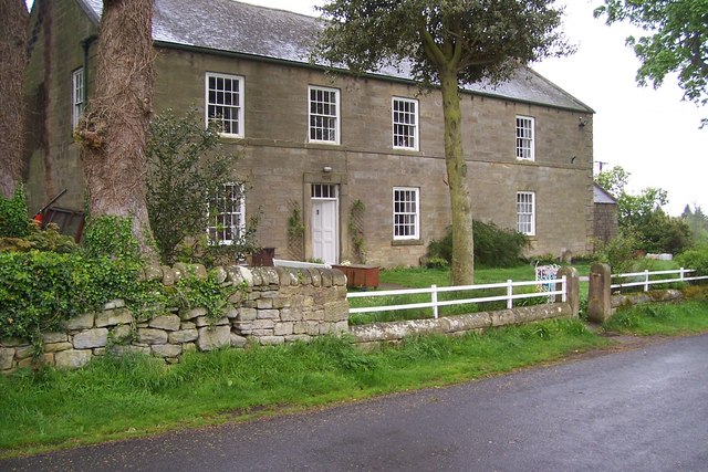
Longshaws
- Overview Map Longshaws and nearby Longshaws Mill are hamlets in Northumberland, located about 5 miles north-west of Morpeth. Longshaws Mill is on the River Font and there is a ford …
Co-Curate Page
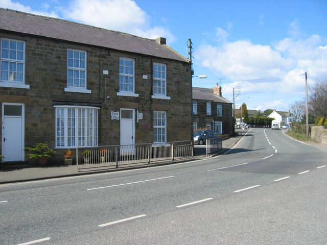
Longhorsley
- Overview About Longhorsley Map Street View Longhorsley is a village in Northumberland located about 7 miles north west of Morpeth. The village has a long history; it's ruined Norman Church is …

Co-Curate Page
Freeholders Quarter, Longhorsley, 1848
- FREEHOLDERS' QUARTER, a township, in the parish of Long Horsley, union of Morpeth, W. division of Morpeth ward, N. division of Northumberland; containing 109 inhabitants. Among the ancient proprietors of …
Co-Curate Page
Todburn Township (Longhorsley Parish), 1848
- TODBURN, a township, in the parish of Long Horsley, union of Rothbury, W. division of Morpeth ward, N. division of Northumberland, 8 miles (N.W. by N.) from Morpeth; containing 22 …
Co-Curate Page
Bigge's Quarter, Longhorsley, 1848
- BIGGE'S QUARTER, a township, in the parish of Long Horsley, union of Morpeth, W. division of Morpeth ward, N. division of Northumberland, 8 miles (N.N.W.) from Morpeth; containing 252 inhabitants. …
Co-Curate Page
Wingates Township, 1848
- WINGATES, a township, in the parish of Long Horsley, union of Rothbury, W. division of the ward of Morpeth, N. division of Northumberland, 6 miles (S.E. by S.) from Rothbury; …
Co-Curate Page
Witton Shields
- Overview Map Witton Shields is a farm and hamlet in Northumberland. It is located just over half a mile west of the larer hamlet of Stanton and is today part …
Co-Curate Page
Stanton
- Overview About Stanton Map Street View STANTON, a township, in the parish of Long Horsley, union, and W. division of the ward, of Morpeth, N. division of Northumberland, 6 miles …
Co-Curate Page
Church of St. Helen
- Overview Map Street View The current building of St Helen's Church on West Road in Longhorsley was the former village school, which was built in 1848. The school was converted …
from https://www.familysearch.org/…
Longhorsley, Northumberland Genealogy
- "...Longhorsley St Helen is an Ancient Parish and includes: Bigge's Quarter, Carlisle's Quarter, Chirn, Freeholders' Quarter, Garrotlee, Longhorsley Moor, Longshaws, Moresley Moor, Riddell's Quarter, Stanton, Todburn, Wholm, Wingates, Wingates Moor, …
Added by
Simon Cotterill
Co-Curate Page
Longshaws
- Overview Map Longshaws and nearby Longshaws Mill are hamlets in Northumberland, located about 5 miles north-west of Morpeth. Longshaws Mill is on the River Font and there is a ford …


