Topics > Northumberland > Longhorsley
Longhorsley
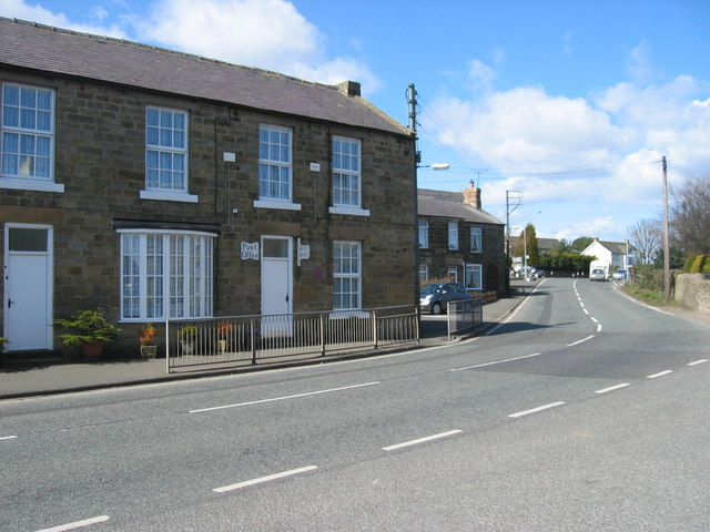
Longhorsley is a village in Northumberland, England about northwest of Morpeth, and about south of Alnwick. The A697 road passes through the village linking it with Morpeth, Wooler and Coldstream in Scotland. There are 7 "Streets" in Longhorsley: Whitegates, Church View, Drummonds Close, South Road, West Road, East Road and Reivers Gate. The village is bordered on the north by the River Coquet. The village formerly lay in three separate townships: Bigges Quarter, Freeholders Quarter and Riddells Quarter.
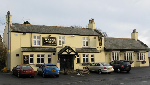
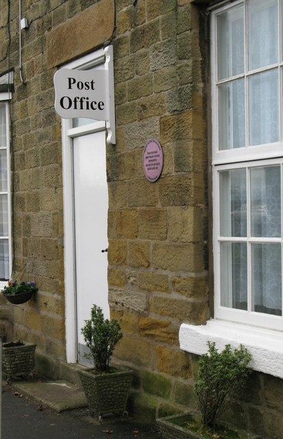
Local amenities at present include: St Helen's First School; Millar's Shop; Albion House Hairdressing; and The Shoulder of Mutton Pub.
The population of Longhorsley Parish is approximately 800, measured at the 2011 Census as 887, and is essentially a residential community for those who work in South Northumberland and Tyneside.
History
The village has a long history. In 1196 we find it referred to as Horsieg, a "woodland clearing where horses are kept" - although it was a pretty tough place for a horse: one traveller, Eneas Mackenzie (1778–1832), described it in his view of Northumberland, as "the prolific source of contagious disorders incident to cattle and of little real use in its present state". Longhorsley Moor is high and bleak (in the winter of 1890 the mail-gig was blown over in a gale and the driver found with his neck broken). In the course of time the manor of Longhorsley was owned by the Gospatricks who gave it to the Merlays, and then it passed into the hands of the Horsleys and, later, to the great Catholic family, the Riddells.
Governance
Longhorseley is in the electoral ward of Chevington with Longhorsley. This ward covers both East Chevington and Longhorsley plus their surrounding areas. The total population of this ward at the 2011 Census was 5,596.
Landmarks
The Devil's Causeway passes the village less than to the west. The causeway is a Roman road which starts at Port Gate on Hadrian's Wall, north of Corbridge, and extends northwards across Northumberland to the mouth of the River Tweed at Berwick-upon-Tweed.
A hoard of Roman coins discovered by metal-detecting enthusiasts on a farm near Longhorsley, Northumberland, could be evidence that entrepreneurial native Northumbrian settlers were recycling old bronze coins and making trinkets to sell back to soldiers in the Roman army, according to experts.
The hoard of 70 Roman coins – 61 sestercii and 9 dupondii — dates from the reign of Emperor Vespasian to the reign of Emperor Marcus Aurelius (AD69–180) — a period when the Antonine Wall, between Glasgow and Edinburgh, and not Hadrian's Wall, marked the northern frontier of the Roman Empire in Britain, and for a short period, Northumberland, which had until then been barbarian territory, became part of the Roman Empire.
The hoard was found close to the route of the Devil's Causeway, the main Roman road which ran north through Northumberland.
Roman expert Lindsay Allason-Jones, Director of Archaeological Museums at Newcastle University, where the coins are shortly to go on display, says: 'What makes this find unusual is that it dates from a period when there was no Roman fort close to Longhorsley, although there were a number of native settlement sites in the area'.
:
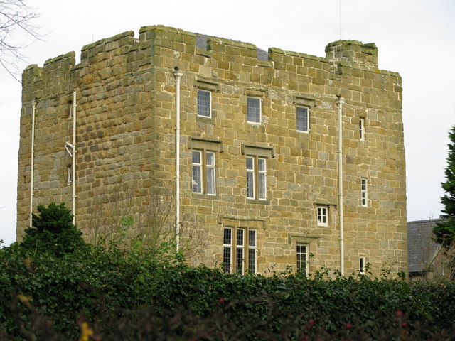
An ancient battlemented Peel tower lies on the western edge of Longhorsley, dating from the early 16th century and formerly belonging to the Horsley family of Brinkburn. Sir Thomas Horsley entertained General Monck here on his way south to effect the Restoration of Charles II. For a time the tower was used as a Roman Catholic chapel. It is now a private residence.
Linden Hall was built in 1812 for Charles William Bigge, a member of one of Northumberland's most notable merchant and banking families. He had acquired the estate from the Earl of Carlisle, whose family had held it since the time of Henry I. His close friend, Sir Charles Monck, designed the mansion, which consisted of six large rooms on each floor, a sweeping staircase with a domed lantern above, and a basement in the main hall. In addition there were kitchens, servants' quarters, a schoolroom, a brew house, a slaughterhouse and stables. In 1861 it passed from the Bigge family into the hands of the Ames, who held it until 1904, when they moved to Ghyllheugh, their Victorian baronial-style house nearby. Linden Hall then passed to the Adamson family, until 1963. The Hall was purchased in 1978 from John Liddell and opened as a first class hotel three years later.
Religious sites
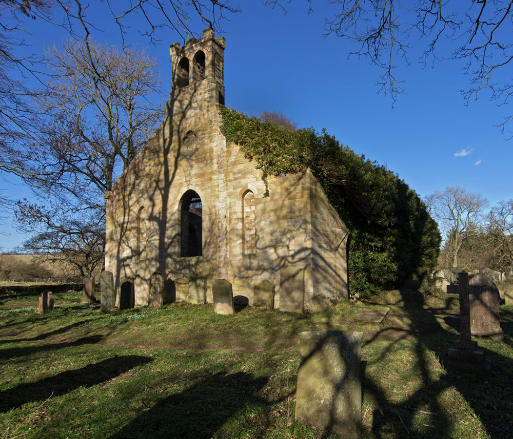
The Anglican Church of St. Helen, which has registers dating from 1688.
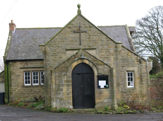
The Roman Catholic church, St Thomas of Canterbury, which was erected in 1841. Before the Catholic church was built, the parish was served from the pele tower which stands adjacent to the present church.
Notable people
- Robert Towns (c.1794 - 1873), Australian businessman, pastoralist, and founder of Townsville, Queensland.
- John Pigdon, mayor of Melbourne from 1881–82.
- Thomas Bell reputedly developed the world's first self-raising flour in Longhorsley village shop. Bell founded a wholesale grocery business near the Tyne Quays in Newcastle in the 1880s. One of his best selling brands was a self-raising flour he called Bell's Royal. A common misconception is that Bell's Royal became Be-Ro because after the death of King Edward Vll it became illegal to use the name Royal. Indeed it was because an American company, trading under the name of Royal's Baking Powder, was too similar to the Bell's Royal name that it was changed. The Be-Ro trade mark patent was filed in 1906 whereas King Edward Vll died on the 6th of May 1910. The name Be-Ro, chosen by Thomas Bells' wife, had been existance a decade before the trade mark was applied for, and registered, under the Trade Marks Act of 1905.
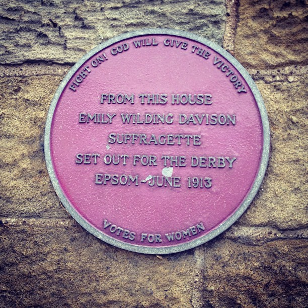
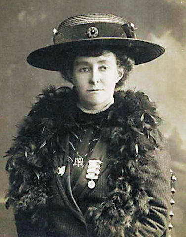
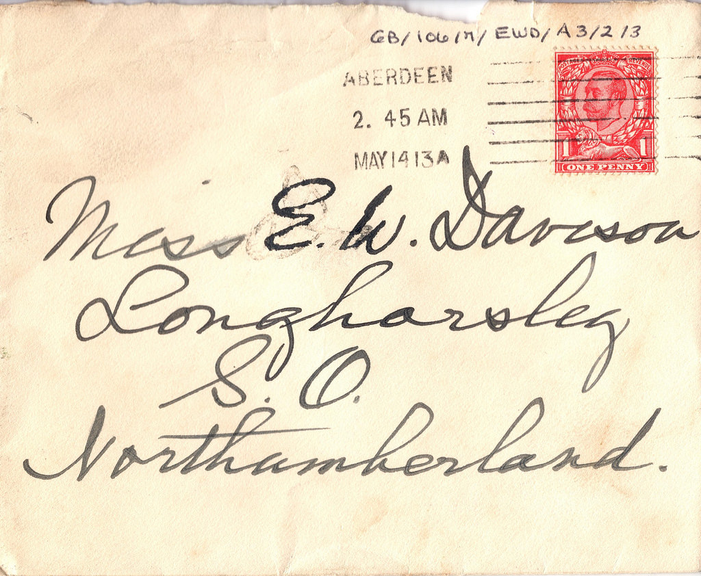
- Emily Wilding Davison, one of Northumberland's most famous heroines lived in the village of Longhorsley. She is notable as the suffragette who was killed after throwing herself in front of the King's horse, Anmer in the Derby of 1913, while campaigning for women's right to vote.
- Muriel Adamson, founder of The Richmond Theatre
Visit the page: Longhorsley for references and further details. You can contribute to this article on Wikipedia.
Co-Curate Page
Emily Davison (1872 - 1913)
- Overview About Emily Davison Timeline Emily Wilding Davison was a militant suffragette campaigning for the right to vote for women in Britain. Davison joined the Women's Social and Political Union …


from Geograph (geograph)
St Thomas of Canterbury Roman Catholic Church, Longhorsley
Pinned by Simon Cotterill
from Flickr (flickr)
Envelope for letter from Katherine Riddell to Emily Wilding Davison
Pinned by Simon Cotterill

Co-Curate Page
Longhorsley Parish, 1855
- Extract from: History, Topography, and Directory of Northumberland...Whellan, William, & Co, 1855. LONG HORSLEY PARISH LONG HORSLEY is a parish comprising the townships of Bigge's or Carlisle’s Quarter, Freeholders' …

Co-Curate Page
Emily Davison (1872 - 1913)
- Overview About Emily Davison Timeline Emily Wilding Davison was a militant suffragette campaigning for the right to vote for women in Britain. Davison joined the Women's Social and Political Union …
from Geograph (geograph)
St Thomas of Canterbury Roman Catholic Church, Longhorsley
Pinned by Simon Cotterill
from Flickr (flickr)
Envelope for letter from Katherine Riddell to Emily Wilding Davison
Pinned by Simon Cotterill
Co-Curate Page
Longhorsley Parish, 1855
- Extract from: History, Topography, and Directory of Northumberland...Whellan, William, & Co, 1855. LONG HORSLEY PARISH LONG HORSLEY is a parish comprising the townships of Bigge's or Carlisle’s Quarter, Freeholders' …

Northumberland

Bigge's Quarter, Longhorsley, 1848
Church of St. Helen, Longhorsley
Church of St.Thomas of Canterbury, Longhorsley
Former parish church of St. Helen, Longhorsley
Freeholders Quarter, Longhorsley, 1848
Horsley Tower

Linden Hall Hotel

Longhorsley Conservation Area
Longhorsley St Helen's C of E First School

Longhorsley Village Hall

Mission Free Church, Longhorsley
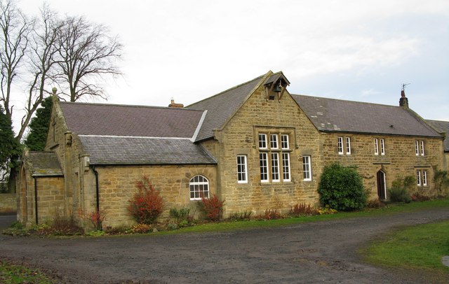
Old Schoolmaster's House and Schoolroom, Longhorsley
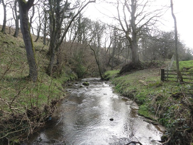
Paxton Dene & Burn, Longhorsley
Riddell's-Quarter, Longhorsley
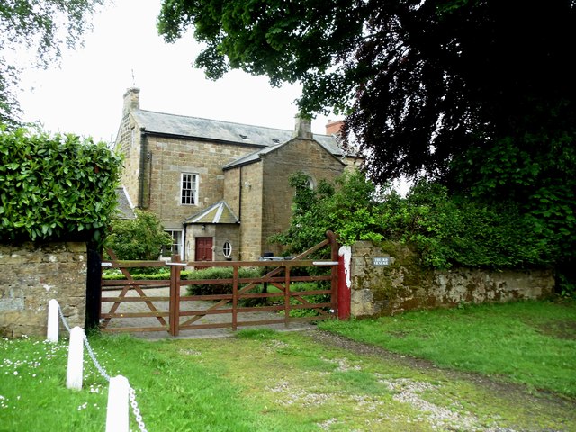
The Old Vicarage, Longhorsley


