Topics > Cumbria > Farms in Westmorland and Furness
Farms in Westmorland and Furness
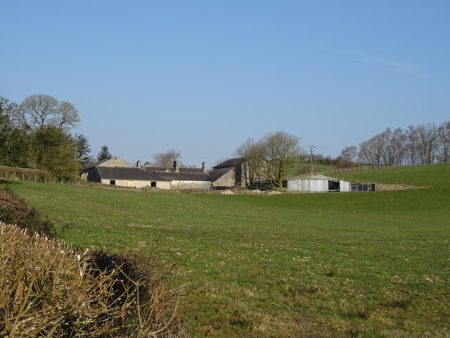
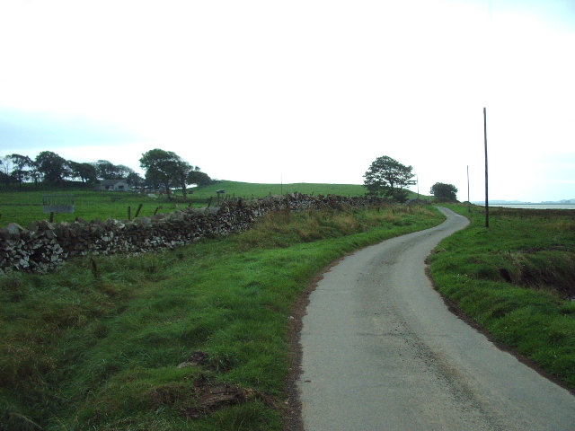
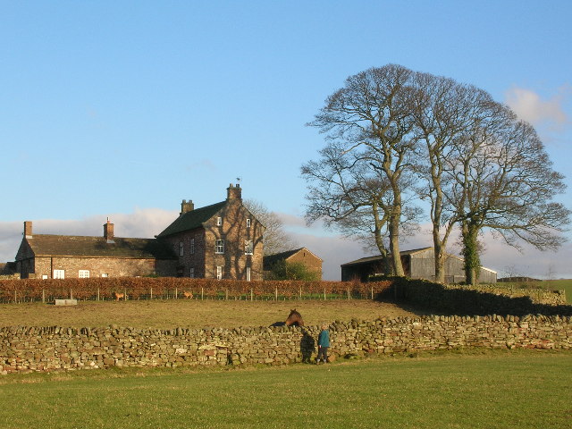
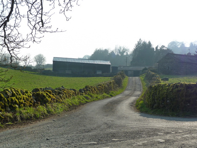
A few of the many farms (extant and historic) in Westmorland and Furness. Work in progress.
| Name | Locality | Civil Parish | Notes |
|---|---|---|---|
| Abbot Holme East | Abbot Holme | Sedbergh | Listed |
| Abbot Holme West | Abbot Holme | Sedbergh | Listed |
| Atkinson Ground | Coniston | Listed | |
| Barton Church Farm | Barton | Barton and Pooley Bridge | Listed |
| Beckbank | Salkeld Dykes | Great Salkeld | Listed |
| Beckside | Beck Side | Lower Allithwaite | Listed |
| Bee Nest | Gateheads | Casterton | Listed |
| Bellgate | Bellgate | Casterton | |
| Berryholme | Helsington | Listed. aka Berry Holme | |
| Biggins Hall | Kirkby Lonsdale | Listed | |
| Birk Hag | Birk Hag | Kendal | Listed |
| Birkrigg Park | Birkrigg Park | Preston Richard | Listed |
| Blake Hill | Mungrisdale | Listed | |
| Blands | Dentdale | Dent | Listed |
| Blunderfield | Kirkoswald | Listed | |
| Bow Windows | Rampside | Barrow-in-Furness | Listed |
| Bridge End | Bridge End | Longsleddale | Listed |
| Bridge End | Little Langdale | Coniston | Listed |
| Briggle Farm | Winskill | Hunsonby | |
| Brow Top | Brow Top | Kentmere | Listed |
| Castlehaw | Sedbergh | Listed | |
| Caudale | Kirkstone | Patterdale | |
| Causeway | Windermere | Listed | |
| Cautley Thwaite | Cautley Thwaite | Sedbergh | Listed |
| Chapel House | Cartmel Fell | Listed | |
| Clifton Hall Farm | Clifton | Clifton | Listed |
| Coldbeck | Coldbeck | Ravenstonedale | Listed |
| Common | Windermere | Windermere | Listed |
| Croglin High Hall | Croglin High Hall | Kirkoswald | Listed |
| Croglin Low Hall | Croglin Low Hall | Kirkoswald | Listed |
| Crook-a-Beck | Patterdale | Patterdale | Listed. aka Crookbeck |
| Dee Side | Dentdale | Dent | Listed |
| Docklesyke | Dentdale | Dent | |
| Eagle Farm | Glenridding | Patterdale | Listed |
| East Banks | Dentdale | Dent | Listed |
| Eycott | Berrier | Mungrisdale | Listed |
| Fell Foot | Little Langdale | Lakes | Listed |
| Fell View | Little Asby | Asby | Listed |
| Field Gate | Bampton Grange | Bampton | Listed |
| Gaisgill Farm | Gaisgill | Tebay | Listed |
| Gaisgill Row Farm | Gaisgill | Tebay | |
| Garths | Marthwaite | Sedbergh | Listed |
| Gate | Howgill | Sedbergh | |
| Gilts | Gilts | Crosby Ravensworth | Listed |
| Greenbank | Deepdale | Patterdale | Listed |
| Grove | Tirril | Sockbridge and Tirril | Listed |
| Haltcliffe Bridge | Haltcliffe Bridge | Mungrisdale | |
| Hawes Farm | Broughton West | Listed | |
| Hawes Farm | Helsington | Listed | |
| Hayclose | Hayclose | New Hutton | Listed |
| Heaning | Windermere | Windermere | Listed |
| Helsfell | Strickland Ketel | Listed | |
| High Barns | Hincaster | Hincaster | Listed |
| High Birks | Sedbergh | Listed | |
| High Farm | Great Blencow | Dacre | Listed |
| High Farm | Lindal-in-Furness | Lindal and Marton | Listed |
| High Farm | Penruddock | Hutton | Listed |
| High Hampsfield | Hampsfield | Broughton East | Listed |
| High House | Firbank | Listed | |
| High Oxen Fell | Oxen Fell | Skelwith | Listed |
| High Tilberthwaite | High Tilberthwaite | Coniston | |
| Hill Farm | Walney Island | Barrow-in-Furness | Listed |
| Hollins | Dockray | Matterdale | Listed |
| Holme Farm | Gaisgill | Tebay | |
| Home Farm | Greystoke Park | Greystoke | Listed |
| Home Farm | Unthank End | Skelton | Listed |
| Hospital Farm | Brougham | Brougham | Listed |
| Howbarrow | Howbarrow | Lower Allithwaite | Listed |
| Johnby Hall | Johnby | Greystoke | |
| Jolliver | Finsthwaite | Colton | Listed |
| Keld | Keld | Shap | Listed |
| Kilnstones | kilnstones | Longsleddale | Listed |
| Laithwaite | Laithwaite | Strickland Roger | Listed |
| Lane Head | Beck Side | Lower Allithwaite | Listed |
| Larkrigg | Larkrigg | Helsington | |
| Lindal Moor | Lindal-in-Furness | Lindal and Marton | Listed |
| Low | Lindal-in-Furness | Lindal and Marton | Listed |
| Low Brown | Celleron | Barton and Pooley Bridge | Listed |
| Low Farm | Baycliffe | Aldingham | Listed. aka Ivy Cottage |
| Low Fell | Mill Side | Witherslack, Meathop and Ulpha | Listed |
| Low House | Helsington | Listed | |
| Low Oxen Fell | Oxen Fell | Skelwith | Listed |
| Low Rosthwaite | Low Rosthwaite | Broughton West | Listed |
| Low Sunbrick | Aldingham | ||
| Lowbyer Manor | Alston Moor | Listed | |
| Mains | Mains | Barton and Pooley Bridge | Listed |
| Marsden | Farleton | Beetham | Listed |
| Marsh Grange | Ireleth | Askam and Ireleth | Listed |
| Mealriggs | Hutton Roof | Listed | |
| Middlefell Place | Great Langdale | Lakes | Listed |
| Midtown | Askham | Askam and Ireleth | Listed |
| Mill Brow | Skelwith Bridge | Lakes | Listed |
| Mirkbooths | Highbridge | Castle Sowerby | |
| Mislet | Mislet | Windermere | Listed |
| Moorahill | Bampton | Bampton | Listed |
| Moorend | Moorend | Barton and Pooley Bridge | Listed |
| Moorhouse | Brougham | Brougham | Listed |
| Moss Side | Moss Side | Barrow-in-Furness | Listed |
| Nether Haresceugh | Nether Haresceugh | Kirkoswald | Listed |
| Newbiggin Hall | Newbiggin | Newbiggin | Listed |
| Newsham | Newsham | Castle Sowerby | Listed |
| Oaks Farm | Loughrigg | Lakes | |
| Ormsgill | Ormsgill | Barrow-in-Furness | Listed |
| Overend | Overend | Kentmere | Listed |
| Oxenholme | Kendal | Listed | |
| Park End | Helsington | Listed | |
| Parkinhill | Parkin Hill | Appleby-in-Westmorland | Listed |
| Pinders | Holme | Holme | Listed |
| Powley | Langwathby | Langwathby | Listed |
| Raines Hall | Sedgwick | Listed | |
| Rampson | Skirrygill | Stainmore | Listed |
| Redscar | Redscar | Underbarrow and Bradleyfield | Listed |
| Raybrigg Hall | Windermere | Listed | |
| Raygarthfield | Kirkoswald(?) | ||
| Rose | Dacre | Dacre | |
| Sandylands | New Barnes | Barrow-in-Furness | Listed |
| Sawrey Ground | Hawkshead | ||
| Seatle East | Field Broughton | Staveley-in-Cartmel | Listed |
| Shorthorn | Holker | Lower Holker | |
| Side House | Great Langdale | Lakes | Listed |
| Skelwith Fold | Skelwith Fold | Skelwith | |
| Sorth End | Summerlands | Preston Richard | Listed |
| Southerfell | Southerfell | Mungrisdale | Listed |
| Sowerby Hall Farm | Barrow-in-Furness | Listed | |
| Sowerby Lodge | Barrow-in-Furness | Non Civil Parish | Listed |
| Stank | Stank | Barrow-in-Furness | Listed |
| Strawberry Bank | New Hutton | Listed | |
| The Ashes | Nether Staveley | Listed | |
| Thompson Fold | Lupton | Listed | |
| Thornbarrow | Hutton in the Forest | Hesket | Listed |
| Thwaite Flatt | Thwaite Flatt | Non Civil Parish | Listed |
| Todd | Soulby | Dacre | Listed |
| Tofts | Dentdale | Dent | Listed |
| Topthorne | Topthorne | Whinfell | Listed |
| Tosca | Tosca | Kirkby Lonsdale | |
| Tossbeck | Tossbeck | Middleton | Listed |
| Town End | Glassonby | Glassonby | Listed |
| Townend | Troutbeck | Lakes | Listed |
| Town Head | Great Salkeld | Great Salkeld | Listed |
| Townend | Little Strickland | Little Strickland | Listed |
| Underhelm | Grasmere | Lakes | Listed |
| Unthank | Unthank | Glassonby | Listed |
| Watson | Greystoke Gill | Greystoke | Listed |
| West Stonehouse | Dentdale | Dent | Listed |
| Whale | Whale | Lowther | Listed |
| Whasdike | Whasdike | Hugill | Listed |
| Wham Head | Hutton Roof | Mungrisdale | Listed |
| Whernside Manor Farm | Dentdale | Dent | |
| Yewtree | Staveley-in-Cartmel | Listed. aka Seven Yews |
Co-Curate Page
House at West of Abbot Holme
- Overview Map Street View The farmhouse at the West side of Abbot Holme, has an attached stable and a cart-shed or barn, and thought to date from the late-17th or …
Co-Curate Page
House at East of Abbot Holme
- Overview Map Street View The farmhouse at the East side of Abbot Holme, has an attached cart-shed and barn are thought to date from the mid-18th century, with later alterations. …
Co-Curate Page
Whale Farmhouse
- The farmhouse at Whale date from the mid 18th century. The farmhouse and it's adjacent barn are Grade II listed on the National Heritage List for England.
Co-Curate Page
Birkrigg Park, Cumbria
- Overview Map Street View Birkrigg Park is a hamlet in Cumbria, located about 3 miles south of Kendal and half mile north-east of the larger hamlet of Summerlands. The farmhouse …
Co-Curate Page
Tosca, Kirkby Lonsdale
- Overview Map Street View Tosca Farm is located about 2½ miles north-west of the town of Kirkby Lonsdale. The farm is situated by Lupton Beck. To the east of the …

Co-Curate Page
Larkrigg, Cumbria
- Overview Map Larkrigg is a farm / hamlet in Cumbria. It is situated near the west banks of the River Kent, and located about south west of the village of …
Co-Curate Page
Angerton (Furness)
- Overview Map Street View Angerton is a farm / hamlet in the Furness area of Cumbria, within Angerton Civil Parish. It is situated by the estury of the River Duddon. …
Co-Curate Page
Nether Haresceugh
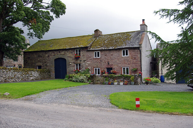
- Overview Map Street View Nether Haresceugh is a farm/hamlet located about 1½ miles north east of Kirkoswald in Cumbria. The red sandstone farmhouse here dates from 1612 with an extension …

Co-Curate Page
Croglin Low Hall
- Overview Map Street View Croglin Low Hall is located about 10 miles south-east of Carlisle and is about 2 miles south-west of the village of Croglin. It is situated near …
Co-Curate Page
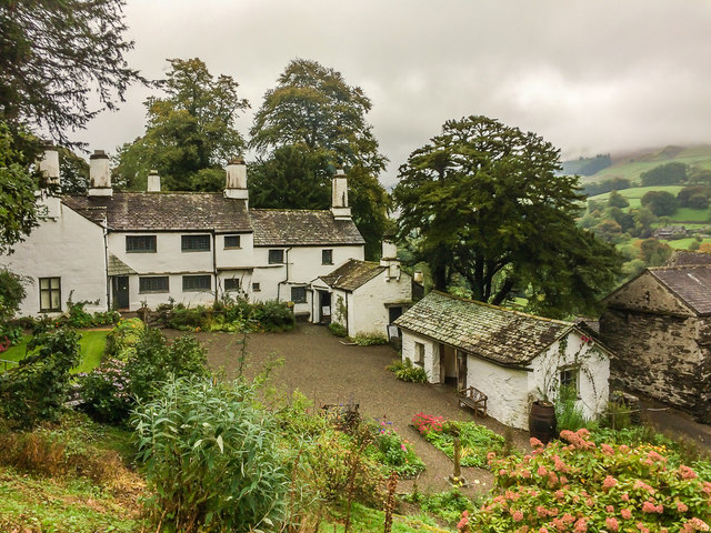
Mislet
- Overview Map Street View Mislet is a farm / hamlet in the South Lakeland district of Cumbria, located on Heaning Lane, about 2miles north-east of Windermere (town) and 6 miles …
Co-Curate Page
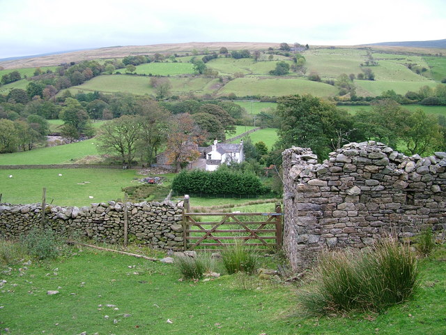
Cautley Thwaite
- Overview Map Street View Cautley Thwaite is a farm in Caurtley, about 3½ miles norh-east of the town of Sedbergh. The farm is situated by the River Rawthey and at …

Co-Curate Page
High Oxen Fell
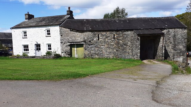
- Overview Map High Oxen Fell is a farm located about 3 miles north-east of Coniston (town) and 1½ miles south-west of Skelwith Bridge. The stone rubble farmhouse is dated 1673 …
Co-Curate Page
Skelwith Fold Farm
- Overview Map Street View Skelwith Fold Farm is located near the south banks of the River Brathay, off Bog Lane, about ¼ mile north of the hamlet of Skelwith Fold.

Co-Curate Page
Low Oxen Fell
- Overview Map Low Oxen Fell is a farm in Cumbria, located about 1½ miles south-west of Skelwith Bridge. The farmhouse, on the east side of Low Oxen Fell (lane), built …

Co-Curate Page
Fell Foot Farm, Little Langdale
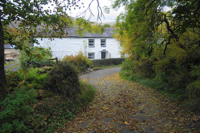
- Overview Map Street View Fell Foot Farm is located by the River Brathay, at the foot of Wrynose Pass in Little Langdale. The farmhouse is of white-washed stone rubble. The …

Co-Curate Page
Bridge End, Little Langdale
- Overview Map Bridge End is a house and attached barn, located to the west of Little Langdale Tarn. The stone rubble house dates fron the late 17th or 18th century, …
Co-Curate Page
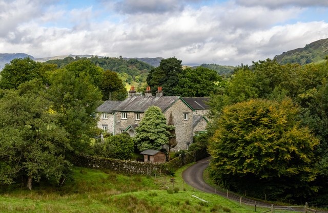
Townend, Troutbeck
- Overview About Townend Map Street View Townend is a large house and farm located on Holbeck Lane to the south of Troutbeck. It was built in 1626 for George Browne, …
Co-Curate Page
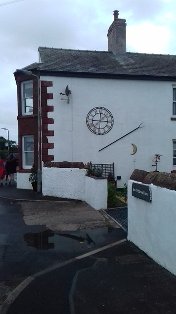
Bow Windows Farm
- Overview Map Street View Bow Windows Farmhouse in Rampside dates from 1654, and was extended in the18th century and altered 19th centry. The associated farm buildings are mid 18th century.[1] …
Co-Curate Page
Gaisgill Farm
- Gaisgill Farm is located on the west side of Gaisgill in Cumbria. The farmhouse is thought to be an 18th century remodelling of 17th century house. It's outbuilding under same …

Co-Curate Page
House at West of Abbot Holme
- Overview Map Street View The farmhouse at the West side of Abbot Holme, has an attached stable and a cart-shed or barn, and thought to date from the late-17th or …
Co-Curate Page
House at East of Abbot Holme
- Overview Map Street View The farmhouse at the East side of Abbot Holme, has an attached cart-shed and barn are thought to date from the mid-18th century, with later alterations. …
Co-Curate Page
Whale Farmhouse
- The farmhouse at Whale date from the mid 18th century. The farmhouse and it's adjacent barn are Grade II listed on the National Heritage List for England.
Co-Curate Page
Birkrigg Park, Cumbria
- Overview Map Street View Birkrigg Park is a hamlet in Cumbria, located about 3 miles south of Kendal and half mile north-east of the larger hamlet of Summerlands. The farmhouse …
Co-Curate Page
Tosca, Kirkby Lonsdale
- Overview Map Street View Tosca Farm is located about 2½ miles north-west of the town of Kirkby Lonsdale. The farm is situated by Lupton Beck. To the east of the …
Co-Curate Page
Larkrigg, Cumbria
- Overview Map Larkrigg is a farm / hamlet in Cumbria. It is situated near the west banks of the River Kent, and located about south west of the village of …
Co-Curate Page
Angerton (Furness)
- Overview Map Street View Angerton is a farm / hamlet in the Furness area of Cumbria, within Angerton Civil Parish. It is situated by the estury of the River Duddon. …
Co-Curate Page
Nether Haresceugh
- Overview Map Street View Nether Haresceugh is a farm/hamlet located about 1½ miles north east of Kirkoswald in Cumbria. The red sandstone farmhouse here dates from 1612 with an extension …
Co-Curate Page
Croglin Low Hall
- Overview Map Street View Croglin Low Hall is located about 10 miles south-east of Carlisle and is about 2 miles south-west of the village of Croglin. It is situated near …
Co-Curate Page
Mislet
- Overview Map Street View Mislet is a farm / hamlet in the South Lakeland district of Cumbria, located on Heaning Lane, about 2miles north-east of Windermere (town) and 6 miles …
Co-Curate Page
Cautley Thwaite
- Overview Map Street View Cautley Thwaite is a farm in Caurtley, about 3½ miles norh-east of the town of Sedbergh. The farm is situated by the River Rawthey and at …
Co-Curate Page
High Oxen Fell
- Overview Map High Oxen Fell is a farm located about 3 miles north-east of Coniston (town) and 1½ miles south-west of Skelwith Bridge. The stone rubble farmhouse is dated 1673 …
Co-Curate Page
Skelwith Fold Farm
- Overview Map Street View Skelwith Fold Farm is located near the south banks of the River Brathay, off Bog Lane, about ¼ mile north of the hamlet of Skelwith Fold.
Co-Curate Page
Low Oxen Fell
- Overview Map Low Oxen Fell is a farm in Cumbria, located about 1½ miles south-west of Skelwith Bridge. The farmhouse, on the east side of Low Oxen Fell (lane), built …
Co-Curate Page
Fell Foot Farm, Little Langdale
- Overview Map Street View Fell Foot Farm is located by the River Brathay, at the foot of Wrynose Pass in Little Langdale. The farmhouse is of white-washed stone rubble. The …
Co-Curate Page
Bridge End, Little Langdale
- Overview Map Bridge End is a house and attached barn, located to the west of Little Langdale Tarn. The stone rubble house dates fron the late 17th or 18th century, …
Co-Curate Page
Townend, Troutbeck
- Overview About Townend Map Street View Townend is a large house and farm located on Holbeck Lane to the south of Troutbeck. It was built in 1626 for George Browne, …
Co-Curate Page
Bow Windows Farm
- Overview Map Street View Bow Windows Farmhouse in Rampside dates from 1654, and was extended in the18th century and altered 19th centry. The associated farm buildings are mid 18th century.[1] …


