Topics > Historical Periods > Anglo-Saxon (410 to 1066 AD)
Anglo-Saxon (410 to 1066 AD)
Co-Curate Page
Venerable Bede (673-735 AD)
- Overview About Venerable Bede Saint Bede the Venerable was a monk at the monastery of Saint Peter at Monkwearmouth and Saint Paul's monastery, Jarrow. Bede's translations of early Christian texts …
Co-Curate Page
Benedict Biscop, Saint (628-690 AD)
- Overview About Benedict Biscop Benedict Biscop (pronounced "bishop" ) (c. 628 – 690), also known as Biscop Baducing, was an Anglo-Saxon abbot and founder of Monkwearmouth-Jarrow Priory (where he …
Co-Curate Page
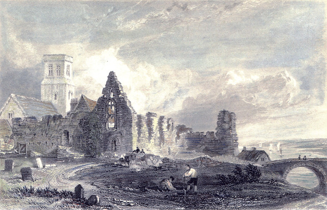
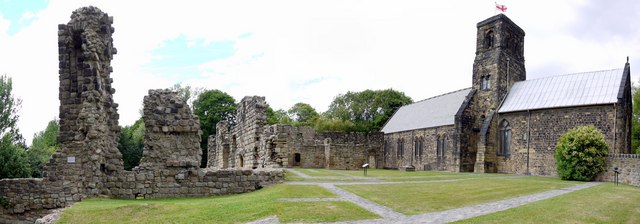
St Paul's Monastery
- Overview History of Monkwearmouth–Jarrow The remains of St Paul's standing today are from the medieval monastery, but part of the Anglo-Saxon monastery survives today as the chancel of St Paul's …

from http://www.twsitelines.info/t…
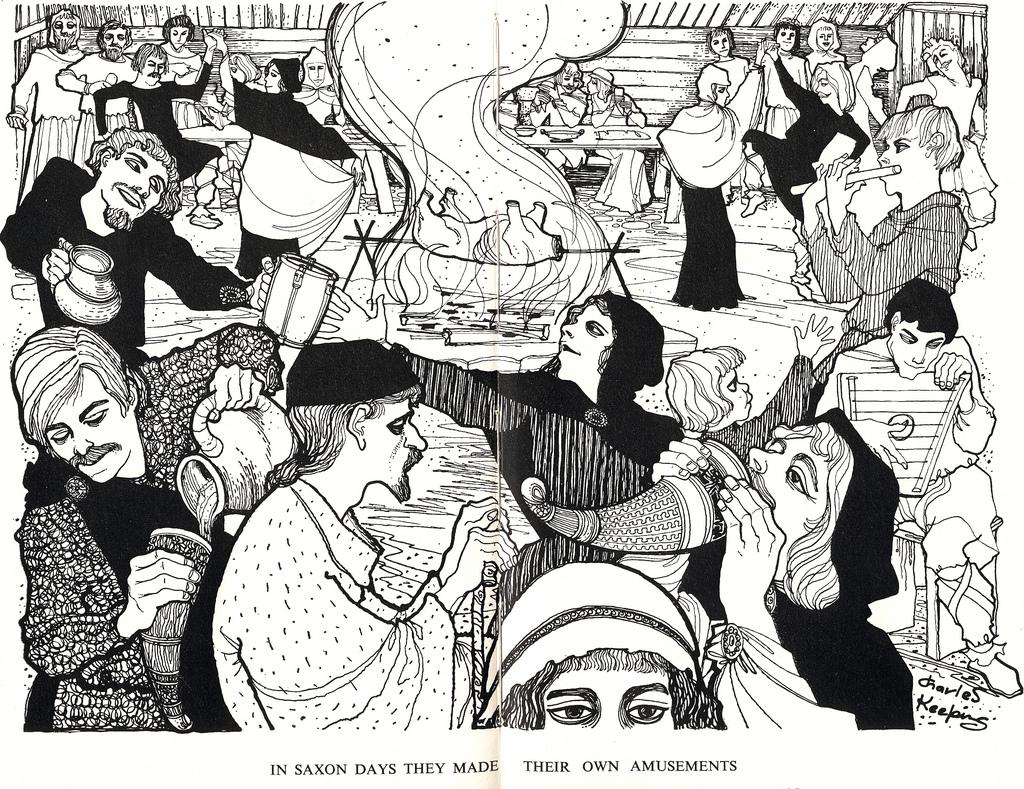
The Anglo-Saxons
- Detailed account of Anglo Saxon times with a focus on the North East. Includes sections on Settlements and Buildings, Economy and Agriculture, Burial and Religion, Bede and the Golden Age, …
Added by
Simon Cotterill
Co-Curate Page
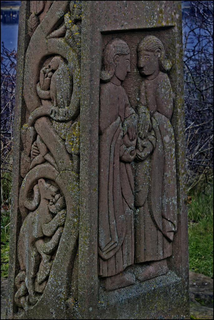
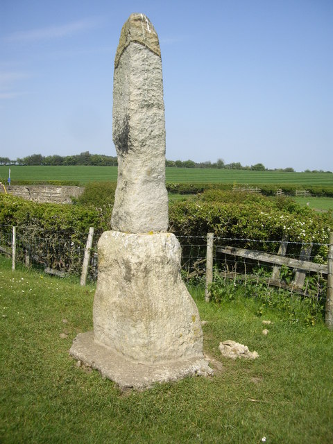
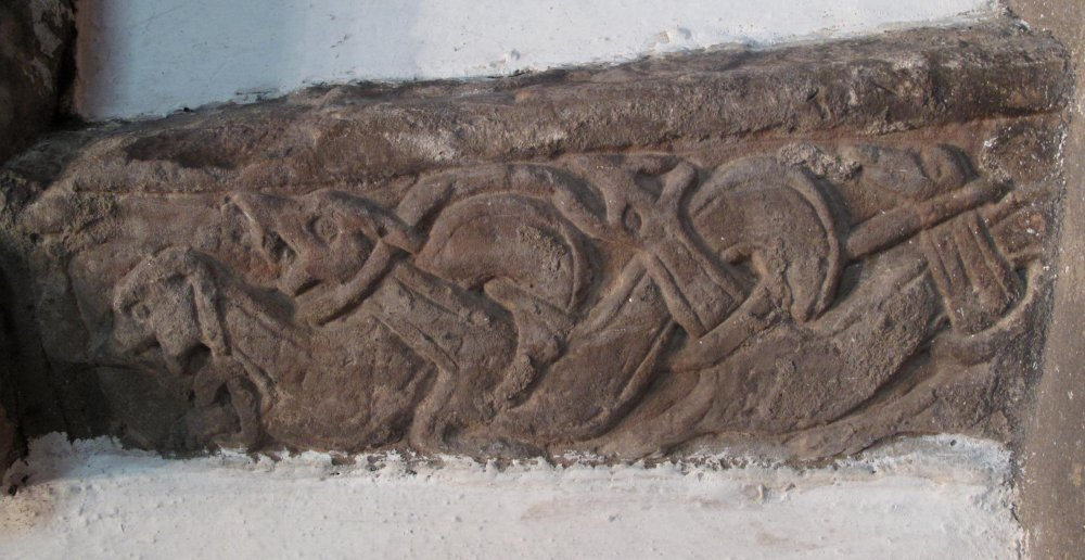
Legs Cross
- Overview Map Street View Near Bolam, County Durham. "The base and fragment of a cross shaft dating from the 9th century. A rough cut rectangular sandstone base, badly worn, but …
Co-Curate Page
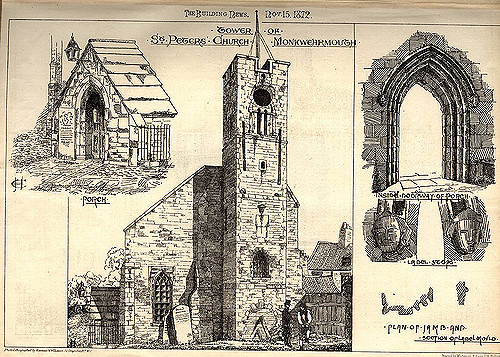
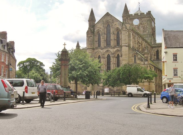
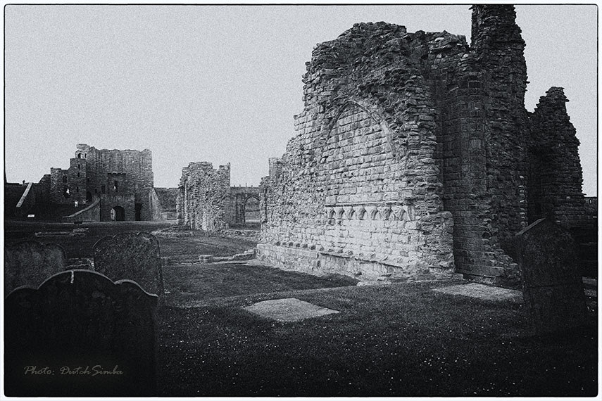
Hexham Abbey
- Overview About Hexham Abbey Map Inside Street View "There has been a church on this site for more than 1,300 years, since Queen Etheldreda made a grant of lands to …
Co-Curate Page
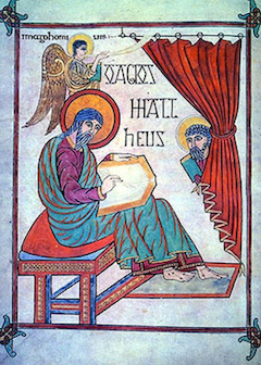
Lindisfarne Gospels
- The Lindisfarne Gospels is a ceremonial illustrated manuscript incorporating the gospels of Saints Matthew, Mark, Luke and John, and art work with Anglo-Saxon and Celtic influences. The manuscripts were produced …
from Flickr (flickr)
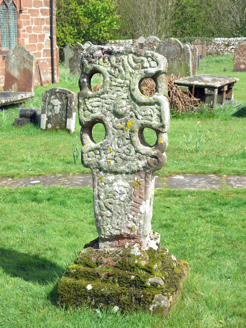
Anglo Saxon/Anglo Norse Cross carving,St Andrews, Aycliffe County Durham, England
Pinned by Pat Thomson
Co-Curate Page
Kirkleatham Museum
- Overview Map Street View "Kirkleatham Museum is the local history museum for the Borough of Redcar & Cleveland with a treasure trove of artefacts and exhibitions set on three floors …
Co-Curate Page
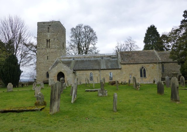
Church of St Andrew, Bolam
- Overview Map The Church of St Andrew at Bolam, Northumberland, dates back to Saxon times. The tower is of the late Saxon period, whilst the interior is largely Norman with …
Co-Curate Page
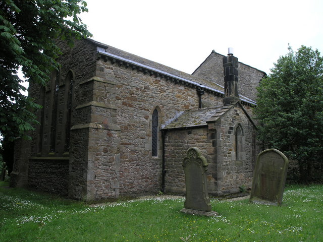
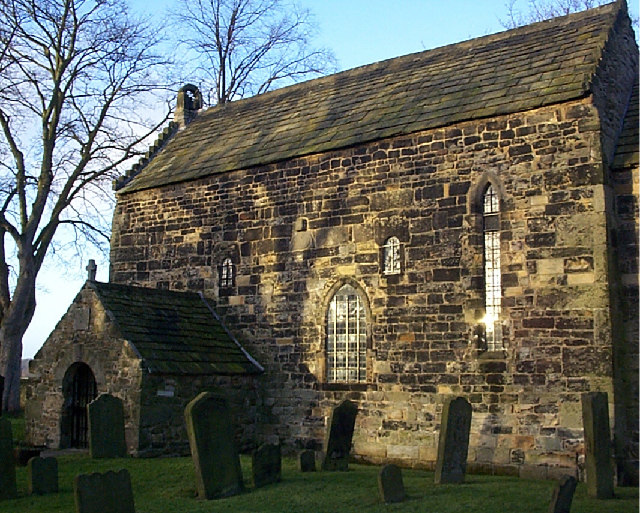
Saxon Church, Escomb
- Overview History Map Street View The Saxon Church in Escomb, County Durham, was built around 675 AD with stone probably from the Roman Fort at Binchester. The church is one …
Co-Curate Page
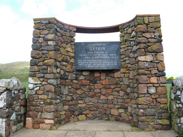
Ad Gefrin
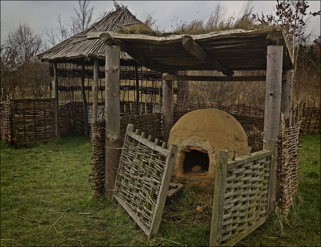
- Overview Map Street View Between Kirknewton and Yeavering in Northumberland are the extensive remains of the Anglo-Saxon royal township of Ad Gefrin. It was a large settlement covering an area …
Co-Curate Page
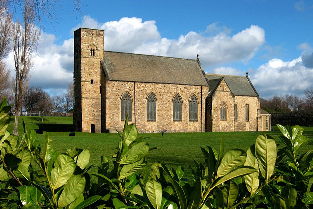
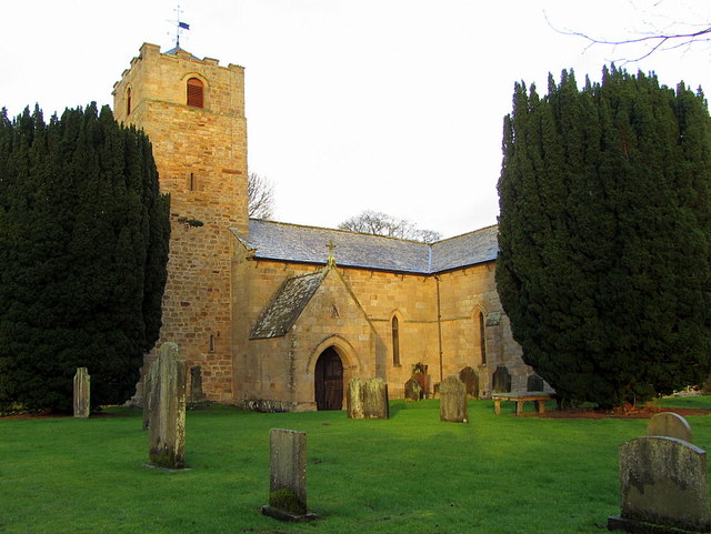
Church of St. Michael, Low Warden
- Overview Map Street View The Church of St. Michael & All Saints is located in Low Warden, Northumberland. This is one of the oldest places of worship in Northumberland still …
Co-Curate Page
Maelmin Heritage Trail
- There were ancient settlements to the east of the modern village of Milfield, by the River Till. The royal Anglo-Saxon palace of Maelmin was founded here in the late 7th …
from Geograph (geograph)
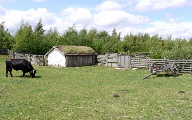
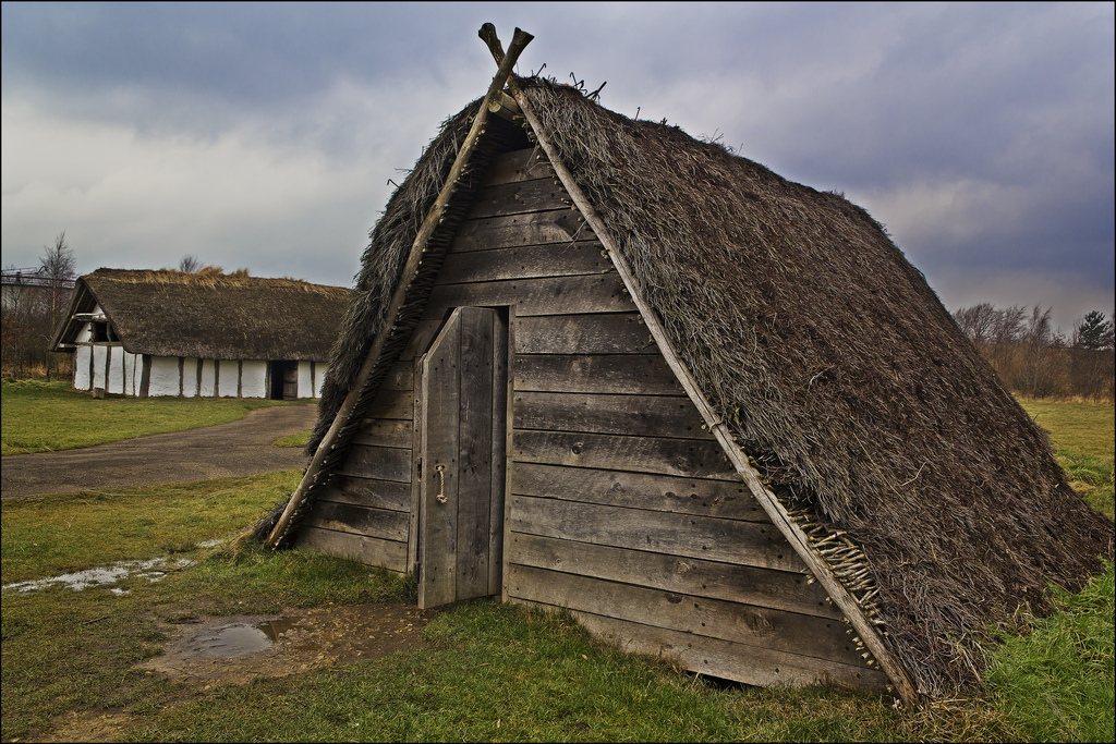
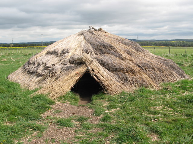
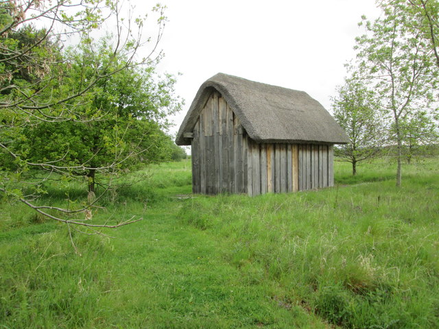
Full scale reconstruction of a Dark Age house AD410-550
Pinned by Simon Cotterill
Co-Curate Page
The Gosforth Cross
- Overview About the Gosforth Cross Map Street View The Gosforth Cross is a 10th century high cross standing in the churchyard of St Mary's Church in Gosforth, Cumbria. The carvings …
Co-Curate Page
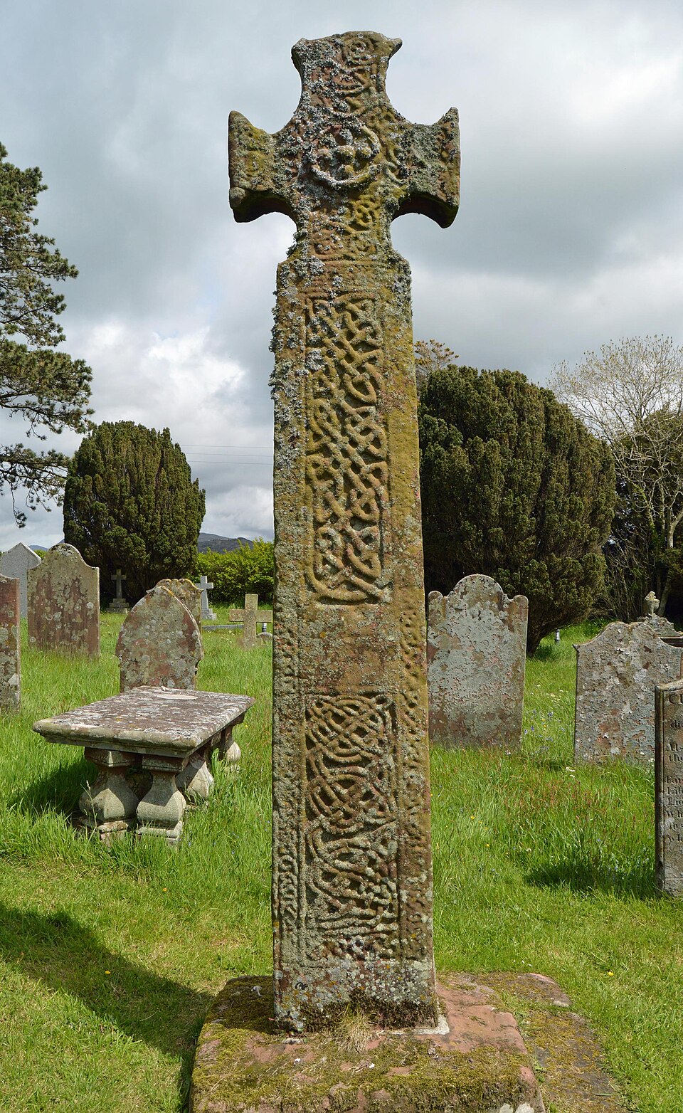
The Giant's Grave, Penrith
- A pair of 10th century Anglian cross shafts and four hogback stones, known locally as 'The Giant's Grave', is located in St Andrew's churchyard, Penrith. By local tradition, it is said …
Co-Curate Page
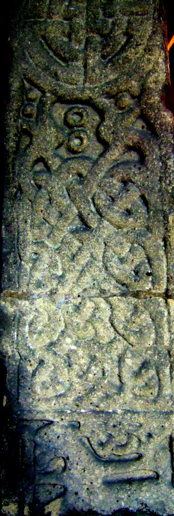
The Irton Cross
- Overview About the Irton Cross 1901 Description Map Street View The Irton Cross is a carved Anglo-Saxon stone cross located in the churchyard of St Paul's Church - the church …
Co-Curate Page
Addingham Cross
- The 'Addingham Cross' is a late 10th or early 11th century Saxon stone cross in the churchyard of St Michael's Church, Glassonby. The cross was originally located in the churchyard …

Co-Curate Page
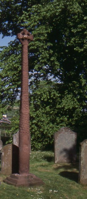
Saxon Cross, Warden
- There is a Saxon stone cross in the churchyard of St Michael's Church in Low Warden, Northumberland. Known as the "Nether Warden Cross", or "Warden Village Cross", it dates from …
Co-Curate Page
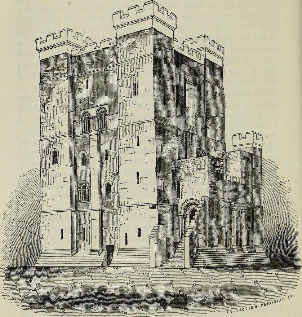
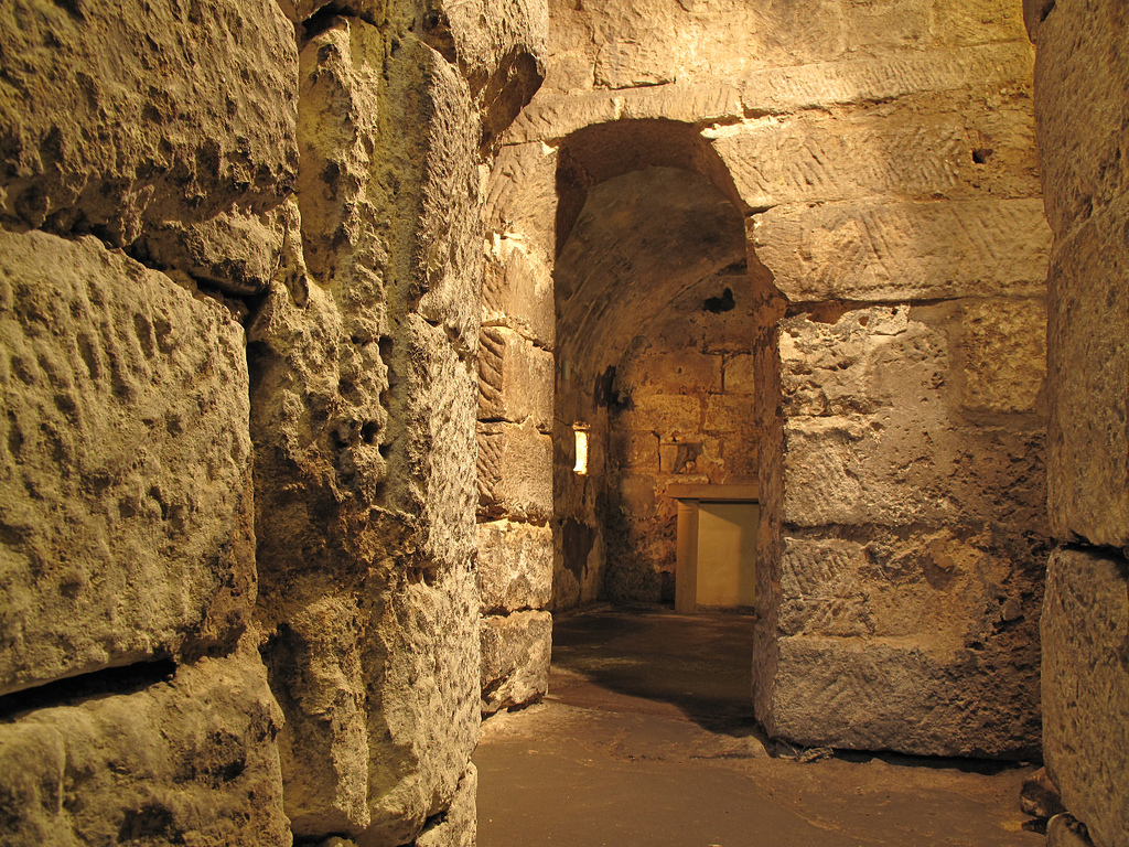
Remains of medieval priory around Hexham Abbey
- Map showing the Scheduled Monument Area The remains of the medieval priory and Anglo-Saxon monastery under and around Hexham Abbey and its precincts are a Scheduled Monument (legally protected). This …

Co-Curate Page
Venerable Bede (673-735 AD)
- Overview About Venerable Bede Saint Bede the Venerable was a monk at the monastery of Saint Peter at Monkwearmouth and Saint Paul's monastery, Jarrow. Bede's translations of early Christian texts …
Co-Curate Page
Benedict Biscop, Saint (628-690 AD)
- Overview About Benedict Biscop Benedict Biscop (pronounced "bishop" ) (c. 628 – 690), also known as Biscop Baducing, was an Anglo-Saxon abbot and founder of Monkwearmouth-Jarrow Priory (where he …
Co-Curate Page
St Paul's Monastery
- Overview History of Monkwearmouth–Jarrow The remains of St Paul's standing today are from the medieval monastery, but part of the Anglo-Saxon monastery survives today as the chancel of St Paul's …
from http://www.twsitelines.info/t…
The Anglo-Saxons
- Detailed account of Anglo Saxon times with a focus on the North East. Includes sections on Settlements and Buildings, Economy and Agriculture, Burial and Religion, Bede and the Golden Age, …
Added by
Simon Cotterill
Co-Curate Page
Legs Cross
- Overview Map Street View Near Bolam, County Durham. "The base and fragment of a cross shaft dating from the 9th century. A rough cut rectangular sandstone base, badly worn, but …
Co-Curate Page
Hexham Abbey
- Overview About Hexham Abbey Map Inside Street View "There has been a church on this site for more than 1,300 years, since Queen Etheldreda made a grant of lands to …
Co-Curate Page
Lindisfarne Gospels
- The Lindisfarne Gospels is a ceremonial illustrated manuscript incorporating the gospels of Saints Matthew, Mark, Luke and John, and art work with Anglo-Saxon and Celtic influences. The manuscripts were produced …
from Flickr (flickr)
Anglo Saxon/Anglo Norse Cross carving,St Andrews, Aycliffe County Durham, England
Pinned by Pat Thomson
Co-Curate Page
Kirkleatham Museum
- Overview Map Street View "Kirkleatham Museum is the local history museum for the Borough of Redcar & Cleveland with a treasure trove of artefacts and exhibitions set on three floors …
Co-Curate Page
Church of St Andrew, Bolam
- Overview Map The Church of St Andrew at Bolam, Northumberland, dates back to Saxon times. The tower is of the late Saxon period, whilst the interior is largely Norman with …
Co-Curate Page
Saxon Church, Escomb
- Overview History Map Street View The Saxon Church in Escomb, County Durham, was built around 675 AD with stone probably from the Roman Fort at Binchester. The church is one …
Co-Curate Page
Ad Gefrin
- Overview Map Street View Between Kirknewton and Yeavering in Northumberland are the extensive remains of the Anglo-Saxon royal township of Ad Gefrin. It was a large settlement covering an area …
Co-Curate Page
Church of St. Michael, Low Warden
- Overview Map Street View The Church of St. Michael & All Saints is located in Low Warden, Northumberland. This is one of the oldest places of worship in Northumberland still …
Co-Curate Page
Maelmin Heritage Trail
- There were ancient settlements to the east of the modern village of Milfield, by the River Till. The royal Anglo-Saxon palace of Maelmin was founded here in the late 7th …
from Geograph (geograph)
Full scale reconstruction of a Dark Age house AD410-550
Pinned by Simon Cotterill
Co-Curate Page
The Gosforth Cross
- Overview About the Gosforth Cross Map Street View The Gosforth Cross is a 10th century high cross standing in the churchyard of St Mary's Church in Gosforth, Cumbria. The carvings …
Co-Curate Page
The Giant's Grave, Penrith
- A pair of 10th century Anglian cross shafts and four hogback stones, known locally as 'The Giant's Grave', is located in St Andrew's churchyard, Penrith. By local tradition, it is said …
Co-Curate Page
The Irton Cross
- Overview About the Irton Cross 1901 Description Map Street View The Irton Cross is a carved Anglo-Saxon stone cross located in the churchyard of St Paul's Church - the church …
Co-Curate Page
Addingham Cross
- The 'Addingham Cross' is a late 10th or early 11th century Saxon stone cross in the churchyard of St Michael's Church, Glassonby. The cross was originally located in the churchyard …
Co-Curate Page
Saxon Cross, Warden
- There is a Saxon stone cross in the churchyard of St Michael's Church in Low Warden, Northumberland. Known as the "Nether Warden Cross", or "Warden Village Cross", it dates from …
Co-Curate Page
Remains of medieval priory around Hexham Abbey
- Map showing the Scheduled Monument Area The remains of the medieval priory and Anglo-Saxon monastery under and around Hexham Abbey and its precincts are a Scheduled Monument (legally protected). This …
Historical Periods
10th Century
5th Century
6th Century
7th Century
8th Century
9th Century

Battle of Carham, 1018
Northumbria