Topics > Historical Periods > 19th Century > 1830s > 1836
1836
from Newcastle libraries (flickr)
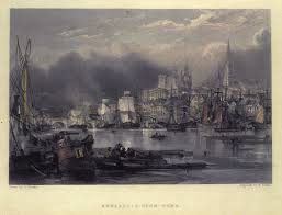
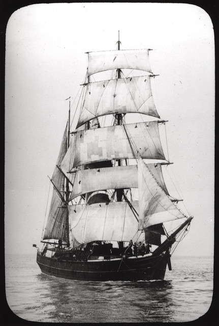
065928:The River Tyne and Newcastle quayside viewed from the south side of the river.1836.
Pinned by Simon Cotterill
from Beamish (flickr)
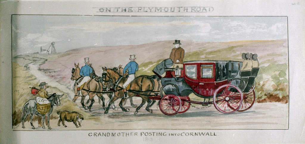
16 - On the Plymouth Road – Grandmother posting into Cornwall 1836
Pinned by Simon Cotterill
from http://www.dmm.org.uk/collier…
Brandon Pit House Colliery
- 1836 - 1968
Added by
Simon Cotterill
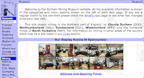
from http://www.workhouses.org.uk/…
The Workhouse - South Shields
- "In a parliamentary report of 1776, South Shields was listed as having a workhouse with accommodation for 50 inmates....The South Shields Poor Law Union was formed on 10th December 1836.... …
Added by
Simon Cotterill
from Newcastle libraries (flickr)
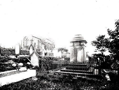
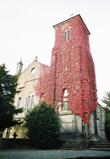
034058:St. Albans Church Earsdon. C.1910
Pinned by Simon Cotterill
Co-Curate Page
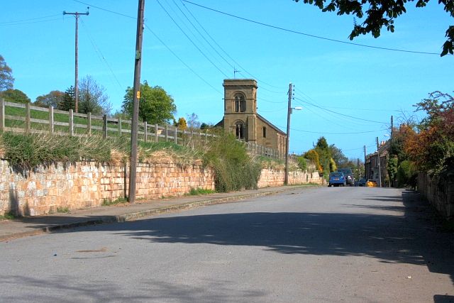
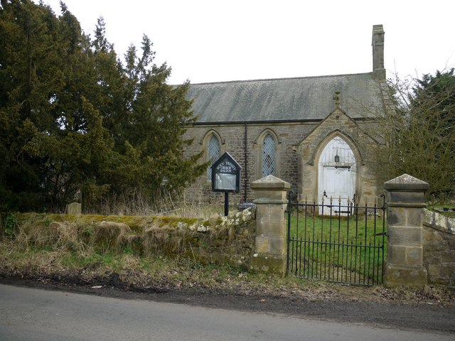
Church of St Bartholomew, Cresswell
- Overview Map Street View The parish Church of St Bartholomew in Cresswell, Northumberland, was built in 1836 for the Baker-Cresswell family of Cresswell Hall.[1] It is one of two churches …
Co-Curate Page
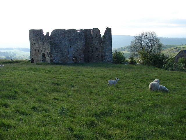
Ridsdale Iron Works
- Overview Map Street View Scheduled Monument area of Risdale Iron Works - based on Historic England data (Open Government Licence). The remains of Ridsdale Iron Works are to the north …
Co-Curate Page
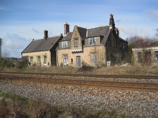
Former Station, Gilsland
- Overview Map Street View The railway station at Gilsland opened on the 9th July 1836 as Rose Hill (renamed Gilsland in 1869). It was built by the Newcastle and Carlisle …
Co-Curate Page
Shoreswood National School
- Overview Map Street View The former Shoreswood National School was built c.1836 for 70 pupils. The school closed in 1962 and it's 17 pupils were transferred to a new county …
Co-Curate Page
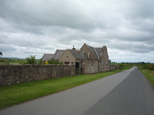
Former Station
- Overview Map Street View The former station-master's house, now private dwelling, was built in c.1836 for the Newcastle and Carlisle Railway Co. It is Grade II listed on the National …
Co-Curate Page
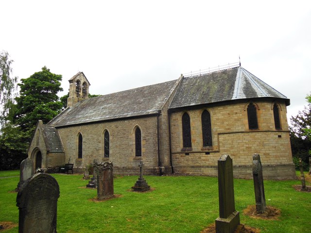
Church of the Holy Trinity, Brathay
- Overview About Holy Trinity Church Map Street View Holy Trinity Church is located on a hill top near Brathay Hall, just over half a mile west of Ambleside. It was …
Co-Curate Page
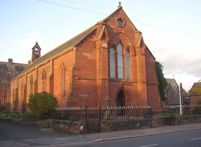
Church of St Andrew's
- St Andrew's Church in Upleatham was built in 1836 and desighned by Ignatius Bonomi. It replaced the ancient parish church, which was located away from the village. Some of the …
Co-Curate Page
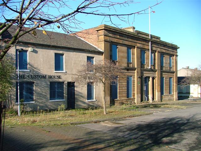
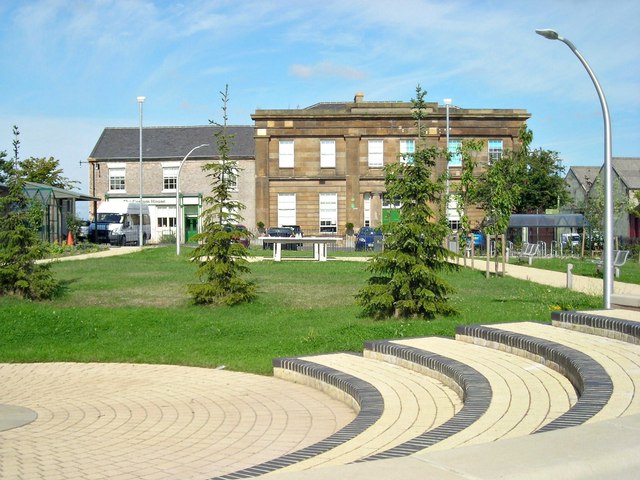
Customs House
- Overview Map Street View The Customs House is located on North Street, Middlsbrough. It was originally built in 1836 as a Coal Exchange and hotel, designed by G. Burlison. It …
Co-Curate Page
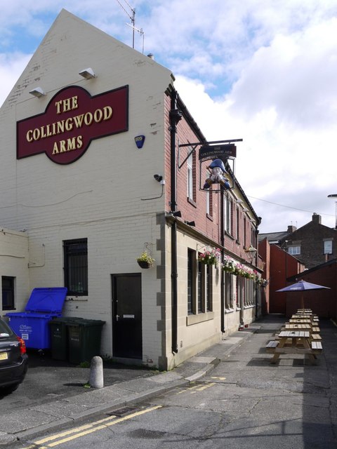
Collingwood Arms, Brandling Village
- Overview Map Street View The Collingwood Arms is a public house in Brandling Village, Jesmond. It first opened in 1836. The first landlord, Robert Hewlitt, named the pub after Newcastle-born …
from https://archive.org/details/v…
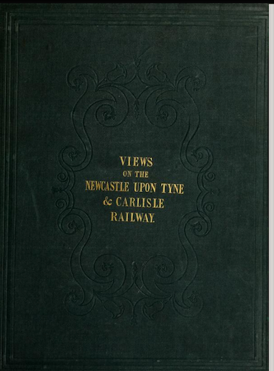
Views on the Newcastle and Carlisle Railway, 1836 [Digitised book]
- Views on the Newcastle and Carlisle Railway
by Blackmore, John; Carmichael, James Wilson
Publication date 1836
Topics Newcastle and Carlisle Railway, Railroads -- Great Britain
Publisher [Newcastle, Tyne ; Wear] …
Added by
Simon Cotterill
Co-Curate Page
Conishead Priory
- Overview About Conishead Priory Map Street View Conishead Priory is a large country house, located 1½ miles south east of Ulverston in Cumbria. It was built on the site of …
Co-Curate Page
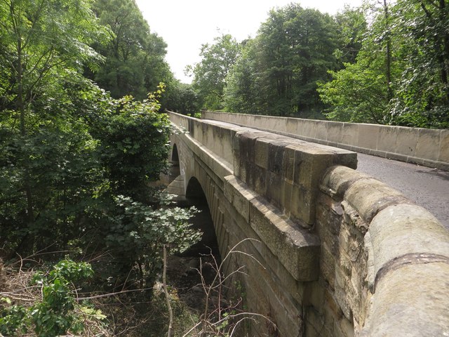
Gilderdale Bridge
- Overview Map Street View Gilderdale Bridge carries the A689 road over Gilderdale Burn, about 1 mile south-east of Kirkhaugh and 1½ miles north-west of Alston. The stone bridge was built in 1836 …
Co-Curate Page
Lowford Bridge, Morpeth
- Overview Map Street View Lowford bridge carries Mitford Road (B6343) over the River Wansbeck at the east of Morpeth. The stone bridge was erected in 1836, funded by public subscription. …
Co-Curate Page
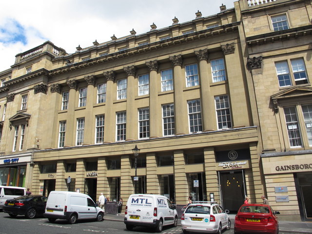
42-50 Grey Street, Newcastle
- Overview Map Street View Nos. 42-50, Grey Street was built in c.1836 by John Dobson for Richard Grainger as part of the redevelopment of the centre of Newcastle (1824 - …
Co-Curate Page
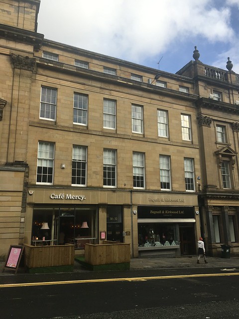
26-32 Grey Street, Newcastle
- Overview Map Street View Nos. 26-32 (even numbers) Grey Street was built in c.1836 by John Dobson for Richard Grainger as part of the redevelopment of the centre of Newcastle from …
Co-Curate Page
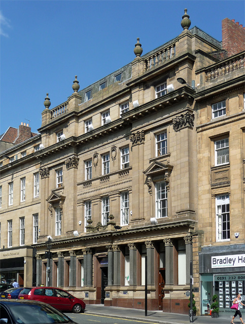
18-24, Grey Street, Newcastle
- Overview Map Street View Nos. 18-24 (even numbers) Grey Street was built in 1836, designed by John Dobson for Richard Grainger as part of the redevelopment of the centre of …
Co-Curate Page
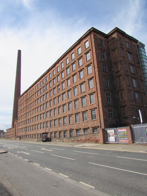
Shaddon Mill
- Overview Map Street View Shaddon Mill is located on Junction Street, off Shaddongate in Carlisle. It was built as a cotton mill 1835-1836 by Richard Tattersall for Peter Dixon. At …
Co-Curate Page
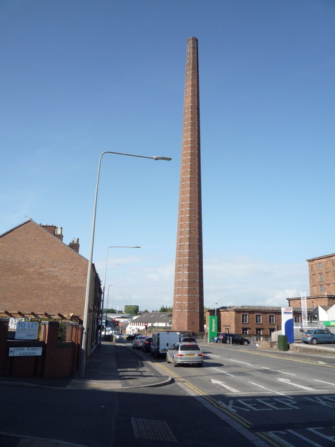
Dixons Chimney, Shaddon Mill, Carlisle
- Overview Map Street View Dixons Chimney is a prominent landmark in Carlisle, located on the corner of Shaddongate and Junction Street. The chimney was built in 1836 to serve Shaddon …

Co-Curate Page
East Hedley Hope Colliery (1836 - 1959)
- East Hedley Hope Colliery opened in 1836 and gave rise to the village of East Hedleyhope in County Durham. At it's peak level of employment, in 1900, the colliery had …
Co-Curate Page
St Cuthbert's RC Church, Wigton
- Overview Map Street View St Cuthbert's Roman Catholic Church is located on King Street in Wigton. Building of the church, designed by Ignatius Bonomi, began in 1836. It was extended …

Co-Curate Page
Ecclesiastical Commissioners
- The Ecclesiastical Commissioners (Ecclesiastical and Church Estates Commissioners for England), established by the Ecclesiastical Commissioners Act 1836, were a body corporate in England and Wales created to manage Church of …

Co-Curate Page
Northrigg Hill
- Overview Map Northrigg Hill, is located about ½ mile north-east of the village of Banks in Cumbria. The farmhouse at Northrigg Hill is dated 1836 over it's entrance. The building …

from Newcastle libraries (flickr)
065928:The River Tyne and Newcastle quayside viewed from the south side of the river.1836.
Pinned by Simon Cotterill
from Beamish (flickr)
16 - On the Plymouth Road – Grandmother posting into Cornwall 1836
Pinned by Simon Cotterill
from http://www.dmm.org.uk/collier…
Brandon Pit House Colliery
- 1836 - 1968
Added by
Simon Cotterill
from http://www.workhouses.org.uk/…
The Workhouse - South Shields
- "In a parliamentary report of 1776, South Shields was listed as having a workhouse with accommodation for 50 inmates....The South Shields Poor Law Union was formed on 10th December 1836.... …
Added by
Simon Cotterill
from Newcastle libraries (flickr)
034058:St. Albans Church Earsdon. C.1910
Pinned by Simon Cotterill
Co-Curate Page
Church of St Bartholomew, Cresswell
- Overview Map Street View The parish Church of St Bartholomew in Cresswell, Northumberland, was built in 1836 for the Baker-Cresswell family of Cresswell Hall.[1] It is one of two churches …
Co-Curate Page
Ridsdale Iron Works
- Overview Map Street View Scheduled Monument area of Risdale Iron Works - based on Historic England data (Open Government Licence). The remains of Ridsdale Iron Works are to the north …
Co-Curate Page
Former Station, Gilsland
- Overview Map Street View The railway station at Gilsland opened on the 9th July 1836 as Rose Hill (renamed Gilsland in 1869). It was built by the Newcastle and Carlisle …
Co-Curate Page
Shoreswood National School
- Overview Map Street View The former Shoreswood National School was built c.1836 for 70 pupils. The school closed in 1962 and it's 17 pupils were transferred to a new county …
Co-Curate Page
Former Station
- Overview Map Street View The former station-master's house, now private dwelling, was built in c.1836 for the Newcastle and Carlisle Railway Co. It is Grade II listed on the National …
Co-Curate Page
Church of the Holy Trinity, Brathay
- Overview About Holy Trinity Church Map Street View Holy Trinity Church is located on a hill top near Brathay Hall, just over half a mile west of Ambleside. It was …
Co-Curate Page
Church of St Andrew's
- St Andrew's Church in Upleatham was built in 1836 and desighned by Ignatius Bonomi. It replaced the ancient parish church, which was located away from the village. Some of the …
Co-Curate Page
Customs House
- Overview Map Street View The Customs House is located on North Street, Middlsbrough. It was originally built in 1836 as a Coal Exchange and hotel, designed by G. Burlison. It …
Co-Curate Page
Collingwood Arms, Brandling Village
- Overview Map Street View The Collingwood Arms is a public house in Brandling Village, Jesmond. It first opened in 1836. The first landlord, Robert Hewlitt, named the pub after Newcastle-born …
from https://archive.org/details/v…
Views on the Newcastle and Carlisle Railway, 1836 [Digitised book]
- Views on the Newcastle and Carlisle Railway
by Blackmore, John; Carmichael, James Wilson
Publication date 1836
Topics Newcastle and Carlisle Railway, Railroads -- Great Britain
Publisher [Newcastle, Tyne ; Wear] …
Added by
Simon Cotterill
Co-Curate Page
Conishead Priory
- Overview About Conishead Priory Map Street View Conishead Priory is a large country house, located 1½ miles south east of Ulverston in Cumbria. It was built on the site of …
Co-Curate Page
Gilderdale Bridge
- Overview Map Street View Gilderdale Bridge carries the A689 road over Gilderdale Burn, about 1 mile south-east of Kirkhaugh and 1½ miles north-west of Alston. The stone bridge was built in 1836 …
Co-Curate Page
Lowford Bridge, Morpeth
- Overview Map Street View Lowford bridge carries Mitford Road (B6343) over the River Wansbeck at the east of Morpeth. The stone bridge was erected in 1836, funded by public subscription. …
Co-Curate Page
42-50 Grey Street, Newcastle
- Overview Map Street View Nos. 42-50, Grey Street was built in c.1836 by John Dobson for Richard Grainger as part of the redevelopment of the centre of Newcastle (1824 - …
Co-Curate Page
26-32 Grey Street, Newcastle
- Overview Map Street View Nos. 26-32 (even numbers) Grey Street was built in c.1836 by John Dobson for Richard Grainger as part of the redevelopment of the centre of Newcastle from …
Co-Curate Page
18-24, Grey Street, Newcastle
- Overview Map Street View Nos. 18-24 (even numbers) Grey Street was built in 1836, designed by John Dobson for Richard Grainger as part of the redevelopment of the centre of …
Co-Curate Page
Shaddon Mill
- Overview Map Street View Shaddon Mill is located on Junction Street, off Shaddongate in Carlisle. It was built as a cotton mill 1835-1836 by Richard Tattersall for Peter Dixon. At …
Co-Curate Page
Dixons Chimney, Shaddon Mill, Carlisle
- Overview Map Street View Dixons Chimney is a prominent landmark in Carlisle, located on the corner of Shaddongate and Junction Street. The chimney was built in 1836 to serve Shaddon …
Co-Curate Page
East Hedley Hope Colliery (1836 - 1959)
- East Hedley Hope Colliery opened in 1836 and gave rise to the village of East Hedleyhope in County Durham. At it's peak level of employment, in 1900, the colliery had …
Co-Curate Page
St Cuthbert's RC Church, Wigton
- Overview Map Street View St Cuthbert's Roman Catholic Church is located on King Street in Wigton. Building of the church, designed by Ignatius Bonomi, began in 1836. It was extended …
Co-Curate Page
Ecclesiastical Commissioners
- The Ecclesiastical Commissioners (Ecclesiastical and Church Estates Commissioners for England), established by the Ecclesiastical Commissioners Act 1836, were a body corporate in England and Wales created to manage Church of …
Co-Curate Page
Northrigg Hill
- Overview Map Northrigg Hill, is located about ½ mile north-east of the village of Banks in Cumbria. The farmhouse at Northrigg Hill is dated 1836 over it's entrance. The building …
Church of St Andrew's, Upleatham
St Cuthbert's RC Church, Wigton
Church of The Holy Trinity, Dalton, Ponteland
East Hedley Hope Colliery (1836 - 1959)
Collingwood Arms, Brandling Village
Church of St Bartholomew, Cresswell
Church of the Holy Trinity, Brathay
Engine House, Ridsdale Iron Works


