Topics > Heritage Sites > Scheduled Monument > Scheduled Monuments in County Durham
Co-Curate Page
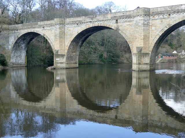
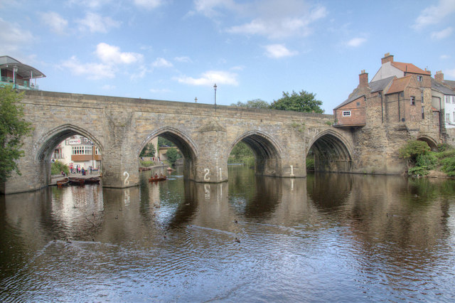
Prebends Bridge
- Overview About Prebends Bridge Map Street View Prebends Bridge over the River Wear at Durham was built for the Dean and Chapter of Durham to provide access to Durham Cathedral …
Co-Curate Page
Sherburnhouse Bridge
- Overview Map Street View The old Sherburnhouse Bridge, located to the north-west of the hamlet of Sherburn House in County Durham, dates from 1335, with the upper part of the …
Co-Curate Page
Coke Ovens at Inkerman Farm
- "The beehive coke ovens are some of the last remaining examples of this type of oven left in County Durham. At one time there were over 100,000 in the County. …
Co-Curate Page
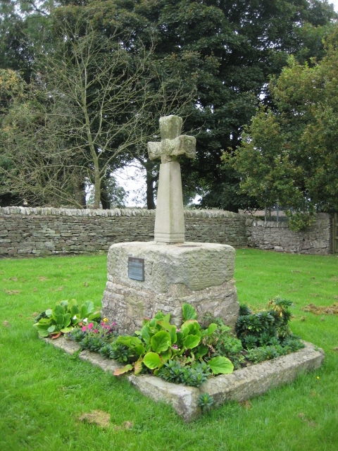
Neville's Cross (monument)
- Overview Map Street View The remains of the medieval Neville's Cross are located on the north side of Crossgate Peth, opposite St John's Church in the Nevil's Cross area of …
Co-Curate Page
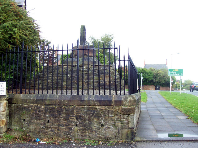
Village Cross, Esh
- Overview Map Street View Esh Cross is located in its original position on a raised area at the southern end of the village green in Esh. It is an important …
Co-Curate Page
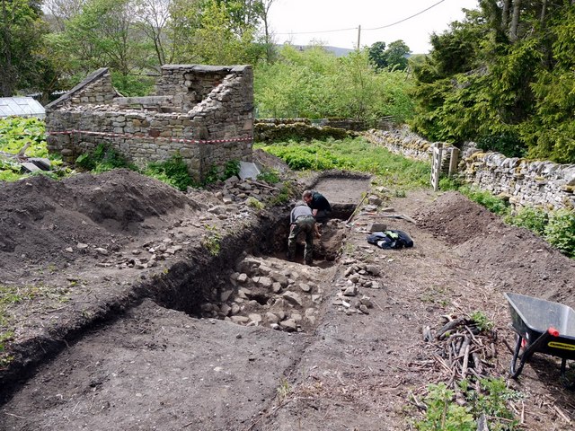
Coxhoe Medieval Settlement
- Overview Map The buried remains of the Medieval village of Coxhoe are located to the south-west of East House Farm, roughly half way between the modern villages of Coxhoe and …

Co-Curate Page
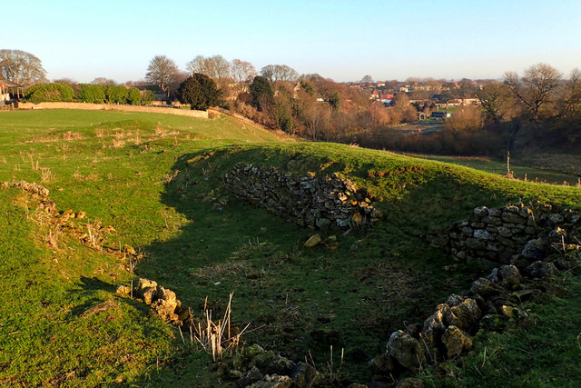
The Castles (camp)
- Overview Map 'The Castles' (camp) a large stone-built enclosure, located near West Shipley Farm, Hamsterley, in County Durham. It is believed to be the remains of a fortified site of …
Co-Curate Page
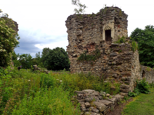
Scargill Castle
- Overview Map Scargill was originally built in the late 12th century by Warren de Scargill whilst he was overseeing building work at the nearby Bowes Castle. King Edward II is …
Co-Curate Page
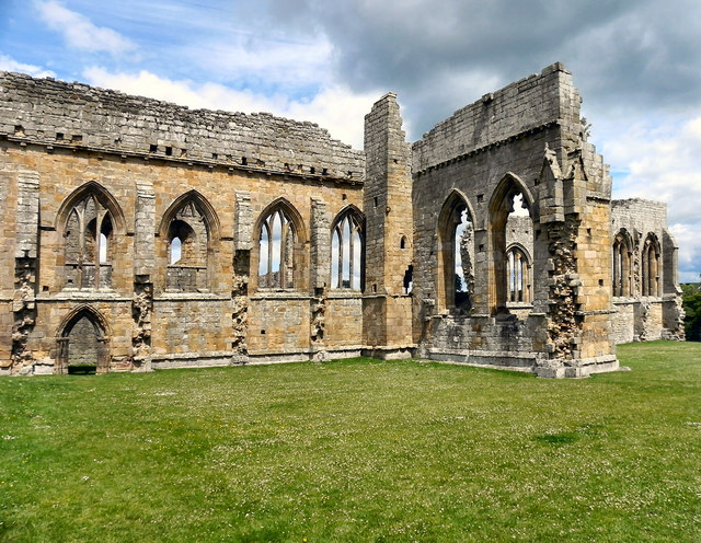
Egglestone Abbey
- Overview About Egglestone Abbey Map Street View Egglestone Abbey is an abandoned Premonstratensian Abbey on the southern (Yorkshire) bank of the River Tees, 1 1⁄2 miles (2.4 km) south-east of …
Co-Curate Page
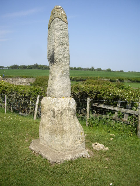
Legs Cross
- Overview Map Street View Near Bolam, County Durham. "The base and fragment of a cross shaft dating from the 9th century. A rough cut rectangular sandstone base, badly worn, but …
Co-Curate Page
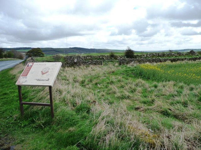
Longovicium, Lanchester Roman Fort
- Overview About Longovicium Map Street View Longovicium was a Roman fort established in the mid 2nd century AD, which lay on Dere Street, the Roman road connecting York with the …
Co-Curate Page
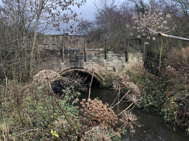
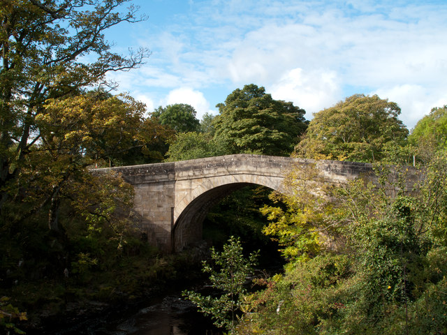
Bridge over the Wear
- Overview Map Street View This stone bridge over the River Wear just west of Stanhope dates from medieval times. The bridge now carries the B6278 road. It is Grade II* …
Co-Curate Page
Framwellgate Bridge
- Overview About Framwellgate Bridge Map Street View Framwellgate Bridge is a medieval stone bridge over the River Wear in Durham. The bridge was built in the 15th century and replaced …
Co-Curate Page
Friarside Chapel, nr Burnopfield
- Overview Map High Friarside Hospice was a Medieval leper hospital, located just south of the River Derwent, north of Burnopfield and south of Rowlands Gill, in County Durham. The hospital was founded …
Co-Curate Page
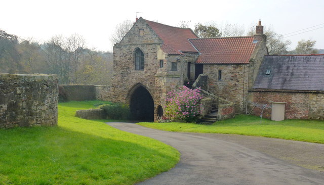
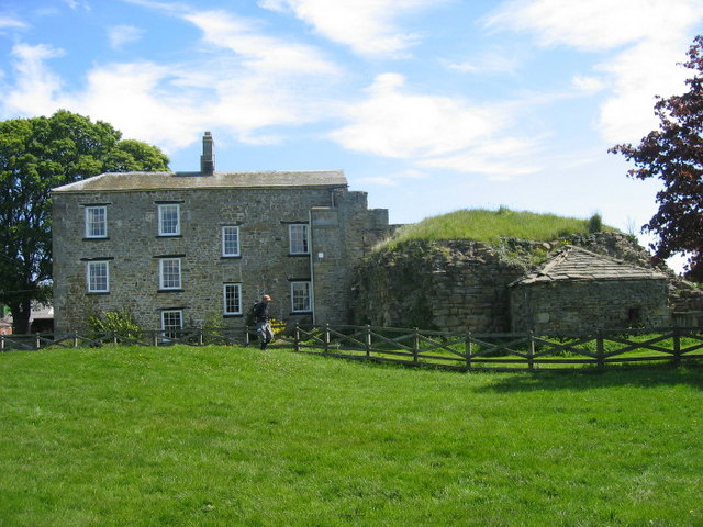
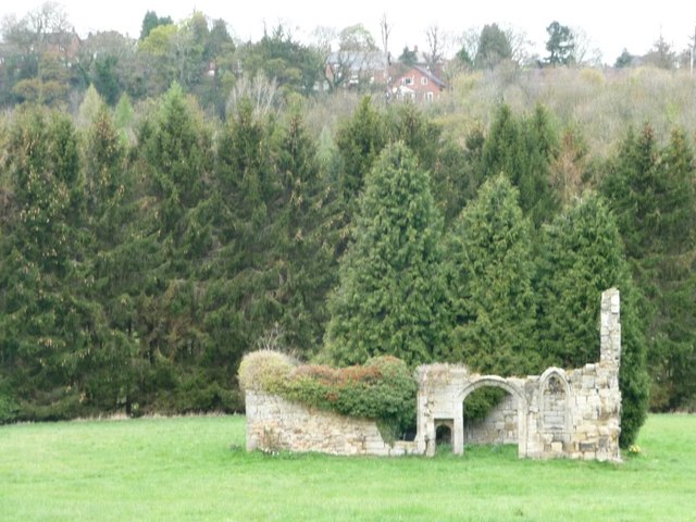
Dalden Tower
- Overview Map Street View Dalden Tower, is located in Seaham in the Dean which runs to Dalton-le-Dale. The pele-tower is the most prominent part of the remains of what was …
Co-Curate Page
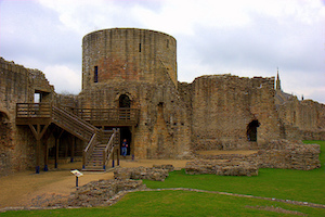
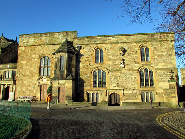
Barnard Castle (castle)
- Overview About Barnard Castle Map Street View The medieval castle in the town of Barnard Castle, is cared for by English Heritage. The castle is a Scheduled Ancient Monument, and …
Co-Curate Page
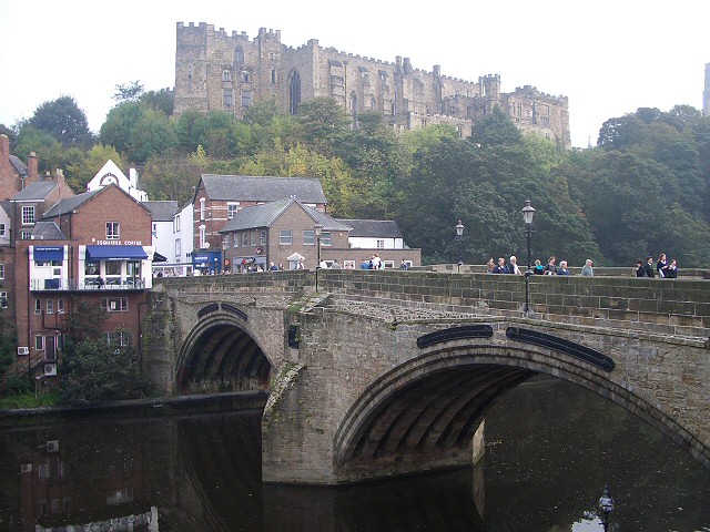
Elvet Bridge
- Overview Further Information Map Street View Elvet Bridge is a stone bridge which crosses the River Wear connecting the peninsula in central Durham and the Elvet area of the city. …
Co-Curate Page
Middleham Castle
- Middleham Castle was the main house of the Bishops of Durham from the Norman Conquest (1066) to the end of the 14th century. It was a fortified manor house, located …

Co-Curate Page
Ebchester Roman Fort (Vindomora)
- % Map of the Vindomora Scheduled Monument area. The site of Vindomora Roman Fort is located in the heart of Ebchester in County Durham. There are no obvious visible remains, …
Co-Curate Page
Archdeacon Newton Medieval Settlement
- Note: Scheduled Monument area - map data from Historic England c/o Open Data UK, under the Open Government Licence, imported into Google MyMaps, March 2026. Archdeacon Newton is the site …

Co-Curate Page
Prebends Bridge
- Overview About Prebends Bridge Map Street View Prebends Bridge over the River Wear at Durham was built for the Dean and Chapter of Durham to provide access to Durham Cathedral …
Co-Curate Page
Sherburnhouse Bridge
- Overview Map Street View The old Sherburnhouse Bridge, located to the north-west of the hamlet of Sherburn House in County Durham, dates from 1335, with the upper part of the …
Co-Curate Page
Coke Ovens at Inkerman Farm
- "The beehive coke ovens are some of the last remaining examples of this type of oven left in County Durham. At one time there were over 100,000 in the County. …
Co-Curate Page
Neville's Cross (monument)
- Overview Map Street View The remains of the medieval Neville's Cross are located on the north side of Crossgate Peth, opposite St John's Church in the Nevil's Cross area of …
Co-Curate Page
Village Cross, Esh
- Overview Map Street View Esh Cross is located in its original position on a raised area at the southern end of the village green in Esh. It is an important …
Co-Curate Page
Coxhoe Medieval Settlement
- Overview Map The buried remains of the Medieval village of Coxhoe are located to the south-west of East House Farm, roughly half way between the modern villages of Coxhoe and …
Co-Curate Page
The Castles (camp)
- Overview Map 'The Castles' (camp) a large stone-built enclosure, located near West Shipley Farm, Hamsterley, in County Durham. It is believed to be the remains of a fortified site of …
Co-Curate Page
Scargill Castle
- Overview Map Scargill was originally built in the late 12th century by Warren de Scargill whilst he was overseeing building work at the nearby Bowes Castle. King Edward II is …
Co-Curate Page
Egglestone Abbey
- Overview About Egglestone Abbey Map Street View Egglestone Abbey is an abandoned Premonstratensian Abbey on the southern (Yorkshire) bank of the River Tees, 1 1⁄2 miles (2.4 km) south-east of …
Co-Curate Page
Legs Cross
- Overview Map Street View Near Bolam, County Durham. "The base and fragment of a cross shaft dating from the 9th century. A rough cut rectangular sandstone base, badly worn, but …
Co-Curate Page
Longovicium, Lanchester Roman Fort
- Overview About Longovicium Map Street View Longovicium was a Roman fort established in the mid 2nd century AD, which lay on Dere Street, the Roman road connecting York with the …
Co-Curate Page
Bridge over the Wear
- Overview Map Street View This stone bridge over the River Wear just west of Stanhope dates from medieval times. The bridge now carries the B6278 road. It is Grade II* …
Co-Curate Page
Framwellgate Bridge
- Overview About Framwellgate Bridge Map Street View Framwellgate Bridge is a medieval stone bridge over the River Wear in Durham. The bridge was built in the 15th century and replaced …
Co-Curate Page
Friarside Chapel, nr Burnopfield
- Overview Map High Friarside Hospice was a Medieval leper hospital, located just south of the River Derwent, north of Burnopfield and south of Rowlands Gill, in County Durham. The hospital was founded …
Co-Curate Page
Dalden Tower
- Overview Map Street View Dalden Tower, is located in Seaham in the Dean which runs to Dalton-le-Dale. The pele-tower is the most prominent part of the remains of what was …
Co-Curate Page
Barnard Castle (castle)
- Overview About Barnard Castle Map Street View The medieval castle in the town of Barnard Castle, is cared for by English Heritage. The castle is a Scheduled Ancient Monument, and …
Co-Curate Page
Elvet Bridge
- Overview Further Information Map Street View Elvet Bridge is a stone bridge which crosses the River Wear connecting the peninsula in central Durham and the Elvet area of the city. …
Co-Curate Page
Middleham Castle
- Middleham Castle was the main house of the Bishops of Durham from the Norman Conquest (1066) to the end of the 14th century. It was a fortified manor house, located …
Co-Curate Page
Ebchester Roman Fort (Vindomora)
- % Map of the Vindomora Scheduled Monument area. The site of Vindomora Roman Fort is located in the heart of Ebchester in County Durham. There are no obvious visible remains, …


